 |
 |
| Melbourne |
Geelong |
 |
 |
Great Ocean Road |
Warrnambool |
 |
 |
Grampians |
Ballarat and Bendigo |
 |
|
Gipsland |
|
 |
(revised May 2017)
Western Victoria
The construction of the Great Ocean Road, which starts in Geelong, began in 1919 and was completed in 1932, during the Great Depression. Initially conceived as both a memorial to and an employment project for the servicemen of the First World War, the initiative in many ways mirrors the construction of California's Pacific Coast Highway. The similarities between the two are great, with spectacular scenery along its windy route on the edge of seaside cliffs and through gentle, forested slopes. The region is popularly known as 'Shipwreck Coast', its jagged rocks leading to the demise of some 100 ships over the last two centuries, and the subsequent construction of lighthouses crucial to safe navigation. During his circumnavigation of Australia in 1803, the explorer Matthew Flinders wrote of the area around Cape Otway, 'I have seldom seen a more fearful section of coastline'. Visitors have ample opportunity at the many scenic overviews to gain an appreciation of the efforts of those sailors and passengers who made the dangerous journey through Bass Strait on their way to the new settlements of the continent.The journey along the Great Ocean Road from east to west begins on the Bellarine Peninsula. The peninsula itself has several points of interest, and is easily accessible from Melbourne.
Transport
Trains run frequently from Melbourne to Geelong every day;
there are also daily V/Line trains running between
Melbourne and Warrnambool (about a 3-hour trip). Along
with many organised tour buses (check with tourist offices
in Melbourne or Geelong), a regular V/Line bus service
leaves daily from Geelong railway station for Apollo Bay,
with a weekly service (on Fridays) to Port Campbell and
Warrnambool. McHarry's
Transit (t 03 5223 2111) provides a regular bus
service between Geelong, the Bellarine Peninsula, Point
Lonsdale and Torquay.
Geelong
The most logical place to begin a tour of the peninsula is in the industrial town of Geelong (population 191,440 up from 128,300 in 1998), 72km south of the city. Geelong itself is popularly known for two things: Geelong Grammar School, probably the most exclusive boarding school in the country, founded in 1857 (Prince Charles attended here in the 1970s); and the Geelong Cats, the town's fiercely loved Aussie Rules Football team. The location of the school is a telling commentary on the development of the town, for it now sits on the edge of the enormous Shell Oil Refinery and next to a fertiliser factory. Despite the overwhelming presence of such industrial sites, Geelong as one of the oldest cities in Victoria, contains many historical buildings and areas of interest. Geelong/Otway Tourism (t 03 5222 6126) is downtown at 48 Brougham St.
|
History of Geelong |
The National
Wool Centre Museum, Moorabool St. (t 03 5272
4701; weekdays 9.30-17.00, Sat and Sun 13.00-17.00;
admission adults $9.00, concession $7.00, children $5.00),
one block from the waterfront on the corner of Brougham
and Moorabool Streets is in the heart of the city's wool
trading district. The museum is housed in the old
bluestone Dennys Lascelles Wool Store, originally
constructed in 1872 by Jacob Pitman and considered the
model for all future wool stores because of its window
design; subsequent buildings were added on until 1930. The
museum is tastefully designed and includes oral history
displays in re-created shearers' quarters, and a
functioning Jacquard textile loom. Geelong's main tourist
information centre--a very thorough and well-staffed
one--is also located here.
Turning right into Brougham Street from Moorabool
Street, you will find the sandstone Customs House, built
in 1856 by W.G. Cornish from a design by Colonial
Architect James Balmain as Geelong's third customs house.
It is considered one of the finest Victorian public
buildings in this region, and still serves its original
purpose. Walk one block up Moorabool Street and turn west
on Malop Street to reach Johnson Park and Little Malop
Street, location of the Geelong Art
Gallery (t 03 5229 3645; open daily 10.00-17.00).
The collection includes several excellent regional
paintings, most notably Frederick McCubbin's famous Bush
Burial (1890).

One block west of Johnson Park is Latrobe Terrace, a
six-block stretch of historic houses from different eras,
most of them originally owned by doctors. They include
'Sarina', nos 266-8, double-storey brick houses built c
1854, and 'Ingliston', a single-storey villa with wooden
verandah built in 1871 by Joseph Watts and owned by
well-known doctor Robert Pincott.
Back at Corio Bay, the most interesting route is off Princes Highway on to the Esplanade around Western and Eastern Beaches. In Osborne Park at Swinburne Street is Osborne House. Built in 1857 for pastoralist squatter Robert Muirhead, the building has a colonnaded verandah and views to Corio Bay. It served as the First Australian Naval College in 1913 and as a submarine base in the early 1920s.
Go back to Princes Highway and turn at Bell Parade into the Esplanade; on the west is Lunan House, a spacious two-storey mansion built in 1850 for James Strahan, early wool broker and member of Victoria's first Legislative Council. The design by Charles Laing included a Doric portico and elaborate iron gates that are now at the entrance to Geelong Grammar School.
If you have transport, you might drive around Western
Beach to look at Cunningham Pier and Steampacket Gardens;
the gardens are on 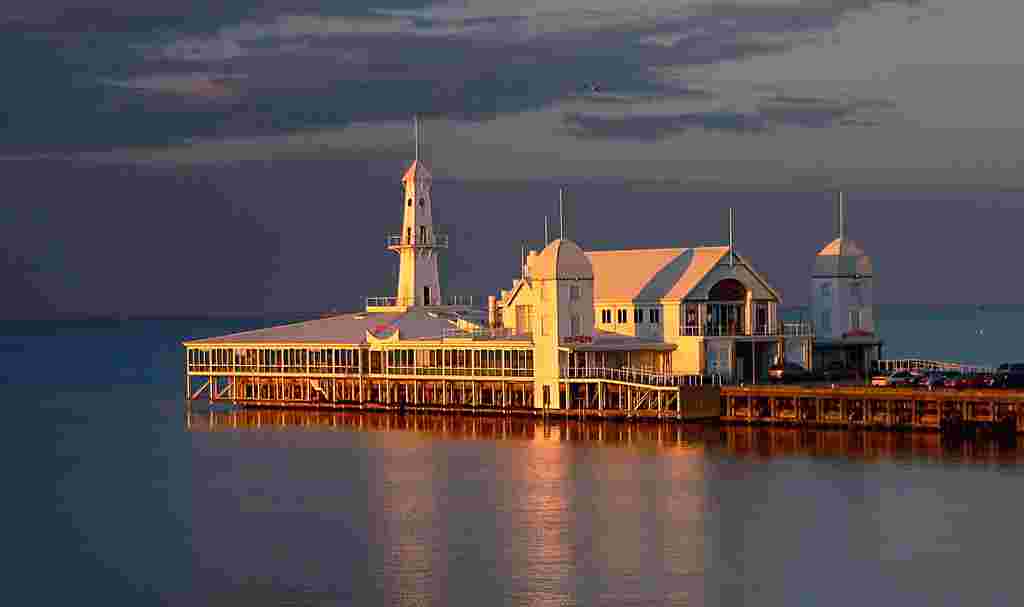 land reclaimed
from the sea, and originally used for industrial purposes.
(A small walking tour brochure of this area is available
at the Tourist Information Centre in the Wool Centre.)
Further along at Eastern Beach is The Royal Geelong Yacht
Club, established in 1859; the first sailing regatta here
was in 1844. In the early days, Eastern and Western
Beaches had six bathing complexes, segregated for men and
women.
land reclaimed
from the sea, and originally used for industrial purposes.
(A small walking tour brochure of this area is available
at the Tourist Information Centre in the Wool Centre.)
Further along at Eastern Beach is The Royal Geelong Yacht
Club, established in 1859; the first sailing regatta here
was in 1844. In the early days, Eastern and Western
Beaches had six bathing complexes, segregated for men and
women.
One of the most fascinating structures in Australia --
probably the most famous domestic building in the country
-- is Corio Villa, 56 Eastern Beach; it is still a private
residence, so visitors can only view the exterior. The
villa is a single-storey prefabricated iron house designed
by the Edinburgh firm of Bell & Miller and cast in
Scotland before being shipped to Australia in 1855. Soon
after, the factory and its moulds burned to the ground,
making this villa the only known extant example of this
unusual building process. Upon arrival in Geelong, the
original consignee (believed now to be Land Commissioner
William Gray, who died in 1854) did not claim the order
and the crates of bulky 13mm thick plates were discarded,
eventually to be purchased by magistrate and banker Alfred
Douglass, and assembled without any detailed
specifications. The overall impression of the house is one
of delicacy and lightness, despite the nature of the
material; iron lacework abounds, its interiors include
English cedar and oak linings, and throughout are
decorative motifs of rose and thistle.
At the end of Eastern Beach at Garden Street is another
important mansion, still in private hands: Merchiston
Hall, designed and built by Backhouse and Reynolds in 1856
for businessman and politician James Cowie. From its
balcony there would originally have been sweeping views of
Corio Bay, but these are now obscured.
 At the
end of Eastern Beach Road there are the Geelong Botanical
Gardens (t 03 5272 4379; open
8.00-19.00 daylight savings, 8.00-17.00 otherwise;
admission free), one of the oldest in Victoria,
with 'notable trees' surviving from the first plantings in
1857. The original designs, laid out by Daniel Bunce, are
no longer distinguishable. In the gardens is Geelong's
first Customs House, prefabricated in Sydney in 1838 and
moved to this site in 1938; a small wooden building, it
also served as the settlement's first telegraph office.
The gardens sit on what was originally called Limeburner's
Point; a cairn at the point recounts the story of the
supposed discovery here of a set of keys (now lost),
believed to have come from a Portuguese ship in these
waters in 1522--one of many mysterious legends throughout
Australia alluding to explorers here before Captain Cook
or Abel Tasman.
At the
end of Eastern Beach Road there are the Geelong Botanical
Gardens (t 03 5272 4379; open
8.00-19.00 daylight savings, 8.00-17.00 otherwise;
admission free), one of the oldest in Victoria,
with 'notable trees' surviving from the first plantings in
1857. The original designs, laid out by Daniel Bunce, are
no longer distinguishable. In the gardens is Geelong's
first Customs House, prefabricated in Sydney in 1838 and
moved to this site in 1938; a small wooden building, it
also served as the settlement's first telegraph office.
The gardens sit on what was originally called Limeburner's
Point; a cairn at the point recounts the story of the
supposed discovery here of a set of keys (now lost),
believed to have come from a Portuguese ship in these
waters in 1522--one of many mysterious legends throughout
Australia alluding to explorers here before Captain Cook
or Abel Tasman.
A National Trust property open to the public is The
Heights (t 03 5221 3510; open Sun 11.00-16.00;
admission adults $10.00, concession $7.00, children
$4.00), on Aphrasia Street in Newtown; take Ryrie Street,
the Hamilton Highway, west past Princes Highway to Shannon
Avenue, turn south to Aphrasia. The original part of the
house was prefabricated in Germany, and erected on the
site in 1854. Home to three generations of the Ibbotson
family, the home was extensively 'modernised' in the
1930s, although the 1850s outbuildings still remain.
Also in Newtown, on Fernleigh Street off Fyans Street, is
Barwon
Grange (t 03 5221 3906; open Sun 13.00-16.00;
admission adults $10.00, concession $7.00, children
$4.00), another National Trust property located on the
banks of the Barwon River. Built in 1856 for merchant and
shipowner Jonathan Porter O'Brien, this house is
distinguished for its decorative roofline and elegant
rooms. The homestead is in original condition, with
beautiful gardens.
In the 1840s and 1850s, the Geelong region became the most important wine-producing area in Victoria. By the 1870s there were over 100 vineyards here, propagated by German, Swiss and French settlers. Unfortunately, Geelong was also the point of entry of the phylloxera virus, which destroyed all the vines by 1880. In 1966, Idyll Vineyards (Ballan Road) began the renewal of wine-making in the district, and now several others have followed suit in the immediate vicinity. All are well signposted on the major roads and offer tours and 'cellar-door' sales.
Bellarine Peninsula
Still in Geelong, Garden Street heads south to Ormond Street, which leads to Bellarine Highway (B110) and the resort villages of the Bellarine Peninsula. At Wallington, an area known for strawberries, turn south to Barwon Heads, where limestone reefs led to numerous shipwrecks; several surf beaches now lure bathers. The town was recently the location for the popular ABC series, Sea Change. Nearby Ocean Grove acquired its name from American Methodist missionaries who attempted in the 1880s to establish a temperance resort here similar to Ocean Grove, New Jersey (it did not succeed).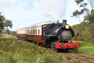 Grubb Road leads north to
Drysdale, a picturesque village known for its natural
springs. Its name derives from Anne Drysdale who, along with
Caroline Newcomb, settled here in 1849 and established the
Coryule homestead, still in existence today. From Drysdale,
you can take the Bellarine
Railway, a tourist steam train (t 03 5258 2069; Sunday late
mornings and afternoons, some Saturdays, and more
frequently during school holidays; fares
Queenscliff to Lakers Siding, 15 minutes, return adults
$15.00, concession and children $12.00, Queenscliff to
Drysdale, 50 minutes adults $30.00 concession and children
$20.00 ) to Queenscliff, the furthest point on the
peninsula.
Grubb Road leads north to
Drysdale, a picturesque village known for its natural
springs. Its name derives from Anne Drysdale who, along with
Caroline Newcomb, settled here in 1849 and established the
Coryule homestead, still in existence today. From Drysdale,
you can take the Bellarine
Railway, a tourist steam train (t 03 5258 2069; Sunday late
mornings and afternoons, some Saturdays, and more
frequently during school holidays; fares
Queenscliff to Lakers Siding, 15 minutes, return adults
$15.00, concession and children $12.00, Queenscliff to
Drysdale, 50 minutes adults $30.00 concession and children
$20.00 ) to Queenscliff, the furthest point on the
peninsula.
|
History of the Peninsula |
To the northwest of Indented Head is
Portarlington, a lovely fishing village, and the site of
the Portarlingto
Mill (t 03 9656 9800; open Sat. and Sun.
mid-Sept to May and Wed. Jan. 12.00-16.00; admission
adults $5.00, concession $4.00, children $3.00), a flour
mill opened in 1857; the building is now part of the
National Trust, which conduct tours of the preserved
steam-driven mill.
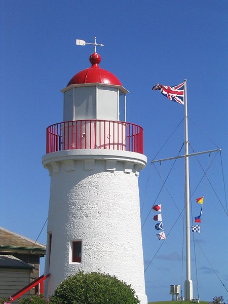
Queenscliff
Queenscliff rapidly developed as a pilot station and
customs point for entering ships. In 1861 The Black
Lighthouse was erected here; along with the nearby White
Lighthouse, it provides a line bearing for navigation of
the Rip waters.
By the 1880s, Queenscliff had become Melbourne's most
popular weekend seaside resort; while initially smart, it
quickly became the holiday destination for all stratas of
society. In Frank Hardy's Power Without Glory
(1950), the poor of Carringbush in the 1900s dreamed of
weekends at Queenscliff, and rides on its giant
paddlesteamers; in Graham McInnes' The Road to
Gundagai (1965), Queenscliff is 'pedestrian,
respectable and family'.
Remnants of its more elegant days are the Victorian era
hotels, The Grand (now the Vue Grand), The Ozone
(renovated as apartments in 2010), the Royal (carefully
renovated and renamed Q Hotel), and the Queenscliff, still
open as a bed and breakfast. The Queenscliff Hotel is
architecturally the grandest of all; the Grand Dining Room
here should not be missed. 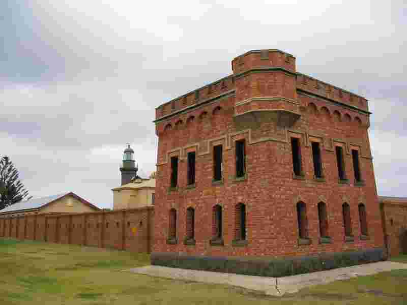
Queenscliff was also a garrison town; during the Crimean
War (1853-56), fear of Russian invasion led Australians to
build fortresses everywhere, particularly around Port
Phillip Heads. Fort
Queenscliff (t 03 5258 1488; tours on Sat. and
Sun. at 13.00 and 15.00) is a fascinating reminder of this
period, built to withstand assault from land or sea; a
tour of the facility includes a museum in the underground
powder rooms. The town also houses the Queenscliff
Maritime Musuem (t 03 5258 3440; open daily
10.30-16.30; admission adults $8.00, concession $7.00,
children $5.00), on Weeroona Parade, with changing
displays relating to the seagoing history of the
peninsula, and the Marine Studies Centre next door; and
the Queenscliff
Historical Museum (t 03 5258 2511; open weekdays
1.00-16.00, weekends 13.30-16.00), on Hesse Street, which
presents the history of the region, including relics from
shipwrecks.
Queenscliff is also important as the point of departure of
the Sorrento-Queenscliff
ferry (t 03 5257 4500; on the hour 7.00-18.00, 40
minute crossing), including the car ferry linking the
Bellarine and Mornington Peninsulas. The route is a great
way to avoid Melbourne for those travelling the Princes
Highway between the Ocean Road and Gippsland.
Along surf coast ~ the Great Ocean Road
The Great Ocean Road proper begins at Torquay, on the Bellarine Peninsula, some 106km south of Melbourne. Torquay has a nicely protected town beach, around Point Danger which faces the Bass Strait; this point was the site of the wreck of the three-master clipper, Joseph H. Scammell, in 1891. Tourist information: The Plaza on Beach Road, t 03 5261 4219. In the world of surfing, it comes as no surprise that the Surf World Museum (t 03 5261 4606; daily 9.00-17.00; admission adults $12.00, concession and children $8.00; Surf City Plaza) is in Torquay, nor that boards and surfers are featured.Torquay is most famous for the big surfing beaches nearby. Rip Curl, makers of surfboards and surfing paraphernalia, have been here since the 1960s. First to the west along the Ocean Road is Jan Juc Beach; then, most famous of all, is Bell's Beach, location of some of the toughest, meanest surf, revered by the most skilled surfers in the world. Waves as big as 3m with exceedingly long swells are standard fare, and 6m waves are not unknown. The area is named after the Bell family, original settlers in the 1840s. There is a lookout above the beach where viewers can watch surfers in action and admire the spectacular view along this rugged coast of the Bass Strait; the lookout includes a memorial plaque to a young surfer drowned in waves in 1984. At Easter time, the Bell's Beach Surfing Carnival attracts participants from around the world, and the beach has been the site of the World Surfing Championships. A splendid Surf Coast Walk begins at Jan Juc Beach and continues all the way to Airey's Inlet.
The Ocean Road continues 15km to Anglesea, the
tranquillity of which is somewhat blighted by the presence
on the edge of town of a coal mine and power station. The
town itself has a lovely beach; on New Year's Day, an
annual regatta of the town's 100-year-old boats sails on
the Anglesea River, and in September the Angair Festival
presents displays of wildflowers and excursions into the
bushland. The area also displays charred reminders of the
Ash Wednesday Fire, the devastating bushfires of 1983 that
spread across much of Victoria and all the way to the
coastline.
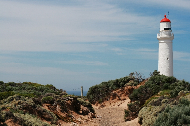
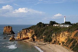 10km along the road is Airey's Inlet, named for settler J.
Eyrie in 1846. Of most interest here is the Split Point
Lighthouse (t 03 5263 1133, tours on the hour
11.00-14.00; admission adults $14.00, concession $12,
children $8.00), built in 1891 after the wreck of the
Joseph Scammell at Torquay. Still in operation, the
lighthouse can be climbed by visitors, to provide
stunning, if vertigo-inducing, views of the cliffs and
sea. Its location figures in detective writer Arthur
Upfield's The New Shoe
(1952).
10km along the road is Airey's Inlet, named for settler J.
Eyrie in 1846. Of most interest here is the Split Point
Lighthouse (t 03 5263 1133, tours on the hour
11.00-14.00; admission adults $14.00, concession $12,
children $8.00), built in 1891 after the wreck of the
Joseph Scammell at Torquay. Still in operation, the
lighthouse can be climbed by visitors, to provide
stunning, if vertigo-inducing, views of the cliffs and
sea. Its location figures in detective writer Arthur
Upfield's The New Shoe
(1952).
Lorne and Apollo Bay
From here the road continues 21km to Lorne (population 1046 up from 930 in 1998), a traditional old summer resort, initially established as such by the local grazier family the Mountjoys at the temperance hotel Erskine House in 1868. While Erskine House still remains, the town is now thoroughly overrun by hordes of tourists (at least in summer), making it difficult to appreciate any bucolic charm it may have had. Arthur Upfield, in The New Shoe (1952) nicely sums up the atmosphere:
Once upon a time Lorne was charmingly beautiful. Situated above a wide, sandy and safe bathing beach, its doom was inevitable. Crowded hotels and a fun fair, souvenir shops and crude cafes attracted the flash elements from the city. When Bony saw Lorne, he shuddered.
In the 1960s, this scenario was overlaid with a hippie-surfer attitude; now it is a bit more yuppified, with oversize holiday condos on the main street, but the overall impression is the same. Tourist information: 144 Mountjoy Parade, t 03 5289 1152.
Nearby is Teddy's Lookout, with magnificent views of
the coastline, and the Angahook-Lorne State Park (now part
of the Great
Otway National Park, t 03 8427 2002) stretching 50km
along the coast, with pleasant walking trails through the
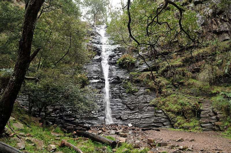
hills and to the beautiful Erskine Falls.
45km further west on the Ocean Road is Apollo Bay
(population 1095, up from 880 in 1998), still a quiet,
lovely spot, with gorgeous, soft hills in the background
where hang-gliders fly (there is even a hang-gliding
school here), and which provide open views of relatively
calm surf, and a long, friendly stretch of beach. Founded
in the 1860s as a timber town, the area is also home to
the Old
Cable Station Museum (check locally, access may be
curtailed), marking the site where in 1936 telephone cable
was laid across the Bass Strait to Tasmania; it now
contains a local history collection. In October, Apollo
Bay hosts a popular music festival.
Be sure to take a trip up into the meadows and hills north
of Apollo Bay to Paradise, c 6km. Enchanting fern forests
along the Barham River offer a beautifully cool respite,
especially on hot days.
West of Apollo Bay on the Ocean Road, you enter the Great
Otway National Park, site of treacherous Cape Otway;
about 7km into the park is a turn-off to the cape, some
14km south. After numerous early shipwrecks along these
reefs, the sandstone lighthouse here was erected in 1848,
making it the oldest along the Bass Strait coast; the
second lighthouse keeper, Henry Bayles Ford, lived here
with his family for 30 years. The lighthouse can be
climbed, offering a terrifying glimpse of this dangerous
coastline; nearby is a cemetery with the graves of
lighthouse families and shipwreck victims.
The Otway Ranges receive some 200 days of rainfall a year,
making this one of the wettest spots in Victoria. The park
is also home to the Otways Black Snail, a rare carnivorous
snail that retards its prey through an injected secretion.
One can also spot koalas in the wild here, along with a
vast number of other native species. Bimbi Park provides
camping accommodation within the park, and nearby are
excellent walking trails with views of the coast.
'Shipwreck Trail'
Back on the Ocean Road, it is c 50km to Lavers Hill,
and 3km further west to Melba
Gully State Park (open daily), a 48 ha preserve
donated to the state by the local Madsen family and named
for the famous opera singer Dame Nellie Melba. The park is
known for its fern gullies, myrtle beech trees, and blue
glow worms.
From this point, continue west some 20km to Port
Campbell
National Park, the starting point of the Historic
Shipwreck Trail, 100km of steep cliffs and world-renowned
rock formations within sight of land. All of these
landmarks have well-marked turnoffs from the Ocean Road.
15km from the beginning of the national park is
Princetown, site of the Glenample
Station (the Station had a tea room and display but
may have been closed for several years; let us know if you
visit, please), owned in the 1860s by Scottish immigrant
Hugh Hamilton Gibson. Gibson built his own homestead in
1868, on the Simpson Road nearby. Gibson built the
Gibson's Steps to reach the nearby beach; these still
provide access to the sand. It was also at Gibson's
homestead that, in 1878, the only two survivors of the
shipwreck Loch Ard, Tom Pearce and Eva Carmichael, were
rescued and recuperated.
 A bit further west is the
turn-off to the Twelve
Apostles, the most famous of the limestone rock
formations, now some 65m out to sea, having eroded from
the cliffs over time. The rocks vary in height from 10m to
50m; as the plaques at the well-maintained overviews
explain, one cannot always see all of the existing eight
formations at once, but at any time the view is
impressive. From here you can take helicopter rides to
view from the air this stretch of coastline.
A bit further west is the
turn-off to the Twelve
Apostles, the most famous of the limestone rock
formations, now some 65m out to sea, having eroded from
the cliffs over time. The rocks vary in height from 10m to
50m; as the plaques at the well-maintained overviews
explain, one cannot always see all of the existing eight
formations at once, but at any time the view is
impressive. From here you can take helicopter rides to
view from the air this stretch of coastline.
Further on is the turn-off for Loch Ard Gorge, so named
because it was near here that the above-named Loch Ard
crashed in June 1878, killing all but two of its 53
passengers; only four bodies were recovered, and the story
of survivors Tom Pearce and Eva Carmichael provided
numerous romanticised stories. The cave on the beach here
where Eva sought refuge is named in her honour.
The gorge area reveals some fascinating examples of
the interaction of sea and rock, including a blowhole and
caves; it is also the nesting site for mutton birds, the
short-tailed shearwaters that annually make an
extraordinary 15000km migration around the Pacific Ocean.
The road from here to the town of Port Campbell, c
7km, is dotted with more scenic views of the rough coast;
the town itself (population 599 up from 250 1998) is named
for a Captain Campbell who sheltered here in the inlet in
1843. Indeed, the turn into this small port leads to one
of the only calm beaches along this rugged coast, where
swimming is a cold prospect at most times. Tourist
information: Morris Street, t 03 5598 6089.
7km west of Port Campbell is another interesting set of
ocean rock formations. Originally called London Bridge
because a bridge linked what are today two separate rocks,
the formation's central section broke off on 15 January
1990, stranding two people on the outer rock; they were
quickly airlifted to safety.
From here, the next town is Peterborough, believed to have
been settled by people who had come to see the shipwreck
Schomberg in 1855. As with so many other shipwrecks here,
the timbers and fittings were salvaged and reused. The
Schomberg was captained by flamboyant 'Bully' Forbes, who
had in 1852 made the Liverpool-Melbourne run in the
unprecedented time of 68 days. In his haste to make the
run in 60 days with the Schomberg, he ran aground here to
the east of Curdies Inlet, today known as Schomberg Rock.
About 6km west of Peterborough is Massacre Bay. Its scenic
turn-off includes information plaques about the Mahogany
Ship, one of the most romantic and mysterious legends
along the coast, and thought to be located somewhere
nearby. See Flagstaff Maritime Museum, Warrnambool, for a
more detailed description.
Warrnambool
The coastal road now turns inland through grazing land and dairy farms. Allansford, just outside Warrnambool, has a large cheese factory (t 03 5565 3130; open weekdays, 09.00-17.00, Sat and Sun. 10.00-16.00). It is 66km from Port Campbell to Warrnambool.At Warrnambool (population 34,000 up from 28,000 in 1998), the Great Ocean Road meets Princes Highway. The town seems much larger than it is, perhaps because it is decentralised in layout and because its natural port, although unsuitable for large-scale maritime activity, enabled the early growth of a thriving industrial economy. Fletcher Jones, a leading clothes manufacturer, and Nestlé, both have headquarters here. Tourist information: Merri Street, open 9.00-21.00. The V/Line trains from Melbourne via Geelong arrive daily.
|
History of Warrnambool |
From Princes Highway, proceed to Spence Street
and Raglan Parade, where a substantial tourist information
centre offers excellent material about the region's
features, including a small brochure of the town's
Heritage Trail.
The blocks bounded by Timor, Liebig, Koroit and Fairy
Streets still contain many fine examples of buildings from
Warrnambool's 19C boom period, many of them built by local
architects Andrew Kerr, George Jobbins, and James McLeod.
A mural on the corner of Liebig and Koroit Streets depicts
much of Warrnambool's history, including the contribution
of Chinese immigrants and the amusing images of deep-sea
divers playing cards underwater, homage to those who
helped dredge the harbour in the 1880s.
The most grandiose structure of this period, The Grand
Ozone Coffee Palace (1890), was on the corner of Kepler
Street, where the Hotel Warrnambool now stands; the palace
burned to the ground in 1929.
On the corner of Liebig and Timor Streets (locally
pronounced LAI-big and TAI-mor) is the Warrnambool Regional
Art Gallery (t 03 5559 4949; weekdays 10.00-17.00,
weekends 10.00-15.00), in a modern blue building
tastefully designed to complement its 19C neighbours. Its
excellent collection of Australian paintings includes
Eugen von Guerard's brilliant Tower Hill (1855, the
painting has been used as the model for recent
reforestation of the Tower Hill site) and Robert Dowling's
Minjah in the Old Time (c 1858). Also on display is a
model of the demolished Grand Ozone Coffee Palace.
Other interesting sites are the lovely Botanic Gardens
(t 03 5559 4800http://www.thewag.com.au/en
Mon.-Fri. 10.00-17.00, Sat. and Sun. 10.00-15.00), c 2km
north on Fairy Street. Laid out in 1877 by William
Guilfoyle, Director of the Melbourne Botanic Gardens, the
gardens retain their original design. On the
south east of the town are the Hopkins River bridge
(1895), the last remaining timber truss bridge in
Victoria, and the Logan's Beach Whale Watching Platform
from which southern right whales can be spotted from May
to October.
 At the south end
of Banyan Street, on Merri Street, is Flagstaff Hill
Maritime Museum (t 03 5559 4600), an excellent
'open-air museum' re-creating the history of this part of
the Australian coast. The museum is built around the
remains of an old fort built after the Crimean War (fear
of that Russian invasion again!). Other buildings include
two original lighthouses from the 1870s and various
artisan shops where such activities as shipbuilding and
blacksmithing are demonstrated.
At the south end
of Banyan Street, on Merri Street, is Flagstaff Hill
Maritime Museum (t 03 5559 4600), an excellent
'open-air museum' re-creating the history of this part of
the Australian coast. The museum is built around the
remains of an old fort built after the Crimean War (fear
of that Russian invasion again!). Other buildings include
two original lighthouses from the 1870s and various
artisan shops where such activities as shipbuilding and
blacksmithing are demonstrated.
On the water the passenger steamer Rowitta (1909) and a
trading ketch Reginald M are on view. In the Shipwreck
Museum are many artefacts and treasures retrieved from the
coast's many shipwrecks. Of greatest interest is the Loch
Ard Peacock, a magnificent life-size piece of Minton
pottery, designed by Italian Paul Comolera and on its way
to Melbourne for the International Exhibition of 1880 when
it was salvaged from the Loch Ard disaster in 1878. The
museum complex's restaurant, The Mahogany Ship, alludes to
the area's most enduring legend.
| The Mahogany Ship Between 1836 and 1880, several reliable sources maintained that they had seen in the drifting sandhills outside of Warrnambool the remains of an ancient wreck, consistently described as built of dark wood and with enormous timbers. Aborigines of the region agreed that the remains had been there for centuries, and even, in some stories, spoke of 'yellow men' coming from a big ship. As the Australian Encyclopedia (1956) summarises, 'it poses a problem of the first magnitude in the controversial history of the discovery of Australia by European navigators'. Alas, none of the witnesses at the time established an accurate location for the relic. By the 1850s the timbers had been removed and burned by whalers, and by 1880, the remains disappeared entirely from view beneath the dunes. The wreck figures romantically in Henry Kingsley's novel Geoffrey Hamlyn (1859) and in Vernon Williams' historical romance The Mahogany Ship (1923). Poet George Gordon McCrae made an intensive investigation of the subject, presenting a paper on his findings to the Royal Geographical Society in 1910. As late as 1992, the Victorian government offered a prize of $250,000 for the rediscovery of the ship. To date, the only remnants found are a few iron bolts and latches. |
Some 15km west on the Princes Highway is Tower
Hill State Game Reserve. The site provides
fascinating evidence of Victoria's largest volcano.
Geologically, the site is described as a nested maar with
a flooded crater and deposits of volcanic tuff creating
fertile soil. The lake contains three small islands,
produced when eruptions produced scoria cones (scoria is
lava with steam holes). The region was cleared for farming
and quarried in the mid-19C, leaving barren hills; recent
reforestation has depended on the 1855 oil painting by
Eugen von Guerard, now in the Warrnambool Regional
Art Gallery (open Mon.-Fri. 10.00-17.00, Sat. and
Sun. 10.00-15.00). A loop drive around the lake is well
worth the detour.
Port Fairy
29km west of Warrnambool is the historic village of Port Fairy (population 2,800). Today the town is internationally famous for its Labour Day folk festival in March, which brings up to 20,000 visitors to hear formal and impromptu performances by folk bands and music groups of all stripes; tickets for the formal events are sold out months in advance (contact tourist information for details). In January, the town also hosts the Moyneyama Festival, with outdoor events and boat races along the Moyne River. During the rest of the year, the town remains a charming fishing village with an interesting maritime history. Tourist information: Borough Chambers, Bank Street; t 03 5568 2682. V/Line buses run here daily from Warrnambool and Mount Gambier.The area was first visited by whalers and sealers at the beginning of the 19C. Indeed, the town's name is in honour of the cutter Fairy, the fboat of early sealer and explorer Captain James Wishart who sheltered here in the 1820s. By 1835 a whaling station was established on Griffiths Island, a spit of land at the southeastern end of town and now site of the largest mutton bird rookery on the mainland. Viewing platforms here make it possible to watch the birds' arrival at twilight during the months of September through April, when they take off again on their 15,000km migration to the north Pacific from eastern Siberia to western British Columbia. The island also has a lighthouse built in 1859 of local bluestone and now solar-powered. At Griffiths Island, you can also get a great view of Port Fairy Bay and East Beach, usually windswept and choppy, although enjoyable for picnicking on a sunny day.
In 1844, Irishman and New South Wales solicitor James Atkinson obtained thousands of hectares of land here and renamed the area Belfast after his native town. He subdivided the area, created a harbour, and established the township, controlling all properties until land sales in the 1880s; at that time, the town was renamed Port Fairy. In the 1840s and 1850s, the town prospered along with the business enterprises of Atkinson and William Rutledge & Co., a commercial concern controlling an international firm headquartered here; most of the substantial buildings of the settlement date from this period. When Rutledge crashed in 1862, the town was paralysed and development ground to a halt. Consequently most of the old buildings have been retained, with minimal additions since the turn of the century. Today there is a small fishing fleet, and it is a centre for the abalone industry (but do not expect abalone on the town's menus; most of it is exported).
Entering on Princes Highway, turn on to Bank Street to
reach the centre of town. Here you will find several
historic buildings, including,on the left, the Drill Hall,
built c 1896 and now an antiques barn; and on the right,
the Caledonian Hotel, believed to be, since 1844,
Victoria's oldest continuously licensed hotel. In the
hallway of the hotel you can see original hand-adzed
timber, plus a section left unfinished when 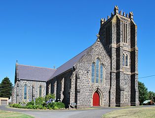 workers dropped
their tools when word of the Ballarat gold discovery
reached them. In the hotel's yard, author 'Rolf
Boldrewood' sold horses bred from his nearby station. A
little further on Bank Street, on the east side at Barkly
Street, is St John's Church and Hall, designed by
Nathaniel Billing and erected in the late 1850s at a cost
of £7000, an extravagant sum at the time. The tower was
completed in 1956 by Maltese stonemasons.
workers dropped
their tools when word of the Ballarat gold discovery
reached them. In the hotel's yard, author 'Rolf
Boldrewood' sold horses bred from his nearby station. A
little further on Bank Street, on the east side at Barkly
Street, is St John's Church and Hall, designed by
Nathaniel Billing and erected in the late 1850s at a cost
of £7000, an extravagant sum at the time. The tower was
completed in 1956 by Maltese stonemasons.
Back on Bank Street, in what was once the second post
office building of 1881, is 'Lunch', a pleasant
restaurant; next door is the tourist information centre,
which provides an excellent historical walking tour
brochure, as well as a 'Shipwreck tour'. Next to the
centre is the Star of the West Hotel, on the corner of
Sackville and Bank Streets. The hotel was built in 1856 by
John Walwyn Taylor, a West Indian who made money on the
goldfields and dreamed of building a chain of 'Star'
hotels throughout Victoria. This was the only one to be
built, and was at one time a staging post for the Cobb
& Co. coaches. 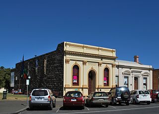
Sackville Street has always been the main public
street, and still includes many 19C structures, such
as the Lecture Hall, completed in 1884; the Corangamite
Regional Library next door, which was once the Mechanics
Institute; the Cafe Gazette in the building which was the
home of the Port Fairy Gazette from 1849 to 1989; the
bluestone ANZ Bank, designed in 1857 by Nathaniel Billing,
a well-known architect in Western Victoria, and considered
by famous educator and historian James Bonwick in his
description of 1858, 'the handsomest house in the town';
and the opulent post office, opened in 1881 at a cost of
£4200.
On the corner of Sackville and Cox Streets is Seacombe
House, begun in 1847 and in the 1850s the social centre of
the town. In 1873, it became a boys' school and later a
guest house. Walk south down Cox Street to Gipps Street
and the lovely Moyne River canal; the two blocks here
between Campbell and Bank Streets contain some of the most
historic buildings from the town's early days, including
'Emoh', 8 Cox Street, now a youth hostel and originally
the residence of William Rutledge, 'the King of Port
Fairy'.
On the corner of Cox and Gipps Streets is a bluestone
wall, the only remnants of Rutledge's warehouses. The
early structures have been tastefully preserved, with
later buildings complementing their architectural styles.
East on Gipps Street is Mill House, originally a flour
mill constructed in 1866, and now a bed and breakfast; the
stone house across Gipps Street belonged to the miller
Joseph Goble. West from Cox Street on Gipps Street is
Mills Cottage, incorporating the 1841 wooden hut that was
the original home of Charles Mill, Harbour Master from
1853 to 1871.
Further along Gipps Street is the former Court House, now
the headquarters of the Port
Fairy Historical Society (t 03 5568 2263; open Sat.,
Wed. and holidays 14.00-17.00, Sun. 10.30-12.30; admission
adults $4.00) and a local museum. The building, begun in
1859, was unusually large as it was designed to seat the
Supreme Court as well as the county and magistrates'
court; a sign of Port Fairy's early importance in this
rather isolated location. At Gipps Street and Campbell
Streets is the old 1861 customs house, now a private
residence; at the time of its construction, Port Fairy was
an important point of entry into Victoria. Also at this
corner is the Merrijig Inn, built in 1841 and, opposite
the Old Moyne Mill, a five-storeyed wind-driven mill that
operated until 1883.
Back on Sackville Street is Mott's
Cottage (t 03 5568 2682; open Wed. and St.
14.00-16.00 and by
appointment through the visitor centre in winter), a
typical 1850s cottage now owned and operated by the
National Trust; Sam Mott had been a member of Captain
Wishart's whaling crew. Along Campbell Street are fine
examples of stone cottages of the 1850s and 1860s. Further
north at Cox and College Streets is St Patrick's Church,
the town's second Roman Catholic church built in 1859 and
another example of architect Nathaniel Billing's design.
From Port Fairy, you can also take a four-hour boat
tour out to Lady Julia Percy Island, a volcanic island
that is now home to some 4000 fur seals, the animals that
were nearly decimated by sealers in the 19C.
Portland
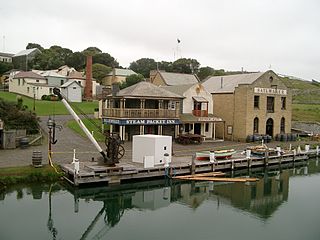
From Port Fairy, the Princes Highway continues west 71km to Portland (population 9,600 up from 11,000 in 1998), the westernmost Victorian coastal town and the only deep-water port between Melbourne and Adelaide. Portland itself maintains a strong consciousness of its historical past as a pioneering settlement. The information centre at Henty Park (t 03 5523 2671) provides excellent material on the region and friendly service; the centre also organises several walking tours, and natural history day-tours around Portland. The is in an 1850 bluestone watchtower; this historic area of town contains many substantial bluestone buildings that are well preserved. Nearby on Bentinck Street is the former Steam Packet Inn, one of Victoria's oldest timber buildings, erected in 1842 from pieces prefabricated in Van Diemen's Land (Tasmania). Of special note is the hotel's steep staircase and attic roof with dormers. Recently renovated by the National Trust, the Inn is now a privately owned residence. Now an industrial town with aluminium factories and
huge commercial docks, including berths for 8-tiered sheep
ships, the area was the land of the Gunditjmara Aborigines
who called it Pulumbete, or 'little lake' for the swampy
region now known as Fawthrop's Lagoon. French navigator
Baudin passed by here in 1802, and Matthew Flinders
charted the bay's waters in 1803.
Permanent white settlement here began in 1833, with the
arrival of the whaler William Dutton and then the Henty
family (see box below), although whalers and sealers had
been processing oil in the area from the early 1800s. The
region was one of the best whaling areas in the world,
until stocks were nearly depleted by the end of the
century. In recent years, whale numbers have increased and
migrating groups can be seen around Portland from June to
September.
| The
Henty family epitomise the history of
squatters in Australia: opportunistic
adventurers who laid claim to large runs in
'uninhabited' and unexplored regions of the new
country, developing pastoralism and gaining
wealth and prominence by tenacious occupation of
the land. Thomas Henty (1775-1839) was a Sussex
farmer and breeder of Merino sheep. One of his
six sons was the first Henty to arrive in
Australia; he joined the Swan River settlement
in Western Australia in 1829. Other members of
the family moved to Tasmania in 1832 and took up
large tracts of land there. In 1834, another
son, Edward (1810-78), sailed into Portland Bay
in the Thistle to establish the first permanent
white settlement in Victoria. By 1835, sheep and
cattle were grazing here, and Henty began a
whaling operation, joined by his brothers. On
the basis of this venture, Portland is
considered 'Victoria's Birthplace by the Sea'. When explorer Thomas Mitchell arrived from overland at the bay in 1836, he was astonished to discover the Henty settlement. By 1842, the Hentys claimed some 110,000 acres around the bay and inland as far as Wannon near Hamilton. After some reversals of fortune, the Hentys settled on these large inland properties, developing lavish estates and becoming prosperous graziers and ultimately politicians. |
In the
Portland region, as in every other part of
Australia, the arrival of white settlers
provoked inevitable conflict with the indigenous
inhabitants, who as supposedly nomadic people
appeared to the whites to have no real claim to
land at all. Ironically, in this region, many of
the Aborigines were not nomadic at all.
Aborigines for the most part were viewed as
little more than pesky obstructions in the way
of civilised settlement. Whalers were the first
to 'punish' these inhabitants, through outright
slaughter, for their 'theft' of whale catches on
the beach.
Resistance by
Aborigines to the invasion of their tribal lands was
fierce once they recognised their total displacement by
these new arrivals. The Eumeralla Wars of this region
raged until the mid-1840s, when the remaining Aborigines
were defeated and eventually removed to mission
settlements such as the one at Lake Condah north of
Portland. Officially operating as an Aboriginal mission
for 'assimilation' from 1867 until 1919, Lake Condah
remained an Aboriginal settlement into the 1950s. It was
from this base that the Gunditjmara people successfully
fought for compensation for their traditional land in a
famous legal battle of the 1980s, being awarded $1.5
million from the Alcoa company who built an aluminium
smelter on a sacred site near Portland. The award included
4000 acres (1600 ha) at Lake Condah, now operated by the
Gunditjmara.
 The
Town Hall on Charles Street, built in 1864 to a Classical
design by Alexander Ross, now houses the History
House (t 03 5522 2266; open daily 10.00-12.00,
13.00-16.00; admission adults $1.00, others .50), which
displays relics and artefacts of the pioneer period. Next
door is the tiny Rocket Shed of 1887, which stored rockets
and ship rescue equipment; today it displays memorabilia
of the town's 150th anniversary celebrations which took
place in 1984.
The
Town Hall on Charles Street, built in 1864 to a Classical
design by Alexander Ross, now houses the History
House (t 03 5522 2266; open daily 10.00-12.00,
13.00-16.00; admission adults $1.00, others .50), which
displays relics and artefacts of the pioneer period. Next
door is the tiny Rocket Shed of 1887, which stored rockets
and ship rescue equipment; today it displays memorabilia
of the town's 150th anniversary celebrations which took
place in 1984.
The basalt ashlar Court House on Cliff Street next to the
town hall was completed in 1853 from designs by Colonial
Clerk of Works Henry Ginn; it is still used as the court
house and stands as Ginn's most significant work. For many
decades the judge would arrive in Portland for court from
Melbourne by sea; once sentenced, a prisoner would be sent
to the gaol next door. When excavations were made for
Beach Road from here to the bay, builders uncovered a
tunnel underneath the gaol, apparently dug by a convict
who left it unfinished a few metres from the beach cliff.
 On Gawler Street
next to the information centre is another fine building by
Henry Ginn, the Customs
House (t 03 5522 3900; open weekdays 09.00-16.00)
completed in 1850 and reminiscent of Tasmanian structures
of the period; it is still used for its original purpose,
and is open for tours.
On Gawler Street
next to the information centre is another fine building by
Henry Ginn, the Customs
House (t 03 5522 3900; open weekdays 09.00-16.00)
completed in 1850 and reminiscent of Tasmanian structures
of the period; it is still used for its original purpose,
and is open for tours.
One of the loveliest spots in Portland is the Botanical
Gardens (t 03 5522 2200, open daily sunrise to
sunset, free) on the corner of Glenelg and Cliff Streets.
One of the oldest public gardens in Victoria, the site was
first developed in 1857 by William Allitt, using Chinese
convict labour. Allitt was a protégé of the famous
Ferdinand von Mueller, curator of the Melbourne Botanical
Gardens. As official curator of the gardens in the 1860s,
Allitt planted some 2000 species, as many as a quarter of
which still survive. The gardens' area has decreased
substantially since Allitt's day, although several unusual
plants remain, including the state's largest known New
Zealand cabbage tree, registered on the National Trust's
list of 'Notable Trees'. The grounds also include the 1858
Curator's Cottage, restored and maintained by the
Historical Society.
Also of interest in Portland are its many gracious homes,
most notably Burswood, 15 Cape Nelson Road, now operating
as a bed and breakfast. The splendid gardens (t 03 5523
4686) are still open to the public in the summer, but
views of the interior are limited to guests. This was the
third home of Edward Henty, designed by James Barrow in
1853 in a Regency style reminiscent of the Hentys' Sussex
home. It has a glazed verandah and superbly decorated
interior walls.
On Battery Hill at Bancroft Street is Kingsley, a
charmingly fanciful structure built in 1893 for William
Thomas Pile, an eccentric businessman who made money on
the Castlemaine goldfields and in the wattlebark industry.
Around Portland
 The area around
Portland provides some stunning coastal views and
opportunities for picnicking and serious bushwalking. Cape
Nelson (t 03 8427 2002), 11km south of Portland, is
now a state park with a 3km self-guided cliff walk around
its 24m-high lighthouse and through the soap mallee, a
unique kind of bush fauna. Cape Bridgewater, 21km
southwest of the town, now the site of a convention
centre, provides stunning coastal views, as well as tours
of its petrified forest and blo
The area around
Portland provides some stunning coastal views and
opportunities for picnicking and serious bushwalking. Cape
Nelson (t 03 8427 2002), 11km south of Portland, is
now a state park with a 3km self-guided cliff walk around
its 24m-high lighthouse and through the soap mallee, a
unique kind of bush fauna. Cape Bridgewater, 21km
southwest of the town, now the site of a convention
centre, provides stunning coastal views, as well as tours
of its petrified forest and blo
whole. It is also the site of a seal colony, which can be
reached after a 90-minute bushwalk. The National Trust
also runs a lodge here, on Cape Bridgewater Road (t 03
5526 7276), that provides accommodation for up to six
people.
For the truly adventurous, the Great South West Walk
begins at the Portland Information Centre and encompasses
250km of track through the Lower
Glenelg
National Park and the seaside village of Nelson. The
National Park and Information Centre (t 03 8427 2002) is
located on North Nelson Road. Campsites with limited
facilities are well marked along the trail. Shorter walks
along the track can be reached by following the emu-logo
markers.
On the Henty Highway north towards Hamilton, you can turn
off towards Homerton and travel c 50km to Mount
Eccles
National Park (t 03 8427 2002) with fascinating
walks through volcanic scenery (long extinct), lava caves,
and Lake Surprise, a crater lake. The visitor's centre has
great displays about Aboriginal life in the region, and
the park is filled with birdlife.
The Wimmera and the Grampians
From Portland, you can reach the gold country and
Ballarat by travelling north on the Henty Highway (A1 to
Heywood; A200 to Hamilton). V/Line bus service extends
from Melbourne via Ballarat to Hamilton and on to the Mt
Gambier in South Australia, and a daily train to Dimboola
via Ballarat, Stawell and Horsham. A more direct train
travels weekdays from Melbourne to Stawell, stopping only
in Ballarat. A 'Grampians link' is a daily train-and-coach
service to Halls Gap.
To the northwest are the wheat-growing flatlands of
the Wimmera, an area reminiscent of grasslands America in
its vastness. This region  was that explored by Major
Thomas Mitchell in his Third Expedition in 1836.
Commemoration of his expedition appears in plaques and
monuments throughout the district, and a 1700km tourist
route through the region retracing his wanderings is
called the Major Mitchell Trail. Mitchell's Three
Expeditions into the Interior of Eastern Australia
(1838) gives an exciting picture of these early days.
Mitchell was so impressed by the green landscape on the
eastern side of the Grampians that he labelled it
'Australia Felix', encouraging pastoralists to settle
here. The Castlemaine artist Eliza Tree mounted a
significant exhibit
detailing the Expedition.
was that explored by Major
Thomas Mitchell in his Third Expedition in 1836.
Commemoration of his expedition appears in plaques and
monuments throughout the district, and a 1700km tourist
route through the region retracing his wanderings is
called the Major Mitchell Trail. Mitchell's Three
Expeditions into the Interior of Eastern Australia
(1838) gives an exciting picture of these early days.
Mitchell was so impressed by the green landscape on the
eastern side of the Grampians that he labelled it
'Australia Felix', encouraging pastoralists to settle
here. The Castlemaine artist Eliza Tree mounted a
significant exhibit
detailing the Expedition.
To the north is Grampians National Park, one of the
state's largest parks, filled with bizarre rock formations
and voluptuous bush. It is one of the best places in the
state to view Aboriginal art, especially at those sites
run by the Aboriginal communities themselves.
Hamilton
From Portland drive 27km north to Heywood, where you
can turn off to the Aboriginal community of Lake Condah,
12km east (see Portland section). Continue 58km north on
the Henty Highway to Hamilton. Hamilton (population 10,100
down from 11,000 1998) proudly proclaims itself as the
'Wool Capital of the World', a fact reinforced by the Big
Woolbales Centre on the outskirts of town-one of the 'big
things' tourist attractions, a more subdued example of the
'roadside grotesques' so popular throughout Australia. The
area was founded by Scottish pastoralists and German
settlers arriving from South Australia; it remains an
important centre for the rural community. Of most interest
for the visitor are the Hamilton
Art Gallery, (check the web-site but late
morning through the afternoon; admission adults $10.00,
concession $8.00, children $4.00) the Sir Reginald Ansett
Transport Museum, (open daily 10.00-16.00; admission
adults $ 10.00, others $8.00). As ever, stop in the Tourist
information centre: Lonsdale Street, t 03 5572 3746.
The art gallery, on Brown Street, is an impressive
regional gallery, emphasising an excellent collection of
Mediterranean pottery and antique porcelain, donated by
local grazier Herbert Buchanan Shaw, as well as a superb
collection of paintings and watercolours by the 18C
English artist Paul Sandby purchased from local resident
C.C.L. Gaussen.
The transport museum on Ballarat Road commemorates Sir
Reginald Ansett, who began his airline service in Hamilton
in the 1930s; Ansett Airlines is now one of the leading
services within Australia. The museum includes a replica
of Ansett's first plane, a Fokker Universal.
Also in the area there are several private gardens that
are part of the Open Garden Scheme, and are open to the
public at different times throughout the year. Check
at the Tourist Information Centre for details.
Grampians National Park
From Hamilton, take the Glenelg Highway (B160) 29km
to Dunkeld, and proceed north 65km on route 111 to Halls
Gap, entrance to Grampians
National
Park. An excellent visitor's centre here provides
displays, audio-visual presentations, detailed walking
guides and books, and tours into the ranges. The
Aborigines--first the Buandig and later the Jardwa
tribe--called the land Gariwerd or Nambun Nambun. When
Major Mitchell passed through the mountains, he named them
the Grampians because they reminded him of that Scottish
range. One of Arthur Upfield's best Napoleon Bonaparte
mystery novels, The Mountains Have a Secret
(1952), is set in the Grampians.
The 167,100 ha of national park was officially proclaimed
as protected in 1984. The chain of mountains is actually
the westernmost end of the Great Dividing Range,
separating the fertile coastal plains from the dry
interior.
Some 65km on the western side of the park is the pastoral
town of Horsham (population 16,450 up from 12,300 1998; tourist
information: Wimmera Tourism, 20 O'Callaghan's Pde,
t 03 5382 1832).
36km northwest of Horsham, the Little
Desert
National Park (information
in the dear little town of Nhill) exemplifies the scrubby
woodland of the Mallee, indicating the beginnings of the
arid desert land of the interior.
33km southwest of Horsham is Mt
Arapiles-Tooan
State Park (t 03 8427 2002), widely regarded as the
best rock-climbing location in Australia. Local climbing
schools offer instruction for the neophyte and the
advanced climber.
The Grampians display all the vegetation and geology
of their transitional situation: the dramatic rock
formations are filled with abundant displays of
wildflowers (especially brilliant in the spring and
autumn), waterfalls, shady picnic grounds and prolific
numbers of native birds and animals.
The main reason to come to the Grampians is to go
bushwalking and rock-climbing; trails and climbs exist for
every level of skill and endurance. The visitor centre at
Halls Gap
can give detailed information on the best sites and
directions to take. The most popular--because it is the
most accessible--section is the Wonderland area
immediately west of the centre.
 A lovely spot for a simple
picnic is Zumsteins,
5km into the park, named for pioneer Walter Zumstein, who
came here in the early 1900s and established a bee farm.
By the 1910s, he had planted orchards and attracted
kangaroos that he hand fed. He built a few tourist
cottages and a swimming pool, and the area has been the
most popular picnic spot in the park since 1920. The
kangaroos are unbelievably brazen, despite strict warnings
not to feed them. Be warned that during the summer and
school holidays, all campgrounds and facilities are
quickly booked out; be sure to check about accommodation
before planning an excursion here.
A lovely spot for a simple
picnic is Zumsteins,
5km into the park, named for pioneer Walter Zumstein, who
came here in the early 1900s and established a bee farm.
By the 1910s, he had planted orchards and attracted
kangaroos that he hand fed. He built a few tourist
cottages and a swimming pool, and the area has been the
most popular picnic spot in the park since 1920. The
kangaroos are unbelievably brazen, despite strict warnings
not to feed them. Be warned that during the summer and
school holidays, all campgrounds and facilities are
quickly booked out; be sure to check about accommodation
before planning an excursion here.
Since Aboriginal habitation of the area dates back
thousands of years, it is not surprising that the
Grampians are the site of numerous examples of Aboriginal
art. Rock art at least 2000 years old has been
substantiated, and more than 4000 different motifs have
been recorded. Next to the Halls Gap visitor centre is Brambuk Living
Cultural Centre (t 03 5361 4000; open daily,
9.00-17.00), organised and operated by the Aboriginal
communities of this region. (Note: Contemporary Aborigines
in this part of the country are known as Koories; the term
is also sometimes applied to urban Aborigines in other
areas of Australia, although not so readily used by the
people of the Central Desert, Western Australia, or the
Northern Territory.)
Along with permanent exhibitions of Aboriginal art and
artefacts, the centre also provides the best introduction
to the rock art of the park and surrounding area; the
community makes every attempt to protect sacred sites and
to preserve the fragile art from too much tourist
intrusion. The Brambuk Centre has also been instrumental
in returning Aboriginal names to the park's topographical
features. Of the 60 known rock sites in the park, only
about six are advertised as available for public view,
among them Billimina and Wab Manja, near the Buandig
camping site.
Outside the park, on the Pomonal Road, 11km south of
Stawell, is Bunjils Shelter, a major Aboriginal site.
Bunjil is the creator-spirit of the Aborigines of this
region. The trail to the shelter is well marked with
explanatory signs that describe the Bunjil story.
Gold Country
Travel on to Stawell, a pleasant country town
(population 6100). Tourist
information: 54 Western Highway, t 03 5358 2314. At
this point you are entering the gold country proper. By
the end of the 1850s, more than 60,000 diggers had
descended upon the fields between Stawell and Ararat; by
the 1860s, alluvial gold was gone, but Stawell sustained
its prosperity until the end of the century through newly
opened quartz reef mines such as Deep Lead to the north of
town. Radical miner John Wood, whose socialist ideas about
ownership of property and division of church and state
found great favour with the newly arrived diggers, began
his career here.
Memorials to gold now exist, both at the alluvial fields
of the Mount Pleasant Diggings to the west of the Western
Highway; and at the Reefs Gold Memorial in Stawell itself,
on the site of the first quartz mining in 1856. But
Stawell's greatest claim to fame is the Stawell Easter Gift,
one of the most lucrative foot races in the world; the
prize money for the 120m handicapped race is currently
about $60,000. The first race was run here in 1877, when a
group of prominent citizens organised the Stawell Athletic
Club and offered a prize of $200. Now the event attracts
some 20,000 visitors and many participants from all over
the world. The event traditionally begins in Central Park,
site also of the Stawell
Gift Hall of Fame (t 03 5358
1326; Tues.-Sun. 10.00-17.00; admission adults
$5.00 others free), commemorating those athletes who have
been involved in the event.
Along the Western Highway
Travel south on the Western Highway 14km to the
little town of Great Western, site of the oldest vineyards
in the district and today home of Seppelt's
Great Western (t 03 5361 2239; open daily
10.00-17.00, tours Mon-Sat, 10.30, 13.30 & 15.00),
makers of champagne-method wine. Winemaking was first
introduced in this region in 1863 by Frenchmen, the
Blampieds and Jean Pierre Trouette.
Western vineyards
A Western Vineyards Tour covering 110km and several
wineries begins here. (For information and maps of this
tour, contact the Visitor's
Information Centre in Melbourne, or the tourist
office in Ararat's
old railway station, open 9.00-17.00, t 03 5355 0281). The
Seppelt's tour is especially interesting as it includes a
tour of the underground cellars built by gold-miners over
60 years; they were begun in 1868 by the founding vintner
Joseph Best and continued under Hans Irvine in the 1880s
and 90s. Irvine really established the area as a
champagne-producing region. The cellars provide over 6km
of rack space. Also in the area is Best's Concongella
Vineyard, another winery founded by Henry Best in 1868 and
continued by his son Charles into the 1920s, when it was
purchased by the great wine-maker Frederick P. Thomson.
Tastings and sales are, of course, available here, as at
all the other wineries in the region.
Continue 17km into Ararat (population 7,00 down from 8,200 in 1998), so named in 1841 by the first settler Horatio S. Wills, 'for like the Ark, we rested here'. Wills holds the dubious honour of being the first squatter to use strychnine to kill dingoes. Gold was discovered here in 1857 by Chinese prospectors, hence the name of the find, the Canton Lead. On the site of this lead is a life-size sculpture by Dorothea Saaghy of a Chinese miner. However, the gold here quickly dwindled, and by the 1860s, Ararat returned to sheep-farming as its major occupation.
The town has several bluestone municipal buildings of
note from the late 1800s. The Ararat
Gallery (t 03 5352 2836; closed for renovation until
mid 2018), on Vincent Street, houses an excellent
collection of fabric and fashion, centred on the
Collection of Lady Barbara Grimwade, a Melbourne socialite
who donated her own gowns of the 1950s-80s in 1991. Also
included is a collection of Japanese  packaging
and paperworks. On the corner of Barkly and Queen Streets
is a funny little collection of Aboriginal artefacts,
household appliances, and photographic equipment in the Langi
Morgala Museum (t 03 5352 3117; Tues.-Thurs.
10.00-15.00, weekends 13.00-16.00). The photo
accompanying the Museum is of a former horse trough, now a
planter. This is one of about 700 water troughs
placed mostly in the 1930s for working horses financed by
George
Bills' will.
packaging
and paperworks. On the corner of Barkly and Queen Streets
is a funny little collection of Aboriginal artefacts,
household appliances, and photographic equipment in the Langi
Morgala Museum (t 03 5352 3117; Tues.-Thurs.
10.00-15.00, weekends 13.00-16.00). The photo
accompanying the Museum is of a former horse trough, now a
planter. This is one of about 700 water troughs
placed mostly in the 1930s for working horses financed by
George
Bills' will.
One of the weirdest tourist attractions in Ararat is J Ward, on
Girdlestone Street (t 03 5352 3357; tours daily at
10.00, 11.00, 13.00, and 14.00, plus 12.00 and 15.00Sun.
and Vict. holidays; admission adults $16.00, concession
$14.00, children $5.00), formerly the institution for the
criminally insane; it now gives tours that display all
those gruesome implements of psychiatric treatment over
the last 100 years.
On Golf Links Road in town is One Tree Hill Lookout, which
offers a tremendous view towards the Grampians and of Mt
Langi Ghiran (an Aboriginal word for the Yellow-tailed
Black Cockatoo).
At Maroona, 19km south of here, was the property of
radical politician and poet J.K. McDougall, Labor member
of parliament 1906-12, during which time the National
Party leader Billy Hughes deliberately distorted
McDougall's poem 'The White-Man's Burden' to discredit his
socialist politics. The shabby tactic by Hughes so
infla,med public opinion that McDougall was tarred and
feathered by some war veterans.
 Continue on the
Western Highway, passing through the tiny mining town of
Buangor, which consists only of a general store and a Cobb
& Co. staging station.
Continue on the
Western Highway, passing through the tiny mining town of
Buangor, which consists only of a general store and a Cobb
& Co. staging station.
| Cobb
& Co. Established in 1853 by Americans Freeman Cobb, John Peck, James Wanton and John Lamber and purchased in 1859 by James Rutherford, the company dominated Australian inland transport for 70 years and provided horse-drawn carriage service until 1924. The company used American coaches in contrast to the prevalent English imports because the Australian road conditions required the leather-sprung, cradled design for stability and comfort. Similarly distinct from the English black body, the Concord-manufactured bodies were bright red with gold and floral ornament. The company passed into Australian hands relatively quickly. After the Victorian goldfields had access to railways, the company moved to New South Wales where it again first served the goldfields, then the rural settlers. As the railways were extended, Cobb & Co. moved its routes farther inland. In the 1870s, the firm harnessed 6000 horses daily and travelled nearly 45,000km per week. The country's affection for the firm was furthered by its generous treatment of its drivers who were themselves often near legends. Legendary driver Cabbage-tree Ned (Edward Devine), who drove the English cricketers during their famous 1862 tour, was buried in a Ballarat pauper's grave before a public subscription caused the erection of a suitable tombstone. Restored coaches can be seen at the Queensland Museum, Vaucluse House in Sydney, and the National Museum in Melbourne, and other smaller venues in Victoria and New South Wales. |
A further 21km south along the Western Highway is
Beaufort, birthplace of another radical poet, Bernard
O'Dowd in 1866. At Lake Goldsmith, 15km south of here is
the twice-yearly Lake Goldsmith Steam Rally, one of the
biggest meetings of steam-powered machines in the country
(usually about 300 of them).
Travel another 48km to reach the grand Victorian town of
Ballarat.
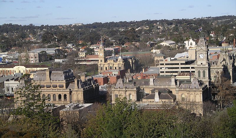
Ballarat and Bendigo
Ballarat (population 101,700 up from 63,500 in 1998) holds a special place in the hearts of most Australians, not only because it became the grandest city in Victoria's goldfields, but also because it was the site of the Eureka Stockade Rebellion, Australia's only significant civil uprising and a symbol of democratic resistance to governmental authority. Tourist information in the Town Hall, 225 Sturt Street, t 1800 44 66 33. Regular and frequent V/Line trains and buses leave Melbourne for Ballarat, Bendigo, and other towns in the goldfields region; local bus services to smaller towns from the main centres such as Ballarat are also quite good. Ballarat itself has a very good bus service to all parts of town (t 03 5331 7777).History
Balla-arat, from the Aboriginal word meaning 'camping or resting-place', lies on a rich alluvial plain much favoured for hunting by the indigenous people; evidence suggests that Aborigines occupied this area 26,000 years ago. In the 1830s the Scottish squatters Yuille and Anderson established sheep runs here.
This bucolic existence ended when, in 1851, Edward Hargraves, fresh from the goldfields of California and convinced that Australia's landscape was similar geologically, discovered gold in New South Wales. Victoria had just achieved separation from its northern neighbour. In the euphoria of independence and with the knowledge of Hargraves' discovery, the new colony at Melbourne encouraged the search for goldfields nearby.
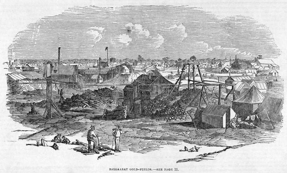 In 1850-51,
considerable deposits were found at Clunes, 40km north of
Ballarat by James Esmond and then in the Buninyong Ranges to
the south. The rush was on, and by the end of 1851, full
mining production was in swing, with hordes of people
arriving daily in unprecedented numbers from all over the
world. Subsequent finds appeared throughout the undulating
hills of the region. By 1853, more than 20,000 miners were
digging here; by the end of the 1850s, 2,500,000 ounces of
alluvial gold had been found, including, at Bakery Hill in
1858, the Welcome Nugget, at 2195 ounces (63,000 grams) one
of the largest intact nuggets ever found.
In 1850-51,
considerable deposits were found at Clunes, 40km north of
Ballarat by James Esmond and then in the Buninyong Ranges to
the south. The rush was on, and by the end of 1851, full
mining production was in swing, with hordes of people
arriving daily in unprecedented numbers from all over the
world. Subsequent finds appeared throughout the undulating
hills of the region. By 1853, more than 20,000 miners were
digging here; by the end of the 1850s, 2,500,000 ounces of
alluvial gold had been found, including, at Bakery Hill in
1858, the Welcome Nugget, at 2195 ounces (63,000 grams) one
of the largest intact nuggets ever found. As old fields were exhausted, new ones were begun, until the alluvial resources were depleted. By the 1860s, quartz mining shafts into the deeper reefs enabled further finds, producing gold into the 1920s. By the 1860s, Ballarat had developed such a thriving economy that it was able to establish a strong industrial base, producing mining equipment and locomotives, and becoming the hub of the region's agricultural cultivation. This diversity enabled it to prosper even when the gold ran out.
The social and cultural transformation of Australia caused by gold fever cannot be overestimated. Victoria became the focus of world attention, and for a time, the wealthiest and most socially diverse spot on earth. As Mark Twain wrote in Following the Equator (1897), 'A celebrity so prompt and universal has hardly been paralleled in history.' Diggers direct from the California goldfields arrived by ship in Melbourne and Geelong, along with thousands of other hopefuls of all nationalities, making the inland journey on bush tracks to Ballarat by whatever means possible. Australians everywhere fled to the fields, leaving jobs in the cities and abandoning farms. The state's population quadrupled in four years, while the rest of the country was brought to an economic standstill.
Ballarat and the surrounding area took on all the chaotic trappings of any frontier boom town. Stories of tragedy, opportunism, opulent indulgence, and social injustice all played a part in these vigorous days. The renowned artiste Lola Montez caused a sensation when she performed her exotic dances here in 1855, and came to blows with the newspaper editor on a public street; the editor had dared to criticise her performance and impugn her morality. Australia Felix, the first volume of the semi-autobiographical trilogy The Fortunes of Richard Mahony (1917) by 'Henry Handel' (Ethel) Richardson, is set here and gives vivid descriptions of the physical discomfort of dusty roads, oppressive heat, and substandard housing.
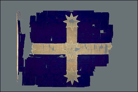 No event came to symbolise more forcefully
the unjust conditions that greeted the hopeful arrivals than
the Eureka Rebellion, a fifteen-minute armed conflict that
occurred on 3 December 1854 during which 30 men, both miners
and government troops, died. The 'spirit of the Eureka
Stockade' has a romantic resonance that far outweighs the
event itself, and the design of the Eureka Flag, carried by
the miners, is still flown as a sign of protest against
governmental power; in many quarters, there is today strong
sentiment to make the flag Australia's national emblem.
No event came to symbolise more forcefully
the unjust conditions that greeted the hopeful arrivals than
the Eureka Rebellion, a fifteen-minute armed conflict that
occurred on 3 December 1854 during which 30 men, both miners
and government troops, died. The 'spirit of the Eureka
Stockade' has a romantic resonance that far outweighs the
event itself, and the design of the Eureka Flag, carried by
the miners, is still flown as a sign of protest against
governmental power; in many quarters, there is today strong
sentiment to make the flag Australia's national emblem. The conflict stemmed from the miners' discontent at the imposition of stiff licensing fees for the right to dig; the payment of these fees was brutally enforced by thuggish and corrupt officials, and little democratic representation was offered in return. The situation led several miners, including J.B. Humffray, Peter Lalor, Frederic Vern and Raffaello Carboni, to form the Ballarat Reform League. Inherent in the organisation's aims were larger issues of democratic rights along with reforms in the administration of the goldfields. The leaders were branded as dangerous radicals, fuelled by the fact that the protesters were seen as non-British and, most especially, Irish discontents continuing in Australia the conflicts of 'home'. A confrontation with the forces of Crown authority was inevitable. Ironically, the process of licensing reform had already been proposed by Governor La Trobe when the rebellion itself took place, but the wilder elements among the miners led to a breakdown of negotiations and consequent bloodshed. The insurrection became a symbol of a revolutionary spirit, and the leaders, particularly Peter Lalor who lost an arm in the conflict, were long championed as the first Australian democrats. Even Karl Marx described Eureka as 'a symptom, a concrete manifestation of the general revolutionary movement in Victoria'.
In reality, the Eureka Rebellion saw the establishment of a more equitable system of licensing and more civilised conditions for the region. Peter Lalor went on to become a politician in the Victorian Parliament, espousing for the most part conservative views.
By far the best chronicler of social conditions of this period was the artist S.T. Gill (1818-80). His anecdotal lithographs of life on the diggings, with his witty renditions of the nouveau riches as well as the pathetic failures, embodied, as art historian Bernard Smith describes, 'a distinctly Australian attitude to life; the sardonic humour, the nonchalance and the irreverent attitude to all forms of authority.' Gill's work popularised the image of the Australian bush for the world, an image that endured long after frontier life had disappeared in places like Ballarat, where the urge for civic improvement and the trappings of civilised society quickly overtook the haphazard squalor of the miners' settlements.
Indeed, 'civic pride' and 'grand' are the terms most frequently used to describe Ballarat's public character by the 1870s. From the 1850s, while the east side of town continued as a place of tents, 'sly grog shops' and rough shanty dwellings, the west side developed broad tree-lined streets and elegant public buildings. East and West Ballarat remained separate municipalities for decades.
When Anthony Trollope visited the city in 1871, he was astonished at its opulence and the quality of its civic amenities. By that time, Ballarat boasted a mechanics' institute, a town hall, several large banks and a mining exchange, a substantial library, an elegant theatre, a synagogue and prominent churches, and distinguished hotels. Architecturally, the city today retains outstanding representatives of the Australian adaptation of late 19C British municipal styles.
Ballarat's information
centre is located at the corner of Eureka and Rodier
Streets (t 03 5320 5741) in Eureka, about 2 km east of the
city's historic commercial areas. A second
information centre is open at the Art
Gallery of Ballarat (north of Sturt Street on
Lydiard St. N.; t 03 5320 5858; open daily 10.00-17.00;
admission free) Sturt Street, one of the city's main
thoroughfares, is three chains wide and tree-lined. 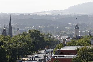 In the median (the
landscaped dividing area between the traffic lanes of the
street) is the delightful Titanic Memorial Bandstand,
erected in 1915 with an elaborate hipped roof and Titanic
weather-vane. The bandstand is an indication of the
street's pleasure building programme and its aspirations
as the city's centre for social festivities. Three blocks
west on Sturt Street in the median strip is the Queen
Alexandra Bandstand, constructed in 1908 with iron
filigree decorations and a more delicate appearance. This
median strip also includes a number of memorial statues,
including the inevitable monument to the Scottish poet
Robert Burns (Australia is said to have more Burns
monuments than Scotland). The statue's sculptor John Udny
came from Italy and sculpted the piece from Carrara
marble.
In the median (the
landscaped dividing area between the traffic lanes of the
street) is the delightful Titanic Memorial Bandstand,
erected in 1915 with an elaborate hipped roof and Titanic
weather-vane. The bandstand is an indication of the
street's pleasure building programme and its aspirations
as the city's centre for social festivities. Three blocks
west on Sturt Street in the median strip is the Queen
Alexandra Bandstand, constructed in 1908 with iron
filigree decorations and a more delicate appearance. This
median strip also includes a number of memorial statues,
including the inevitable monument to the Scottish poet
Robert Burns (Australia is said to have more Burns
monuments than Scotland). The statue's sculptor John Udny
came from Italy and sculpted the piece from Carrara
marble.
At 11 Sturt Street is the Union Hotel, erected in 1863 and
in relatively original condition, making it an important
example of gold rush period building. Its first-floor
French doors once opened into an iron balustraded
verandah. Further along is an 1891 shop, designed in a
Flemish style and covered with decorative blue glazed
tiles, a distinctly Australian Art Nouveau element.
On the north side of the street, the equally colourful
Camp Hotel, built in 1907, is covered in green tiles.
To the east of the centre, at 115-119 Sturt Street, is the
Mechanics' Institute,
the foundation stone of which was laid in 1869; the
present façade was added in 1878. The interior includes a
fine staircase. The institute's Library still functions as
such. The Institute has a varied program. Next door
is the former Unicorn
Hotel (t. 03 5338 7312), parts of which were erected
as early as 1856, making it one of the town's oldest
hotels. The building is now considerably altered, but its
two-storeyed verandah with ironwork is one of the only
remaining examples in the state.
The intersection of Lydiard Street South and Sturt Street
was known as 'the Corner', for it was here that the most
frenzied trading took place during the boom days in the
offices of the share brokers, and where major gold
discoveries were announced. The National Mutual Insurance
Company Offices of 1905, on the western side of the
corner, demonstrates the ostentatious ambition of the
Ballarat town fathers. While the proportions of the
building have been ruined by first-floor modernisation,
the Venetian Gothic design of architects J.J. and E.J.
Clark can be seen in the trefoil arches of the upper
floors. These same architects designed Melbourne's City
Baths, and had originally included here a huge ceiling
dome similar to their work in Melbourne.
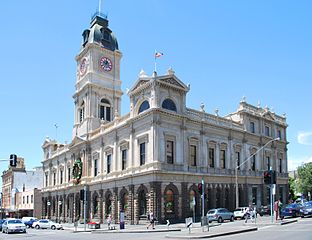 In the same block
on Sturt Street is Ballarat Town Hall. As in so many other
Australian towns with grandiose aspirations, this public
structure became the focus of much architectural and civic
wrangling. Initially conceived as a plain utilitarian
building in the 1860s, by 1868 the City Council decided to
conduct a design competition, then promptly rejected the
judge's choice and settled for separate architects for
exterior and interior. The resultant building is an
amalgamation of the designs of J.T. Lorenz, H.R. Caselli,
and Percy Oakden. It was completed in 1872 at a cost of
£18,000; the four-storey tower was added in 1912. The town
fathers were immensely proud of this awkward
conglomeration when it opened and were disappointed when
visiting English dignitaries were unimpressed. Of greatest
interest are the preponderance of giant Corinthian
columns, its Palladian form, and its rectangular interior
stairway.
In the same block
on Sturt Street is Ballarat Town Hall. As in so many other
Australian towns with grandiose aspirations, this public
structure became the focus of much architectural and civic
wrangling. Initially conceived as a plain utilitarian
building in the 1860s, by 1868 the City Council decided to
conduct a design competition, then promptly rejected the
judge's choice and settled for separate architects for
exterior and interior. The resultant building is an
amalgamation of the designs of J.T. Lorenz, H.R. Caselli,
and Percy Oakden. It was completed in 1872 at a cost of
£18,000; the four-storey tower was added in 1912. The town
fathers were immensely proud of this awkward
conglomeration when it opened and were disappointed when
visiting English dignitaries were unimpressed. Of greatest
interest are the preponderance of giant Corinthian
columns, its Palladian form, and its rectangular interior
stairway.
From here, it is easy to walk back to Lydiard Street
North, the location of the most substantial early
commercial buildings. The entire length of Lydiard Street
was first surveyed in 1851 and named after a police
officer on the Mt Alexander diggings. The northern end's
importance grew with the establishment of the railway
station above Mair Street in 1862, thus prompting the
erection of several hotels and commercial warehouses in
this section.
On the northwest corner of Sturt and Lydiard Streets are a
cluster of banks' buildings, all designed in the 1860s by
prominent architect Leonard Terry. They are considered to
be the most important group of buildings in Ballarat,
speaking to the confident commercial prosperity of the
town's early days. While Terry used a variety of styles
and a mixture of Tuscan and Corinthian orders, the group
presents a unified integration of rustication and arched
fenestration.
Further north on this block is The
George Hotel (t 03 5333 4866), still operating as a
hotel. A hotel occupied this site from 1853 and was an
important social centre, with some of the only fashionable
dining in town. The present building was erected in 1902;
its three-storey ironwork verandah is unique in Victoria.
Immediately across the street are the most significant 19C
public buildings. At no. 6 Lydiard Street is the former
Mining Exchange, built in 1887 to replace the exchange
that had been on 'the Corner'. In keeping with its pivotal
role in Ballarat's economy, the building was a formidable
construction by architect C.D. Figgis, featuring a grand
main hall with Tuscan arcading and elegant natural
lighting, and an elliptical entrance arch. The building
now houses antiques and collectables, but the architecture
is relatively intact.
Next door is Old Colonists' Hall, built in 1887 on the
site of the early gold escort stables; it is now owned by
R.F. Scott & Co., leading suppliers of fishing and
shooting equipment. Its elegant upper-storey iron
balustrade complements the adjoining verandah of the
Alexandria Tea Rooms, with its unusual iron panels with a
radiating pattern. The tea rooms were originally the club
rooms of the Commercial Club.
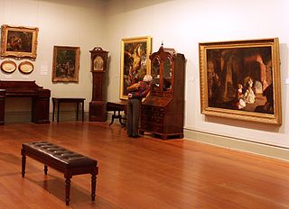 At 40 Lydiard
Street is the Ballarat
Fine Art Gallery (t 03 5320 5858; open Mon-Fri,
9.00-17.00, free), the first provincial art gallery in
Australia, designed for this purpose in 1887 (with
renovations in 1927 and 1967). Leading parliamentarian
Alfred Deakin officially opened the building on 13 June
1890 amidst great fanfare. Initially the main galleries
were upstairs, reached by ascending an impressive stone
stairway. The important historic paintings are still on
the first floor, while the ground floor galleries are used
for changing exhibitions.
At 40 Lydiard
Street is the Ballarat
Fine Art Gallery (t 03 5320 5858; open Mon-Fri,
9.00-17.00, free), the first provincial art gallery in
Australia, designed for this purpose in 1887 (with
renovations in 1927 and 1967). Leading parliamentarian
Alfred Deakin officially opened the building on 13 June
1890 amidst great fanfare. Initially the main galleries
were upstairs, reached by ascending an impressive stone
stairway. The important historic paintings are still on
the first floor, while the ground floor galleries are used
for changing exhibitions.
The gallery's collection is an important one, emphasising
the full spectrum of Australian art. One section on the
ground floor is dedicated to artworks associated with the
Eureka Stockade, the centrepiece of which is the Eureka
Flag itself. Surrounding it are the only known eyewitness
drawings of the rebellion by Swiss digger Charles Doudiet,
recently purchased from Canada. The gallery also has a
long affiliation with the Lindsay family, renowned
Australian artists, who originally hailed from nearby
Creswick (the Lindsay Gallery includes the family's
Creswick sitting room); the collection of drawings and
prints by the Lindsay artists is extensive.
Upstairs the rooms include some of the early monuments of
Australian painting, not only Eugen von Guerard's view of
Old Ballarat in 1853 and Walter Withers' Last Summer
(1898), but also J.C.F. Johnstone's delightful Euchre in
the Bush (c 1867), a folk-art depiction highlighting the
ethnic diversity on the goldfields, and, of course, many
of S.T. Gill's famous watercolours from the gold rush era.
As part of Victoria's regional gallery scheme, in which
these institutions concentrate on specific special
collections, the Ballarat collection also contains a small
but impressive number of medieval manuscripts.
Heading north to Mair Street and one block east is the
crooked Camp Street, so named because the first Government
Camp was installed here in 1851. Here are some splendid
old buildings: Pratt's Warehouse on the corner of Mair
Street, the Greek Revival Freemason's Hall (now Electra
Hall) of 1872, the 1887 Trades Hall, and the bluestone Old
Ballarat Police Station, also from the 1880s. These are
now somewhat overshadowed by the imposing State Government
Offices built in 1941.
From the corner of Lydiard and Mair Streets and along the
next block north are several early commercial warehouses,
evidence of the mercantile activity engendered by the
railway. Most intact is J.J. Goller & Co. Warehouse,
erected in 1861-62, its rusticated façade and window
quoinings reminiscent of early Chicago warehouses. At the
end of this block opposite Market Street is Reid's Coffee
Palace, built in the 1880s at the height of the Coffee
Palace vogue. While much of its exterior has been
lamentably renovated, the interior still includes the
original hand-painted ceiling.
Across the street on the corner of Mair Street is the
former Ballarat Palace Hotel of 1887 (now an insurance
company), notable for its 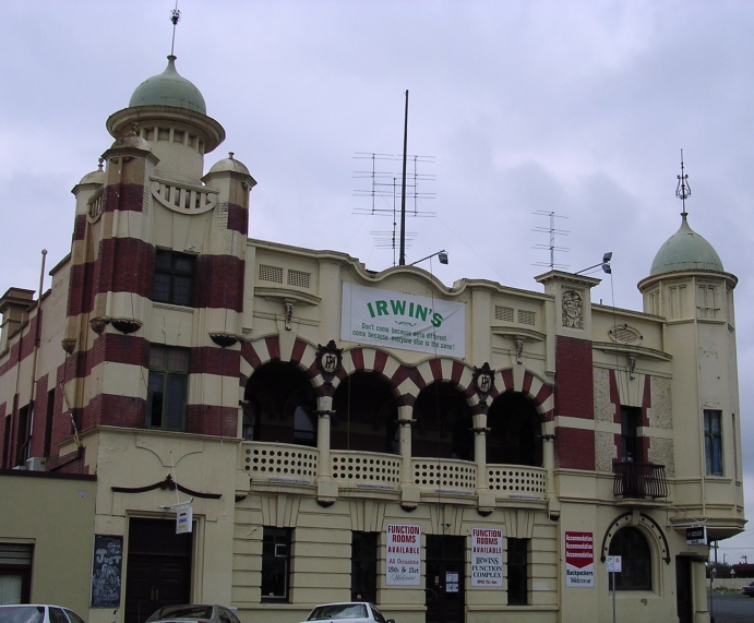 original exterior
with crisp details and proportions. In marked contrast on
this side of the street, further north at Ararat Street,
is the flamboyant Provincial Hotel, built in 1909 by P.S.
Richards, on the site of an earlier hotel of the same
name. It is a remarkable if clumsy example of eclectic
Edwardian design, with its orientalist towers and
Romanesque arched balconies.
original exterior
with crisp details and proportions. In marked contrast on
this side of the street, further north at Ararat Street,
is the flamboyant Provincial Hotel, built in 1909 by P.S.
Richards, on the site of an earlier hotel of the same
name. It is a remarkable if clumsy example of eclectic
Edwardian design, with its orientalist towers and
Romanesque arched balconies.
this point the railyards begin. The railway station itself
represents the central position played by Ballarat in the
growth of Victoria's provincial rail system. The main
building was constructed in 1862, when an indirect line
from Melbourne reached the city. The platform shed covered
three railway tracks and extended sixteen bays along the
platform. By 1889, when the link between Ballan and
Bacchus Marsh finally created a direct route to Melbourne,
the southern entrance building, with its impressive clock
tower was completed. Trains from Melbourne and other parts
of Victoria still arrive at this station.
Lydiard Street South properly begins at the junction
of Eyre and Armstrong Streets and continues to Sturt
Street. Interestingly, this corner is the site of Ebenezer
Presbyterian Church, with the former Gaol and Supreme
Court next door. The church is a Classical Revival
structure, erected in 1862 to a design by H.R. Caselli;
the ornate iron fence which surrounds the church, manse
and hall was added in 1892. The remnants of the gaol next
door on Lydiard Street South, as well as the former
Supreme Court Building, are now part of the Ballarat
School of Mines grounds.
When the gaol was built in 1857, it was one of several
gaols constructed in the Victorian countryside in response
to the need for prison accommodation once the hideous
prison hulks (in Port Phillip Bay) were removed. As with
the other prison buildings in the state, the design was
based on the Pentonville system, with a central hall and
radiating wings. Now only the gateway, flanking buildings
and guard tower remain.
The adjoining Supreme Court building, from 1868, consists
of a public room and a central court room with flanking
offices. Its façade is similar to any number of
Commonwealth country courthouses of the era. Further north
is the original building of the School of Mines and
Industries, a central institution in Ballarat's social
history since 1870. Founded by members of the Mining Board
to provide all-rounded practical education of use to the
mining industry, the school soon gained a reputation for
the excellence of its training in engineering, metallurgy,
chemistry and geology.
To the right at Dana Street is the Ballarat Club,
representative of the town's ambitious striving for
English sophistication. Formed in 1872 and in this
building since 1888, the purpose of the club was to uphold
upper-class English values. Historians of the social life
of the era point out that the club did not allow
membership to tradesmen, women, Jews, or Catholics. The
predominant entertainment in the club, after eating,
drinking, playing cards and smoking, was betting. The
building, by C.D. Figgis, is one of appropriately
restrained elegance.
On the opposite corner of Dana Street is further evidence
of genteel society, in the cluster of churches, most
notably the former Wesleyan Church by architects Terry and
Oakden (Terry seems to have specialised in the
ecclesiastical buildings of the non-conformist
denominations, while Oakden served the needs of the
Anglicans and Catholics). Thus begins the most public
block of the street up to Sturt Street and 'the Corner',
dominated by two of the most historical structures in the
city.
On the east side is the former Academy of Music, now the Royal South
Street Memorial Theatre (t 03 5332 1054) , and the
scene of some of the most boisterous events in Ballarat's
social history. Here was an annual music competition for
which Ballarat was well known in the late 19C. Opening in
1875 with an operatic production of La Fille de Madame
Angot, the building also saw performances by Dame Nellie
Melba, Gladys Moncrieff, and Harry Lauder; future prime
minister James Scullin won a debating championship here
when a young man.
Architecturally, the building has been substantially
renovated, first in 1898 by the famous theatre architect
William Pitt. This remodelling extended the seating
capacity to 2000 and saw the addition of the Art Nouveau
interior decorations and a double balcony, which still
survive.
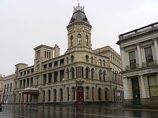 Across the street
is the grandest hotel associated with the gold rush era, Craig's Royal
Hotel (t 03 5331 1377). The building stands on the
site of the town's first licensed hotel, opened in 1853 by
Thomas Bath. In 1857 this modest timber building was
purchased by Walter Craig, and by 1862 he had built the
grandiose southern wing, in an Italianate style. Over the
next 40 years the hotel expanded, incorporating a variety
of architectural styles and culminating in the
ostentatious corner tower in 1890. Many original features
remain, especially the elegant stairway, the dining room
pilasters, and a fantastic bar surrounded by painted
stuccowork. The entrance is still flanked by original gas
lamps.
Across the street
is the grandest hotel associated with the gold rush era, Craig's Royal
Hotel (t 03 5331 1377). The building stands on the
site of the town's first licensed hotel, opened in 1853 by
Thomas Bath. In 1857 this modest timber building was
purchased by Walter Craig, and by 1862 he had built the
grandiose southern wing, in an Italianate style. Over the
next 40 years the hotel expanded, incorporating a variety
of architectural styles and culminating in the
ostentatious corner tower in 1890. Many original features
remain, especially the elegant stairway, the dining room
pilasters, and a fantastic bar surrounded by painted
stuccowork. The entrance is still flanked by original gas
lamps.
Historically, Craig's has many important associations. The
poet Adam Lindsay Gordon ran the livery stables here in
1867; the cottage in which he lived behind the hotel has
been re-erected in the Ballarat Botanic Gardens. Famous
guests included Queen Victoria's sons, Prince Alfred, the
Duke of Edinburgh, and the Prince of Wales, and Mark
Twain. At the end of the American Civil War in 1865,
officers of the Confederate ship, the Shenandoah, were
fêted here, while they supposedly recruited men for their
cause (although it appears more likely that they were just
having a rip-roaring good time). In 1911, Dame Nellie
Melba began a tradition of singing operatic arias from the
Grand Victorian Balcony for the people in the street
below.
East Ballarat
Sturt Street travelling east from Lydiard Street makes
a loop around a shopping mall to become Victoria Street or
the Melbourne Road. This is now East Ballarat, where the
diggers lived and where construction was far less
organised and stolid than in West Ballarat. The roads are
less regulated, with small streets that simply emerged
from the growing settlements.
Turn south on East Street to Barkley Street, and turn left
into Barkly Street (named for Sir Henry Barkly, Governor
of Victoria 1856-63). At this juncture on both sides of
the street are major brick structures of the early period.
On the right is the East Ballarat Library (now a branch of
the School of Mines), erected in 1867 by J.T. Lorenz and
C.H. Ohlfsen-Bagge, an innovative engineer-architect much
taken with polychrome brickwork. Across the street is the
East Ballarat Fire Station, the brick tower of which was
constructed first in 1864 to house the fire bell.
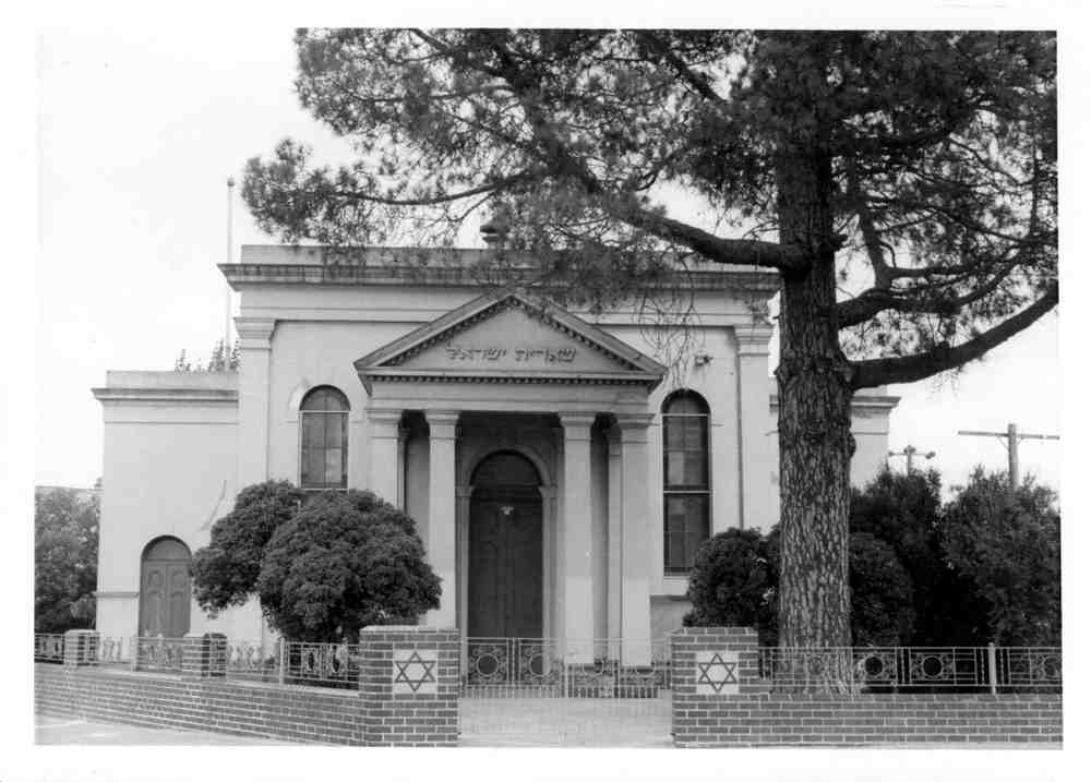 At the corner of
Barkly and Princes Streets is the elegant Synagogue, built
as early as 1861 by T.B. Cameron-evidence of a sizeable
Jewish population in early Ballarat; Jewish author Pinkus
Goldhar, in fact, wrote a story, 'The Last Minyan' (1939),
set among the community here. The building follows the
pattern of European Orthodox synagogues, although the
exterior is a Classical design with Tuscan columns. It is
one of the only 19C synagogues remaining in Victoria.
At the corner of
Barkly and Princes Streets is the elegant Synagogue, built
as early as 1861 by T.B. Cameron-evidence of a sizeable
Jewish population in early Ballarat; Jewish author Pinkus
Goldhar, in fact, wrote a story, 'The Last Minyan' (1939),
set among the community here. The building follows the
pattern of European Orthodox synagogues, although the
exterior is a Classical design with Tuscan columns. It is
one of the only 19C synagogues remaining in Victoria.
Gold-mining in Ballarat ~ Eureka Street
Turn south on Princes Street to Eureka Street,
location of many historical attractions. Here were the
actual goldfields and the miners' settlements, and here
the Eureka Rebellion took place. This section was strongly
identified with the Irish community, and a Catholic chapel
was erected as early as 1854.
West towards Main Street is Montrose
Cottage, the oldest stone cottage in Ballarat, was
built in 1856 of bluestone by Scottish stonemason John
Alexander. It has been restored and is now an elegant
bed and breakfast.
About a km further up Eureka Street is the supposed site
of the Eureka
Stockade (t 03 5333 0333; museum admission
adults $12.00, children $8.00; open 1000-17.00;
re-enactment, admission adults $59.50, children 31.50;
call for hours). Across the street is the Eureka Centre,
telling the story of the rebellion through a series of
computer screens. The surrounding gardens were set
aside as a commemorative in the 1870's.
At Fussell Street, turn south to the Ballarat
Wildlife Park (t 03 5333 5933; open daily,
09.00-17.00; admission adults $33.00, concession $27.00,
children $18.50), 16 ha, replete with all the expectable
Australian fauna offering viewings at feeding times.
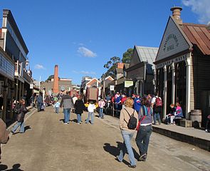 Turn west on York Street,
then follow the signs south on Main Street to Sovereign
Hill Gold-Mining Township (t 03 5337 1199, open
daily 9.30- 17.30; admission audlts $55.50, concession
44.40, children $25.00). As an open-air museum re-creating
an 'authentic' 1850s gold-mining town, Sovereign Hill does
as good a job as any of these kinds of endeavours, with
everyone dressed in 19C costumes and using original
machines and equipment. You can pan for gold, walk down a
re-created main street, and visit a mining museum with
actual tunnel tours. There is even a Chinese village,
although at last count no Chinese were included amongst
the historically dressed guides. Overnight accommodation
is even offered in a re-created Government Camp.
Turn west on York Street,
then follow the signs south on Main Street to Sovereign
Hill Gold-Mining Township (t 03 5337 1199, open
daily 9.30- 17.30; admission audlts $55.50, concession
44.40, children $25.00). As an open-air museum re-creating
an 'authentic' 1850s gold-mining town, Sovereign Hill does
as good a job as any of these kinds of endeavours, with
everyone dressed in 19C costumes and using original
machines and equipment. You can pan for gold, walk down a
re-created main street, and visit a mining museum with
actual tunnel tours. There is even a Chinese village,
although at last count no Chinese were included amongst
the historically dressed guides. Overnight accommodation
is even offered in a re-created Government Camp.
At night a sound-and-light production, 'Blood on the
Southern Cross', recounts the Eureka story (see
re-enactment at Eureka Stockade above). Opposite the venue
itself is the Gold Museum (open weekdays 09.30-17.30);
admission here is included in the township's entry fee. A
thoughtfully designed building allows a view of the hills
and gullies of Ballarat where the gold was found. The
exhibitions themselves are quite spectacular in terms of
actual minerals displayed, and include a good history of
gold and minting, as well as a social documentation of
Ballarat and Eureka.
Western Ballarat
If you enter Ballarat from the west on the
Ballarat-Burrumbeet Road, you pass by a 23km Avenue of
Honour, containing 4000 trees commemorating the soldiers
of the First World War. It ends at an Arch
of Victory, erected through the fund-raising efforts
of the women employees of E. Lucas & Co., makers of
women's underwear. The arch was opened in 1920 by the
Prince of Wales. From this point, it is a short distance
further to Lake
Wendouree Botanic Gardens on Wendouree Parade (t
03 5320 5135; conservatory open dialy 9.00-16.30,
gardens open 7.30-21.00 Oct.-Apr., 7.30-18.00 May-Sept;
free admission). Turn north on Gillies Street to reach the
gardens and its conservatory. The lake is on the site of
what was Yuille's Swamp; by the 1850s it had been
consolidated into this lake, and by the 1860s boating
clubs and other amusement centres began to develop. At the
same time, the adjacent police horse paddock was converted
into the botanic gardens.
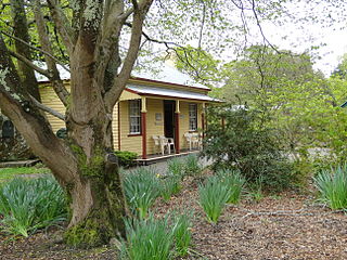 The
real heyday of the area was the 1880s, when genteel ideas
of leisure activity led to the establishment of
picturesque walks, the installation of paddle steamers,
and the erection of picnic pavilions. Elegant Victorian
villas surround the lake. The gardens contain a Statuary
Pavilion, erected in 1887 and filled with sculptures
imported from Italy (Ballarat is known as Victoria's 'city
of statues'). These had been donated by wealthy Ballarat
bachelor Thomas Stoddart, one of several prominent
citizens who sought to elevate Ballarat's self-image. The
cottae of Adam Lindsay Gordon, mid-19C poet and horseman,
has been moved here to act as a craft shop. Also in the
gardens is the Begonia House, centre of the city's annual
Begonia Festival each February/March. The house is now the
Robert Clark Conservatory an elegant new greenhouse that
recently won a design award from the Royal Australian
Institute of Architects. The grounds also display several
trees that are now on the National Trust's Register of
Significant Trees. Most striking are the California
redwoods, difficult to grow in Australia; they commemorate
the historical ties between the Californian and Victorian
gold rushes, and the number of American diggers who
arrived here in the 1850s. It should be noted that,
conversely, Australian diggers brought eucalyptus
trees-now ubiquitous in the US state-to California in
1856.
The
real heyday of the area was the 1880s, when genteel ideas
of leisure activity led to the establishment of
picturesque walks, the installation of paddle steamers,
and the erection of picnic pavilions. Elegant Victorian
villas surround the lake. The gardens contain a Statuary
Pavilion, erected in 1887 and filled with sculptures
imported from Italy (Ballarat is known as Victoria's 'city
of statues'). These had been donated by wealthy Ballarat
bachelor Thomas Stoddart, one of several prominent
citizens who sought to elevate Ballarat's self-image. The
cottae of Adam Lindsay Gordon, mid-19C poet and horseman,
has been moved here to act as a craft shop. Also in the
gardens is the Begonia House, centre of the city's annual
Begonia Festival each February/March. The house is now the
Robert Clark Conservatory an elegant new greenhouse that
recently won a design award from the Royal Australian
Institute of Architects. The grounds also display several
trees that are now on the National Trust's Register of
Significant Trees. Most striking are the California
redwoods, difficult to grow in Australia; they commemorate
the historical ties between the Californian and Victorian
gold rushes, and the number of American diggers who
arrived here in the 1850s. It should be noted that,
conversely, Australian diggers brought eucalyptus
trees-now ubiquitous in the US state-to California in
1856.
The Ballarat Vintage
Tramway (t 03 5334 1580; open 12.30-17.00 weekends
and holidays; fare adults $4.00 chilred $2.00) also
operates at the botanic gardens, the last vestige of the
city's previously extensive tram system. The lake was the
venue for the rowing events at the 1956 Melbourne
Olympics, and one still finds Olympic athletes training
here.
Imposing churches
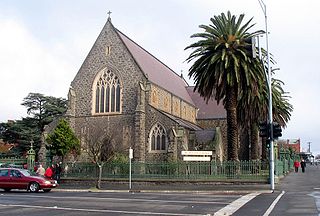 As a city with
grand Victorian-era aspirations, Ballarat of course set
aside prime land for the construction of imposing
churches. To the west of Doveton Street (Glenelg Highway)
on Sturt Street are several: on the southern corner of
Sturt and Dawson Streets is St Patrick's Cathedral, for
which construction began as early as 1857, but work halts
delayed its completion until 1891. In the 1860s, the main
design was conceived by J.B. Denny, local architect in
thrall of Puginesque Gothic Revival; elements of Pugin's
ideas are evident throughout the cathedral complex, a
characteristic that makes it unique in Victorian
ecclesiastical design.
As a city with
grand Victorian-era aspirations, Ballarat of course set
aside prime land for the construction of imposing
churches. To the west of Doveton Street (Glenelg Highway)
on Sturt Street are several: on the southern corner of
Sturt and Dawson Streets is St Patrick's Cathedral, for
which construction began as early as 1857, but work halts
delayed its completion until 1891. In the 1860s, the main
design was conceived by J.B. Denny, local architect in
thrall of Puginesque Gothic Revival; elements of Pugin's
ideas are evident throughout the cathedral complex, a
characteristic that makes it unique in Victorian
ecclesiastical design.
Opposite the cathedral on Dawson Street is the former
Baptist Church of 1867 (now Church of Christ), a
marvellously intact example of classical Roman revival
design, quite similar to the Collins Street Baptist Church
in Melbourne. Across Sturt Street on the northwestern
corner is St Andrew's Kirk, another formidable structure
that took more than 30 years and several architects to
complete, from 1862-89. Overall, the impression is of
Norman detailing and Presbyterian sobriety (it is now a
Uniting Church).
A block north on the corner of Dawson and Mair Streets is
the former Congregational Church, an 'eclectic Gothic'
monument of the 1880s. Finally, it is interesting to see
at Neill and McCarther Streets, in an area of residential
buildings, a set of three churches of the same
congregation, built at twenty-year intervals as the
congregation outgrew the last building.
Ballarat to Bendigo
From Ballarat, you might decide to travel north on
the Midland Highway (A300) to the other great gold-town,
Bendigo; there are also train connections between Ballarat
and Bendigo, and from Melbourne. En route, the rolling
countryside is dotted with small towns that owe their
existence to the presence of gold in the nearby rivers and
hills, and each is rich in historic buildings, tourist
attractions, and has information centres which provide
walking tours and detailed descriptions.
18km from Ballarat is Creswick, home of the famous Lindsay
family. The author and artist Norman Lindsay based the
descriptions in his Redheap novels on the town, referring
to it as 'one of those eruptions of human lunacy called a
mining centre'. The books were banned in the town for
their unsympathetic portrayal of recognisable residents.
Lindsay's father, the town doctor, was present at the
birth here in 1885 of John Curtin, the famous Labor Prime
Minister during the Second World War. A granite monument
commemorates Curtin as a native son. The present Creswick
Historical Museum (t 03 5345 2845; open
weekends and holidays 11.00-15.30; admission adults $5.00,
concession $ 4.00, children free), in the 1876 Town Hall
on Albert Street, displays many artworks by the Lindsays
and other regional artists, and provides historical
background on the area.
Creswick is also home to the Creswick
Woolen Mill (tours 11.00, 12.00, 13.00, 14.00;
admission $15.00 voucher at shop), the only surviving
industrial scale woolen mill in Australia. It is at
the end of Railway Parade, about 2 km from the Town Hall,
left on Williams off of North Parade.
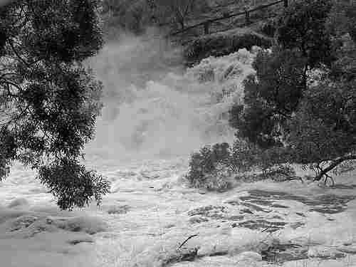 A further 27km
north on A300 are the twin 'spa towns' of Daylesford and
Hepburn Springs. In the region are numerous mineral
springs; 50 per cent of Australia's mineral water sources
are located here, and the residents have been bottling
water since 1850. Unfortunately, the Hepburn
Springs Blowhole is closed at present due to the
floods in 2016, but other springs in the park are open.
Tourist
information: 49 Vincent Street, t 03 5321 6123. A
daily bus/train service runs from Melbourne, and also has
weekday buses to Ballarat, Castlemaine and Bendigo. A
shuttle bus between Daylesford and Hepburn Springs runs
eight times a day, weekdays only.
A further 27km
north on A300 are the twin 'spa towns' of Daylesford and
Hepburn Springs. In the region are numerous mineral
springs; 50 per cent of Australia's mineral water sources
are located here, and the residents have been bottling
water since 1850. Unfortunately, the Hepburn
Springs Blowhole is closed at present due to the
floods in 2016, but other springs in the park are open.
Tourist
information: 49 Vincent Street, t 03 5321 6123. A
daily bus/train service runs from Melbourne, and also has
weekday buses to Ballarat, Castlemaine and Bendigo. A
shuttle bus between Daylesford and Hepburn Springs runs
eight times a day, weekdays only.
The area developed quickly as a fashionable health
resort, only an hour's drive from Melbourne. Initially,
gold discoveries here encouraged the arrival of European
diggers: at Daylesford Swiss-Italian tunnellers, and at
Hepburn Springs some 20,000 Italians by the 1860s.
Consequently, much of the early architecture bears a
resemblance to Northern Italian and Tyrolean models.
By the 1890s, the region had the elegant air of a European
spa, evident in the Hepburn Springs
Spa complex (t 03
5321 0000), originally constructed in 1895 and
renovated in 1991. Today renewed interest in natural
health therapy has made the area a centre for alternative
lifestyles and New Age crafts (and excellent bookshops!).
Each April since 1987, the Daylesford Spa Festival is
held. In Daylesford is also the Convent Gallery,
corner of Daly and Hill Streets (t 03 5348 3211), a lovely
arts-and-crafts centre in a restored 1892 convent which is
also known for its restaurant. The town has the requisite
Historical
Society Museum (100 Vincent St., Daylesford; open
Sat. and Sun. 13.30-16.30, and school holidays Tues.,
Wed., and Thurs.; admission adults $4.00, children $1.00)
and a nice botanic
gardens (at Wombat Hill in Daylesford).
Daylesford is also the site of the Scottish Highland
Gathering in the first week of December, like
several of these celebrations people describe it
as the largest Scottish gathering outside of
Scotland. In July, the region's Swiss-Italian heritage is
celebrated at the Mid-Winter Festival.
Castlemaine
From Daylesford, continue north 40km to Castlemaine
(population 6,700 down from 7,450 in 1998), one of the
major centres for gold-mining. The Mt Alexander Goldfields
were here, whose gullies produced some of the richest
alluvial yields in the world. Castlemaine was initially
the administrative centre for all of the goldfields and
site of the government camp. Tourist
information centre: Duke Street; t 03 5471
1795. Daily trains operate from Melbourne to Castlemaine
and on to Bendigo and Swan Hill.
Today Castlemaine is known for its substantial number of
gold-era buildings, and most especially the Market Hall (t
03 5472 2679) on Mostyn Street, designed as if it were a
Roman basilica, complete with Tuscan portico and a statue
of Ceres, Roman goddess of the harvest, on top of the
entrance. It was used as a market until 1967, and is now a
museum.
The Castlemaine
Art Gallery and Historical Museum (t 03 5472
2292; open weekdays 10.00-17.00, closed Tues., and
weekends and holidays 12.00-17.00; admission adults
$10.00, concession and children $8.00) contains some
excellent Australian paintings, including Frederick
McCubbin's Golden Sunlight (c1895) donated by Dame Nellie
Melba, and works by Margaret Preston. The Theatre
Royal (t 03 5472 1196) on Hargraves Street is touted
as one of the oldest theatres in Victoria, one where the
notorious Lola Montez played to rowdy and adoring miners.
Today, it serves as a popular cinema and restaurant.
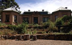 The gallery is also the
caretaker for a superb historical house and gardens, 'Buda',
42-8 Hunter Street (t 03 5472 1032; open Wed. through Sat
12.00-17.00, Sun and holidays 10.00-17.00). The house was
originally in the style of a British-Indian bungalow with
wide verandahs, built for Colonel John Smith, but it was
purchased in 1857 by noted Hungarian silversmith Ernest
Leviny, who named it after his native city and extended
the rooms considerably to accommodate his large family.
While the present exterior appears rather shabby, the
house's treasures are the beautiful gardens and the
interior rooms, lovingly maintained by Leviny's five
daughters with fine examples of their father's silver
work. Each spring, an Annual Garden Party continues a
Leviny tradition; the gardens are considered among the
most important in Victoria.
The gallery is also the
caretaker for a superb historical house and gardens, 'Buda',
42-8 Hunter Street (t 03 5472 1032; open Wed. through Sat
12.00-17.00, Sun and holidays 10.00-17.00). The house was
originally in the style of a British-Indian bungalow with
wide verandahs, built for Colonel John Smith, but it was
purchased in 1857 by noted Hungarian silversmith Ernest
Leviny, who named it after his native city and extended
the rooms considerably to accommodate his large family.
While the present exterior appears rather shabby, the
house's treasures are the beautiful gardens and the
interior rooms, lovingly maintained by Leviny's five
daughters with fine examples of their father's silver
work. Each spring, an Annual Garden Party continues a
Leviny tradition; the gardens are considered among the
most important in Victoria.
Castlemaine also has one of the oldest provincial botanic
gardens, at Downes Road along Barkers Creek (t 03 5471
1705; open 8.30-17.00), begun in 1856 with many plants
provided by Melbourne's famous botanist Ferdinand von
Mueller. The town is also famous as the original home of
Queensland's XXXX Beer; it was first brewed here by
Irishman Edward Fitzgerald in 1859. When Fitzgerald moved
to Brisbane in 1887, he took the name and the recipe with
him; hence the 'Castlemaine' on every Queensland bottle
today.
The area around Castlemaine is dotted with picturesque
towns and remnants of old diggings, and the countryside
boasts an abundance of tranquil country bed and
breakfasts.
18km northwest is Maldon (population 1,400 up from
1,110 in 1998), voted in 1965 by the National Trust as the
'First Notable Town in Australia' for its well-preserved
overall streetscape. It has subsequently served as an
ideal stage-set for historic films and now is filled with
tea-rooms, antique shops and cottage gardens. The
buildings are quite 'authentic', offering small
storefronts of 1850s and 1860s. Tourist
information centre: High Street; t 03 5475 2569.
The road to the town travels through hills with a distinct
geology, and evidence of mining tailings appear in the
landscape everywhere. The Historical
Museum (t 03 5475 1633; open Sat. 13.30-16.00;
admission adults $5.00, others free) has quaint and
informative displays, and the Castlemaine and Maldon
Preservation Society run steam trains along an old
section of track on selected dates -- see their website
for particulars.
Gold was discovered here in 1853 by German prospector John
Mechosk, who located several other major finds. Once the
rich alluvial fields were depleted, enormous quartz reefs
were discovered, and continued to produce until the 1930s.
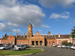 From Castlemaine
48km west on the Pyrenees Highway (B180) is Maryborough
(population 7,100 down from 7,800 in 1998), another
country town growing out of gold diggings. It certainly
had delusions of grandeur if the railway station is any
indication. It is worth visiting just to see this
grandiose structure, 400m long with marble dressing-tables
in the toilets and oak and walnut panelling. Legend has it
that the design was actually produced for Spencer Street
Station in Melbourne. On his famous tour of Victoria in
1895, Mark Twain described Maryborough as 'a railway
station with a town attached'. Tourist
information: Alma and Nolan Streets, t 03 5460
4511.
From Castlemaine
48km west on the Pyrenees Highway (B180) is Maryborough
(population 7,100 down from 7,800 in 1998), another
country town growing out of gold diggings. It certainly
had delusions of grandeur if the railway station is any
indication. It is worth visiting just to see this
grandiose structure, 400m long with marble dressing-tables
in the toilets and oak and walnut panelling. Legend has it
that the design was actually produced for Spencer Street
Station in Melbourne. On his famous tour of Victoria in
1895, Mark Twain described Maryborough as 'a railway
station with a town attached'. Tourist
information: Alma and Nolan Streets, t 03 5460
4511.
Bendigo
North from Castlemaine 40km on the Calder Highway (A79/A300) is Bendigo (population 92,800 up from 70,000). The train from Melbourne and Castlemaine also travels on to Bendigo. If 'grand' describes Ballarat, 'proudly prosperous' describes Bendigo, more low-key and less touristy than its southern neighbour. Tourist information: 51-67 Pall Mall; t 03 5444 4445; freecall 1 800 813 153.
History
The first gold discovery here occurred in 1851, when
Margaret Kennedy, the stationmaster's wife, allegedly made
a small find. Initial alluvial mining quickly died out,
but plentiful reef mining began in the 1860s. Ultimately,
over 35 reefs would be discovered in the vicinity.
Improved mining methods allowed Bendigo to continue as a
gold producer into the 1950s.
The town itself was first called Sandhurst, but popular
opinion finally led to the official adoption of the
goldfield name Bendigo in the 1890s. The name, popular
tradition maintains, was the nickname of a shepherd who
had become a local prizefighter and emulated 'Bendigo'
Thompson, a famous English fighter of the time. The name
itself is a corruption of the Biblical Abednego.
In his humorous novel, Illywhacker (1985), Peter
Carey's hero Herbert Badgery gives a poetic description of
Bendigo which captures the impression it must have given
to 19C eyes:
I have heard people describe Bendigo as a country town ... These people have never been to Bendigo and don't know what they are talking about ... if there are farmers in the streets, dark cafes with three courses for two and sixpence and, in Hayes street, a Co-op dedicated to Norfield Wire Strainers and Cattle Drench, it does not alter the fact that Bendigo is a town of the Golden Age.
Early aspirations for Sandhurst to be a grand British provincial town are evident in the naming of streets. The surveyor Richard Larritt called the central square Charing Cross and its intersecting street Pall Mall; a bit north of here on View Street is the information centre. The park Larritt planned to the north of Pall Mall was later called Rosalind Park, after the character in Shakespeare's As You Like It.
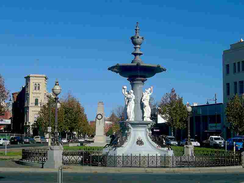 At Charing Cross
Square is Alexandra Fountain, built in 1881 by noted
architect W.C. Vahland and named for Alexandra, Princess
of Wales. At the time the town was proud of its reputation
for polished stonework, and the fountain gave an
opportunity to employ local talent. From here you can
begin a Heritage Walk with accompanying brochure available
from the information centre.
At Charing Cross
Square is Alexandra Fountain, built in 1881 by noted
architect W.C. Vahland and named for Alexandra, Princess
of Wales. At the time the town was proud of its reputation
for polished stonework, and the fountain gave an
opportunity to employ local talent. From here you can
begin a Heritage Walk with accompanying brochure available
from the information centre.
This square was originally known as View Point,
because it overlooked Bendigo Creek. The town's early
prestigious banks were located across the street, as can
be seen in a row of buildings on the northwest block and
leading up View Street itself.
View Street North is lined with public buildings of the
Victorian era, some of them carefully restored and
preserved and others in various states of renovation. The
elegant Union Bank (now ANZ Bank), no. 45, built in 1876
with Corinthian columns and bluestone pedestals, has been
restored to its original state, to complement the
stupendous Masonic Hall and Temple, further north on the
west side, no. 52. The architects of this impressive
structure were Robert Getzschmann and W.C. Vahland (not
surprisingly, they were both freemasons and Vahland was
Grand Master of this lodge); the majority of prominent
early buildings in town were designed by this prolific
architectural team. The main building, with its perfectly
proportioned Corinthian portico, was completed in 1873.
The interior contains ornate plasterwork with Masonic
symbols and above every window a depiction of Tubal Cain,
the Biblical metal-worker. In 1890, the building became
the Capitol Theatre; next to the Melbourne Town Hall, it
was the largest hall in Victoria. Originally part of the
ground floor and the basement were the Masonic Hotel,
known as the 'Shades'; a faded sign at the back still
bears witness to this establishment, although the hotel
was delicensed in 1922.
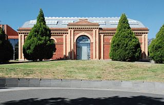 Next door is the
Bendigo Art
Gallery (t 03 5434 6088; open Tues.-Sun.
10.00-17.00; free admission). The original structure was a
polychrome brick Orderly Room built for the town's Rifle
Brigade, again by Vahland and Getzschmann, in 1867. This
building was covered over in the 1950s by the unfortunate
façade. Plans are apparently afoot to retrieve the
original façade, although this may be wishful thinking on
the part of the gallery's curators. The interior gives
evidence to the original building's pleasant proportions.
Next door is the
Bendigo Art
Gallery (t 03 5434 6088; open Tues.-Sun.
10.00-17.00; free admission). The original structure was a
polychrome brick Orderly Room built for the town's Rifle
Brigade, again by Vahland and Getzschmann, in 1867. This
building was covered over in the 1950s by the unfortunate
façade. Plans are apparently afoot to retrieve the
original façade, although this may be wishful thinking on
the part of the gallery's curators. The interior gives
evidence to the original building's pleasant proportions.
The gallery's collection is a jewel in the crown of
Victoria's regional art gallery system. Not only is there
a good selection of Australian paintings, but also a
substantial number of 19C English and French paintings,
especially of the Barbizon School. Most of these works
were given to the gallery by Dr Neptune-Scott, a local
surgeon, and by some of the gold-wealthy citizens of the
community.
On the northern side of the Arts Centre Building is
Dudley House, Bendigo's oldest government building. It was
originally the offices of surveyor Richard Larritt, who
moved in 1854, having already laid out Bendigo's street
plan. The building now houses the Bendigo Branch of the
Royal Historical Society of Victoria, and contains period
furnishings and historical documents.
At no. 28 View Street is Temperance Hall, another Vahland
and Getzschmann structure of 1860, now a Chinese waxworks
museum. Note to the north of the building an old wall sign
indicating the 'Births and Deaths Registrar Office' with
finger pointing up the passageway.
Pall Mall
From Charing Cross, travel northeast on Pall Mall, the
central business district. At no. 18 is the Beehive Store,
site of the earliest trading exchanges in the city. After
a fire gutted the first structure in 1871, this handsome
building was erected by Charles Webb, architect of the
Windsor Hotel in Melbourne.
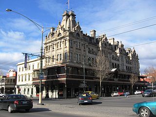 In the next block, on the
corner of Williamstown Street and Pall Mall is the Shamrock Hotel
(t 03 5443 0333), centre of Bendigo's social life from the
town's earliest days. As early as 1854, a restaurant with
entertainment hall was located here; as the Shamrock, it
had one of the first liquor licenses in town. The Irish
owners, Billy Heffernan and John Crowley, made a fortune
presenting first-class entertainment and good dining; the
goldfield comic Charles Thatcher, a popular entertainer of
the period, appeared here nightly. By 1860, they had built
a new hotel and theatre, designed by the ubiquitous team
of Vahland and Getzschmann. It was lit by gas throughout
and had a bowling alley in the basement. The present
building was erected in 1897 for new owners; the architect
this time was Philip Kennedy, who had trained in the
Vahland offices. No expense was spared in the opulent
design, and the hotel boasted electricity and hot water.
Every distinguished visitor to Bendigo stayed here.
In the next block, on the
corner of Williamstown Street and Pall Mall is the Shamrock Hotel
(t 03 5443 0333), centre of Bendigo's social life from the
town's earliest days. As early as 1854, a restaurant with
entertainment hall was located here; as the Shamrock, it
had one of the first liquor licenses in town. The Irish
owners, Billy Heffernan and John Crowley, made a fortune
presenting first-class entertainment and good dining; the
goldfield comic Charles Thatcher, a popular entertainer of
the period, appeared here nightly. By 1860, they had built
a new hotel and theatre, designed by the ubiquitous team
of Vahland and Getzschmann. It was lit by gas throughout
and had a bowling alley in the basement. The present
building was erected in 1897 for new owners; the architect
this time was Philip Kennedy, who had trained in the
Vahland offices. No expense was spared in the opulent
design, and the hotel boasted electricity and hot water.
Every distinguished visitor to Bendigo stayed here.
In 1898 the Australian Natives Association, the most
powerful social organisation in the country, met at the
Shamrock and agreed to support Federation of the
Australian colonies. In 1975, the hotel was threatened
with demolition, until it was rescued by the State
Government to the tune of $2,300,000. It is still a centre
of social life, with good restaurants and accommodation.
Across the street from the Shamrock on Pall Mall is the
Post Office, as ambitiously grandiose as so many other
Victorian post offices. The building, designed by G.W.
Watson, is identical in external details to the Law Courts
next door, also designed by Watson. This one was completed
in 1887 at a cost of £50,000. The clock tower contains
bells to chime the hour; these have been a source of some
civic controversy over the years. Dame Nellie Melba,
staying across the street at the Shamrock, apparently
complained vehemently about the bells when she visited in
the 1900s.
At Pall Mall and Bridge Street along Rosalind Park is
the Conservatory, an 1898 structure with a cast-iron
framework. It was so derelict in 1981 that it was almost
demolished. It has now been restored, with elegant
woodwork in the interior. In Rosalind Park itself are
several interesting buildings. The former Supreme Court
Building, first erected in 1858, was rebuilt in 1865, and
is now the gymnasium for Bendigo High School; the high
school, first known as Central School and also in the
park, was built in 1877. Next to the old court building is
the Bendigo Gaol, a grim old 1860s complex still in use.
At the junction of Pall Mall, Bridge and Mundy Streets,
Pall Mall becomes McCrae Street. In the first block are
several old hotel buildings, as well as another Vahland
and Getzschman structure, the former Mechanics Institute
and School of Mines (now part of the TAFE), built between
1864 and 1889. The institute's octagonal library is worth
a look; its domed ceiling includes a 'Sunlight' by T.J.
Connelly, an American whose lamp store provided such
illumination for all of Bendigo's public buildings. The
Connelly Store operated from 1860 until 1985, and the
business's building still exists on the corner of High and
Forest Streets.
Bridge Street was initially the location of Bendigo's
substantial Chinese community, and here, at nos 5-9, is
the Golden
Dragon Museum (t 03 5441 5044; open daily
09.30-17.00; admission adults $11.00, concession $9.00,
children $6.00), an excellent tribute to Chinese culture
in the goldfields. The central exhibit is the Sun Loong
Dragon, at 100m long and requiring 52 carriers the longest
imperial dragon in the world. Since 1892, the Bendigo
Chinese have paraded a Loong dragon in the town's annual
Easter Fair parade, still a major civic event. The present
'new dragon' was made in Hong Kong and has been paraded
since 1970; the older Loong dragon is also on display.
Other museum exhibits give a good picture through
artefacts and costumes of the daily life of Chinese during
the goldfield days. The museum has recently added
classical Chinese gardens with arched bridges and temple,
and is developing more extensive exhibition halls.
 Further out of
the centre of town, at Emu Point, site of an early Chinese
encampment, is the Chinese
Joss House (t 03 5443 8322; Wed., Sat., Sun
11.00-16.00) on Finn Street. The House is an active
temple and admission is free. The word 'joss'
derives indirectly from the Latin 'deus' for god. Built
as the Chinese Masonic Hall in the 1860s of hand-made
bricks, it is painted a traditional Chinese red and
consists of a central main temple flanked by an Ancestral
Temple. It is the oldest functioning joss house in
Australia and is dedicated to General Kwang Gung (c AD
300), revered for his wisdom. While the house is operated
by the National Trust and is open to visitors, one should
remember that it is still an active place of worship
rather than a tourist attraction.
Further out of
the centre of town, at Emu Point, site of an early Chinese
encampment, is the Chinese
Joss House (t 03 5443 8322; Wed., Sat., Sun
11.00-16.00) on Finn Street. The House is an active
temple and admission is free. The word 'joss'
derives indirectly from the Latin 'deus' for god. Built
as the Chinese Masonic Hall in the 1860s of hand-made
bricks, it is painted a traditional Chinese red and
consists of a central main temple flanked by an Ancestral
Temple. It is the oldest functioning joss house in
Australia and is dedicated to General Kwang Gung (c AD
300), revered for his wisdom. While the house is operated
by the National Trust and is open to visitors, one should
remember that it is still an active place of worship
rather than a tourist attraction.
The Talking Tram tour (running
10.00-16.30; fares covered for two days, adults
$17.50, concession, $15.00, children $11.00) from
Central Deborah Mine, which also stops here and there
throughout town, ending at the Tram Museum.
Belgravia
The area to the southwest of Charing Cross developed into
a prosperous residential neighbourhood; in the early days,
it was called Belgravia, with allusions to fashionable
London. Many of the wealthy merchants' and miners' villas
still remain here, as well as substantial churches and
other public buildings. Pall Mall now becomes High Street.
The area bordered by View Street, Rawson, Vine, and High
Streets contains several good examples of these
fashionable buildings from the late 19C, including All
Saints, on the corner of Forest and MacKenzie Streets,
showing the signs of erratic building phases between 1855
and 1935. On Forest Street towards High Street are
exemplary residences. Bishopscourt, no. 40, was in the
1870s the home and surgery of Paul MacGillivray, resident
surgeon at Bendigo Hospital; it later became the Anglican
bishop's quarters, hence the name. Across the street, no.
57 is 'Illira', built in 1886 by architects Smith and
Johnson for a wine merchant, with lovely cast-iron
verandah and balcony. Next door, no. 22 is a more modest
residence of 1864, with unusual arches and French windows.
Around the corner on MacKenzie Street is 'Euroma', an
example of Vahland and Getzschmann's domestic style, built
in 1870 for miner-financier William Tipper and purchased
in 1874 by George Lansell of 'Fortuna Villa' fame. Its
cavity wall construction is a feature adapted by later
local architects.
 On the corner of
Wattle and High Streets is Sacred Heart Cathedral.
Conceived in the 1890s on land acquired in 1855 by
Bendigo's first parish priest, Rev. Henry Backhaus, the
cathedral was not completed until 1977, by which time
stonemasons had been brought in from England and Italy to
finish the work as it was meant to appear in the original
plans.
On the corner of
Wattle and High Streets is Sacred Heart Cathedral.
Conceived in the 1890s on land acquired in 1855 by
Bendigo's first parish priest, Rev. Henry Backhaus, the
cathedral was not completed until 1977, by which time
stonemasons had been brought in from England and Italy to
finish the work as it was meant to appear in the original
plans.
A few streets further west on Don Street, and six blocks
north at Webster Street, no. 233 is 'Braeside', local
architect Robert Getzschmann's own residence, built in
1871 as a timber cottage with decorative iron
ornamentation. The area to the west of here around Old
Violet Street was originally a German neighbourhood,
evident in the 1866 Violet Street Primary School, another
Vahland and Getzschmann project, which for years was known
as the German School. Similarly, the Lutheran Church and
School at Violet and MacKenzie Streets are the
earliest-known examples of Vahland's work, from 1857.
Services and classes were conducted in German until the
First World War.
On High Street at Violet Street is also the Central
Deborah Mine (t 03 5443 8322; a variety of tours
throughout the day ar varying admissions, check the
website for particulars, one of the last deep shaft mines
to be opened (not until the 1940s). While it closed in
1954, it has been reopened by the Bendigo Trust to serve
as a living monument to the town's mining history. There
is both an above ground exhibition of mining history,
as well as an underground mine tour, with hardhat,
mining lights and descent into the second of the
mine's seventeen levels. Not a tour for
claustrophobics, the experience is fascinating
nonetheless.
Between Lily and Booth Streets on St
Barnard/Chum Street is 'Fortuna Villa',
an extravagant mansion, begun in 1869 by mining
magnate Ballerstedt and extended over the next 40
years as the home of 'Quartz King' mining boss George
Lansell. High end three
hour long tours ($90, starting with a string quartet
and high tea) are offered morning and
afternoon on the last Sat. and Sun. of the month.
|
George Lansell ~ Fortuna Villa's
first owner |
The district around Victoria Hill is known as Ironbark,
and still contains architectural remnants of its early
history. One of the most pleasant is Goldmines Hotel, on
Marong Road (Calder Highway). Another Vahland and
Getzschmann structure of 1872, the hotel is still owned by
the original family, the Sterrys. David Sterry arrived in
Bendigo in 1853, and gained his wealth from the Victoria
Reef, a mine across the street from this hotel. He built a
hotel on this site as early as 1857. The present owners
should be acknowledged for their efforts to preserve the
building both internally and externally, allowing no
contemporary advertising on the façade.
North of Bendigo on the Midland Highway in Epsom (c
10km) is Bendigo
Pottery, the most historical of several ceramic
factories in the region. It was founded in 1858 by
entrepreneur George Duncan Guthrie, who recognised that
the superior clay in the soil here would produce exquisite
pottery. After his death in 1910, production of sewer pipe
and tiles kept the plant going. Today, fine pottery is
again produced in the salt kilns, and the distinctive
dinnerware, particularly in white and blue, is still
stamped with the original label.
Murray River
 The Victoria-New South Wales
border is largely determined by the Murray River's course.
The Murray River is Australia's longest river, flowing for
some 2600km, mostly towards the west. It was first named
the Hume by explorer Hamilton Hume, when he saw it in
November 1824, but it was renamed by explorer Charles
Sturt in January 1830 after Secretary of State for the
Colonies, Sir George Murray.
The Victoria-New South Wales
border is largely determined by the Murray River's course.
The Murray River is Australia's longest river, flowing for
some 2600km, mostly towards the west. It was first named
the Hume by explorer Hamilton Hume, when he saw it in
November 1824, but it was renamed by explorer Charles
Sturt in January 1830 after Secretary of State for the
Colonies, Sir George Murray.
The river's basin has its catchment on the western slope
of the Great Dividing Ranges generally south of Sydney.
The source of the Murray itself is in Victoria's Alpine
National Park. At Corryong in Victoria, it is only a few
metres across in midsummer. By Albury/Wodonga, on the New
South Wales-Victoria border, a succession of smaller
rivers have joined it, making a river of substance.
The lovely Murrumbidgee River rises near Kiandra in the
Snowy Mountains and meanders over 2000km to join the
Murray near Balranald in Victoria. Its progress is
initially southeast, then it makes a giant northward loop
through the ACT and then finally westward; it is joined by
the Lachlan River from central New South Wales a short
distance before its junction with the Murray. The Darling
River from west-central New South Wales joins at Wentworth
near the Victoria-South Australia border. Once in South
Australia the Murray flows south to Lake Alexandrina and
into Encounter Bay on the southwest side of the Fleurieu
Peninsula east of Adelaide.
The Murray's initial appearance is like that of the
Murrumbidgee: steep inclines, forested gorges and
occasional open grassy valleys. Casaurinas thrive along
the banks and in the seasonally dry floodplain. Beyond
Albury/Wodonga to the west the land around the river
becomes quite flat, allowing the river to meander, form
billabongs, fill and drain swamps and marshes. Here the
river red-gum is the predominant tree. From about Swan
Hill to the South Australia border, the Murray passes
through mallee scrub. Once past the border its source is
marked by limestone cliffs and remarkable twists and
turns. At the entrance to Lake Alexandrina these cliffs
are 30m high.
River-boat trade on the river from its source reached as
far north as Albury but rail lines to the agricultural
centres brought this lengthy extension to a halt by the
end of the 19C. For a short while in the mid-19C, Echuca
in Victoria became the second busiest port in the state
after Melbourne. Recently, the pleasure of vacationing on
a Murray riverboat has been rediscovered. House boat
rentals, day cruises, and river trips are available at
Albury, Cobram, Echuca, Swan Hill, Mildura, Wentworth,
Renmark, Mannum, Murray Bridge and Goolwa.
Albury/Wodonga has been described in the New South Wales section on the Hume Highway.
 Cobram (population 6,000 up
from 3,650 in 1998), 140km west of Albury on the river, is
a small town with large, sandy beaches along the river.
Its Australian Yabby Farm is the largest in the country.
Yabbies, by the way, are freshwater crayfish prevalent
throughout Australia. Although richer than their marine
cousins, they are easily caught and prepared. The
light-coloured Euastacus armantus yabby is native to the
Murray and may reach 40cm excluding their pinchers. Tourist
information: Station and Punt Streets; t 03 5872
2132.
Cobram (population 6,000 up
from 3,650 in 1998), 140km west of Albury on the river, is
a small town with large, sandy beaches along the river.
Its Australian Yabby Farm is the largest in the country.
Yabbies, by the way, are freshwater crayfish prevalent
throughout Australia. Although richer than their marine
cousins, they are easily caught and prepared. The
light-coloured Euastacus armantus yabby is native to the
Murray and may reach 40cm excluding their pinchers. Tourist
information: Station and Punt Streets; t 03 5872
2132.
Echuca (population 13,000 up from 8,500 in 1998) at
the junction of the Murray and Goulburn Rivers, was
founded by Isaac White, who first operated a punt service
across the river, and by eccentric ex-convict Henry
Hopwood, who took a greater interest in the settlement by
operating a punt, building a pontoon bridge to cross sheep
destined for the Victorian goldfields and opening a hotel.
Tourist information:
Old Pumphouse, corner Heygarth and Cobb Highway, t 03 5480
7555.
At one time, Echuca was Australia's largest inland port,
leading to its designation as the 'Chicago of Australia'.
The Port of Echuca and its red-gum wharf, built in 1864
and at one time a mile (1.6km) long, has been restored; a
variety of paddle steamer and other boat tours depart from
here, making Echuca a great place from which to begin a
Murray River Cruise. The Dharnya Centre (t 03
5869 3353) in the nearby Barmah Red Gum Forest presents
the traditional life of the area's Aboriginal population.
Swan Hill (population 9,700 up from 8,830 in 1998) c
157km north of Echuca along the river, was named by
explorer Thomas Mitchell when he camped here in 1836. The
nearby black swans had disturbed his sleep. This was the
farthest point Francis Cadell reached on his pioneering
steamer voyage up the Murray in 1853. The local history
museum, the Pioneer
Settlement (t 03 5036 2410; open daily,
09.30-16.00), is a reconstruction of a pioneer community,
with buildings brought from all over the state; it
operates as an 'open air museum' with evening performances
and daily tours by costumed guides.
The town's multi-cultural population--both Italians and
Aborigines are here in large numbers--is reflected in the
Swan
Hill
Regional Art Gallery (t 03 5036 2430; open
weekdays 10.00-17.00, weekends 10.00-16.00; free
admission), which specialises in Aboriginal and folk/naive
art. Its touring exhibits are quite ambitious.
Mildura and Renmark
In the heart of the mallee, Mildura (population 30,000 up
from 22,300 in 1998) in Victoria and Renmark (population
7,500 up from 4260 in 1998) in South Australia owe their
establishment to irrigation. Mildura is 558km northwest of
Melbourne, at the junction of the Calder and Sturt
Highways. Tourist
information: Langtree Mall, t 03 5018 8380.
Following a serious drought in the 1880s, prominent
parliamentarian Alfred Deakin visited the United States to
study its irrigation systems. While in California he
persuaded brothers George and William Chaffey to examine
the Murray as a possible source for the first major
irrigation system in Australia. Their achievement in the
late 1880s and early 1890s saw the region blossom and
brought thousands of settlers to the area. The historical
significance of this achievement is chronicled in novelist
Ernestine Hill's Water into Gold (1937) and by
Mildura native Alice Lapstone, in Mildura Calling
(1946).
Mildura is currently a wine grape and citrus centre. The
name 'Sunraysia' for this region and its produce
originated in a competition started in the 1920s by writer
and newspaperman C.J. de Garis; sultanas and raisins grown
here were said to be 'Sunraysed'. De Garis then founded a
local newspaper called the Sunraysia Daily.
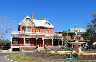 Mildura is a
pleasant agricultural town. The Arts
Centre (t 03 5018 8330; open daily 10.00-17.00) is
located in W.B. Chaffey's 1890s home, 'Rio Visto' on
Cureton Avenue, overlooking the river. The building of red
brick had extravagant appointments, with jarrah woodwork,
stained-glass windows and Italian tiles. The collection
centres around the donations of senator and publisher R.D.
Elliott, and contains mostly British and Australian
paintings. The ground floor has several murals by Sir
Frank Brangwyn. The gallery is especially proud of its
Degas pastel (1890) and a 1924 sculpture by Sir Jacob
Epstein.
Mildura is a
pleasant agricultural town. The Arts
Centre (t 03 5018 8330; open daily 10.00-17.00) is
located in W.B. Chaffey's 1890s home, 'Rio Visto' on
Cureton Avenue, overlooking the river. The building of red
brick had extravagant appointments, with jarrah woodwork,
stained-glass windows and Italian tiles. The collection
centres around the donations of senator and publisher R.D.
Elliott, and contains mostly British and Australian
paintings. The ground floor has several murals by Sir
Frank Brangwyn. The gallery is especially proud of its
Degas pastel (1890) and a 1924 sculpture by Sir Jacob
Epstein.
Mildura can also be proud of its local tennis courts. In
1998, the Davis Cup competition was played here, to
overwhelming praise for its excellent grass surface.
Given the majesty of the Murray at this point, it is no
surprise that Mildura's great attraction is a variety of
river cruises. A special treat is the opportunity to rent
a houseboat for lazy meanders on the ri
ver. Many of the trips on offer can be arranged through
the tourist office.
Renmark is 143km west of Mildura, over the South
Australian border and at the centre of the Chaffey
brothers' irrigation area. Charles Chaffey's wife, M. Ella
Chaffey, set a novel, The Youngsters of Murray Home
(1896), here. Their home, 'Olivewood' (t 08 8586 6175;
open Thurs-Mon, 10.00-16.00, Tues 14.00-16.00), built in
1887 of horizontally placed mallee logs, is now a National
Trust Museum. Tourist
information: Murray Avenue; t 08 8580 3000.
The river at Renmark is particularly enchanting. Many of
the boat tours on the river end their cruises here. The Renmark Hotel
(t 08 8586 6755) overlooking the river's bend was
established in 1897 as a public trust in a successful
effort to suppress local bootleg liquor trade. It was the
first communally owned hotel in the British Commonwealth.
It is still an impressive structure, with three storeys of
verandahs in the original section and beautifully situated
across from the river's most expansive turn.
Also on the river here is the PS
Industry (t 08 8586 6704; 1.5 hr. cruises on the 1st
of each month from Renmark, more adventuresome ones a
couple of times a month; fares adults $20, concession
$15.00, children $10.00), a restored paddle steamer now
opened as a museum. Still powered by steam, it makes
regular river trips.
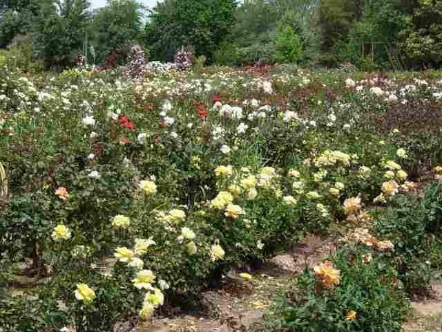 The Renmark Rose
Festival held in October centres on Rustons Rose Garden,
Moorna Street (t 08 8586 6191; open daily), filled with
more than 50,000 bushes with more than 3000 varieties. The
garden also has a large number of flowering trees, iris
and day lilies.
The Renmark Rose
Festival held in October centres on Rustons Rose Garden,
Moorna Street (t 08 8586 6191; open daily), filled with
more than 50,000 bushes with more than 3000 varieties. The
garden also has a large number of flowering trees, iris
and day lilies.
Eastern Victoria and The Dandenongs
Directly to the northeast of Melbourne proper c 35km are the Dandenong Ranges, a popular and convenient excursion destination for all Victorians. Comprised of volcanic lava and cooled by high rainfall, the area supports not only natural reserves and forests filled with all manner of Australian flora and fauna (most notably the relatively rare lyrebird), it is also the location of many impressive public gardens and ornamental flower farms. Walking trails abound, making the area a great spot for weekend outings and bushwalking. The main tourist offices in Melbourne will have vast amounts of information, maps, and tour options to the Dandenongs.Access is along Mount Dandenong Tourist Road, from Upper Ferntree Gully to Mount Dandenong and Montrose, or from Sherbrooke Road to Kallista. The Belgrave line of the train goes through Upper Ferntree Gully and on to Belgrave, where you can take a bus to further destinations. Scores of tourist coaches also travel here daily; check with the Melbourne tourist office.
For a treat from Upper Ferntree Gully, take Old Monbulk Road 5km to Belgrave to catch Puffing Billy (t 03 9757 0700; the schedule and fares are best seen on their website), an antique steam train 13km to Menzies Creek and eventually to Emerald Lake Park (t 1 300 787 624), part of the original Nobelius Nursery, in the 1900s the largest nursery in the Southern Hemisphere, founded by Carl Alex Nobelius, a relative of Alfred Nobel. The park now consists of several kilometres of walking tracks, interspersed with freestanding plaster murals depicting the region's history.
From Upper Fern Tree Gully, you can take Mt Dandenong
Tourist Road north to Olinda and Mt Dandenong. Along the
route are many popular picnic grounds and forest reserves
known as the haunt of lyre birds. Near Olinda is the National
Rhododendron Garden (t 03 8427 2002; open daily
10.00-16.30; free admission; a 25 minute trolly tour is
available from 18 Sept. to 3 Nov. for $12.00 adults, $10
others), with brilliant floral displays and walking
trails. Olinda is also the site of the Edward Henty
Cottage, one of the many properties of Victoria's first
settler.
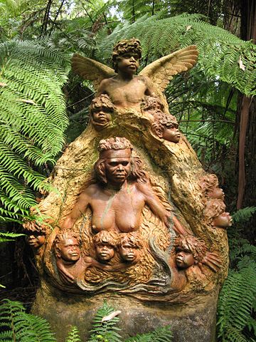 At Mount
Dandenong, the range's highest point at 633m, is the William
Ricketts Sanctuary (open daily 10.00-16.30), the
legacy of inspirational eccentric artist William Ricketts
(d. 1993). From the 1930s, Ricketts began to create an
outdoor 'church' dedicated to the spirit of Aboriginal
mythology and love of the land. His clay sculptures--most
of them based on the real likenesses of Aborigines he
knew--are fitted into the ferns and forests, surrounded by
grottoes and springs gushing forth from sculpted
concentric circles, a sacred symbol among Central
Australian Aborigines. Ricketts hoped to encourage harmony
and unity among the races, and lamented the lack of
understanding of Aboriginal culture. The sanctuary was
most prominently featured in comedian Billy Connolly's
video tour of Australia.
At Mount
Dandenong, the range's highest point at 633m, is the William
Ricketts Sanctuary (open daily 10.00-16.30), the
legacy of inspirational eccentric artist William Ricketts
(d. 1993). From the 1930s, Ricketts began to create an
outdoor 'church' dedicated to the spirit of Aboriginal
mythology and love of the land. His clay sculptures--most
of them based on the real likenesses of Aborigines he
knew--are fitted into the ferns and forests, surrounded by
grottoes and springs gushing forth from sculpted
concentric circles, a sacred symbol among Central
Australian Aborigines. Ricketts hoped to encourage harmony
and unity among the races, and lamented the lack of
understanding of Aboriginal culture. The sanctuary was
most prominently featured in comedian Billy Connolly's
video tour of Australia.
From here, continue to take the winding Mt Dandenong Tourist Road some 10km to connect to the Canterbury Road and Dorset Road, then to Lilydale on the Maroondah Highway. The Lilydale Historical Society, 61 Castella Street (in the Old Court House; open Wed., Sat. and sun. 11.00-16.00, Fri. 13.00-16.00), compiles as much information as they can about Australia's famed operatic prima donna, Dame Nellie Melba, who lived in the area at the end of her life.
The Maroondah Highway then leads 22km through beautiful eucalyptus forests to Healesville, a popular tourist destination because of its winery tours and native fauna sanctuary (t 1 300 966 784; open daily 9.00- 17.00; admission adults $32.50, coincession $24.90, children $16.30). Originally part of the Coranderrk Aboriginal Reservation, the sanctuary includes excellent facilities to view Australian fauna; it was here, in 1944, that a platypus was bred in captivity for the first time. The centre does significant work towards the preservation and care of Australian native species.
19km northwest of Healesville is Toolangi, site of
Arden, home of C.J. Dennis. Here Dennis wrote many of his
books, including his classic The Sentimental Bloke
(1915), made into Australia's first great film in 1919.
The C.J.
Dennis Singing Garden and Tea Rooms, 98 Main Road (t
03 5962 9282) were developed by Dennis and his wife, with
great shows of rhododendrons and semi-formal walks.
The Garden is now used mostly to raise funds for cystic
fibrosis reseach but is also open for tours or events on
ocassion.
Back at Healesville, you can continue on the Maroondah
Highway through forest ranges to Alexandra, a tidy little
country town formerly known as Red Gate Digging. 26km east
of here is Eildon, site of Lake Eildon, Victoria's largest
man-made lake. At this point, you are only 138km northeast
of Melbourne.
Continuing northwest on Maroondah Highway it is 69km to
Mansfield, which is at the edge of the Victorian Alps and
location for the 1982 filming of the movie, The Man
from Snowy River. The road proceeds eastwards 48km
to Mt Buller Alpine Village, the most developed ski resort
on this side of the Snowy Mountains. The first ski lift
here was installed in 1949, and as it is only 250km from
Melbourne, it is the most popular spot for weekend skiers.
From Mansfield, route 153 continues as the Midland Highway
into Benalla and the Hume Highway.
Gippsland to the southeast corner of Victoria
Gippsland is the region in the southeast corner of Victoria, from the eastern edge of Melbourne at Dandenong to the Pacific Coast and north to the beginnings of the Victorian Alps.History
The area was named in honour of New South Wales Governor
Sir George Gipps (1791-1847) by the Polish explorer Paul
Strzelecki, who traversed the area in 1840. Strzelecki
(see box below) was heralded as the white discoverer of
Gippsland, but in 1839 Scottish explorer and settler Angus
McMillan (1810-65) had already entered the region from the
north with an Aborigine of the Monaro region, Jimmy
Gibber, and eventually, with the help of Aboriginal
trackers, managed to cross the country to the sea at
present-day Port Albert.
Because of its dense vegetation and teeming wildlife, the
region was much favoured by indigenous people; the
Aborigines were mostly of the Kurnai tribe, while around
Western Port were the Bunurong group of the Kulin tribe.
The Kurnai were studied extensively by Lorimer Fison and
A.W. Howitt in the 1880s, with many of their legends
published in popular editions.
Because of McMillan's early reports about the region, the
first European settlers were Highland Scots speaking
Gaelic; many Gaelic words persisted in local vernacular,
and place-names demonstrate the predominance of Scottish
settlement. The development of the region was particularly
valuable as a source for rich arable land, and early
clearing led to the establishment of flourishing dairy
farms, for which much of the region is still known.
Indeed, three internal geographical divisions identify the
region: the dairy land of South Gippsland, the central
plains of East Gippsland, and the mountainous timberland
of the northeast. The southern section also was a major
coal-producing area (at Wonthaggi, South Gippsland's major
town, the State Coal Mine offers guided underground tours)
and the coastline, with its many lakes and marshlands,
quickly became a holiday destination for all Victorians.
The author Hal Porter describes the scenery of the
southern forests as 'Pre-Raphaelite stuff', while Anthony
Trollope described the region favourably in his Australia
and New Zealand (1873).
|
Paul Edmund de Strzelecki
(1797-1873) was born in Poland, and had an
adventurous life exploring in the Americas and the
South Seas before his arrival in Australia in 1839.
His use of the title of count was an unsubstantiated
affectation, but he was certainly trained as a
scientist, a skill he put to work in his exploration
of Australia. While exploring New South Wales in
1839, he discovered gold, but was persuaded by
Governor Gipps to keep it secret for fear of unrest
caused by such an announcement in the penal colony.
Years later, when the gold rush began, he felt
compelled to verify his early findings to prove that
he had successfully carried out his tasks as a
geologist. |
Wilsons Promontory
From Melbourne, the greatest tourist destination in
this region is Wilsons Promontory in South Gippsland,
230km from the city. The train from Melbourne goes as far
as Fish Creek, some 60km away; it is best to arrange a
tour here, or have your own car. To reach this rugged
rock, the southernmost tip of the Australian mainland,
travel from Melbourne via the South Gippsland Highway
(route 180) through Leongatha; at Meeniyan, take route 189
south c 60km into the Wilsons
Promontory
National Park (t 03 8427 2002). The Tidal River
entrance includes a National Parks Office, with excellent
displays and tourist information. The park also offers a
variety of overnight accommodation, from camping to bunk
houses and holiday flats; most facilities centre around
the Tidal River area, and all are booked out well in
advance of school holidays. Call to make bookings.
The 'Prom', as it is locally called, was named by Bass and
Flinders after Flinders' friend, London merchant Thomas
Wilson; it had originally been known as Furneaux's Land,
for Tobias Furneaux, explorer of this region and captain
of one of the ships on Captain Cook's second voyage. The
area became a national park in 1908, now one of the most
popular sites for bushwalkers and holiday-makers.
The dominant features of the region are the enormous
granite crags, the highest of which, Mt La Trobe, rises to
754m. The park contains more than 80km of walking-tracks
of varying lengths and over all kinds of terrain. The
beaches here are of white sand with rugged mountains in
the background. At the southern tip of the park is a
lighthouse, built in 1859 as one of the most important
markers for ships around the coast between Sydney and
Melbourne. In Nathan Spielvogel's 1913 novel The
Gumsucker at Home, the rock dominates: 'Looking
south I saw Wilson's Promontory, like a crouching lion,
far more imposing than Gibraltar.'
Gippsland Lakes
Return to the South Gippsland Highway at Foster and
head east into the Gippsland Lakes district which begins
at Sale, about 160km from Foster. From the 1860s, the
Gippsland Lakes, centred around Port Albert, served as an
important shipping centre, allowing for the opening of the
interior as far as present-day Sale. The railway link
(which extends to Bairnsdale) from Melbourne to Sale
opened in 1879 and led to the demise of the water shipping
trade.
From Sale today you can easily reach the Gippsland
Lakes
Coastal Park (t 03 8427 2002) and the start of the
amazing Ninety Mile Beach, a stretch of sand between the
lakes and the ocean that provides a great location for
seaside holidays. The dominant activity around the lakes
is fishing, fishing, fishing--both along the coast on the
beach, and in deep-sea fishing boats out to sea. Tourist
information: Central
Gippsland Tourism, 8 Princes Highway, Sale, t 04
2782 2904.
On Princes Highway (Highway 1) c 22km east of Bairnsdale
en route to Lakes Entrance is the turn-off to Metung
(population 1,200 up from 425 in 1998), a charming village
built on a narrow strip of land next to Lake King on Reeve
Channel, one of the primary entrances to the inland
waterways. Naturally, this location makes Metung an ideal
spot from which to begin boating cruises; many companies
here offer all types of boat hire. The major industry in
the village is Bull's Marine Industries, begun in the
1870s by pioneer Captain James Bull, who in his paddle
steamer Tanjil explored the waterways before the entrance
was cut.
51km from Sale is Bairnsdale (accessible by train), the
agricultural centre of East Gippsland. Settled by
Archibald McLeod in the 1840s, the name supposedly derives
from the fact that the settlement was soon teeming with
children or 'bairns'; but the name of his property was
originally 'Bernisdale', after a place on the Isle of
Skye.
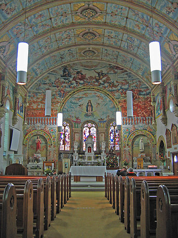 In town is St
Mary's Roman Catholic Cathedral, built in 1913. In the
1930s, an Italian labourer, Francesco Floreani, who had
studied art in Turin, painted trompe l'oeil murals and
ceilings throughout the church. Also of interest is the
court house on Nicholson Street (open daily), dating from
1894, with gables and towers reminiscent of Loire
châteaux; the stonework, however, depicts Australian flora
and fauna.
In town is St
Mary's Roman Catholic Cathedral, built in 1913. In the
1930s, an Italian labourer, Francesco Floreani, who had
studied art in Turin, painted trompe l'oeil murals and
ceilings throughout the church. Also of interest is the
court house on Nicholson Street (open daily), dating from
1894, with gables and towers reminiscent of Loire
châteaux; the stonework, however, depicts Australian flora
and fauna.
At Lakes Entrance, 34km from Bairnsdale, the Ninety Mile Beach ends; a small footbridge here allows visitors to walk over to the surf beach. Lakes Entrance has one of the most active and productive fishing fleets in the state. In the summer, the town and surrounding area is overrun with holiday-makers, and consequently quantities of tourist activities, including numerous cruises that take the visitor to destinations throughout the fascinating inland waterway system, one of the biggest and most interesting in Australia. From Lakes Entrance it is also possible to arrange for all varieties of fishing trips. Tourist information: corner Marine Parade and The Esplanade, t 03 5155 1966.
Nyerimilang
Park (t 03 8427 2002; open daily, 08.30 - sunset;
homestead weekdays 9.30-16.00, weekends 10.30-15.00), 10km
northwest of Lakes Entrance, was originally a homestead
taken up in 1884. The present house, set in formal
gardens, was built in 1892 by Frank Stuart; it is open to
the public. Nyermilang derives from an Aboriginal word
meaning 'chain of lakes'; the Aborigines here were
Tatungolung, part of the Kurnai group. The park offers
spectacular views of the channel and neighbouring islands.
10km east of Lakes Entrance is Lake Tyers, part of which
is an Aboriginal settlement. Founded as a mission in the
1860s by John Bulmer and his wife, who stayed for 50
years, the 1600 ha settlement was the first area in
Australia to be returned to the resident Aborigines under
the groundbreaking Aboriginal Lands Act of 1970, precursor
of the current Native Title Act.
From Lakes Entrance the Princes Highway continues east
through the central plains of Gippsland, much of which is
now industrialised in places around Orbost Tourist
information: Nicholson Street, t 03 5154 2424.
From Orbost, you can travel 58km north to the little town
of Buchan, at the foot of the Snowy
River National Park, noted for its limestone caves.
The caves are covered in stalactites and stalagmites,
evidence of the fact that the land was covered by sea 400
million years ago. Regular
tours of the caves are given year round, with more
frequent trips offered in the peak season.
The road north from Buchan travels along the Snowy River,
through landscape made famous in Banjo Paterson's "Man
From Snowy River"; it offers an adventurous route all the
way to Jindabyne in the heart of the Snowy Mountains of
New South Wales. The scenery at places such as the lookout
at Little River Gorge, about 65km from Buchan, is
stunning. As much of this road is unsealed, and many parts
impassable in winter, be sure to check conditions before
setting out.
At Orbost, the Princes Highway continues east through
forests on each side. Cann River has long been a favoured
fishing resort. The Cann Valley Highway continues north to
the New South Wales border, where it becomes the Monaro
Highway. The road offers a lovely
forest-and-mountain-meadow alternative route to Cooma and
on to Canberra in the ACT.
If you continue on the Princes Highway from Cann River
to the New South Wales border, a nice side trip is to take
the 8km road to Mallacoota Inlet, the last stop in
Victoria before crossing into New South Wales. The inlet
village is surrounded by 86,000 ha of Croajingolong
National Park (t 03 8427 2002). As the last stop in
Victoria, Mallacoota is tremendously popular as a holiday
retreat for people from both states, and can be quite
crowded during summer and school holidays. The inlet
provides some stunning scenery, with calm beaches on one
side and the wild surf of Bass Strait on the other. You
can also take boat trips out to the small islands off the
inlet, now nature reserves.
Omeo and the Australian Alps
From Bairnsdale, you can take the Omeo Highway (B500) 120km north to Omeo (480 up from 285 in 1998), in the heart of the mountain-cattle country. Tourist information: Day Avenue; t 03 5154 3444.
History
In 1834, the explorer John Lhotsky wrote of viewing from
the Snowy Mountains a vast plain to the south that the
Aborigines called Omeo, believed to mean 'mountains'. The
region was settled as early as 1835, when James McFarlane
took up a pastoral run, pre-dating McMillan's
explorations. More squatters arrived in the 1840s, and
gold discoveries in the 1850s and 1860s caused Omeo to
become one of the roughest frontier towns in the country.
'Rolf Boldrewood', author of Robbery Under Arms
(1881), was believed to be a magistrate here in the 1860s;
in his novel Nevermore (1892) he recalls the
district as lawless where 'the worst villains in Australia
are gathered together'. In The Recollections of
Geoffrey Hamlyn (1859), author Henry Kingsley
incorporates real bushrangers and thieves of the region,
such as the infamous 'Bogong Jack'. Members of the Kelly
family and horse thieves such as Thomas Toke also operated
in the mountains around Omeo. The cattlemen of this High
Country were of course heroicised in the 'Man from Snowy
River' legend and stories made popular by author 'Banjo'
Paterson. The Octagon Bookshop on Day Ave. has a
good collection of book on local and regional history for
sale.
Today, the town is still a centre of Victoria's 'high
country' cattle industry; the Omeo Calf Sales every March
are a major event, bringing buyers from all over the
world. The area also marks the beginning of 'brumby'
territory: wild horses, some of which are rounded up each
year (see Longford, Tasmania for an explanation of
brumbies). Annual rodeos attracting national audiences are
also held throughout the area. 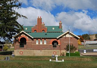 In the centre of
Omeo is A.M.
Pearson Historical Park (t 03 5159 1232; open daily
10.00-14.00), which includes an 1892 Romanesque-style
court house which is now a museum. It was designed by A.J.
MacDonald, who also built the Bairnsdale court house and
the post office at South Yarra in Melbourne.
In the centre of
Omeo is A.M.
Pearson Historical Park (t 03 5159 1232; open daily
10.00-14.00), which includes an 1892 Romanesque-style
court house which is now a museum. It was designed by A.J.
MacDonald, who also built the Bairnsdale court house and
the post office at South Yarra in Melbourne.
A 100km scenic drive south of Omeo through Cassilis,
Swifts Creek and Ensay passes through the old gold-mining
areas, dotted with old mine tailings and timber and
weatherboard cottages. Alternatively, you could continue
north into the Bowen Mountains; 29km northwest is Anglers
Rest, a great fishing retreat and site of The Blue Duck Inn
(t 03 5159 7220), dating from the 1890s and an important
roadhouse along the gold-fields. The area has abundant
walking trails with some breathtaking mountain scenery.
Route 195 continues north from here 128km, some of it
unsealed road, through Mitta Mitta in a picturesque river
valley near Dartmouth Dam and on to Tallangatta
(pronounced Tal-LAN-gatta, while nearby Wangaratta
emphasises the first syllable!) on Lake Hume.
Route B500 from Omeo to Ovens Valley
Another route from Omeo is to take the Tourist Road west
(C543) towards Mt Hotham in the Dargo High Plains; 56km
along is the Mount Hotham Alpine Resort, surrounded by the
Alpine
National Park (t 03 8427 2002). The resort provides
some of the best downhill skiing in the country. Tourist information: Hotham
Heights, t 03 5759 3550. The area is also the home of the
rare mountain pygmy possum, Australia's only alpine
mammal; many walking trails provide opportunities to
appreciate the park's flora and fauna. Be sure to check on
road conditions before venturing on any of these roads in
the winter; many will be closed.
Continue on B500 10km west, where the road continues
north as the Alpine Highway, 41km to the old-fashioned
town of Bright (population 2,200 up from 1675 in 1998) in
the Ovens Valley. Tourist
information centre: Delaney Avenue; t 03 5755
2275.
Originally a pastoral settlement explored by Hume and
Hovell in 1824, Bright became the centre of alluvial
gold-mining in this region in the 1860s. This popular
holiday destination is known for its impressive displays
of autumnal foliage, the result of the planting of
thousands of deciduous trees along its avenues in the
1930s. Walnuts and chestnuts are also grown and harvested
here. Every April, the Bright Autumn Festival brings
thousands of visitors to the town. The historical
museum (t 03 5755 1356; open Sun. 14.00-16.00,
summer Tues., Thurs, Sun. 14.00-16.00) in the former
railway station highlights district history, and the Bright Art
Gallery on Mountbatten Avenue (t 03 5750 1660)
sponsors a prized art competition to coincide with the
Autumn Festival.
The town is the starting point for many excellent walks,
all signposted with triangular markers. One of the nicest
is the 5km Wandiligong Walk, beginning 2.5km south of town
and ending at the tiny village of Wandiligong, registered
on the National Trust for its landscape features and
picturesque buildings. It is also the location of
Wandiligong Apple Orchard, said to be the largest in the
Southern hemisphere.
6km further west on route B500 is Porepunkah, a pretty
settlement known for fishing and hiking. It is also
associated with Pearson William Tewkesbury, who made his
fortune in gold here in the early 1900s, when alluvial
gold was still present.
|
Pearson William Tewkesbury was born in nearby Yackandandah in 1867. After working as a watchmaker in Sydney, he came to the Ovens River and made £1 million by dredging for gold. He then went on to establish in Sydney and Melbourne motor hire services in the 1910s, and in the 1920s the famous Yellow Cab Co. In 1920 he also produced the first film version of Robbery Under Arms by 'Rolf Boldrewood'. He was a great entrepreneur, raising more than £20,000 for disabled servicemen during the First World War by raffling the 'Kitchener Flag' bearing signatures that he had collected of Allied war leaders and other famous men. He bought the Oriental Hotel in Melbourne, where he lived until his death in 1953. |
At the junction of Porepunkah, another road travels south
21km to Buckland, site of a notoriously gloomy gold-mining
valley. In 1857, the Buckland Riot directed against
Chinese miners took place here; the event is commemorated
in the Australian-Chinese Museum in Melbourne.
Back on route B500, you can enter Mount Buffalo National Park (t 03 8427 2002), site of Australia's first ski lift in the 1930s. The park has well-organised walking tracks, over 140km of them, with brochures available at the Visitor's Information Centre. It is also one of the summer homes of the bogong moth, an incredible creature that migrates thousands of miles from Queensland every year to spend the warm months in the rocks of the Alpine valleys; they arrive in the thousands in October. The moth was considered a great delicacy by the Aborigines, who would visit this area and other parts of the Snowy Mountains to have bogong feasts in the summer.
From Porepunkah, travel 23km on the Ovens Highway
(still route B500) to Myrtleford (population 3,200 up from
2850 in 1998), the major town in the Ovens Valley and a
centre for the growing of hops, tobacco, and walnuts. One
of the most prosperous growers in the region was William
Pan Look, a Chinese businessman whose store was razed
during the Buckland Riot; by the 1890s, he and his sons
had cultivated over 600 ha of tobacco and hops. The town
has some lovely picnic spots, and on the highway just
north of town is The Phoenix Tree, an enormous sculpture
created out of a red gum tree by local sculptor Hans
Knorr. Knorr also was one-time owner of Merriang
Homestead, a beautiful old property 6km southwest of town
with wrought-iron verandah and hand-made bricks. At the
time of writing, it was closed to the public.
Beechworth
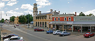
It is always a surprise to find such a tidy and
well-preserved town as Beechworth (population 3250), with
its many imposing 19C honey-coloured granite buildings,
tucked away at 550m altitude and seemingly removed from
civilisation. V/Line has bus service to Beechworth
from Wangaratta and Bright; the closest train connection
is Wangaratta, with runs to Albury, Adelaide, and
Melbourne. A local bus also travels daily to
Albury/Wodonga.
The twisting road from the Ovens Highway is itself quite
charming, with views into the fields and valleys that make
it clear this was an area where gold was found. Indeed,
gold was discovered at nearby Spring Creek in 1852; by
1857, some 400kg of gold left Beechworth for Melbourne
every fortnight, and in 14 years, a total of 1,122,000
ounces (31,800 kg) of gold were mined here. At its height,
Beechworth had a population of 42,000 and boasted 61
hotels and a theatre. The writer Henry Kingsley was here
in 1854; part of his novel The Hillyars and the
Burtons (1865) was set in the area. Most
significantly, Robert O'Hara Burke, leader of the
ill-fated Burke and Wills expedition in the 1860s, was
Beechworth's officer-in-charge of police from 1856 to
1859, a fact commemorated in the Library and
Burke Museum (t 03 5728 8067; open daily,
10.00-17.00) on Loch Street, which includes Burke
memorabilia, along with gold-rush artefacts. The Tourist
Information Centre (103 Ford St.) can provide a
detailed brochure of walking tours.
The Ovens Highway from Wangaratta to Wodonga is known
as 'The Kelly Way', demonstrating that this region is Ned
Kelly country. Beechworth's other great claim to fame is
that both Ned Kelly and his mother were jailed here in the
1880s, in the Beechworth Gaol, built in 1859 and still
used as a prison (mostly for prisoners involved in
reforestation projects). The gaol is part of a group of
public buildings constructed 1857-59 at the northern end
of Ford Street; hence the uniform appearance. The group
includes the Courthouse, Police Station, Survey Office,
and Forest Office along with the gaol.
Other significant public buildings along Ford Street
include banks; the Rock Cavern, where the information
centre is located, used to be the Bank of Victoria.
Further along is the Bank of New South Wales, designed by
Robertson and Hale in 1856, which includes an elaborate
coat of arms at the corner entrance.
For goldminers, of course, the most important buildings in
town were the hotels, a number of which still survive. The
most impressive is Tanswell's, privately restored with
lovely ironwork, dating originally from 1873. It still
operates as a hotel and restaurant, as do the historical
Hibernian Hotel on Loch Street and the Nicholas
Hotel on Camp Street. Regular visitors also make the
Beechworth Bakery on Albert Street a regular stop for its
hundreds of cakes and breads.
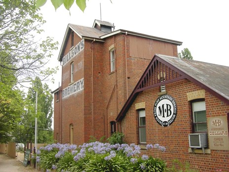 From Ford Street, take Camp
Street west to Last Street and Murray
Breweries (t 03 5728 1304; open daily,
10.00-16.00). Begun in the 1860s by George Bilson, the
brewery produced beer until the 1950s; but it was also
known for its cordials and aerated waters. It still
produced them from nearby spring water. The cellars are
now a museum, with a fascinating history of the aeration
process.
From Ford Street, take Camp
Street west to Last Street and Murray
Breweries (t 03 5728 1304; open daily,
10.00-16.00). Begun in the 1860s by George Bilson, the
brewery produced beer until the 1950s; but it was also
known for its cordials and aerated waters. It still
produced them from nearby spring water. The cellars are
now a museum, with a fascinating history of the aeration
process.
Going out of town towards Wodonga, you will pass through
the Golden Horseshoes Monument, a reference to a famous
event during the gold-rush days. At that time, the miners
were divided between the 'punchers', the dry diggers,
dressed in moleskins, and the 'monkeys', wet miners,
dressed in black woollen trousers. The rivalry between
them was so intense that they fielded different candidates
for parliaments. In 1855 the Monkeys' candidate, Cameron,
paraded into town on a horse shod with golden horseshoes.
They have been a symbol of the town ever since.
Also leaving town, on the right of the Golden Horseshoes
Monument is the cemetery, including two Chinese Burning
Towers, evidence of the number of Chinese miners here in
the 1860s; as many as 500 Chinese graves are found in the
cemetery behind the towers.
To the Murray Valley Highway and Corryong
From Beechworth, you can take several routes towards
Wodonga; one takes you through Yackandandah, a National
Trust classified gold town, with attractive verandahed
streets (population 950 up from 480 in 1998). Tourist
information: Court House, 27 High Street, t 02
6027 1988. Known locally as 'Yack', it was the childhood
home of Australia's first native-born Governor-General Sir
Isaac Isaacs, and the birthplace of Pearson William
Tewkesbury, founder of the Yellow Cab Co.
From here take the Kiewa Valley Highway (C527) north east
and join the Murray Valley Highway (B400) east to find
Corryong on the border of New South Wales and at the foot
of the Snowy Mountains and Kosciuszko National Park. The
road passes by, at Tallangatta, Lake Hume, which, if the
water is low, looks spookily like a Surrealist painting,
with lots of dead tree stumps sticking out of the surface
water and with yellow hills behind.
Corryong (population 1,400 up from 1274 in 1998) is
77km from Tallangatta and is towered over by the boulders
and granite ridges that mark the beginning of the Snowy
Mountains. The area is true bushman's and cattleman's
country, and indeed, 'The
Man from Snowy River' Museum, 103 Hanson Street (t
02 6076 2600; open daily 10.00-16.00) in the centre
of town commemorates the life and resting place of Jack
Riley, widely believed to be the inspiration for 'Banjo'
Patterson's famous poem. They also sponsor a bush
festival in April. Tourist
information: 76 Hanson Street, t 02 6076 2160.
In December, a folk music festival, celebrating the
Australian folk ballad and other forms, takes place at
nearby Nariel
Creek from Dec. 27 to Jan. 3.
From here, you can take a breathtaking drive into Kosciuszko
National Park, past the most impressive construction
of the Snowy Mountains Hydro-Electric Scheme, Tumut Ponds
Dam, and on to Cabramurra, the highest township in
Australia. See Snowy Mountains section, New South Wales
for more detail.
Victorian Heritage Council and its database of registered properties protect, assist, and describe sites which are of historical significance in the state.
Victoria's branch of the National Trust provides a list of buildings which are open to visitors and descriptions of these and numerous historic sites of particular historic significance throughout the state.Photos more of less in the order of their appearance and the photographer (linked where possible)
800px-Kennedy hut Gippsland.jpg - fir0002 | flagstaffotos.com.au
800px-Central_bendigo_from_botanic_gardens.jpg - Robert Merkel
448px-Melbourne_China_Town.jpg - Donaldytong
View_from_Geelong_ferris_wheel.jpg - Mart Moppel
800px-Bells-Beach-View.jpg - Triki-wiki
450px-Warrnambool_lighthouse.jpg - http://www.flickr.com/photos/geowombats/2447553/
800px-20090614_Silverband_Falls_-_Grampians_National_Park_-_Victoria_-_Australia.jpg - Mikeybear
800px-Central_bendigo_from_botanic_gardens.jpg - Robert Merkel
800px-Wilson's_Promontory_-_Tidal_River_from_Mt_Oberon_-_Dec_2004.jpg - Diliff
McCubbin's Bush Burial -- Geelong Art Gallery
Cunningham Pier - MasterMind5991
Twelves Apostles - Homo Homini Canis Est
Geelong Botanical Gardens - Casliber
Bellarine Rail steam engine no. 4 - Wongm
Fort Queenscliff - Cnwb
Erskine Falls - Alpapad
Split Point Lighthouse - Mike Lehmann, Mike Switzerland
Flag Hill Maritime Museum - Ralf 69~commonswiki
St Johns Church - Mattinbgn
Port Fairy Courthouse and Historical Society - Mattinbgn
Port Fairy Lecture Hall and Library - Mattinbgn
Customs House Portland -Mattinbgn
Cape Nelson Lighthouse - Gergely Csatari
Mitchell Glenelg - Three Expeditions ...
Portland Town Hall - Mattinbgn
Zumsteins - Mattinbgn
Bill's Horse Trough Ararat - Njb1969
Cobb & Co Buangor - Mattinbgn
Ballarat gold fields - George Strafford, Illus. Melb. Post, State Library of Victoria
Ballarat Synagogue - State Library of Victoria
Eureka Flag - King Family and Ballarat Fine Art Museum by Steakknife
Sturt Street - Ed Dunens
Ballarat Town Hall - Mattinbgn
Ballarat Fine Arts Gallery - Gervo1865
Provincal Hotel - Biatch
Craig's Hotel Royal - Richard Horvath
Sovereign Hill - Pplu
Adam Lindsay Gordon cottage - Peterdownunder
Maryborough Train Station - Mattinbgn
St. Patrick's Cathedral - Pplu
Buda - pru_mitchell
Bendigo Art Gallery - Elekhh
Shamrock Hotel - Mattinbgn
Budda Altar Bendigo - unattributed
Bendigo Cathedral - Mattinbgn
Alexandra Fountain - 379Jonti379
Yabby - Macr,
Mildura Art Centre - Mattinbgn
Murray River Map - unattributed
Ruston's Rose Garden - Fairv8
Earthly Mother Ricketts - Pierre247
Nyerimiland Homestead - Parks Victoria
St Mary's Church - John O'Neill
Omeo Court House Museum - Mattinbgn
Beechworth - Fir0002
Murray Brewery - Culture Victoria
http://www.esauboeck.com/images/