 |
 |
| History
|
Adelaide |
 |
 |
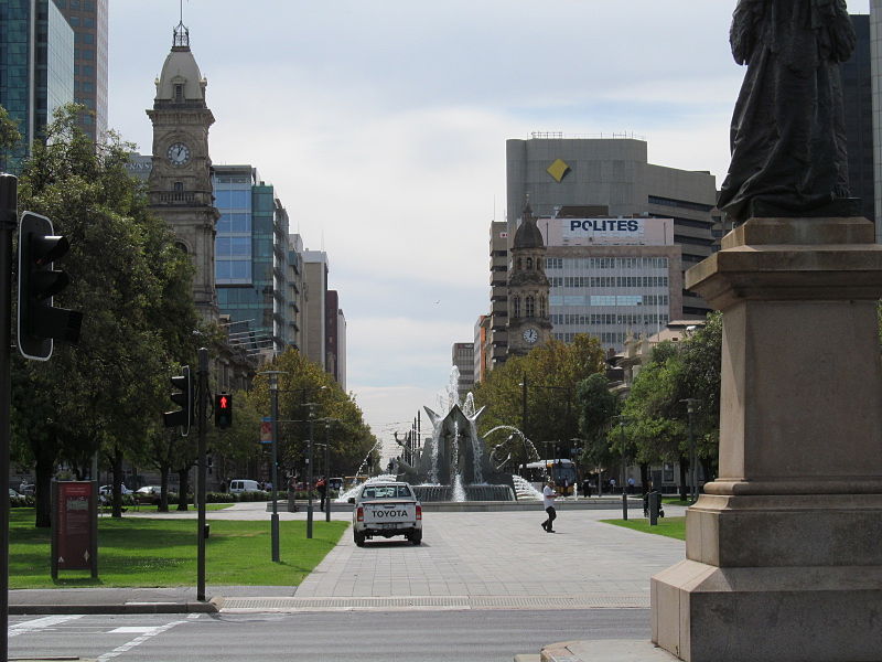
| Victoria Square |
North Terrace |
 |
 |
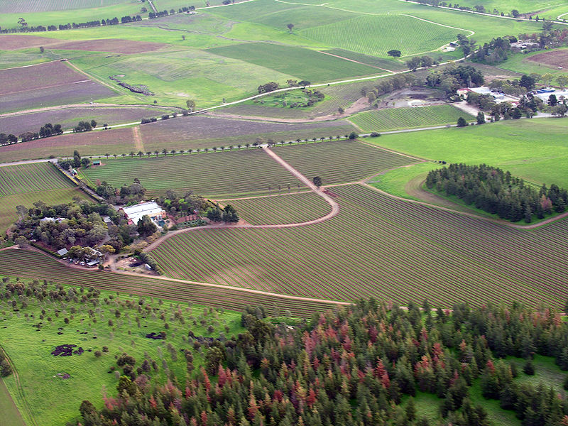
| Barossa Valley |
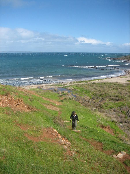
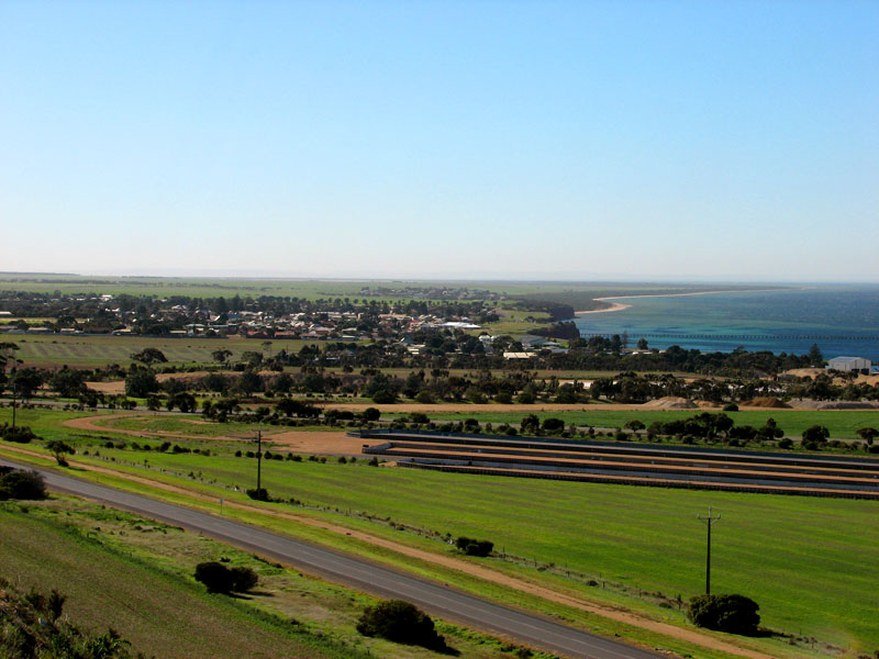
Fleurieu Peninsula |
 |
 |
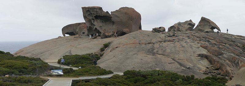
| Kangaroo Island |
Route West and the Yorke Peninsula |
 |
 |
(updated March 2017)
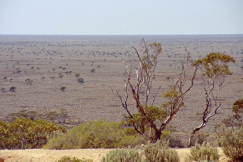
The predominant physical features of South Australia include the Great Australian Bight, the Nullarbor Plain and Great Victoria Desert, the Simpson Desert and Lake Eyre and the Sturt Desert. It is the driest state of the driest continent; as writer Geoffrey Dutton muses, 'Fate, it seems, did not want South Australia to have too much... South Australia was granted only one river and that rising in the eastern states, almost no timber except the tough, twisted mallee, comparatively few minerals, and frontiers of sand or desolate scrub.'
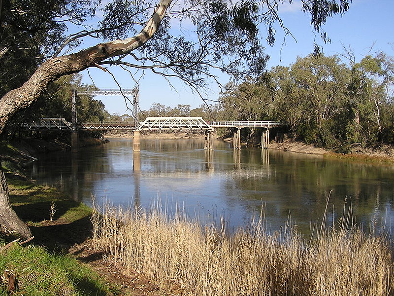
The most densely populated areas are found around Spencer Gulf and Gulf St Vincent which are formed by Eyre Peninsula and Yorke Peninsula and Kangaroo Island. Although there are some modest highlands to the extreme northwest and north of Adelaide, most of the state is remarkably flat. The major river, the Murray, drops only 22m in 642km.
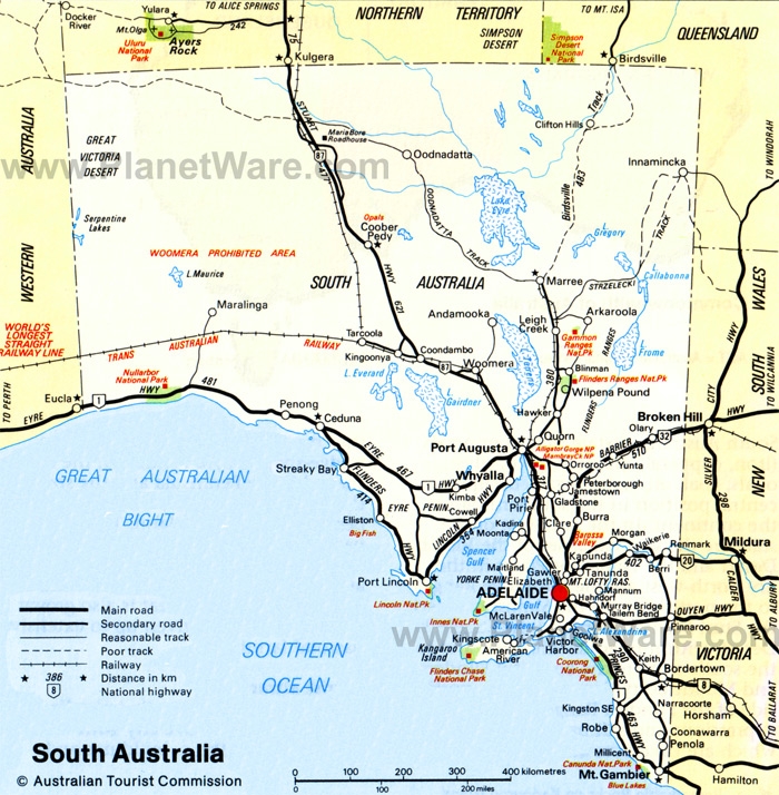 |
Physical curiosities include a basin of ancient sandstone in the Flinders Range called Wilpena Pound, volcanic craters and peaks near Mount Gambier, the cliffs of the Bight, and the normally dry inland lakes which infrequently fill to become lush and productive. The wet winters in the south allow eucalypt forests as well as the lush agricultural and wine-producing areas of the Barossa Valley, the Clare Valley and McLaren Vale. The wineries of these regions have greatly contributed to Australia's international reputation in the field of wine-making. Mount Lofty is the highest point in the modest range of hills north of Adelaide. Currently a mere 700m high, it spent the Tertiary Period submerged. East to west lateral folding during the Cambrian Period established the area's basic structure. When the Mount Lofty Range rose as a horst, rift valleys along the north-south faults brought the sea inland along the western edge of the range as far as Lake Torrens. Spencer Gulf and Gulf St Lawrence are, in fact, rift valleys. The Lofty Range continues to run northward, eventually becoming the Flinders Range. The Barrier Highway from Adelaide through Gawler to Peterborough passes along this range. |
North of the Flinders Range, arid dunes and flood plains become the norm with surface drainage to playas, the interior salt lakes named Torrens, Frome and Eyre. Lake Eyre is actually 16m below sea level, and is dry for years at a time. After heavy rains, the area quickly fills with water and generates a profusion of wildflowers, along with huge quantities of birds and native animals. The vegetation is scrub eucalypt mallee to this point. Past the line of annual rainfall below 25mm, the vegetation becomes tussock saltbush and blue bush with low wattle shrubs. The Great Victorian, Simpson and Sturt Stony Deserts mark the northern border from west to east. At the northernmost extent of the Flinders Range is the Flinders Range National Park and, after another 150km, Gammon Ranges National Park, a vast and rugged wilderness of gorges and geological sites that contain untold numbers of gemstones.
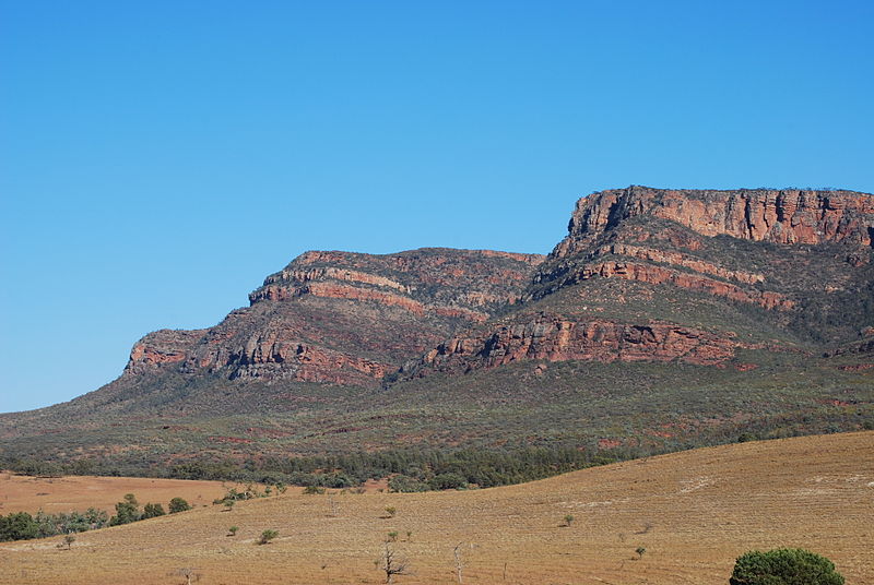 Wilpena
Pound, near the Flinders Range National Park's southern
entrance, is a geological curiosity. One of several oval basins
atop mesas (flat-topped hills), Wilpena Pound is about 8km wide
and 20km long. It appears to be a tiered amphitheatre of
quartzite. The sole entrance is through a narrow gorge and
across Sliding Rock. Nearby are Aboriginal rock carvings at
Arkaroola Rock on the southern slope of Rawnsley Bluff and at
Sacred Canyon on Hawker Road south and east of the Rawnsley Park
Station. The spring wildflowers and verdant flora along small
watercourses in the valley floors contrast with the stark desert
mountain range. The colours in the strata range from purple to
red to white.
Wilpena
Pound, near the Flinders Range National Park's southern
entrance, is a geological curiosity. One of several oval basins
atop mesas (flat-topped hills), Wilpena Pound is about 8km wide
and 20km long. It appears to be a tiered amphitheatre of
quartzite. The sole entrance is through a narrow gorge and
across Sliding Rock. Nearby are Aboriginal rock carvings at
Arkaroola Rock on the southern slope of Rawnsley Bluff and at
Sacred Canyon on Hawker Road south and east of the Rawnsley Park
Station. The spring wildflowers and verdant flora along small
watercourses in the valley floors contrast with the stark desert
mountain range. The colours in the strata range from purple to
red to white. The rock art at Arkaroola Gorge is accessible by permission at Arkaroola Village. The sinuous gorge is said to have been carved by the serpent from which it takes its name. The Proterozoic quartzite, granite and tillite of the surrounding canyons have eroded to form sheer rock walls and lovely pools. Scrubby eucalypt, acacia and yucca are the predominant flora, but wildflowers sprout after winter rains. The road from Hawker, 100km north of Port Augusta, to Parachilna is well-tended gravel.
The Panaramitee Rock Art Site, east of Leigh Creek in Gammon Ranges National Park, is in the Ngadjuri people's region. It dates from the Pleistocene era and may be as much as 30,000 years old. Like other engravings in the area, the motifs include tracks, circles and geometric forms in a style current in the central desert. Because the area is rugged and isolated, only bushwalkers experienced in arid conditions should consider travel here.
2700km long, the Stuart Highway crosses Australia from Port Augusta to Alice Springs, Northern Territory, and eventually Darwin. The major stops are Woomera, headquarters for the former British nuclear testing site; Coober Pedy, the well-known underground opal-mining town; Alice Springs, the railhead of the Ghan from Adelaide and gateway to Uluru and other desert Aboriginal areas; Tennant Creek, near the round granite rocks called the Devil's Marbles and Devil's Pebbles; and Katherine, a cattle station and RAAF airbase near Katherine Gorge rock art and an idyllic natural setting. Broadly, there are two reasons to undertake the drive across country. One is to have driven a long way across desert. The other is to have first-hand experience of Australian desert-dwelling Aboriginal people (for more information see the Northern Territory section).
The Aboriginal presence, particularly in the desert areas, remains strong. Permits to travel are routinely required, though readily obtainable. The northwest of the state is Pitjantjatjara land and includes the Musgrave Ranges. To the south, the Great Victorian Desert is shared with the Maralinga people. Above-ground nuclear testing in the Woomera in the 1950s blighted some of their land. Along the Bight are the Wirangu. To their north and west are a number of desert-dwelling people, the most well known being the Pitjantjatjara in the state's extreme northwest. East of the Pitjantjatjara in the Simpson and Sturt Stony Deserts are the Witjira and Innamincka Reserves. This environment is on the whole extremely dry and hot with unreliable rainfall. Rockholes and dry river soaks provide water.
Indigenous people in the better-watered conditions of the south central regions traditionally included the Adnyamathanha who lived from Port Augusta north to the salt lakes along the windward face of the Flinders Range. Continuing south, the Narangga lived on Yorke Peninsula. Despite wet winters, they shared scant water resources with the other groups mentioned. Their environment consisted of mallee and coastal scrubs with some mangroves along the gulf coast. The Ngadjuri, Narangga and Nukunu living along the coastal wetlands enjoyed the best conditions, water and food being routinely available.
South Australia's climate is governed by low pressure fronts which bring colder moist air from the southwest. These usually come every seven to ten days in the summer and every three to five days in the winter. Summer temperatures can be excessive even in the milder southeastern corner and in Adelaide (although Adelaide's average maximum summer temperature is 29ºC, it is not uncommon on some summer days for the thermometer to climb above 40ºC). The Surveyor-General George Goyder demarcated the areas most likely to be affected by drought (rainfall below 350mm per year). They include all of the state except for the southwest portion of Eyre Peninsula, some of Yorke Peninsula and the far southeast corner of the state.
Colonial history
Although Europeans first sighted the South Australian coastline in 1627, when the Dutch ship Gulden Zeepaard reached as far as Nuyts Archipelago, no other white exploration occurred until 1792-93. In that year the French explorer Bruni d'Entrecasteaux discovered the head of the Australian Bight. It was not until Matthew Flinders's famous circumnavigation of Australia in 1802-04 that any detailed exploration of the area was carried out; in his ship Investigator, Flinders made a thorough study of the coast from Fowlers Bay to Encounter Bay, naming such sites as Port Lincoln, Spencer Gulf, Kangaroo Island, Gulf St Vincent, Yorke Peninsula, Mount Lofty, and Cape Jervis. Whalers and sealers had certainly already made some settlements along this coastline, particularly at Kangaroo Island, by the beginning of the 19C.Unlike the history of the eastern states and Tasmania, South Australia owes its development to voluntary and private settlement, a fact of which the state is still quite proud-no convicts were ever transported here. The intention was to induce unemployed, working-class Britons to migrate to Australia where they would work for landowners until they had sufficient funds to buy land of their own. The state's first governor, Captain John Hindmarsh, established the colony upon his arrival in late December 1836. The first 300 settlers had arrived earlier aboard whalers' and surveyors' ships.
The intention to found a colony of free settlers from among the unemployed working class predates South Australia's establishment by six years. As early as 1830, amidst the fervour of Jeremy Bentham's notions of democratic idealism and the movement to reform Parliament, Edward Gibbon Wakefield, Robert Gouger and a number of Trinity College liberals formed the National Colonisation Society. Its aim was to alleviate unemployment by founding a chartered colony under the auspices of the society, as opposed to those of the government. That South Australia was the chosen site was largely due to Charles Sturt's exploration and reports from whalers and seal hunters who had been using Kangaroo Island for many years before white settlement here.
The selection of Adelaide as the town site and its design by Colonel Edward Wakefield
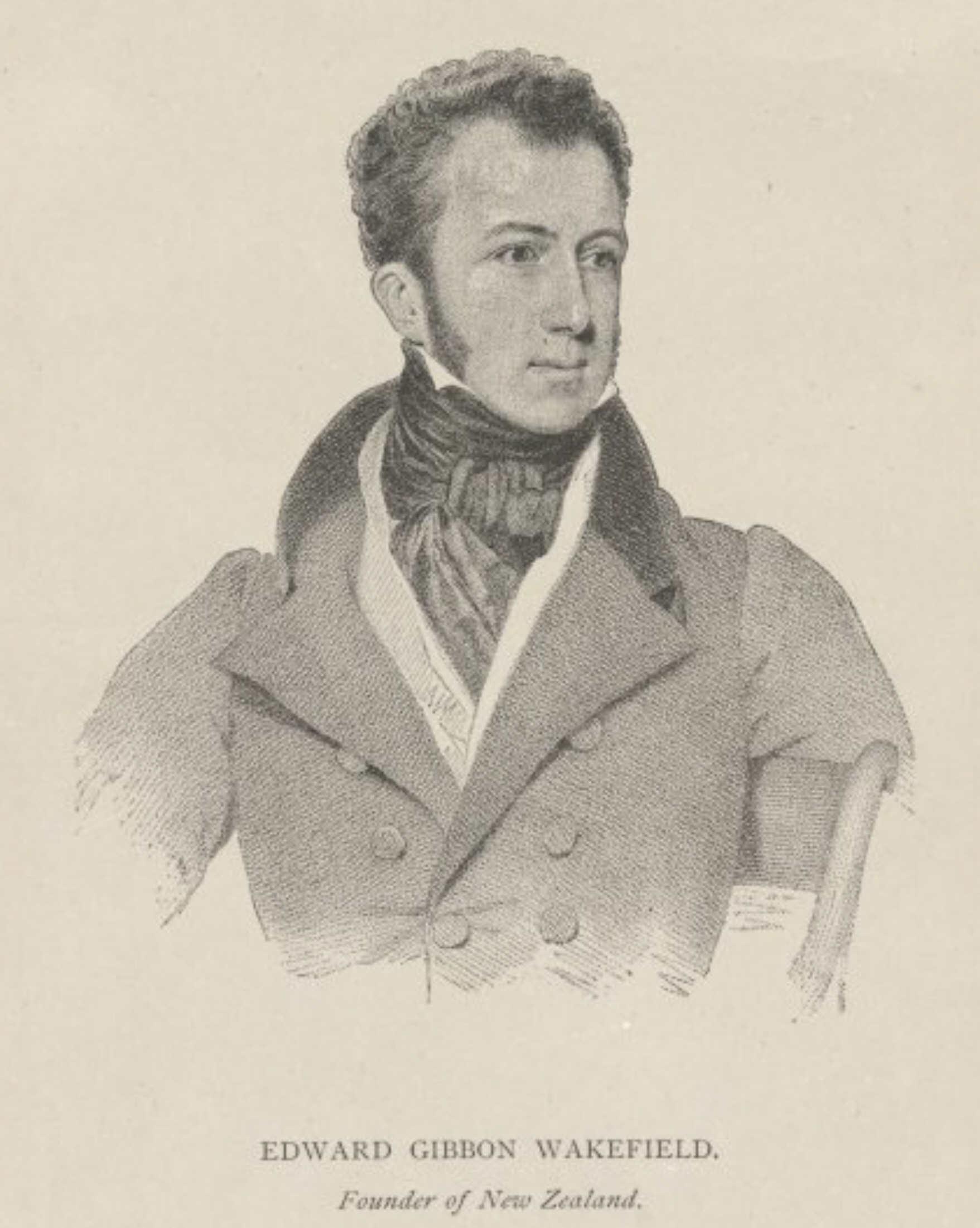 Edward
Wakefield (1796-1862) had a chequered past. Well educated, from
a Quaker family, he had worked for a time for the Foreign
Service. Wakefield had twice abducted Quaker heiresses, the
first time receiving a handsome annual settlement, the second
time as a widower receiving a gaol sentence. In Newgate Gaol,
Wakefield met his subsequent associates Robert Gouger and Major
Anthony Bacon. While in prison he formed a theory of systematic
colonisation in keeping with the current theories of
self-improvement. At Newgate he also met sea captain Henry Dixon
who was familiar with Kangaroo Island and adjacent southern
Australia. In 1829, Wakefield published anonymously Eleven
Letters from Sydney. As if written by a landowner in New South
Wales, it exposed the evils of the convict system and outlined a
system whereby land in colonies could be sold, the proceeds
assisting free immigrant settlers.
Edward
Wakefield (1796-1862) had a chequered past. Well educated, from
a Quaker family, he had worked for a time for the Foreign
Service. Wakefield had twice abducted Quaker heiresses, the
first time receiving a handsome annual settlement, the second
time as a widower receiving a gaol sentence. In Newgate Gaol,
Wakefield met his subsequent associates Robert Gouger and Major
Anthony Bacon. While in prison he formed a theory of systematic
colonisation in keeping with the current theories of
self-improvement. At Newgate he also met sea captain Henry Dixon
who was familiar with Kangaroo Island and adjacent southern
Australia. In 1829, Wakefield published anonymously Eleven
Letters from Sydney. As if written by a landowner in New South
Wales, it exposed the evils of the convict system and outlined a
system whereby land in colonies could be sold, the proceeds
assisting free immigrant settlers. Upon his release in 1830, he formed the National Colonisation Society with Robert Gouger. When the society dissolved after merely a year, Wakefield looked to the Whig banking community and Major Anthony Bacon to form the South Australian Land Company. The Colonial Office rejected the radical notion that the chartered promoters of the enterprise should function as the colony's government. The bankers hesitated due to Bacon's role-he was a direct descendant of impeached Chancellor of the Exchequer Robert Harley.
At this point a group of radicals in Parliament suggested that their South Australian Association should act as trustees. The resulting legislation, the South Australian Act (1834), formed a vague relationship between the Colonial Office and a Board of Colonisation Commissioners. In addition to this novel administrative form, no convicts were to be sent to South Australia. The land was offered at 20 shillings per acre, then, because of poor response, at 12 shillings per acre; the necessary funds were raised for the endeavour by the end of 1835. Only one quarter of the land was purchased by colonists. In fact the largest buyer was the South Australian Company formed by London banker and ship owner George Fife Angas. In effect, the colony started with prominent owners and landed families (who would send miscellaneous relatives to manage their holdings in Australia), influencing events in both London and the colony. William Light, the presentation of land orders and auctioning of remaining lots, the reconfiguration of the governing body to allow outstation settlement, and a flurry of land and commodity speculation engaged the colony until September 1839. At this point the number of penniless working-class migrants reached proportions which necessitated that Governor George Gawler begin construction of public buildings and expanded surveys far in excess of the colony's brief. The buildings included a gaol, barracks, hospital, a mansion for himself, and housing for officials. He established Glenelg on the nearby coast, building wharves there. The governing commission, bankrupted by their own activities in London as surely as by the needs of the colony, was dissolved in 1842. Governance of the colony then reverted to the Colonial Office.
William Light
 William
Light (c 1786-1839) was born in Malaysia, the son of an English
trader who founded the town of Penang and a Malaysian mother.
After his education in England, he joined the navy and then, in
India in 1808, joined the army, and eventually became an
intelligence officer for the Duke of Wellington. He was praised
by his superiors for 'the variety of his attainments-an artist,
musician, mechanist, seaman and
soldier'. After serving in the Spanish army in the 1820s, he
married the daughter of the Duke of Richmond, and spent the next
ten years travelling through Europe and Egypt, and publishing
volumes of his drawings. In 1834, he separated from his wife.
After meeting Captain John Hindmarsh in Egypt, and after being
bypassed for the post of Governor of South Australia, he became
the new colony's Surveyor-General. Light arrived in South
Australia in August 1836, with the mandate to determine the most
appropriate location for the colony's main settlement. He
decided on the present 1042-acre site for Adelaide on the
heights of the Torrens River, named for King William IV's queen,
despite protestations from the incompetent Governor Hindmarsh
and others, who wanted a settlement closer to the sea, or even
at the mouth of the Murray River. In deference to wishes, Light
also surveyed some 300 acres at the harbour, now Port Adelaide.
He stood firm in his belief that he had chosen the right spot,
fighting against constant attempts to sack him. He proceeded
with his enlightened plan for a grid layout for the city. After
his surveying methods were questioned by the Commissioners back
in England, Light resigned, as did his entire loyal crew of
surveyors. He continued to carry out surveying expeditions
nonetheless, but was plagued by bad luck, including the burning
of his work-papers and memoirs, and ill health. When he died of
tuberculosis in October 1839, he named his mistress Maria Gandy
as his sole beneficiary and executrix, although he left his
estranged wife and two sons back in England. The first colonial
officials included Robert Gouger as secretary, Captain John
Hindmarsh as Governor, James Hurtle Fisher as Resident
Commissioner and William Light as Surveyor. Wakefield distanced
himself from the venture, maintaining that the land titles were
too inexpensive. His theory of settlement required waged
labourers who would work for landowners while saving sufficient
money to afford their own parcel.
William
Light (c 1786-1839) was born in Malaysia, the son of an English
trader who founded the town of Penang and a Malaysian mother.
After his education in England, he joined the navy and then, in
India in 1808, joined the army, and eventually became an
intelligence officer for the Duke of Wellington. He was praised
by his superiors for 'the variety of his attainments-an artist,
musician, mechanist, seaman and
soldier'. After serving in the Spanish army in the 1820s, he
married the daughter of the Duke of Richmond, and spent the next
ten years travelling through Europe and Egypt, and publishing
volumes of his drawings. In 1834, he separated from his wife.
After meeting Captain John Hindmarsh in Egypt, and after being
bypassed for the post of Governor of South Australia, he became
the new colony's Surveyor-General. Light arrived in South
Australia in August 1836, with the mandate to determine the most
appropriate location for the colony's main settlement. He
decided on the present 1042-acre site for Adelaide on the
heights of the Torrens River, named for King William IV's queen,
despite protestations from the incompetent Governor Hindmarsh
and others, who wanted a settlement closer to the sea, or even
at the mouth of the Murray River. In deference to wishes, Light
also surveyed some 300 acres at the harbour, now Port Adelaide.
He stood firm in his belief that he had chosen the right spot,
fighting against constant attempts to sack him. He proceeded
with his enlightened plan for a grid layout for the city. After
his surveying methods were questioned by the Commissioners back
in England, Light resigned, as did his entire loyal crew of
surveyors. He continued to carry out surveying expeditions
nonetheless, but was plagued by bad luck, including the burning
of his work-papers and memoirs, and ill health. When he died of
tuberculosis in October 1839, he named his mistress Maria Gandy
as his sole beneficiary and executrix, although he left his
estranged wife and two sons back in England. The first colonial
officials included Robert Gouger as secretary, Captain John
Hindmarsh as Governor, James Hurtle Fisher as Resident
Commissioner and William Light as Surveyor. Wakefield distanced
himself from the venture, maintaining that the land titles were
too inexpensive. His theory of settlement required waged
labourers who would work for landowners while saving sufficient
money to afford their own parcel.William Light's first task was to survey 1500 miles of coast, and to select and survey the site of the capital, which had to be a port, and secondary towns. To Light's credit, he selected the heights above the Torrens River despite some argument by Governor Hindmarsh that the capital be set at Port Adelaide or at the mouth of the Murray at 'Walker's Harbour', then at Granite Island with a breakwater constructed into Encounter Bay on the Fleurieu Peninsula (now Victor Harbour). Port Adelaide had insufficient water.
'Walker's Harbour' was the alcoholic imaginings of a Kangaroo Island sealer. Flinders had reported that the area at the mouth of the Murray was too dangerous for shipping. Tragically Judge Jeffcott, one of the more able colonial administrators, Captain Blenkinsopp and two sailors drowned here in 1837, confirming this observation. Not long thereafter five ships were lost as Hindmarsh continued the effort to find a suitable port in the vicinity. Light maintained that history would prove him right; in his Brief Journal, published in 1839 shortly before his death, he sought to justify his choice of the site of Adelaide, stating that he would 'leave it to posterity to decide whether I am entitled to praise or blame'.
Almost immediately after settlement, free settlers and Governor Hindmarsh pressed to allow selection of land at a distance from Adelaide. Commissioner Fisher held to Wakefield's notion of a concentrated settlement. When Hindmarsh and Fisher resigned in 1838, their administrative positions were combined. Lieutenant Colonel George Gawler, appointed in their stead in 1839, opened settlement in country sections. He also dismissed the bumptious George Strickland Kingston who had replaced Light in a magnificent proof that incompetent political administration prefers incompetent functionaries.
Arguably Gawler could never have succeeded in establishing a stable settlement. The funds for the colony were depleted; unemployed labourers were placed on a wage to build civic structures; an administrative nightmare was furthered by special interests in both London and Adelaide. Prosperity came to the colony only after Captain George Grey began administering the colony in 1841. During his four-year term, silver-lead was discovered at Glen Osmond (1841) and copper at Kapunda (1842) and Burra (1845). An agricultural surplus began in 1843, although it did little good as an export until the repeal of the Navigation Acts in 1849. By 1850 the population of South Australia was 63,700 people. Some clever exchange arrangements saw the proceeds of the Victorian gold fields passing through Adelaide in the early 1850s.
As the city prospered, its suburbs offered inexpensive land for poorer migrants (Enfield and Salisbury), investment opportunities along trade routes (Hindmarsh, Bowden and Prospect), or small estates for the well-to-do (Walkerville, Kensington, Norwood and, even further afield, Glenelg). Contrary to Wakefield's notion, the working class simply bought where they could afford land and made do until times improved rather than working diligently for someone else while living in the squalid rentals familiar from Europe. By the 1850s the busiest part of town was already the intersection of King William Street and the Huntley Street/Rundle Street axis.
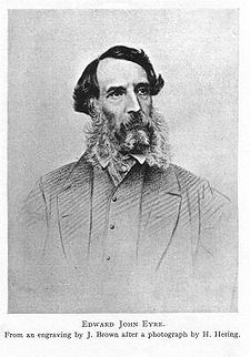
Aboriginal-European relations were more civilised in colonial South Australia than elsewhere in Australia. While thoroughly conforming to a 19C manner, the Europeans here were less likely to shoot or poison indigenous people. As early as 1845, the great explorer and protector of the Aborigines Edward John Eyre (1815-1901) wrote a thorough account of Aboriginal manners and customs, treating them as human beings and defending their traditional place on the land. Rather than extermination, the South Australian government consistently planned assimilation. The Waste Lands Act (1842) reserved marginal agricultural land for natives. An Aboriginal settlement at Moorundie (today's Murray Bridge) on the Murray River, the Adelaide Native School and Walkerville Aboriginals School were established in the 1840s as well. A Parliamentary Select Committee of Inquiry into Aborigines in 1860 established the Point McLeay Mission.
Sadly, the modest gains being made in Aboriginal-European relations were spoiled by draconian measures introduced early in the present century. Following the other states, South Australia introduced protection boards which segregated, restricted and separated Aborigines from traditional lands, family members and white society. Eventually, South Australians elected to repeal the worst discriminatory measures. By the late 1960s protection was given to sacred sites; segregation of public facilities was outlawed; Aboriginal Studies was introduced at teachers' schools; and communities on the reserves were allowed to incorporate.
Charles Sturt
Charles Sturt (1795-1869) was one of the most extraordinary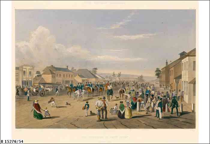 and tenacious of the colonial inland explorers. Born to a judge
of the East India Company in Bengal, he was well educated in
England and joined the army in 1813. In 1826, his regiment
accompanied a transportation of convicts to New South Wales;
Sturt was immediately taken with Australia, and determined to
explore its unknown regions. He gained the confidence of
Governor Darling, and first led an expedition in 1828, along
with Hamilton Hume, to discover the source of the Macquarie
River. During this trip, they also discovered, in 1829, the
Darling River. At the end of that year, Sturt headed the inland
expedition to determine the course of the Murrumbidgee River, a
journey which is considered one of the greatest in Australian
history, for Sturt and his company overcame incredible hardships
to discover the continent's largest river-system, the
Murray-Darling basin. Of greatest significance was Sturt's
sympathetic treatment of and interest in the indigenous people
they encountered; no natives were harmed during any of Sturt's
many expeditions.
and tenacious of the colonial inland explorers. Born to a judge
of the East India Company in Bengal, he was well educated in
England and joined the army in 1813. In 1826, his regiment
accompanied a transportation of convicts to New South Wales;
Sturt was immediately taken with Australia, and determined to
explore its unknown regions. He gained the confidence of
Governor Darling, and first led an expedition in 1828, along
with Hamilton Hume, to discover the source of the Macquarie
River. During this trip, they also discovered, in 1829, the
Darling River. At the end of that year, Sturt headed the inland
expedition to determine the course of the Murrumbidgee River, a
journey which is considered one of the greatest in Australian
history, for Sturt and his company overcame incredible hardships
to discover the continent's largest river-system, the
Murray-Darling basin. Of greatest significance was Sturt's
sympathetic treatment of and interest in the indigenous people
they encountered; no natives were harmed during any of Sturt's
many expeditions. Sturt had expected promotion as a result of his many accomplishments, only to be denied compensation due to the jealousy of fellow explorer T.L. Mitchell. This disappointment, along with his failing health caused by the hardships of his journeys, prompted Sturt to return to England. Here he published Two Expeditions into the Interior of Southern Australia 1828-31 (1833), which served as inspiration for Edward Wakefield's choice of South Australia for his Utopian settlement (see below). Sturt married and returned to Australia in 1834, to take up property in New South Wales. He was soon anxious to explore further, and in 1838 took on the dangerous assignment of bringing provisions overland to the struggling colony at Adelaide. This strenuous journey allowed him to explore the mouth of the Murray River and much of southeastern South Australia. He settled in Adelaide, where he built a house, the Grange, which still stands. When his hopes of being appointed Governor were dashed in 1841, Sturt continued his services to the colony, and in 1844 mounted his most ambitious expedition, to explore the interior of the region. While Sturt considered this horrendous episode, where temperatures sometimes exceeded 50°C, to be a failure, he succeeded in establishing that no inland sea existed; that he survived this gruelling assignment was victory enough. His efforts were recognised in the naming of Sturt's Stony Desert to that most desolate area between Cooper Creek and the Diamantina; and in that most showy of Australian wild-flowers, Sturt's Desert Pea.
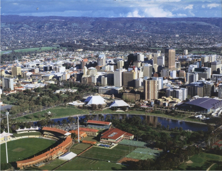
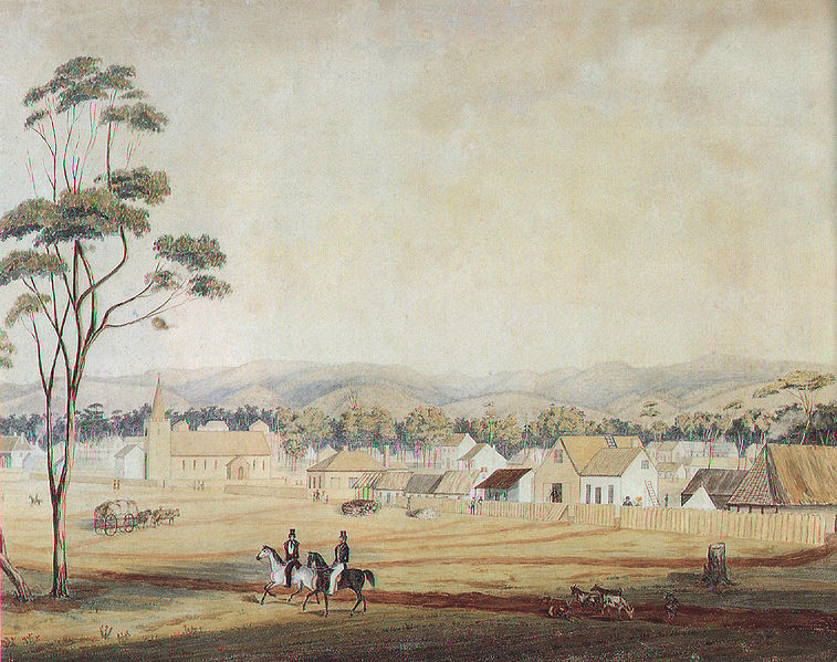
Adelaide
Central Adelaide (total population 1,081,000), a square-mile grid, is defined by Terraces which comprise the rim of the main civic centre, in the middle of which is Victoria Square and beyond which are parklands. North Terrace contains the most historic public buildings, and is one of the most gracious streets in Australia. The adjacent parkland contains many of the city's notable public institutions. Across the Torrens River is North Adelaide. Adelaide Airport is west of town, virtually on the Gulf of St Vincent, and the Rail Passenger Terminal is across the West Terrace Cemetery from the city proper.In 1910 J.F. Fraser observed, 'Adelaide for culture, Melbourne for business, Sydney for having a good time.' Adelaide still evokes a sense of cultivation, enhanced by its fame as the location for the Adelaide Festival, Australia's oldest (since 1960) and most successful cultural festival, now held annually in February or March. The festival is definitely worth a visit as it includes the best of international theatre, dance, music, literary events, and performances, as well as the most contemporary of Australian productions and artistic efforts. Adelaide has always been a good centre for bookshops, some of which have contributed substantially to the literary life of the country. F.W. Preece opened its bookshop in 1907 on King William Street, from where the owner published many books about South Australia, as well as the first publications of the Jindyworobak poets and the cultural journal Desiderata in the 1930s. Another, Mary Martin's Bookshop, was founded in 1945 by Mary Martin and Max Harris, important literary figures in the community. Harris went on to found the modernist journal Angry Penguins and was most famous for his publishing of the Ern Malley hoax.
In 1869 Charles Wentworth Dilke, an imperialist author from Britain, called Adelaide 'the farinaceous village', 'the City of Churches', 'The Athens of the South', 'the resting place of Australian wowsers', 'a kind of high-rise-pimple surrounded by an ever-extending contusion of villas'. The town's reputation received the comment by others that it was 'beautifully laid out ... like in a morgue'. Its many stone churches are indeed still prominent architectural features, constructed in a variety of stone and in many styles, and speak of Adelaide's rare status in Australia for harbouring a multitude of religious congregations, leading to inevitable early debates over theological distinctions.
More caustic observations are similarly unfair. Dilke continued to describe it as 'One of the most crude and impracticable schemes in reference to a British race population that the brain even of modern practical economists has hatched'; he conceded finally that 'in Adelaide, all the comfort and luxuries of life may be obtained; and an individual who is pining in the cold-catching and uncertain climate of Great Britain-struggling to keep up the necessary appearances of fashionable life, and to be a somebody, upon a limited income may, by changing his abode to the genial climate of South Australia, live like a little prince, and become a "somebody", with the same income on which he could barely exist in England.'
Even native son, the writer Geoffrey Dutton, described it in the 1960s as the 'square city, named for a dull dead queen, ...a level-headed city of ornate feuds'. Adelaide is also known to have the worst drinking water in Australia. While substantial improvements have been made in the last few years, popular belief still maintains that it is one of only two ports where international ships do not take on water, the other being Dubai.
Still, the city is an attractive and comfortable place, with some of the best and most reasonably priced restaurants in the country. The presence from the early days of settlement of Germans has had the positive effect of nurturing a more varied cultural climate; even Dutton must concede that 'the humble leberwurst or mettwurst has always given South Australia some heritage more varied than boiled mutton and Irish stew'. This early ethnic diversity also accounts for Adelaide's long-standing reputation as the home of good food and, of course, wine.
Touring the city
Adelaide is quite clearly a 'planned city'. The original site
was chosen by Colonel William Light in 1836, Surveyor-General of
the newly established colony. Named by the new free settlers
(upon the suggestion of Governor Hindmarsh) after Queen
Adelaide, wife of King William IV, the entire city had been
completely planned before any building began. Light's
enlightened plan established a grid of the city on the south
side of the River Torrens, which would contain the major public
buildings and governmental structures. The River Torrens runs through the middle of town, and there are a number of parks and reserves along its flood plain. In 1937 the river was diverted through a series of weirs which drained a section of reed beds at the delta shared with the Port Rivers and this produced a large area of land for suburban development.
 The
river was named for Sir Robert Richard Torrens (1814-84), who
was the 21st Premier of South Australia and an original member
of the South Australian Land Co. in 1831. He wrote Colonization
of South Australia in 1835 and emigrated in 1839. His service to
the colony was enhanced when he devised a simplified method of
property transfer described in his book, The South Australian
System of Conveyancing by Registration of Title published in
1859. Initially, he was attempting to clarify the transfer of
freehold land, an extremely important aspect of the law in a
colony so far from the homeland and so fraught with questions of
ownership and land distribution. The Torrens system was adopted
in Canada and the United States by the 1880s and in England in
the 1920s following the Birkenhead legislation.
The
river was named for Sir Robert Richard Torrens (1814-84), who
was the 21st Premier of South Australia and an original member
of the South Australian Land Co. in 1831. He wrote Colonization
of South Australia in 1835 and emigrated in 1839. His service to
the colony was enhanced when he devised a simplified method of
property transfer described in his book, The South Australian
System of Conveyancing by Registration of Title published in
1859. Initially, he was attempting to clarify the transfer of
freehold land, an extremely important aspect of the law in a
colony so far from the homeland and so fraught with questions of
ownership and land distribution. The Torrens system was adopted
in Canada and the United States by the 1880s and in England in
the 1920s following the Birkenhead legislation. Walk 1 Around Victoria Square
Victoria Square lies at the heart of the town. A 3.6 hectare open plaza, it was laid out by Colonel William Light in 1837 'for the use and recreation of the public'. King William Street cuts through the square to the north and south. The walk described here begins at the General Post Office at the northeast corner and continues clockwise around the square, ending at the courthouses on the southwest.The General Post Office on the corner of King William and Franklin Streets was built in 1867-72 on the site set aside for the post office in the original plan of the city. (It superseded the original 1851 building which continued to serve as the police station until it was demolished in 1891. That building's clock was removed in 1876, and still functions in the tower of Glenside Mental Hospital.) Following a design competition, the architects of the General Post Office were E.W. Wright and E.J. Woods.
 |
Edmund William WrightEdmund William Wright (1824-88) trained in London as a civil engineer and architect. On his way to South Australia, he stopped in Canada, where he constructed a tubular bridge over the St Lawrence River in Montreal. Once in Australia, he proceeded to the gold diggings in Victoria before returning to Adelaide to set up practice in 1860 in partnership with E.J. Woods. He became Mayor in January of 1859, but resigned in December of the same year, for which he was fined £10. Despite this setback, he succeeded in his design for the Town Hall in 1863, and remained an important figure in architectural circles. |
Prince Alfred laid the foundation stone during his visit to Adelaide in November 1867. It opened with great fanfare on 6 May 1872, at a cost of £53,258. The building's crowning glory is its clock tower. The clock itself was made in England in 1874 by J.B. Joyce of Whitchurch, and the chimes are meant to correspond with those of Great St Mary's in Cambridge, England, as well as those at the Houses of Parliament in London. A great throng appeared to hear the first chimes on 13 December 1875, and despite an initial mistake in striking the correct hour, the clock has served as an Adelaide landmark ever since. The clock is purported to be the most accurate GPO clock in Australia; it is kept within the limits of plus or minus one second from true mean time, and is checked daily with the observatory at Mount Stromlo in the ACT.
The central hall presents arched and deeply coffered ceilings and a gallery with ornamental cast-iron trusses and balustrade. The middle King William entrance was originally used as a carriageway, while an extension to King William façade was added in 1891-93. The interior of the building, with its painted ceiling, is an impressive example of Victorian public space.
Outside the General Post Office on Franklin Street is one of Adelaide's many 'pie carts', an institution in the city since 1915. These carts serve the Adelaide speciality, a 'Pie Floater': a hot meat pie with tomato sauce (ketchup) floating in a bowl of green pea soup. A trip to Adelaide is not complete without a taste of this dish.
North of the post office on King William Street is Electra House. The classical detailing and figure brackets framing the entrance make this building an architectural pleasure. It was associated first with the insurance industry then with the Eastern Extension Australasia and China Telegraph Company, which had somewhat earlier established electrical communication between Darwin and Singapore and thereby Europe, as well as service between South Africa and Adelaide.
Like the post office, the Palladian-style Town Hall complex, across King William Street on the southeast corner of Pirie Street, was also designed by E.W. Wright, and built in 1863-66. The building immediately to the south, built in 1869 by Daniel Garlick (architect) and Charles Farr (builder), was originally the Prince Alfred Hotel. In 1953 it was incorporated into the town hall, its balcony removed and the entrance and vestibule extensively renovated with a covering of marble. Now the building functions as a venue for civic and club meetings and a hall for concerts.
The Treasury Building is across King William Street on the northeast corner of Victoria Square. It was designed by E.A. Hamilton, Colonial Architect, and built in several stages beginning in 1858. It took nearly 20 years to complete the block, although its unified style suggests that its design was conceived of by Hamilton as a whole. The construction proceeded in the following order: most northerly King William part of two storeys, built 1858; corner two-storeyed section, 1859; central three storeys, 1860; eastern two-storeyed Victoria Square, 1867; three-storeyed Victoria Square block completed in 1876. The central courtyard gardens were started by James Milton in 1840. The building now houses the Adina Apartment Hotel, but tours of Old Treasury Museum are ocassionally conducted by the Ayers House Museum.
Behind the Treasury Building on Flinders Street is Pilgrim Uniting Church, formerly Stow Memorial Church. Originally named
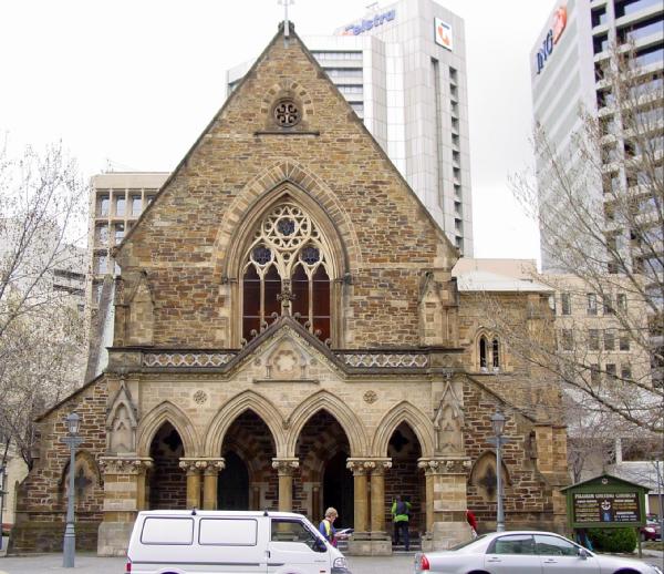 after
T.Q. Stow who was important in the establishment of
Congregationalism and the Bible Society in South Australia, the
church was designed by Robert
George Thomas (see his Baptist Church on the opposite side
of Flinders Street a block further along), built by Brown and
Thompson, and opened in 1867. The design is English neo-Gothic
style, and includes carved capitals and sandstone-dressed
bluestone walls. The interior has a wide nave and narrow aisles.
The Gothic style is softened by the double-porch column and the
large windows in the south wall. Behind the church is the former
meeting hall, constructed in 1863 of bluestone, also in a Gothic
Revival design by E.W. Wright.
after
T.Q. Stow who was important in the establishment of
Congregationalism and the Bible Society in South Australia, the
church was designed by Robert
George Thomas (see his Baptist Church on the opposite side
of Flinders Street a block further along), built by Brown and
Thompson, and opened in 1867. The design is English neo-Gothic
style, and includes carved capitals and sandstone-dressed
bluestone walls. The interior has a wide nave and narrow aisles.
The Gothic style is softened by the double-porch column and the
large windows in the south wall. Behind the church is the former
meeting hall, constructed in 1863 of bluestone, also in a Gothic
Revival design by E.W. Wright.The Pilgrim Church manse is now the Ethnic Affairs Commission building. Initially built in the same style as the church, it was given an Italianate colonnade façade just after the turn of the century. At that time it functioned as a sanatorium under Dr T.A. Hynes, an Australian graduate of Edinburgh University who followed the then radical American approach of making mental patients comfortable in cheerful conditions. The renovations undertaken in 1975-76 won an architectural award of merit.
The large Torrens Building, across Flinders Street and along Victoria Square to the corner of Wakefield Street, now houses the Public Works and Registrar-General's Department. Built in 1876, the simple style of Melbourne architect Michael Egan's design makes the building something other than an austere block, particularly the lightened effect of the arched windows on the first storey.
The architectur
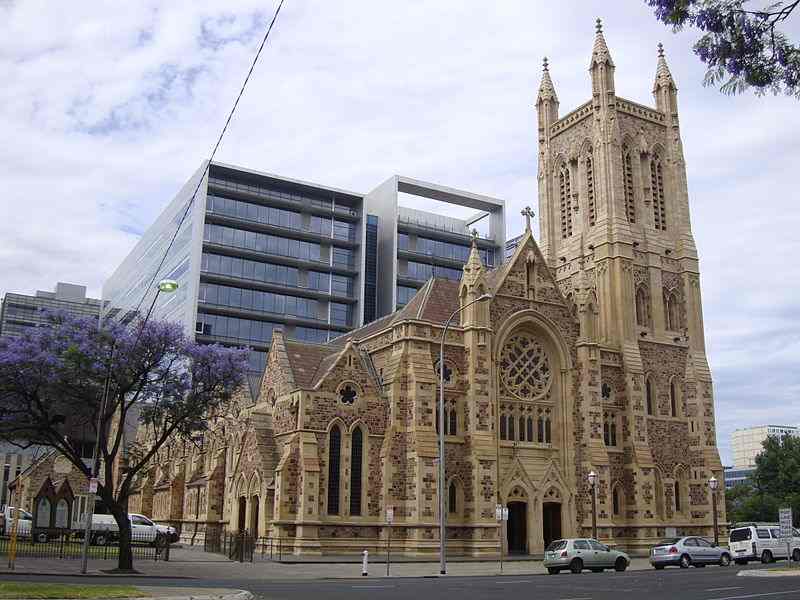 al
history of St Francis Xavier's Cathedral, across Wakefield
Street, is a series of building programmes. Plans for the
building began in 1848 with a subscription drive. After initial
hesitations, the Catholics, uncharacteristically, accepted state
aid to defray construction costs. Richard Lambeth was selected
as the architect, but construction had not got far beyond the
foundations when the Victorian gold rush lured most of the
colony's workforce to the gold fields. The cathedral attained
its present shape in 1926 based on designs by Woods, Bagot, Jory
and Laybourne Smith. The firm's designs were based on those of
Pugin and Pugin, of London's Houses of Parliament fame, for the
1887 enlargement and included plans for a tower.
al
history of St Francis Xavier's Cathedral, across Wakefield
Street, is a series of building programmes. Plans for the
building began in 1848 with a subscription drive. After initial
hesitations, the Catholics, uncharacteristically, accepted state
aid to defray construction costs. Richard Lambeth was selected
as the architect, but construction had not got far beyond the
foundations when the Victorian gold rush lured most of the
colony's workforce to the gold fields. The cathedral attained
its present shape in 1926 based on designs by Woods, Bagot, Jory
and Laybourne Smith. The firm's designs were based on those of
Pugin and Pugin, of London's Houses of Parliament fame, for the
1887 enlargement and included plans for a tower.Supreme, Magistrate and Local Court Buildings are at either side of King William Street at the south end of the square. The Magistrate's Courthouse on the southeast corner was originally the Supreme Court. Begun in 1847, this is the only Greek Revival building, with a Doric façade, in Adelaide. The portico is constructed of Finniss River sandstone. Except for the original courtroom's skylight, canopy and public gallery, very little of the original building remains.
Richard Lambeth, who was described as the 'Clerk of Works and Architect' in the Colonial Engineer's Office, designed the structure. Berry and Gilbert report an anecdote related to the building in their Pioneer Building Techniques in South Australia (1981): 'Although the new building was eventually completed and occupied on 30th June, 1850 after having taken three years to build, it was not without a struggle, as the builder had barricaded himself in and the authorities had to make a forced entry.'
The building was not completed upon occupancy and the Adelaide Times complained that the 'vast height of the hall, the large globular skylight that surmounts it, and the extensive subterranean vault leading to the dock, seem all combined to deprive the voice of any speaker of any particle of distinctiveness'.
The judges themselves complained about the placement of the bench, the lack of toilets and robing rooms and about the smoking fireplaces in chambers. The building was used for the Supreme Court until 1873, then as the Local and Insolvency Courts until 1891, and finally as the Police Courts.
Colonial Architect R.G. Thomas and William McMinn designed the Supreme Court, across King Street, facing the square. Originally the Local and Insolvency Court, it was built between 1866 and 1869 by Brown and Thompson, who also constructed the post office. The front is Tea Tree Gully sandstone in a Victorian Classical Revival style with balustraded parapet, carved keystones on the arches and Ionic columns. The south and west elevations are of bluestone. It has been used by the Supreme Court since 1873.
The Local Court House, across King Street behind the Supreme Court, was built in 1867 as the police court when William Hanson was the Colonial Architect. The building features a Roman Doric portico, cement dressings and what was described at the time as a 'somewhat elegant interior'. In 1891 it became the Local and Insolvency Courts.
Across Gouger Street on the southwest corner of the square, the Local and District Courts, also known as the Samuel Way Building, were formerly Moore's Department Store. Opened in 1916 and consciously inspired by store owner Charles Moore's trip to the Paris Exhibition of 1878, the building was radical for a number of reasons at the time of its construction. The shell is of reinforced concrete with cast cement and run cement dressings. Its original function as a department store placed it a considerable distance from the retail section of the town which at the time was along the far northern edge of the central business district. Charles Moore hired Garlick and Jackman as the architects and William Lucas from England designed the central staircase. A fire in 1948 required substantial rebuilding of the structure and only the façade and central staircase of the original survive.
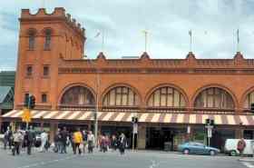 The site for the Central Market
dates from 1870. It is back across Gouger Street to the west,
extending through to Grote Street. The present structure was
constructed in the mid-1960s, but maintains the original
partitioning of space into stalls. The market is a great place
to find fresh produce and delicatessen items of the best
quality. It has varying hours, open Tues., Fri., Sat. 7.00,
Wed., Fri. 9.00, closing Tues., - Thurs. 17.30, Fri. 11.00, Sat.
15.00. Adelaideans are so proud of their market that they have
organised entertaining tours (9.30 Tues., Thurs., Fri, and Sat.,
duration 2 hrs.) on the historic premises. Paul's Cafe across
Grote Street is a traditional fish, chips, coleslaw and beer
cafe, but its fish is more than a cut above the average battered
fish offering. It has remained the same for decades, and is a
beloved Adelaide institution.
The site for the Central Market
dates from 1870. It is back across Gouger Street to the west,
extending through to Grote Street. The present structure was
constructed in the mid-1960s, but maintains the original
partitioning of space into stalls. The market is a great place
to find fresh produce and delicatessen items of the best
quality. It has varying hours, open Tues., Fri., Sat. 7.00,
Wed., Fri. 9.00, closing Tues., - Thurs. 17.30, Fri. 11.00, Sat.
15.00. Adelaideans are so proud of their market that they have
organised entertaining tours (9.30 Tues., Thurs., Fri, and Sat.,
duration 2 hrs.) on the historic premises. Paul's Cafe across
Grote Street is a traditional fish, chips, coleslaw and beer
cafe, but its fish is more than a cut above the average battered
fish offering. It has remained the same for decades, and is a
beloved Adelaide institution. Her Majesty's Theatre (t 08 8216 8600), on the north side of Grote Street towards Victoria Square, was erected as the Princess Theatre in 1912-13 and was first leased by Harry Rickards, a well-known Vaudevillian who had made his name in Britain and America before becoming a leading 'variety entrepreneur' in Australia. The original stage was 81 x 63 ft with a height of 53 ft, considered quite large by Adelaide standards of the day. It seated more than 2000 and featured a then state-of-the-art ventilation system which pumped 2600 cubic feet of air per minute. After alterations in 1962, it received its current name, although it was called the Opera Theatre in the 1970s, when it was home to the State Opera Company of South Australia until they moved to the Festival Theatre in 1989. It is still one of Adelaide's major venues for musical performances and theatre.
The Central Business District
The Central Business District (CBD) covers three blocks north of the General Post Office on either side of King William Street, up Rundle Street to the market.
The first section of the ANZ Bank, formerly the Bank of Adelaide, on the corner of King William and Currie Streets, was built in 1880-81 by Wright, Reed & Beavor at the end of a period of prosperity caused by success in agriculture. While it replicated the Doric ornament of the original, the contrasting sandstone dressings were painted and the interior remodelled.
Behind the ANZ Bank on Currie Street is the Head Office of the Savings Bank of South Australia. Designed by Edward Davies and constructed of Pyrmont stone (imported amid much controversy from New South Wales), the turn-of-the-century Classical style building needs a more interesting street in order to look at home.
Across King William Street from the ANZ Building, the T & G Building was built during the boom years immediately following the First World War to house the South Australia branch of the T & G Insurance Company. One of Adelaide's first high-rise buildings, its eleven storeys were the maximum allowed in Adelaide at the time of its opening. The design is by K.A. Henderson and the construction was through the McLeod Brothers, a Sydney firm. The building was renovated in 1982.
Edmund Wright House is on King William Street on the left. Formerly the Bank of South Australia, until recently the Registrar of Births, then the SA History Trust. The Bank of South Australia is the oldest in the state. Founded in 1835 as a department of Angas' South Australian Company, the bank received its royal charter in 1847 and was among the more important colonial banks operating in London at the time. The Union Bank of Australia took over the business and operated out of this building from 1893 until it merged with the Bank of Australasia in 1951 to become the ANZ. The style is French Renaissance and the main façade is in two orders, ground floor Composite, first floor Corinthian. The Scottish sculptor William Maxwell carved the keystones and Joseph Durham's coat of arms, which refer to the Royal Charter under which the bank was founded. The interior is lavish with Corinthian pilasters, enriched pedestals and entablatures-all in Devonshire marble-a deeply coffered ceiling in the banking chambers and original cedar fittings. During the 1970s, the building was seriously threatened with destruction because of its valuable site. Due to a public outcry, the State Government purchased the structure for $750,000 rather than have it demolished.
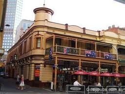 Taking a left turn on Hindley Street, you come to the
Tattersalls and Princes Berkeley Hotels. The Tattersalls Hotel,
originally designed by H.L.
Jackman, was rebuilt in 1901-02 by the South Australian
Brewing Company. Garlick and Jackman were the architects. The
original structure on the site was the Blenheim Hotel (1851),
which was subsequently known as the Weilands (1879) before
taking the current name (1882). In its current form the verandah
and balcony ironwork deserve attention.
Taking a left turn on Hindley Street, you come to the
Tattersalls and Princes Berkeley Hotels. The Tattersalls Hotel,
originally designed by H.L.
Jackman, was rebuilt in 1901-02 by the South Australian
Brewing Company. Garlick and Jackman were the architects. The
original structure on the site was the Blenheim Hotel (1851),
which was subsequently known as the Weilands (1879) before
taking the current name (1882). In its current form the verandah
and balcony ironwork deserve attention.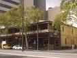 The Princes Berkeley Hotel building dates from
1878 and was erected on the site of the earliest colonial hotel,
the Buffalo's Head (1838). The building was designed by Thomas
Engish and constructed by Charles Farr. The balcony was
extended to span the building in 1905 and 1923. The present name
dates from 1947, though this structure's original name, the
Black Bull, is still applied to it occasionally by old-time
locals.
The Princes Berkeley Hotel building dates from
1878 and was erected on the site of the earliest colonial hotel,
the Buffalo's Head (1838). The building was designed by Thomas
Engish and constructed by Charles Farr. The balcony was
extended to span the building in 1905 and 1923. The present name
dates from 1947, though this structure's original name, the
Black Bull, is still applied to it occasionally by old-time
locals.At the turn of the century there were 16 hotels along Hindley Street, down from a high of 18 in 1880. The number dropped as restrictions were placed on pub life. Bar maids were abolished in 1908; six o'clock closing was enforced in 1916. Only Tattersalls Hotel and the Royal Oak would be recognised today by their early patrons. As an aside for beer aficionados, John Warren was the first brewer in South Australia, having been licensed by Captain Hindmarsh in 1836. The South Australian Brewing, Malting, Wine and Spirit Co. was formed by the merger of the older West End Brewery and the Kent Brewery. This company now holds a virtual monopoly on brewing in the state. Cooper and Sons, also a mid-19C firm, offers a series of beers, some of them at micro-brewery standards. The Tasmanian firm Cascade Brewery, founded in Hobart in 1824, and Redback and Matilda Bay in Perth are of similar size and quality.
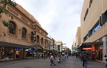
Rundle
Mall is the main shopping complex in Adelaide, touted as the
largest pedestrian mall in the Southern hemisphere; it runs east
from King William Street to Pulteney Street, one block south of
North Terrace. This strip has been Adelaide's premier shopping
district since the 1880s. It contains all of the leading shops,
such as Myer Centre and David Jones. It was at the intersection
of Rundle/Hindley Streets and King William Street that
Adelaide's first electric street lighting was installed in 1985.Adelaide Arcade runs from Rundle Mall to Grenfell Street. The arcade was built during the economic boom of the 1880s when Rundle Street was established as a renowned shopping area, distinct from the working class hotels across King William Street on Hindley Street. Withall and Wells' original plan showed ambition in its use of electric light, plate glass, and cast-iron. (Their design of the Adelaide Racing Club Grandstand in Victoria Park off Wakefield Road shows similar structural and ornamental use of cast iron.) The main promenade is nearly 8m wide and features three fountains; its floor is of Carrara marble and white encaustic tiles. Although some alterations of doubtful taste were allowed to the shop fronts on the ground floor in the 1950s and 1960s, the first floor shop fronts are splendid. The pedestrian mall allows a good view of the octagonal tower and dome at the arcade's top floor which also depicts the Australian coat of arms on the entrance side of the tower.
Gays Arcade, which joins the Adelaide Arcade at a right angle from Twin Street, was designed by J. Cumming and constructed by N.W. Trudgen at about the same time as the Adelaide Arcade to replace Patrick Gay's fire-damaged furniture showroom.
Walk 2 North Terrace
If the area around Victoria Square is governmental and the section slightly to the north is a shopping district, then North Terrace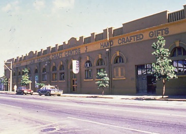 and
the Park Lands are for public institutions. North Terrace is
still the location of the city's most important and impressive
cultural monuments. This walking tour begins from the western
end of the street. The Nexus Multicultural Centre (t 08 8212 4276, open 10.00-17.00)
at 19 Morphett Street close to the junction with Hindley Street
is the original building of the Mumzone jam and pickle factory
in the section of town called St Peters. The complex houses
bilingual theatre performance spaces, and a variety of
experimental exhibitions. The centre also houses the Jam Factory (t 08
8410 0727, open 10.00-17.00), a craft and design centre since
1973, with four training workshops devoted to glass-blowing,
leatherwork, silver-smithing and weaving. The centre also houses
an impressive gallery and a craft shop, as well as the
administrative arm of the Fringe Festival, an alternative or
experimental variation on the Adelaide Arts Festival, and the
Nexus Cabaret. The redesign of the structure represents a
successful example of creative adaptation of 19C architectural
space.
and
the Park Lands are for public institutions. North Terrace is
still the location of the city's most important and impressive
cultural monuments. This walking tour begins from the western
end of the street. The Nexus Multicultural Centre (t 08 8212 4276, open 10.00-17.00)
at 19 Morphett Street close to the junction with Hindley Street
is the original building of the Mumzone jam and pickle factory
in the section of town called St Peters. The complex houses
bilingual theatre performance spaces, and a variety of
experimental exhibitions. The centre also houses the Jam Factory (t 08
8410 0727, open 10.00-17.00), a craft and design centre since
1973, with four training workshops devoted to glass-blowing,
leatherwork, silver-smithing and weaving. The centre also houses
an impressive gallery and a craft shop, as well as the
administrative arm of the Fringe Festival, an alternative or
experimental variation on the Adelaide Arts Festival, and the
Nexus Cabaret. The redesign of the structure represents a
successful example of creative adaptation of 19C architectural
space. A little further afield is the Adelaide Gaol (t 08 8231 4062, weekdays 10.00-17.00, and hour-long guided tours on Sundays 11.00-15.30, admission family $34, adult $14, concession $12, children $9, guided tours on Sundays 11.00, 12.00, and 13.00 cost slightly more). It is located in the northwest section of the parklands from the corner of North and West Terraces. Built in 1840-41 under the supervision
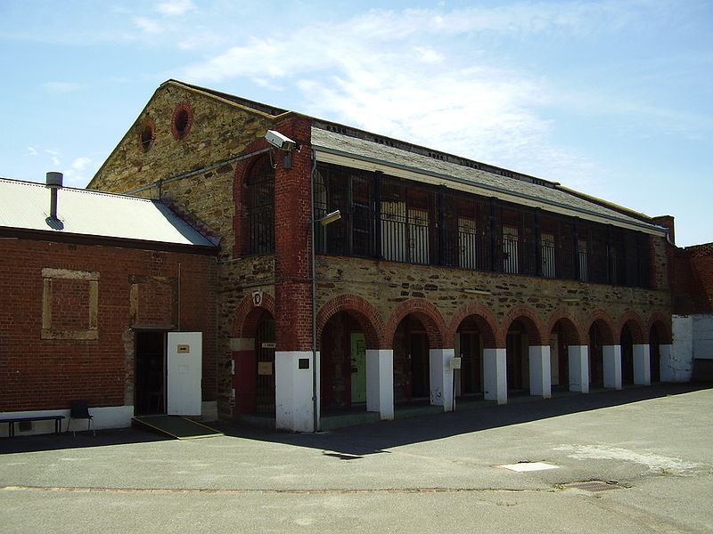 of
Sir George Kingston, its eventual cost of £32,002 greatly
exceeded the original estimate. Criticism of the cost and design
of the gaol was one of the contributing factors in Governor
Gawler's replacement by Governor Grey in 1841. It was built to
accommodate 140 prisoners, but the conviction rate in the colony
at the time was only 24 per year.
of
Sir George Kingston, its eventual cost of £32,002 greatly
exceeded the original estimate. Criticism of the cost and design
of the gaol was one of the contributing factors in Governor
Gawler's replacement by Governor Grey in 1841. It was built to
accommodate 140 prisoners, but the conviction rate in the colony
at the time was only 24 per year. The gaol is one of the best examples of Kingston's surviving work and an interesting demonstration of the model prison design of the late 18C and early 19C: a radial layout gave the central guard station a general overview and prisoners were grouped according to the seriousness of their crimes.
The buildings are surrounded by stone walls, designed by E.J. Woods in 1882. The western tower later became the gallows; the second half of the building was built in 1848, with various additions over the next 30 years. The Powder Magazine behind the gaol was also designed by Woods in the same year. These are the only surviving examples of such magazines in South Australia, and remain virtually unchanged from their original days.
Holy Trinity Church, at the corner of North Terrace and Morphett Street, is one of a few churches to be routinely open during the day; its Sunday services commence at 08.00. It was the first Anglican Church in the city and is the state's oldest surviving church. The foundation stone was laid by Governor Hindmarsh on 26 January 1838 and the church was finished in August of that year. The design was by John White. A temporary church, which preceded this structure, had been imported as a prefabricated building, but was partially ruined on the voyage out. To provide a roof for this temporary structure the first vicar, Reverend Charles Beaumont Howard, and the Colonial Treasurer, Osmond Gilles, dragged a ship's sail on foot from Holdfast Bay. Reverend Howard is locally remembered as having refused to visit the dying Colonel Light because Light was living with a woman who was not his wife.
The clock in the tower, intended as the Adelaide town clock, was cast by King William's clockmaker, Vuillamy. The church was rebuilt again in 1888 and now only the lower parts of the nave and tower survive of the original edifice and only a stained-glass window commemorating King William IV remains of the prefabricated church building. Its current appearance was based on architect Edward John Woods's original design. Brian Dickey published Holy Trinity Adelaide's Pioneer Church A Brief History on-line.
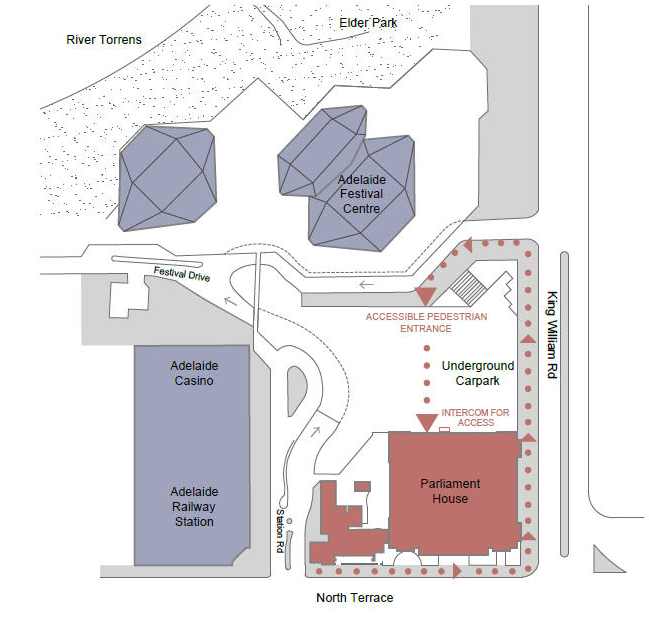 Northwest
of the junction of King Willam Street and North Terrace is a
group of buildings including the Adelaide Railway Station,
currently the Adelaide Casino and Convention Centre, The
Adelaide Festival Centre, and Parliament house. The
Railway Station was built under railway commissioner W.A. Webb
during the 1920s, the building's size assumed the continued
heavy use of rail transport. Webb's aggressive refurbishment of
the system nearly bankrupted the state at the beginning of the
Depression of the late 1920s. On the other hand, construction of
the railway station was continued during these years to give
employment to workers who would otherwise have had no likelihood
of work. It also contributed to the readiness of South Australia
to advance the manufacturing necessitated by the Second World
War. The neo-classical station was designed by Garlick and
Jackman. Its construction is reinforced concrete. After
considerable, largely sympathetic, renovation during the 1980s,
it now houses the Adelaide Casino.
Northwest
of the junction of King Willam Street and North Terrace is a
group of buildings including the Adelaide Railway Station,
currently the Adelaide Casino and Convention Centre, The
Adelaide Festival Centre, and Parliament house. The
Railway Station was built under railway commissioner W.A. Webb
during the 1920s, the building's size assumed the continued
heavy use of rail transport. Webb's aggressive refurbishment of
the system nearly bankrupted the state at the beginning of the
Depression of the late 1920s. On the other hand, construction of
the railway station was continued during these years to give
employment to workers who would otherwise have had no likelihood
of work. It also contributed to the readiness of South Australia
to advance the manufacturing necessitated by the Second World
War. The neo-classical station was designed by Garlick and
Jackman. Its construction is reinforced concrete. After
considerable, largely sympathetic, renovation during the 1980s,
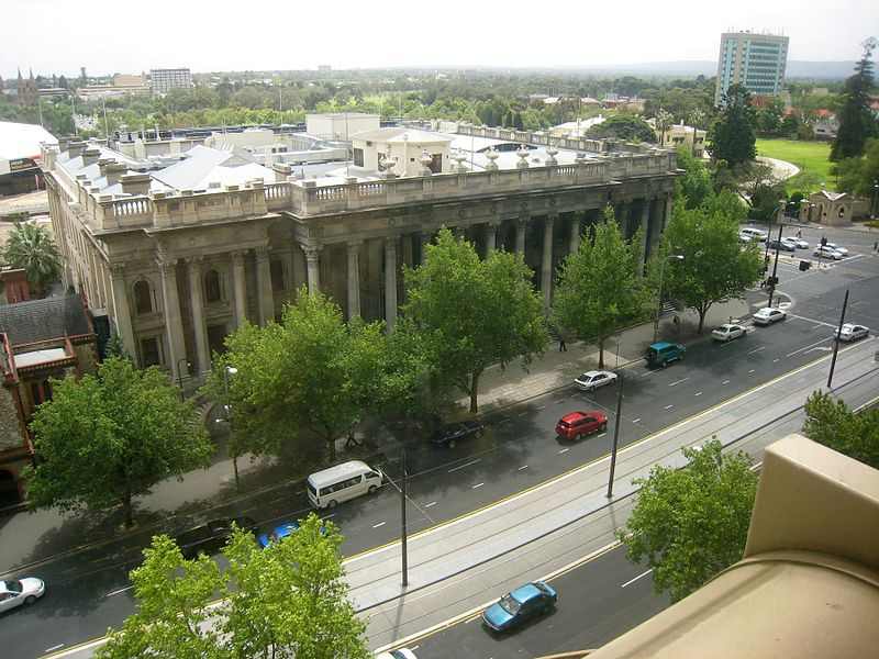
it now houses the Adelaide Casino. Next to the current Parliament House, on the corner of North Terrace and King William Road, the Old Parliament House and Legislative Council Chambers building has had a chequered history. The initial design was by W. Bennet Hayes who became Colonial Architect shortly after being awarded the design competition for the building. The competition was held in 1851 to replace a stone cottage where the Legislative Council met. Hayes' winning design was later rejected as too expensive.
The subsequent construction attracted much debate and controversy. Due to labour and materials shortages caused by the gold strike, the initial building contract was based on usual builders' profits rather than a total contract award; it was built in 1854 at a cost of £17,000. Substantial additions were made in 1857 to suit the bicameral system of government instituted at the time. It was used by Parliament until 1889, when Parliament House was completed.
Architecturally, New Parliament House features an unusual modified Dutch gable form, rusticated brick quoins and semi-circular ground-floor archways. Until 1980 it housed a variety of governmental departments and had been altere
 d
and neglected for some time. (It would have been demolished but
for the start of the Second World War.) Visitors can only view
the interior lobby.
d
and neglected for some time. (It would have been demolished but
for the start of the Second World War.) Visitors can only view
the interior lobby.New Parliament House on the northwest corner of North Terrace and King William Streets is open to the public when parliament is sitting (tours occur on non-sitting days at 10.00 and 14.00). It was constructed of Kapunda marble on a base of West Island granite; the original design was by E.W. Wright & Lloyd Taylor of Melbourne. Progress on the building was delayed by financial problems and arguments about whether North Terrace or Victoria Square was the better site. The location was decided in 1883 and the building was begun, using a slightly altered design by then Colonial Architect E.J. Woods. By 1889 only the west section was completed; the remainder was not built until 1936-39 when the state received a centenary gift of £100,000 from Sir Langdon Bonython(1848-1939), editor of the Adelaide Advertiser and public benefactor. A planned central dome was abandoned and the number of columns in the portico increased from six to ten. The finished work includes carved portraits on keystones of past governors, presidents and speakers and a sumptuous interior of teak, maple and walnut. The stone lion was a gift from London in 1939.
In response to the hot and stuffy chambers in the Old Parliament House, a complex system of heating and cooling was incorporated in the new building, described in a governmental brochure thus: 'A unique system of evaporative cooling was a feature of the building. Air shafts were incorporated in the walls, terminating in openings under the windows with water trays and deflecting plates to direct the air over the water before it entered the room. The trays had taps and wastes to enable them to be simultaneously emptied and filled with fresh water.'
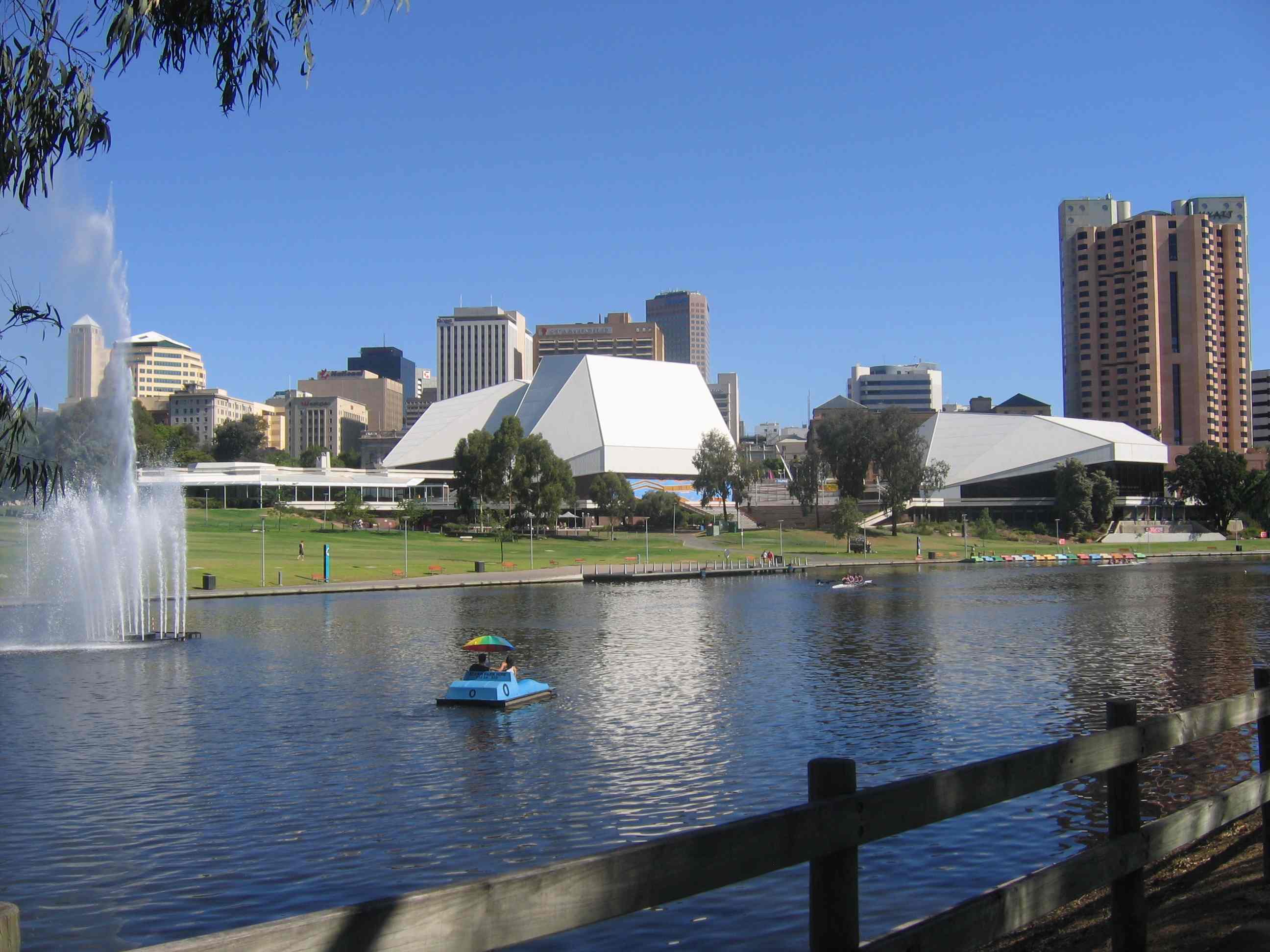
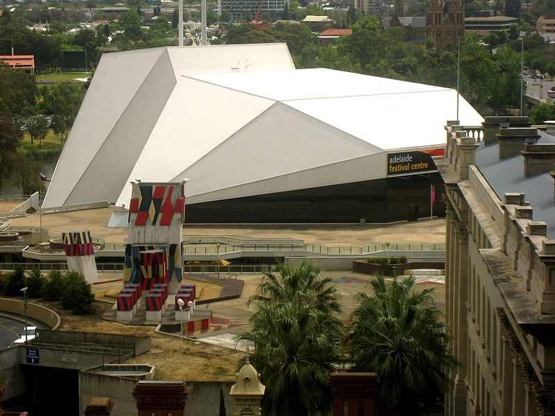 Adelaide
Festival Centre (t 08 8216 8600) is located behind the
railway station on King William Road. The biennial Adelaide
Festival of Arts, begun in 1960 as a celebration of the city's
commitment to the performing arts, necessitated the construction
of the centre. Should you have the good fortune to be in
Adelaide during March on an even-numbered year, you will find
the city taken over by its festival. Theatre and dance are the
central activities, but a variety of musical and alternative
performances are presented as well.
Adelaide
Festival Centre (t 08 8216 8600) is located behind the
railway station on King William Road. The biennial Adelaide
Festival of Arts, begun in 1960 as a celebration of the city's
commitment to the performing arts, necessitated the construction
of the centre. Should you have the good fortune to be in
Adelaide during March on an even-numbered year, you will find
the city taken over by its festival. Theatre and dance are the
central activities, but a variety of musical and alternative
performances are presented as well.Designed by Hassell and Partners and built by A.V. Jennings Industries, the centre was completed in 1973. It features the Hajek sculpture plaza and several theatres in a starkly modern setting. Although subject to much criticism (the stark plaza uncomfortably abuts the northern wall of the Parliament House; the structure of the Festival and Playhouse Theatres is made to look like concrete when it is steel), audiences and artists describe the facilities as versatile and comfortable performance spaces.
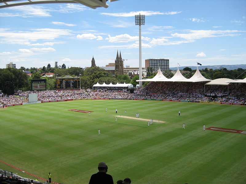 Across the
river on the way to North Adelaide via King William Road or
Montefiore Road is the Adelaide Oval, leased to the South
Australian Cricket Association in 1872. The first grandstand was
erected in 1882 and the inaugural match played between England
and South Australia. The present appearance of the park dates
from renovations undertaken in the mid- and late-1920s. The
scoreboard dates from 1911 and was noteworthy at the time for
its novel layout of the tallies, batters and score. Widely
considered to be the best and most beautiful cricket oval in the
world, it is the site of international test matches as well as
state contests. It was on this oval in the 1932-33 season that
the infamous 'bodyline' defence, in which several Australian
players were actually injured by balls thrown at them by English
bowlers, reached its climax, when the Adelaide crowds nearly
stormed the field in protest.
Across the
river on the way to North Adelaide via King William Road or
Montefiore Road is the Adelaide Oval, leased to the South
Australian Cricket Association in 1872. The first grandstand was
erected in 1882 and the inaugural match played between England
and South Australia. The present appearance of the park dates
from renovations undertaken in the mid- and late-1920s. The
scoreboard dates from 1911 and was noteworthy at the time for
its novel layout of the tallies, batters and score. Widely
considered to be the best and most beautiful cricket oval in the
world, it is the site of international test matches as well as
state contests. It was on this oval in the 1932-33 season that
the infamous 'bodyline' defence, in which several Australian
players were actually injured by balls thrown at them by English
bowlers, reached its climax, when the Adelaide crowds nearly
stormed the field in protest. The clubhouse for the Municipal Golf Course is at the corner of Montefiore Road and War Memorial Drive just across the Victoria Bridge. Said to be Australia's most popular public course, it is certainly within walking distance of North Terrace. The links, encircling the western edge of North Adelaide, offer two courses. That to the north is 69 par and extends as far as the Adelaide Aquatic Centre, that to the south is par 72 and features bunkers. Both have tree-lined fairways.
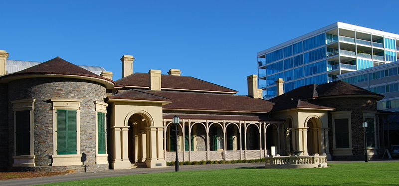
Facing the Festival Centre is Government House, the earliest-surviving building in Adelaide. It is open to the public twice a year, on changeable open days advertised in the newspapers. The oldest section of Government House is the east front, built in 1839-40 to replace the wattle-and-daub slab hut which had been Governor Hindmarsh's residence, on the site of the present-day casino. His successor, Colonel Gawler, preferred to sleep in a tent, using the hut as offices while he arranged for more appropriate accommodations. The Regency style design of Government House was adapted from a London pattern book by Edward O'Brien, but was substantially altered and erected in stone by Sir George Kingston, the colony's first 'Government Architect'.
The central portion of the structure was added in 1855, to a design by W.B. Hayes. At this point it took on the dimensions of an elegant mansion, with ballroom, state dining room, Adelaide room, Governor's study, south hall and entrance portico. In 1873 the Watchhouse-constructed of bluestone with Classical Revival stuccoed detailing-at the entrance was added, as was the west wing, designed by G.T. Light in 1878. Much of Adelaide's public history has taken place in Government House, including the hosting of the Duke of York when he visited Australia to open the first Federal Parliament in 1901. (His visit is commemorated in stained-glass windows installed at the north end of the ballroom.) The grounds include beautiful gardens, tours of which are regularly advertised in the local newspapers.
A bronze equestrian statue at the corner of North Terrace and King William Road commemorates the efforts of the South Australian Bushmen's Corps in the Boer War (1899-1902). Sculpted and cast by Adrian Jones of Ludlow, Shropshire, it was paid for by subscription and public fund-raising, and erected on a base of Murray Bridge granite in 1902. Australian soldiers in London for the coronation of Edward VII were asked to visit Jones to give information on regimental regalia; as it turned out, the regimental quartermaster, George Henry Goodall, sat for the sketch of the head of the mounted trooper.
Set in the footpath of the Jubilee Walk are 150 commemorative bronze plaques honouring prominent individuals, such as the inventor of the jump stump plough and the founder of Meals on Wheels. Ask at the downtown bookstores for a biographical guide to the walk.
The Migration Museum
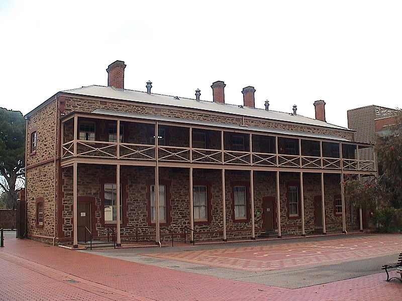 The Destitute
Asylum, now the site of the Migration
Museum, is further east along North Terrace and left on
Kintore Avenue (t 08 8207 7580, open Mon-Fri 10.00-17.00, Sat,
Sun and holidays 13.00-17.00, free admission). This complex had
its origins in the earliest days of the colony: construction
began in 1853 and continued for 30 years. While the original
social welfare functions of the buildings began to be replaced
by the 1880s, many of the original buildings survived in various
capacities. The remaining five buildings have now been restored
to comprise the Migration Museum, which offers a fascinating and
well-planned exhibition of the experience of migrants to South
Australia; it is still the only museum in Australia to explore
this historical process, through displays of past material
culture as well as participation by current ethnic groups living
in the state. The museum ranks as one of the most intelligent,
in terms of presentation, in Australia.
The Destitute
Asylum, now the site of the Migration
Museum, is further east along North Terrace and left on
Kintore Avenue (t 08 8207 7580, open Mon-Fri 10.00-17.00, Sat,
Sun and holidays 13.00-17.00, free admission). This complex had
its origins in the earliest days of the colony: construction
began in 1853 and continued for 30 years. While the original
social welfare functions of the buildings began to be replaced
by the 1880s, many of the original buildings survived in various
capacities. The remaining five buildings have now been restored
to comprise the Migration Museum, which offers a fascinating and
well-planned exhibition of the experience of migrants to South
Australia; it is still the only museum in Australia to explore
this historical process, through displays of past material
culture as well as participation by current ethnic groups living
in the state. The museum ranks as one of the most intelligent,
in terms of presentation, in Australia. The complex was originally established with the reasonable acceptance by the South Australian government of some responsibility for those immigrants who found themselves destitute upon their arrival. The museum also presents a moving, if at times grim, description of the building's tragic early history as the 'place where Adelaide hid her poor and homeless'. In the late 1870s, for example, the lying-in hospital for women in childbirth was separated into three areas. One was for women who had only 'fallen' once, another for women who had previous illegitimate children, and a third for prostitutes. Remarkably, once a woman was admitted, she was routinely confined for six months. The Victorian associations of unwed mothers with other forms of socially unacceptable behaviour led to the establishment of a reformatory for women at the same site. Not surprisingly, other refuges for women in the city which opened at about this time proved more popular due to a somewhat more sensible approach to the women's situation. In keeping with this history a recent exhibition displayed, along with descriptive texts, the horrific medical instruments used in childbirth in the 19C.
The remaining buildings include the chapel, the government store (now the museum proper) and the barracks. The chapel and schoolroom was erected in 1865 as a schoolroom for soldiers of the adjacent barracks. After 1870 it was the chapel for the Destitute Asylum. To the left is a building from 1861 which was meant to be a schoolroom for soldiers' children, although it soon became the laundry for the asylum. It is assumed to have been designed by E.A. Hamilton. The Historical Museum was built in 1867 as the Colonial Ordnance Store. It became the State Archives in 1919, after having served as army offices during the First World War. In 1976 it was restored to its original condition.
The Mounted Police Barracks, now the South Australia Police Museum within the Migration Museum complex, was built somewhat earlier, in 1854. Designed by W.B. Hayes as a quadrangle of buildings, only the central armoury, part of the west building and the gateway remain. At one time, the armoury contained up to 2000 arms. Extensive additions and alterations were made to the building between 1860 and 1888. The gateway, now undergoing restoration, was originally described as looking like a dog kennel.
The Institute Building, now the Mortlock Library of South Australiana (t 08 8207 7250; opening hours vary some but Mon-Wed 10.00-20.00, Thurs-Fri 10.00-17.00, weekends 10.00-17.00), can be visited by returning to the northeast corner of North Terrace and Kintore Avenue. Originally a Mechanics' Institute, this was one of the first public buildings on North Terrace. It is a typical example of a Victorian era building in a derivative 'Renaissance' style. Constructed of Angaston white marble, the south front has a porch with Doric columns and is surmounted by a balustrade. The State Library is 'Jervois Wing' and was added from 1879 to 1884. Originally it held the Public Library and the Art Gallery; in 1881, the Princes Albert, Victor and George opened the gallery. A statue of Robert Burns in front of the library was designed by Scottish sculptor W.J. Maxwell and erected in the 1890s.
The 1877 design of the Mortlock Library is attributed to R.G. Thomas but the drawings were prepared in the Colonial Architect's Office by E.J. Woods, who was responsible for governmental buildings at the time. When the post office was being built, Thomas had been the Colonial Architect and Woods the designer. The style is a rich conglomerate of French Renaissance and Victorian Classical Revival. The east wing, which mimics this original style, was added in 1909-11, and lacks some of the earlier wing's historicist detail. Its name commemorates Colonial Governor William Jervois (1821-97) and houses part of the South Australia Museum.
South Australian Museum
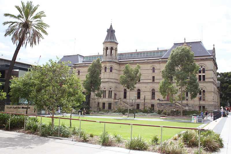
The North Wing was designed by C.E. Owen Smith during the Depression of the 1890s. Despite an extremely limited budget which required him to use brick rather than stone, the decoration makes a reasonable match with the State Library. It opened in 1895.
The Museum also exhibits the Mawson Antarctic Collection, which includes the famous photographs and films taken by Frank Hurley during Douglas Mawson's 1911-14 exploration of Antarctica.
Immediately east of the museum is the Art Gallery of South Australia which opened in 1898 (t 08 8207 7000, free admission, open daily 10.00-17.00). The building, in freestone Classical Revival style, received additions in 1936-39 (the Tuscan portico) and 1963 and a complete restoration in 1979. The most recent renovation, completed in 1998, presents
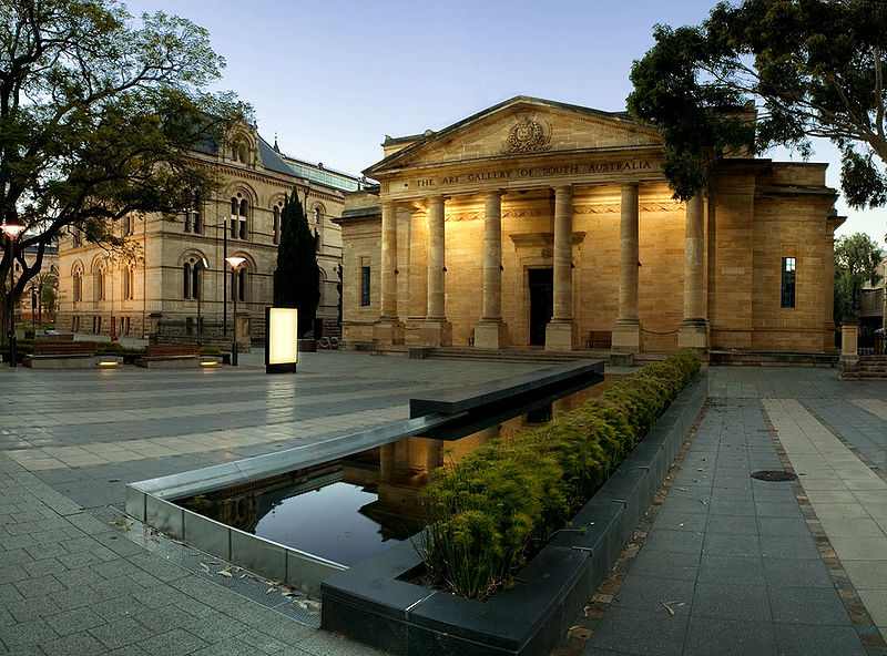 a grand
staircase which leads into a series of contemporary galleries.
a grand
staircase which leads into a series of contemporary galleries. As with so many other institutions in Adelaide that function successfully without much fuss and fanfare, the gallery has been quietly acquiring an intelligent and thoughtful collection for many years. An aggressive acquisitions programme, under the leadership of director Ron Radford (since 2005 the Director of the National Gallery of Australia) and aided by generous local benefactors (public philanthropy for cultural institutions is more well established in South Australia than in the other Australian states), has transformed the gallery into one of the best and most comprehensive collections in the country.
The North Terrace entrance leads into a vestibule which spans the upper ground floor's two wings. On the left side, the Melrose Wing houses the gallery's European Collection, the section that contains some of the collection's most surprising treasures, including Claude Lorrain's Caprice with Ruins of the Roman Forum (c 1635), Anthony van Dyck's Portrait of a Seated Couple (c 1620), Luca Giordano and Giuseppe Recco's The Riches of the Sea with Neptune (1684), and a superb Scipione Pulzone portrait from 1580. This section also displays much of the gallery's extensive collection of British art, highlighting an aluminium statue of Eros by Albert Gilbert (c 1892) and a portrait of Madame le Brun by Thomas Gainsborough (1780). Twenty bronze sculptures by Auguste Rodin are also displayed throughout these rooms.
The Elder Wing on the right-hand side of the entrance vestibule exhibits the gallery's excellent collection of Australian art, particularly valued for its major works of the colonial period. Paintings include John Lewin, Fish catch and Dawes Point, Sydney Harbour (c 1813), one of the first still-lifes painted in Australia; John Glover's A View of the Artist's House and Garden, Van Diemen's Land (1835), the English painter's optimistic tribute to his new country; Tom Roberts's A break away! (1891), one of the most iconic works of the nationalist school; and Charles Conder's Holiday at Mentone (1888), the epitome of the Australian adaptation of Impressionist technique and theme.
Examples of specifically South Australian painters, such as Alexander Schramm's paintings from the 1850s and those of George French Angas (1822-86), form an important exhibition in these rooms. Also in this collection are significant examples of Aboriginal art, with the finest collection of the desert dot paintings, such as Clifford Possum Tjapaltjarri, Honey Ant Dreaming (1980) and Turkey Tolson Tjupurrula, Straightening Spears at Ilyingaungau (1990). More contemporary Australian art, of which the gallery is now a major collector, occupies the west wing galleries of this floor, and range from works by Peter Booth to Imants Tillers and performance pieces and installations.
The lower ground floor houses the gallery's growing collection of Asian art, especially fine in Southeast Asian ceramics. Also on this floor are the rooms devoted to decorative and folk arts, announced by entrance to the galleries through an actual Barossa Valley German stone chapel. These exhibitions include probably the best examples of German craftsmanship, especially woodwork and furniture, produced in the regions around Adelaide; an identifiable 'Barossa style' developed here and is well documented in the gallery's displays. The Adelaide Club at 165 North Terrace on the south side of the street east of King William Street is private. Founded mainly by English and Scottish men of financial substance, the Adelaide Club has been a meeting place for the city's business leaders since its completion in 1864. An example of an early Victorian palazzo style, it was designed by G. Thomas Elder.
Thomas Elder
 Thomas Elder
(1818-97) was an important pastoralist and partner from 1863 in
Elder, Smith & Co., one of the most prosperous wool-brokers,
stock and station agents, and general merchants. He owned (with
fellow pastoralist and eventual philanthropist to the University
of Adelaide, Peter Waite) Paratoo Run and Beltana sheep station
behind the Flinders Ranges. He subsequently owned a tract of
land larger than Scotland. In 1862 he brought camels to South
Australia from India; these became invaluable in the exploration
of inland tracts, several expeditions of which were funded and
supplied with camels by Elder. He was also a legislator,
involved in copper-mining, and an expert horse breeder, bringing
valuable blood-stock from England. In 1874 he endowed the
University with £20,000; his later gifts amounted to £100,000.
He was also a benefactor of the Zoological Gardens. & E.
Hamilton and built by English & Brown. The materials are Dry
Creek stone with shaped brick quoins and window surrounds.
University of Adelaide
Thomas Elder
(1818-97) was an important pastoralist and partner from 1863 in
Elder, Smith & Co., one of the most prosperous wool-brokers,
stock and station agents, and general merchants. He owned (with
fellow pastoralist and eventual philanthropist to the University
of Adelaide, Peter Waite) Paratoo Run and Beltana sheep station
behind the Flinders Ranges. He subsequently owned a tract of
land larger than Scotland. In 1862 he brought camels to South
Australia from India; these became invaluable in the exploration
of inland tracts, several expeditions of which were funded and
supplied with camels by Elder. He was also a legislator,
involved in copper-mining, and an expert horse breeder, bringing
valuable blood-stock from England. In 1874 he endowed the
University with £20,000; his later gifts amounted to £100,000.
He was also a benefactor of the Zoological Gardens. & E.
Hamilton and built by English & Brown. The materials are Dry
Creek stone with shaped brick quoins and window surrounds.
University of AdelaideThe University of Adelaide was established in 1874 by a group of philanthropists, among whom was Sir Walter Watson Hughes, commemorated by the statue near the entrance. Nearby is a statue of another city father, Sir Thomas Elder, a Scotsman who rose from modest finances to become the organising force behind the wool-selling firm of Elder Smith Goldsbrough Mort. Adelaide University was the first Australian university to admit women to degrees in 1881; they had admission to classes from the beginning.
The Mitchell Building, the nucleus of the university, was constructed between 1879 and 1881 from a design by local architect William McMinn (1844-84), a colourful Irishman who came to South Australia in 1850. He was at one time a surveyor in the Northern Territory, and gained fame for accomplishing a 2000-mile voyage in an open boat from Escape Cliffs to Champion Bay in Western Australia. McMinn set up practice as an architect in Adelaide in 1870, where he worked for the last 14 years of his life. One of the best examples of Gothic Revival in Adelaide, the building's design was apparently contested by Melbourne architect Michael Egan, and it is usually considered to be Egan's design and McMinn's construction. Initially housing administration, class rooms and the library, it now houses a good Museum of Classical Archaeology (open weekdays 09.00-17.00) which displays some 500 objects.
Across Goodman Crescent from the Mitchell Building is Bonython Hall, designed by Walter Hervey Bagot in 1936. Funded from a bequest by Adelaide's great benefactor Sir Langdon Bonython, its intended use was as a great hall similar to those at the universities in Melbourne and Sydney. Its structure and ornament consciously evoke British university style. The exterior is of Murray Bridge limestone, in a rough finish which shows the stone's texture. The windows are arcaded to shelter against direct sunlight. The slate roof is from Willunga, near McLaren Vale in the south of the state. Its interior is marked by a sloping floor because Bonython wanted the building to be used for ceremonial purposes rather than frivolous dancing. Other features include steel trusses and reinforced concrete as a decorative ceiling, jarrah and pine floors, and oak joinery.
Elder Hall (t 08 8228 5925), the conservatory of music, is the university's second oldest building. Built through a bequest by Sir Thomas Elder in 1898 as part of a series of bequests, which included the first art gallery and a number of workman's homes, it opened in 1900. The design by F.J. Naish is in Gothic Revival style; built in sandstone, the roof line is ornamented with flèches and corner turrets. It remains one of Australia's finest concert venues with a famous organ built by Casuant Freres, Quebec. The conservatory has regular free concerts at lunchtime; call for details and current times for the concerts. Barr-Smith Library is behind Elder Hall to the west of the University Club. Robert Barr Smith was a benefactor of the university library during the late 1800s. Upon his death in 1915, his son continued the family's interest, eventually funding the W.H. Bagot-designed library which bears his father's name. It opened in 1932 and features a Mediterranean style façade and interior design. The reading room is particularly pleasant, the colours lightening in hue as they rise to the ceiling.
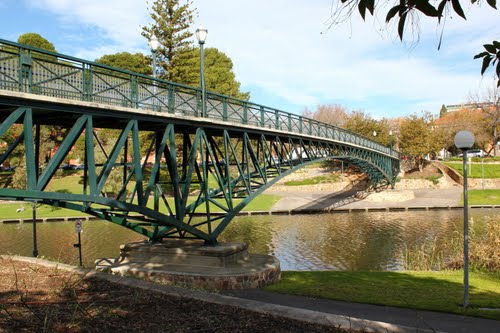
A bit of a walk through campus to the north, just across Victoria Drive, leads to River Torrens Footbridge, a romantic favourite for weekend walks to Angus Gardens. This cantilever welded steel bridge, built in 1938 by the South Australian Railways, features light ornament and an aesthetically pleasing relationship to the site.
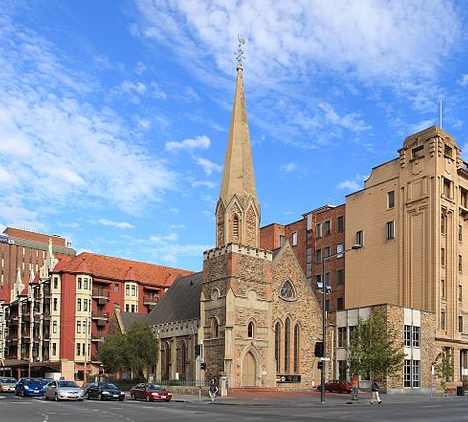
Scots Church, across North Terrace from Bonython Hall, was built in 1851 to a design by Thomas English; the spire was added in 1856 and the gabled addition to the south in 1863-64. Now a Uniting Church, this was the first permanent place of worship for Presbyterians in the city. It is also the second oldest extant church in Adelaide. Constructed of bluestone, with brick quoins, an asymmetrically placed spire and a steeply pitched roof, its stained-glass windows are original.
Ayers House and Botanic Chambers Hotel
Architect Sir George
Kingston took nearly 30 years to build Ayers House
across North Terrace past Frome Road. This beautiful structure
is now owned by the National Trust (t 08 8223 1234; open
Tues-Sun. 10.00-16.00, admission adults $10, concession
$8, children $5, under 12 free). The central one-storeyed
section was built in 1846 for William Paxton, a Rundle Street
chemist. Sir Henry Ayers, active in South Australia government
for 50 years, was intermittently South Australian premier in the
1860s and 1870s and was the namesake of Ayers Rock, now again
called Uluru. Ayers bought the property in 1855, and added the
downstairs library and second-storey bedrooms in 1858. The
western wing, which includes an elegant drawing room, was added
in 1874. The building features white-painted shuttered window
architraves, stuccoed entry porches, original cedar joinery and
flooring and underground excavation for living accommodation
during the hot summer months. 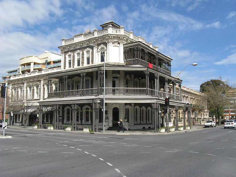 Next door to
Ayers House is Botanic Chambers Hotel, an absolute gem of a 19C
grand hotel and pub. The hotel is reminiscent of a wedding cake,
with stepped-back verandahs culminating in the heavy cornices
and Corinthian-capped pilasters, as well as a balustraded
parapet and a mansard-roofed short tower. In country areas and
other cities, verandahs straddling the footpath were continued
through the full height of the building on every floor.
Regulations taking effect in the 1920s and 1940s have caused
examples of footpath-wide verandahs to be removed in Sydney and
Melbourne, and in Perth only one such hotel survives. The same
regulation has begun to affect hotels in Adelaide. As a
consequence the Botanic Chambers Hotel is now one of the few as
well as the finest example of stepped-back verandah construction
in Adelaide. The Botanic has served as a centre for social life
for over 100 years.
Next door to
Ayers House is Botanic Chambers Hotel, an absolute gem of a 19C
grand hotel and pub. The hotel is reminiscent of a wedding cake,
with stepped-back verandahs culminating in the heavy cornices
and Corinthian-capped pilasters, as well as a balustraded
parapet and a mansard-roofed short tower. In country areas and
other cities, verandahs straddling the footpath were continued
through the full height of the building on every floor.
Regulations taking effect in the 1920s and 1940s have caused
examples of footpath-wide verandahs to be removed in Sydney and
Melbourne, and in Perth only one such hotel survives. The same
regulation has begun to affect hotels in Adelaide. As a
consequence the Botanic Chambers Hotel is now one of the few as
well as the finest example of stepped-back verandah construction
in Adelaide. The Botanic has served as a centre for social life
for over 100 years.Originally without verandahs and balconies, the hotel now features a spectacular double recession typical of the tiered balconies of Adelaide. The main entrance is emphasised by verandah pediments. The balconies feature paired columns and elaborate spandrels and frieze work, cast-iron hand rails and balustrading. The date of their introduction is uncertain, but Harley's 'Sun' Catalogue, a local publication dated 1914, affirms that they were in place by then; they may, however, have been made in earlier years. The stepping back of the first-floor balcony and the top floor left without façade is a device peculiar to Adelaide and Brisbane.
The hotel was designed by Michael McMullen and built by J. Barry for R. Vaughan in 1876-77. This elaborate survival of the city's original structures was intended as a family, that is, a temperance, hotel. Initially, it had seven residences, each with twelve rooms and a bay window on the ground floor and a balcony above. The hotel contained twenty-five rooms. A liquor licence was granted the hotel in 1883. Most of the modern renovations have been internal.
Tandanya Aboriginal Cultural Institute is at 241-59 Grenfell Street, two blocks south of North Terrace, in a building that was formerly the central power station for Rundle Street. (t 08 8224 3200, open daily 10.00-17.00, free admission) Tandanya was established in 1989 as Adelaide's premier gallery, cultural centre and artists' cooperative devoted to Aboriginal culture. The multicoloured design in concrete block at the entrance is of the River Spirit Dreaming by Bluey Roberts. The institute's performing arts space seats 160 people and is used by the resident drama group, Eastenders. Tandanya is the sole Aboriginal-operated outlet for arts and crafts in Adelaide. Offering work from across Australia, it is arguably the best gallery of Aboriginal art in the state. The building's original use as a power station is a reminder of Adelaide's once ambitious system of trams. Although there is little evidence currently of electrical tramways, they did exist after the government purchased all privately owned horse-drawn tramways in 1906. The electricity was supplied by the new Municipal Tramways Trust. Its power station was erected on East Terrace behind Grenfell Street Power Station. Rebuilt in 1912, it was designed by Alfred Wells and M. Stuart Clarke in a British Baroque style similar to Luytens' style. The electric tramways buildings on Hackney Road were built in 1907-08. Designed as a single project by H.E. Sibley and C.W. Woolridge, they included an administration building, now called Goodman Building after the first electrical tramway engineer.
A nostalgic collection of the tramway cars of this period (the last Adelaide tram system was dismantled in 1958) is preserved at the Australian Electric Transport Museum (t 08 8261 9110, call for opening hours, admission adults $10, concession and children $8), located in St Kilda on Barker Inlet, c 25km north of Central Adelaide off Port Wakefield Road, on St Kilda Road.
The Botanic and Zoological Gardens The main gate of the Adelaide Botanic Gardens (t 08 8222 9311, open weekdays 08.00, weekends 09.00 more or less until sunset, free admission) is on North
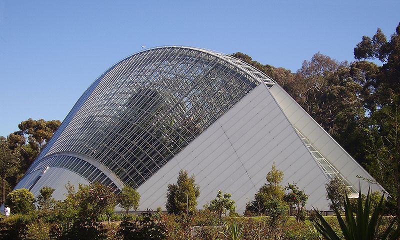 Terrace;
the back entrance is on a road to the left off Hackney Road.
Both the Botanic Gardens and the adjacent Zoological Gardens
accessible on Frome Road, were established in the 19C spirit of
scientific investigation. The gardens were founded in 1855 by
G.W. Francis and opened to the public in 1857. Initially they
also provided a forum for speakers, similar to Speakers' Corner
at Hyde Park, London. The Adelaide Bicentennial
Conservatory, a topical room of some grandure, was designed by
Douglas Gordon Raffen and openned in 1988. It's
predecessor, the Palm House was openned in 1877. Imported
from Germany it was designed by Gustav Runge. George
Thomas Light supervised its construction.
Terrace;
the back entrance is on a road to the left off Hackney Road.
Both the Botanic Gardens and the adjacent Zoological Gardens
accessible on Frome Road, were established in the 19C spirit of
scientific investigation. The gardens were founded in 1855 by
G.W. Francis and opened to the public in 1857. Initially they
also provided a forum for speakers, similar to Speakers' Corner
at Hyde Park, London. The Adelaide Bicentennial
Conservatory, a topical room of some grandure, was designed by
Douglas Gordon Raffen and openned in 1988. It's
predecessor, the Palm House was openned in 1877. Imported
from Germany it was designed by Gustav Runge. George
Thomas Light supervised its construction.Consonant with the spirit of the times, what had been a wilderness area here was groomed into an English garden. It offered public venues for concerts and forums and was the site of the inaugural meeting of the Salvation Army in Australia. The gardens currently contain some 3000-4000 plants from Australasia and Malaysia.
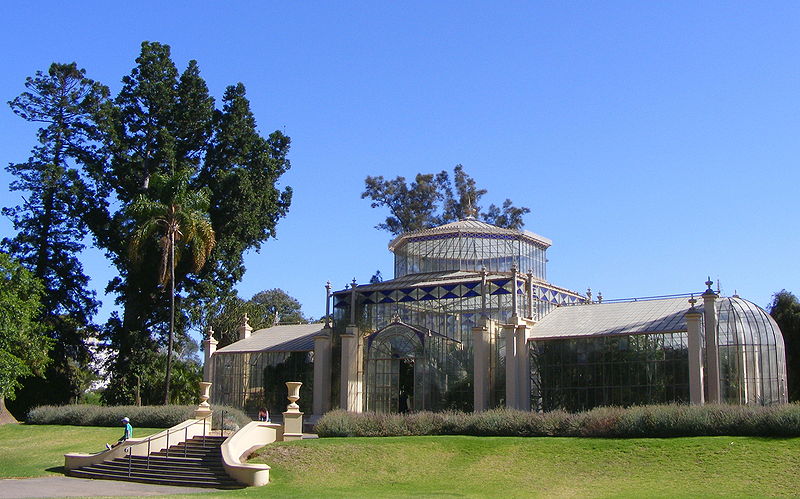 |
The Palm House in the
Botanic Gardens was erected during the directorship of
Dr Richard Schomburgk (1811-91). Schomburgk's biography
is uncommon in Australia. Born in Freiburg and educated
in Berlin and Potsdam, his brother was Sir Robert
Hermann Schomburgk, who explored British Guiana in
1830s. During the 1848 German Revolution, he migrated to
South Australia where he cultivated vineyards on Gawler
River on a property named Buchsfelde. In 1865, he
somehow succeeded G.W. Francis as director of the
Botanic Gardens, a post he held for 26 years. The palm
house was one of his best improvements during his
tenure. He imported it from Bremen in 1871 and it opened
in 1876. After a period of disrepair, the city has
renovated it. Since the tropical gardens have been
housed in the conservatory, this cute building has
recently been given over to a novel display of the cool,
dry climate of Madagascar. |
The Museum of Economic Botany (Herbarium) is a result of Director Schomburgk's notion that crop testing as well as species sampling was a function of the gardens. It displays changing demonstrations in a pedagogical vein. The building was erected from sketches prepared in 1878 for a museum building to house botanical specimens. Originally in Romanesque style, the then Colonial Architect E.J. Woods altered it to a Grecian style. The ceiling decoration is by W.J. Williams.
The Bicentennial Conservatory, opened in 1988, is the largest interior rainforest in the Southern hemisphere and includes its own cloud-making system. It holds 15 to 20 medium-sized rainforest trees and associated ground vegetation. The sculpture in front of the conservatory is entitled Cascade; made of Pilkington glass it is by Sergio Redegalli, and was installed in the 1980s.
At the north entrance to the Botanic Gardens is North Lodge, now the gardens' shop, with brochures of the gardens and a variety of books on gardening and Australian plant life.
The Zoological Gardens (t 08 8267 3255, open daily 09.30-17.00, children $18, concession $22, adults $31.50, family $85) were an outgrowth of the Acclimatization Society. This curiously misguided group sought to import European, especially British, animal and plant species to Australia. Like those people who found the bush forbidding and ominous, these people found it necessary to 'import to our somewhat unmelodious hills and woods the music and harmony of the English country life'. To this rather ambitious aim, they introduced blackbirds, sparrows, and starlings among other now pernicious species. Today, the zoo is a pleasant one, with a famous reptile house and walk-through southeast Asian rainforest. Wang Wang and Funi are the only pandas in the southern hemisphere. The zoo is also well known for its participation in conservation efforts and research about endangered species. Reportedly, an enjoyable way of travelling to the zoo is by motor launch along the Torrens River; check with the tourist office for details.
North Adelaide
In Colonel Light's original plan, North Adelaide, across the Torrens River, was laid out as a grid of 1042 one-acre lots and associated squares and parks; he envisioned this section as the residential area, close enough to the commerce of the city but removed enough to allow quiet and comfortable living conditions. Permanent development began by the 1840s, with continuous growth throughout the 19C. The area today retains its historical charm, with many of the Victorian mansions and small shops still in evidence.
The main thoroughfare is King William Road, crossing the River Torrens and continuing as O'Connell Street, which became the shopping and commercial street of North Adelaide and led into the outer suburbs. You can walk across the bridge at King William Road or the Victoria Bridge at Montefiore Road and reach North Adelaide in 10 minutes. In Early Adelaide Architecture (1969), Morgan and Gilbert wrote about the various routes that Light envisioned to reach this section of the city.
North Adelaide is accessible via King William, Montefiore (becomes Jeffcott Street) and Frome Roads, across the park district, Torrens River and common lands from the central district, If a more extensive walk through the old neighbourhood is desired, take bus nos 231-233 and 235-237 on King William Road to Jeffcott Street, where many of the earliest colonial buildings in North Adelaide are located.
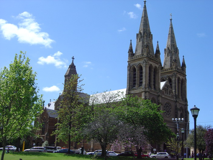 Immediately
north across Adelaide Bridge on King William Road at Pennington
Terrace is St Peter's Cathedral, designed by English architect
William Butterfield and built by the local firm of Woods and
McMinn. The foundation stone was laid in 1869, and construction
progressed in stages, with the final Lady Chapel consecrated in
1904. The church is said, by Bishop Reed in the 1960s, to have
the 'finest and heaviest ring of bells in the Southern
hemisphere'. The interior includes an excellent organ and
particularly elegant stained-glass windows, as well as a carved
and painted reredos, installed in 1904.
Immediately
north across Adelaide Bridge on King William Road at Pennington
Terrace is St Peter's Cathedral, designed by English architect
William Butterfield and built by the local firm of Woods and
McMinn. The foundation stone was laid in 1869, and construction
progressed in stages, with the final Lady Chapel consecrated in
1904. The church is said, by Bishop Reed in the 1960s, to have
the 'finest and heaviest ring of bells in the Southern
hemisphere'. The interior includes an excellent organ and
particularly elegant stained-glass windows, as well as a carved
and painted reredos, installed in 1904. Behind the cathedral at St Mark's College is The Cottage, also built in 1840; it is one of the oldest extant brick buildings in South Australia.
At the western end of Pennington Terrace is Montefiore Hill, site of Light's Vision, a rather poignant statue of Adelaide's creator, William Light. The statue originally stood on Victoria Square, where it was unveiled in 1906; it was moved to this location in 1938, where it looks across the parklands and the river to the city and the Adelaide Hills beyond.
Also in Pennington Terrace is th
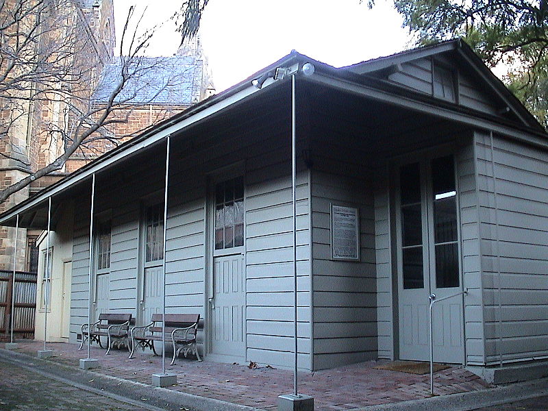 e Friends'
Meeting House, a prefabricated timber building brought from
England in 1840. It was shipped in 69 separate packages of
wooden sections and iron pillars; another ship brought its 3000
roof slates.
e Friends'
Meeting House, a prefabricated timber building brought from
England in 1840. It was shipped in 69 separate packages of
wooden sections and iron pillars; another ship brought its 3000
roof slates. | The North Adelaide
Railway Station, north on War Memorial Drive by the
intersection with Mildred Road, was opened in 1857, two
years after the construction of the Torrens Railway
bridge during a period of rapid steam-driven railway
development. Benjamin Herschell Babbage (1815-57), in
association with Isambard Kingdom Brunel, designed and
built railways in England and on the continent for the
Great Western Railway Company. The Adelaide to Port
Adelaide line was of the same type. The line to the
north to Gawler opened the same year as the North
Adelaide Station and by 1860 the rail service to Kupunda
had commenced. Alterations made in 1878 to the station's
doors, windows and verandah altered its appearance
relatively little. The signal box was erected shortly
thereafter, and remains one of the only original boxes
in the city. On the eastern side of the North Adelaide
terrace circuit, Robe Terrace is an old residential area
with large, wealthy homes. Before the expansion of the
road it was very close to the parklands. The
intersection traffic makes it unlikely that its present
functions will be changed. |
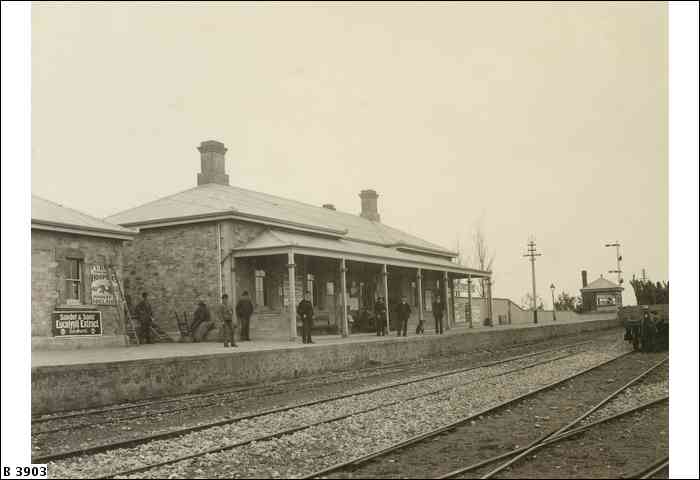 |
Settlement of the area was slow, largely due to the flooding of the River Torrens each winter. These floods routinely destroyed bridges until 1856, when the second King William Bridge was built. It stood until replaced in 1931. The Morphett Street bridge, replaced in 1965, had stood since 1870. The 1879 Frome Road bridge, a cast-iron structure with attractive hand rails and scalloped girders, still stands.
The finest house in North Adelaide is arguably Kumanka House, still a private residence. Originally called St Margaret's, it can be found on Childers Street west of Jeffcott Street, on the northern fringe of the district. Henry Hill had it built in 1870 at considerable cost. He and his son John Hill founded a coach and carrying company which bought the failing South Australian branch of Cobb & Co. in 1871. The house has been associated with many prominent Adelaide families, most notably the colourful Charles Valentine Tighe Wells, owner of a New Guinea gold-mine and founder of Guinea Airways, who lived in the house in the 1930s.
Ru Rua Mansions, Maori for 'both equally', is a block north at nos 101-110 Barton Terrace. The place was named by a syndicate of medical doctors who set up practice in the three pairs of houses. The design was by F.W. Dancker, probably influenced by the designs of American architect George Barber, a populariser of Queen Anne style, whose designs were available through catalogues. These houses have since returned to private residences after years as part of a nursing home.
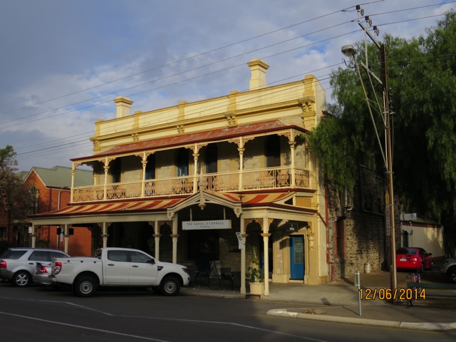 |
The most socially
prestigious area of North Adelaide is perhaps Tynte
Street west of O'Connell Street. At nos 165-169 is the
North Adelaide Hotel. Margaret Iben, widow of William,
had it built at the outset of the 1880s boom. Its
elaborate Italianate design and stuccoed detail alone
would have offended the sensibilities of many of the
era's more sober civic leaders. |
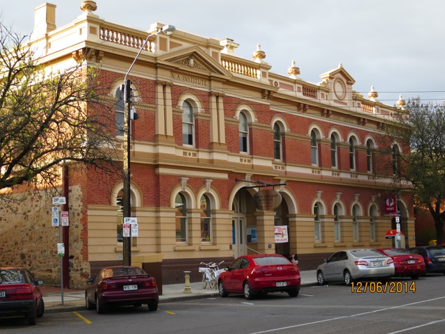
Across the street from this pub are the classical blocks of the North Adelaide Institute and Post Office, the former Rechabite Hall and University College. Their solidity and lack of ornament are a clear indication of the dour attitude at work in the design of the late-19C suburbs.
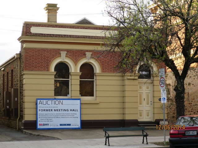
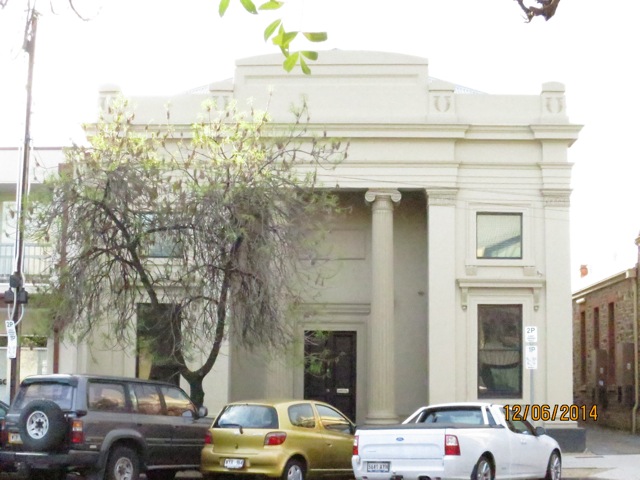 The Rechabite
Hall, erected in 1858 for the South Australian Total Abstinence
Society, is one of a number of meeting and entertainment venues
built by abstemious 19C Australians. The Rechabites took their
world-view from the story of Rechab in the Bible, the Book of
Jeremiah. Rechab followed his son's insight and told his people
not to drink wine or cultivate crops but to live nomadically in
tents. The Lord, according to Jeremiah chapter 35, commended the
filial loyalty of Rechab's subsequent generations and brought
disaster on Jeremiah's Jerusalem for not heeding His prophets.
There were established branches of the Rechabites in most
Australian cities by the end of the 19C.
The Rechabite
Hall, erected in 1858 for the South Australian Total Abstinence
Society, is one of a number of meeting and entertainment venues
built by abstemious 19C Australians. The Rechabites took their
world-view from the story of Rechab in the Bible, the Book of
Jeremiah. Rechab followed his son's insight and told his people
not to drink wine or cultivate crops but to live nomadically in
tents. The Lord, according to Jeremiah chapter 35, commended the
filial loyalty of Rechab's subsequent generations and brought
disaster on Jeremiah's Jerusalem for not heeding His prophets.
There were established branches of the Rechabites in most
Australian cities by the end of the 19C. The Rechabite building was designed by James William Cole, a Methodist and participating member of the society. Built in 1856-58, it was remodelled in 1883, three years after the Rechabites move to Grote Street.
The Nonconformist aesthetic of the time draws on English sources. It follows John Soane's aesthetic simplicity: no ornament atop the columns or corners, virtually no entry porch, plain horizontal lines. A somewhat later and more ambitious structure of Nonconformist design is a block west at Tynte Street on Wellington Square, the former Primitive Methodist church. Designed in the early 1880s by Daniel Garlick, it displays something like a Gothic Revival style allowing more ornament than J.W. Cole might have presented.
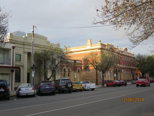
The combined Institute and Post Office to the right of the Rechabite Hall on Tynte Street demonstrates the importance of civic participation in building design. Local donations enabled the building of the hall to the building's rear and the Institute; the Post Office was built with public funds. According to Susan Marsden in Heritage of the City of Adelaide (1990), repeated calls for a cultural institute in North Adelaide were successful only when a local post office was constructed in 1882. The eventual construction is unconventional for its classical style, brick façade with cement dressings and asymmetrical frontage.
A final note on North Adelaide's late-19C social fabric on Tynte Street also concerns religious matters. While the German Lutheran schisms in the early century occurred in a relatively agrarian setting, the Baptists of North Adelaide were thoroughly suburban. They had been prominent and divisive since the colony's foundation; David McLaren, manager of the South Australia Company, was father of Alexander McLaren, divine of the English Baptist church.
Church buildings were erected upon each congregation's division. Some of these divisions had theological bases. The appointment of Reverend Silas Mead and the building of his church in Flinders Street in 1863 was meant to effect unity in the North Adelaide Baptist community. The Manse, a modest two-storey residence with window seats at 142 Tynte Street, and now a restaurant, was built by James Cumming in 1877. Next to the manse is the Baptist church, completed in 1820, also by James Cumming. He attempted to add grandeur to the design by using contrasting colours in the stone. The heavy style is somewhat similar to the Flinders Street Baptist church. The interior includes perforated zinc ceiling grates for ventilation and curved pews.
A short walk west to Wellington Square and south to nos 34-38 Wellington Square is the Wellington Hotel, first licensed in 1851; it retains its original wooden balcony, although most of the building was substantially altered in 1885. The unusual cantilevered balcony has distinctive verandah brackets, unlike the usual cast-iron embellishment of the time.
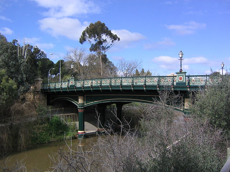
Entering North Adelaide via Frome Road near the zoo leads to the eastern section of the area, bounded by Kingston Terrace on the north, and crossing the river at Albert Bridge. The painted bridge dates from 1879 and was designed by John Grainger (Percy Grainger's father, incidentally). This route leads through the parklands to Melbourne Street (or take bus nos 204-209 from King William Road), the chic shopping street of the suburb, filled with good cafes, antique shops and clothing boutiques.
Not North Adelaide
Among the venues you would miss following the foregoing closely is the dear Embroiderer's Guild of South Australia (t. 08 8234 1104) just west of the city center at 16 Hughes Street. Excuse the city planners who gave us this succession of streets to get there, all the same road called: Grenfell, Currie, Glover, and Henley Beach. Don't let the Museum's rather too plain website put you off, the exhibits show embroidery at its best.
Another venue of note is the Unley Museum (t 08 8372 5117; open Mon.-Wed. 10.00-16.00, Thurs. 10.00- 18.00, Sat. 14.00-17.00) which, in addition to an award winning display of local history, offers a family history service on Thursdays and Saturdays.
Western Adelaide and Glenelg
From the centre of town, a single vintage tram, the Bay Tram, travels the 11km to the popular beach resort of Glenelg; it departs from Victoria Square and ends its run at Moseley Square on the beach.Glenelg is called the 'Birthplace of South Australia', for it was here, on 28 December 1836, that John Hindmarsh was proclaimed governor of the new colony. The 'Old Gum-Tree' on McFarlane Street (c 1km east of Glenelg North beach off Tapleys Hill Road), encased in concrete and iron in 1963, is still used as the site for Proclamation Day (28 December) ceremonies every year. Tourist information centre, Marina Pier at the end of the Anzac Highway, Glenelg, t 08 8294 5833.
To the northeast of Glenelg c 3.5km at the suburb of Novar Gardens is Cummins House (t 08 8294 1939; open first and third Sun 14.00-16.00), off Saratoga Drive on Sheoak Avenue. This was the property of John Morphett (1809-92), South Australian pioneer and surveyor with Light's expedition. The house includes original furnishings in its Italianate interiors.
The area around the beach at Glenelg includes the usual beachside amusement park and outside eateries, but the adjoining streets also house extravagant Victorian summer homes, where the wealthy used to spend the hot summer days. Also on the foreshore is a replica of the HMS Buffalo, Governor Hindmarsh's ship. It functions as a restaurant but does have a small museum depicting early settlement and life on ship (t 08 8294 7000).
8km north along the coastal Military Road and past the other popular beach resort of Henley Beach, is the suburb of Grange, named for the home that explorer Charles Sturt built here in 1840. The Grange house, on Jetty Street, is an interesting place to visit (t 08 8356 8185; open first and third Sun14.00-17.00; entry fees adults $5, concession $3).
 After overlanding cattle to Adelaide
from New South Wales, Sturt purchased two 84-acre (34 ha)
sections of land here, then called Reedbeds. The house Sturt
built here was, according to his friend George MacLeay, 'the
most English-looking place in the Province'. Sturt's wife often
played her harp for informal summer gatherings on the stone
terrace that looks out on to Mount Lofty. When the Sturt family
finally left the colony for England in 1853, the Grange passed
through many hands and fell into disrepair. In 1956, it was
purchased by a trust which set out to restore it. Aided by
donations of original furniture from the Sturt family, the house
is now a historical museum with many authentic artefacts.
After overlanding cattle to Adelaide
from New South Wales, Sturt purchased two 84-acre (34 ha)
sections of land here, then called Reedbeds. The house Sturt
built here was, according to his friend George MacLeay, 'the
most English-looking place in the Province'. Sturt's wife often
played her harp for informal summer gatherings on the stone
terrace that looks out on to Mount Lofty. When the Sturt family
finally left the colony for England in 1853, the Grange passed
through many hands and fell into disrepair. In 1956, it was
purchased by a trust which set out to restore it. Aided by
donations of original furniture from the Sturt family, the house
is now a historical museum with many authentic artefacts. The Royal Adelaide (t 08 8356 5511) and Grange Golf Clubs (t 08 8355 7100) are in Seaton, about 2km from Grange and 10km northwest of Adelaide. One of the country's oldest clubs, the Royal Adelaide's founding was the dream of Scotsman Sir James Fergusson, Governor of South Australia from 1869 to 1873. Its location changed several times. The present Seaton location was laid out by Dr Alister Mackenzie in 1926 and its seaside atmosphere has been maintained during more recent upgrades.
The Grange Golf Club was established in 1926 and subsequently enlarged to include the East Course which higher handicapped players sometimes prefer. The West Course was cleared by hand, explaining the effect the rough can have on the game. On a day with wind the 6th hole par 4 is a challenge made more difficult by the rough and scrub flanking it and the traps at the green. Golfers are advised to swing slowly to keep their shots low. On the way back, a wind from behind and a raised tee facing a wide and open fairway make the first two shots look impressive.
Port Adelaide
Military Road continues from Grange c 6km north to Bower Road and into Port Adelaide, the original area of harbour development that caused such grief for William Light's vision of Adelaide. You can also take a train to 'the Port' from Adelaide's central station, or bus nos 258 or 259 from North Terrace. The Visitor Information Centre, on the corner of Commercial Road and St Vincent Street, t 08 8405 6560.In Port Adelaide, three vessels offer cruises along the river and around Barker Inlet. These cruises depart from Queens Wharf; check with the tourist office for full details. Queens Wharf is also the site of Sunday markets (08.00-17.00), featuring 'trash and treasure' and ethnic food.
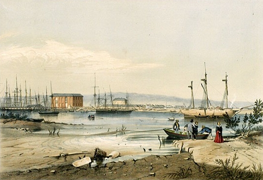
The early authorities, at least the naval men such as Governor Hindmarsh, were furious that Light's settlement was situated so far from the sea; in the early days, transportation from the port to the town was indeed rigorous, as supplies had to be dragged through the mud and scrub. Eventually, of course, Light's persistence proved to be correct, as the port area would have flooded and would not have had enough fresh water to support a large settlement.
The area around the port itself did develop from the 1840s as the principal gateway to the colony for both immigrants and supplies; by the 1880s, Port Adelaide was a thriving hub of industry and shipping, a fact attested to by the many substantial buildings in the historic precinct around the intersection of St Vincent Street and Commercial Road. Particularly noteworthy are the 1861 Court House and Police Station, 66 Commercial Road, with its graceful arcades; and next door, at no. 56, the former Customs House, ingeniously constructed on a bed of red-gum timbers embedded in lime concrete. The tower of the Customs House was an important landmark for ships coming into port.
Two blocks east of Commercial Road on Lipson Street are three interesting museum. The excellent South Australian Maritime Museum (t 08 8207 6255; open daily 10.00-17.00; admission adult $10, concession $8; Children $5) is located in an old Bond Store. The museum, now run by the History Trust of South Australia, was originally the Port Adelaide Nautical Museum, the oldest in Australia, with all kinds of artefacts of maritime life along the South Australian coast. Today, the main concentration in this well-presented museum is the story of migration to South Australia, as well as a history of the coastal ketch trade.
Further along Lipson Street is the National Railway Museum (t 08 8341 1690; open daily 10.00-17.00; admission adults $12, Concession $9, children $6), filled with the predictable detritus of the era of rail, including miniature steam trains and large numbers of locomotives, exhibits, and a museum shop with a surprising array of publications. Also on Lipson Street, at Ocean Steamers Road, is the South Australian Aviation Museum (t 08 8341 2678; open 10.30-16.30; admission adults $10, concession $7, children $4.50). They have over a dozen aircraft on display and ocassionally have demonstration days on which they start several of the aircraft engines that they have mounted.
On Hart Street, 3km to the west, you pass by Fort Glanville at Semaphore, open to the public every third Sunday from September to May. This site is the most complete of the many fortress complexes built along the Australian coast after the Crimean War led the colonies to fear the possibility of Russian invasion.
Also in Semaphore, on Semaphore Road, is a Time Ball Tower, built in 1874 in stone, to enable ships' masters to set their chronometers by reference to a black ball dropped every day at 13.00. It operated until 1932 and is still preserved as a reminder of the importance of the shipping trade in the early days of the colony.
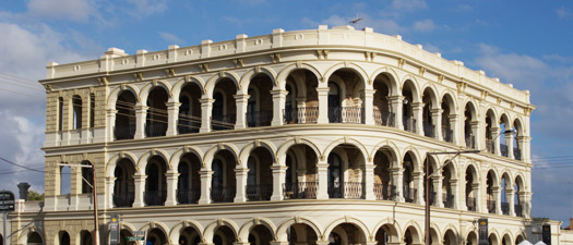
From Semaphore, the Esplanade along the foreshore continues north to the Outer Harbor, which is now the location of the Overseas Passenger Terminal. En route, at Largs Bay, is Largs Pier Hotel (t 08 8449 5666), an elaborate three-storey bluestone structure curving around the corner with Classical arcades running around each storey. Ernest Bayer and Latham A. Withall designed this grand structure in 1882. Despite many internal changes, the building still boasts an impressive double-flight staircase, ingeniously connected to the lobby and verandahs. The hotel would have been one of the first buildings seen by newly arrived visitors from overseas in the 19C.
Towards the Adelaide Hills
A trip to the Adelaide Hills is usually discussed as 'taking a tourist drive', but public transport may also be available to some of these locations, and coach tours operate throughout the region. For public buses, check with the bus Adelaide Metro, t 1300 311 108, or their Live Chat service. For coach tours, contact the tourist office at 1 King William Street, Adelaide, t 08 8212 1505 or at Rundle Mall, Adelaide, t 08 8203 7611.Only 15 minutes from the city centre in the suburb of Magill is Penfold's Magill Estate (Penfold Road, t 08 8301 5569; open daily 10.00-17.00; admission from Heritage at $15 (6 wines; add $25 to taste premium wines) to Great Grange at $150 4 person minimum), a living museum on the site of the first cellars of Australia's most highly regarded wine-making families. Take Wakefield Road east, turn left (north) on Fullarton Road, then east on to The Parade; c 6km is Penfold Road, with the winery on the corner. Tours are given of the historic vintage and maturation cellars, ending with a view of the Still House, from where came the first of Penfold's great vintages. The Still House now operates as a tasting room and offers cellar door sales.
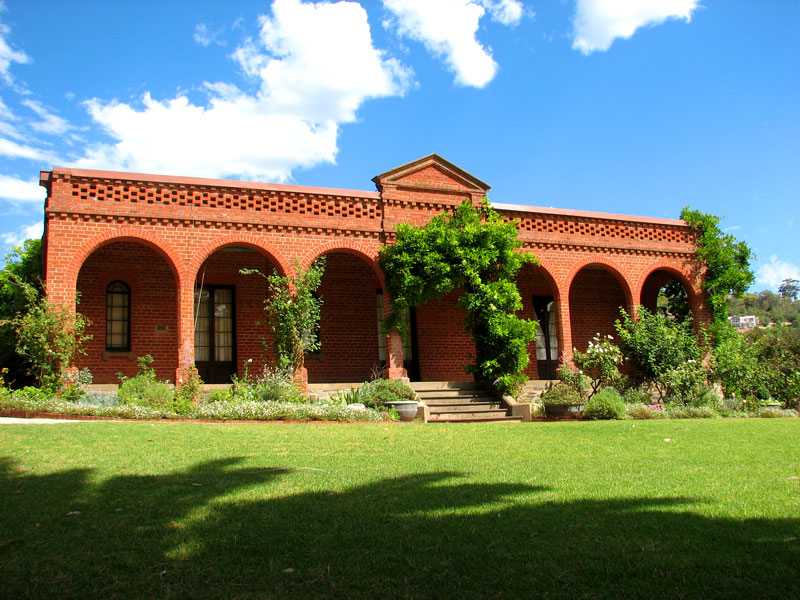 Leave
the centre of town heading south on Glen Osmond Road, which
becomes Highway 1. 6km southeast of Adelaide, between the
suburbs of Burnside and Glen Osmond on the Princes Highway, is Beaumont
House (631 Glynburn Road, Beaumont; t 08 8379 5301; open
first Sun each month Sept - May, 14.00-16.30, admission $8.00).
This Classic Revival house with a deep arcade and narrow-arched
windows is an early attempt by the Adelaide residents to cope
with the heat of the region. Built in 1851 on Samuel Davenport's
property for Anglican Bishop Augustus Short, it was donated in
1967 to the National Trust by owners Kenneth and Lilian Brock.
Leave
the centre of town heading south on Glen Osmond Road, which
becomes Highway 1. 6km southeast of Adelaide, between the
suburbs of Burnside and Glen Osmond on the Princes Highway, is Beaumont
House (631 Glynburn Road, Beaumont; t 08 8379 5301; open
first Sun each month Sept - May, 14.00-16.30, admission $8.00).
This Classic Revival house with a deep arcade and narrow-arched
windows is an early attempt by the Adelaide residents to cope
with the heat of the region. Built in 1851 on Samuel Davenport's
property for Anglican Bishop Augustus Short, it was donated in
1967 to the National Trust by owners Kenneth and Lilian Brock.Also in Burnside, at Kurralta Drive off Greenhill Road, is the homestead 'Kurralta', built in 1843-46 by the architect of Ayers House, George Strickland Kingston, for Dr William Wyatt (not open to the public). Wyatt was an important figure in the early colony, serving many roles as well as physician. As Protector of Aborigines, he was a staunch advocate of their rights, and became an authority on the tribes of Adelaide and Encounter Bay. He chose to name the house 'Kurralta', an Aboriginal word for 'on the hill'. Wyatt was also a keen botanist, and the gardens at Kurralta rivalled those of the city's Botanic Gardens; despite encroaching development, some of these plants still exist in the gardens around the house. From the balcony of the house, Wyatt had a panoramic view of the town and the Gulf of St Vincent; his telescope here could read the time on the General Post Office clock. The house itself has a decidedly Mediterranean style, with limited ornamentation, large bay windows, and an arched patio.
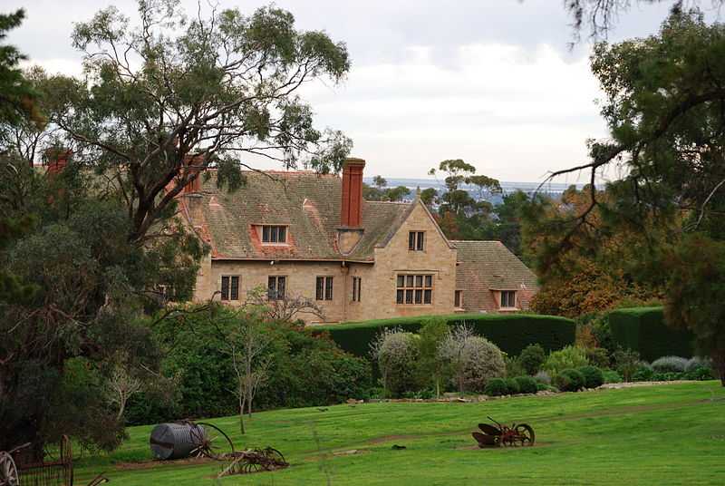 To
the southwest of Burnside c 5km in the suburb of Springfield is
Carrick
Hill (46 Carrick Hill Road, t 08 8433 1700;
open Wed-Sun and holidays, 10.00-16.30; free guided tours 11.30
and 14.30; closed July for conservation; admission house adults
$10.50, concession $6.50, families $24.00, grounds and gardens
free admission), an extravagant property famed for its 39 ha of
gardens and spectacular views of the city. From the city, take
Fullarton Road south c 7km until it becomes Carrick Hill Road.
The creation of leading Adelaide businessman Sir Edward Hayward
and his wife Ursula Barr Smith, the house, built in 1939, is in
the style of an English manor. The gardens are considered the
best English-style gardens in Australia, and include a
sculpture, park and a number of beautiful walks.
To
the southwest of Burnside c 5km in the suburb of Springfield is
Carrick
Hill (46 Carrick Hill Road, t 08 8433 1700;
open Wed-Sun and holidays, 10.00-16.30; free guided tours 11.30
and 14.30; closed July for conservation; admission house adults
$10.50, concession $6.50, families $24.00, grounds and gardens
free admission), an extravagant property famed for its 39 ha of
gardens and spectacular views of the city. From the city, take
Fullarton Road south c 7km until it becomes Carrick Hill Road.
The creation of leading Adelaide businessman Sir Edward Hayward
and his wife Ursula Barr Smith, the house, built in 1939, is in
the style of an English manor. The gardens are considered the
best English-style gardens in Australia, and include a
sculpture, park and a number of beautiful walks. Immediately north of the Carrick Hill site, also along Fullarton Road, is the University of Adelaide, Waite Campus; the postal address here is Netherby, but the area is now referred to as the Mitcham Foothills Tourist Precinct, because of several historic attractions in the district. On the campus at Fullarton Road between Cross Road and Kitchener Street is the Urrbrae House Historic Precinct (t 08 8303 7497; open weekdays 10.00-16.00; the house is not air conditioned and may be closed on particularly hot days, tours first Sunday Feb. - Nov. 14.00).
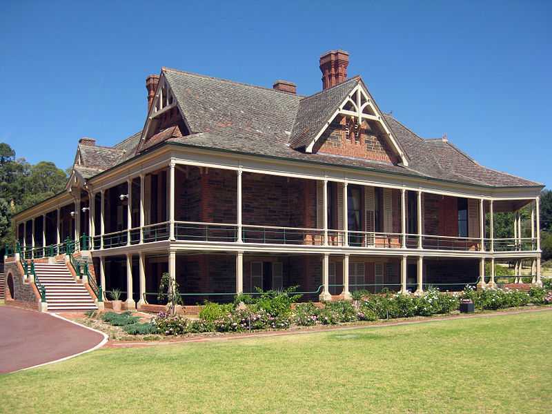 The house itself is a
bluestone mansion built in 1891 as the home for prominent South
Australia pastoralist Peter Waite (1834-1922), who donated this
property to the university for the purposes of establishing an
agricultural research centre. During Waite's residence here in
1895, the house became the first in South Australia to have
electricity for lighting and refrigeration.
The house itself is a
bluestone mansion built in 1891 as the home for prominent South
Australia pastoralist Peter Waite (1834-1922), who donated this
property to the university for the purposes of establishing an
agricultural research centre. During Waite's residence here in
1895, the house became the first in South Australia to have
electricity for lighting and refrigeration.The building now houses a museum about the Waite family, and maintains the original rose gardens, filled with 'heritage plants'. Also on the Waite campus is the Waite Arboretum (t 08 8303 7405; open dawn to dusk, tours 11.00 every first Sunday). Established in 1928 soon after Waite had donated the land to the university, the arboretum contains more than 2500 labelled trees of native and introduced species. The grounds include a watercourse and lake.
Adelaide Hills
Only 30 minutes' drive from the middle of the city, the green hills of the Mount Lofty Ranges have always provided Adelaidians with a refreshing getaway. Many people live in the Adelaide Hills, and regular bus and train services run throughout the area. Tourist information: 41 Main Street, Hahndorf, t 1 800 353 323/08 8388 1185. The famous Hans Heysen Trail, a long-distance bushwalking trail, cuts across these hills, through a variety of terrain. The trail, inaugurated in the 1970s, now covers 1500km from Cape Jervis on the southern tip of Fleurieu Peninsula to the Northern Flinders Ranges. Routes of the Heysen Trail offer opportunities for bushwalking at all levels.From the city, Glen Osmond Road becomes the South Eastern Freeway, the main route to Melbourne. From here, take the exit at Crafers for Summit Road, which leads past the lovely Mount Lofty Botanic Gardens (t 08 8370 8370; open daily) to the Mount Lofty lookout, at 727m the highest point in the range. The lookout offers truly splendid views, on one side all of Adelaide and out to the Gulf of St Vincent; on the other side, calming views of the gently rolling green valleys of the hills themselves. On Summit Road is an information centre.
To the west of the lookout is Cleland Conservation Park, which includes a wildlife park (t 08 8339 2444) and picnic areas.
To the south of Mount Lofty is Belair Recreation Park (t 08 8278 5477), accessible from the city by a delightful train, which begins at the Morphett Street Station in central Adelaide and provides great views of the city and coastline as it climbs up into the park. One half of the park, originally the property of early pioneer Nicholas Foot, is rather elegant, with man-made lake, hedge maze, and a restored Old Government House, which is open on Sunda (13.00 - 16.00)
Hans Heysen
|
|
Hans Heysen (1877-1968) became one of the most famous of Australian painters for his many depictions of gum trees in all their varieties and for his admiration for the rugged terrain of South Australia's Flinders Ranges. Heysen came from Hamburg to Adelaide as a child, and studied at the Adelaide School of Design, where he came to the attention of a group of city businessmen, who supported his art studies in Europe. Upon returning to Australia, he applied his technique, both in watercolour and oil, to the Australian landscape. Following some years of struggle, he gained enthusiastic patronage after an exhibition in Melbourne in 1912. He was championed by such celebrities as Dame Nellie Melba. He became the great populariser of Australian landscape painting and was identified entirely with his views of sinuous eucalyptus and the unique colours of the Australian bush. In 1912, he and his wife discovered 'The Cedars', built by a pastoralist in the 1870s, while walking in the Adelaide Hills, and determined to make it their home. As the artist Norman Lindsay wrote about Heysen, the Hahndorf environment 'was to Heysen what the little village of Barbizon was to ...Millet. It made him the intimate of nature and of the life of the farmers.' The property became the centre of Heysen's creative and family life; extensive renovations to the house were carried out in the 1920s by Adelaide architect E. Phillips Dancker, who was sympathetic to the natural setting and to the German-style homesteads of the area. Here Heysen and his wife Sallie raised their eight children, including Nora, also a painter who in 1938 became the first woman to win the Archibald Prize. Any famous visitor to Adelaide was obliged to make the trek to 'The Cedars', including the ballerina Anna Pavlova in 1926, and in the 1940s Laurence Olivier and Vivien Leigh, and Helen Keller. Today the house has been preserved essentially as it was when the Heysen family lived there. To reach 'The Cedars' from Adelaide travel via the South Eastern Freeway exit the Freeway at Hahndorf; just before entering the village turn left into Ambleside Road and continue for one kilometre to Heysen Road and then turn left (t. 08 8388 7277; open Tues. to Sun. 10.00-16.30; tours daily). |
Hahndorf 
Only 28km southeast from the centre of Adelaide, the village
of Hahndorf (population 1600) is the most immediate reminder of
the presence of German settlers and the significance of German
culture in the history of the South Australian colony. From the
South Eastern Freeway (Highway 1), exit on to Mount Barker Road
(Highway 57), which becomes Main Street in Hahndorf. (It can be
reached from central Adelaide; contact the Tourist Commission's
website
to make arrangements.) Hahndorf is the central location
for the Adelaide Hills Harvest Festival, held annually in March,
when hotels, wineries and restaurants throughout the region join
together to present a weekend of food, wines and fun. History
The village was founded in 1839, when a group of Prussian Lutherans, seeking freedom to worship according to their own beliefs, arrived in South Australia on the ship Zebra. Their captain, Dirk Meinertz Hahn, had never even heard of Adelaide when he was commissioned to bring his cargo of pious Prussians to the country. In the course of the trip, Hahn became quite attached to his charges, and, upon arriving in the colony, helped them to negotiate the purchase of the settlement's property from the new English landowner, W. H. Dutton. The grateful settlers, all followers of Reverend Kavel, named their new village Hahndorf in honour of the captain. The industriousness of these first German settlers led to a thriving community, well established by the turn of the century. Anti-German sentiment during the First World War caused the village's name to be changed to Ambleside in 1917, and its German Lutheran school was closed. The town returned to the name Hahndorf in 1935 as part of the state-wide celebrations of the contribution of German pioneers during a century of settlement. Today, Hahndorf is a State Heritage Area, fully conserved and protected, famous for the beautiful European trees which line its Main Street. This historical status has not, however, stopped it from becoming the tourist-trap to beat all tourist-traps. Essentially one street long with a few side lanes, every one of the historic buildings now houses a tea room, craft gallery or tourist shop of some kind. Every weekend is tremendously crowded with visitors who are catered to by German-style restaurants and delicatessens. Still, the buildings are a fascinating display of German vernacular architecture transplanted to a colonial setting. Every building has a plaque with a full history of its functions. While one is warned not to trespass on private property, it is especially interesting and a more authentic experience to take a look into the side alleys and the back yards of the buildings, where small structures and farming functions remain untouched by tourism's heavy hand.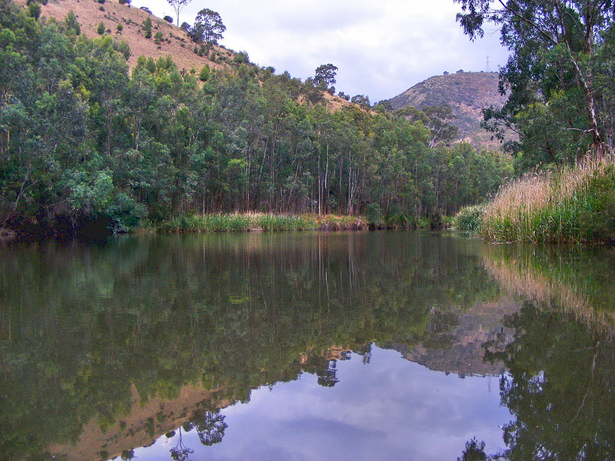 To the north of Hahndorf c
20km via Lobethal and Gumeracha, and still considered part of
the Adelaide Hills, is the Torrens River Gorge, one of the most
beautiful valleys in this scenic area. From the centre of
Adelaide, travel east via the North East Road (route 58), which
becomes the Adelaide-Mannum Road. (Again, coach service is
available to the area, although it will be difficult to explore
all the area's small towns and views unless you have your own
car or are part of a coach tour that will stop frequently.)
Alternatively, take Payneham Road to Lower North East Road or
Gorge Road, passing by Black Hill Conservation Park, 88 Addison
Avenue, Athelstone, and Morialta Conservation Park, Stradbroke
Road, Rostrevor, both of which offer scenic walking trails and
picnic spots; Morialta is well known for its three waterfalls.
To the north of Hahndorf c
20km via Lobethal and Gumeracha, and still considered part of
the Adelaide Hills, is the Torrens River Gorge, one of the most
beautiful valleys in this scenic area. From the centre of
Adelaide, travel east via the North East Road (route 58), which
becomes the Adelaide-Mannum Road. (Again, coach service is
available to the area, although it will be difficult to explore
all the area's small towns and views unless you have your own
car or are part of a coach tour that will stop frequently.)
Alternatively, take Payneham Road to Lower North East Road or
Gorge Road, passing by Black Hill Conservation Park, 88 Addison
Avenue, Athelstone, and Morialta Conservation Park, Stradbroke
Road, Rostrevor, both of which offer scenic walking trails and
picnic spots; Morialta is well known for its three waterfalls.Off North East Road, at Perseverance Road in Tea Tree Gully, 20km from central Adelaide, is the Tea Tree Gully Heritage Museum, formerly called Old Highercombe Hotel Folk Museum (every third Sunday 13.00-16.00, admission $5, $4 concession , under 16 free, Devonshire tea $5), now a National Trust property. Built in 1854, the hotel was an important community centre until the main road bypassed it in 1875; it then became the Tea Tree Gully post office. The hotel now contains historic furniture and memorabilia of the late 19C. From the upper balcony, one can see as far as Port Adelaide.
Lobethal (population 2100), 36km southeast from Adelaide and c 12km northeast of Hahndorf, was settled by Pastor Gotthard Fritzsche in 1841, along with 18 Prussian families; hence the name, which means 'Valley of Praise'. The original 'Hufendorf' plan for the village, that is 'horseshoe village', is typical of German agricultural settlement patterns of the time. In town on Main Street, the Lobethal Bakery is known far and wide as probably the best German bakery in Australia; it is open on weekdays only. Also on Main Street is the Lobethal Archives and Historical Museum (open by appointment, lobethal.sa@lca.org.au), which has interesting displays about the history of German settlement in the area. Of interest as well, the Lobethal Grand Carnival uses the circuit of its Grand Prix (1937-1939, 1948) to display historic racing cars and motor cycles. (Confirm that it will occur. First weekend in October).
From Lobethal, route 58 continues through some of the most impressive of the Torrens Gorge scenery to Cudlee Creek, home of Gorge Wildlife Park (t 08 8389 2206; open daily 09.00-17.00; admission $17, concession $14, children $10 ), one of Australia's largest privately owned collection of animals and birds, where you can have cuddly experiences with koalas and other creatures, as well as find a children's petting zoo. The other road from Lobethal leads to Gumeracha (population 840), one of the oldest settlements in the state, founded in 1839. While the village has a Baptist church and Randell Mill dating from the 1840s, its greatest attraction is an 18.3m tall rocking horse in front of a wooden toy factory (t 08 8389 1085; open daily 9.00-17.00; modest admissions); you can climb to the top of the horse, all six storeys of it.
At Gumeracha, the Torrens Gorge, with its high rock walls, begins to soften into grazing pastures. At Birdwood, c 6km further east on the Adelaide-Mannum Road, the surrounding landscape is pastoral. Originally named Blumberg-German for 'hill of flowers'-the name was changed after the First World War in honour of Australian Forces Commander Field Marshall Lord Birdwood. Today, the village is best known for Birdwood Mill: National Motor Museum (t 08 8568 4000; open daily 10.00-17.00, admission $12, concession $10, children $5). The mill was built in 1852 by W.B. Randell and his sons; you can still see the massive adze-trimmed red gum columns and beams in the interior, with stone lintels and plinths. The original 18m high round chimney still stands. In 1965, the mill was bought by a motorcycle enthusiast to display his collection of historic motorcycles; it has now become Australia's largest collection of vintage automobiles and motorcycles. In September/October, the museum is the destination of the participants in the Bay to Birdwood Motorfest, in which pre-1950 vehicles travel from Glenelg on the Adelaide bay to Birdwood. The event attracts participants and spectators from around the country.
The Barossa Valley
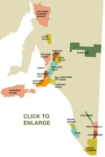 From central Adelaide,
take King William north to Main North Road in North
Adelaide. Connect with A52 to Gomersal Road and eventually
Barossa Valley Way. The ride takes a little over and hour.
From central Adelaide,
take King William north to Main North Road in North
Adelaide. Connect with A52 to Gomersal Road and eventually
Barossa Valley Way. The ride takes a little over and hour.There are five major wine-growing districts in South Australia. Here, the Barossa Valley has been outlined as a fairly comprehensive tour. The other districts include some scattered vineyards in the Adelaide Hills; Clare Valley, north of the Barossa Valley; McLaren Vale, less than an hour south of Adelaide; and the justly famous Coonawarra, in the southeast corner of the state. Geologically part of the Flinders and Mount Lofty ranges, the Barossa Valley sits between the Bremer and Stockwell fault zones. Its easternmost edge is the Kaiser Stuhl, an early Palaeozoic injection of granite and gneiss outcropping through the valley's bed of quartzite, schist and marble. Deposits of copper, gold and other minerals in this area led to early mining and prospecting. The western slopes of the Barossa Range are relatively infertile dark brown cracking clays and deep sands which support some orchards, cereal crops and beef cattle. The valley's famous vineyards are grown on the alluvial soils and red-brown earths of the valley's floor. Amap meant for biking that's not as difficult to understand at it looks at first glance is here.
The naturally occurring vegetation in the valley was first influenced by the Aboriginal hunting method in which fires were set in the undergrowth and scrub to drive game towards hunters or nets. The two dominant species of large eucalypt at the time of settlement can still be readily seen, where the red gums follow the creek beds and the taller blue gums are thinly scattered in paddocks and along roadsides. Other fire resistant species include acacias, peppermint gums and tufts of kangaroo grass and, at higher elevations, stringybarks.
The native populations of Peramangk, Kaurna and Ngadjuri Aborigines suffered much the same fate as the other indigenous people in the southern and eastern regions of Australia. Mobile, successful hunting and gathering groups of about 30 individuals fell victim to European diseases, then were displaced by the parcelling of land to European immigrants. Following continued population decline, those few remaining Aboriginals from the area were moved to Manuka Mission on the Murray River around the beginning of the 20C.
European settlement occurred in the 1840s and 1850s. The valley was given its name by William Light who had fought under Baron Thomas Graham Lynedoch (1748-1843) in Barrossa, Spain, against the French in 1811 (both names, for the place and hero, were misspelled when Light used them for his Australian locations). Unlike most of Australia, the area's early history is based on religious sectarian and denominational relations. The initial immigrants were Evangelical Lutheran Prussians settling on land owned by the Angas family. George Fife Angas (1789-1879) controlled the South Australian Company which owned a considerable part of South Australia. Pastor August Kavel of Klemzig, Prussia, approached Angas in 1836, requesting his help to resettle the persecuted sect. They had refused to follow Prussian King Frederick William III's unification of the Calvinist and Lutheran churches in the 1830s. Following an investigation by Charles Flaxman and protracted negotiations with the Prussian government, Angas loaned the group £8000 necessary for transport. Arriving in late 1838 and early 1839, the first shipload leased land from Angas northeast of Adelaide which they called Klemzig, after their native region in Brandenburg. The next group to arrive leased land in the Adelaide Hills from W.H. Dutton which, as mentioned above, they called Hahndorf after the captain of their ship.
The first road into the Barossa Valley was finished by 1841 and Kavel's group established Bethany in 1842. Their land-use pattern was the Prussian Hufendorf style in which the Tanunda Creek provided the back of their properties with narrow strips of orchards, then cultivated land running from the creek to houses aligned along the road. The
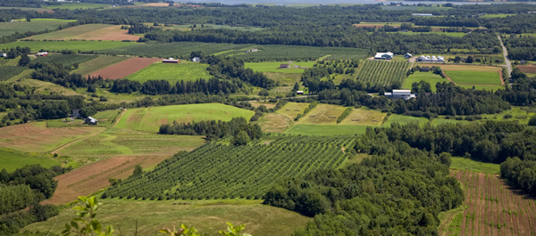 crops were in a three-year rotation
(vegetables, cereals, then left fallow). Subsequent English and
German settlers coming in the late 1840s and 1850s followed
English land-use patterns in which the farm buildings were
centred on the property, and the crop rotation proceeded through
six years (barley, beans, wheat, clover and rye, oats, and
manured fallow). Throughout the valley, these two land-use
patterns intermingled, though larger industrial vine yards now
predominate.
crops were in a three-year rotation
(vegetables, cereals, then left fallow). Subsequent English and
German settlers coming in the late 1840s and 1850s followed
English land-use patterns in which the farm buildings were
centred on the property, and the crop rotation proceeded through
six years (barley, beans, wheat, clover and rye, oats, and
manured fallow). Throughout the valley, these two land-use
patterns intermingled, though larger industrial vine yards now
predominate.The two most noteworthy additions to the population in the Barossa Valley occurred in 1846 and then in 1851. At the annual Lutheran synod in 1846, the district's two Lutheran theologians, Kavel and Gotthard Fritzsche, split the church over doctrine. While the immediate cause of the schism was interpretations of Luther's Small Confession regarding the separation of church and state, chiliasm was the actual basis of the divergence between the two congregations. Plainly stated, Kavel anticipated a thousand-year-long reign of Christ prior to the world's end. Fritzsche considered this an idle hope not supported by Christ's statements that he would return only once on the day of final judgement. The result was adherents of Kavel's stance from Hahndorf followed him to Hain and Gruenberg in the Barossa.
This strident debate was somewhat ameliorated by the arrival of Wendish Catholics from Saxony in 1851 and Cornish Wesleyan Methodists in 1852. Like many of the later arrivals, they settled to the north of the valley. Subsequent movement by the valley's East European Lutheran Germans established settlements in the Murray River basin, near Hamilton in Victoria, and in the Darling Downs of Queensland.
History of wine production
Although now justly famous for its wine, the Barossa valley did not always have a substantial export market. In 1888, while travelling as a nominee of the French Minister of Trade and Industry to the International Centenary Exhibition in Melbourne, Oscar Comettant wrote:Nonetheless, modest commercial operations did exist in the late 1840s and early 1850s. Wine-makers Carl Sobels and, somewhat later, Benno and Oscar Seppelt, were instrumental in establishing the character of the export wines. Sobels made dry table wines and introduced hock and verdelho at Pewsey Vale, and shiraz, riesling and muscatel at Evandale. He was marketing his wines in Melbourne and England in the 1850s. Benno and Oscar Seppelt, son and grandson of pioneer settler Joseph Seppelt, introduced important production techniques (particularly pasteurisation and cooling to control wild yeasts) to the region, making Seppeltsfield the region's largest producer in the 1890s. By this time, demand from the English export market, perhaps as a result of South Australia's superb showing at the Colonial and Indian Exhibition in London in 1886, induced the establishment of the second series of Barossa wineries.
Production grew steadily in the first half of the 20C as vintners responded to public taste for wine varieties. Table wines were preferred from the 1800s to the 1920s, then sweet wines and sherry from the 1920s to the 1960s when table wines became quite popular again. The upsurge in wine drinking and the development of an enthusiastic local market in the last 20 years has greatly increased the yield and the quality of Barossa wines today.
During the Barossa Valley Festival, in the week following Easter on odd-numbered years, the entire valley celebrates its ethnic and occupational heritage. The climax occurs in Tanunda on the Saturday after Easter. The Barossa Classic Gourmet Festival in August also highlights the region's food and wine. In October, the International Barossa Music Festival provides 16 days of classical music performances accompanied by gourmet meals and wine tastings.
The Barossa Valley tour described here leads from Adelaide to Gawler then through Tanunda, Seppeltsfield, Greenock, Nuriootpa, and Angaston. While it is certainly possible to accomplish a visit to the Barossa Valley from Adelaide in a day, the experienced tourist will have to be somewhat selective in the choice of walking tours if several wineries are to be visited.
In common with any wine-making region, the valley's most characteristic and interesting wines are often those intended for sale exclusively from the wineries' cellar doors. This pleasant institution allows an unobtrusive look at the Barossa Valley's rural buildings, construction techniques and occasionally wine production equipment.
|
Head north out of Adelaide on Main North Road, taking care to follow its jog to the left at Grand Junction Road. The cityscape is rather dreary until you pass Elizabeth and approach Smithfield.
The first destination is Gawler (population 16,000), about 45 minutes from the journey's start. Tourist information: Lyndoch Road (t 08 8522 9260; hours Mon.-Fri. 9.00-17.00, Sat., Sun. and holidays 10.00-16.00). South Australia's second oldest town, Gawler was founded in 1839 as a property investment based on city plans drawn by Colonel William Light. It was named in honour of George Gawler (1795-1869), South Australia's second governor (Light had wanted it named after himself). A manufacturing town during the 19C, its smelters supplied equipment for agriculture and mining and ornamental ironwork. The buildings in the central historical district are constructed of locally quarried bluestone, slate, and sandstone. The accent is provided by stucco, brick quoins and openings, and decorative ironwork. Much of this ironwork was manufactured at the Phoenix Foundry built by town patron James Martin.
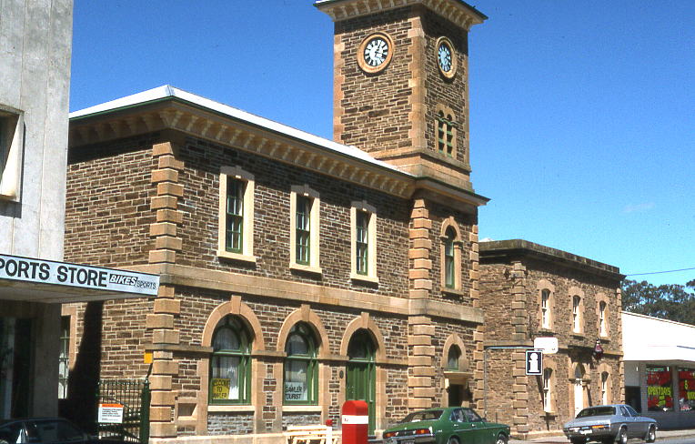 To the right across
Julian Terrace immediately after crossing the bridge is the
Union Mill. Built in 1915 to replace the original 1855 flour
mill destroyed by fire the year before, it now functions as a
shopping centre. At 51 Murray Street is the Old
Telegraph
Station (t 08 8522 4709; open Tues.-Fri. 13.00-16.00),
built in 1859-60, now the oldest surviving public building in
town. It now houses a pioneer museum with early musical
instruments-perhaps in commemoration of Carl Linger, an early
German pioneer and musician who in 1860 wrote in Gawler 'The
Song of Australia', which served as an unofficial anthem until
anti-German sentiment in the First World War led to a neglect of
any German-Australian accomplishment.
To the right across
Julian Terrace immediately after crossing the bridge is the
Union Mill. Built in 1915 to replace the original 1855 flour
mill destroyed by fire the year before, it now functions as a
shopping centre. At 51 Murray Street is the Old
Telegraph
Station (t 08 8522 4709; open Tues.-Fri. 13.00-16.00),
built in 1859-60, now the oldest surviving public building in
town. It now houses a pioneer museum with early musical
instruments-perhaps in commemoration of Carl Linger, an early
German pioneer and musician who in 1860 wrote in Gawler 'The
Song of Australia', which served as an unofficial anthem until
anti-German sentiment in the First World War led to a neglect of
any German-Australian accomplishment.Continue on Murray Street to the central business street. To the right are the South End Hotel (1859) with an interesting curved iron roof, the Professional Chambers (1859) with a fairly formal and Italianate façade, and, a bit further along, the Savings Bank of South Australia (1911), with a balustraded parapet and pediment in an ornate version of Classical Revival style. To the left, set off the street, is the Baptist church's complex (1870-1905) with limestone and contrasting brick.
Down the street on the left is the Kingsford Hotel (1858) with noteworthy decorative cast-iron lacework. It was the first home of the Gawler Humbug Society Chronicle, a sometimes satirical and libellous newspaper, currently published as the Bunyip. At no. 58 Murray Street, the Italianate mood of the post office's Tuscan-style clock tower continues a bit further along in the National Bank (1881), Town Hall (1878), Gawler Institute (1870) and ANZ Bank (1857-59). The simplicity of the latter, along with its locally manufactured fences and gates, offers an interesting contrast to the other more ornate buildings in its proximity.
For those travellers particularly interested in bridge engineering, the sole remaining example of a timber-arch bridge is a few minutes to the west of Gawler in Heaslip Road in Angle Vale. Built in 1876 and redecked in 1940, it has four parallel arch ribs spanning 25.9m.
Lyndoch
Following the Barossa Valley Way (also called Lyndoch Road) towards Lyndoch, grape arbours begin to replace wheat fields as the soil improves. After about 9km, a sign directs you to the left to the Chateau Yaldara Estate Winery (open daily until 10.00-17.00, tours upon arrangement, at least 4 persons, $20 each; t 61 437 804 501). The castle-like Charles Cimicky Winery (t 08 8524 4025; open daily, call for hours) is on the right; the elaborately formal gardens and architecture of Chateau Yaldara are offset by the swinging footbridge which crosses the North Para River.
Again on the Barossa Valley Way c 1.5km further east, the Kies Winery (t 08 8524 4110; phone for help arranging a tour of the valley's wineries; cellar door open 9.00-16.00) on the left in a tidy German-style house of the 1850s, acts as one of the valley's tourist information centres. A stop here provides the opportunity to buy Explore the Barossa by Sue Barker, a well-produced booklet. The proprietor's family has been in the Barossa since the 1850s; most of the land in the area originally belonged to the Kies family.
A little further along, Lyndoch's older buildings date from the 1850s and 1860s and are constructed of ironstone. The town was established in 1839 when Stephen Gower built the Lord Lyndoch Hotel. The current structure, now a hardware store immediately to the right at the town's centre, dates from 1855. Other structures at the crossroads include the Lyndoch Hotel (1869; rebuilt after being gutted by a fire in 1914); the Institute Hall and Public Library (1912; with 1940s Art Deco front) and Post Office (1912).
Now, turn left on the Sturt Highway towards Rowland Flat and Tanunda.
The Orlando Winery, on the right just beyond Rowland Flat, was established by Johann Gramp in 1847. This site was given to his son Gustav as a wedding present in 1877. The winery was sold to international concerns in 1970 and ownership returned to the valley when the Orlando management bought it back in 1988. The wine-tasting centre is in a bluestone and red-brick building from the 1870s which was originally a primary school and teacher's residence. Orlando produces the well-known label Jacob's Creek, plus many other popular brands. They are currently owned by the international company pernod-ricard.
Grant Burge Wines (t 1 800 088 711), on the left, is in the restored winery of William Jacob's Moorooroo property (1851). At Krondorf Road, c 700m, turn right to Rockford Wines (t 08 8563 3787; open 11.00-17.00), one of the best of the small vineyards, set amongst original farm buildings of the 1850s; farm cottages are used for the tasting room and sales cellars. Also on Krondorf Road in historic surroundings is Charles Melton Wines (t 08 8563 3606), producer of 'Nine Popes' label red wine. On the other side of Krondorf Road on St Hallet Road, off the highway, is The Keg Factory (t 08 8563 3012; open weekdays 8.00-16.00, Sat. 11.00-16.00), an old-fashioned cooper's shop with barrels and furniture.
Bethany
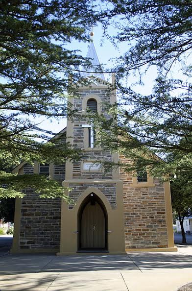
Tanunda
Return to Barossa Valley Highway and turn right towards Tanunda. Entry into the town in spring is charming, with banked beds along the road filled with native plants and flowers. The significance of the many wineries in the area is apparent; you enter the town through the Orlando arch and leave it through the Seppelt arch.The area around what became the town was settled by Pastor Augustus Kavel and his followers. Tanunda itself was planned around goat square (der Ziegenmarkt). The land had been granted to Charles Flaxman who laid out the town in 1848. Central to the nearby villages of Bethany (Bethanien at the time) and Langmeil (now a street running parallel to Murray in the north end of town), Tanunda became a market and gathering place. Goat Square is to the left of Murray Street on John Street.
The oldest buildings date from the late 1850s and 1860s. These include a two-storey winery and several other rust-coloured sandstone buildings on Langmeil Street and some houses on Goat Square itself. Of the latter, Rieschiek House is perhaps the most interesting, if more modest than modern taste might admire. It is a single-storey clay, rubble and brick building of five rooms with flanking verandahs. Originally built for the town shoemaker, Johann G. Rieschiek, it was used for church services when Kavel broke from the local synod in 1860. The associated church, St John's, on Jane Place, was built in 1868. The extent of the fractious religious sentiment in these communities should not be underestimated. Both the St John's and Langmeil congregations petitioned the colonial government to close the other's cemetery as a danger to public health.
Murray Street has a number of interesting buildings. Starting from the entrance to the town from the south (from the Orlando Arch), the wine cellar at no. 14 was originally Pastor John Auricht's printery. Like the buildings on Goat Square, the walls are of rubble and brick.
Set back from the street, the Langmeil Lutheran Church is a Gothic Revival structure of random bluestone built in 1888. Inside, it has an unusual matchboard ceiling which follows the rafters to a cross at the collar ties. The sanctuary is contained by a columned arch and the gallery at the rear features cast-iron columns and balustrade. Pastor Fritzsche is buried in the adjacent cemetery. Several of the tombstones present biographical details in Gothic script.
 The Barossa
Valley Tourist Information (t. 1 300 852; open Mon.-Fri.
9.00-17.00, Sat. 9.00-16.00, Sun. and holidays 10.00-1.00) is on
the corner of Murray and John Streets. This office also serves
as the Barossa Wine Centre, and includes a 'wine trail' map; an
audio-visual presentation about the Barossa Valley; and taped
talks by famous wine-makers, such as John Duval, speaking about
the illustrious Penfold's Grange. Originally functioning as a
post office, telegraph station and post master's residence, this
structure from 1865 is a good example of colonial era public
buildings. The Tanunda
Museum (t 08 8563 0507; open daily 13.00-16.30, summer
10.00-16.30), with local artefacts, including a noteworthy
organ, is at the corner of Mill and Murray Streets in the
old post office. The Tanunda Hotel next door was first licensed
in 1847. Redecorated and eventually rebuilt in marble in 1945,
its lacework and columns come from England. What was the
temperance hotel is a fairly nondescript building, now housing a
group of shops on the corner across the street from the museum.
The Barossa
Valley Tourist Information (t. 1 300 852; open Mon.-Fri.
9.00-17.00, Sat. 9.00-16.00, Sun. and holidays 10.00-1.00) is on
the corner of Murray and John Streets. This office also serves
as the Barossa Wine Centre, and includes a 'wine trail' map; an
audio-visual presentation about the Barossa Valley; and taped
talks by famous wine-makers, such as John Duval, speaking about
the illustrious Penfold's Grange. Originally functioning as a
post office, telegraph station and post master's residence, this
structure from 1865 is a good example of colonial era public
buildings. The Tanunda
Museum (t 08 8563 0507; open daily 13.00-16.30, summer
10.00-16.30), with local artefacts, including a noteworthy
organ, is at the corner of Mill and Murray Streets in the
old post office. The Tanunda Hotel next door was first licensed
in 1847. Redecorated and eventually rebuilt in marble in 1945,
its lacework and columns come from England. What was the
temperance hotel is a fairly nondescript building, now housing a
group of shops on the corner across the street from the museum.The Tabor Lutheran church on the right-hand side of Murray Street just beyond the Tanunda Hotel was rebuilt in 1870 on the site of the Free Evangelical church organised in 1850 by Dr Carl Mielke. Note the fine railing around the graves of the Schroeder family.
Residences of bluestone or ironstone are scattered along the length of Murray Street. A number of them feature cast-iron fences. That at no. 90 Murray Street has a windmill-driven waterpump and concrete cisterns at the back, and no. 76 Murray Street (now a business) has Wunderlich-pressed metal sheeting. The monument across Julius Street from this building commemorates E.H. Coombe (1858 -1917), a Member of Parliament from the district who was convicted and fined for his opposition to military conscription during the First World War.
In north Tanunda, still on the Barossa Valley Highway, is the Kev Rohrlach Technology and Heritage Centre (t 08 8563 3407; open daily 11.00-16.00, Sun till 17.00), an amazing private collection ranging from pioneer memorabilia to aerospace rockets, solar-powered machines and vintage cars. The centre is also the location of the Barossa Markets held every Sunday, with arts and crafts and speciality foods. The main wineries around Tanunda include Peter Lehmann, Para Road (t 08 8565 9555); the Burge Family Winemakers (t 08 8524 4644).
Seppeltsfield
Seppeltsfield lies to the north and west of Tanunda. While nearly all of the roads will lead through pleasant rural scenery, the simplest route follows the Barossa Highway (Murray Street in Tanunda) north nearly 8km to Siegersdorf Road. Turn left towards Marananga. This area, currently called Dorrien, was originally called Siegersdorf (German for Victory Village, a problem during the First World War solved by renaming the area after British General Smith-Dorrien). The palm trees flanking the avenue were planted during the 1920s and 1930s in association with the Seppelt family's Doric-columned mausoleum which stands prominently, and surprisingly, on the north side of the road.Just beyond Marananga's St Michael's Gnadenfrei Church (1873, tower added 1913), the road takes a series of turns to the Seppelt winery (t 08 8568 6200; open 10.30-17.00). The first vines here were planted by Joseph Seppelt in 1852. The main cellars, built of Bethany bluestone with a parapeted front and balcony, were completed in stages between 1867 and 1878. The old offices and columnar chimney on the boiler house are in Roman Revivalist style and date from the late 19C. The gravity-fed wood and iron-stepped winery was designed by Benno Seppelt in 1888. His building programme saw the completion of a dining area for workers and, remarkably for the time, rooms for child care.
Having toured Seppeltsfield, turn right at the entrance to continue towards Greenock. On the right at the first junction is an old-style bush vine vineyard planted in about 20 rows. Modern vineyards are trellised and drip irrigated. In either case, the fields are often interplanted with field beans which control weeds and are turned under as green manure. Turn right, cross the highway, and drive through Greenock. Turn right (east) on Murray Street towards Nuriootpa.
Nuriootpa
Nuriootpa, first a neutral barter centre for Aboriginal groups, grew around a slab hotel built for bullock drivers serving the Kapunda mines. The two most noteworthy domestic buildings in the town are Schaedel House and Coulthard House. Turning left (north) on yet another Murray Street, Schaedel House is on the left side of the street a few doors beyond First Street. Built around 1870 by Carl F.J. Schaedel and his wife Maria, the house has clay walls and hand-adzed beams. Coulthard House was begun in 1855 by the town's planner, William Coulthard. The house features a pleasant verandah on three sides and timber fretwork decorations. Next to the village's Lutheran church, called 'Strait Gate' and built in 1851, is Luhrs Pioneer German Cottage (open weekdays 10.00-16.00, weekends 13.00-16.00). Built in 1848 by J.H. Luhrs, the valley's first German school teacher, the building documents German home and school life in 19C Barossa.The main wineries around Nuriootpa include Penfolds, Tanunda Road (t 08 8568 8408; open daily 9.00-17.00), the valley's largest and most commercial winery; and, c 4km north of town, Wolf Blass, 97 Sturt Highway (t 08 8568 7311; open 10.00-16.30), run by its eccentric eponymous wine-maker, well known for consistency. This complex includes a small wine museum.
Continue east on Penrice Road towards Penrice and Angaston. At the railroad tracks just past Light Pass Road lies the Stockwell Fault zone which forms the Barossa Valley's eastern scarp. At the base of the hills, known for a good light marble, about 500m beyond the Penrice Quarry is a contemporary sculpture by Paul Trappe on the left. The Cornish mining community, Penrice, is another 500m along at Salem Road.
Penrice was established in 1849 by Captain Richard Rodda, a mining agent who subdivided part of his land grant to form the community. Named after an estate near Rodda's native St Austell, Cornwall, it is noted for its Wesleyan Methodist chapel (currently the Salem Lutheran Church) and village Cornish cottages. The stone shed and houses opposite Salem Road were part of the flour mill Rodda established to supply the men going to the gold fields, eventually transported through the Murray River shipping trade.
Angaston
Angaston (population 1950) was named in 1839 after George Fife Angas by his agent Charles Flaxman. Although it was first inhabited by Johann Gottfried Schilling and his family in 1841, the style of the town is English rather than German. The oldest building in town is the remnants of the Union Church, established in 1841 by Angas who intended it as the community's sole church. More recently, the building was used as a barn. It stands on the right just at the edge of town before Penrice Road jogs slightly to the left.Angas built a second, more substantial, church in 1854. It is to the right on Murray Street. Now the Zion Lutheran Church, it has bluestone walls with quoins and dressing of pink and cream sandstone. The Congregationalists withdrew from the church in 1861; the Baptists used it until 1929. After a period of disuse, the Lutheran congregation bought it in 1941 and have made a number of improvements to the building, notably the halls on the eastern side.
One of South Australia's more interesting bridges is a bit further along the road. The skew-arched masonry of 1865 bridge is one of two in the state; the other is about 30km to the northwest of the Barossa in Tarlee.
Returning on Murray Road past Penrice Road to take a right on Sturt Street then a short walk on Washington Street to the first left on Fife Street, you will find the Town Hall, built in 1911 on a base of bluestone with walls of grey marble; it was initially the second home of the local Institute, then a library and cinema. The former police station and gaolhouse from 1855 and 1864, built largely through Angas's donated land and materials, are also on the street, as are the Uniting Church's buildings. This latter was built by the Congregationalist group in stages. The initial 'colonial bond' brickwork church, now the Sunday School Hall, was built in 1861. The present Gothic Revival church was designed and built by Adelaide architect D. Garlick in 1878.
Turn left on Sturt Street, then right on Murray Road for a glance at the town proper. Among the most interesting buildings are a number of businesses. The old flour mill (a stone's throw to the left down Tyne Street) was established by Edwin Davey and his son Arnold in 1885 when their mill in Penrice burnt down. On the right beyond Tyne Street is the old blacksmith shop (c 1873), recognised by the galvanised iron front. Established by William Doddridge in 1849, its last proprietor was the founder's grandson, Hardy, who at one time contracted to keep the Angaston to Freeling mail coach teams shod for five shillings a month.
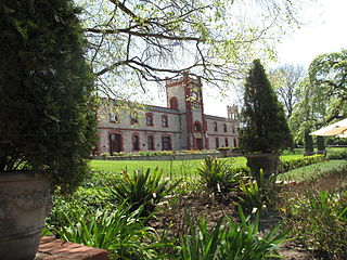 Angaston is flanked by
two prominent wineries, Saltram (t 08
8561 0200; open 10.00-16.30) to the east on Murray Street and
Nuriootpa Road, and Yalumba
(t 08 8561 3200) to the south on Eden Valley Road. Both of these
wineries are among the original Barossa vineyards and are still
housed in their 1850s buildings, with aesthetically attractive
tasting rooms. Beyond Yalumba is Collingrove,
also on Eden Valley Road. It is currently undergoing
extensive renovation. A large, single-storey house was designed
by Henry Evans for John Howard Angas, his brother-in-law, and
built about 1854 of blocks of micaceous slate quarried on the
property. The quoins, sills and chimneys are of contrasting
soapstone. Its verandah and symmetrical wings give the building
visual appeal. The property was named for Angas's new bride,
Suzanne Collins, and the land and cost of building were a
wedding gift from the elder Angas. To return to Adelaide, either
work your way towards the west, through Angaston to the Barossa
Valley Highway or the Sturt Highway, or continue on a longer
route through Eden Valley and Mount Pleasant.
Angaston is flanked by
two prominent wineries, Saltram (t 08
8561 0200; open 10.00-16.30) to the east on Murray Street and
Nuriootpa Road, and Yalumba
(t 08 8561 3200) to the south on Eden Valley Road. Both of these
wineries are among the original Barossa vineyards and are still
housed in their 1850s buildings, with aesthetically attractive
tasting rooms. Beyond Yalumba is Collingrove,
also on Eden Valley Road. It is currently undergoing
extensive renovation. A large, single-storey house was designed
by Henry Evans for John Howard Angas, his brother-in-law, and
built about 1854 of blocks of micaceous slate quarried on the
property. The quoins, sills and chimneys are of contrasting
soapstone. Its verandah and symmetrical wings give the building
visual appeal. The property was named for Angas's new bride,
Suzanne Collins, and the land and cost of building were a
wedding gift from the elder Angas. To return to Adelaide, either
work your way towards the west, through Angaston to the Barossa
Valley Highway or the Sturt Highway, or continue on a longer
route through Eden Valley and Mount Pleasant.South of Adelaide
Fleurieu Peninsula, named by French navigators after the scientist Comte de Fleurieu, extends some 115km south of Adelaide, ending at Cape Jervis. From here, the vehicular ferry crosses Backstairs Passage to take visitors to Kangaroo Island, at 150km long and 55km wide Australia's third-largest island.Fleurieu Peninsula
From Adelaide, take the South Road out of town. At Reynella, 20km south of Adelaide city, is 'Reynella House', a homestead built in 1845 by pioneering vintner John Reynell (it is a private residence). He constructed elaborate wine cellars in the limestone, using local gum trees as supports. His house here has small-paned French windows and an encircling verandah. The old towns of Noarlunga-now Port Noarlunga, with good beaches, and Old Noarlunga-to the south contain some interesting pioneer buildings. About 10km south of Old Noarlunga is Maslin Beach, famed throughout Australia for being the first legal nude beach. Another 10km east of Maslin Beach is McLaren Vale (population 1200), centre of what tourism now calls 'The Wine Coast'. Indeed, excellent wines have been produced here since 1876, when Thomas Hardy bought Tintara Vineyards; Hardy's (t 08 8329 4124; open Mon-Fri. 11.00-16.00, weekends 10.00-16.00) is still the main winery in the area, although at least 60 others are clustered here as well. (Tourist information: Main Road; t 08 8323 9944; open weekdays 9.00-17.00, weekends and holidays 10.00-16.00) here you can get a detailed map of all the wineries that can be visited.At the southern end of the Southern Vales is the town of Willunga (population 1200). In 1837, the first expedition in the state ended here. In 1840, slate was discovered here and became an important industry in the colony, prompting the arrival of Cornish slate workers. Once the slate industry waned, the town became the centre of almond growing, which it still is; each spring when the almond trees are in bloom, the town holds a festival. The main street of Willunga has many examples of colonial architecture, including the Willunga Hotel (1870), with a cantilevered balcony, and the former Police Station and Court House, built in two stages in 1855 and 1864.
Encounter Bay
From McLaren Vale, it is 42km to the south side of the peninsula, with its old port towns along Encounter Bay. Goolwa (population 2400) was an important port during the paddlesteamer days, when bales of wool and produce from inland Australia were shipped down the Murray River and on to overseas ships here. You can still book cruises here to the mouth of the Murray from the Goolwa Wharf. The railway was also important to the region; as early as 1854, a horse-drawn railway operated between Goolwa and Port Elliot, 10km west. One of the most interesting buildings in town, evidence of the difference between South Australian vernacular architecture and other Australian colonies, is the Old Railway Superintendent's Cottage, on Government Road, now a National Trust property being used as a community radio station studio, ALEX FM (96.5/87.6). Built in 1852 of limestone rubble, it has a distinctive semi-circular vaulted roof covered in galvanised iron.Port Elliot also has some fine colonial buildings, including St Jude's Church of England, built in 1854 out of bluestone, with a turretted tower. The town is located on Horseshoe Bay, with a very pleasant beach. Tourist information centre: Goolwa Wharf (t 1300 466 592) or Victor Harbour (08 8551 0777). This centre offers excellent displays about the Ngarrindjeri people of this region.
The coastline between here and Victor Harbor, 5km south, has good surf beaches. From Goolwa you can also take a vehicular ferry to Hindmarsh Island, a once tranquil spot at the mouth of the river and now the centre of a vexed political dispute between developers and the indigenous owners.
Victor Harbor (population 5300) has been a whaling post since the 1830s, and since the beginning of the 20C a popular holiday resort for South Australians. For reasons unexplained, the town does use the American spelling for 'harbor'. Whales are again the focus of attention here, but now as a tourist attraction. From May to October Encounter Bay was the summer breeding ground for Southern Right Whales, making this the most popular spot for the killing of whales in the 19C. By the 1930s, whales had nearly been exterminated here. In recent years, their numbers have begun to increase; in 1991, over 40 were seen in the bay, and thousands of tourists now flock here every year. The Victor Harbor South Australian Whale Watch Centre (t 08 8551 0750; open daily 09.30-17.00)
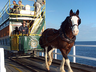 Visitors to Victor Harbor
may be interested in two attractions involving transportation.
The horse-drawn tram, a service begun here in 1894, still
travels along a small causeway rail between the mainland and
Granite Island, the small island which is home to a colony of
fairy penguins (the island's Penguin Interpretative Centre has
displays about the creatures, and tours can be arranged through
the tourist office). Next to the horse tram on Flinders Parade
is the
Encounter
Coast
Discovery
Centre (t 08 8552 5388; open 13.00-16.00; admission
adults $5.00, concesssion $4.00, children $3.00), a history
museum housed in the Old Customs and Stationmaster's Residence
(1866). The other transport adventure is Horse
Drawn Tram (t 08 8551 0720). Another venture of the Victor
Harbor Tourist Railway service (t 08 8391 1223).
Considered one of the most scenic train rides in the country,
this 'selected Sundays' run travels along the coast past the
beaches and historic towns between Victor Harbor and Goolwa;
only 40km long, the ride takes about 30 minutes.
Visitors to Victor Harbor
may be interested in two attractions involving transportation.
The horse-drawn tram, a service begun here in 1894, still
travels along a small causeway rail between the mainland and
Granite Island, the small island which is home to a colony of
fairy penguins (the island's Penguin Interpretative Centre has
displays about the creatures, and tours can be arranged through
the tourist office). Next to the horse tram on Flinders Parade
is the
Encounter
Coast
Discovery
Centre (t 08 8552 5388; open 13.00-16.00; admission
adults $5.00, concesssion $4.00, children $3.00), a history
museum housed in the Old Customs and Stationmaster's Residence
(1866). The other transport adventure is Horse
Drawn Tram (t 08 8551 0720). Another venture of the Victor
Harbor Tourist Railway service (t 08 8391 1223).
Considered one of the most scenic train rides in the country,
this 'selected Sundays' run travels along the coast past the
beaches and historic towns between Victor Harbor and Goolwa;
only 40km long, the ride takes about 30 minutes.South of Victor Harbor around Encounter Bay, take Franklin Parade to the end at Rosetta Head (c 3km). This 100m high granite outcrop has good walking trails and magnificent views of the bay. Also here is a tablet dedicated to intrepid explorer Matthew Flinders, who explored and named the many places in the region on his famous circumnavigation of Australia 1801-04.
The Gulf St Vincent side of the peninsula also has glorious beaches, most of them a bit calmer than the Southern Ocean side. At the end of the west coast is Cape Jervis, with its important lighthouse. From here there are splendid views across Backstairs Passage to Kangaroo Island. It is also here that the famous Hans Heysen Trail begins its 1500km trail to the Flinders Ranges. 11km east of Cape Jervis is Deep Creek Conservation Park (t 08 8598 0263), 4030 ha of rugged hills, luxurious fern gullies and several varieties of native orchid in the valleys. The walking trails along the cliffs in the park provide spectacular views across to Kangaroo Island.
Kangaroo Island
Lying 13km off the Fleurieu Peninsula south of Adelaide, access to Kangaroo Island (known as 'KI' to locals) is by air through Air Kangaroo or Lloyds Aviation out of Adelaide and by vehicular ferry via SeaLink from Cape Jervis to Penneshaw (Philanderer III) (t 13 13 01, international 61 8 8202 8688). Tourist information: Kangaroo Island Tourist Information Centre, Howard Drive, Penneshaw, t 08 8553 1185; National Parks and Wildlife Service, Flinders Chase National Park, t 08 8553 4470. The latter can provide annual island passes for park entry, camping and guided tours.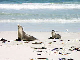
Kangaroo Island is largely sea-worn granite with limestone deposits from the Permian Period of the lower Paleozoic. The Remarkable Rocks, large rounded boulders on Kirkpatrick Point, are reminiscent of the Giant Marbles of central Australia. The northern coast has higher elevations with limestone arches, cliffs and inlets.
The Flinders Chase National Park comprises the western end of Kangaroo Island. The vegetation here is essentially a mallee thicket alternating with towering eucalypt forest.
Mount Taylor Conservation Park contains some small limestone caves but is known for the flourishing population of the otherwise endangered Trigger Plant. South and east of Mount Taylor Conservation Park is the Seal Bay Refuge, home to sea lions, fur seals and leopard seals as well as koalas and platypus. The Nepean Bay Park is also on the island, a short distance south of Kingscote. As well as Tammar Wallabies, it has remnant areas of the original vegetation of this part of the island.
History
The history of habitation on Kangaroo Island is an intriguing one. Archaeological evidence suggests that Aborigines inhabited the place some 11,000 years ago, and at some time later disappeared. Flinders charted and named the island in 1802, but it had also been explored by the French navigator Nicolas Baudin, who left so many French names in the region. In the early 19C, whalers, sealers, and escaped convicts all inhabited the island, establishing rather brutal conditions that included the enslavement of native women captured in Van Diemen's Land and carrying out piracy on passing ships.
The island's relative geographical isolation has allowed the native flora and fauna to flourish without the dangers of introduced species such as rabbits and foxes. Recently, the koala and platypus have actually been introduced here, to promote the survival of these species. So successful has been the koalas' adaptation that they now threaten to decimate the island's stock of gum leaves, and many have had to be removed back to the mainland. Today, the island is an excellent place to enjoy Australian natural environments. Despite an active tourist campaign over the last decade, the place is still relatively unspoiled and makes for a great getaway. The ferry from Cape Jervis lands at Penneshaw, along with Kingscote and American River the island's only towns. A ferry from Port Lincoln and Adelaide also lands at Kingscote. There is no public transportation on the island, so you must either bring a car or rent one (preferably in advance) on the island itself. While the island has more than 1600km of roads, many of them are unsealed and care must be taken when driving.
Penneshaw is located on cliffs filled with fairy penguins, who come into town at night. American River sits on Pelican Lagoon, and is a quiet little beach resort. In
 winter,
the southerlies blow so fiercely on the other side of the island
that the roar of the waves can be heard here. One
heritage-listed construction here is First House, built c 1844
by boat-builder John Buick, who made the colony's first boat out
of native pine. Kingscote (population 1400) is 60km west, on the
Cygnet River, and is the island's main
town. Located here is an Esplanade, leading to Reeves Point
Historic Site, the colony of South Australia's first settlement
(in 1836); an original mulberry tree here in the old
cemetery still produces fruit. On Seaview Road is the Hope Cottage Folk
Museum (t 08 8553 2656; open Jan. 10.00-16.00, otherwise
13.00-16.00, closed Aug.; admission adults $6, concession $4.00,
children $2.00), with artefacts and history relating to the
house's original occupants from the 1860s. A fine
lighthouse is there, Cape du Couedic Lighthouse.
winter,
the southerlies blow so fiercely on the other side of the island
that the roar of the waves can be heard here. One
heritage-listed construction here is First House, built c 1844
by boat-builder John Buick, who made the colony's first boat out
of native pine. Kingscote (population 1400) is 60km west, on the
Cygnet River, and is the island's main
town. Located here is an Esplanade, leading to Reeves Point
Historic Site, the colony of South Australia's first settlement
(in 1836); an original mulberry tree here in the old
cemetery still produces fruit. On Seaview Road is the Hope Cottage Folk
Museum (t 08 8553 2656; open Jan. 10.00-16.00, otherwise
13.00-16.00, closed Aug.; admission adults $6, concession $4.00,
children $2.00), with artefacts and history relating to the
house's original occupants from the 1860s. A fine
lighthouse is there, Cape du Couedic Lighthouse.
Just outside Kingscote is an earlier settlement of Cygnet River, near the airport. 28km south of here is Cape Gantheaume Conservation Park (t 08 8204 1910), an expansive 21,254 ha park extending along the southern coast from Bales Beach near Seal Bay on the west to Cape Linois on the east. Access is largely confined to bushwalkers, who can view carved high cliffs and caves, as well as an amazing variety of wildlife, sheltered in the mallee heath and including bandicoots, possums and marsupial mice. Also in the park is D'Estrees Bay, a long sweep of beach, once a whaling station and notorious site for shipwrecks. The tourist centre provides a guide to the island's Maritime Heritage Trail, which leads you to the location of the island's many shipwreck disasters.
Also on D'Estrees Bay at Hundred Line Road is Clifford's Honey Farm (t 08 8553 8295), evidence of KI's status as an official sanctuary for Ligurian honey bees, an important genetic pool untainted by mainland bee diseases. The bees are descendants of 12 hives imported from Liguria, Italy, by August Fiebig in 1881. The island's sanctuary status means that no honey or honey products can be brought to the island.
From the Victorian border to Adelaide
The Princess Highway crosses the Victoria-South Australia
border in the state's far southeast corner. Mount Gambier,
Millicent, Kingston and Meningie are along the route that
traverses the coastline known as the Coorong. To the north,
the Dukes Highway parallels the route, passing through
Bordertown and Keith before joining the Princes Highway at
Tailem Bend and on to Murray Bridge on the Murray River.
Between the two, quite near the border north of Mt Gambier, is
the famous wine-growing region of Coonawarra.
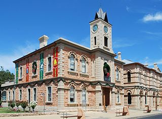 Mount Gambier is an agricultural
and forestry service centre with a population of about 20,000.
The Hentys, the first white settlers in Victoria, built the
first house here in 1841. Interstate rivalries, however, were
already rife by this stage, and the South Australian colonists
evicted them in 1844, giving the land grant to explorer
Charles Sturt's brother. Soon a community grew up, and regular
postal service between Melbourne and Adelaide made a stop here
by 1850. Its most interesting buildings are constructed of
locally quarried white stone. The Town Hall and Post Office
date from the 1860s. G.T. Light designed the Old
Court House, built in 1864. Currently, the National
Trust uses it as a folk museum (t
Mount Gambier is an agricultural
and forestry service centre with a population of about 20,000.
The Hentys, the first white settlers in Victoria, built the
first house here in 1841. Interstate rivalries, however, were
already rife by this stage, and the South Australian colonists
evicted them in 1844, giving the land grant to explorer
Charles Sturt's brother. Soon a community grew up, and regular
postal service between Melbourne and Adelaide made a stop here
by 1850. Its most interesting buildings are constructed of
locally quarried white stone. The Town Hall and Post Office
date from the 1860s. G.T. Light designed the Old
Court House, built in 1864. Currently, the National
Trust uses it as a folk museum (t
The same limestone formed a number of caves in the area and
impart the stark blue to Mount Gambier's four crater lakes.
The most impressive of these lakes, appropriately named Blue
Lake, is 197m deep. Its greatest curiosity is the change from
grey to blue in November and back again at the end of summer,
a normally occurring, seasonal inversion due to temperature
changes. In 1910, poet Mary Gilmore wrote longingly of the
lake, 'once more to see the Blue Lake like a sapphire
shimmer', while Arthur Upfield's Aboriginal detective Napoleon
Bonaparte is told in Battling
Prophet (1956) that the colour comes from washing
blue that the locals dump into the lake every few months (a
popular local myth).
Much is made locally of horseman and balladeer Adam Lindsay Gordon.
And forcing the running,
discarding all cunning,
A length to the front went the rider in green ;
A long strip of stubble, and then the big double,
Two stiff flights of rails with a quickset between.
...
She came to his quarter, and on still I brought her,
And up to his girth, to his breastplate she drew ;
A short prayer from Neville just reach'd me, 'The Devil!'
He muttered—lock'd level the hurdles we flew.
A hum of hoarse cheering, a dense crowd careering,
All sights seen obscurely, all
shouts vaguely heard;
'The green wins !' 'The crimson !' The multitude
swims on,
And figures are blended and features are blurr'd.
from "How We Beat the Favourite".
Coonawarra wines
John Riddoch began the viniculture at Coonawarra in 1890.
He established an orchard and vines on his property. While
these were successful and produced excellent wine from the
start, the Coonawarra did not gain its current reputation
until the 1960s, when awareness of wines expanded in
Australia. Today the area packs nearly a dozen wineries into a
region only 12km by 2km. Well aware of the current resurgence
of interest in Australian wines, a number of wineries are open
for cellar door sales and tastings. Probably the best known of
these wineries is Wynns
Coonawarra Estate (Memorial Drive, 61 8 8736 2225, 10:00
- 17:00) established in 1896 and still producing its great
reds. The
Penola Tourist Information Centre on Arthur Street (t 08
737 2855) on the Memorial Park provides maps and directions.
Gordon's horseback leap to a ledge above the lake in the
1860s. An obelisk commemorating this feat still exists on
MacDonnell Bay Road, erected in 1887 at the height of Gordon's
posthumous fame. About 50km west of Mount Gambier through pine
plantations, Millicent (population 8200) sits on reclaimed
land near the Canunda
National Park
(t 08 8735 1177). The park is known for its extensive sand
dunes and wild grasslands. Tantanoola
Caves
Conservation Park (t 08 8734 4153) is south of
Millicent. These limestone caves with delicate formations have
walking trails and provide wheelchair access.
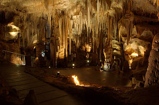
In Millicent itself, on Mt Gambier Road, the National Trust operates a museum and gallery in the town's first school (t 08 8733 0904; weekdays 9:00 - 17:00, weekends 10:00 - 16:00; admission adults $12.00, concession $8.00, children $5.00). Built in 1873, the school's exhibits present a number of period rooms as well as an array of horse-drawn carriages from the late 19C. The museum include a portion of the wonderfully eccentric Shell Garden. The creation of Iris Howe, who began covering things with shells and glass in 1952, the garden was a whimsical extravaganza of vernacular visionary art. The coastal road (Princes Highway, route 1) north passes by turn-offs to Beachport and Robe, then travels through Kingston S.E. and Meningie to Adelaide. Again the sand dunes, lagoons and salt lakes are the predominant geological features.
The remarkable sand dunes on Younghusband Peninsula, called the Hummocks locally, shelters the Coorong, a 140km-long lagoon, now a national park (t 08 8575 1200). The name derives from a local Aboriginal word 'Karangh', meaning 'narrow neck'. The entire coast provides habitats for an incredibly diverse shore and water bird population. Nearly 420 species have been logged in the park. Coastal mallee, tea tree and paperbark grow in the reddish, late Pleistocene sand and heaths. The area park of the Coorong National Park, was the setting for the popular splendid 1977 film Storm Boy. At Camp Coorong near Meningie (t08 8575 1557) the Ngarrindjeri community provides camp sites and bunkhouses and descriptions of their traditional culture.
At Beachport, 32km northwest of Millicent, fairy penguins
can be spotted in the evenings on Penguin Island. These birds
come 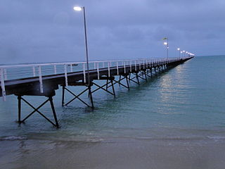 ashore at
Robe as well. Colin Thiele's touching novel Storm Boy (1963) was set
here, and the later film version was also made in the area.
The town has one of the longest jetties in Australia, and a
fleet of lobster boats. Aboriginal artefacts and historical
displays are at the local
museum (t. 08 8735 8013; open daily 10.00-15.00;
admission adults $5, concession $4.00, children $2.00) a
former wool and grain store. The drive between Beachport and
Robe, c 40km north, is particularly scenic. About 5km north of
Beachport is the Pool of Siloam, a lake seven times saltier
than the ocean and reputed to have therapeutic qualities.
ashore at
Robe as well. Colin Thiele's touching novel Storm Boy (1963) was set
here, and the later film version was also made in the area.
The town has one of the longest jetties in Australia, and a
fleet of lobster boats. Aboriginal artefacts and historical
displays are at the local
museum (t. 08 8735 8013; open daily 10.00-15.00;
admission adults $5, concession $4.00, children $2.00) a
former wool and grain store. The drive between Beachport and
Robe, c 40km north, is particularly scenic. About 5km north of
Beachport is the Pool of Siloam, a lake seven times saltier
than the ocean and reputed to have therapeutic qualities.
Robe
The lobstering fleet docks at Robe (population 950)
between October and April. Robe acted as a major wool shipping
port in the mid-19C. To avoid the £10 Victorian Poll Tax
imposed to profit from the influx of Chinese miners on their
way to the Ballarat gold fields, thousands of Chinese (as well
as other hopefuls) disembarked here in late 1857. The restored
and functioning Caledonian
Inn on Victoria Street,
Due to the pleasant sea breezes, a number of prominent South
Australians built summer homes at Robe. This tendency
continues, the winter resident population increasing from
around 1000 to ten times that in summer. Self-guided tours of
the town commence from the public library building, also on
Victoria Street. Tourist
information: Robe Library, Victoria Street; t 08 8768
2465.
Kingston S.E. (population 1360) was first named Maria Creek, after the wreck of the Maria in 1840. A memorial cairn commemorates the massacre of the ship's survivors by local Aborigines. The town has another 'Big Thing' tourist centre at the entrance to town, in this case, 'Larry Lobster'. The town's elegant little post office, built in 1867, was chosen for an Australian stamp design in 1982. Tourist information centre: t 08 8767 2033.
North from Mount Gambier
The highway north from Mount Gambier passes through
Penola, Naracoorte and Keith where it joins the Dukes Highway.
The region is on a limestone base on terra rossa soil which
provides excellent conditions for growing wine grapes,
particularly at Coonawarra and Padthaway.
Penola's (population 1300) current reputation depends as much
on the beatified Mary McKillop as on wine. Australian-born
McKillop formed an order of nuns here, the Sisters of Saint
Joseph of the Sacred Heart, in 1866. Mother Mary McKillop and
Father Julian Woods founded the first Australian school to
admit children of lower socio-economic backgrounds in 1867. The school, on
the corner of Portland Street and Petticoat Lane is open to
the public with much McKillop memorabilia. As the first
Australian to be beatified and on the way to becoming a saint,
as announced by the Pope John Paul II when he visited
Australia in 1995, McKillop's residence in Penola has made the
town one of three significant McKillop pilgrimage sites.
Adam Lindsay Gordon was stationed here in 1853-54 and married
here. In 1868, Gordon stayed at the nearby Yallum Park,
property of his friend, the vintner John Riddoch; it is
believed he wrote his most famous poem, 'The Sick Stockrider',
at this time. North of Penola, the Dukes Highway traverses a
fairly arid part of the state which depends on irrigation for
agricultural activities. 12km southeast of Naracoorte are three
caves of note: the Victoria Fossil Cave, the Blanche
Cave and Alexandra Cave (t 08 8760 1210). The former has an
incredible record of fossilised Ice-Age animals and the latter
two have stalagmite and stalactite formations worth seeing;
tours of the caves, both guided and self-guided, are
available. The bird sanctuary at Bool
Lagoon Game Reserve (t 08 8760 1201) allows views of
Cape Barren geese and brolgas among other wetlands species.
The Sheep's
Back Museum at Naracoorte (t. 08 8762 13399, open
Mon.-Fri. 9.00-17.00, Sat. and Sun. 10-.00-16.00), set in an
1860's stone flour mill, presents sheep raising and the
limestone geology of the region. Irrigation marks the
approach to Keith (population 1200) where the low scrub of an
arid plain abruptly becomes farmland. The Oxford Literary
Guide to Australia quotes Keith-born Christine Churches's poem
'My Mother and the Trees', creating an image that is
characteristic of much of Australia:
She shook the doormat free of
dogs,
struck the tank to measure water, as she
marshalled us with iron buckets
to carry rations for the trees
From fibres of air, who wove
us there the hope of leaves,
and in the flat and tepid dust
she dreamed a dwelling place of shade.
The journey from Keith, on Dukes Highway, to Tailem Bend (population 1540) is 130km. Tourist information centre: 51 Railway Terrace, t 08 8572 4277. The town sits at the junction of the Princes and Western Highways, and on the Murray River. Its name is derived either from the Aboriginal 'thelim' meaning 'bend in a river', or from the vernacular 'tail 'em', referring to lambing. Nearby is the Point McLeay Mission, where David Unaipon, member of the Ngarintjari group, was born. Unaipon became the first Aborigine to publish his writings in English, and now appears on the Australian $50 note.
Murray Bridge
A further 24km northwest is Murray Bridge (population
11,800), South Australia's largest river town. Only 80km from
Adelaide, the town is a welcome sight for those who have been
travelling the long and arid distances from Victoria. The town
has had many names. The local Ngaralta group called the area
'Moop-pol-tha-wong', or 'haven for birds'; white settlers
changed this to Mobilong. The first white resident, George
Edwards, settled here in the 1850s. At his property,
overlanding cattle used to swim across the 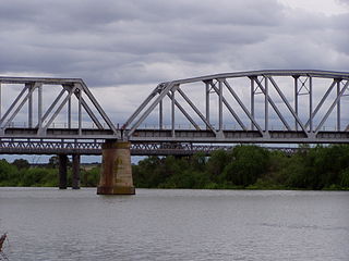 river; thus the early name of
Edwards Crossing. The first bridge over the Murray
River--named by Charles Sturtafter George Murray, Secretary of
State for the Colonies--was constructed between 1873 and 1879.
The town was not officially named Murray Bridge until 1924 (Visitor
Information Centre, 18 Standon St.; t 08 8539 1142). The
town is a pleasant little place, with a classic old river-town
hotel, appropriately enough called the Murray Bridge
Hotel, on Sixth Street. The hotel has broad upper-storey
balcony-verandahs that look out on to the flat river. Also in
town on Mannum Road is St John the Baptist Anglican cathedral,
the oldest church in town (built in 1887) and the smallest
cathedral in Australia. The Murray Bridge itself, is
classified by the National Trust; made of iron, it measures
1980 ft (594m) in length. Until 1925 it carried the rail line
as well, during which time toll gates were used at each
end.
river; thus the early name of
Edwards Crossing. The first bridge over the Murray
River--named by Charles Sturtafter George Murray, Secretary of
State for the Colonies--was constructed between 1873 and 1879.
The town was not officially named Murray Bridge until 1924 (Visitor
Information Centre, 18 Standon St.; t 08 8539 1142). The
town is a pleasant little place, with a classic old river-town
hotel, appropriately enough called the Murray Bridge
Hotel, on Sixth Street. The hotel has broad upper-storey
balcony-verandahs that look out on to the flat river. Also in
town on Mannum Road is St John the Baptist Anglican cathedral,
the oldest church in town (built in 1887) and the smallest
cathedral in Australia. The Murray Bridge itself, is
classified by the National Trust; made of iron, it measures
1980 ft (594m) in length. Until 1925 it carried the rail line
as well, during which time toll gates were used at each
end.
To the north of Murray Bridge 34km on the river is Mannum
(population 2000), a picturesque little town, one of the
oldest on the river. Mannum is recognised as the place where
the Mary Ann, the river's first paddle steamer, was launched
by W.R. Randell in 1853. It was also the place where the first
steam-driven car was built in Australia by David Shearer in
1900. The National Trust operates a museum on the PS Marion, built in
1898, and now at Arnold Park. This boat is also the town's
tourist office, t 08 8569 2733; open daily 09.00-16.00.
Someone needs to write a description of places along the Murray River.
West of Adelaide
Travelling north of Adelaide, Highway 1 veers west
towards Two Wells and continues c 60km to Port Wakefield and
the edge of the Yorke Peninsula, the boot-shaped bit of land
that sits between Gulf St Vincent on the east and Spencer
Gulf on the north. At the same point that Highway 1 heads
west, the Sturt Highway (route 20) heads north to Gawler,
then continues as the Main North Road/Barrier Highway (route
32) another 113km to the interesting mining town of Burra.
At Riverton, only 96km north of Adelaide, the Main North
Road becomes Routge 83 and heads northwest towards Clare,
the centre of the wine-growing Clare Valley.
The best -- and in some cases, the only -- way to explore
all of these regions is to have your own car, or to be part
of a coach tour, which can be arranged through the Adelaide
tourist office.
Burra
This former copper-mining town (population 2000) is only
154km north of Adelaide, in the Bald Hills Range, but
already in the arid landscape that marks the beginning of
the immense South Australian outback. Tourist information,
2 Market Square, t 08 8892 2154.
History
The derivation of the town's name, taken from the nearby Burra
Burra Creek, is the source of some debate: initially thought
to be of Aboriginal origin and meaning 'great', it is now
believed to be of Hindi origin, since many Indian shepherds
were in the region before the discovery of copper here. In
1845, a shepherd named Pickett discovered copper-ore in the
area, and by 1849 smelters operated here, greatly aiding the
economy of the fledgeling colony.
For the first ten years of its existence, the Burra mine was
the largest mine in Australia. For most of its productive
life, the mine was managed by two men: Henry Ayers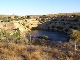 (1821-97), company
secretary and later Premier of South Australia for whom Uluru
was given the name of Ayers Rock; and Henry Roach, chief
captain of the mine who arrived in South Australia from
Cornwall in 1846. The township was divided in two, the present
township of Burra (previously Kooringa) with the wealthier
owners on the south side, and Burra North (formerly Redruth
and Aberdeen) where the miners lived on the other side. In
between was 'no man's land', where the mine's smelter was
situated. Mining copper here yielded more than £5 million of
ore, but was worked out within 32 years. The mine closed in
1877, and many of the miners who had arrived from Cornwall,
Wales and Scotland dispersed; the town became a virtual ghost
town for a while, although some pastoral activity kept it
going as a market town into the 20C. The current residents of
Burra and the surrounding region have been particularly
devoted to the preservation of the town's heritage with an eye
to tourism.
(1821-97), company
secretary and later Premier of South Australia for whom Uluru
was given the name of Ayers Rock; and Henry Roach, chief
captain of the mine who arrived in South Australia from
Cornwall in 1846. The township was divided in two, the present
township of Burra (previously Kooringa) with the wealthier
owners on the south side, and Burra North (formerly Redruth
and Aberdeen) where the miners lived on the other side. In
between was 'no man's land', where the mine's smelter was
situated. Mining copper here yielded more than £5 million of
ore, but was worked out within 32 years. The mine closed in
1877, and many of the miners who had arrived from Cornwall,
Wales and Scotland dispersed; the town became a virtual ghost
town for a while, although some pastoral activity kept it
going as a market town into the 20C. The current residents of
Burra and the surrounding region have been particularly
devoted to the preservation of the town's heritage with an eye
to tourism.
The tourist highlights the Burra Mine Site and Powder
Magazine, off Market Street, an enormous archaeological site
of the mine itself; the miners' dugouts on Blyth Street, a
group of mud shacks along the river where as many as 2000
miners lived rather than pay rent in company housing;
Morphett's Engine-house Museum, also off Market Street,
restored to original condition and displaying beam engines and
the engine-house itself; and the Police Lock-Up and Stables,
on the corner of Ludgvan and Tregony Streets, built in 1847.
The Redruth Gaol, also on Tregony Street, was built in 1856;
after 1894, it served for many years as a girls' reformatory.
The gaol was the location for the filming of Bruce Beresford's
famous film Breaker Morant
(1979), all of which was shot in the area round Burra. On
Bridge Terrace is the Unicorn Brewery Cellars, the cavernous
interior providing cool temperatures for Unicorn Beer, which
was brewed in town from 1873 to 1903.
Other town features include the Bon Accord Mine Complex (t 08 8892 2154; open Mon., Thur.-Sat. 14.00-16.00; admission adults $4.50, concession $3.50, children, $2.50), now a museum and interpretative centre with a viewing platform looking down a mine shaft; at the time of the mine's operation in the 1850s, Burra had a population of 5000 when Adelaide only had 18,000 people. Malowen Lowarth, on Paxton Square, gives an indication of the cottages built for miners between 1849 and 1852; one of the cottages is now a museum of miners' furniture and artefacts. Finally, the Market Square Museum (t 08 8892 2154; open Sat, Sun. and holidays 13.00-15.00 and by arrangement; admission adults $3.50, concession$2.50, children $2.00), on Market Square, re-creates the buildings of the 1870s, including a general store, post office, and family home. It is interesting to explore the region around Burra, for remnants of the 19C industrial landscape in this rather bleak terrain.
Clare Valley
The town of Clare (population 4000), only 136km north of
Adelaide, is a picturesque place nestled in the green and
fertile landscape in the northern Mount Lofty Ranges. The town
as the centre of the Clare Valley vineyards, one of the
lesser-travelled wine-making regions of the state. Wines have
been produced here for nearly 150 years, and today over 28
wineries offer tastings and cellar sales. These include such
well-known names as Leasingham, established in 1893; Sevenhill
Cellars, the first vines of which were planted by Jesuit
priests in 1848 and the cellars still housed in the original
buildings from the 1850s; and Tim Knappstein, established in
1976 on the site of the Clare Brewery (1878), a structure
built of bluestone and with massive timber joints. Tours of
many wineries and maps of the district are available through
Clare's tourist
information office: 8 Spring gully Road, t 08 8842
2131. The Clare Valley Gourmet
Weekend is held annually in May over the Adelaide Cup
long weekend, and highlights Clare wine-makers, presenting a
progressive lunch through the region.
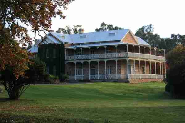 The town of Clare and
the surrounding area have several other architectural and
historic attractions besides wineries. Bungaree Station
(t 08 8842 2677; open daily 10.00-16.00 unless otherwise
booked; admission adults $15.00, children $7.50), 12km north
of town off Main North Road, was established as a sheep
station in 1841 by the Hawker brothers, famous Australian
graziers. George Hawker (1818-95) eventually bought out his
brothers and extended his holdings here to almost 80,000 acres
(32,376 ha). He entered the South Australian House of Assembly
in 1860, retired in 1865 to England, but returned in 1874 and
again became a Member of Parliament until his death. This
property, which in its heyday operated as a self-sufficient
community with shearing complex, workers' cottages, local
council chamber and its own church (St Michael's, built 1864
in Gothic Revival style by E.A. Hamilton), is still owned by
Hawker's descendants. It is still one of Australia's leading
merino sheep studs. Most of these historic buildings have been
preserved as a living museum and bed and breakfast
accommodation.
The town of Clare and
the surrounding area have several other architectural and
historic attractions besides wineries. Bungaree Station
(t 08 8842 2677; open daily 10.00-16.00 unless otherwise
booked; admission adults $15.00, children $7.50), 12km north
of town off Main North Road, was established as a sheep
station in 1841 by the Hawker brothers, famous Australian
graziers. George Hawker (1818-95) eventually bought out his
brothers and extended his holdings here to almost 80,000 acres
(32,376 ha). He entered the South Australian House of Assembly
in 1860, retired in 1865 to England, but returned in 1874 and
again became a Member of Parliament until his death. This
property, which in its heyday operated as a self-sufficient
community with shearing complex, workers' cottages, local
council chamber and its own church (St Michael's, built 1864
in Gothic Revival style by E.A. Hamilton), is still owned by
Hawker's descendants. It is still one of Australia's leading
merino sheep studs. Most of these historic buildings have been
preserved as a living museum and bed and breakfast
accommodation.
The Clare Regional History Group is responsible for preserving and presenting local history. It is situated upstairs in the Town Hall (t 08 8842 4100 ; open Thurs. and Fri. 13.00-16.00). Evidence of Clare's age of prosperity for early Irish immigrants can be seen at Wolta Wolta, a homstead offering accommodation on West Terrace home to four generations of the Hope family and featuring a fine collection of antiques. The house was built by pioneer Irish immigrant John Hope between 1846 and 1870; badly damaged in the 1983 bushfires that swept through this district, it has been carefully restored. The Old Police Station is also on West Terrace; it was Clare's first public building, and demonstrates an interesting vernacular style of architecture. On Old North Road the Clare Library (formerly the Mechanics' Institute) is a lovely example of a rural adaptation of Classical Revival style, erected in 1871 with French windows opening on to small balconies enclosed by iron railings and brackets. The interior staircase has radiating steps. The building is one of several Victorian-era structures along Old North Road and Ness Street.
Yorke Peninsula
From Clare and the Clare Valley, it is c 80km southwest (via Main North Road 26km south, then west on the route towards Balaklava) to Port Wakefield (population 500) at the northeastern edge of Yorke Peninsula. Port Wakefield is also 99km north of Adelaide.Yorke Peninsula is often described as 'that funny, leg-shaped bit of land opposite Adelaide across the Gulf St Vincent'. The peninsula has some 800km of coastline, much of it secluded and unspoiled and only two or three hours from Adelaide itself. With little surface water, the peninsula would not have easily sustained any Aboriginal population; to date, no Aboriginal sites have been found in the region. The area first gained some attention when great copper deposits were discovered in 1859 and 1861 at Kadina and Moonta at the northwestern edge of the peninsula. The 'Copper Triangle' of Kadina, Moonta and Wallaroo soon attracted thousands of Cornish miners, a heritage still nurtured and recognisable in architecture and festivities: in May of odd-numbered years, the 'Triangle' hosts the Kernewek Lowender, said to be the only Cornish festival in the world. By 1923, the copper mines had been worked out, and the area became best known for its wheat and barley, touted as the richest grain yields in Australia.
 Its status as the 'Granary of
Australia' is commemorated in the biennial (odd-numbered) Yorke Peninsula Field
Days, held in Paskeville (19km southeast of Kadina) in
September; this event is the oldest of its kind in Australia,
first held in 1895 and featuring farm machinery and agricultural
demonstrations. It is now a multi-million-dollar event, with
hundreds of exhibitions. The main tourist office is now at
Moonta, 165km northwest of Adelaide, 67km west of Port
Wakefield: Moonta
Visitor Information Office, Railway Station, t 08 8825
1891. The road along the east coast of the peninsula passes
through several small settlements all in sight of the sea;
because of its long isolation before roads were built, this part
of the coast is dotted with long jetties and landing ports where
coastal ships could stop to load grain. These areas now provide
excellent fishing opportunities, as well as spots for diving and
beachcombing.
Its status as the 'Granary of
Australia' is commemorated in the biennial (odd-numbered) Yorke Peninsula Field
Days, held in Paskeville (19km southeast of Kadina) in
September; this event is the oldest of its kind in Australia,
first held in 1895 and featuring farm machinery and agricultural
demonstrations. It is now a multi-million-dollar event, with
hundreds of exhibitions. The main tourist office is now at
Moonta, 165km northwest of Adelaide, 67km west of Port
Wakefield: Moonta
Visitor Information Office, Railway Station, t 08 8825
1891. The road along the east coast of the peninsula passes
through several small settlements all in sight of the sea;
because of its long isolation before roads were built, this part
of the coast is dotted with long jetties and landing ports where
coastal ships could stop to load grain. These areas now provide
excellent fishing opportunities, as well as spots for diving and
beachcombing. The first of these settlements, Ardrossan (population 1100), is still a thriving port. Proclaimed in 1873, the town's pioneers initially lived in dugouts
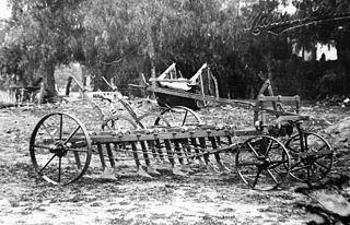 while they attempted to clear the
difficult mallee brush to build houses. These circumstances led
to the invention by an ingenious local of the famous 'stump
jump' plough which greatly eased the farmers' work; the Smith
brothers, Clarence and Richard, developed the machine in the
1870s for world-wide use, and are rightly commemorated at the
local Historic
Museum, on Fifth Street (t 08 8837 3939; open Sun
14.00-16.00; admission adults $5.00, children $2.00). The
area around Ardrossan is also a major source of dolomite in
Australia.
while they attempted to clear the
difficult mallee brush to build houses. These circumstances led
to the invention by an ingenious local of the famous 'stump
jump' plough which greatly eased the farmers' work; the Smith
brothers, Clarence and Richard, developed the machine in the
1870s for world-wide use, and are rightly commemorated at the
local Historic
Museum, on Fifth Street (t 08 8837 3939; open Sun
14.00-16.00; admission adults $5.00, children $2.00). The
area around Ardrossan is also a major source of dolomite in
Australia. The next settlement south is Port Vincent (population 400), a sleepy seaside resort with a backdrop of steep tree-covered cliffs; the calm waters here provide good swimming, and water sports of all kinds are available. 17km further south Stansbury used to be known as Oyster Bay (no oysters are here now), and promotes its waters as a great place for power boating. The village also has a funny little schoolhouse museum in the town's 1870s schoolroom (t 08 8852 4136; open during January).
Another 20km south is Edithburgh (population 450), a popular site for fishermen and especially for underwater divers; a wonderful rock swimming pool stands at the beach and the area reefs are wonderful for viewing fish. In town, many late 19C buildings remain; the Edithburgh District Museum (t 08 8852 6273; open Sat. and Sun. 14.00-16.00; admission adult $3.00, children .50) presents the region's maritime history, and highlights the importance of the salt industry on the peninsula. Just offshore is Troubridge Island, a conservation park accessible by permit only, great for birdwatchers; the island includes an historic lighthouse, along with 5000 penguins, 3000 nesting terns and 10,000 cormorants as well as other seabird species.
The main road now heads inland 15km to Yorketown (population 750), the southern peninsula's main shopping centre, surrounded by salt lakes, which were the source of the region's early salt industry; some of the lakes have an unusual pink tinge. The coast road from here to Innes National Park at the tip of the peninsula goes down to a number of bays, ideal for fishing, and surrounded by craggy cliffs.
Innes National Park, c 75km southwest of Yorketown, occupies the 'big toe' of the peninsula; its visitor's centre is at Stenhouse Bay on the eastern side of the peninsular tip (t 8854 3200). Now encompassing 9100 ha, the park was declared in 1970 in part as an effort to save the rare Great Western Whipbird, which was sighted here, in one of its easternmost locations. Vegetation in the park ranges from cleared land with regenerating mallee scrub to sand dunes and saline lakes. On the western side of the park is a set of high sand-dune barriers leading down to Pondalowie Beach, world renowned for its surfing. Some of the most ancient rocks ever discovered-over two billion years old-can be seen in the granite boulders at Rhino Head and Cape Spencer, at the very southern tip next to Inneston, once a thriving mining centre and now a ghost town managed by the park authorities; during school holidays, the park rangers organise guided activities here for children.
The western coastline of Yorke Peninsula is particularly rugged with crashing waves and jagged rock formations at the southern end. You now travel a bit inland through Minlaton (population 790), birthplace of early aviator Harry Butler, and on to Port Victoria (population 350), c 114km from Innes National Park. This port was at one time an international destination for the great windjammer clippers from the Northern hemisphere that stopped here to load grain. It was consequently the starting point of the great competitive races to see which ship could get the most grain back to England and America most quickly. Such mad shipping traffic, coupled with Spencer Gulf's turbulent
 waters, accounts for the
inordinate number of shipwreck sites in the waters surrounding
the entire peninsula. Port
Victoria's Maritime Museum on Main Street (t 08 8834
2202; open daily, 14.00-16.00; admission adults $6.00,
concession $5.00, children $1.00) documents this era with
displays of the square-rigged sailing ships; at the jetty next
to the museum is a Shipwreck Interpretative Display, as well as
the start of an interesting Geology Trail. Most interesting is
the Wardang Island Heritage Diving Trail, centred around Wardang
Island, about 10km offshore from the port. The island is
surrounded by shipwrecks, eight of which have been located and
are identified by underwater plaques. Divers can also purchase
waterproof booklets from the museum and other local shops. Trips
to the island by groups of divers require permission from the
Goreta Aboriginal Community; for more information call t 08 8836
7205.
waters, accounts for the
inordinate number of shipwreck sites in the waters surrounding
the entire peninsula. Port
Victoria's Maritime Museum on Main Street (t 08 8834
2202; open daily, 14.00-16.00; admission adults $6.00,
concession $5.00, children $1.00) documents this era with
displays of the square-rigged sailing ships; at the jetty next
to the museum is a Shipwreck Interpretative Display, as well as
the start of an interesting Geology Trail. Most interesting is
the Wardang Island Heritage Diving Trail, centred around Wardang
Island, about 10km offshore from the port. The island is
surrounded by shipwrecks, eight of which have been located and
are identified by underwater plaques. Divers can also purchase
waterproof booklets from the museum and other local shops. Trips
to the island by groups of divers require permission from the
Goreta Aboriginal Community; for more information call t 08 8836
7205. Moonta
From Port Victoria, travel north via Maitland (population 1200), the peninsula's inland farming hub, c 56km to Moonta (population 2500), one of the Cornish 'Copper Triangle' towns. Sitting on Moonta Bay and only 163km from Adelaide, the town is a popular seaside resort with pleasant beaches and excellent fishing; the town's name apparently derives from a corruption of the Aboriginal 'Moonterra', or 'place of impenetrable scrub'. Moonta makes much of its mining and its Cornish heritage, as a trip to the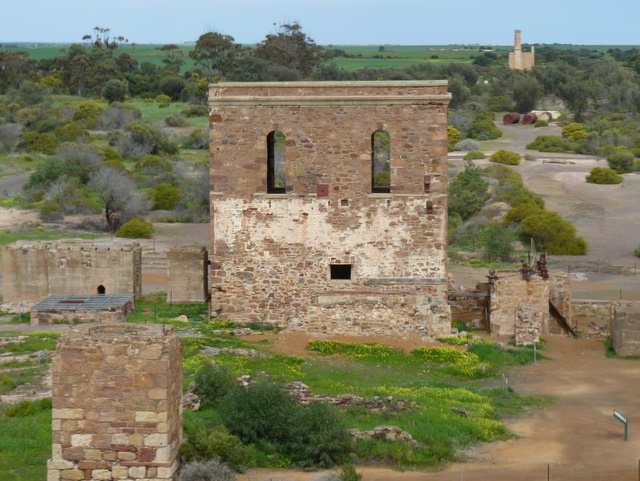 main tourist information office in
the old Railway
Station will attest (t 08 8821 2333). Moonta
Mines Museum on Verran Terrace (t 08 8825 1891; open
daily 13.00-16.00, holidays 11.00-16.00; admission adults $8.00,
children $4.00). A National Trust property, is situated in
the Moonta Mines School building, constructed in 1878. At one
time, the school had more than a thousand students a year. After
it closed in 1968, the building was turned into a tribute to the
mine and the Cornish miners who worked there. The complex also
houses the Moonta History Resource Centre, a collection of rare
documents and microfilm concerning local history; it is open to
the public every afternoon except Monday. The Trust also runs as
part of the museum the Moonta
Mines Railway, a narrow-gauge steam train that runs
(departs Wed. 14.00, Sat. and Sun. 13.00, 1400, and 15.00,
holidays 10.30, 11.30, 13.30 and 14.00, tikets adults $8.00 and
children $4.00) through display yards of mining equipment and
ore trucks, and even passes through a tunnel under a copper
skimp heap. The train departs hourly on weekends and holidays
from the railway station next to the museum. The National Trust
also maintains a Miner's
Cottage and Garden on Vercoe Street (t 08 8825 1988; open
Wed., weekends, and holidays 13.30-16.00, holidays
11.00-16.00; admission adults $4.00, children $2.00), an
original wattle-and-daub and mudbrick Cornish cottage built in
the 1870s. The garden and picket fence have been re-created, the
furnishings are in 'period style'. A combined ticket will
allow admission to these three facilities. The town also
has an enormous Methodist Church on Milne Street, built in 1865;
it can seat 1250, is noted for its beautiful cedar fittings and
stained glass, and has a 600-pipe organ.
main tourist information office in
the old Railway
Station will attest (t 08 8821 2333). Moonta
Mines Museum on Verran Terrace (t 08 8825 1891; open
daily 13.00-16.00, holidays 11.00-16.00; admission adults $8.00,
children $4.00). A National Trust property, is situated in
the Moonta Mines School building, constructed in 1878. At one
time, the school had more than a thousand students a year. After
it closed in 1968, the building was turned into a tribute to the
mine and the Cornish miners who worked there. The complex also
houses the Moonta History Resource Centre, a collection of rare
documents and microfilm concerning local history; it is open to
the public every afternoon except Monday. The Trust also runs as
part of the museum the Moonta
Mines Railway, a narrow-gauge steam train that runs
(departs Wed. 14.00, Sat. and Sun. 13.00, 1400, and 15.00,
holidays 10.30, 11.30, 13.30 and 14.00, tikets adults $8.00 and
children $4.00) through display yards of mining equipment and
ore trucks, and even passes through a tunnel under a copper
skimp heap. The train departs hourly on weekends and holidays
from the railway station next to the museum. The National Trust
also maintains a Miner's
Cottage and Garden on Vercoe Street (t 08 8825 1988; open
Wed., weekends, and holidays 13.30-16.00, holidays
11.00-16.00; admission adults $4.00, children $2.00), an
original wattle-and-daub and mudbrick Cornish cottage built in
the 1870s. The garden and picket fence have been re-created, the
furnishings are in 'period style'. A combined ticket will
allow admission to these three facilities. The town also
has an enormous Methodist Church on Milne Street, built in 1865;
it can seat 1250, is noted for its beautiful cedar fittings and
stained glass, and has a 600-pipe organ.The Moonta Mines State Heritage Area, on Arthurton Road 2km southeast of town, is a fascinating glimpse at the remains of the mining industry and its altered landscape.
Kadina
Kadina (population 4000) is the largest town on Yorke Peninsula and its commercial centre. Its citizens actively preserve the town's Cornish architecture, and several heritage trails are worth exploring; guides are available from the information centre in Moonta and from some local shops. Matta House (0439 399 735; open Mon.-Fri. 9.00-17.00, weekends and holidays 10.00-15.30) on Kadina-Moonta Road is now a complex of buildings (Matta House was built in 1863 for the manager of the Matta Matta copper mine at Wallaroo) that explore all aspects of the region's history. Photographic displays document Kadina's history, emphasising mining and Cornish culture, while the grounds now house one of Australia's most significant collections of dry land farming equipment; Matta House also includes a large museum about printing and printing machines in South Australia. Access to Matta House includes access to the Farm Shed Museum.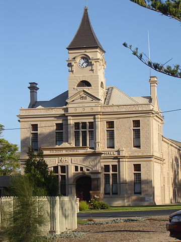 The last of the 'Copper Triangle'
towns is Wallaroo (population 2480), 9km west of Kadina and an
important deep-water port on Wallaroo Bay. The origins of the
town's name are convoluted: from an Aboriginal word 'wadlu
waru', supposedly meaning 'wallaby's urine' (what this would
have to do with the town's location is entirely unclear), the
squatters of the region came up with Wall Waroo, which was
eventually shortened to Wallaroo when the word was stencilled
onto wool bales for shipment. During the mining boom, Wallaroo
was the location of a smelter, with ore that yielded an amazing
copper ratio of 30 per cent. Once the copper was gone, the
port's deepwater jetty and bulk-loading capabilities caused it
to remain an important shipping and export centre. Now rock
phosphate processing is a major industry. The beaches around the
bay are calm and pleasant, and the town boasts of its excellent
fishing. The Heritage
and Nautical Museum on Jetty Road (t 08 8823 3015;
open daily 10.00-16.00) presents a worthwhile exhibition of the
region's history, with emphasis on its status as one of the
state's busiest ports.
The last of the 'Copper Triangle'
towns is Wallaroo (population 2480), 9km west of Kadina and an
important deep-water port on Wallaroo Bay. The origins of the
town's name are convoluted: from an Aboriginal word 'wadlu
waru', supposedly meaning 'wallaby's urine' (what this would
have to do with the town's location is entirely unclear), the
squatters of the region came up with Wall Waroo, which was
eventually shortened to Wallaroo when the word was stencilled
onto wool bales for shipment. During the mining boom, Wallaroo
was the location of a smelter, with ore that yielded an amazing
copper ratio of 30 per cent. Once the copper was gone, the
port's deepwater jetty and bulk-loading capabilities caused it
to remain an important shipping and export centre. Now rock
phosphate processing is a major industry. The beaches around the
bay are calm and pleasant, and the town boasts of its excellent
fishing. The Heritage
and Nautical Museum on Jetty Road (t 08 8823 3015;
open daily 10.00-16.00) presents a worthwhile exhibition of the
region's history, with emphasis on its status as one of the
state's busiest ports.Towards Western Australia
The highways north and west from Adelaide lead to Western Australia via the Eyre Highway (route 1) or to the Northern Territory via the Stuart Highway (route 87). The highways to the north and east lead to New South Wales via the Barrier Highway (route 32) or to Victoria via the Sturt Highway (route 20) through Renmark, the Dukes Highway (route 8) or the Princes Highway (route 1) along the coast. The great transcontinental train, the Indian Pacific, also traverses the Nullarbor, completing its four-day journey from Sydney through Adelaide to Perth. The Eyre Highway proceeds from Adelaide across the Nullarbor to Western Australia. Travelling north from Adelaide round Spencer Gulf, the first towns of note are Port Pirie, Melrose, and Port Augusta. The former was established in 1845 as an agricultural centre. Its industrial functions began at the turn of the century when Broken Hill Associated Smelters began treating silver, lead and zinc here for export.Melrose has a good heritage museum, open 13.00-16.00 and by appointment (t. 08 8666 2141).
Port Augusta
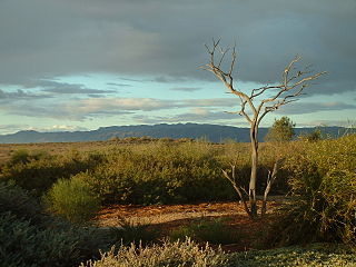 Port Augusta (population 15,000)
itself is an industrial town and junction for the Ghan (north to
Alice Springs) and the Indian-Pacific railways
(trans-continental to Perth). It is the major commercial centre
for the far north as well as the most northerly port in the
state. Largely built in the 1880s, the town continues as a
supply centre for the outback sheep stations to the north along
the Ghan. The waterworks building was originally a troopers'
barracks (1860 to 1882); the Town Hall (1866 by Black and
Hughes) is a two-storey Victorian Revival building; on the town
square are a curiously ornamented cast- iron drinking fountain
and a handsome rotunda. The Australian
Arid
Lands Botanic Garden (t 08 8641 9118 ; open daily from
7.30 until dusk) is at the end of McSporin Crescent; it focuses
on the fragile ecology of South Australia's northern regions.
From the adjacent Red Cliff lookout, the Gulf and Flinders Range
can be seen. The railway workshops offer interesting guided
tours on Tuesdays. Tourist information: Wadlata Outback Centre,
Flinders Terrace, t 08 8641 9193. The Wadlata Centre serves
as an interpretative centre about Outback life.
Port Augusta (population 15,000)
itself is an industrial town and junction for the Ghan (north to
Alice Springs) and the Indian-Pacific railways
(trans-continental to Perth). It is the major commercial centre
for the far north as well as the most northerly port in the
state. Largely built in the 1880s, the town continues as a
supply centre for the outback sheep stations to the north along
the Ghan. The waterworks building was originally a troopers'
barracks (1860 to 1882); the Town Hall (1866 by Black and
Hughes) is a two-storey Victorian Revival building; on the town
square are a curiously ornamented cast- iron drinking fountain
and a handsome rotunda. The Australian
Arid
Lands Botanic Garden (t 08 8641 9118 ; open daily from
7.30 until dusk) is at the end of McSporin Crescent; it focuses
on the fragile ecology of South Australia's northern regions.
From the adjacent Red Cliff lookout, the Gulf and Flinders Range
can be seen. The railway workshops offer interesting guided
tours on Tuesdays. Tourist information: Wadlata Outback Centre,
Flinders Terrace, t 08 8641 9193. The Wadlata Centre serves
as an interpretative centre about Outback life. The Eyre Peninsula
The Eyre Peninsula can either be crossed via the Eyre Highway to Ceduna or circumnavigated via the Lincoln and then the Flinders Highway. On its east coast a number of small tourist and fishing villages below Whyalla, the industrial hub of the region, have a natural appeal. Among them Cowell is noted for jade, including the rare black jade, and Tumby Bay (population 1000) for fishing among the off-shore islands. The beaches along the Eyre Peninsula on Spencer Gulf are quite fine, with white sand, excellent fishing, and gentle surf.Port Lincoln (population 11,500) at the tip of the peninsula sits on a crystalline Boston Bay, home of a tuna fishing fleet. It was at one time considered as a site for South Australia's capital city. Tourist information: t 1300 788 378. Port Lincoln holds South Australia's oldest festival, and the only Australian festival dedicated to fish, the Tunarama Festival, held annually over Australia Day weekend. It includes a variety of processions and concerts and a tuna-tossing contest.
Situated 20km south of Port Lincoln is Lincoln National Park (t 08 8688 3111), 17,000 ha along the headland of the southeast tip of Eyre Peninsula. The park features cliffs and sheltered beaches and encompasses a number of small islands off the coast. With an average rainfall of 55mm, the area offers a considerable variety of habitats and
 vegetation types and
supports a number of migratory sea birds along the coast,
including the Wandering Albatross, the White-Breasted Sea Eagle
and the Osprey. The mallee scrub regions of the park are the
eastern limit of some western species, including the Port
Lincoln (Ringneck) Parrot (Barnardius zonarius), Western Yellow
Robin, and the Western Whip Bird. At Stamford Hill on the
northern end of the park and overlooking Spencer Gulf, is the
Flinders Monument, an obelisk erected in 1844 in honour of that
inveterate explorer Matthew Flinders; that it was erected by
Flinders' nephew and Governor of Tasmania Sir John Franklin adds
to its historic significance as one of the earliest
commemorative monuments in the country. Also in the park is
Memory Cove, commemorating one of the few places in South
Australia where Flinders came ashore during his circumnavigation
of the continent. The Flinders Tablet at the cove is in honour
of the sailors on Flinders' voyage who drowned here when their
boat capsized. Thistle Island off the coast at this point
further commemorates one of these sailors, Master John Thistle,
who had also accompanied Flinders and Bass on their 1798
exploration of the Bass Strait. Understandably, Flinders
christened this point Cape Catastrophe.
vegetation types and
supports a number of migratory sea birds along the coast,
including the Wandering Albatross, the White-Breasted Sea Eagle
and the Osprey. The mallee scrub regions of the park are the
eastern limit of some western species, including the Port
Lincoln (Ringneck) Parrot (Barnardius zonarius), Western Yellow
Robin, and the Western Whip Bird. At Stamford Hill on the
northern end of the park and overlooking Spencer Gulf, is the
Flinders Monument, an obelisk erected in 1844 in honour of that
inveterate explorer Matthew Flinders; that it was erected by
Flinders' nephew and Governor of Tasmania Sir John Franklin adds
to its historic significance as one of the earliest
commemorative monuments in the country. Also in the park is
Memory Cove, commemorating one of the few places in South
Australia where Flinders came ashore during his circumnavigation
of the continent. The Flinders Tablet at the cove is in honour
of the sailors on Flinders' voyage who drowned here when their
boat capsized. Thistle Island off the coast at this point
further commemorates one of these sailors, Master John Thistle,
who had also accompanied Flinders and Bass on their 1798
exploration of the Bass Strait. Understandably, Flinders
christened this point Cape Catastrophe.At the southernmost tip of Eyre Peninsula, 32km south of Port Lincoln, is an area locally referred to as Whalers Way, site of some of the most dramatic coastal scenery in Australia. The area around Sleaford Bay is filled with cliffs, caves, blowholes and beaches with yellow sand. Cape Carnot features a lookout, with one of the oldest rocks found in the state, estimated to be more than 200 million years old. Information about this tourist route is available from the Port Lincoln tourist office.
To the northwest of Port Lincoln c 50km is Coffin Bay, a beautiful village named by Flinders in honour of his friend Sir Isaac Coffin. The area cultivates Australia's best oysters and scallops, and provides superb fishing. Coffin Bay National Park (t 08 8688 3111) surrounds the small settlement, and includes several scenic drives, some accessible only by four-wheel drive. Almonta Beach, to the east of Flinders-named Point Avoid, is one of Australia's best surfing beaches. The park's wildlife includes Coffin Bay brumbies, free-ranging horses.
Nullarbor Plain's caves
The Nullarbor's caves were formed by surface drainage through limestone deposited during the Tertiary Period. Throughout this period the plain was covered by a shallow sea extending over 250km inland from the present coast. The limestone deposits are the remains of minute marine organisms and have been found to be 300m deep in places. Mechanical erosion rather than the chemical reactions of calcium carbonate and carbon dioxide carved caverns and watercourses. This would have occurred principally at the end of the Tertiary era, for it was during the Pliocene era that this part of Australia last had considerable rainfall.
The west coast of the Eyre Peninsula is unprotected and has spectacular coastal scenery and rugged cliffs to Streaky Bay, so named by Flinders for the streaks of seaweed in the bay. This is a great spot for beaches and fishing. Crossing the peninsula to the north, the predominant plant species are scrub eucalypt and acacia, the latter becoming dominant between Port Augusta and Kimba.
Coober Pedy
If 'godforsaken' and 'infernal' were meant to be applied to any place on earth, Coober Pedy (population 2500) is it. Tourist information centre: District Council Offices, Hutchison Street. The McCaffertys/Greyhound bus passes through on the Adelaide-Alice Springs route.On the Stuart Highway from Port Augusta in the south it is 540km through extremely harsh terrain traversing the Woomera Prohibited Area, site in the 1950s of British atomic bomb testing sites; it is 937km northwest of Adelaide. The town's sole purpose for being is opal-mining, and the landscape around the town is dotted with thousands of deserted mine shafts (the area is indeed one of the largest opal-producing centres in the world, Australia providing 95 per cent of the world's supply of the gem). The name of
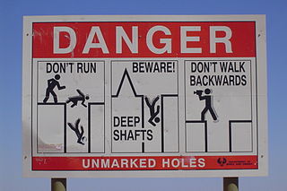 the settlement derives from an
Aboriginal (the Arabana group) term meaning 'white fellows in a
hole', referring, of course, to Coober Pedy's one claim to fame,
that the extreme temperatures found here compelled them to build
houses underground. (These subterranean habitations were also
the result of the fact that the surrounding countryside provides
no timber for any kind of construction.) Indeed, summer
temperatures regularly climb to 50º C (over 130º F) and night
temperatures can be very cold. Water is the area's most precious
commodity, with reticulated water provided from a bore 23km
north of town. This overwhelmingly harsh environment provided
the backdrop for the films Mad Max III (1985) and Wim Wenders's
Until the End of the World (1991). In his novel The Fire in the
Stone (1973), Colin Thiele describes Coober Pedy's appearance: A
flat, bare landscape it was for the most part, with undulations
here and there and flat-topped hills and breakaways and
wind-swept plains. An old land, eroded and wrinkled, worn down
over endless ages...And in the sides of the slopes, cut into
very knoll and knob, were doorways and entrances and burrows as
if the whole place was inhabited by five-foot-high rabbits
walking about on their hind legs. Unless you are really fond of
opals-you can find interesting ones to purchase in town-or have
an overwhelming desire to admire eccentric underground
dwellings, there is very little reason to travel here. The town
is volatile, filled with 'colourful' characters who can border
on the desperate and violent, and the landscape is risky to walk
through, with mine shafts a constant danger. One can experience
the great Australian Outback, and vast expanses of desert
scenery, in better places, too.
the settlement derives from an
Aboriginal (the Arabana group) term meaning 'white fellows in a
hole', referring, of course, to Coober Pedy's one claim to fame,
that the extreme temperatures found here compelled them to build
houses underground. (These subterranean habitations were also
the result of the fact that the surrounding countryside provides
no timber for any kind of construction.) Indeed, summer
temperatures regularly climb to 50º C (over 130º F) and night
temperatures can be very cold. Water is the area's most precious
commodity, with reticulated water provided from a bore 23km
north of town. This overwhelmingly harsh environment provided
the backdrop for the films Mad Max III (1985) and Wim Wenders's
Until the End of the World (1991). In his novel The Fire in the
Stone (1973), Colin Thiele describes Coober Pedy's appearance: A
flat, bare landscape it was for the most part, with undulations
here and there and flat-topped hills and breakaways and
wind-swept plains. An old land, eroded and wrinkled, worn down
over endless ages...And in the sides of the slopes, cut into
very knoll and knob, were doorways and entrances and burrows as
if the whole place was inhabited by five-foot-high rabbits
walking about on their hind legs. Unless you are really fond of
opals-you can find interesting ones to purchase in town-or have
an overwhelming desire to admire eccentric underground
dwellings, there is very little reason to travel here. The town
is volatile, filled with 'colourful' characters who can border
on the desperate and violent, and the landscape is risky to walk
through, with mine shafts a constant danger. One can experience
the great Australian Outback, and vast expanses of desert
scenery, in better places, too. Nullarbor
Beyond Kimba, the vegetation becomes increasingly scrubby, and the true outback begins. From Kimba, it is 311km west along the Eyre Highway to Ceduna, the last major settlement on the eastern edge of the Nullarbor.Ceduna (population 3650), which derives its name from an Aboriginal term for 'resting place', sits on Murat Bay, named by French expolorer Ncholas Baudin in 1802. Denial Bay, on the western side of the inlet, received its name from Matthew Flinders, who was disappointed that this point offered no waterway into the interior. If you follow Jonathan Swift's maps in his Gulliver's Travels (1726), the Lilliputian should have lived on St Peter Island, offshore from Ceduna. This island is now part of the Nuyts Archipelago Conservation Park. Peter Nuyts sighted these islands in 1627 while exploring aboard the Dutch ship the Gulden Seepard. Nuyts' reports of this voyage no doubt provided Swift with his geographical information. Today, Ceduna is a favoured spot for whale watching and home of the Big Oyster, symbol of the area's thriving industry. All kinds of whale spotting cruises can be arranged through Ceduna's tourist information office: 58 Poynton Street, t 08 8625 3407. The Ceduna Arts and Cultural Centre, Tjutjuna Arts (t 08 8625 2487), sells aboriginal art and artifacts from the region.
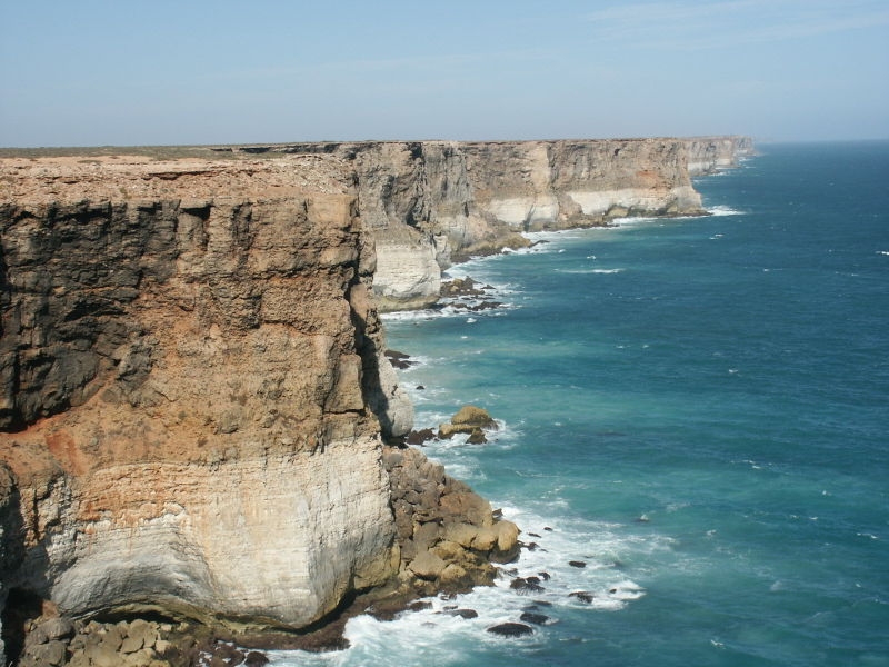 |
The cliffs of the Great Australian Bight are near the road about 350km west of Ceduna in the Nullarbor Regional Reserve (t 08 8625 3123). Here and at Eucla (on the border with Western Australia) are spectacular views of the storeys-deep abrupt drop from the limestone plains to the Southern Ocean. |
This section of the Nullarbor, all 495km of it, crosses Yalata Aboriginal land. The extent and austerity of the Nullarbor is difficult to describe. The distance from Ceduna to Norseman (at the end of the Eyre Highway in Western Australia) is 1207km. The towns between have a combined population of less than 100--Eucla (30), Mundabrilla (12), Madura (under 20), Cocklebiddy (12), Caiguna (10) and Balladonia (12). Beyond the view of the Bight and a meditative calm caused by driving across such an incredible expanse of arid bushland, the purpose of the journey is to stop for refreshment and a cordial chat at the roadhouses. The cars and their occupants travelling in the same direction become quite familiar.
Beyond Balladonia (towards the end of the Eyre Highway in Western Australia) a series of sand ridges mark the change in geology from the current era to some of the oldest Archaean and Proterozoic material on the continent's Precambrian shield. The soil worsens here, becoming intermittently saline and calcareous. Calcareous soils have high levels of calcium carbonate which reduce the availability of what nutrients may be present. In fact, except for some patches east of Perth around Northam and Narrogin and on the far southwestern tip of the state, the soils of this area are remarkably poor. Despite this, as water becomes more prevalent, the eucalypt and acacia species re-emerge between Balladonia and Norseman, the acacia becoming increasingly rich to the south and west.
Department Environment and Energy National Heritage List
National Parks South Australia
Adelaide Hills history info
SA Tourist Commission
National Trust
Explore Australia
Visits to vineyards
Architects of South Australia
800px-Nullabor_Plain_With_Trees.jpg -- Tasmdevi
800px-TooleybucPiangilBridge2 -- Matilda
225px-Edward_John_Eyre -- from www.archive.org
adelaide-city-skyline -- Beneaththelandslide
800px-OIC_victoria_square_N_from_grote -- Orderinchaos
St Francis Xavier's Cathedral-- JohnArmagh
Pilgrim Uniting Church -- Tim Lubcke, used with permission
Adelaide Central Market -- WikiAustralia
800px-Flinders_Ranges_-_near_Rawnsley's_Bluff.jpg -- Peripitus
Eward Gibbon Wakefield -- National Library of Australia
Martha Berkeley's North Terrace 1839 -- Art Gallery of South Australia
Departure of Captain Sturt by S.T. Gill -- State Library of South Australia, B 15276/54
Adelaide Festival Centre across River Torrens -- Unclespitfire
Tattersalls --
Princes Berkeley Hotel --
360px-Rundle_mall,_adelaide.jpg -- Adam.J.W.C.
Jam Factory --
800px-Adelaide_gaol_cell_block -- Peripitus
800px-Parliament_House_Adelaide_and_Adelaide_Railway_Station.jpg -- Mike Switzerland
Parliament_House,_Adelaide.jpg -- Alan Levine
800px-Festival_Center -- Alan Levine
800px-Adelaide_Oval_NE_Dec2010 -- http://imageshack.us/g/29/img0786rc.jpg/
800px-Migration_Museum,_Adelaide_-_former_Destitute_Asylum_building.jpg -- Bahudhara
800px-OIC_adelaide_sa_museum.jpg -- Orderinchaos
800px-AGSAfront.jpg -- K Lindstrom
Thomas%20Elder%20SLSA%20B%2034518.jpg -- SLSA B 2034518
Footbridge over the River Torrens -- Daryl_SA
800px-Ayers_House_-_North_Terrace_-_Adelaide.jpg -- Adam.J.W.C.
800px-Adelaide-BotanicHotel-35-Aug08.jpg -- Pdfpdf
800px-Adelaide_Botanic_Gardens_Bicentennial_conservatory.jpg -- Peripitus
800px-Palm_house,_Adelaide_Botanic_Gardens_-_oblique.jpg -- Peripitus
St_Peters_Cathedral.JPG -- Rocky88
800px-Friends_Meeting_House,_Adelaide.JPG -- Bahudhara
North Adelaide Railway Station
-- Pdfpdf
North_Adelaide_Hotel.jpg -- Kris Nielsen & Brian Fleming Adelaide South Australia
North_Adelaide_Institute.jpg -- Kris Nielsen & Brian Fleming Adelaide South Australia
North_Adelaide_Post_Office.jpg -- Kris Nielsen & Brian Fleming Adelaide South Australia
Reshabite_Hall.jpg -- Kris Nielsen & Brian Fleming Adelaide South Australia
North_Adelaide_Streetscape.jpg -- Kris Nielsen & Brian Fleming Adelaide South Australia
800px-Adelaide (Albert Bridge) -- Phil Whitehouse
Grange House - JERRYE KLOTZ MD
Port Adelaide - George French Angas SA State Library
800px-Fort_Glanville_-_quad.jpg - Peripitus
Largs Pier Hotel - Port Adelaide Historical Society
Beaumont_house.jpg
800px-Carrick_Hill_-_front_view.jpg - Peripitus
800px-Urrbrae_House.jpg - Bilby
Barossa map I think - http://www.barossa.com/visit/attractions/experiences/cycling-tours-and-trails/jack-bobridge-track
ADH_hahndorf_35_inn_1 Orderinchaos
Torrens_gorge_wier_at_dusk Peripitus
http://www.genxywines.com/regions/sa_regions/regions_sa.html
Barossa land use https://ag.purdue.edu/agcomm/PublishingImages/TopStory/rural.jpg
Gawler Telegraph Station - Sardaka
Kies Winery Celler Door - User:Orderinchaos
View from Bethany - Matthew Summerton
Bethany Luthern Church
Tanunda Museum - Sardaka
Nuriootpa Memorial Hall - Mattinbgn
Yalumba Winery - Stephen Michael Barnett
Victor Harbor horse drawing tram - Ian W. Fieggen
Seals at Seal Bay Kangaroo Island - Didier B (Sam67fr)
Tantanoola Cave - Kevin
Beachport Pier - Peterdownunder
Murrary River Bridge - Maggas
Burra mine pit - Geomartin
Mount Gambier Court House - Mattinbgn
Bungaree Station - http://www.clarevalley.com.au/learn/local-directory/bungaree_station/
Kids in cab of aggie machine - http://www.ypfielddays.com.au/html/2015_general_event_photos_0.html
Stump Jump Plough - State Library of South Australia
Port Victoria Maritime Museum - Aclister
Moonta copper works remains - Fairv8
Wallaroo Town Hall - Frances76
Port Augusta Arid Gardens - Peterdownunder
White Breasted Sea Eagle - Manojiritty
Coober Pedy warning sign - Guji~commonswiki
800px-Great_Australian_Bight_Marine_Park.jpg -- Nachoman-au