 |
 |
|
|
Melbourne in Victoria
 (click image to
enlarge)
(click image to
enlarge)
Victoria is on the southeast corner of the continent,
with Melbourne as its capital and around which most of the
population of the state is congregated. Its ports are within
Port Phillip Bay at Port Melbourne and Geelong. The highways
radiate from Melbourne. Highway 1, Princes Highway, follows
the coastline. The Western and Dukes Highway, route no. 8,
is a more direct route east to Adelaide. The Calder, route
no. 79, proceeds northwest to Mildura where it meets the
Sturt Highway. The Newell, no. 39, runs directly north,
across New South Wales to Queensland. The Hume, no. 31, is
the most direct route to Sydney or Canberra.
The physical features most frequently visited by tourists
are the mountainous regions, the Great Ocean Road, the
mining towns of Ballarat and Bendigo and the southwest
coastal areas. The mountain ranges include the Grampians
(variously coloured sandstone and shale with grey granite
intrusions noted for their wildflowers in spring lying in
the state's central west), the Dandenongs (fairly moist with
fertile volcanic soil a mere hour northwest of Melbourne),
and the Victorian Alps (the southern extension of the rugged
alpine granite formations of the Kosciuszko Uplift 250km
northwest of Melbourne).
Geologically, Victoria is at the southern end of the Tasman
Geosyncline, a Palaeozoic formation. The surface of the
western portion of the state is sedimentary and metamorphic
rocks of the Cainozoic era. This area is a corridor of
fairly flat land extending from the central north near Wagga
Wagga in New South Wales to the west and south to beyond the
South Australian border. Part of the Darling River basin,
this border area is marked by the Mallee region to the north
and the Little Desert, an area which gives way to Palaeozoic
granites in the Grampian Mountains.
Igneous intrusions are abundant on the volcanic plains west
and northwest of Geelong, this activity being the basis of
the mining deposits at Ballarat, Bendigo and elsewhere.
Similar intrusions are revealed by erosion in the high
relief hills and mountains in the Australian Alps in the
west of the state. The Murray, Murrumbidgee and Lachlan
Rivers form the Murray floodplain to the interior of these
highlands.
The natural vegetation is predominantly eucalypt forest,
becoming quite tall and interspersed with ferns in the
Dandenong Mountains to the east of Melbourne. The soil in
Victoria is routinely fertile, mostly supporting sheep and
cattle with some grains planted in the north and west and
vineyards around Rutherglen. Irrigation on the sedimentary
plains allows some vegetable and fruit production,
particularly to Melbourne's southwest.
Climatically moderate, the winters (May through September)
receive relatively more rain than the summers, although the
Dandenongs and the southeast coast receive relatively
uniform precipitation during the year. The summer
temperatures are rarely uncomfortably hot (average maximum
26ºC, minimum 14ºC), and heatwaves infrequently last longer
than a few days. Winter is cool (in Melbourne, average
minimum 7ºC), rather than cold, though snow falls frequently
in the mountain ski fields of the northern section of the
state. Melbourne itself is famous for its fluctuations in
climate, with rain and sunshine intermingling throughout
many days.
Melbourne is situated on Port Phillip Bay, a large inlet
bounded by the Mornington and Bellarine Peninsulas. The
prevailing southwesterlies have created sandy eastern
beaches. Speaking of Port Phillip Bay's narrow entrance,
known as the Rip, the Australian Encyclopedia
mentions 'in some conditions of weather and tide vessels
encounter very heavy seas when negotiating the Rip, which
has cleared many dining salons in its day'. The tidal flow
through the Rip can attain speeds up to eight knots. Four
natural channels cut through shoals and sandbars within the
bay.
The coastline west of Melbourne faces Bass Strait, and
includes some of the most rugged and tempestuous waters of
the entire Australian continent. The Great Ocean Road
(Princes Highway west of Melbourne) hugs this coastline,
with its many enormous rock formations near the coast giving
evidence of the immense power of the waves to erode the
sandstone cliffs. Although a small state by Australian
standards, Victoria encompasses great geographical diversity
and spectacular scenery. Victorians are rightfully proud of
their 34 national parks and 40 state parks, all of them
carefully tended and enjoyable for the visitor.
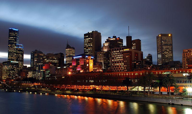
Geographically, Melbourne (population 4,541,000) has
nothing to compete with Sydney's harbour, the Yarra River
being a muddy stream that supposedly runs 'upside down',
with the mud on top. The flatness of the town and
unpredictable weather lead to acrimonious comparisons with
its more glamorous northern neighbour. The Melburnian psyche
has been described by many writers as introverted, more
political and community-based (Melbourne has traditionally
been the centre of unionism and left-wing politics) than
Sydney's individualistic hedonism.
Despite such generalised and oft-stated opinions, the
visitor to Melbourne can easily be charmed by the cultivated
atmosphere of the place, an interesting blend of the
patrician and the multicultural, in many ways more
comfortable and intriguing than Sydney's flashy façade; it
has often been voted one of the world's 'most livable
cities' in international polls, and it is certainly the most
'European' city in Australia. As Melbourne has been a centre
for immigration since the 1850s, its ethnic diversity is
significant and deeply entrenched. It is said to have the
largest Greek community in the world outside Greece, and its
Italian, Lebanese, Turkish and Maltese populations are of
long standing; a thriving Chinatown has existed here since
last century. Between 1947 and 1968, some 800,000
non-British European immigrants came to Australia, a large
percentage of them settling in Melbourne. In the 1970s,
Asian immigration expanded the multicultural communities
even further. Consequently, restaurants of all types present
superb dining opportunities, and ethnic festivals abound.
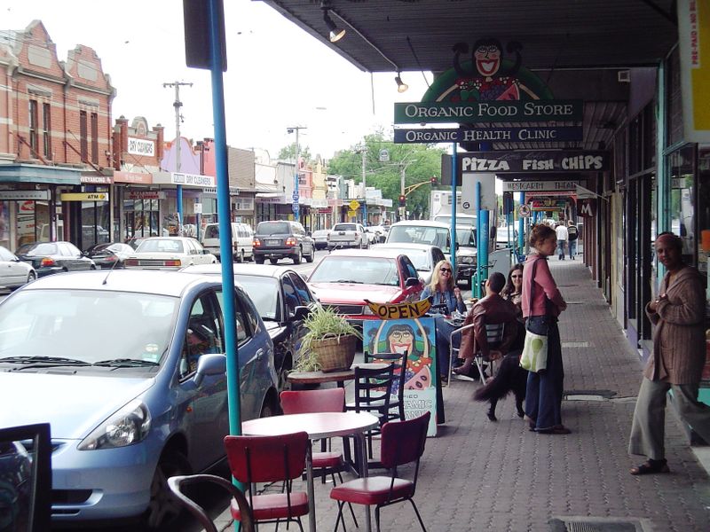
Cafe culture is an essential part of the city's street life;
Carlton's Italian residents of the 1950s can make a valid
claim of having introduced Australia to the  concept of espresso
coffee at small tables accompanied by music and
art-journals, as well as ethnic eating experiences. The city
also has some of the country's best bookshops, and art
galleries present both the well established and the
contemporary. Of most significance is Melbourne's place in
the country's theatrical life, from grand and revered venues
for the established repertoire to its long tradition of
alternative and street theatre; it is the host of the annual
Comedy Festival, as well as numerous theatrical events,
comedy television and outdoor performances. Melbourne is
undisputedly the fashion capital of Australia, with
prominent designers, elegant boutiques and the best shopping
opportunities in the country. The city also boasts a
plethora of carefully considered parksEaglemont' and green
areas, which provide pleasant places to cycle, walk and
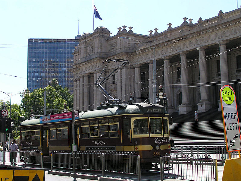
relax. Unlike Sydney, which dismantled its tramways in the
1950s, Melbourne's green and yellow trams are not only the
most pleasant way to get around the city, but add
considerably to Melbourne's character.
concept of espresso
coffee at small tables accompanied by music and
art-journals, as well as ethnic eating experiences. The city
also has some of the country's best bookshops, and art
galleries present both the well established and the
contemporary. Of most significance is Melbourne's place in
the country's theatrical life, from grand and revered venues
for the established repertoire to its long tradition of
alternative and street theatre; it is the host of the annual
Comedy Festival, as well as numerous theatrical events,
comedy television and outdoor performances. Melbourne is
undisputedly the fashion capital of Australia, with
prominent designers, elegant boutiques and the best shopping
opportunities in the country. The city also boasts a
plethora of carefully considered parksEaglemont' and green
areas, which provide pleasant places to cycle, walk and
relax. Unlike Sydney, which dismantled its tramways in the
1950s, Melbourne's green and yellow trams are not only the
most pleasant way to get around the city, but add
considerably to Melbourne's character.
Despite Melbourne's reputation for staidness, the city does
nurture some alternative or subversive strands, both of the
intellectual street theatre and New Age sort, and, more
explicitly, the Gothic and skinhead sort (the controversial
film Romper Stomper took place in Melbourne). The
city is also the location of Moonee Ponds, fabled home of
Edna Everage, comedian Barry Humphries' alter ego, and a
place that has come to epitomise the sprawling sterile
suburbs of 1950s Melbourne.
In Road to Gundagai (1965), author Graham McInnes
commented on Melbourne's suburban sprawl, 'these immense
deserts of brick and terracotta, or wood and galvanised iron
induce a sense of overpowering dullness, a stupefying
sameness, a worthy, plodding, pedestrian, middle-class,
low-church conformity'. Today this suburEaglemont'ban
phenomenon does not seem so unusual, and Melbourne proper
can still be an interesting place to visit.
The area around Port Phillip had been surveyed as early
as 1803 during Flinders' circumnavigation of the continent
(see p 58). In that same year, Lieutenant David Collins,
Judge-Advocate with the First Fleet, was sent from Sydney to
found a settlement here, but having attempted to settle on
the eastern side of the bay, at present-day Sorrento, found
the area unsuitable and continued on to Tasmania. The site
for the settlement of today's Melbourne was not chosen until
the 1830s, when two groups of explorers out of Launceston
embarked for that purpose. One group was headed by John
Pascoe Fawkner in 1835. The other group, headed by John
Batman, was the first to find an appropriate location,
acquiring some 600,000 acres (240,000 ha) through a 'treaty'
with the indigenous Aborigines in exchange for blankets and
tomahawks. From 1836 to 1850, the so-called Black War saw
nearly continuous battles with tribes who fought to keep
their land and deter settlers. By 1850, great decimation of
the Aborigines through disease and the increasing pressure
of white settlement caused their numbers to dwindle from
about 16,000 to 2500.
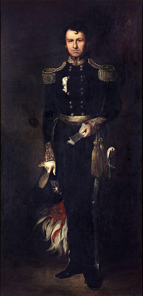
John Pascoe Fawkner
 |
John Pascoe Fawkner (1792-1869)
epitomises the colourful characters that define much
of early Australian history. Born in London, Fawkner
as a young boy accompanied his family when his father
was transported to Australia for receiving stolen
goods. In 1803, the Fawkners were part of David
Collins' unsuccessful settlement at Port Phillip,
travelling eventually to Hobart, where his father
received a land allotment for good behaviour and the
family took up various occupations. In 1814, the
younger Fawkner assisted some convicts in building a
boat with which to escape and was consequently
sentenced to prison in Newcastle, an experience which
strengthened his lifelong fight against oppression and
authority. He returned to Hobart in 1817, and moved on
to Launceston in 1819, where he worked as a baker, a
butcher, a bookseller and an entertainment promoter,
before marrying in 1822 and establishing the Cornwall
Hotel in 1824. His battle against authoritarian rule
gained impetus when he founded the Launceston
Advertiser in 1829, a newspaper that became a leading
advocate for governmental reform and an end to convict
transportation.
In 1835, Fawkner took advantage of reports of opportunities for settlement across the Bass Strait in the Port Phillip District. He purchased the schooner Enterprise and prepared it for exploration and the transportation of settlers to the region. While Fawkner himself was prevented from making the first voyage because of seasickness, his party sailed up the Yarra River in August 1835, and established a camp near present-day Spencer Street. Fawkner and his family arrived here in October and set up a store and hotel in a framed cottage he had brought along. By 1838, he established a hotel on the corner of Collins and Market Streets, as well as the colony's first newspaper. By 1840, he owned three newspapers and a large plot of farming land, and had leased the hotel to the early Melbourne club. By 1841, he began his long career as a prominent public servant in the rapidly growing colony. His pugnacious temperament made him a popular champion of the people's causes, and he was a central figure in the tumultuous events during the period of the gold rush; he was a member of the Melbourne Legislative Council from 1851 to 1869 and most significantly on the Commission for the gold-fields from 1851 to 1856. By the time of his death in 1869, Fawkner's status as Melbourne's founder and elder statesman was well established. |
In September 1835, at the site of the present-day Spencer
Street railway yards, an advance party established a camp
named Batman's Hill on the banks of the Yarra River, where
it begins to be fresh water (Yarra is an Aboriginal word
meaning 'flowing water'). It was here that Batman
established a permanent home in 1836; as the writer Barry
Oakley concludes, 'if Batman pioneered the district, Fawkner
founded the town'. (See box above.) While the settlement was
not considered legal by the authorities in Sydney, settlers
continued to arrive until acknowledgment of its existence
could not be ignored. Governor of New South Wales Richard
Bourke appointed William Lonsdale as Police Commissioner of
the region, and in 1837 visited the town and named it
Melbourne after the then British Prime Minister.
A town was first laid out in 1837 by surveyor Robert Hoddle and his assistant Robert Russell on a grid plan; Hoddle's enlightened vision led to the creation of wide streets (originally 99 feet), with narrower city lanes in between (the present-day 'Little' streets). The original area was defined by Flinders, Spencer, Lonsdale and Spring Streets. At the time known more generally as the Port Phillip District, the town's streets were renowned for their poor drainage, and habitation was primitive. As late as the 1850s horses and riders were being drowned in Elizabeth Street, and many town dwellings were no better than 'piggeries', to quote one contemporary.
With the discovery of gold near Ballarat in 1851, Melbourne's haphazard growth was immediately altered, as 250 immigrants a day arrived heading for the goldfields. In one decade, from 1851 to 1861, the colony grew from 77,000 to 540,000, although by the 1880s this number stabilised at about 500,000 with the official population of the Port Phillip region at about 250,000. In 1857, some 160,000 settlers were still living in tents or 'humpies' within the city limits. In July 1851, only days before gold was discovered, Victoria gained separation as a self-governing colony from New South Wales, a rivalrous division that, as the states of Victoria and New South Wales, is still vociferously (and, many would say, almost childishly) maintained.
Comparisons between Melbourne and Sydney (a curiously unconsidered slight to the remainder of the country) are still a national obsession. Playwright David Williamson, who has lived in both places, offered in 1980 the following assessment: 'Melbourne is a much more belligerent city [than Sydney]. Its dinner parties are more violent. The trouble with Melbourne is that it's made up of Scots stockbrokers and Irish publicans.' Historians corroborate this assertion: Scottish and Irish settlement in the region was especially pronounced from the 1840s.
The period between the 1860s and 1880s, until the
precipitous economic crash of the 1890s, saw the rise of
'Marvellous Melbourne', a term coined by journalist George
Sala in the newspaper Argus in 1885. The frontier
town was transformed into a bustling cosmopolitan city,
described in its ambition and modernity as 'Yankee' compared
to Sydney's 'English' sleepiness-quite the opposite of the
notion today. Not only did it become the largest city on the
continent, but also one of the wealthiest in the world.
Evidence of what one critic called its 'confident
palladianism' can be seen in the lofty goals of its early
leaders: the judge Sir Redmond Barry (see box below), who
saw that the new public library contained every work
mentioned in Gibbons' Roman Empire, but no fiction; Governor
Charles La Trobe (see box below), who laid out English-style
parks in the surrounding bush; and those citizens who
founded a university in 1853, when the town was less than 30
years old. It can be said that Melbourne is the only city in
the world to develop into a metropolis entirely during the
Victorian era, and the era's architecture and institutions
today make it seem more Old World than Sydney.
Redmond Barry
 |
Redmond Barry (1813-80), an
important figure in the development of Melbourne,
arrived in Australia in 1839. Having already studied
law at Trinity College, Dublin, he immediately set up
practice in the fledgling community of Melbourne. By
1842 he was commissioner of the Court of Requests.
Barry was instrumental in the establishment of most of
Melbourne's first cultural institutions. Before a
library could be established, he allowed people to use
his personal collection at his home in Bourke Street.
The first president of the Mechanics' Institute and a
founder of the Melbourne Hospital, Barry was appointed
Solicitor-General in 1851 when Victoria became a
separate colony. In 1853 he became a Supreme Court
Justice (one of his greatest claims to fame was as the
judge who sentenced Ned Kelly to hang). He was the
university's first chancellor, a position he held
until his death, and remained personally involved in
the development of the public library and the National
Gallery. The epitome of the Victorian gentleman, Barry
nonetheless refused to marry his mistress of many
years, the mother of his four children-a bewildering
situation for 19C moralists. |
Charles Joseph La Trobe
 |
C.J. La Trobe (1801-75) was born
into an intellectual family of the Moravian religion
in London; his father, a minister, was a personal
friend of the composer Franz Haydn. Many years of
travel throughout Europe and America in the 1820s and
1830s led Charles to consider himself a 'citizen of
the world'. Washington Irving, his travel companion in
America, called him a 'complete virtuoso'. He wrote
several books about his travels which brought him to
the attention of the British Colonial Office. After
submitting a report on the question of negro education
in the West Indies, he was appointed as Superintendent
to the Port Phillip District in 1839. His tenure
spanned the most tumultuous period in Victorian
history. As La Trobe himself commented on the period
after the discovery of gold in 1851, just as an
independent Victorian government was being
established, 'it was a matter of wonder...that the
government was in any way enabled to stand its ground
and perform its manifold functions.' La Trobe was greatly hampered by the fact that, administratively, he was still considered subordinate to the Governor of New South Wales, a situation that caused confusion and unease throughout his administration. Despite his immense achievements-the establishment of Melbourne's many gardens, the founding of the Royal Melbourne Hospital, the University and the Public Library-La Trobe's administration was criticised for indecisiveness, certainly an unfair claim given the unprecedented circumstances during his tenure. While he personally objected to the goldfields taxes which ultimately led to the famous Eureka Stockade Rebellion in 1854, he was unable to convince his legislative council of the taxes' inequity. La Trobe resigned his office in 1854 and retired to England. |
By the time of the crash and depression of the 1890s,
Melbourne was known as the financial capital of Australia,
as well as a major manufacturing centre. At the time of
Federation in 1901, Melbourne became the national capital
until Canberra was established in 1927. Despite its heady
days in the 19C, Melbourne has not since been able to
surpass Sydney as the premier city of the continent, a fact
that has often led to a defensive snobbishness among its
citizens.
The cultural character of Melbourne can be exemplified
with the story behind its biggest public festival, Moomba,
which takes place each year in March. Originally the event
was conceived as a Labor Festival to celebrate the unions'
victory in the 8-hour day campaign. With the coming of the
1956 Olympics to the city, an event which precipitated the
introduction of television to the country, Melbourne wanted
to present a more elaborate festival with a conscious
national theme. The planners asked Bill Onus, Koorie leader
and artist, to suggest a name for the festival; he gave them
'Moomba'. There is still great debate about what it means;
usually it is translated as 'let's have a good time,' but
others maintain it is an Aboriginal word for 'back side':
hence, an insider's joke on the part of Aboriginal people.
The festival originally revolved around floats parading down
Swanston Street, but it has now developed to include a
variety of street events, loosely joined together under the
Moomba banner. The city is also the location for the
Melbourne Festival of the Arts in September, a more cultural
event combining music, theatre, and art exhibitions.
Finding your way around
As Melbourne's central streets were originally laid out
as a grid, the town is easy to negotiate on foot. The main
thoroughfare is Swanston Street, running northwest through
the centre of the original town grid. Since 1992 Swanston
Street between Flinders and Latrobe Streets has been a
pedestrian walk and increasingly a showcase for modern
sculpture-Petrus Spronk's Architectural Fragment, a
diagonal slice of a pediment, and Pamela Irving's Larry
Latrobe, a bronze cast dog being particularly light
hearted.
To the west of Swanston Street are Spencer, King, Queen, and
Elizabeth Streets; to the east Russell, Exhibition, and
Spring Streets. The main cross streets are, from the south,
Flinders, Collins, Bourke, Lonsdale and Latrobe Streets,
with the narrower 'Little' streets in between. This grid
still marks the Central Business District, the 'CBD' in
local parlance.
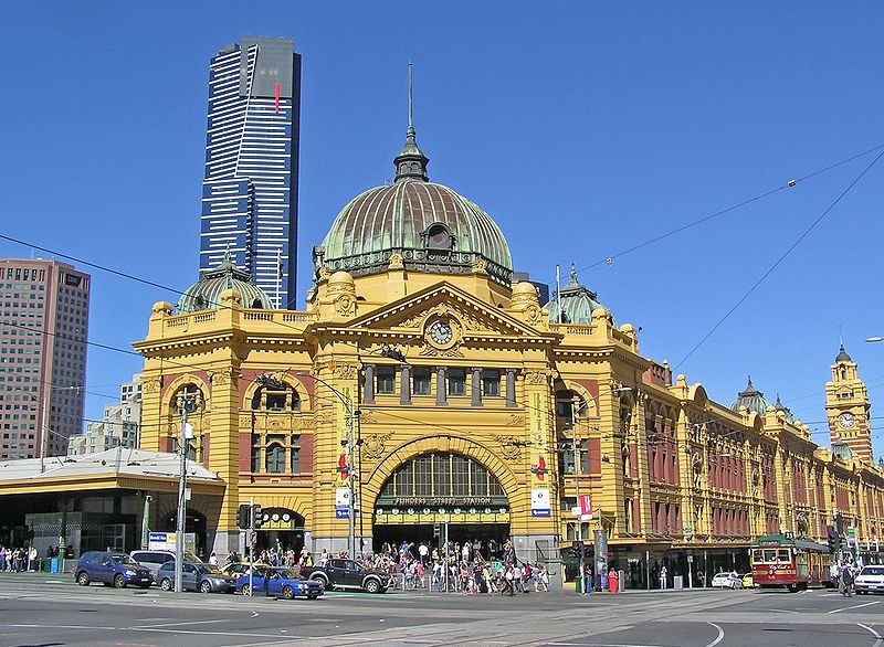
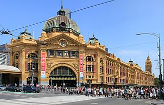 This
walk begins at Flinders Street Station. In many ways, this
grandiose railway station is the real landmark of
Melbourne's cityscape; 'under the clocks' of Flinders
Station is the Melburnian's traditional point of rendezvous.
The site was the centre of the city's railway system from
1854, and the rail-lines themselves were well-established
before the building was completed in 1910. The architects,
J.W. Fawcett and H.P.C. Ashworth, were winners of a design
competition. The architectural style seems supremely
imperial, with hints of colonial India in its cupolas and
arched entrance.
This
walk begins at Flinders Street Station. In many ways, this
grandiose railway station is the real landmark of
Melbourne's cityscape; 'under the clocks' of Flinders
Station is the Melburnian's traditional point of rendezvous.
The site was the centre of the city's railway system from
1854, and the rail-lines themselves were well-established
before the building was completed in 1910. The architects,
J.W. Fawcett and H.P.C. Ashworth, were winners of a design
competition. The architectural style seems supremely
imperial, with hints of colonial India in its cupolas and
arched entrance.
Across the street from Flinders Station is Young and
Jackson's Hotel, a famous watering hole, now pretty seedy,
but best known as the residence of the daring painting Chloe
which hung behind the bar for years.
The hotel stands on land purchased by John Batman in
1837 for £100; built in 1860, the hotel was purchased by
Henry Young and Thomas Jackson in 1875. Their business sense
saw the establishment become one of the first hotels to
feature Foster's new lager beer in 1888. The painting of the
standing nude, by Jules Le Febvre, had won the gold medal at
the 1880 International Exhibition, and caused a scandal when
exhibited at the National Gallery. It was eventually
purchased by the bar in 1908, where it remained until moving
to the restaurant upstairs.
From Flinders Street Station, you can walk south one block
and turn right on to Flinders Walk, which leads in about
250m to a footbridge to Southgate Promenade, the site of
Southgate Plaza. For many years an industrial site and a
major eyesore on the edge of the business district, this
area has now been redeveloped as an activities centre in
conjunction with the nearby Victorian Arts Centre. Much of
the Southgate complex is dedicated to fashionable franchise
shopping venues and restaurants, but the ground floor
includes an interesting aquarium suspended from the ceiling,
housing over 100 species of fish.
Continuing west along the promenade, you come to Queens
Bridge, on the other side of which is one of the earliest
areas of settlement in Melbourne. At 400 Flinders Street is
Old Customs House, built in two stages, in 1856 and 1876.
The building is typical of the simplified 'Classical' style
of many Victorian buildings; on this site were earlier
buildings, of which the foundations still exist. This area
was originally the landing of Queen's Wharf, with the 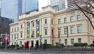 Customs
House at the top of the busy port on the Yarra, now occupied
by the railway yards. The building was the subject of a
major preservation battle when it was threatened with
demolition in the 1970s. Old Customs House currently houses
the
Immigration Museum (t 03 9927 2754; open daily
10.00-17.00; admission adults $14.00, otherwise free). The
museum presents a thematic display of the immigrant
experience recounting for a number of periods why people
left their birth places, how they travelled, and what
conditions they met upon arrival.
Customs
House at the top of the busy port on the Yarra, now occupied
by the railway yards. The building was the subject of a
major preservation battle when it was threatened with
demolition in the 1970s. Old Customs House currently houses
the
Immigration Museum (t 03 9927 2754; open daily
10.00-17.00; admission adults $14.00, otherwise free). The
museum presents a thematic display of the immigrant
experience recounting for a number of periods why people
left their birth places, how they travelled, and what
conditions they met upon arrival.
On the corner of William and Flinders Streets in front of
the Customs House is a plaque commemorating the site where
John Batman declared, 'this is the place for a village'. The
point on the river across the street was where a waterfall
marked the beginning of fresh water, the only source of
drinking water for the early settlement; it was here that
Batman's only son drowned at the age of nine.
Back on the Southgate Promenade, you come to the Crown
Entertainment Complex and Casino (t 03 9292 8888;
casino always open), filled with shops, restaurants and
cinemas. This centre, which opened with unprecedented and
extravagant fanfare in 1997, represents Premier Jeff
Kennett's ambitious bid to turn Melbourne into 'Las Vegas on
the Yarra'. The casino in the complex is the largest in the
southern hemisphere, with something like 1km of poker
machines! The architectural design of the complex is
predictably extravagant, and the casino has, so far, been
far from the money spinner envisioned by the planners; but
the restaurants include some of the showiest in town, and
the shops are of the Gucci-Christian Dior range. It is not
Las Vegas, but it beats the industrial wasteland that used
to be here.
Further along, on the western side of Spencer Street, is the
Melbourne Exhibition Centre, then along Yarra River Board
Walk about 300m, the Polly Woodside
Maritime Museum (t 03 9699 9760; open Sat. and Sun.
and school holidays 10.00-16.00; admission adults $16.00,
concession $13.00, children $9.50) vehicle access is also
from the west, at Lorimer Street off the Charles Grimes
Bridge, Footscray Road. The centrepiece of the museum is the
commercial sailing ship Polly Woodside, built in 1885, now
restored as one of the last functional windjammers in the
world. The museum includes other artefacts of Melbourne's
maritime history. On the north side of the Spencer Street
Bridge is the World Trade Centre and behind it, the thriving
Crown Casino.
Back at Southgate Plaza, it is an easy walk south along
St Kilda Road to the Arts Centre
Melbourne (t 1300 182 183), comprised of three
buildings, the Concert Hall, Theatres Building, and the
National Gallery of Victoria. The centre is topped by an
appallingly ugly tower. When it was first built in the
1860s, a promotional campaign had children donate a penny to
be hammered into a copper dome; this was never accomplished,
although thousands of children donated their pennies. The
Concert Hall is said to have better acoustics than the
Sydney Opera House (hence the saying that Australia has one
great concert hall, the exterior in Sydney and the interior
in Melbourne). The Theatres Building includes what is said
to be one of the biggest stages in the world. If you can,
try to see a theatrical performance here in the Theatres
Building, to appreciate the ambience of the venue.
National Gallery of Victoria
The National Gallery
of Victoria (t 03 8620 2222; open daily 10.00-17.00;
free admission), despite its impressive waterfall wall at
the entrance, must be one of the ugliest exteriors of an art
gallery. J.M. Freeland, writing in 1968 in Architecture
in Australia, found Roy Grounds' solution to be
particularly pleasing, expressing modernist tastes of that
time when the building had just been completed. Its use of
bluestone perhaps contributes to its penitentiary
appearance. The interior spaces, however, are quite
functional and effective in displaying the gallery's
significant collections, considered the most comprehensive
in Australia. The Great Hall includes a stunning
stained-glass ceiling designed by prominent Melbourne artist
Leonard French, who also created the stained-glass for
Canberra's National Library.
History of the National Gallery
The history of the National Gallery begins with the
noble ambitions of Melbourne's early benefactors, who in the
1860s sought to provide the new colony with all the cultural
attributes of home. Under the auspices of people such as
Redmond Barry, funds were established to purchase in London
a set of casts of classical sculpture and reproductions of
great paintings; these were the first collections of the
colony's 'National' Gallery, in emulation of the National
Gallery in London. (When the National Gallery was opened in
Canberra in 1982, Victoria chose to retain the 'national'
title for their gallery as well.) In the first years, the
gallery also established a school of art. By 1863, further
funds were provided for the purchase of paintings-again, in
England. The resultant pieces, still in the collection,
reflect popular tastes of the time for sentimental genre
works such as A Fern Gatherer by R. Herdman and
Thomas Faed's Mitherless Bairn (1855). By the 1870s,
more ambitious British paintings, such as a duplicate of
Alma-Tadema's Vintage Festival (1871) were acquired.
Under the directorship of artist Bernard Hall, who from 1891
became the gallery's driving force for 40 years, major
acquisitions of a more substantial nature occurred. These
included historical works of the British school, such as
John Waterhouse's Ulysses and the Siren (1891), and
graphic works by Rembrandt, Max Klinger and Whistler. The
gallery's collection of Australian art started slowly and
with some ambivalence; art by local artists began to trickle
into the collection in the late 1860s. In 1868, a
competition awarded Nicholas Chevalier's painting The
Buffalo Ranges the honour of first Australian work in
the gallery. Soon other Australian paintings entered the
collection. The artists included the popular Swiss-born
Melburnian Louis Buvelot (Waterpool at Coleraine
[1869]) and Eugen von Guerard (Valley of the Mitta Mitta
[1866], presented to the gallery in 1871). These came to be
the basis for the collection's greatest strength.
Of special significance to the gallery, and the reason it
was able to become the foremost art collection in the
country, was the bequest in 1904 by Melbourne merchant
Alfred Felton of a portion of his estate for the purchase of
art works of quality. The story of those works accepted and
rejected is a fascinating study in artistic politics and
aesthetic tastes. The gallery acquired through the Felton
Bequest such paintings as Pissarro's Boulevard
Montmartre (1897), Van Dyck's The Countess of
Southampton (1640) and Turner's watercolour
Oakhampton. The Felton Bequest has subsequently allowed the
acquisition of major European paintings, such as Tiepolo's Banquet
of Cleopatra (1743-45), purchased in 1934 from the
Soviet government 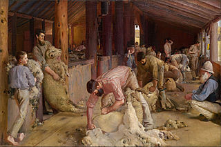 and paid for in
London with a suitcase full of hard cash; and in 1938
Cézanne's La Route Montante. Australian icons were
also acquired through the Felton Bequest, including Tom
Roberts' Shearing the Rams (1890), not purchased
until 1932; and Frederick McCubbin's The Pioneer
(1904), purchased in 1906. The bequest also enabled the
development of major collections in Chinese and Indian art,
an area of substantial recent growth.
and paid for in
London with a suitcase full of hard cash; and in 1938
Cézanne's La Route Montante. Australian icons were
also acquired through the Felton Bequest, including Tom
Roberts' Shearing the Rams (1890), not purchased
until 1932; and Frederick McCubbin's The Pioneer
(1904), purchased in 1906. The bequest also enabled the
development of major collections in Chinese and Indian art,
an area of substantial recent growth.
Despite the gallery's early ambivalence concerning
Australian art, the collections are now substantial. Along
with Roberts's and McCubbin's famous works, the gallery also
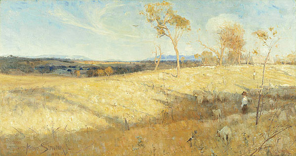
owns Arthur Streeton's famous Purple Noon's Transparent
Might, purchased by Hall in 1896, and numerous works
by lesser-known members of the Heidelberg School and the
Melbourne art scene, such as Aby Alston, John Longstaff and
Emmanuel Phillips Fox. It was only in the 1950s and 1960s
that any serious collecting of early Australian art took
place, with the acquisition of paintings by John Glover,
William Westall, and Conrad Martens.
Of special interest for the viewer is the great selection of
paintings by that group of Australian artists loosely
associated with the Angry Penguins movement and the circle
of art patrons John and Sunday Reed: Sidney Nolan (1917-95)
(Luna Park in the Moonlight [1945] and one of the Ned Kelly
series, Sergeant Fitzpatrick and Kate Kelly [1946]), Arthur
Boyd (b. 1920) (the Chagall-like Shearers Playing for a
Bride [1957] and Burning Off [1958]), Albert
Tucker (b. 1914) (Night Image no. 28 [1946]), John
Perceval (b. 1923) (an Expressionistic Survival
[1942]) and the Russian-born Danila Vassilieff (1897-1958)
(a sculptural piece, Expressive Female Nude [1950]).
More contemporary holdings include exemplary works by
Melbourne artists Roger Kemp (b. 1908) and John Brack
(1920-99), as well as representative paintings by Fred
Williams, Brett Whiteley, and Peter Booth.
Recently, the gallery has also assembled an excellent
collection of Aboriginal art, with active acquisition
programmes now keeping the holdings up to date and
contemporary.
The gallery also established the country's first department
of photography, which now contains its own collection and
mounts important international exhibitions. A popular
restaurant adorns the back of the gallery, looking on to a
soothing enclosed garden.
Behind the gallery on Sturt Street is the headquarters
of Alcock's,
maker of fine billiard tables since 1853.
Billiards and snooker
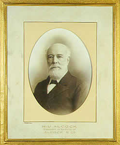 |
Henry Upton Alcock came to Melbourne
in the 1850s as a furniture-maker, and established
himself as the colony's sole maker of billiard tables.
Finding appropriate materials was at first difficult,
with slate taken from prefabricated houses and wood in
short supply. Alcock stimulated sales by arranging
tours by British players, establishing the popularity
of the game in Australia. The game of snooker was
introduced into Australia in the 1880s by members of
the Indian army, and was also taken up
enthusiastically. The world's greatest champion
billiards player, Walter Lindrum, was born into a
billiards family in Melbourne. Master of the 'nursery
cannon', Lindrum's prowess was so great that rules had
to be changed to limit his phenomenal scores. At his
death in 1960, Lindrum, who had retired in 1950, still
held 47 world records. His residence at 26 Flinders
Street is now the Lindrum Hotel which maintains a
billiard room for its guests. Speaking of which, here are a few interesting places to pick up a cue: |
| Central District. |
Cue City, now 398 Elizabeth Street, a long standing hall recently moved to new digs. |
| AK8, 45 Therry St., east on Therry off of Elizabeth, (open 13.00-3.00). Reputed to be the best pool and snooker hall in the central district. As well as a bar, it includes a Mahjong, poker and karaoke rooms. | iCUE Billiards, 191 Little Lonsdale St. (corner of Little Lonsdale and Russell; open daily 11.00-2.00, Fri. and Sat. 11.00-3.00), a friendly hall for a variety of levels of competence. A bit expensive at $17.00/hour. |
| Suburbs. |
Tien Loi Pool Hall, 441 Victoria Street, Abbotsford (Tram 109, stop #21) (open 10.00-22.00). An informal and relaxed hall that's relatively inexpensive. |
| Cue8, 1866 Princes Highway, Clayton N. (open 11.00-1.00). If you happen to be about a half an hour south of the central district and would like to shoot a couple of games, this is the place. Young owners, good tables. | Masters Billiards, 150 Barkley St., St. Kilda (open Sun.-Thurs. 17.00-24.00, Fri and Sat. 17.00-1.00). A really nice hall with professional level tables and a good bar. At $15.00/hour within reason for the quality of the venue. |
| Legends Billiards Club, 321 Middleborough Rd., Box Hill South (open daily 12.00-1.30, Fri. and Sat. 12.00-2.30). Over 20 tables, including 2 full-size snooker tables in a designed hall, they boast the best prices per hour. | Mr. Pockets,
217 Mickleham Road, Tullamarine (hours vary but, Sun.
opening a 14.00, Sat. at 16.00, and others at
17.00). You are there for the tables, but some
poker is available as well. |
| Mr
Cue Billiard Room and Hall, 973 Whitehorse Road,
Box Hill (open 13.00-1.00). One of the rare halls
that is well-lit. Fine tables. |
Fast
Eddies Pool Room, 168 Chesterville Road, Moorabbin
(open 16.00-1.00). A swell venue sporting live
local bands. |
Back on St Kilda Road once more, you can walk back into
the Central Business District (CBD), crossing the Yarra
River on Princes Bridge. The first bridge, a major
monument dedicated in 1853 by Governor La Trobe, opened the
southern regions for urban expansion. The present
bridge, the only known metal arch bridge from the Victorian
era (1888), is a replacement of the earlier timber bridge.
St Kilda Road is still the major thoroughfare into the
southern suburbs.
Traditionally, a stroll down Collins Street began at
Spring Street, as this walk does. If you are walking up from
Flinders Street Station, to Collins Street from Swanston
Street to Spring Street, reverse the order of buildings.
In the 1880s, the eastern end of Collins Street at Spring
Street became known as 'the Paris end' because the planting
of trees along the footpath and the construction of elegant
office buildings provided an air of cosmopolitan European
style. As early as the 1850s, the street became the site for
medical practices and residences and subsequently the
location for banks and financial institutions in smart and
substantial buildings. This area was early known as Howitt's
Corner, after Dr Godfrey Howitt and his family, who arrived
in 1840 and immediately acquired considerable properties
from Collins to Flinders Streets. Dr Howitt was not only a
leading medical practitioner, but was famed for his work as
a botanist and naturalist; he established magnificent
gardens at his house here. By the 1860s, Howitt's properties
had been completely subdivided and his family had moved to
the suburb of Caulfield.
No. 1 Collins Street was an example of the
neighbourhood's stately buildings in the late 19C. It was
designed by Leonard Terry in 1870 as a town house for
pastoralist William Campbell; the adjoining terrace houses
were constructed in the 1880s. During the First World War
Australia's war cabinet met there. The current building,
constructed in 1984, incorporates elements of the original
building in the façade. Across the street at no. 2 is
Alcaston House, a 1920s example of a multi-storey apartment
and office building in a Renaissance Revival style. Next
door at nos 4-6 is Anzac House, built in 1938 of reinforced
concrete as offices for the Returned Sailors and Soldiers
Imperial League of Australia. Portland House, at 8-10
Collins Street, dating from 1872, was also designed as a
town house and surgery as a wedding present for the daughter
of Henry 'Money' Miller, a well-known land speculator,
financier and politician who was instrumental in the
founding of the Bank of Victoria and several insurance
companies.
 Melbourne Club, no. 36, was
established in 1838, making it Victoria's oldest
institution; the club purchased this land from Melbourne
founder John Pascoe Fawkner. The present building was
erected in 1858 by Leonard Terry, with later additions from
the 1880s. In a Classical style, the building also features
an enclosed rear garden known for its plane trees, one of
the only private gardens left in the central city. Melville
House, at nos 52-54, dates from 1881.
Melbourne Club, no. 36, was
established in 1838, making it Victoria's oldest
institution; the club purchased this land from Melbourne
founder John Pascoe Fawkner. The present building was
erected in 1858 by Leonard Terry, with later additions from
the 1880s. In a Classical style, the building also features
an enclosed rear garden known for its plane trees, one of
the only private gardens left in the central city. Melville
House, at nos 52-54, dates from 1881.
Across the street is Collins Place, a shopping plaza
originally designed in the 1970s by American architect I.M.
Pei. Its construction was plagued by industrial disputes; it
was eventually completed in 1981 by E.A. Watts. Its vast
interior plaza offers musical performances and other
activities, and an arts and crafts market takes place here
on Sundays.
A sterling example of the street's medical-commercial
reputation is Harley House at numbers 71-73. Designed by
Sydney Smith Ogg and Serpell in 1923 as a building for
medical practitioners, it was owned by Dr Gengoult Smith,
Lord Mayor of Melbourne from 1931 to 1934. The building's
decorative motifs indicate the Art Deco interest in Greek,
Roman and Egyptian elements.
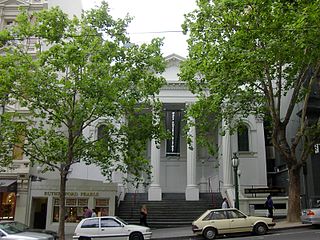
The Athenaeum Club, nos 83-87, was originally founded in
1868 on the site of what is now the Athenaeum Theatre
further down Collins Street. This building dates from 1929
and was designed by Cecil Ballantyne with an elaborate
Spanish-style interior.
The C.B.A. Bank at 70 Collins Street was built in 1867 for
surgeon John Wilkins, and operated as a surgery until 1911.
Next door, nos 72-74 is one of the only surviving Georgian
style town houses in the city, dating from 1855.
Nauru House, the 1972 precast concrete skyscraper further
along on the north side of the street, represents the kind
of modernist office block which began to appear all over
town in the 1960s and 1970s, leading to the demolition of
many old Melbourne buildings and the subsequent, if belated,
establishment of active preservation organisations. It seems
somehow appropriate that this building is named for a South
Pacific island so rich in phosphate that most of the land
has been mined to retrieve it.
The two surviving terrace houses at nos 86-88 were designed
in 1873 as medical offices for Dr Robert Martin by architect
James Gall; shops have occupied the ground floor since the
1920s. The building's pleasant proportions, with arched
windows and ironwork balconies, is representative of the
prevalent streetscape during the city's boom years. The
Professional Chambers at nos 110-114 were designed by
architect Beverley Ussher in 1908. The design represents a
blending of Gothic-medieval elements with Australian
'Federation style' characteristic of office buildings for
the period.
The rather theatrical façade of the Austral Building, at nos
115-119, is the product of architect Nahum Barnet, who was
commissioned to design this commercial building by Alex
McKinley & Co., publishers of Melbourne Punch. Described
as 'Queen Anne Revival' in style and completed in 1891, the
building was home to the Lyric Club, the Austral Dramatic
Club, and the studio of the German-Australian photographer
J.W. Lindt.
Evidence of the optimistic extravagances of 'marvellous
Melbourne' is the Former Alexandra Club, at nos 133-39,
commissioned by one of the city's most colourful characters,
the surgeon Dr J.G. 'Champagne Jimmy' Beaney (see box). In
1887 Beaney held a competition for the design of his house
and surgery; the result was a 23-room structure designed by
William Salway and known as Cromwell House. In 1916, the
building was purchased by the Alexandra Club, which added
the top floor.
James George Beaney
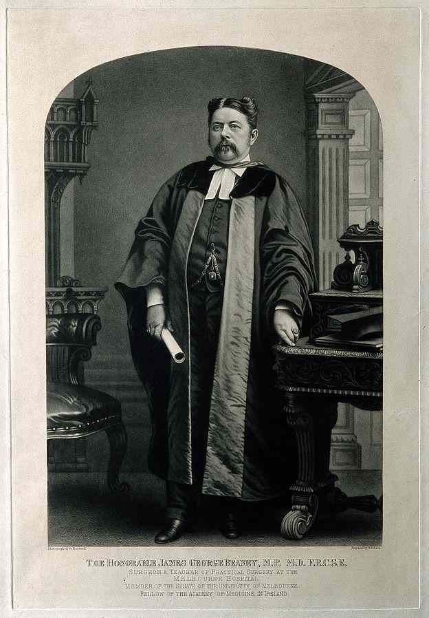 |
James George Beaney (1826-91)
arrived in Melbourne from England in 1852, and
established himself as a high-profile surgeon, despite
his unkempt and grossly bejewelled appearance and the
suspicion by many that he was a charlatan; as the
Australian Encyclopedia describes him,
'self-advertisement was an art in which he may be said
to have specialised'. Even in the 1880s, Beaney
disdained the germ theory, operating in filthy
blood-soaked clothing while wearing diamond rings and
prescribing champagne as anaesthetic. Even after his
trial in 1866 for the performance of an 'illegal
operation' resulting in a girl's death, Beaney somehow
retained his reputation and died a wealthy man,
bequeathing £3900 to the medical school. His gravesite in Melbourne's General Cemetery is marked by an enormous monument. |
Uniting Church (formerly the Independent Church), on the
northeast corner of Collins and Russell Streets, is the site
of Melbourne's earliest permanent church. The present
building, with its campanile tower and unusual polychrome
brick, was designed by Reed & Barnes in 1866 for the
Independent Congregational Church. The interior, in the
shape of an amphitheatre, includes superb stained-glass
windows.
Across Russell Street from the Independent Church is Scots
Church. This church was built in the 1870s as a rather
austere Gothic Revival structure by Joseph Reed.
Parishioners made rich by gold eventually donated more
elaborate interior decorations. It is associated with many
famous churchmen, including the educationist and temperance
leader Reverend James Forbes, who was instrumental in the
founding of Melbourne's Scotch College, one of the country's
greatest public schools. The famous opera singer Nellie
Melba and David Mitchell both sang in the church choir. The
adjoining Assembly Hall was added in 1914; designed by H.H.
Kemp, it blends well with the original church. The grounds
are defined by the fountain which was donated by Georges Ltd
in 1981, and designed by the architect Peter Staughton.
Having gained an awareness of the American penchant for
skyscrapers, the architects of the offices of the Temperance
and Life Assurance Society across the street from the Scots
Church (now the T & G Buildings) designed in 1928 a
modified version of Chicago-style high-rise buildings. In
1930, the Herald newspaper voted it 'Melbourne's most
beautiful building'. The entrance hall includes a mural
painted by M. Napier Waller.
The former Auditorium Building, nos 167-173, has had a
colourful past, belying its current incarnation as yet
another shopping complex. Designed in 1913 by Nahum Barnet
for a theatrical firm, it was redesigned as a cinema in the
1930s by C.N. Hollinshed.
Another Barnet building was erected in 1884 at nos 162-68 as
a warehouse for entrepreneur Benjamin Fink. In 1888 it was
converted to Georges Store by Albert Purchas; for years it
was the most exclusive retail shop in Melbourne. Sadly,
Georges Store closed in 1995. In 1998, it reopened,
completely redesigned by British designer Terence Conran,
with an entirely different style of product and a glitzier
kind of fashionable clientele.
 The
Baptist Church on the north side of Collins Street at nos
170-174 is the oldest Baptist church in Victoria. The
original brick building was erected in 1854; the present
façade, with its beautiful Corinthian portico, was added in
1861-62 by Reed & Barnes when the church was expanded to
seat 1000 people. The colony's first Baptist minister,
Reverend John Ham, arrived in 1842 with his three sons; his
son Thomas engraved the brass plate that served as this
building's foundation stone. Ham's engravings of Melbourne
views are important historical documents and collector's
items today.
The
Baptist Church on the north side of Collins Street at nos
170-174 is the oldest Baptist church in Victoria. The
original brick building was erected in 1854; the present
façade, with its beautiful Corinthian portico, was added in
1861-62 by Reed & Barnes when the church was expanded to
seat 1000 people. The colony's first Baptist minister,
Reverend John Ham, arrived in 1842 with his three sons; his
son Thomas engraved the brass plate that served as this
building's foundation stone. Ham's engravings of Melbourne
views are important historical documents and collector's
items today.
Further along, the Athenaeum Theatre at 184-92 Collins
Street was formerly the Mechanics' Institute. As in all
colonial towns, the Mechanics' Institute was an important
social and educational centre in the early days of
settlement; its building was on this site as early as 1840.
The present structure dates from the 1880s, and includes a
theatre with verandah completed in 1924. The classical
façade includes a statue of Athena.
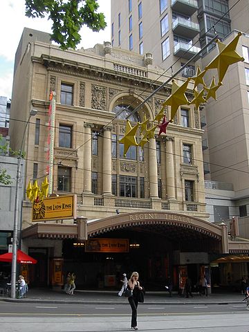
Across the street, the Regent Theatre (bookings through
Ticketek, t 132 849) was designed by Cedric H. Ballantyne
for Thring's Hoyts Theatres, and was meant to rival the
State Theatre on Flinders Street. After a fire in 1947, the
interior was remodelled as a true Hollywood-style cinema,
which along with the adjacent Plaza Theatre could seat more
than 3000. In 1969, the theatre fell into disrepair and
stood derelict for 27 years, before it was lovingly and
expensively ($35 million) restored in 1996. It is now the
city's main venue for musical theatre and other productions.
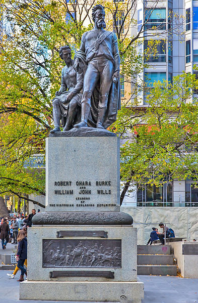 On the corner of Swanston and
Collins Streets is the Melbourne City Square, an attempt at
an urban plaza that had long been a consideration among
Melbourne's town planners. Work on the present site began in
1961, and by 1968 acquisition of this site saw the
demolition of the Queen Victoria Buildings although an
approved design for the square was not in place until 1976.
The winning firm was Denton Corker Marshall, with a design
incorporating waterfalls, shops and a pedestrian plaza. A
famous statue commemorating the explorers Burke and Wills,
designed in 1865 by Charles Sumner, was moved from Collins
and Russell Streets to the square. This original conception
never functioned successfully, the pedestrian intentions
hampered by the fact that the city trams continued to
intersect the area, and in 1989 the square was redesigned to
mixed reviews. Public events including street theatre and
afternoon concerts are presented here amid the clamour of
inner-city traffic and congestion.
On the corner of Swanston and
Collins Streets is the Melbourne City Square, an attempt at
an urban plaza that had long been a consideration among
Melbourne's town planners. Work on the present site began in
1961, and by 1968 acquisition of this site saw the
demolition of the Queen Victoria Buildings although an
approved design for the square was not in place until 1976.
The winning firm was Denton Corker Marshall, with a design
incorporating waterfalls, shops and a pedestrian plaza. A
famous statue commemorating the explorers Burke and Wills,
designed in 1865 by Charles Sumner, was moved from Collins
and Russell Streets to the square. This original conception
never functioned successfully, the pedestrian intentions
hampered by the fact that the city trams continued to
intersect the area, and in 1989 the square was redesigned to
mixed reviews. Public events including street theatre and
afternoon concerts are presented here amid the clamour of
inner-city traffic and congestion.
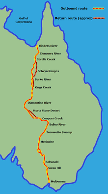 |
The Burke and Wills Expedition is,
like Gallipoli, another example of a disastrous event
that has become an important part of Australian lore.
In 1860, the Royal Society of Victoria organised an
expedition to explore unknown Central Australia to the
Gulf of Carpentaria and back. Chosen to lead the
expedition was Robert O'Hara Burke (1821-61), a
temperamental Irishman who had served as a policeman
on the Victorian goldfields. Selected as astronomer
and surveyor of the expedition was William John Wills
(1834-61). Leaving in August 1860 amidst great fanfare with camels and several other men, including the German naturalist and artist Ludwig Becker (c 1808-61), the group headed north, well equipped but with little knowledge of the bush. Through Burke's impetuousness, incompetent blunders, and inability to learn survival skills from the Aborigines encountered, both he and Wills perished near Cooper Creek in June 1861, trying to return after reaching the mouth of Flinders River. Becker had already perished south of Cooper Creek in April of that year; his illustrated journals of the ill-fated trip survived, and provide fascinating images of the hardships encountered. One member of the expedition, King, survived by seeking aid from the Aborigines. Despite the complete failure of the explorers and the fact that it was the rescue parties sent to find them that actually accomplished the task of traversing the region, Burke and Wills were championed as heroes, with statues and commemorative artworks produced throughout the colony. Tim Bonyhady's book Burke & Wills: from Melbourne to Myth (1991) analyses the endurance of the Burke and Wills iconography in the Australian national psyche. |
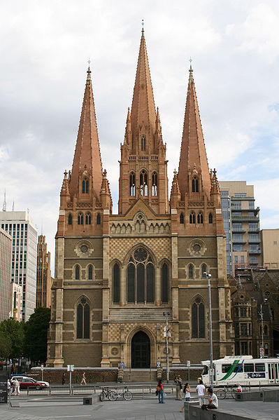
St Paul's Cathedral, on the corner of Flinders and Swanston Streets, is considered Melbourne's most significant ecclesiastical structure. It was designed by William Butterfield and building commenced in 1880. On this site the first church service in Melbourne was held in 1836. As with so many other public projects in Australia, the architect had great difficulties with the authorities concerning his choice of materials and the extent of his supervision of the building. After much haggling over choice of stone and certain design aspects, Butterfield resigned, and the work was completed by J. Reed in 1891. While still Gothic in style, the original plans were substantially altered. The interior retains the best of Revival ornamentation and colouring. The church spires were not completed until 1931. Beside St Paul's is a statue commemorating Matthew Flinders.
Melbourne Town Hall, 90-130 Swanston Street, is another
design of the firm of Reed & Barnes. Built between 1867
and 1870, its foundation stone was laid by Prince Alfred,
Duke of Edinburgh, during his royal visit. The portico dates
from 1887. The clock tower, named after Prince Alfred, was
added in 1869. The main hall includes interesting murals,
chandeliers, and an impressive organ.
The Westpac Bank on the southwest corner of Collins and
Swanston Streets was originally the Manchester Unity
Building. Designed by Marcus Barlow in a 'Commercial Gothic'
style in 1932, it was at the time the tallest building in
Melbourne, and included the city's first escalator and a
ventilation system using tons of ice. Manchester Unity was
an Order of Odd Fellows organisation established in
Melbourne in 1840 by Dr Augustus Greeves, a pioneer
politician instrumental in the separation of Victoria from
New South Wales and founder of the Mechanics' Institute.
 Capitol House, 109-117 Swanston Street, is one of the only
remaining examples in Melbourne of the work of American
architect Walter Burley Griffin; the building vaguely
imitates a Chicago-style commercial building. The Capitol
Theatre inside the building contains remnants of Griffin's
auditorium design, including a crystalline ceiling created
by his wife Marion Mahony.
Capitol House, 109-117 Swanston Street, is one of the only
remaining examples in Melbourne of the work of American
architect Walter Burley Griffin; the building vaguely
imitates a Chicago-style commercial building. The Capitol
Theatre inside the building contains remnants of Griffin's
auditorium design, including a crystalline ceiling created
by his wife Marion Mahony.
At 241-245 Collins Street, the Fourth Victorian Building
Society building has one of the city's only examples of an
Art Nouveau façade. Designed in 1911 by Robert Haddon, the
façade incorporates terracotta decorations with Aztec and
Egyptian motifs.
Next door is Newspaper House (now Tasmanian Tourist Bureau),
which was occupied from the 1930s by the Herald and Weekly
Times. At that time, the publishers conducted an
architectural competition for renovation of the existing
building; the winners were Stephenson and Meldrum, who
created an interior around a glass mosaic by Napier Waller
based on the newspaper's motto 'I'll put a girdle around the
earth.'
Next to Newspaper House, a small walkway leads one block
south to Flinders Lane, where two buildings of unusual
design are worth seeing. Royston House, 247-51 Flinders
Lane, is the only remnant of a massive commercial warehouse
that originally extended to Flinders Street. It was built in
1898 by Sydney architects Sulman & Power and represents
the kind of large warehouses that surrounded this area at
the turn of the century.
Majorca Building, 258-60 Flinders Lane, designed by
Harry Norris in 1928, is so called because of its coloured
terracotta façade, meant to be reminiscent of the Spanish
island's decor. The façade, with its delicate pilasters and
arches at the cornice placed in front of recessed windows,
is reminiscent of Louis Sullivan's Chicago commercial
buildings.
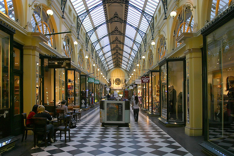
 Walk back through Centre Place
to Collins Street. Block Arcade, 282-4 Collins Street and
96-102 Elizabeth Street, is Melbourne's earliest fashionable
shopping mall. In the 1880s and 1890s, all of fashionable
Melbourne knew that the place to be seen was 'the Block'.
Between 2.30 and 4.30 pm, one would 'do the Block', a
promenade around Elizabeth and Collins Streets (the phrase
and the practice may have been in existence as early as the
1850s). At the centre of this promenade, architect David
Askew, with the backing of financier B.J. Fink, built the
Block Arcade in the early 1890s, a six-storey L-shaped
commercial building in a style based loosely on Milan's
Galleria Vittoria. It is still one of Melbourne's most chic
shopping complexes.
Walk back through Centre Place
to Collins Street. Block Arcade, 282-4 Collins Street and
96-102 Elizabeth Street, is Melbourne's earliest fashionable
shopping mall. In the 1880s and 1890s, all of fashionable
Melbourne knew that the place to be seen was 'the Block'.
Between 2.30 and 4.30 pm, one would 'do the Block', a
promenade around Elizabeth and Collins Streets (the phrase
and the practice may have been in existence as early as the
1850s). At the centre of this promenade, architect David
Askew, with the backing of financier B.J. Fink, built the
Block Arcade in the early 1890s, a six-storey L-shaped
commercial building in a style based loosely on Milan's
Galleria Vittoria. It is still one of Melbourne's most chic
shopping complexes.
In colonial days, Elizabeth Street was known locally as
River Townend, as a small creek ran along this roadway down
to the Yarra River; thus the early problems with flooding.
Even today basements on this street can be flooded in
torrential weather.
333 Collins Street dates originally from 1891 to a design
chosen in competition by the architects Lloyd Tayler and
Alfred Dunn. A new façade was added in 1939 which
incorporated the original foyer and its great domed
interior; renovation in 1990 retained this last feature,
which was considered the most splendid Victorian-era
interior in the city.
Former Mercantile Bank, nos 345-349, was designed by William
Salway in 1888 in an elegantly flamboyant style representing
the rise of the 'land banks' during the great boom of the
1880s; by 1892, the bank had been liquidated.
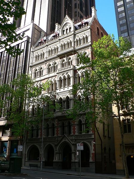
ANZ Bank Ltd, formerly the English, Scottish and Australian Bank (386-388 on the corner of Collins and Queen Streets) was built in 1883 by the English-born architect William Wardell. In a style reminiscent of the Doges Palace in Venice, the three-storey bank is now combined with the Stock Exchange, a six-storey structure designed by William Pitt in 1888. They remained separate buildings until the 1920s when they were extended and joined. Historically, the Stock Exchange is associated with B.J. Fink, its founder and great boom speculator, while the 'Gothic Bank' was the inspiration of its General Manager, Sir George Verdon, well-known as a connoisseur of the arts. The interior of the bank is well worth a visit, to inspect the carefully restored ceiling stencils and Gothicised pillars. This complex houses (at 380 Collins Street) the ANZ Banking Museum (open weekdays 10.00-15.00). The museum depicts the history of Australian banking and financial services.
On the opposite corner is the ANZ Bank Building, an
example of standard commercial style, with storeys added
between the 1870s and 1920s. On this site the first
Methodist church was established; by 1857, this land had
become so valuable for commercial ventures, that the church
sold it for a handsome sum and built several churches with
the proceeds.
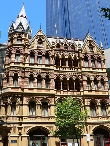
 A truly
fanciful structure, an example of 19C historicist symbolism,
is the former Melbourne Safe Deposit Building around the
corner from the 'Gothic Bank' on Queen Street; it is now
part of the large bank complex. Designed in 1890 by William
Pitt, its neo-Gothic façade seems to mimic an elaborate
storage chest of the era, and even appears to be slightly
crooked.
A truly
fanciful structure, an example of 19C historicist symbolism,
is the former Melbourne Safe Deposit Building around the
corner from the 'Gothic Bank' on Queen Street; it is now
part of the large bank complex. Designed in 1890 by William
Pitt, its neo-Gothic façade seems to mimic an elaborate
storage chest of the era, and even appears to be slightly
crooked.
Another Gothic Revival office building is down Collins
Street at nos 389-90; now called the A.C. Goode House, it
was originally built for an insurance company in 1891 by
Adelaide architects Wright Reed and Beaver; the vestibule is
in original form with elegant mouldings and freestone. The
former AMP Building, nos 419-29, is an example of a
steel-framed construction, clad in a Renaissance Revival
style of freestone and granite; built in 1929, it won a
medal for 'street architecture' in 1932. At this time,
Melbourne still imposed a 132-foot (20m) height limit to all
buildings, a mandate maintained until the 1960s.
Midway through this block of Collins Street is a small lane
called Bank Place, accessible on Collins Street by steps;
street entry is on Little Collins Street. You will find two
buildings of historical interest here. The Mitre Tavern has
been a popular meeting place for artists and businessmen
since it was built in 1868; its present medieval decor dates
from the 1920s. Further along is the Savage Club, a portion
of a large townhouse built in 1884 for Australia's only
baronet, Sir William Clarke. The club has owned its
structure since 1923, altering its interior in 1927; the
dining room includes giant palm fans for cooling.
Continue on to Little Collins Street; on the corner of Bank Place is Stalbridge Chambers, one of the only examples in the city of a multi-storeyed building built in the Victorian period. Designed in 1895 by architect David Askew, it curves around the street corner, defining the entire block in the best modernist fashion.
Continue west on Little Collins Street to Williams
Street; on the corner is the Australian Club, the most
elegant of the Victorian clubs in Australia. It was built in
three stages between 1879 and 1893; the principal architect
was Lloyd Tayler. The interior still maintains a sense of
Victorian opulence.
Continue south to William Street nos 90-98, Scottish House.
Erected in 1907 as the headquarters of the shipping firm
McIlwraith McEachern Ltd, the name comes from the Scottish
Line of Sailing Ships founded by this firm in 1875. One of
the founders, Malcolm McEachern, was Mayor of Melbourne, as
well as Lord Mayor in 1903-04.
Squeezed next door to Scottish House is the six-storey
Queensland Building, a delightfully whimsical structure with
an ornate façade incorporating Australian motifs, as became
fashionable in the 1910s.
At the corner of Collins and Williams Streets are a number
of noteworthy buildings. At the southeast corner is National
Mutual Plaza, which was originally the site of Western
Market, Melbourne's first market laid out by Robert Hoddle
in 1837. In the 1860s, a covered market was constructed of
bluestone with colonnades. This remained until 1960, when it
was demolished for the construction of the present building
and plaza. In the forecourt of the building are statues in
honour of Melbourne's two founders, John Batman and John
Pascoe Fawkner.
The Olderfleet Building at 477 Collins Street consists
of three Gothic façades of what was originally a complex
extending to Flinders Lane. It was designed by William Pitt
in 1888 for businessman Patrick McCaughlan; the brick façade
is decorated with tiled surfaces and festooned with arches,
half columns, and pinnacles and topped with the ever-popular
clock tower. It was on this site that Peter Bodecin's
cottage served as the first gathering place for Catholic
settlers at the time of settlement.
On the southwest corner of William and Collins Streets,
where the Capita Centre now stands, John Batman built what
is believed to be the first brick house in the settlement in
1837. When Governor La Trobe arrived in 1839, he was
formally greeted here, during a land sale interrupted by the
Collector of Customs to read La Trobe's Commission. The
governor then adjourned to Fawkner's Hotel at Market and
Collins Streets.
 At 497 Collins Street is the
Rialto Building, built in 1890 as one of the last great
buildings of the 'Marvellous Melbourne' boom. In profuse
Venetian Gothic, with gargoyles and arches in polychrome
brickwork designed by William Pitt, it once housed the
offices of T. Fink and his Wool Exchange, one of the most
prominent of the boomers. It has now been transformed into a
luxury hotel, until 2008 Le
Meridien, now one of the Intercontenental
Hotels (t 03 8627 1400). Next door, facing Flinders
Lane, is Rialto Towers (t 03 9614 5888; open weekdays
11.00-23.30, weekends 10.00-23.30), touted as one of the
tallest building in the Southern hemisphere. It was built in
the mid-1980s and has the requisite observation deck on the
55th level that gives a view of Melbourne and Port Phillip
Bay. Across Collins Street on the northwest corner of King
Street is the present-day Stock Exchange, open to the public
on weekdays, with a market display centre, bookshop and
investor centre.
At 497 Collins Street is the
Rialto Building, built in 1890 as one of the last great
buildings of the 'Marvellous Melbourne' boom. In profuse
Venetian Gothic, with gargoyles and arches in polychrome
brickwork designed by William Pitt, it once housed the
offices of T. Fink and his Wool Exchange, one of the most
prominent of the boomers. It has now been transformed into a
luxury hotel, until 2008 Le
Meridien, now one of the Intercontenental
Hotels (t 03 8627 1400). Next door, facing Flinders
Lane, is Rialto Towers (t 03 9614 5888; open weekdays
11.00-23.30, weekends 10.00-23.30), touted as one of the
tallest building in the Southern hemisphere. It was built in
the mid-1980s and has the requisite observation deck on the
55th level that gives a view of Melbourne and Port Phillip
Bay. Across Collins Street on the northwest corner of King
Street is the present-day Stock Exchange, open to the public
on weekdays, with a market display centre, bookshop and
investor centre.
 Facing Parliament House on Spring
Street between Collins and Bourke Streets is the Hotel
Windsor, Melbourne's most historic hotel; it is locally
called 'the Windsor' (t 03 9633 6000, Superior Room for about
$260/night; Windsor Suite for about $520/night). Designed by
Charles Webb and built in 1883 as the Grand Hotel, it was a
temperance hotel from 1886 until 1920. Upon obtaining its
licence, it was renamed the Windsor. Situated near the theatre
district, it has been the favoured hotel of visiting
celebrities such as the Oliviers in 1948, Robert Helpmann,
Katherine Hepburn, Robert Morley and Rudolf Nureyev. In 1961,
the hotel was extended to the corner, replacing the famous
White Hart Inn, a well-known theatrical haunt. Chrystopher
Spicer has written a book chronicling the hotel's history, Duchess: The Story of The
Windsor (1993).
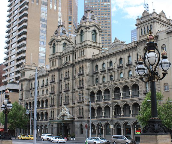
Facing Parliament House on Spring
Street between Collins and Bourke Streets is the Hotel
Windsor, Melbourne's most historic hotel; it is locally
called 'the Windsor' (t 03 9633 6000, Superior Room for about
$260/night; Windsor Suite for about $520/night). Designed by
Charles Webb and built in 1883 as the Grand Hotel, it was a
temperance hotel from 1886 until 1920. Upon obtaining its
licence, it was renamed the Windsor. Situated near the theatre
district, it has been the favoured hotel of visiting
celebrities such as the Oliviers in 1948, Robert Helpmann,
Katherine Hepburn, Robert Morley and Rudolf Nureyev. In 1961,
the hotel was extended to the corner, replacing the famous
White Hart Inn, a well-known theatrical haunt. Chrystopher
Spicer has written a book chronicling the hotel's history, Duchess: The Story of The
Windsor (1993).Across the street, on the southwest corner is the
Southern Cross Hotel. It was on this site that the Eastern
Market was established as the city's vegetable market in
1859. It was in operation until the 1950s; the present hotel
was built in 1962.
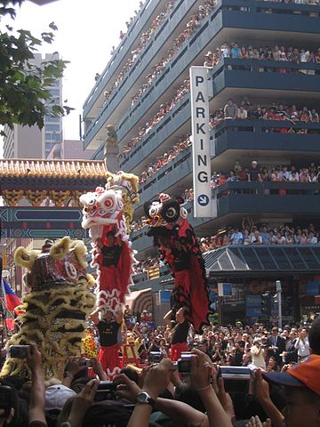
One block north from here is Little Bourke Street; from here
to Swanston Street is Melbourne's Chinatown.
Melbourne's Chinatown became the most important locus
for Chinese culture and protection during the gold rush
years. Businesses and restaurants, as well as residences,
shot up, most of them in buildings of Victorian, not
Chinese, design. The warehouse structure at 112-114 Little
Bourke Street is one of the most substantial of these
buildings, built in 1888 for Lowe Kong Meng, a wealthy
merchant and leader of the community. On the many side
alleys warehouses and small businesses appeared, such as
those at 15-17 Celestial Lane, which was built as lodgings
in 1883; next door is housing constructed by the See-Yup
Society, a fraternal benevolent association. One of the only
early restaurant buildings to survive, from 1891, is the
former Wing Ching Restaurant, 11 Heffernan Lane; while its
name changed over the years, it remained as a restaurant.
Nam Poon Soon Chinese Club, at 200-202 Little Bourke Street,
is in the heart of Chinatown. This two-storey structure
dates from 1861 and is believed to have been designed by
Peter Kerr for another benevolent society, the Sam-Yup
Society, which supported migrants from the districts of
Nanhai, Punyu and Shute. It has been a significant centre
for Chinese-Australian life since its erection.
At nos 107-109 the Chinese National Club was established in
1903, in a building designed by Nahum Barnet for the
merchant C.H. Cheong. It was this building that Walter
Burley Griffin redesigned in the 1920s; much of his façade
was for some reason removed in 1978.
Another important part of Chinese life in Australia centred
on the mission churches, such as the Methodist Mission
Church, no. 196, the oldest of these churches, opened in
1872 and designed by Crouch and Wilson in an incongruous
Gothic style. An Anglican training centre and hall was
commissioned by missionary Cheong Cheok Hong at 108-110 and
built by Charles Webb in 1894. After this church was given
to the Church Missionary Association in 1897, Cheong Cheok
Hong built the Church of England Mission at 119-125, another
Nahum Barnetdesign.
A fascinating and informative description of the Chinese
contribution to Australian society is available at the Museum of
Chinese Australian History (t 03 9662 2888; open daily
10.00-16.00), opened in 1985 at 22-24 Cohen Place in an
1890s warehouse building. The entrance is through a replica
of the Ling Xing Gate which faced the Heaven Palace in
Nanjing. Exhibitions include the Dai Loong dragon used in
New Year's festivities, and an excellent audio-visual
presentation chronicling Chinese life in Australia. Tours of
Chinatown are available through the museum.
Chinese immigration
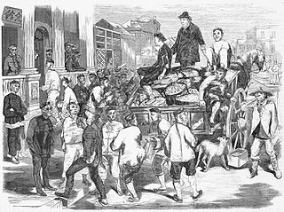 |
Chinese immigrants first entered Australia in the 1840s, when the end of convict transportation led to a lack of cheap labour and employers looked to China as a new source. This practice ended when gold was discovered, as the Chinese flocked to the fields. In 1854, there were 2300 Chinese in Victoria; by 1858, that number had risen to 42,000. Their presence almost immediately led to racial hostilities with other miners, and by 1855 restrictions on Chinese immigration were enacted. In every goldfield town, the Chinese presence was significant. In some places, such as Ballarat's Sovereign Hill and Bendigo's Chinese Museum, their contribution is positively commemorated; in others, their presence is indicated only in the graveyards and perhaps through descendants who still run Chinese restaurants in these country towns. |
Little Bourke Street still bustles with life, food shops and
restaurants, bookstores and shops of many Asian varieties.
Dining in one of Chinatown's many authentic restaurants is
an essential Melbourne experience.
Back on Bourke Street, the blocks from Exhibition Street to
the General Post Office on Elizabeth Street are dominated by
modern cinema houses and, from Swanston to Elizabeth
Streets, a pedestrian mall. Here are the major department
stores, David Jones and, that very Melbourne establishment,
Myers (see box).
The pedestrian mall followed years of debate about the
desirability of such a mall in the inner city; it was
officially opened by the Prince and Princess of Wales in
1983. Next to the Myer Building is another Melbourne
institution, the Buckley and Nunn Menswear Store; the
building, designed by Bates, Smart & McCutcheon, won the
Royal Victorian Institute of Architects Street Architecture
Medal in 1934. The company's name has entered Australian
folk etymology as the origin of the term 'haven't got
Buckley's'; the first usage was as 'you have two chances:
Buckley's and none (Nunn)'.
 |
The Myers store was founded by Sidney Baerski Myer (1878-1934), a Polish immigrant who arrived in Australia in 1897. He first established businesses in Bendigo and Ballarat, and then moved to this site in the 1920s, constructing a 'Cathedral of Commerce' after acquiring several other companies. By 1928 the business was enormous, employing in the 1930s some 5000 workers, and providing them with rest homes and holidays at the seaside. At Sidney Myer's death in 1934, his will was valued at £920,000. The Myer family continued his charitable activities, providing unemployment relief during the Depression, promotion of the Melbourne Symphony Orchestra, and contributions to the University of Melbourne (the Chair of Commerce was named in honour of Sidney Myer). The Myer name continues to be associated with business and philanthropy throughout Australia. This main store of the Myer empire is part of Melbourne life; everyone awaits Myer's Christmas windows, and the best buskers are located outside its doors. |
Royal Arcade, 331-337 Bourke Street to Little Collins
Street, was erected in 1869 and designed by Charles Webb in
Classical style. The arcade contains the seven-foot wooden
sculptures of the mythological giants Gog and Magog who
serve as strikers of the giant clock, designed by Mortimer
Godfrey in 1870. It is the oldest arcade in Melbourne. The
rest of the mall block of Bourke Street contains some
delightful commercial structures from the early 1900s,
including, at no 310, an Art Deco gem with a decorative
glass façade, and at 315, a little gothicised pink
skyscraper.
At the corner of Bourke and Elizabeth Streets is the General
Post Office. A post office was on this site from 1841. The
present structure was begun in 1859, and was not completed
until 1909; during its construction Bourke Street became the
commercial centre of the city, and it served as a focal
point for Melbourne activities. Evidence of its significance
to the colony was its final cost of £140,000. When its main
structure was completed in 1867, all of Melbourne turned out
to inspect this most important building. In the early days,
the arrival of mail from England was an enormous event, and
flags were flown from the GPO to announce the sighting of
the mail boat; the post office then became a hive of
activity, with more than 10 tons of mail sorted. Designed by
A.E. Johnson, this building incorporates ideas from as many
as 65 architects. An architectural heritage guide gives the
following description of its style: 'It is the finest
example in Victoria of an arcuated structure in the
Classical style with a superimposed trabeated system of
Doric, Ionic, and Corinthian pilasters rising up the
façade.' In any case, the building demonstrates the central
role the post office played in the civic life of 19C
Melbourne. Available inside is a History of Postal
Services in Victoria, a quite substantial publication.
Early skyscrapers
|
On the southwest and southeast corners of William and Bourke Streets are two contemporary buildings: the Australian Mutual Provident Building and BHP House. When erected in the 1970s, they caused great controversy for their height (certainly above the traditional 132 feet prescribed for earlier Melbourne buildings) and for their modernist functionalism which contrasted with the rest of the streetscape. Both were designed in association with the American firm Skidmore Owings and Merrill: the epitome of a corporate architectural group. This block was also the original site of St James Cathedral, which had been moved in 1913; somehow these new skyscrapers seemed a sacrilegious assault on such hallowed ground. The award to the BHP House of an architectural medal in 1975 fanned the flames of public outrage. The Menzies Hotel, an important early focal point for Melbourne's social life, stood on this spot until it was demolished for this building. Anthony Trollope, when visiting Australia in the 1870s, stayed at the Menzies and praised its hospitality. |
If one compares these contemporary buildings to the Abrahams Building down Bourke Street, the reason for outrage about the modern skyscrapers is apparent. This extravagant Queen Anne-style warehouse and office building, built in 1901 by architect Charles D'Ebro, epitomises the colourful Victorianism that was characteristic of 19C Melbourne architecture.
Further along, past King Street, is St Augustine's Roman
Catholic church, a Gothic design in bluestone designed by
T.A. Kelly and built by Reid and Stewart in 1869-70 to
replace a timber church which was on the site from 1853. The
hall used to house St Augustine's School, a leading
parochial institution in the early 20C. The church has
traditionally been the mission church for seamen; the Stella
Maris Seafarers Centre is located behind the church.
On the same side of the street, the Tramways Building was
designed in 1891 by Twentyman & Askew for the offices of
the Melbourne Tramway & Omnibus Co. The company itself
was founded in 1868 by an American businessman, F.B. Clapp,
who operated horse-drawn cabs to the suburbs. He convinced
the government to install a cable tramway system, considered
the largest in the world. Clapp ran the company as a
monopoly until 1916.
Robert Hoddle, Melbourne's first
surveyor
| The southeast corner of Bourke and Spencer Streets (where the Savoy Tavern is today) was purchased in 1840 by Robert Hoddle, Surveyor-General of central Melbourne. He established a home here with a garden of native plants. Along with laying out the city's streets, Hoddle also served as the colony's first land auctioneer, in payment for which he was given the block of land now occupied by the State Bank Centre on the southwest corner of Bourke and Elizabeth Streets. |
Hoddle's Corner, extending from Bourke to Little Collins
Street along Spencer Street, was early known as Government
Block, as at the Little Collins Street intersection, the
first police magistrate William Lonsdale built his cottage
in 1836 and erected barracks for soldiers and policemen.
Further barracks were erected in the 1850s between Little
Collins and Collins Streets; in the middle of this block
towards King Street, the first permanent gaol was
established in 1839. The execution ground was located at
Melbourne Gaol, near the present site of the Royal Melbourne
Institute of Technology.
The area on Spencer Street near Collins Street and
Flinders Lane, is the site of the original Batman's Hill
(now levelled and indistinguishable). The hill was a source
of great contention between rivals Batman and Fawkner.
Fawkner spent all his life fighting Batman's claim as
founder of the settlement and eventually settled elsewhere.
Batman's Cottage was no doubt a humble affair, although it
is known to have had a chimney constructed by William
Buckley, the famous escaped convict who had lived with the
Aborigines for 32 years when discovered. When Batman died,
having never legally acquired the hill, his family were
evicted from the farm.
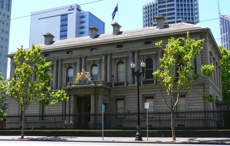 North on William
Street to Little Lonsdale Street is the site of the former
Royal Mint, now the home of the Hellenic Museum (t 3
8615 9016; open Tues-Sun. 10.00-17.00; admission adults $10,
concession $5.00). In 1854, an Exhibition Building modelled on
the Crystal Palace was built here, but quickly fell into
disrepair. In 1871, the Mint was erected to a design by J.J.
Clark, in a style more reminiscent of a private mansion than a
Public Works structure. It operated as a mint until 1968. The
royal coat of arms still adorns the front iron gates. In 2007
Spiros Stamoulis gave this nobel building its current
function, to convey the rich cultural traditions of historic
and contemporary Greeks. This purpose is certainly appropriate
to the city given the number of immigrants from Greece living
in Melbourne today.
North on William
Street to Little Lonsdale Street is the site of the former
Royal Mint, now the home of the Hellenic Museum (t 3
8615 9016; open Tues-Sun. 10.00-17.00; admission adults $10,
concession $5.00). In 1854, an Exhibition Building modelled on
the Crystal Palace was built here, but quickly fell into
disrepair. In 1871, the Mint was erected to a design by J.J.
Clark, in a style more reminiscent of a private mansion than a
Public Works structure. It operated as a mint until 1968. The
royal coat of arms still adorns the front iron gates. In 2007
Spiros Stamoulis gave this nobel building its current
function, to convey the rich cultural traditions of historic
and contemporary Greeks. This purpose is certainly appropriate
to the city given the number of immigrants from Greece living
in Melbourne today.Walk north to Latrobe Street and west to William Street;
here is the entrance to Flagstaff Gardens. Located to the
southwest of Queen Victoria Markets, the gardens stand on
the site of the town's original burial grounds. The first
burial here was a child, James Goodman, in 1836. Formerly a
prominent hill, in 1840 it was chosen as the location for a
signal station, hence the name flagstaff. It became the most
popular meeting place for early settlers, as they could gain
news of incoming ships and the arrival of mail. From here,
one could see the Williamstown Time Ball Tower; the ball
dropped every day at 1 pm for ships to set their
chronometers. In the middle of the gardens is the Pioneers'
Monument, commemorating the resting place of the earliest
settlers.
On the King Street side of Flagstaff Gardens, at Batman
Street, is St James Cathedral. Built in 1842-51 on a site at
the corner of Collins and William Streets, it was for many
years the most prominent landmark in the city. It was moved,
stone by stone, to its present location in 1913. Designed by
Melbourne's first architect, the London-born Robert Russell,
its foundation stone was laid by Governor Charles La Trobe
in 1839. As Melbourne's oldest surviving building the
cathedral is closely associated with its founding families:
John Batman donated £50 for its erection, and William
Lonsdale, first Police Magistrate of the district and a lay
preacher himself, was instrumental in its construction. It
remains as Russell's only surviving work, although
disagreements during construction led to his dismissal in
1841. Upon its opening in 1842, it was far from complete,
with later stages being built by Charles Laing. Construction
is of sandstone, both locally quarried and imported from
Tasmania.
The tower still contains the original bells, which were cast
in London and hung in 1853, when the building was
consecrated as a cathedral. They are rung by hand during
Sunday services and practice is on Friday evenings at 19.30.
The interior includes an 800-year-old baptismal font,
brought from St Katherine's Abbey in London, a church
demolished in 1837. Other features include an elaborate
Bishop's Throne and solid walnut pulpit; the windows are
those originally installed.
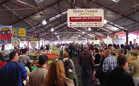
Exit Flagstaff Park at William Street, where it turns into
Peel Street at the entrance to the Queen Victoria Market
(open Tues and Thurs 06.00-14.00, Fri 06.00-18.00, Sat
06.00-15.00, Sun 09.00-16.00). This is a world-class
inner-city open market, wonderful to visit on Saturday
morning, with hawkers, buskers, divine sausage sandwiches,
and an invigorating cosmopolitan atmosphere. Spanning two
city blocks, the market is now listed by the National Trust,
not only because of its historical buildings, but for the
significant place it has held in the hearts of Victorians
for more than 100 years.
Locally the area is described as the Upper and Lower Market,
with the Lower Market being the oldest. In 1857, area market
gardeners petitioned Parliament for a permanent vegetable
market to be set up at the corner of Swanston and Victoria
Streets; this area was used mainly as an animal market until
1867, when it reverted to fruit and vegetables.
Eventually the markets expanded and areas for produce, meat,
dairy and retail goods were specifically delineated in the
1880s, when the present buildings were erected, with their
arched halls and appropriately decorated façades.
Now the market include stalls for leather goods, clothing,
and housewares. One section of the market between Peel and
Queen Streets at Victoria Street was the site of the town's
original cemetery; many of the graves were removed and
reinterred at the Fawkner Cemetery in Coburg, where some of
their 'red-gum' headstones can still be seen, along with a
memorial to John Batman, who was believed to have been
buried in the original cemetery. As one of the last
inner-city open markets, Queen Victoria is a must for any
Melbourne visitor.
From the market return towards the city via Elizabeth
Street. At Latrobe Street, turn east (left) to enter
Melbourne's glitziest new shopping mall, Melbourne Central
(300 Lonsdale Street; open daily). Along with the most
upscale shops in town, the complex includes a Marionette
clock, Butterfly Vivarium, and, most astonishingly, a glass
cone over the historic Shot Tower. Coop's Shot Tower, built
in 1889-90, is one of two surviving shot towers in Australia
(the other is outside Hobart). It retains much of the
original shot-making equipment.
Around the corner on Elizabeth and Little Lonsdale Streets
is St
Francis's Church. The foundation stone for this church
was laid in 1841 and dedicated in 1845, making it one of the
earliest churches built in Melbourne and its first Roman
Catholic church. Melbourne's first priest, Reverend Patrick
Geoghegan, arrived in 1839; his congregation was so
impoverished that it was unable to raise enough money to
qualify for a land grant, but Captain Lonsdale allowed them
to take possession of this site until the funds could be
raised. The structure now standing was meant to be a
temporary one, but has managed to survive and has recently
undergone major renovation. It was designed by Samuel
Jackson in a modified Gothic style; the interior includes a
cedar panelled ceiling added in 1850, which creates a
soothing atmosphere in the middle of the city. It was in
this church that Ned Kelly's parents were married, and Dame
Melba gave recitals here.
State Library and museum complex
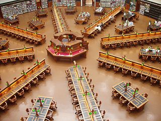 Continuing
east on Little Lonsdale Street, you come to the State Library (t
03 8664 7000; open Mon-Thurs 10.00-21.00, Fri-Sun
10.00-18.00) and museum complex facing Swanston Street. On
the front lawns stands a statue of Sir Redmond Barry, the
driving force behind the establishment of so many of
Melbourne's cultural institutions. The foundation stone for
the Public Library was laid in 1854, on the same day as that
for the university. Among Joseph Reed's earliest large-scale
works, the central portion was completed in 1870; the long
façade was not completed until 1961. The original interior
design is now only apparent in the first-floor reading
rooms; the dome, added in 1911, is one of the largest
concrete domes in the world. In Glen Tomasetti's novel Thoroughly
Decent People (1976), main character Bert Pater
marvels at the reading room, with its eight sides and 'three
tiers of balconies adorned with plastic laurel leaves linked
by swags of fruit'. The library also contains enormous
collections of artworks and the largest photography
collection in Australia. Until 1968, the accompanying
galleries contained the art collections of the State of
Victoria, now housed at the National Gallery of Victoria.
Continuing
east on Little Lonsdale Street, you come to the State Library (t
03 8664 7000; open Mon-Thurs 10.00-21.00, Fri-Sun
10.00-18.00) and museum complex facing Swanston Street. On
the front lawns stands a statue of Sir Redmond Barry, the
driving force behind the establishment of so many of
Melbourne's cultural institutions. The foundation stone for
the Public Library was laid in 1854, on the same day as that
for the university. Among Joseph Reed's earliest large-scale
works, the central portion was completed in 1870; the long
façade was not completed until 1961. The original interior
design is now only apparent in the first-floor reading
rooms; the dome, added in 1911, is one of the largest
concrete domes in the world. In Glen Tomasetti's novel Thoroughly
Decent People (1976), main character Bert Pater
marvels at the reading room, with its eight sides and 'three
tiers of balconies adorned with plastic laurel leaves linked
by swags of fruit'. The library also contains enormous
collections of artworks and the largest photography
collection in Australia. Until 1968, the accompanying
galleries contained the art collections of the State of
Victoria, now housed at the National Gallery of Victoria.
Back on Lonsdale Street and to the south are two
institutions closely associated with this once-poor
neighbourhood. The Wesley Church (now Uniting Church) was
built in the 1850s during the ministry of Daniel Draper. It
was highly criticised by Methodists for its Gothic design
(by the seemingly ubiquitous Joseph Reed), a style too
closely linked to Catholicism. For many years, it was
referred to as 'a blunder in bluestone'. In the entrance is
a well-known statue of John Wesley. For many years located
in the most deprived section of town, the church gained a
reputation for social welfare and reform.
Further along Lonsdale Street is the former Melbourne
Hospital (Queen Victoria Hospital). The foundation stone for
the city's third hospital was laid in 1846; most of the
buildings still extant date from the 1910s. In 1896, the
site became the home of the Queen Victoria Hospital, staffed
by women for women; it operated as such until 1946, when the
new Royal Melbourne Hospital was established. Closed in
1987, the site is currently occupied by a weekend market.
The other side of the block is a small Greek Quarter in the
inner city, worth visiting for its great cafes, bakeries and
restaurants.
Old Melbourne Gaol
Turn north on to Russell Street; continue past Latrobe
Street to Old
Melbourne Gaol (t 03 9663 7228; open daily
09.30-17.00; admission adults $25.00, concession $20.00,
children $13.50), probably the most popular tourist site in
the city, due largely to the fact that Ned Kelly, the famous
bushranger and Australian legend, was hanged here in 1880.
The exhibitions include Kelly's suit of armour, as well as
his wax death mask, along with those of the many colourful
outlaws who also met their end here. In the 19C many people
held the belief that moral character could be determined by
physiognomic features; just as now we feel that something of
the character of Ned Kelly can be understood by seeing the
impression of his face. To the physiognomist, however, these
death masks were made to use as case studies.
Architecturally, the gaol is a fascinating example of
colonial penal design. The first section was opened in 1845,
with constant expansions, especially during the goldrush
days, until the massive bluestone structure occupied the
entire block (most of it has now been taken over by the
Royal Melbourne Institute of Technology). One of the most
intriguing features is the elaborate corrugated iron ceiling
above the execution chamber--an extravagant, nearly
medieval, example of the Australian mastery of this building
material.
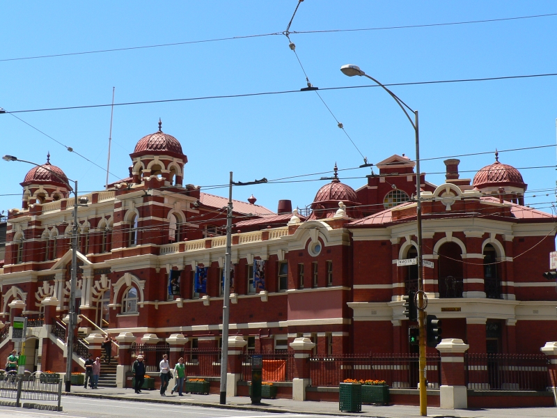 To the west of the gaol on
Victoria Street is the marvellous City Baths (Swim, Spa,
Sauna admission adults $13.40, student $11.00, concession
$8.00, open Mon.-Thurs. 6.00-22.00, Fri. 6.00-20.00, Sat.
and Sun. 8.00-18.00). Since 1858, public baths have been
available on this site. This ornate Orientalist structure
dates from 1903, designed by J.J. Clark, with separate
swimming pools for men and women, as well as actual baths.
The building was restored in 1980, and is now includes a
modern gym, with aerobics classes, spas and saunas.
To the west of the gaol on
Victoria Street is the marvellous City Baths (Swim, Spa,
Sauna admission adults $13.40, student $11.00, concession
$8.00, open Mon.-Thurs. 6.00-22.00, Fri. 6.00-20.00, Sat.
and Sun. 8.00-18.00). Since 1858, public baths have been
available on this site. This ornate Orientalist structure
dates from 1903, designed by J.J. Clark, with separate
swimming pools for men and women, as well as actual baths.
The building was restored in 1980, and is now includes a
modern gym, with aerobics classes, spas and saunas.
Royal Melbourne Institute of Technology
At this point, the buildings of the Royal Melbourne
Institute of Technology, more popularly known as RMIT,
straddle both sides of Victoria Street. The City Campus
fills the block behind the baths to Latrobe Street, and on
the other side of Victoria Street, runs over to Lygon Street
and north to Queensberry Street. The institute 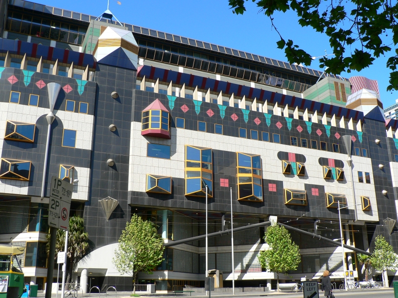 is one of Australia's largest
and oldest campuses, renowned for its training in
architecture, art and technical studies. At 360 Swanston
Street is RMIT Building no. 8, a smashing new structure that
dominates the streetscape, looking like a colourful,
jewel-encrusted crown. The polychromatic façade, added in
1993, covers a severe 1980s structure which houses the
Kaleide Theatre and the student union and, in the new
additions, the library and several faculties; one critic
described it as a 'feral vision'. The renovation was
designed by architects Peter Corrigan and Maggie Edmond; it
has won numerous architectural awards, including the Royal
Australian Institute of Architects' Walter Burley Griffin
Award for Urban Design in 1995.
is one of Australia's largest
and oldest campuses, renowned for its training in
architecture, art and technical studies. At 360 Swanston
Street is RMIT Building no. 8, a smashing new structure that
dominates the streetscape, looking like a colourful,
jewel-encrusted crown. The polychromatic façade, added in
1993, covers a severe 1980s structure which houses the
Kaleide Theatre and the student union and, in the new
additions, the library and several faculties; one critic
described it as a 'feral vision'. The renovation was
designed by architects Peter Corrigan and Maggie Edmond; it
has won numerous architectural awards, including the Royal
Australian Institute of Architects' Walter Burley Griffin
Award for Urban Design in 1995.
From 1908 to 1962, the RMIT area at 350-352 Swanston Street
was the premises of the Australian Journal, one of
the most significant literary journals in the colony's
history. It began as a weekly in 1865; its editor in 1870
was Marcus Clarke, whose pioneering book For the Term of His Natural
Life (1874) originally appeared as a serial in the
Journal in 1870-72. Other writers who published in
its pages were Charles Harpur, Ada Cambridge, and 'Rolf
Boldrewood' (Thomas Alexander Browne).
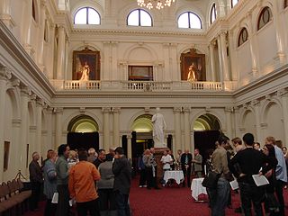 8.30-17.30
weekdays non-sitting, 8.30-day's adjournment on sitting days).
Begun in 1856 but not completed until 1930, this building and
the other public structures surrounding it more than any other
epitomise Victoria's grand efforts to be considered as a seat
of government and civic responsibility. Evidence of the
success of this effort, after Federation in 1901, the
Commonwealth Parliament sat here until Canberra was opened in
1927. The Parliament dominates and defines the East Melbourne
area. Designed by Peter Kerr and J.C. McKnight, the original
plan included an enormous dome which, once the economic boom
waned, was never built. The Doric façade with its massive
colonnade presents one of the most architecturally complex
designs in Australia. The interiors are equally impressive,
with stone and gilded columns and ornate carvings representing
industry, government and other symbolic references to the
strength of Victoria. Queen's Hall, added in 1879, includes a
sombre statue of Queen Victoria. Tours are available when the
houses are not in session, and include a view of the
jewel-like library.
8.30-17.30
weekdays non-sitting, 8.30-day's adjournment on sitting days).
Begun in 1856 but not completed until 1930, this building and
the other public structures surrounding it more than any other
epitomise Victoria's grand efforts to be considered as a seat
of government and civic responsibility. Evidence of the
success of this effort, after Federation in 1901, the
Commonwealth Parliament sat here until Canberra was opened in
1927. The Parliament dominates and defines the East Melbourne
area. Designed by Peter Kerr and J.C. McKnight, the original
plan included an enormous dome which, once the economic boom
waned, was never built. The Doric façade with its massive
colonnade presents one of the most architecturally complex
designs in Australia. The interiors are equally impressive,
with stone and gilded columns and ornate carvings representing
industry, government and other symbolic references to the
strength of Victoria. Queen's Hall, added in 1879, includes a
sombre statue of Queen Victoria. Tours are available when the
houses are not in session, and include a view of the
jewel-like library. At Parliament House behind the Old Treasury Building and State Government Offices is Tasma Terrace, a lovely block of six terrace houses constructed between 1878 and 1887 to a design by Charles Webb. The use of ironwork decoration is particularly pleasing. The offices of the National Trust are located here.
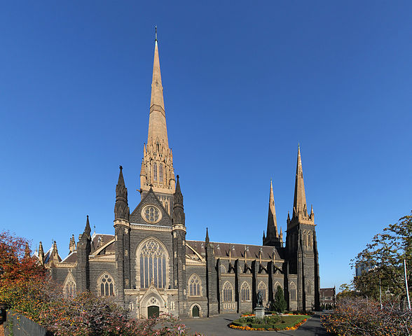 Continue
along Gisborne Steet to St Patrick's
Cathedral (t 03 9662 2233; open daily 07.00-17.50,
later for evening services). This splendid Gothic Revival
church dominates the Eastern Hill skyline; the third church
on the site, its foundation stone was laid in 1850. Building
began in 1857 to the design of W.W. Wardell. It stands as
his masterpiece, although the rapid expansion of the town
during the gold rush required constant additions, and the
building itself was not completed until 1897. The three
spires, part of Wardell's original plans, were not added
until 1939; the marble altars are also credited to Wardell.
It is now the largest cathedral in Australia, and the 103m
spire is the tallest in Melbourne.
Continue
along Gisborne Steet to St Patrick's
Cathedral (t 03 9662 2233; open daily 07.00-17.50,
later for evening services). This splendid Gothic Revival
church dominates the Eastern Hill skyline; the third church
on the site, its foundation stone was laid in 1850. Building
began in 1857 to the design of W.W. Wardell. It stands as
his masterpiece, although the rapid expansion of the town
during the gold rush required constant additions, and the
building itself was not completed until 1897. The three
spires, part of Wardell's original plans, were not added
until 1939; the marble altars are also credited to Wardell.
It is now the largest cathedral in Australia, and the 103m
spire is the tallest in Melbourne.
On the other side of the cathedral, on the corner of
Albert and Gisborne Streets, is St Peter's Eastern Hill.
Building began here in 1848, to a design by Charles Laing;
the first walls were built of English brick, imported as
ballast, which were plastered to give a lighter appearance
among all the bluestone edifices of the area. The
accompanying vicarage and school were designed by William
Pitt in 1886. In 1848, Melbourne was proclaimed a city on
the steps of St Peter's.
Across Albert Street in this block, squashed next to the
imposing ICI Building skyscraper, are several ecclesiastical
structures. The Baptist Church, designed to seat 700 and
built between 1855 and 1865, has a fine classical façade.
Next door is the Synagogue of the East Melbourne Hebrew
Congregation. This group split in 1857 from the Bourke
Street synagogue. The building dates from 1877, and is
Melbourne's oldest existing synagogue. The design by Crouch
and Wilson includes a classical façade with two eight-sided
domes.
On Albert Street is also the Salvation Army Printing Works,
home since 1901 of the army's paper War Cry (it has
been printed in Melbourne since 1883). Around the corner, on
Gisborne and Victoria Streets, is the former Eastern Hill
Fire Station, built in 1891; its imposing tower offered
great views over Melbourne. The building now houses the Fire Services Museum (t
03 9662 2907; open Thurs and Fri 09.00-15.00; Sun
10.00-16.00).
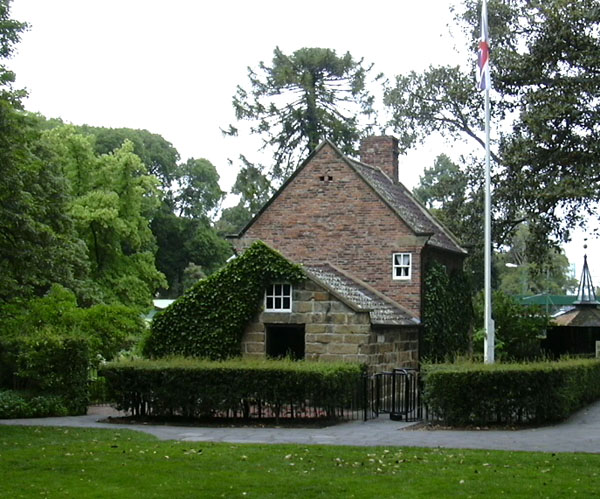 To the east of Treasury Gardens
are Fitzroy
Gardens, originally planned as subdivided blocks, but
set aside in 1848 in honour of Governor Fitzroy. Perhaps
appropriately for a site named for this 'immoral' governor,
the place was first used as a refuse tip. Formal designs for
a garden were first drawn in 1857 by Governor La Trobe's
nephew, Edward La Trobe Bateman, a plan greatly modified by
the gardens' first curator, James Sinclair. He had been
responsible for the planting of Czar Nicholas' Royal Gardens
in the Crimea. Sinclair intended to create here an English
plan with woodlands and fern gullies; he designed the
pathways roughly in the shape of the Union Jack. In 1929 a
conservatory was erected, and in 1934, to celebrate
Melbourne's centenary, the Yorkshire cottage of Captain
Cook's parents was disassembled, transported and re-erected
here (Cooks'
Cottage; open daily, 09.00-17.00). In the 1930s, Ola
Cohn sculpted a faerie tree here, which she describes in her
book The Fairies' Tree (1932); the tree, with its
possums and wombats, is still a popular attraction for
children. The author Jack Lindsay wrote that he was
conceived in the Fitzroy Gardens.
To the east of Treasury Gardens
are Fitzroy
Gardens, originally planned as subdivided blocks, but
set aside in 1848 in honour of Governor Fitzroy. Perhaps
appropriately for a site named for this 'immoral' governor,
the place was first used as a refuse tip. Formal designs for
a garden were first drawn in 1857 by Governor La Trobe's
nephew, Edward La Trobe Bateman, a plan greatly modified by
the gardens' first curator, James Sinclair. He had been
responsible for the planting of Czar Nicholas' Royal Gardens
in the Crimea. Sinclair intended to create here an English
plan with woodlands and fern gullies; he designed the
pathways roughly in the shape of the Union Jack. In 1929 a
conservatory was erected, and in 1934, to celebrate
Melbourne's centenary, the Yorkshire cottage of Captain
Cook's parents was disassembled, transported and re-erected
here (Cooks'
Cottage; open daily, 09.00-17.00). In the 1930s, Ola
Cohn sculpted a faerie tree here, which she describes in her
book The Fairies' Tree (1932); the tree, with its
possums and wombats, is still a popular attraction for
children. The author Jack Lindsay wrote that he was
conceived in the Fitzroy Gardens.
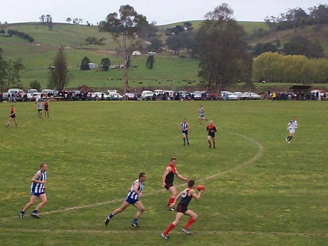 There are currently 18
teams in the national league, and hundreds of amateur leagues
each with a number of competing teams.
There are currently 18
teams in the national league, and hundreds of amateur leagues
each with a number of competing teams. The Kings Domain includes Jolimont
(La
Trobe's Cottage) (t 03 9656 9800; open Sun 14.00-16.00,
Oct.-Apr.), the original residence of Governor Charles La
Trobe. When La Trobe was appointed administrator of Port
Phillip, he contacted H. Manning of Holborn, a London
manufacturer renowned for his prefabricated wooden houses
designed especially for colonial outposts. Manning had already
provided such structures for the Swan River settlement in
Western Australia and for Governor Hindmarsh in South
Australia. While La Trobe ordered two structures, one more
substantial than the other and certainly intended to be his
Melbourne residence, he was forced to sell the larger one on
his arrival in order to afford the purchase of the land on
which he was to establish his governmental headquarters! (New
South Wales was notoriously parsimonious in its dealings with
its southern subordinate.)
The Kings Domain includes Jolimont
(La
Trobe's Cottage) (t 03 9656 9800; open Sun 14.00-16.00,
Oct.-Apr.), the original residence of Governor Charles La
Trobe. When La Trobe was appointed administrator of Port
Phillip, he contacted H. Manning of Holborn, a London
manufacturer renowned for his prefabricated wooden houses
designed especially for colonial outposts. Manning had already
provided such structures for the Swan River settlement in
Western Australia and for Governor Hindmarsh in South
Australia. While La Trobe ordered two structures, one more
substantial than the other and certainly intended to be his
Melbourne residence, he was forced to sell the larger one on
his arrival in order to afford the purchase of the land on
which he was to establish his governmental headquarters! (New
South Wales was notoriously parsimonious in its dealings with
its southern subordinate.)The Royal Botanic Gardens on Birdwood Avenue (t 03 9252 2300; open daily, 07.30-sunset) are considered by many to be one of the finest botanic gardens in the world; Arthur Conan Doyle said that it was 'the most beautiful place that I have ever seen'. German historian J.A. Froude comments on Australian gardens in his Oceana, a description of his visit to the country in 1885:
Whether it be the genius of the country, or some development of the sense of beauty from the general easiness of life, or the readiness of soil and climate to respond to exertion, certain it is that the public gardens in Australian towns are the loveliest in the world, and that no cost is spared in securing the services of the most eminent horticulturalists.
Certainly Melbourne's gardens evoke a quite genteel
atmosphere, situated on the banks of the Yarra River,
bounded by Government House to the west and the King's 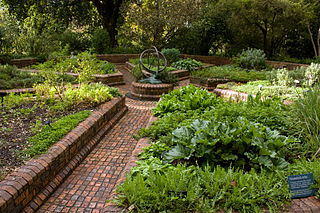 Domain
to the south, and filled with ornamental lakes, winding
paths, and magnificent flowerbeds. Although only 35.4
hectares in area, careful design gives the impression of
infinite space. The grounds were chosen in 1845, but real
development began when the great botanist and explorer
Ferdinand von Mueller was appointed director in 1857. In
keeping with his tenacious interest in Australian flora of
all sorts, he immediately established the National
Herbarium, an invaluable collection which is still
part of the gardens. The herbarium is now an administrative
and research centre, and contains an extensive botanical
library. The oldest part of the gardens is Tennyson
Lawn, which includes Arthur's Elms, four English elm trees
some 120 years old. Near the ornamental lake is Separation
Tree, memorialising Victoria's separation from New South
Wales in 1851. The real landscaping of the gardens occurred
under Mueller's successor, William Guilfoyle, who, from 1873
to 1909, took advantage of Mueller's collections, both
native and imported, and used them in the topographical
designs of the beds and lawns.
Domain
to the south, and filled with ornamental lakes, winding
paths, and magnificent flowerbeds. Although only 35.4
hectares in area, careful design gives the impression of
infinite space. The grounds were chosen in 1845, but real
development began when the great botanist and explorer
Ferdinand von Mueller was appointed director in 1857. In
keeping with his tenacious interest in Australian flora of
all sorts, he immediately established the National
Herbarium, an invaluable collection which is still
part of the gardens. The herbarium is now an administrative
and research centre, and contains an extensive botanical
library. The oldest part of the gardens is Tennyson
Lawn, which includes Arthur's Elms, four English elm trees
some 120 years old. Near the ornamental lake is Separation
Tree, memorialising Victoria's separation from New South
Wales in 1851. The real landscaping of the gardens occurred
under Mueller's successor, William Guilfoyle, who, from 1873
to 1909, took advantage of Mueller's collections, both
native and imported, and used them in the topographical
designs of the beds and lawns.
Government House
Behind the gardens, following Dallas Brooks Drive, is Government
House (t 03 9655 4211; tours for 10 or more;
tours of the well-appointed grounds and gardens are on the
3rd Thurs. at 11.00). The present majestic structure is the
fourth official residence, the earlier ones extending from a
wattle-and-daub hut in 1837, to a prefabricated wooden
structure for Governor La Trobe in 1840, and finally the
rental of the substantial 'Toorak House' in 1854.
By the 1870s, Victoria's growth and prosperity within the empire was such that a more dignified and grandiose house was deemed necessary. Certainly Victorians were also quite consciously stressing their progressive ambitions in relation to New South Wales when they constructed this lavish structure for their own governmental leader. The Inspector-General William Wardell (1823-99) was assigned the task of designing an appropriately ostentatious building. Unlike his more common Gothic Revival plans, Wardell drew heavily on Queen Victoria's Italianate Osborne House on the Isle of Wight for the design of Government House.
Situated in 11 hectares of beautiful grounds, the
stuccoed-brick building includes an impressive tower which
dominates the exterior view. The stunning State Ball  Room occupies the
entire south wing of the building. It is 46 metres long, 18
metres wide, and 15 metres high-surpassing in size the
ballroom in Buckingham Palace--a fact that did not please
Queen Victoria. The walls have been painted with stencilled
patterns and adorned with highly crafted plaster- and
woodwork; the room is illuminated by three massive
chandeliers. The State rooms are just as sumptuous, with
detailed columns and iron works around the staircases and
balustrades. The outer buildings, especially the stables,
are architecturally significant in their own right. The
current residents are kind enough to allow the National
Trust to conduct regular tours of the residence. These
generally occur on Monday, Wednesday and Saturday mornings,
but bookings are essential.
Room occupies the
entire south wing of the building. It is 46 metres long, 18
metres wide, and 15 metres high-surpassing in size the
ballroom in Buckingham Palace--a fact that did not please
Queen Victoria. The walls have been painted with stencilled
patterns and adorned with highly crafted plaster- and
woodwork; the room is illuminated by three massive
chandeliers. The State rooms are just as sumptuous, with
detailed columns and iron works around the staircases and
balustrades. The outer buildings, especially the stables,
are architecturally significant in their own right. The
current residents are kind enough to allow the National
Trust to conduct regular tours of the residence. These
generally occur on Monday, Wednesday and Saturday mornings,
but bookings are essential.
Back on to St Kilda Road and heading south you come to the Shrine of Remembrance (t 03 9661 8100; open daily 10.00-17.00) which is also in the King's Domain (you could also walk there directly from Government House, about 1km). In 1934, only 16 years after the end of the Great War in which Australia experienced appalling losses, this massive war memorial was opened by the Duke of Gloucester in front of a crowd of some 300,000. The monument's design incorporated heroic elements of the Parthenon and the Temple of Halicarnassus, with a pyramidal dome some 26m high. The Shrine is laden with symbolic inscriptions and sculptures; the central effect is a ray of light which dramatically strikes a marble plaque at the moment of armistice, in the eleventh month on the eleventh day at the eleventh hour. Sombre ceremonies also occur on Anzac Day, 25 April. On its opening, one critic described the structure as 'old-fashioned, over-cautious, and, as usual, excessively obsessed with getting a landmark by invoking the great Australian hobby of gilding the lily'. A cenotaph in the forecourt, with eternal flame, commemorates the victims of the Second World War. The Shrine's upper balcony offers spectacular views of south Melbourne.
Back on St Kilda Road again, south of the Botanic
Gardens, is Melbourne Church of England Grammar School, one
of the city's oldest private schools. The foundation stone
was laid in 1856, and the building designed by Charles Webb
and Thomas Taylor in a style that could be called
Elizabethan School style. Building materials include
bluestone with sandstone dressings, and white painted
woodwork. The Witherby Tower was added in 1876, and the
grounds retain a sense of the school's traditions and links
to English public school ideas.
Albert Park
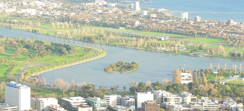
About 500m south is the beginning of Albert
Park (t 03 8627 4699), a lovely and enormous city
greenland with a lake big enough for sailing, a golf course
and other sporting facilities. It is now also the site of
the Australian Grand Prix racing event each year, despite
tremendous controversy and protest by local residents and
environmentalists, concerned about the inevitable
destruction of Albert Park itself (especially its venerable
trees) and the ensuing noise. The Grand Prix was happily
ensconced in Adelaide until 1995, when the present Victorian
premier, Jeff Kennett, ever ambitious to increase
Melbourne's tourist dollar and its cultural status, managed
to whisk it away from South Australia and plonk it in the
middle of Albert Park. So far, the event seems successful,
although at the time of writing resident protests continue.
The park is still a superb place to go cycling, sailing and
walking.
North Melbourne
To the north of the inner city, on the other side of
Victoria Street bordered by Rathdowne, Carlton and Nicholson
Streets, is Carlton Gardens. From Nicholson Street to the
east past Hoddle Street are the historically working-class
suburbs of Melbourne. Today, the suburbs of Abbotsford,
Alphington, Burnley, Clifton Hill, Collingwood, Fairfield,
Fitzroy, North Carlton, North Fitzroy and Richmond are
administered as the City of Yarra. While these traditional
neighbourhoods have seen tremendous demographic change, the
old divisions remain, and Melburnians have strong emotional
and historical ties to the old neighbourhoods. All of these
suburbs are well served by public transport, with trams,
trains, and buses travelling to them from the centre of
Melbourne and from Spencer Street Station.
The Richmond Council Offices and Town Hall, on Bridge Street
at Church Street, offer several brochures, including
Discover Yarra and a guide to The Yarra Trail.
Carlton Gardens
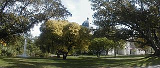 Today Carlton
Gardens (t 03 9658 9658) appear to be two
separate spaces, with the great complex of the Royal
Exhibition Buildings in the middle. While designated a park
area as early as 1852, plans for the design of the gardens
did not begin until 1858, when paths were laid out. The area
continued to be the haunt of vandals and feral goats until
the 1860s, until careful surveillance allowed the planted
trees to grow. In 1880, one of the most significant cultural
events in Australian history took place with the
inauguration of the International Exhibition, a time for
'Marvellous Melbourne' to present itself to an international
audience. The Carlton Gardens exhibition grounds covered 20
acres (8 ha) during the event. The remaining buildings,
built by Reed & Barnes in 1879-80, were part of the main
complex at the exhibition. The dome was modelled on that of
Florence Cathedral. The buildings served as the home of the
Victorian Parliament from 1901 to 1927, while the Parliament
buildings were used by the Federal Parliament. Now the
buildings house exhibitions and trade fairs, and provide an
elegant backdrop for pleasant garden strolls.
Today Carlton
Gardens (t 03 9658 9658) appear to be two
separate spaces, with the great complex of the Royal
Exhibition Buildings in the middle. While designated a park
area as early as 1852, plans for the design of the gardens
did not begin until 1858, when paths were laid out. The area
continued to be the haunt of vandals and feral goats until
the 1860s, until careful surveillance allowed the planted
trees to grow. In 1880, one of the most significant cultural
events in Australian history took place with the
inauguration of the International Exhibition, a time for
'Marvellous Melbourne' to present itself to an international
audience. The Carlton Gardens exhibition grounds covered 20
acres (8 ha) during the event. The remaining buildings,
built by Reed & Barnes in 1879-80, were part of the main
complex at the exhibition. The dome was modelled on that of
Florence Cathedral. The buildings served as the home of the
Victorian Parliament from 1901 to 1927, while the Parliament
buildings were used by the Federal Parliament. Now the
buildings house exhibitions and trade fairs, and provide an
elegant backdrop for pleasant garden strolls.
Fitzroy and Collingwood
On the eastern side of Nicholson Street begins the suburb of Fitzroy, and, at Smith Street to Hoddle Street is Collingwood. Together they originally formed the neighbourhood of Newtown. By the 1850s, their constituencies had developed competitive rivalries, evident not only in football, but also in the grandiosity of their town halls. Built in the 1880s, both town halls are vastly overscaled amidst the modest terrace houses of the area.
Fitzroy was the birthplace of Alfred Deakin, prime minister and would-be novelist. Also born here was novelist 'Henry Handel Richardson' (Ethel Florence Lindesay Richardson), author of The Getting of Wisdom (1910). Edmund Finn, better known as 'Garryowen', early chronicler of Melbourne life, lived here for 38 years; he is commemorated with a park on the site of his house in Leicester Street. In 1966, Peter Mather in his novel Trap, ruminated on Fitzroy's fate: 'and one day soon ... this area will be discovered by the suburb-haters and wrested from the natives and hoisted level with Carlton and Parkville. And probably made twee and chi-chi-unless enough of the present locals can hang on'.
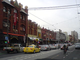 Always a
working-class area, at times quite rough, Fitzroy became
bohemian in the 1960s and 1970s, when students and artistic
types moved in. Brunswick Street is still the arty centre,
with alternative and women's bookshops, second-hand clothing
stores, ethnic cafes, and a strong gay presence.
Intriguingly, Brunswick Street no. 11 is also the location
of the Mary McKillop
Pilgrimage Centre (open weekdays 10.00-16.00) with
displays about the life of Australia's first saint. Her
efforts for the education of the children of poor people
were largely opposed by the male Catholic hierarchy despite
approval of her efforts from the Vatican.
Always a
working-class area, at times quite rough, Fitzroy became
bohemian in the 1960s and 1970s, when students and artistic
types moved in. Brunswick Street is still the arty centre,
with alternative and women's bookshops, second-hand clothing
stores, ethnic cafes, and a strong gay presence.
Intriguingly, Brunswick Street no. 11 is also the location
of the Mary McKillop
Pilgrimage Centre (open weekdays 10.00-16.00) with
displays about the life of Australia's first saint. Her
efforts for the education of the children of poor people
were largely opposed by the male Catholic hierarchy despite
approval of her efforts from the Vatican.
Most of the Aboriginal community centres are located in
Fitzroy, and Johnston Street is also the location for
Melbourne's Spanish-speaking community. Gertrude
Street has recently become a centre for avant-garde art
galleries and craft centres. The Gertrude Contemporary
at 200 Gertrude Street houses a complex of studio spaces and
contemporary galleries. Craft Victoria, 114 Gertrude Street,
sponsors exhibition programmes and provides information on
Victorian crafts people. An important and
long-standing cultural institution has closed, but deserves
mention, the Erwin Radio Theatre, formerly at 211 Johnson
Street, a site since 1994 of previews of the Melbourne
International Film Festival with a seating of only
60. The immense Town Hall, on Napier
Street had been partially used for the public library, in a
lovely wood-lined room. This room is still accessible as the
Reading Room, a venue for weddings and similar
functions. Across the street at Condell and Young,
next to blocks of housing project apartments, is Cubbies, an adventure
playground where children are allowed to build cubbies and
express themselves creatively.
Collingwood remains a bit more rugged, less trendy. Smith Street, its main thoroughfare, is unpretentious, with budget clothing places and modest ethnic eateries. Named for one of the admirals at the Battle of Trafalgar, Collingwood was a bucolic place in the 1840s, and as late as the 1900s, farmers here still herded their cows down to the Yarra River.
The area's greatest claim to fame is as the location,
under the name of Carringbush, for Frank Hardy's epic novel,
Power Without Glory (1950), a barely fictionalised
account of the rise of notorious bookmaker and criminal
entrepreneur John Wren (in the novel, John West) spanning
the 1890s to the 1950s. Hardy, a leader in left-wing
politics of the period, was sued by Wren in a famous legal
battle of the early 1950s that coincided with government
attempts to ban the Communist party in Australia. Many of
the locales in Collingwood where Wren began his career are
only thinly disguised in the book, including the former
Cullins Tea Shop, 146 Johnston Street, the site in the 1890s
of Wren's original tote (gambling operation). The Richmond
(Carringbush) Regional Library, 415 Church Street, Richmond,
also commemorates Hardy's great literary achievement. ![]()
The southeast corner of Gipps and Hoddle Streets was
actually the site of a goldmine, opened in 1862 and quickly
closed. Following Hoddle Street north past Johnston Street,
you come to the Victoria Park Football Ground, across the
street from the Victoria Park railway station. The
Collingwood Magpies, often AFL champions, have been playing
football here since 1892.
Abbotsford
On the eastern side of Hoddle Street, the suburb is
actually called Abbotsford, filled along Victoria Parade
with grim reminders of the industrial factories that were
the source of employment for Collingwood's poor, and the
cause of hardship during times of depression. It is no
coincidence that many of the factories were involved in
activities that utilised the quickly polluted waters of the
nearby Yarra River: breweries, wool scouring and tanning.
Two venues marking this industrial period are of interest:
the former Alma Wool Scouring Factory, 663 Victoria Street,
Abbotsford; and the Carlton
Brew House, on the corner of South Audley and Nelson
Streets, Abbotsford (if you are over 18 you can book a tour
and tasting, $29). The Yarra had, of course, been the home
of the Wurundjeri people for thousands of years. By the
early 1900s, the river was so ruined by industrial waste
that it was unusable as a water source.
To the south of Johnston Street Bridge (c 300m) and on
the Yarra River is the Collingwood
Children's Farm, St Heliers Street (t 03 9417 5806;
open daily 09.15-16.45, cow milkings at 10.00 and 16.00,
guinea pig cuddles at 10.30-11.00, 12.30-13.00, and
15.15-15.45; admission adults $10.00, kids and concession
$5.00), a fun petting farm on a nicely reclaimed stretch of
riverbank at one of the many bends in the river. The site
was farmed for 100 years by the Sisters of the Good Shepherd
to feed 1000 residents of the convent here (the historic
convent buildings are visible from the farm).
Along the Yarra
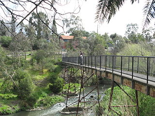 On the east side of Johnston
Street Bridge, the road becomes Studley Park Road, and you
enter Yarra
Bend
Park (t 03 8427 2002), 223ha of natural bushland
amidst the many bends of the upper Yarra River-a delightful
amount of open space nearly in the heart of Melbourne. This
area of the Yarra was understandably popular with early
Melbourne artists, and Yarra Bend scenery figures in many
paintings by Eugen von Guerard, S.T. Gill, and Tom Roberts.
These parklands are beloved by runners, picnickers, rowers
and cyclists; a variety of walking trails and excellent
cycling paths meander throughout the area, all of them
discussed and mapped in a number of brochures available at
the tourist offices or from the Yarra City Council offices
in the Richmond Town Hall on Bridge Street. The Yarra Bend
Public Golf Course, on the gentle slopes down to the river,
is considered one of the most picturesque courses in
Australia.
On the east side of Johnston
Street Bridge, the road becomes Studley Park Road, and you
enter Yarra
Bend
Park (t 03 8427 2002), 223ha of natural bushland
amidst the many bends of the upper Yarra River-a delightful
amount of open space nearly in the heart of Melbourne. This
area of the Yarra was understandably popular with early
Melbourne artists, and Yarra Bend scenery figures in many
paintings by Eugen von Guerard, S.T. Gill, and Tom Roberts.
These parklands are beloved by runners, picnickers, rowers
and cyclists; a variety of walking trails and excellent
cycling paths meander throughout the area, all of them
discussed and mapped in a number of brochures available at
the tourist offices or from the Yarra City Council offices
in the Richmond Town Hall on Bridge Street. The Yarra Bend
Public Golf Course, on the gentle slopes down to the river,
is considered one of the most picturesque courses in
Australia.
The best way to explore the park is either by car, along the many scenic drives, or by bicycle. Public transport entrance will involve quite a bit of walking. Take the no. 42 tram from Collins Street east along Victoria Street, get off at stop no. 28 and walk up Walmer Street and over the footbridge into the park at Dickinson Reserve; or take bus nos 201 or 203 from Flinders Street Station, which travel up Studley Park Road with stops in the park near the public golf course and several picnic areas along the river at Boathouse Road.
At the boathouse, you can rent rowing boats, and nearby
is Kanes suspension bridge, which takes you to the other
side of the river. From here it is about a 20-minute walk to
Dights Falls, now a picnic area at the confluence of the
Yarra River and Merri Creek (the falls can be reached by car
from Trennery Crescent, off Johnston Street in Abbotsford,
on the western side of the Johnston Street Bridge). The walk
goes by Deep Rock Picnic Area, where a foundation stone
commemorates the Deep Rock Swimming Club, a popular
recreation spot here until the 1940s. In 1918, a member of
the club, Alec Wickham (who also invented the Australian
crawl), dived 62.7 metres from the cliffs on the opposite
bank into the Yarra River with 70,000 people looking on; he
lost his swimming togs, but survived the attempt. Near these
cliffs on the southern side of the river is also the Pioneer
Memorial Cairn, honouring Charles Grimes, an early settler
considered the first European to discover the Yarra River in
1803, and who brought cattle from Sydney to Melbourne in
1836.
Until recently, Merri Creek was thoroughly neglected and
largely polluted (although its volcanic soil has long been
used for the Melbourne Cricket Ground pitch). Since 1976,
efforts by the local councils and government agencies have
seen the area impressively revegetated, with native flora
and fauna returning. The area around Dights Falls was an
important ceremonial site for the Wurundjeri tribe, one of
the five groups belonging to the Woiworong clan within the
Kulin nation that occupied the Port Phillip region. In the
1840s an Aboriginal mission was established here.
Today, the walk along the Yarra River at Victoria Street
Bridge, about 2km from Hoddle Street on Victoria Street, is
part of a 29km trail around the city known as the Capital
City Trail. This part of the walk takes about 1.5 hours, and
passes many important sites, including an Aboriginal sacred
Corroboree Tree, and at Yarra Bend itself, the Burnley
School of Horticulture, since the 1860s an experimental
garden on the river's banks. The trail continues all the way
along the river to Barkly Avenue in Richmond. You can also
get to Richmond from Victoria Street, south on Hoddle or
Church Streets. There are train stops at North, West, and
East Richmond.
Richmond
Most Melburnians come to Richmond to shop, especially
at the clothing outlets along Bridge Street (east on
Wellington Parade). Richmond is also the centre of
Melbourne's enormous Greek population, with the best Greek
restaurants and bakeries here. A sign of the changing face
of Melbourne culture can be seen on Victoria Street, now
filled with the city's best Vietnamese restaurants, evidence
of the area's latest wave of immigrants. In January,
Victoria Street hosts the Lunar Festival, to celebrate the
city's Asian culture.
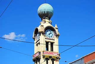 Richmond's mercantile
past is represented by Martin's Hardware, 38 Victoria
Street, run by the same family for more than 100 years,
and, on Swan Street, the suburb's other major
shopping strip, Dimmeys Department Store, with its
80-year-old dome and clock tower. This discount department
store has been there since 1853, and is a wonderfully
old-fashioned bazaar of wares. It was sold in 2008,
closed in 2012, and re-opened 2015 as a Cole' grocery
store.
Richmond's mercantile
past is represented by Martin's Hardware, 38 Victoria
Street, run by the same family for more than 100 years,
and, on Swan Street, the suburb's other major
shopping strip, Dimmeys Department Store, with its
80-year-old dome and clock tower. This discount department
store has been there since 1853, and is a wonderfully
old-fashioned bazaar of wares. It was sold in 2008,
closed in 2012, and re-opened 2015 as a Cole' grocery
store.
The walk north along Church Street from Swan Street to
Bridge Street includes several structures of interest in
Melbourne's history. The area was known as Richmond Hill,
and was quickly subdivided into elegant residential blocks.
The site of the Carringbush Regional Library, at no. 415,
used to be the Globe Picture Theatre, a classic old cinema
palace with a sliding roof. 'Ivanhoe', at 383 Church Street,
was the home of Joseph Bosisto, first manufacturer of Parrot
Brand eucalyptus oil (still available) and twice Mayor of
Richmond. 'Helenvale', no. 377, was built by Johannes Koch
in 1884; he too was Mayor of Richmond and a noted architect.
No. 293 was Lalor House, built in 1888 for Dr Joseph Lalor,
son of Eureka Stockade hero Peter Lalor, who died here in
1889.
St Ignatius Roman Catholic Church was built by William
Wardell in 1870, with a 213-foot spire that dominated the
skyline. St Stephen's Anglican Church, built in the 1850s,
was the first bluestone church in Gothic style in the
colony, although little of the original structure remains.
Turn into Vaucluse at St Ignatius Church; this was from the
1870s one of the most exclusive neighbourhoods in the city.
Most of the area became the property of the Jesuit Order in
1882, where Vaucluse College is now.
To the north of Carlton Gardens is the famous suburb of
Carlton, which borders and surrounds the campus of the
University of Melbourne and continues, on Lygon Street,
alongside the Melbourne General Cemetery. Several tram lines
from the city travel up Royal Parade, Lygon Street, and
Nicholson Street. Rathdowne Street, along Carlton Gardens,
was the site of one of the earliest tram lines out of the
city. Elizabeth Street north from the city turns into Royal
Parade, a wide tree-lined boulevard leading past the
university and, to the west, the architecturally elegant
district of Parkville, next to the Royal Park. Royal Parade
turns into Sydney Road and the ethnically diverse suburb of
Brunswick at Brunswick Road, leading out to the Hume Highway
towards Canberra.
University of Melbourne
While today Melbourne and vicinity boasts several
prominent institutes of higher learning, for at least a half
century the University of Melbourne stood alone. Founded by
an Act of Parliament in 1853, it opened in 1855 with three
professors and 16 students; in 1995, it had 16,000 students;
in 2015, 45,000. The current campus comprises the 19
hectares originally set aside for the purpose; in the early
days, much of this land served as a public park with lake
and walking paths. Those areas are now occupied thickly by
academic buildings. Women were first admitted to the
university in the late 1870s, some 40 years before their
counterparts in England.
The campus now is a blend of predictably Oxbridge-style
Tudor buildings of the 1870s and multi-storeyed contemporary
facilities built since the Second World War, when enrollment
soared. As one description of the campus states, '...no
logical course exists by which one might easily comprehend
the university entire'. Indeed, there is a cosiness about
the campus, aided by well-planned landscaping and public
sculpture, but it is difficult to orientate oneself, as the
older buildings radiate from the northern edge with pathways
leading towards other centres. Noted historian Geoffrey
Blainey wrote a centenary history of the university in the
1950s, which is still a good source for historical
information. The university has been home to two of
Australia's most important literary magazines, Meanjin (1940- ) and
the short-lived Scripsi (1984-1994).
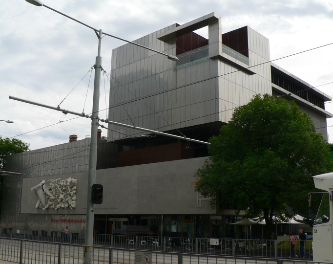 The campus also
includes several interesting
collections, including the Sir Ian
Potter Gallery (t 03 8344 5148; open Tues-Fri
10.00-17.00, Sat & Sun 12.00-17.00; free admission)
which has changing exhibitions and the Percy Grainger
Museum (t 03 8344 5270; open Sun.-Fri. 12.00-16.00;
free admission) which, in addition to changing topical
exhibits, commemorates the life and work of the eccentric
Australian composer Percy Grainger (1882-1961), including
his significant collection of world folk music.
The campus also
includes several interesting
collections, including the Sir Ian
Potter Gallery (t 03 8344 5148; open Tues-Fri
10.00-17.00, Sat & Sun 12.00-17.00; free admission)
which has changing exhibitions and the Percy Grainger
Museum (t 03 8344 5270; open Sun.-Fri. 12.00-16.00;
free admission) which, in addition to changing topical
exhibits, commemorates the life and work of the eccentric
Australian composer Percy Grainger (1882-1961), including
his significant collection of world folk music.
Directly to the north of the university is the Melbourne
General Cemetery; it is the country's first landscaped
garden cemetery, 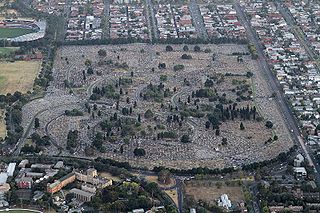 and was opened in
1852. The cemetery follows the Scotsman John Claudius
Loudon's (1783-1843) directive that 'churchyards and
cemeteries are scenes not only calculated to improve the
morals and taste, and by their botanical riches to cultivate
the intellect, but they serve as historical records'. The
principle architect was Albert Purchas; the Melbourne
Botanic Gardens supplied much of the plantings, and it is
indeed a pleasant place to walk and study historical
gravestones-monuments to singer Nellie Stewart and physician
Emma Stone, to bookman E.W. Cole of the Cole's Book Arcade
and artist Louis Buvelot. The cemetery also houses a
memorial to Elvis Presley, maintained by the local fan club.
(The most impressive funereal monument in the city is the
Springthorpe Memorial, built by Dr John Springthorpe after
the death of his young wife in the early 1900s; it is in
Boroondara Cemetery in Kew High Street, a little west of the
central city.)
and was opened in
1852. The cemetery follows the Scotsman John Claudius
Loudon's (1783-1843) directive that 'churchyards and
cemeteries are scenes not only calculated to improve the
morals and taste, and by their botanical riches to cultivate
the intellect, but they serve as historical records'. The
principle architect was Albert Purchas; the Melbourne
Botanic Gardens supplied much of the plantings, and it is
indeed a pleasant place to walk and study historical
gravestones-monuments to singer Nellie Stewart and physician
Emma Stone, to bookman E.W. Cole of the Cole's Book Arcade
and artist Louis Buvelot. The cemetery also houses a
memorial to Elvis Presley, maintained by the local fan club.
(The most impressive funereal monument in the city is the
Springthorpe Memorial, built by Dr John Springthorpe after
the death of his young wife in the early 1900s; it is in
Boroondara Cemetery in Kew High Street, a little west of the
central city.)
The suburb of Carlton was Melbourne's most dynamic ethnic
enclave from the early days of the arrival of New
Australians after the First World War until the waning of
European immigration in the late 1970s. Before the Italians
and Greeks arrived, Carlton was principally Jewish. Yiddish
author Pinkus Goldhar, who lived in Melbourne from 1926
until 1947, set many of his short stories in Jewish
Carlton.
Traditionally, Lygon Street, leading from the central
district into Carlton, was the domain of Italian migrants
who early on established restaurants along this stretch. In
the 1950s, Lygon Street, with its espresso bars and pizza
stands (the restaurant Toto's, still
operating, claims to have introduced pizza to Australia),
was positively exotic in staid Melbourne, and the area
became the hip place to be. Today, it caters to a much more
upscale market, with glitzy fashion boutiques and yuppie
bars, the bohemians having moved elsewhere (although student
life from the nearby university still keeps the
neighbourhood lively).
In Carlton one will still find La Mama on Faraday
Street. Founded in 1967 by Betty Burstall, La Mama is one of
the oldest of Melbourne's excellent experimental theatre
venues. Today, 'po-mo culture' ('post-modern', alternative
and hip) thrives at the Step's Gallery
(owned and operated since 1992 by the Meat
Industry Employees' Superannuation Fund) and the Black Cat Cafe.
The day-long Lygon Street Italian Festa in October presents
fantastic Italian food and fun.
Drummond Street, from Victoria to Palmerston Streets, is
filled with Victorian townhouses and shopfronts, appearing
spruce with cast-iron verandahs and tree-lined verges.
Rathdowne Steet along Carlton Gardens was one of the first
cable tram routes from the central city and consequently saw
early commercial development. At no. 357 Rathdowne Street is
Our Lady of Lebanon Church, originally designed in 1878 by
Reed & Barnes as the Carlton Independent Church. In 1958
it became the first Lebanese Catholic Church in Victoria:
further evidence of the area's ethnic diversity.
To the west of the university and Royal Parade is the huge
expanse of Royal Park. The residential area between Royal
Parade and the park itself is known as Parkville, and
contains terrace-houses adorned with one of the greatest
concentrations of wrought-iron work in the country. Strolls
through Parkville's streets are recommended for all fans of
such architecture; several books have been written
discussing these works from the late 19C, many of which may
be available from local bookshops or in the tourism centres.
Royal Parade from Grattan Street to Gatehouse Street, then
along the Avenue are particularly good venues for an
architectural stroll.
In the park itself is the Royal Melbourne Zoological Gardens (t 03 9285 9300; open daily 09.00-17.00, until 21.30 on some summer nights; admission adults $32.50, concession 24.90, children 16.30 but free weekends and public holidays), established in 1861, making it the oldest zoo in Australia and the third oldest in the world. It is a pleasant, visitor-friendly spot, and the Butterfly House, with many varieties of Australia's impressive lepidoptera population fluttering everywhere, is definitely worth a visit. Public transport from the city stops directly in front of the zoo's main entrance; take the Upfield-line train to Royal Park Station, or tram nos 55 or 56 from William Street.
Back south on Royal Parade towards the city, turn into
Peel Street, then take Queensberry Street west to Howard
Street, turn north on Howard Street to Courtney Street and
finally right on Blackwood Street, the Meat Market Craft
Centre (03 9329 9966; contact for definite hours, but
probably open Tues-Sun and holidays 10.00-17.00). Built in
1880 by G.R. Johnson as a private market hall, it was
designated in 1979 by the Victorian Government as a centre
for the promotion and implementation of crafts. Today
craftspeople of all sorts work on site, and there are
demonstrations, displays and salesrooms. The quality and
standard is very high, and the setting particularly
attractive.
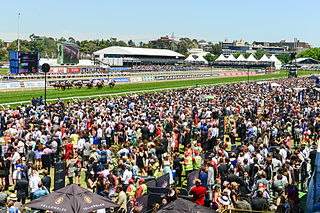
South Melbourne
From Albert Park, take Clarendon Street north into
South Melbourne. The no. 1 tram from Swanston Street travels
down Sturt Street to South Melbourne, Albert Park and South
Melbourne Beach; the no. 12 tram leaves Collins Street to
South Melbourne, Albert Park, Middle Park and St Kilda. A
pleasant residential area centred on the early settlement of
Emerald Hill, the area is bounded by Clarendon, Park, Cecil
and Dorcas Streets. The Town Hall provides a heritage trail
brochure with a well-marked bicycle ride. The site was
originally surrounded by swamps and was a corroboree spot
for Aborigines.
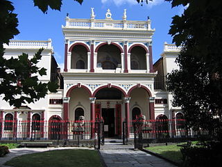 Off Clarendon Street
on Raglan Street is a Chinese Joss House, built in 1856 by
the Sze-Yup Society, and one of the best in Australia. As
with other churches and temples, please keep in mind that,
while it is open to the public, it is a place of worship.
Off Clarendon Street
on Raglan Street is a Chinese Joss House, built in 1856 by
the Sze-Yup Society, and one of the best in Australia. As
with other churches and temples, please keep in mind that,
while it is open to the public, it is a place of worship.
Continue on Clarendon Street to Park Street, where a former
knitting mill has been converted into the Victorian Tapestry
Workshop, now producing large-scale tapestries and
weavings by contemporary artists. One block further north is
Bank Street, where the grandiose South Melbourne Town Hall
looms enormously on the summit of a hill; erected in 1880,
it is another Classical edifice by Charles Webb. In
contrast, the adjacent police station and courthouse were
constructed in 1927 in Spanish Mission style.
At Cecil Street, continue two blocks north to the ever-popular South Melbourne Market (open Fri. 8.00-17.00, Sat.-Sun. 8.00-16.00, Wed. 8.00-16.00). Operating since 1867, it offers fish, vegetables and fruit, delicatessen products, as well as clothing and jewellery.
At 399 Coventry Street are three
prefabricated iron houses (open first Sun.
13.00-16.00; admission adults $6.00, concession and children
$4.00; group tours phone 03 9656 9889), erected in the
1850s, some of the few surviving iron cottages. These
include displays illustrating the history of portable
housing in Australia. The Clarendon Street shopping district
at Emerald Hill still retains its Victorian shopfronts.
Further south on Ferrars Street, on the border with the
neighbourhood of Albert Park, is St Vincent Place, a
remarkably well-preserved residential square, laid out in
1875 and reminiscent of London squares. Ferrars Street leads
south into Kerferd Road, then west to the neighbourhoods of
Albert Park on one side, Middle Park on the other side and
the bay beaches at the end of the road (tramroutes 1 and 2
end here). The Kerferd Road Pier, erected in 1881, sets the
tone for this lovely city beach area, most popular with the
locals. Running parallel to the stretch of sand is a walled
promenade that extends from Port Melbourne to the northwest
and St Kilda to the southeast, about 5km. Albert Park feels
like a village, with tiny beach-cottage-like houses, and a
cosy shopping block on Bridport Road at Dundas Place, filled
with great cafes and clothes shops.
History
Initially named Sandridge, the port's first settlers
were Wilbraham Liardet and his large family, who landed here
in 1839, and quickly built a jetty, watchtower and a hotel,
then established a ferry service between this point and
Williamstown. Liardet's jetty stood on the site of today's
Port Melbourne Yacht Club. At the time of settlement, the
area now noted only by Lagoon Pier was a verdant swamp,
which was completely polluted by the 1870s; once it was
dredged and filled in, the road to St Kilda could be built.
The lagoon marked the eastern boundary of the port town.
With the gold rush, the port swelled in population; in 1854,
Australia's first passenger railway service was opened
between the Port and Melbourne, and soon the Railway Pier
(now Station Pier) allowed ships to be unloaded directly
onto trains going into Flinders Street Station. Some of the
Victorian workers' cottages and storefronts on Bay Street
have been restored, and there are great neighbourhood pubs.
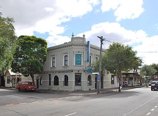 At one time, the
port maintained its reputation of having a pub on every
corner, although in the 1880s a religious temperance group
called The Rechabites made a concerted effort to close as
many as possible, installing drinking fountains near the
hotels. By 1919, only 19 pubs remained, and the other hotels
took on different functions. Some of those still operating
are grand old structures, such as The Rex, on Bay and Graham
Streets, formerly The Victoria or 'Squares', opened in 1859;
and, next door to the Town Hall on Bay and Spring Streets,
the Prince Alfred
Hotel, named in 1868 in honour of the visit of Queen
Victoria's son. At Bay Street between Graham and Liardet
Streets is the former Rose & Crown, with an Art Deco
façade and original 1875 interior. At Bay and Rouse Streets
is the former Post Office and Mail Exchange, opened in 1860
and at one time the colony's busiest.
At one time, the
port maintained its reputation of having a pub on every
corner, although in the 1880s a religious temperance group
called The Rechabites made a concerted effort to close as
many as possible, installing drinking fountains near the
hotels. By 1919, only 19 pubs remained, and the other hotels
took on different functions. Some of those still operating
are grand old structures, such as The Rex, on Bay and Graham
Streets, formerly The Victoria or 'Squares', opened in 1859;
and, next door to the Town Hall on Bay and Spring Streets,
the Prince Alfred
Hotel, named in 1868 in honour of the visit of Queen
Victoria's son. At Bay Street between Graham and Liardet
Streets is the former Rose & Crown, with an Art Deco
façade and original 1875 interior. At Bay and Rouse Streets
is the former Post Office and Mail Exchange, opened in 1860
and at one time the colony's busiest.
Further west along Beach Street is Station Pier, the
main passenger terminal and the point of departure for the
ferries travelling to Tasmania. The current pier was
completed in 1930 and is the largest timber structure in
Australia. The light-rail tram 109 from the city ends here,
on the same route that the first rail service travelled in
the 1850s.
To the west of Station Pier is Bayside, now the most
ambitious housing development in the region, a sign of the
port's new popularity as a place to live. The Boulevard
continues past Princes Pier to Garden City, a planned estate
built in the 1920s in emulation of Britain's Garden City
movement. The original intention was to provide low-cost
housing and to eliminate the squalid conditions existing on
this side of the tracks. These 'bank houses' were built on
small streets to discourage traffic, with green spaces in
between. The district between the Boulevard and Howe Parade
was erected in the 1940s, and known locally as 'Baghdad' for
it supposedly attracted 'forty thieves'. Ironically, the
'bank houses' constructed north of Howe Parade required a
deposit of £50 to buy, beyond the reach of most workers. The
architectural experiment is nonetheless interesting to view
today, despite its enormously increased value as real
estate. The beach here is on the migration route of
thousands of birds each spring.
Williamstown
From Todd Road in Port Melbourne, you can enter the
West Gate Freeway heading west over the towering West Gate
Bridge and exit at Melbourne Road (route 37) into the
historic maritime district of Williamstown. The area is also
accessible by train from the centre of Melbourne (the
Williamstown line), the no. 472 bus, and by ferry from St
Kilda on weekends; the tourist boat along the Yarra River
from the World Trade Centre also travels here on Sundays.
For Bay
& River Cruises information and timetables, t 03
9682 9555.
History
Williamstown was established as the settlement's main port in 1837 by Governor Bourke. It bustled with maritime activity until the Yarra River was dredged and the Port of Melbourne was expanded in the 1880s; then this little peninsula was forgotten, allowing it to remain a well-preserved community of 19C buildings and working-class neighbourhoods. Locals affectionately refer to the place as 'Willy'. It is one of the only places in Australia named after King William IV, whose reign ended the year it was settled. From 1893 to 1912, novelist Ada Cambridge lived here with her Anglican vicar husband G.F. Cross; it is the setting for her novel Fidelis (1895), in which she describes it as 'quiet and homely, and unpretentious! Not overrun with summer lodgers, like St Kilda'. Author Hal Porter also lived and taught school here during the 1930s Depression, a period he recounts in his autobiographical novel, The Paper Chase (1966). More recently, Williamstown has gained some recognition as the hometown of tennis phenomenon, Mark Philippousis.
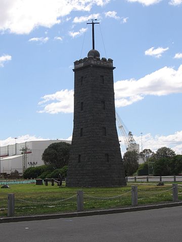 Take Melbourne Road to Ferguson
Street and east towards the bay and Nelson Place, the most
significant historical area, named appropriately enough
after Admiral Horatio Nelson (since it is a maritime centre
and was founded at the time of Nelson's greatest fame in the
British Colonies). To the north of Nelson Place, the road
along the bay is The Strand, where wealthy homes have the
most outstanding view of the port and the skyline of
Melbourne. At Nelson Place, old-fashioned hotels amongst the
historic public buildings offer ambience and good cheap
food; at Nelson Place and Kanowna Street is the former
Prince of Wales Hotel, now the RMS Titanic, one of the most
historic hotels from the 1850s. A short distance from here,
at the end of Nelson Place at Gellibrand Point, is the
Lighthouse and Time Ball Tower; in the 19C it was topped by
a copper-plated ball that dropped every day at 13.00 and
could be seen from Flagstaff Gardens in the city. Of
particular note on Nelson Place near the elegant Yacht Club
are the Customs House, built in 1873 by Peter Kerr in
subdued classical style; and the Tide Gauge House, erected
in 1860 at the head of Breakwater Pier, one of the only
surviving automatic tide gauges, and now in Commonwealth
Reserve.
Take Melbourne Road to Ferguson
Street and east towards the bay and Nelson Place, the most
significant historical area, named appropriately enough
after Admiral Horatio Nelson (since it is a maritime centre
and was founded at the time of Nelson's greatest fame in the
British Colonies). To the north of Nelson Place, the road
along the bay is The Strand, where wealthy homes have the
most outstanding view of the port and the skyline of
Melbourne. At Nelson Place, old-fashioned hotels amongst the
historic public buildings offer ambience and good cheap
food; at Nelson Place and Kanowna Street is the former
Prince of Wales Hotel, now the RMS Titanic, one of the most
historic hotels from the 1850s. A short distance from here,
at the end of Nelson Place at Gellibrand Point, is the
Lighthouse and Time Ball Tower; in the 19C it was topped by
a copper-plated ball that dropped every day at 13.00 and
could be seen from Flagstaff Gardens in the city. Of
particular note on Nelson Place near the elegant Yacht Club
are the Customs House, built in 1873 by Peter Kerr in
subdued classical style; and the Tide Gauge House, erected
in 1860 at the head of Breakwater Pier, one of the only
surviving automatic tide gauges, and now in Commonwealth
Reserve.
The Commonwealth Reserve is also the location for a craft market, held on the third Sunday of the month. At Gem Pier is HMAS Castlemaine, (t. 03 9397 2363; 10.00-16.00 weekdays and holidays; admission adults $6.00, children $3.00) a Second World War mine sweeper built in Williamstown and now converted to a maritime museum.
From Commonwealth Reserve walk up Parker Street to Electra
Street to find the Williamstown
Historical Society Museum (t 03 9397 5423; open
Sun 14.00-17.00; admission adults $3.00, concession $2.00,
children free), in the former Mechanics' Institute, filled
with maritime memorabilia and artefacts; it is only open on
Sunday afternoons. About 300m north on Electra Street at
Ferguson Street is the Town Hall with its memorial plaque to
novelist Ada Cambridge. To the right on Ferguson Street, is
Cox's Gardens, which contains one of the only surviving
examples of a 19C worker's cottage, built in the 1850s and
still inhabited. Thompson Street south from Nelson Place
leads to The Esplanade and a cosy beach with the Anglers
Club and the Williamstown Life Saving Club.
At North Williamstown, next to the train station and in the
Newport Railway Workshops is a Railway
Museum (t 03 9397 7412; open Sat. 12.00-17.00;
admission adults $8.00, concession and children $4.00).
Steam-train rides and locomotive displays made this a
popular destination for children.
Spotswood
Just north of Williamstown, off Douglas Parade on
Booker Street in Spotswood, is the excellent museum Scienceworks
(t 03 9392 4800: open daily 10.00-16.30; general admission
adults $14.00, others free, specific displays slightly
more), the science and technology campus of the Museum of
Victoria. Built on the site of Melbourne's earliest sewage
plant on the banks of the Yarra River, the museum
incorporates the old industrial buildings along with its
contemporary structure, with hands-on displays and
interactive exhibitions. The section on the science of sport
is especially innovative. The museum is a 15-minute walk
from the Spotswood train station.
St Kilda
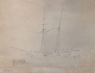
Full honours go to the St Kilda
Historical Society, whose website presents a wealth of
pertinent material including the full text of several books.
Richard Peterson's A
Place of Sensuous Resort: Buildings of St. Kilda and
Their People is a particularly valuable resource
available on-line. Anyone local should consider
becoming a member (individual $20.00, couples
$3.0.00, businesses $40.00). According to Melbourne
historian Garry Owen, this seaside suburb acquired its name
when then superintendent Charles La Trobe who was
picnicing with Lieutenant James Ross Lawrence, commander of
the schooner Lady of St. Kilda, at what would become
St. Kilda. La Trobe, it has been suggested, named the suburb
after having seen the handsome the schooner. To lovers
of history, the suggestion only starts the quest. The
schooner, it has been suggested, was named after Lady Grange
of Edinburgh, Rachel Chiesley, who was kidnapped by her
husband in 1732 when she threatened to reveal a Jacobite
(Catholic conspiracy to over turn the Scottish throne)
meeting at her husbands house. She was sent to the
island of St. Kilda where she lived for eight years.
In fact, the schooner was not named for the poor woman or
her Catholic sympathies, as supposed, but for the Scottish
island St. Kilda.
At the other end of the beach is the atmospheric area of
St Kilda; from Swanston Street in central Melbourne, take
trams 15 or 16; from Collins Street, trams 10 or 12; from
Bourke and Spencer Streets, the light-rail tram 96.
Until the 1920s it was a fashionable and exclusive
neighbourhood; the publisher George Robertson built his
mansion in East St Kilda in 1865. After the 1890s crash, the
rich began to move to Toorak, and the area declined into a
seedy area of strip-tease joints and carnival rides, cheap
lodging and bohemian hangouts.
Before and after the Second World War, European migrants
settled here in large numbers. Today the suburb has been
rejuvenated, with a mixture of beach-town attractions, great
Jewish and Continental (European) bakeries, elegant dining
and boating venues. The main thoroughfare into St Kilda is
Fitzroy Street. It retains hints of its reputation as the
city's red-light district, although it is now more
noticeable for its cafes and entertaining shops. Acland
Street between Carlisle and Barkly Streets is a foody's
heaven, with Central European cake shops and real
delicatessens.
The upper end of Acland Street is residential, except for
the contemporary art gallery at no. 26, 'Linden' (t 03
9534 0099; closed for the moment for renovation), an 1870
mansion built by Alfred Kursteiner for German entrepreneur
Moritz Michaelis; the building is now operated by the
National Trust and houses a contemporary art gallery. In
February, Acland Street is the site of the St Kilda
Festival, known for its tremendous displays of food.
The Town Hall, corner of St Kilda Road and Carlisle Streets, serves as an information centre and can provide a St Kilda Heritage Walk brochure.
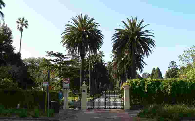 At Barkly Street at
the end of Acland Street, turn on to Blessington Street to
reach the lovely, quiet St
Kilda Botanical Gardens (t 03 9209 6777; open
sunrise to sunset; free admission; the website has good
descriptions of public transit), first planted in 1859 and
now with a conservatory and rose garden.
At Barkly Street at
the end of Acland Street, turn on to Blessington Street to
reach the lovely, quiet St
Kilda Botanical Gardens (t 03 9209 6777; open
sunrise to sunset; free admission; the website has good
descriptions of public transit), first planted in 1859 and
now with a conservatory and rose garden.
About 500m down Blessington Street west is the St Kilda
Beach and Marine Parade. Walking towards St Kilda Pier, at
Cavell Street, is the site of Melbourne's Luna Park
(t 03 9525 5033; open weekends and holidays
11.00-18.00; free admission, but the rides cost),
a nostalgic fun-park landmark since 1912, with its
gaping-mouth entrance and tacky old-fashioned rides said to
be modelled on those at New York's Coney Island. It was
opened by the American cinema entrepreneurs J.D. Williams
and the Phillips Brothers.
Walk up to The Espanade, the main beachside centre and
promenade. At the corner is a traditional entertainment
venue, the Palais
Theatre. The Palais was built in 1927 by Harry E.
White as a grand picture palace, seating 3000. It is now
used for live shows. Down on the beach on Jacka
Boulevard near the pier is St Kilda Baths,
one of the only remaining hot sea baths in Australia. At one
time, there were four sea baths along this beach, with
separate facilities for men and women.
The Upper Esplanade continues as an entertainment
centre, focusing especially on The Esplanade Hotel
(t 03 9534 0211), a venue for live bands and
comedy, and famous because Sarah Bernhardt stayed here in
1891 (it was built in 1880). Recently, local residents and
lovers of live music campaigned to save The Esplanade from
possible closure. After being closed for two years, it
was purchased in 2017 by hotelier/pub owner Sand Hill Road
and will be thoroughly renovated across the next two years.
venue for live bands and
comedy, and famous because Sarah Bernhardt stayed here in
1891 (it was built in 1880). Recently, local residents and
lovers of live music campaigned to save The Esplanade from
possible closure. After being closed for two years, it
was purchased in 2017 by hotelier/pub owner Sand Hill Road
and will be thoroughly renovated across the next two years.
Directly east is Alfred Square, site of the first building
erected in St Kilda in 1840. The square now contains two
interesting war memorials and the remnants of two very early
cottages. On Sundays, the Upper Esplanade is the location of
a long-standing art and craft market. A walk out along the
St Kilda Pier has become something of a local weekend
ritual--to have coffee at the historic Edwardian kiosk and
to watch the sailing activities. It is also one of the most
interesting places to experience the sudden transformations
of Melbourne's infamous weather, as sea breezes bring in
clouds and rain and as swiftly blow them out to the bay
again. The breakwater rocks on the end of the pier are now a
wildlife sanctuary for Little (Fairy) Penguins, who can
occasionally be seen here at sunset. On Sundays, ferries
depart from here to Williamstown. On the other side of the
pier is Catani Gardens, named in honour of Carlo Catani,
Chief Engineer of the Public Works Department at the time of
its construction in the 1910s. Judging by the other edifices
named in his honour--a Memorial Clock Tower on The Esplanade
and the Catani Arch on the foreshore--Catani was quite
successful in having things named after him.
Take The Esplanade east to Barkly Street and north to
Alma Road to enter St Kilda East. The Jewish Museum of
Australia (also known as the Gandel Centre of Judaica;
t 03 8534 3600; open Tues-Thurs 10.00-16.00, Fri.
10.00-15.00, Sun 10.00-16.00; admission adults $12.00,
concession and children $6.00) is at 26 Alma Road, fittingly
in the middle of Melbourne's traditional Jewish
neighbourhood, next to the St Kilda Synagogue, in itself a
historical structure, built by Joseph Plottel in 1927. The
museum includes permanent and temporary exhibitions,
focusing on Australian Jewish history and culture.
Prahran suburbs and South Yarra
To the east and north of St Kilda are the city's most
fashionable suburbs. The Prahran Council area covers the
upscale suburbs 'south of the Yarra', these being, South
Yarra, Prahran, Toorak and Armadale. The no. 8 tram goes
through these suburbs along Toorak Road, tram no. 6 travels
along High Street to Glen Iris, and tram no. 72 is on
Commercial Road, Malvern Road, and on to Burke Road to
Camberwell.
The Pakenham train line travels via Toorak, Armadale, and
Caulfield; the Sandringham Line stops at Prahran, Ripponlea,
and Elsternwick.
South Yarra is one of the earliest suburbs to be
established, and was traditionally working class. The
novelist 'Rolf Boldrewood' (Thomas Alexander Browne)
remembers his childhood here in the 1840s as 'the sandy
forest of South Yarra'; by the 1920s, according to Martin
Boyd, it had become the 'Mayfair of Melbourne'. As well as
remaining the residence of Melbourne's most established
gentry, these suburbs are now known for upscale
shopping.
Toorak has the most exclusive designers' shops, art
galleries, luxury car dealers and antique stores, on Toorak
Road.
Chapel Street, from Dandenong Road in Windsor, to Toorak
Road in South Yarra, is less exclusive, but chock-a-block
with trendy clothing shops and multicultural boutiques,
unique if still pricey. It used to be a real inner-city
shopping street for local business, but is now geared to the
rich and fashionable. Grenville Street, a side street off
Chapel Street between High and Commercial Streets, is an old
hippy hangout that now has New Age shops and antiquarian
bookdealers. Further east on High Street, Armadale has the
best art stores, antique furniture dealers, and accompanying
bookshops.
As an area that was early developed as a place for
prestigious residence, South Yarra and Toorak are littered
with elegant homes and estates. The stellar example of these
mansions is Como
House (t 03 9656 9889; gardens open Mon.-Sat.
9.00-17.00, Sun. 10.00-17.00, house by tour only Sat. and
Sun. 11.00, 12.30, and 14.00; house admission adults $15.00,
concession $12.00, children $9.00), at Williams Road and
Lachlade Avenue, South Yarra. To get there take Toorak Road
to Williams Road, and follow the signs, or take the no. 8
tram from Swanston Street.
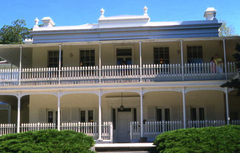 In the 1840s and 1850s, prosperous merchants
began buying property and building on estates to the south
of Yarra River, with its views towards the city but still in
bucolic settings. Como was one of the first of these
estates. The property was developed by lawyer Edward Eyre
Williams in 1846; the earliest parts of the house date from
this period. During the gold rush, the house changed hands
twice before being transferred to the architect John Brown
in 1854. It was Brown-who came to be known as 'Como
Brown'-who gave the property its pretentious proportions,
with an elegant Georgian-style mansion and superb gardens;
the characteristic wrought-iron railings and gates were
imported from Scotland.
In the 1840s and 1850s, prosperous merchants
began buying property and building on estates to the south
of Yarra River, with its views towards the city but still in
bucolic settings. Como was one of the first of these
estates. The property was developed by lawyer Edward Eyre
Williams in 1846; the earliest parts of the house date from
this period. During the gold rush, the house changed hands
twice before being transferred to the architect John Brown
in 1854. It was Brown-who came to be known as 'Como
Brown'-who gave the property its pretentious proportions,
with an elegant Georgian-style mansion and superb gardens;
the characteristic wrought-iron railings and gates were
imported from Scotland.
The property became the centre for extravagant social life,
until Brown's fortunes were reversed and Como sought a new
owner. In 1864, pastoralist Charles Henry Armytage purchased
the house. He made substantial additions and changes to the
house, most notably a two-storey ballroom completed by
Arthur Ebden Johnson (architect of Melbourne's General Post
Office and the Law Courts). Armytage also developed the
splendid gardens, with the aid of the famous curator of the
Botanic Gardens, Baron von Mueller. The house was turned
over to the National Trust in 1959.
Next door is Como Park, originally part of the Como grounds
and now a public park, directly on the banks of the Yarra
itself. It is one of the few remaining suburban gardens in
Melbourne, and still contains examples of trees and shrubs
planted in the 1850s.
Elsternwick
From Prahran, follow Williams Street directly south
past Dandenong Road where it becomes Hotham Street. At the
point where the suburb of Balaclava becomes Elsternwick-now
the most Jewish suburb in Melbourne, with consequent delis
and bakeries-you will find another great publicly accessible
mansion, Rippon
Lea (t 03 9523 6095; open daily 10.00-16.00; admission
adults $20.00, concession $18.00, children $10.00, admission
to the garden is free). Get there by the Sandringham train
line to Rippon Lea and a short walk, by bus nos 216 or 219
from Bourke and Queen Streets or by tram no. 67 from
Swanston Street. Once there, you can view the house as well
as changing exhibits.
A lavish Romanesque-style brick estate, Rippon Lea was
the brainchild of Frederick Thomas Sargood (1834-1903), a
leading Melbourne merchant and politician. A product of
Melbourne's most extravagant boom period, Sargood set out to
create a stunningly impressive estate worthy of his stature
and his times. Built by the firm of Reed & Barnes,
Rippon Lea was named for Sargood's mother. The original
house consisted of 15 rooms in the 1860s, and grew to 33
rooms by the 1880s.
By the time of Sargood's death in 1903, his property
included 43 acres (30 ha), complete with elaborate gardens,
a 1.6 ha lake, aviary, conservatories, carriage houses,
archery range, shade house and a lookout tower with a view
of Melbourne and Port Phillip. After many changing of hands,
mercenary subdivisions, and a tenacious battle to preserve
its main features, Rippon Lea remains on 9.5 ha.
The house is relatively intact. Elegant features include a cast-iron porte-cochère, and stunning Renaissance motifs in the interiors. The gardens are a reminder of the grand manner of 19C private urban gardens.
The third of these fine suburban mansions is Labassa,
2 Manor Grove, Caulfield North (t 03 9527 6295; open third
Sun of the month 10.30-16.30); admission adults $15.00,
concession $12.00, children $9.00). Take Hotham Street north
to Balaclava Road, turn east and travel c 1km to Orrong
Road, turn north directly to Manor Grove. Tram no. 3 from
Swanston Street travels down Balaclava Street one block
south, and Balaclava Station of the train line is c 1km
west. Originally known as 'Ontario', it was built by J.A.B.
Koch for pastoralist William Alexander Robertson; when it
was purchased in 1905 by mining baron John Watson, it was
renamed 'Labassa'. The building is noteworthy in that its
design is more European Baroque than English in style, and
the interiors include elaborate stencilling, still intact.
Travelling on St Kilda Road, at St Kilda Town Hall, the
route becomes Brighton Road and then, at Elsternwick, joins
the Nepean Highway (route 3) to travel south along the east
side of Port Phillip Bay and around the Mornington
Peninsula. The peninsula is also easily accessible by public
transport from the city, using a Zone 3 ticket on both train
and bus.
The suburbs closest to town were, naturally, the first areas
to develop as beach neighbourhoods, emulating British
seaside towns with names like Brighton and Sandringham, and,
further along, the loftier-sounding Beaumaris (pronounced
'bow-maris') and Mentone. At the Brighton foreshore near the
Marine Hotel is a plaque in memory of poet Adam Lindsay
Gordon, who shot himself here in 1870. Mentone was one of
the favoured spots for painters Charles Conder and Arthur
Streeton in the 1880s, site of Conder's elegant painting, A
Holiday in Mentone (1888), now in the Art Gallery of
South Australia.
the suburb mutated from a sleepy retreat beyond the end of the Sandringham train line ... to a place for the upwardly mobile with leased motor cars, who wanted to raise children close to sandy beaches. By degrees, the timber cottages ... gave way to solid middle-class, brick and tile residential investments. The housewives became slimmer, better dressed and more worldly. Children who went off to school from there wore the uniforms of Melbourne's private schools rather than that of the local High.The area, then, quickly became a playground for the upwardly mobile.
Indeed, one of the district's greatest claims to fame is
as the location of a series of famous 'sandy' golf courses.
In Sandringham is the grandest of all, the Royal Melbourne
Golf Club. The club, founded in 1891 and initially limited
to 100 members, moved from Caulfield to Sandringham in 1901.
Alister Mackenzie, renowned for the design of Augusta and
Cypress Point in the US, laid the West course in 1926. Alex
Russell, his local partner, built the East course.
|
While there is some controversy about the date
of the establishment of the first golf club in
Australia, the first course was probably that laid
out in 1847 at Flagstaff Gardens in Melbourne. At
about the same time a club was formed in Geelong,
Victoria; the Melbourne Golf Club was formed later
at Caulfield in 1891. The first course in Sydney was
established in 1855, but the first Sydney course of
long standing was the Australian Golf Club which
opened in 1882. After a pause in the early 1890s,
this club was revived and became the Royal Sydney
Golf Club. Its Cadogan Cup dates from 1883. What was
to become the Royal Brisbane Club was established in
the 1890s as well. The Royal Brisbane, the Royal
Queensland at Hamilton (1920) and the Indooroopilly
were the first full-length courses in Queensland
until the 1930s. |
The Mornington Peninsula proper extends from Frankston,
now a commuter suburb of Melbourne, all the way around the
eastern side of Port Phillip Bay to Portsea and Point Nepean
National Park at the entrance to the bay. Frankston and the
nearby beach of Canadian Bay in Mt Eliza gained some fame in
the 1950s as the location for the film of Neville Shute's
book On the Beach. (It was at this time, of course, that Ava
Gardner, starring in the film, made her famous comment about
Melbourne: 'It's a story about the end of the world, and
Melbourne sure is the right place to film it.'
An information centre for the peninsula is on the Nepean
Highway at Dromana (t 03 5987 3078). It has been the most
popular excursion destination for Melburnians since the
1870s and before that was the site of pastoral settlement.
It still retains its mixture of resort towns and rural
industry. The bayside or 'front beaches' provide sheltered
locations good for family outings, while the 'back beaches'
along the ocean coastline have rugged open-surf stretches
with stunning views. It was on this side of the bay that
Lieutenant David Collins unsuccessfully attempted to
establish a colony in 1803, at present-day Sorrento (see p
286).
At Seaford, you can take Seaford Road from the Nepean
Highway, join with the Frankston Highway (route 11) and
travel south to Skye Road (officially in the suburb of
Langwarrin). Here, connect with McClelland Drive south to
find McClelland
Art Gallery (t 03 9789 1671; open Tues-Sun,
10.00-17.00), surrounded by bushland with sculptural
displays. The collection was donated by the McClelland
family and specialises in Australian 20C art, primarily
watercolours and sculptures.

From Cruden Farm, travel east on Cranbourne Road to Warrandyte Road, about 500 m.; turn south, travel to North Road, turn west to Aldershot Road, which will lead to the entrance of the Langwarrin Flora and Fauna Reserve (t 03 9705 5200; open daylight hours) (2km); the reserve is on the site of a colonial military installation once used for German prisoners of war and as a hospital for the treatment of venereal disease. All evidence of its former usage is gone, and the area has returned to its natural state. The reserve offers walking tracks into native heathlands with great displays of wildflowers in the spring.
Continue on McClelland Road a further 3km to Golf Links Road in Baxter to reach Mulberry Hill (t 03 9656 9889; open by appointment; open Sun. 11.00-16.00; admission adults $10, concession $7.00, children $4.00), a National Trust property, home from the 1920s until the 1980s of Sir Daryl and Joan Lindsay. Yet another member of the artistic Lindsay clan, Daryl was best known as the director of the National Gallery of Victoria and as an art critic. His wife Joan is most famous for her book Picnic at Hanging Rock (1967), the basis for Peter Weir's 1975 film of the same name (the Hanging Rock in question is located 80km north of Melbourne, near the town of Woodend; Lindsay's direct inspiration may have been a painting of the site by William Ford, completed in 1875. Contrary to widely-held belief, the story is not based on a specific historical incident). The property has been left as it was at the time of Joan Lindsay's death in 1984, including hand-painted murals by Daryl in the writing rooms. It is open to the public on Sundays, and the Trust often holds musical and artistic events in the grounds.
From Golf Links Road, turn south on to Fultons Road, travel c 1.5km to Baxter-Tooradin Road (site of Baxter train station), turn west towards the bay and continue on to Sages Road. Near the intersection to the Moorooduc Highway is Baxter Barn by Going Gormet, at Sages Cottage, a venue for weddings and special events. The cottage was built on a pastoral property by John Edward Sage in the 1840s. He became well known for the development of stations in the area. Now the cottage is best known for its restaurant, which uses fresh herbs and vegetables from its own gardens. The cafe helps support Wallara Australia, which works with disabled young people.
Return to the bay via the Moorooduc Highway (route 11)
and the Mornington -Tyabb Road (route 62) into Mornington,
the shire headquarters of the peninsula. To the north of
here on Nepean Highway is Mount Eliza. Off Nepean
Highway at Mt Eliza Way is the Anglican church St James the
Less, a small brick Gothic Revival structure built in 1865
and noted for its sanctuary murals painted by local artist
Violet Teague (1872-1951) in 1931.
Back on Mornington -Tyabb Road, you come to Civic Reserve, at Dunns Road before entering the main street of Mornington. At Civic Reserve is the Mornington Peninsula Regional Gallery (t 03 5950 1580; open Tues-Sun, 10.00-17.00; admission adults $4.00, children $2.00), one of the Victorian regional art galleries, concentrating on the collection of Australian drawings; the contemporary sandstone building is located next to a small lake in a bushland setting.
 Earlier
known as Schnapper Point, Mornington includes some
fascinating examples of 19C architecture, including the
courthouse and police station from the early 1860s, and the
old post office, now a museum (open Sun. and public
holidays 13.30-16.30 and school holidays Wed. 11.00-15.00;
admission gold coin), at Main Street and the beachfront
Esplanade. From here, you can walk to Schnapper Point with
its wonderful views of the bay and down the peninsula.
Earlier
known as Schnapper Point, Mornington includes some
fascinating examples of 19C architecture, including the
courthouse and police station from the early 1860s, and the
old post office, now a museum (open Sun. and public
holidays 13.30-16.30 and school holidays Wed. 11.00-15.00;
admission gold coin), at Main Street and the beachfront
Esplanade. From here, you can walk to Schnapper Point with
its wonderful views of the bay and down the peninsula.
At Queen Street is St Peter's Church of England, one of Leonard Terry'sGothic Revival designs, built in the early 1860s. At the northern end of The Esplanade, at Frontage Way, is 'Southdean', a delightful wooden structure, in a Gothic Revival style; its elaborately detailed tower is a local landmark. It was built in the 1870s for Judge George Henry Webb, possibly to a design by Edward La Trobe Bateman, Governor La Trobe's nephew. Further north on The Esplanade at 42-4 Kalimna Drive is 'Beleura', a private home, but well worth a view. Built in 1863 for James Butchart, it is an extraordinary example of Italianate design, with its verandah-like colonnade of Corinthian columns and extensive balustraded parapet.
From Mornington, you might take The Esplanade south to
enjoy views of the bay to Mount Martha, a pleasant beach
community; the mountain behind the town was named in honour
of the wife of Captain Lonsdale, the colony's first
lieutenant-general. Alternatively, you could return to the
Nepean Highway (route 3) and continue south c 5km to 'The
Briars' in Mount Martha (t. 03 5974 3686;
garden open daily, 8.30-17.00, house 10.00-16.00 when a
guide is on duty, call; admission adults$10, concession and
children $5.00). A National Trust property, this pastoral
holding was established in 1843 by Alexander Balcombe, who
named it after his birthplace on the island of St Helena;
Balcombe was supposedly a friend of Napoleon, and one room
of the homestead includes Balcombe's furniture, with a table
said to have been used by Napoleon to write his memoirs. The
homestead, dating from 1863, now houses the Dame Mabel
Brooks Napoleonic Collection in conjunction with Balcombe's
artefacts. The grounds are particularly interesting, with
marked walks through the wetlands where many varieties of
birds can be viewed from enclosures. The site also houses a
Wine Centre, with tastings from the Briars Vineyard, as well
as other wines from the area.
Arthurs Seat and Dromana
The Nepean Highway south c 5km connects with the
Mornington Peninsula Freeway (route 11), which leads
directly to Dromana at the base of the panoramic rise of
Arthurs Seat; exit at Arthurs Seat Road to enter the public
and state park, with a chairlift to the top of the 305m
promontory. The mountain received its name from Lieutenant
John Murray, on Flinders' expedition in 1802-03, inspired by
a place of that name in Scotland. Matthew Flinders himself
climbed the peak at that time. A winding road also leads to
the summit, offering spectacular views of Port Phillip Bay
and Melbourne. The park includes several walking and
driving trails, with bistros and tearooms dotted throughout.
Simon's Creek in the park is named for Simon the Frenchman,
a 19C eccentric who lived here in a tree and survived on
goannas (monitor lizard).
On Purves Road, 500m south but still in Arthurs
Seat State Park, is Seawinds, enormous formal gardens
first established by surgeon Sir Thomas Travers in 1946. A
number of walks meander through the grounds, which include
fountains and sculptures by William Ricketts, creator of the
William Ricketts Sanctuary in the Dandenongs (see Dandenongs
section). Seawinds is definitely worth a visit for an
inspiring stroll in a natural setting with views to the
sea.
At Dromana, the real tourist beaches begin, and the
foreshore is filled with camping sites, caravan parks, boat
landings and picnic areas. Traffic in this area is quite
overwhelming in the summer.
At Latrobe Parade, just south of the main tourist
information centre, is 'Heronswood',
another National Trust property (open 9.00-17.00; admission
adults $10.00, others free), built of bluestone in 1871 as a
retreat for academic and politician William Edward Hearn. An
unusual Gothic Revival design, the house is believed to have
been built by Edward La Trobe Bateman. Today it is best
known for the surrounding cottage gardens with original
1870s plantings, best viewed between October and April; the
house is not open to the public.
Starting at the property McCrae
House (t. 03 5981 2866; open Sun. 11.00-16.00;
admission adults $10.00, concession $7.00, 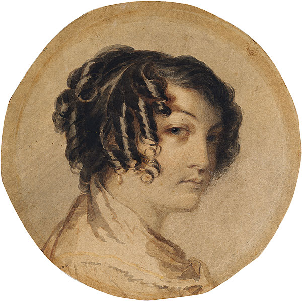 children $4.00), the story of
pioneers Andrew and Georgiana McCrae epitomises the
extraordinary adventures of Victoria's early settlers;
Georgiana's story is especially powerful, for she was an
accomplished artist, musician and writer, and her diary
serves as a vivid account of a talented woman's struggle for
recognition while living a difficult life in a new land.
Lawyer Andrew arrived in Australia from England in 1838; he
was an abolitionist, fighting against the slave system that
had brought wealth to his father through Jamaican sugar
plantations. His wife Georgiana, the acknowledged
illegitimate daughter of the Duke of Gordon, joined him with
their four children in 1841. They moved to this house in
1844 on 12,800 acres of land; it was the first homestead in
the region. Four more children were born here, before the
family returned to Melbourne in 1851. As upper-class people
with little practical skills on the land, the McCraes
depended on servants, including the tutor John McLure, and
the local Bunurong tribe of Aborigines for help and support
in farming and hunting. Georgiana, who had studied painting
with the English watercolourist John Varley, continued to
paint miniatures and landscapes, and to record her
impressions in her illustrated diaries; she has recently
been championed as a stellar example of a pioneer woman of
strength and cultivation, and her artworks are now eagerly
sought. Examples of her work are exhibited at the homestead,
along with original furniture. The McCraes did not succeed
as graziers; when they left, the property went through a
succession of owners until it was purchased in 1961 by
George Gordon McCrae, a great-grandson of the original
owners. In 1969, his son sold the homestead to the National
Trust.
children $4.00), the story of
pioneers Andrew and Georgiana McCrae epitomises the
extraordinary adventures of Victoria's early settlers;
Georgiana's story is especially powerful, for she was an
accomplished artist, musician and writer, and her diary
serves as a vivid account of a talented woman's struggle for
recognition while living a difficult life in a new land.
Lawyer Andrew arrived in Australia from England in 1838; he
was an abolitionist, fighting against the slave system that
had brought wealth to his father through Jamaican sugar
plantations. His wife Georgiana, the acknowledged
illegitimate daughter of the Duke of Gordon, joined him with
their four children in 1841. They moved to this house in
1844 on 12,800 acres of land; it was the first homestead in
the region. Four more children were born here, before the
family returned to Melbourne in 1851. As upper-class people
with little practical skills on the land, the McCraes
depended on servants, including the tutor John McLure, and
the local Bunurong tribe of Aborigines for help and support
in farming and hunting. Georgiana, who had studied painting
with the English watercolourist John Varley, continued to
paint miniatures and landscapes, and to record her
impressions in her illustrated diaries; she has recently
been championed as a stellar example of a pioneer woman of
strength and cultivation, and her artworks are now eagerly
sought. Examples of her work are exhibited at the homestead,
along with original furniture. The McCraes did not succeed
as graziers; when they left, the property went through a
succession of owners until it was purchased in 1961 by
George Gordon McCrae, a great-grandson of the original
owners. In 1969, his son sold the homestead to the National
Trust.
About 11km along the coast from Dromana, in Rye, is
Whitecliffs, on Point Nepean Road. From the 1840s, this was
the site of a limekiln for the Melbourne building trade; it
has now been re-created as an historic exhibit.
Sorrento, site of Victoria's first, albeit brief,
settlement, begins c 15km from Rye Limekilns. The site of
the Collins
Camp at Sullivan Bay (3km southeast of Sorrento
proper), established in 1803, is marked by a small historic
display. The site includes gardens incorporating four graves
from the 1803 settlement.
The purpose of this settlement was to establish an English
presence here to prevent French occupation of the coastline,
and to explore this unknown part of the continent. Collins
led a group of some 310 convicts and marines and families;
after several months, the site was abandoned, as water was
scarce, and the group moved on to Tasmania. Before leaving,
Collins also discovered the 'wild white man' William
Buckley, who had lived with the Aborigines here for decades.
It was not until 1872, when entrepreneur George Coppin
established the Sorrento Ocean Ampitheatre Company and
formed a steam ferry operation between here and Queenscliff,
that the region developed as a fashionable resort. The great
paddle-steamers Ozona, Hygeia, and Weeroona plied the waters
of the bay into the 1910s.
 Sorrento still has an air of
wealth, as the playground of Melbourne's old money, who
often own holiday houses here and come for the 'season',
from Boxing Day to Easter. Just as in Coppin's day, Sorrento
is the landing point for the ferries from Queenscliff
crossing the entrance to Port Phillip Bay. The foreshore
here has beautiful rock pools and Sorrento Back Beach, at
the end of Ocean Beach Road on the ocean side of the
peninsula, is a great surf beach. Sullivan Bay is now a
popular place for snorkelling, and cavorting dolphins can
often be seen swimming here. Sorrento Park on the breakwater
is a popular picnicking spot, with stunning views of the
entire bay. Remains of the town's 19C elegance can be seen
in Continental Hotel, built in 1875 on Ocean Beach Road, as
well as St John's Church of England of 1874 on Point Nepean
Road.
Sorrento still has an air of
wealth, as the playground of Melbourne's old money, who
often own holiday houses here and come for the 'season',
from Boxing Day to Easter. Just as in Coppin's day, Sorrento
is the landing point for the ferries from Queenscliff
crossing the entrance to Port Phillip Bay. The foreshore
here has beautiful rock pools and Sorrento Back Beach, at
the end of Ocean Beach Road on the ocean side of the
peninsula, is a great surf beach. Sullivan Bay is now a
popular place for snorkelling, and cavorting dolphins can
often be seen swimming here. Sorrento Park on the breakwater
is a popular picnicking spot, with stunning views of the
entire bay. Remains of the town's 19C elegance can be seen
in Continental Hotel, built in 1875 on Ocean Beach Road, as
well as St John's Church of England of 1874 on Point Nepean
Road.
Also on Nepean Highway is 'Hindson House', built in the
1870s from local limestone as the summer home of Judge
George Briscoe Kerferd, Premier of Victoria and Supreme
Court Justice in the 1870s. At the corner of Melbourne and
Ocean Beach Roads is the Nepean
Historical Museum (t 03 5984 0255; open
13.30-16.30 Sat. and Sun. and some holidays and Tues. and
Thurs. winter school holidays; admission adults $5.00, teens
$2.00), in the former Mechanics' Institute, built in 1876,
with limestone additions from 1895. The museum has an
interesting display of historical artefacts, and sits next
to a lovely formal garden surrounded by limestone walls, a
project in the 1980s of the Flinders Shire.
Continue on Point Nepean Road, past the Sorrento Golf
Club--one of the many famous 'sand courses' along the
peninsula--to Portsea, an even swankier resort town at the
entrance to Mornington Peninsula National Park/Point
Nepean
National Park. The passenger ferry to and from
Queenscliff also stops at Portsea Pier. Of greatest interest
here, aside from the opulent summer mansions of the rich,
are the splendid surfing back beaches, which are actually
part of the National Park (no dogs allowed). Diving and
snorkelling facilities abound for the seasoned and beginning
diver. Follow London Bridge Road to the natural rock
formation and walking beach.
At the end of Point Nepean Road is the Orientation Centre
for the National Park. No vehicles are permitted into the
2200 ha park, which includes 28km around the coastline to
Cape Schanck. Because of the fragile ecology of the point,
only 600 people are allowed into the park at a time, so it
may be necessary to make bookings during the busy seasons;
call the Orientation Centre (t 03 5984 4276). The centre
also provides an informative brochure to guide the visitor
through the park. From the Orientation Centre, you can also
take a tractor-drawn transporter into the park, if you do
not fancy a 14km walk around the point. On the first weekend
of each month, when the transporter does not run, the park
is also opened to cyclists. The Peninsula Coastal Walk, well
marked and with a brochure obtainable from the Orientation
Centre, extends from London Bridge to Portsea Back Beach,
Cape Schanck and Bushrangers Bay.
As a former military site, the park has many areas marked on
maps as 'unexploded ordnance', making them inaccessible to
the public and allowing a return to natural vegetation; it
is important, therefore, to remain on the roads and tracks.
You can, however, visit the former Quarantine Station and
the cemetery, where many immigrants, victims of illness or
shipwreck, were buried before they reached Melbourne. The
Quarantine Station, now the School of Army Health, was
established in 1852 as a result of a typhus outbreak on
board the immigrant ship Ticonderoga. The cemetery also
contains the remains of some early settlers, including James
Ford, a convict transported for 'machine breaking' in 1841
who was pardoned and settled on the peninsula; he named
Portsea after the town near Portsmouth in England.
About 1km along the road from the cemetery is Cheviot
Hill, with Cheviot Beach below it; the name commemorates a
ship that crashed here in 1887. It was at Cheviot Beach that
Prime Minister Harold Holt went missing in December 1967.
Many conspiracy theories arose, including that he was
whisked away by a Chinese submarine or that the American CIA
had a hand in the disappearance, but it is most likely that
he simply drowned while diving into dangerous surf; his body
was never found. The coastline from Point Nepean to London
Bridge is now known as the Harold Holt Marine Reserve. From
Cheviot Hill there are terrific views across The Rip and to
Queenscliff on the other side. It is no surprise that
swimming at the beach is not permitted, since the currents
are strong and unpredictable.
From the hill you can continue along the Walter Pisterman
Heritage Walk to Point Nepean itself, visiting Fort Pearce
and finally Fort
Nepean, built at the same time as Fort Queenscliff, in
response to the fear of Russian invasion after the Crimean
War. Major construction occurred in the 1880s; the complex
cost over £1 million to construct, and was one of the
largest engineering projects undertaken in the colony. The
fort was used as a military installation throughout the
Second World War, when there was fear of Japanese submarine
invasion into Port Phillip Bay. You can tour the remains of
the fort, with its many tunnels and gun emplacements. The
brochure available from the Orientation Centre gives
detailed descriptions of the site.
Somers
Exiting the National Park, several small roads lead
down to various ocean beaches. Alternatively, return to
Boneo Road in Rosebud (route 67) and travel south to Cape
Schanck and its lighthouse station, built in 1859 as a
landmark on the eastern side of Port Phillip Bay and still
functioning. The area has several picnic areas and majestic
views to Bass Strait. From here, return to route 67 and
travel east to Flinders, a small fishing village at the
beginning of Western Port; a plaque here commemorates George
Bass's discovery of the port in 1798.
 Continue along the
Flinders-Frankston Road (route 67) 18km, turn on to Sandy
Point Road at Balnarring and travel 2km to Coolart
Reserve
and Homestead (t 131 963; call for opening hours but
usually wetlands and gardens daily 9.00-17.00, homestead
summer daily 9.00-17.00) on Lord Somers Road in Somers. This
mansion is part of one of the most prosperous of the early
peninsula properties. First settled in 1840 by Alfred
Meyrick, the main mansion was built in 1897 by Frederick S.
Grimwade, founder of a famous pharmaceutical firm.
Subsequent owner Tom Luxton, owner of the hardware chain
McEwans, developed the elegant gardens and created the
nearby lagoon. Today some 15 ha of wetland provide an
important bird sanctuary, carefully maintained by the state
government. Excellent walking trails allow visitors to
observe the many birds in their natural habitat.
Continue along the
Flinders-Frankston Road (route 67) 18km, turn on to Sandy
Point Road at Balnarring and travel 2km to Coolart
Reserve
and Homestead (t 131 963; call for opening hours but
usually wetlands and gardens daily 9.00-17.00, homestead
summer daily 9.00-17.00) on Lord Somers Road in Somers. This
mansion is part of one of the most prosperous of the early
peninsula properties. First settled in 1840 by Alfred
Meyrick, the main mansion was built in 1897 by Frederick S.
Grimwade, founder of a famous pharmaceutical firm.
Subsequent owner Tom Luxton, owner of the hardware chain
McEwans, developed the elegant gardens and created the
nearby lagoon. Today some 15 ha of wetland provide an
important bird sanctuary, carefully maintained by the state
government. Excellent walking trails allow visitors to
observe the many birds in their natural habitat.
From here, take the South Beach Road back to route 67 and on
to Stony Point, to catch the passenger ferry to French
Island and Phillip Island. It is also possible to cross a
bridge to Phillip Island (see below) by travelling all the
way around Western Port and crossing over at San Remo, a
trip of about 90km from the other side of Western Port.
French Island
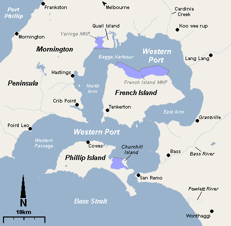
From Stony Point, a passenger ferry travels daily to
Tankerton, the only settlement on French Island; no cars can
arrive on the island, so sightseeing is either by a 4-hour
coach tour, conducted by an islander family, or by bicycle
rental or walking. More than 50 per cent of the island is
state park, and only 75 inhabitants live on the island. Tortoise Head Lodge
(t 03 5980 1234) provides the only accommodation, aside from
four camping sites; the lodge is also the only place for
meals. With 144km of relatively undisturbed coastline, the
island makes for a fascinating day trip, with abundant
examples of Australian flora and fauna. It is home to the
potoroo, a small member of the kangaroo family, decimated on
the mainland by feral foxes, but thriving here. Also
plentiful are koala and a variety of waterbirds. The
shoreline includes salt marshes, mudflats, and mangrove
forests.
French Island was actually named by French explorers; two ships on a scientific expedition, Le Geographe, captained by Nicolas Baudin, and Le Naturaliste, were in these waters in 1802, when Matthew Flinders was exploring the same region. The French made the most complete charting of this port. Earlier, in 1801, Lt James Grant on the Lady Nelson had explored the area, building a cottage on Churchill Island off Phillip Island and planting crops. French Island saw the establishment of several processing industries, including a salt works, and a few pastoral runs, and in 1893 the Victorian government subsidised six settlements with lofty names such as Energy and Star of Hope. The main activity at this time was chicory production, which continued into the 1960s. Remains of these settlements' homesteads can still be seen. For most of the late 19C and into the 1970s, the island was a prison centre, considered a country club farm because of its sports facilities and lenient conditions. The prison was closed in 1975 and used as a youth camp; visitors can take a tour of the complex.
Passengers can travel from here on the ferry to Cowes on
Phillip Island, the more developed and tourist-oriented
island in the port.
Phillip Island is one of the most popular tourist
destinations in Australia, because of the appearance every
night in enormous numbers of Little (Fairy) Penguins. These
wonderful birds are the smallest of the penguins and inhabit
the southern coast of Australia, extending as far north as
the New South Wales-Queensland border. While they
occasionally establish colonies on the mainland, they prefer
to nest on islands; the Phillip Island colony has been a
popular attraction since the 19C. The viewing area is well
controlled to prevent people disturbing the birds. Every
hotel in Melbourne will have brochures advertising tours to
the island that include a visit to the Penguin Parade.
Access via the bridge at San Remo has been possible since
1940, when a suspension bridge was completed. The current
concrete bridge was opened in 1969, and carries almost four
million day trippers a year.
There is no public transport on the island, but it can be
reached by taking the train to Dandenong and transferring to
a bus to Cowes, the island's main town; on Fridays a direct
service runs from Melbourne, and on weekends tours by ferry
are available from St Kilda Pier. From the island, it is
possible to arrange inexpensive flights to Tasmania.
In the early 19C, French exploration of the port led the British to establish a military presence here; in 1826, a Captain Wright built on Phillip Island near Rhyll a small post, named ironically Fort Dumaresque. Later this settlement was moved to Corinella on the mainland. Permanent settlers did not arrive until the 1840s, when dairy farming and grazing were established. A sign of the island's success as a dairy producer can be seen at the Australian Dairy Centre (t 03 5956 7583; open daily), across from the Information Centre, with its small museum. Phillip Island was also a major centre for chicory production, and the island still has many of the old chicory kilns.
The tourist information centre at Newhaven is built in
the form of an old-fashioned kiln. This centre, 1km from the
bridge from San Remo, is the best place to begin a visit to
the island; and you can make bookings here for the
(t 03 5951 2800). It is a good idea to book for
the Penguin Parade, especially in the summer, when the
crowds at the event are enormous.
Off the coast at Newhaven is Churchill Island, until
recently the only privately owned island in the state.
Because James Grant landed here in 1801 on the Lady
Nelson and planted wheat and corn on the island, it is
sometimes considered the first European settlement in
Victoria; but Grant did not stay for long. A small bridge
gives access to the island, where you can visit the historic
homestead and gardens, as well as enjoy the natural setting
and birdlife.
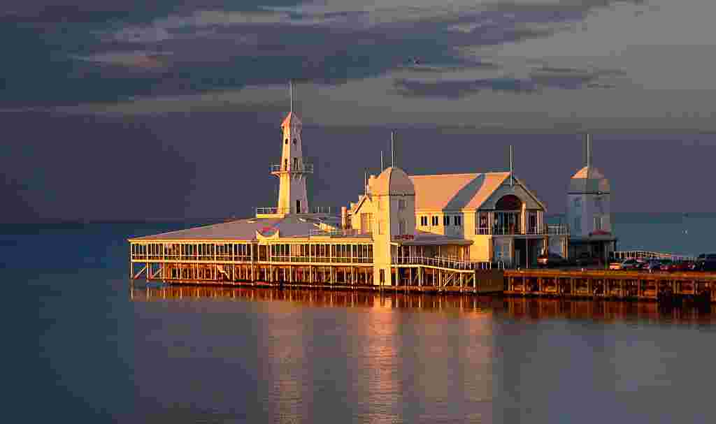 About
5km south of Phillip Island's information centre is Cape
Woolamai; the name is an Aboriginal word for 'snapper',
given by George Bass who thought the point appeared like the
shape of this fish. The cape has a famous surf beach, and is
now a fauna reserve, particularly for the shearwater, or
mutton-bird, who have a rookery here between September and
May.
About
5km south of Phillip Island's information centre is Cape
Woolamai; the name is an Aboriginal word for 'snapper',
given by George Bass who thought the point appeared like the
shape of this fish. The cape has a famous surf beach, and is
now a fauna reserve, particularly for the shearwater, or
mutton-bird, who have a rookery here between September and
May.
Rhyll, about 14km from Newhaven, is the site where George
Bass landed in 1798 and where Fort Dumaresque was
established by Captain Wright to guard against any possible
French invasion. It is a quietly beautiful spot with
cliffside walks and places to explore the salt marshes and
view the birds.
The main settlement on the island is Cowes, 8km west. It
is a picturesque village, aptly named after the holiday town
on the Isle of Wight. The ferries from Stony Point and
French Island land here, and cruises depart from here to
Seal Rocks, off Summerland on the southwest tip of the
island. As many as 6000 fur seals arrive here in November to
begin the breeding season--this is the best place to see
these animals along the whole of the Australian coast. Early
sealers came to these waters to hunt the seals; by 1891
their numbers had been so drastically reduced that they had
to be protected, which they have been ever since. Wildlife
Coast Cruises, departing from the Cowes Jetty, offers
two-hour long cruises to see the seals.
Along Phillip Island Road is a Koala Reserve and the Koala
Conservation Centre (t 03 5951 2800; open daily,
10.00-17,00; admission adults $12.80, concession $8.95,
children $5.90), established to protect and preserve the
dwindling number of koalas on the island. The centre
includes an excellent interpretative centre and informative
displays; fondling of koalas, however, is not allowed in the
State of Victoria.
From Cowes, it is another 10km to Summerland and the Penguin
Parade, the major tourist attraction. Be sure to bring warm
weather gear at all times; it is most enjoyable to visit
here in the off season when there is less of a tourist mob.
The authorities are to be commended for controlling the
crowds who come to see this delightful natural phenomenon
and protecting the penguins and their environment at the
same time. The beach is illuminated for about an hour every
night at dusk as the penguins arrive; more muted lighting
later allows visitors to enjoy the penguin antics after the
main show. Be mindful of the walkways and obey the
guidelines for viewing.
Between Summerland and Sunderland Bay is the Phillip Island
Racing Circuit, site of Grand Prix motorcycle racing and
stock-car races which often bring some 60,000 fans to the
island for a very noisy event.
Back at San Remo, a pleasant fishing village with a
50-boat fishing fleet, you can explore the cemetery, which
includes the graves of early pioneer families such as the
Anderson family, who took up graziers' leases in the 1840s.
The coastline south of here is called the Anderson
Peninsula, and from Punchbowl, 3km south of San Remo, the
George Bass Coastal Walk follows the shore on a 10km
round-trip to Kilcunda. The walk traverses the grounds of
the Bunurong Aboriginal group, and evidence of kitchen
middens can be found near the beaches. The Punchbowl itself
is an impressive blowhole. George Bass explored the area by
sea in 1798, while William Howell covered it on foot in
1826.
Heidelberg's name, along with that of Coburg to the
west, indicates the prevalence of German settlers in this
region in the 1870s, 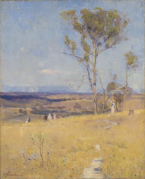 when it was a
farming village. The artists Tom Roberts, Arthur Streeton,
Charles Conder, and Frederick McCubbin travelled here to set
up camps where they could experience 'the bush' (city boys
that they were) and paint en plein air in emulation of the
painters of Barbizon. Significantly, Heidelberg was only
15km from central Melbourne, and by the time the artists
were travelling here, a train deposited them easily into the
landscape; today the area is entirely suburban, and it is
difficult to envision it as open bushland. In nearby
Eaglemont, Arthur Streeton set up house in the mid-1880s
where the group that came to be known as The Heidelberg
School coalesced. Frederick McCubbin late in life fondly
recalled the area as 'not the suburban Heidelberg of today,
but the remote sleepy Heidelberg of years ago, with its
winding country roads, its wooded hills and quiet village
life'. In his poem 'That Last Summer at Eaglemont',
Christopher Wallace-Crabbe evokes the brilliant landscapes
of the Heidelberg paintings:
when it was a
farming village. The artists Tom Roberts, Arthur Streeton,
Charles Conder, and Frederick McCubbin travelled here to set
up camps where they could experience 'the bush' (city boys
that they were) and paint en plein air in emulation of the
painters of Barbizon. Significantly, Heidelberg was only
15km from central Melbourne, and by the time the artists
were travelling here, a train deposited them easily into the
landscape; today the area is entirely suburban, and it is
difficult to envision it as open bushland. In nearby
Eaglemont, Arthur Streeton set up house in the mid-1880s
where the group that came to be known as The Heidelberg
School coalesced. Frederick McCubbin late in life fondly
recalled the area as 'not the suburban Heidelberg of today,
but the remote sleepy Heidelberg of years ago, with its
winding country roads, its wooded hills and quiet village
life'. In his poem 'That Last Summer at Eaglemont',
Christopher Wallace-Crabbe evokes the brilliant landscapes
of the Heidelberg paintings:
In the beginning it was much to do with light
Feeling at brushtip the afternoon's full glare,
Pale paddocks and streaky stalks of grass
Crushed only where an easel had briefly stood...
Today, you can take part of the Yarra Trail through the
area, on foot or by bicycle, where reproductions of the
artists' paintings are strategically placed near the
relevant views.
Significantly, for an area so identified with artistic
creativity, the Museum
of Modern Art at Heide (t 03 9850 1500; open
Tues.-Sun. and public holidays 10.00-17.00; admission adults
$18.00, concession $14.00, children under 12 free) is near
to the centre of Heidelberg. From the Heidelberg train
station, take Banksia Street east c 2.5km across the Yarra
Flats by Banksia Park (or catch bus no. 291 from the
station); turn north on Bulleen Road to enter Heide Park;
from the Central Business District every second or third
Yarra Valley Views bus from Russell and Lonsdale Street will
stop here.
As the current director maintains, it is no exaggeration to
consider 'Heide' as the birthplace of modernism in
Australia, for it was here that wealthy patrons John and
Sunday Reed purchased a dairy farm in 1934 and converted it
into the most significant meeting place for artists,
writers, and poets. They named the place 'Heide' in the
1940s. It was here that Sidney Nolan painted his famous Ned
Kelly series, where Joy Hester and Albert Tucker created,
and where the Reeds nurtured avant-garde ideas in all the
arts. In the 1950s, the Reeds even established a museum of
modern art in central Melbourne, using their own collection
as the basis for exhibitions--quite a feat in a city that
still considered Impressionism as too 'modern'. In the
1960s, they built a modernist house on the Heide site; the
present museum incorporates this house along with a gallery
added in 1993. The gardens are equally important, as homage
to Sunday's inspired gardening; additionally, a 5 ha
Sculpture Park provides an ideal setting for Australian and
international sculpture.
Recently a number of books and television productions have
appeared documenting the lives of this fascinating couple
and their unconventional lifestyle; this museum is a fitting
legacy to their nearly single-handed commitment to the
modernist cause. One architect has described the museum
building as 'International Style set down amongst the
Melaleucas [ti-trees]', and that assessment certainly sets
the tone for the display of modernist artworks, most notably
but not exclusively those who worked at Heide. Not to be
missed are the delightfully expressionist early paintings by
Sidney Nolan, before he became a famous expatriate in
England. The museum also mounts original exhibitions,
predominantly focusing on contemporary Australian art.
Montsalvat and Eltham
To get to Montsalvat from Heide, continue east on
Templestowe Road about 5km to Fitzsimmons Road; turn north
and travel about 4.5km to Mount Pleasant Road. Turn east and
travel past the cemetery about 1.5km, turn south on to
Hillcrest Road to Montsalvat in Eltham. The train service is
on the Hurstbridge Line.
Montsalvat
(t 03 9439 7712; open daily 09.00-17.00; admission adults
$14.00, concession $10.00, children $8.00) was an artists'
colony founded in 1934 by Justus Jorgensen, a visionary
artist who died in 1975. Eclectic artists' houses are dotted
aesthetically throughout the hills in a variety of styles on
some 8 ha of gardens; the main aim was to appear as if it
were a French provinci
al village. Members of the community included Mervyn
Skipper, correspondent for the Bulletin and author
of The White Man's Garden (1930); and Robert Close,
who in the early 1940s lived in a Montsalvat hut and wrote
the novel Love Me Sailor (1945), for which he was
jailed for obscenity. Betty Roland wrote a fascinating
depiction of the community, The Eye of the Beholder
(1984). Montsalvat now hosts an annual poetry festival, as
well as a well-known jazz festival at the end of January. At
the centre of the community is the Great Hall, which
includes Gothic windows which were taken from the Royal
Insurance Building in Collins Street before it was
demolished. The Great Hall is open to the public and
contains some of Jorgensen's paintings.
Eltham itself, about 2km north back on Main Road, has
also been the home of many writers and artists, including
C.B. Cristensen, who moved here in 1945 to establish the
literary journal Meanjin; his house Stanhope on
Peter Street became a literary meeting-place. The poet Chris
Wallace-Crabbe lived here from 1976 to 1983, in one of the
pisé houses (pisé means mud bricks) built in the suburb by
the novelist J.M. Harcourt. The town also houses the Eltham
Library and Shillinglaw Cottage. The cottage dates from 1878
and is now a fine restaurant; the library is a stunningly
modern building, designed in a style reminiscent of Frank
Lloyd Wright's Marin County Civic Center in California.
Warrandyte
From Eltham, you can continue northeast on Main Road
(route 44) c 4km to Research Warrandyte Road; or back south
on Fitzsimmons Lane to Porter Street/Warrandyte Road (route
42, tourist route 2) to the village of Warrandyte near the
winding Yarra River. Take Harris Gully Road south to Gold
Memorial Road; along Andersons Creek, only 30km from central
Melbourne, the very first Victorian gold was found on 5 July
1851, marked now by a memorial cairn. This discovery began
the gold rush, but was quickly abandoned when the larger
strike was found at Clunes soon after. The area has been a
popular getaway for artists and writers since the 1870s.
Most notable were the artist Clara Southern, a pupil of
Frederick McCubbin; the painter Penleigh Boyd, brother of
writer Martin Boyd (Boyd's novel Outbreak of Love
[1957] was set here); the great potter Reg Preston; and
painter and writer Adrian Lawlor, who built a Bauhaus-style
house on Research Road after his first home was destroyed in
the 1939 Black Friday fires. The Warrandyte Historical
Society on Warrandyte Road contains artefacts and
photographs from the area's goldmining era; it is open on
weekends. The Warrandyte State Park, with entry gates at
Jumping Creek Road and Pound Bend, has excellent walking and
cycling paths along the many bends of the upper Yarra River.
The area is great for picnicking, bird watching, and
canoeing. The gates to the park close every evening at dusk,
so be mindful of closing time signs.
Southwest of Melbourne
Taking Princes Highway (route 1) south out of Melbourne
towards the Bellarine Peninsula and Geelong, you come to Werribee
Park (t 131 963; grounds 9.00-17.30, house
10.00-16.00, both slightly later in the summer; admission to
grounds is free, to the house adults $9.80, concession and
children $7.30), 34km from the CBD. The train's Werribee
Line ends in the town of Werribee, about 2km from the park.
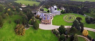
Standing grandly alone in the sandy flatlands west of the
city, the elaborate estate of Werribee Park was built in the
1870s for pastoralists Thomas and Andrew Chirnside, who at
one point owned an enormous empire of sheep. In the 1880s
they were even able to purchase a castle in their native
Scotland. The mansion here is Italianate in style, made of
bluestone with a freestone facing, with opulent use of
Corinthian columns, gold leaf, and classical ornamentation.
Tradition maintains that one brother had it built to
convince a countrywoman to marry him; indeed, Andrew did
marry and occupied the house with his family. The original
house had some 50 rooms, but extensive additions by the
Chirnside sons included a tower and other incongruous
details.
The building is noteworthy as an ugly heap; obviously, the
two bachelors, with very little aesthetic sense but a lot of
money, were responsible for this oddity in the middle of
nowhere. At various times in the early 20C, the estate was
used as a research farm, airforce base, and Jesuit seminary,
all of which made additions and some unfortunate
modifications; it has also served as the location for
several Australian films, including Libido (1973).
It is now owned by the Victorian government, and open to the
public. Attendants in 19C costume can provide some history
and comment for self-guiding tours. The gardens have also
been restored to their original state, including one of the
few remaining Lake Grottoes (recently closed because of
vandalism), greenhouses and lodge, as well as a unique
ha-ha, a bluestone wall set in a trench to create a moat.
The outbuildings and well-kept gardens are really the most
interesting things to see.
Also in Werribee Park, on K Road, is Werribee
Zoo (t 03 9731 9600; open 09.00-17.00, animal areas
close 16.30; admission adults $32.50, concession $24.90,
children free on holidays, $16.30 otherwise), an open range
zoo with African, Asian and Australian wildlife.
A further 8km south on the Princes Highway is Little River
Road, which leads to You
Yangs
Regional Park (t 131 963; open daily 7.00-17.00,
7.00-18.00 daylight savings), some 2000 ha with an
interesting range of volcanic hills, discovered and climbed
in 1802 by Matthew Flinders himself. Climb Flinders Peak in
the park for great views to Geelong and the coast, or enjoy
the walking tracks with abundant birds and native animals.
Good Sources
The best sources for information about Melbourne are Parks
Victoria, the National
Trust and the commercial site Australia
for Everyone.