esauboeck
| Welcome
|
Our Blog | A
Tourist's Guide to Australian Culture and History |
esauboeck.com Contents |
| MELB,
SYD,
NSW,
VIC,
ACT, TAS, SA, NT, QLD, WA, Nat. & Hist., The Arts Practicalities |
 |
 |
Walks and Short Trips
Circular Quay |
Hyde Park |
 |
 |
The Rocks |
The Domain |
 |
 |
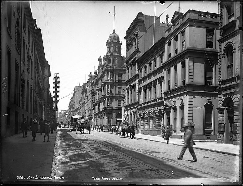
| Pitt Street |
Darlinghurst |
 |
 |
Paddington |
Vaucluse and Eastern Suburbs |
 |
 |
Parramatta and Western Suburbs |
North Sydney |
 |
 |
(revised April 2017)
New South Wales
New South Wales is situated on the southeast corner of
Australia between Victoria to the south, Queensland to the
north and South Australia to the west. East to west, it is
marked by a narrow coastal plain, the Great Dividing Range
and the Murray Darling Plain. Its population is concentrated
along the sea coast, principally around Sydney, the state’s
capital. It is the country’s most populous state, with an
estimated population in 2012 of 7,303,700, more
than a third of Australia’s total population.
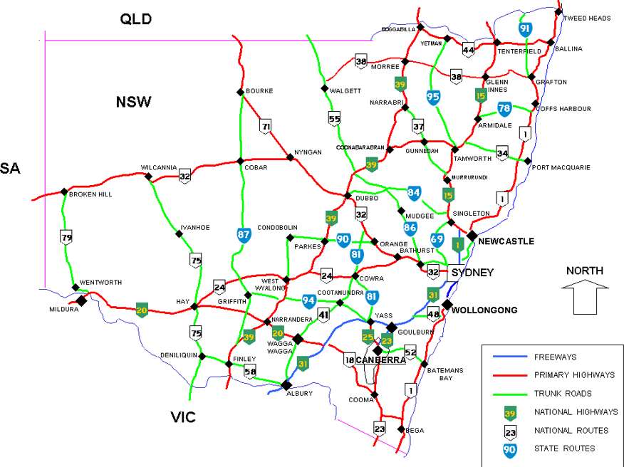 The
major ports are at Newcastle, Wollongong and Sydney. The
highway system is fairly simple. Highway 1, the Pacific
Highway, extends north from Sydney along the coast through
Newcastle and eventually to Brisbane. Highway 31, the
Southwestern Highway then Hume Highway, proceeds south
through the Murray Darling Plain to Melbourne with a side
route to Canberra. An alternative route to Melbourne along
the coast, the Princes Highway, is considerably slower, but
much more interesting. Inland highways
include the New England Highway (route 15, to the interior
from Newcastle to Brisbane); the Newell Highway (route 39,
through the interior from Melbourne to west of Brisbane);
and the Sturt Highway (route 20, crossing southern New South
Wales to Adelaide).
The
major ports are at Newcastle, Wollongong and Sydney. The
highway system is fairly simple. Highway 1, the Pacific
Highway, extends north from Sydney along the coast through
Newcastle and eventually to Brisbane. Highway 31, the
Southwestern Highway then Hume Highway, proceeds south
through the Murray Darling Plain to Melbourne with a side
route to Canberra. An alternative route to Melbourne along
the coast, the Princes Highway, is considerably slower, but
much more interesting. Inland highways
include the New England Highway (route 15, to the interior
from Newcastle to Brisbane); the Newell Highway (route 39,
through the interior from Melbourne to west of Brisbane);
and the Sturt Highway (route 20, crossing southern New South
Wales to Adelaide).
The physical features most attractive to the visitor
include fine surf beaches (thirty-four in Sydney alone and
hundreds more along the entire coastline), Sydney Harbour,
the Blue Mountains (a day trip west of Sydney), limestone
caves at Jenolan and Wombeyan, the Australian Alps or Snowy
Mountains in Kosciuszko National Park, the Hawkesbury River,
and ‘Back ’o Bourke’, that is, the outback, in the state’s
arid northwest.
Sydney
Sydney (population in 2010= 4,504,469) has
always been the premier city of Australia. The capital of
the state of New South Wales, it encompasses a vast area
around Port Jackson Harbour and as far west as the Blue
Mountains; officially, it is listed at 33°55’ south, 151°17’
east. With a population of more than four million, the
Sydney region now comprises almost a quarter of the
country’s entire population.
Sydney
Local Public Transit
Sydney
Suburban Rail Map
Sydney
Intercity Rail Map
Administratively, Sydney City refers to a very small
segment of this metropolitan area, but the many
municipalities and surrounding suburbs around this central
district are generally considered part of Sydney. In the
last forty years, Sydney has been transformed from a
provincial British colonial outpost to a world-class
multicultural city, a central player, as David Dale states
in The 100 Things Everyone Needs to Know About Australia
(1996), in Australia’s change from ‘one of the dullest
nations on earth to one of the most interesting’. Jan
Morris, in her book on Sydney (1992), mirrors these
sentiments, amazed at its transformation since her first
visit in 1962; she declares it the ‘shiniest’ city of the
old British Empire.
Sydneysiders, as residents are called, while
notoriously disinterested in self-reflection, would
certainly agree with this description. They are immensely
proud of their robust and vibrant city, and all the glitzy
glamour of its most recent decades, and not very interested
in dwelling on its history (although that attitude is
changing, too).
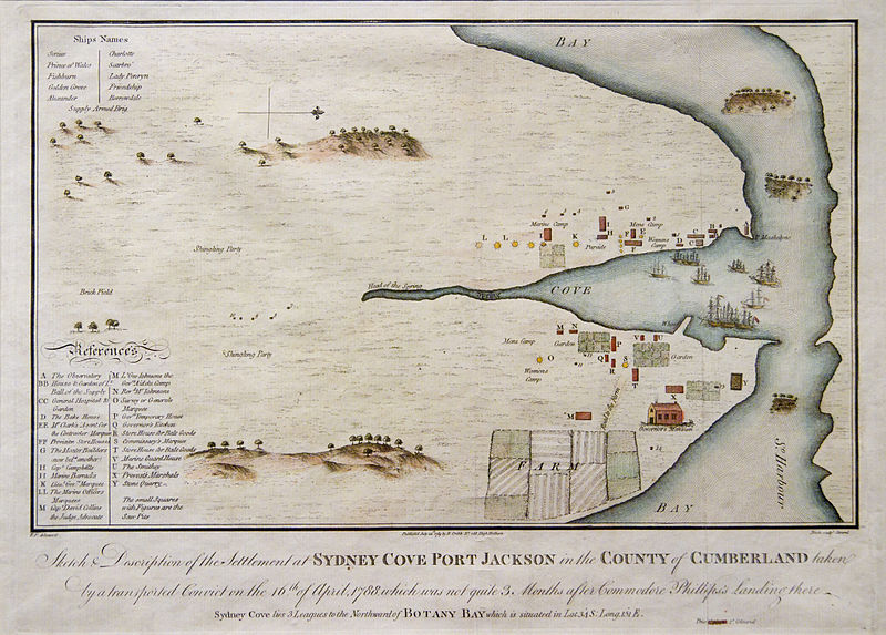
The development of Australia as a Western nation began on 26 January 1788, when Captain Arthur Phillip and his shipment of 736 convicts and four companies of marines landed, first at Watson’s Bay and, finally, at Sydney Cove; these were the members of The First Fleet, so frequently referred to in Australian literature and popular culture. Their trip had taken eight months from Portsmouth and had covered more than 22,000km (14,000 miles). When their proposed site of settlement at Botany Bay proved unsuitable, they sailed on to find what is today Sydney Harbour. The penal colony of New South Wales was established as soon as the prisoners and marines disembarked.
This strange event came about as a result of the draconian legal codes and harsh social conditions of 18C England, leading to an enormous prison population which could no longer be housed. Once England lost the American colonies as a convenient dumping ground for convicts, it had to look elsewhere to find a solution to the prison problem.
The continent that became known as Australia had been discovered and claimed for England in 1770 by Captain James Cook; upon the suggestion of Cook’s naturalist Sir Joseph Banks, this continent on the other side of the world was seen as the ideal place to transport a large portion of the law-breakers. Not only would the horrendous overcrowding in prison be alleviated, but British imperialist ambitions in the Pacific would be furthered by the establishment of a colony in this land about which Cook and Banks had so romantically enthused. In his 1771 report, Cook wrote ‘it can never be doubted but what most sorts of Grain, Fruits, Roots etc of every kind would flourish’ and ‘here are Provender for more Cattle at all seasons of the year than can be brought to this Country.’
While the first years of settlement were anything but flourishing, with deprivation and isolation exacerbated by failure of crops and livestock, inadequate housing, lack of building materials and skilled labour, Captain Phillip undertook the venture with ambitious conscientiousness and fortitude. He bestowed the name Sydney in honour of Thomas Townshend, 1st Viscount Sydney, who was then Home Secretary in the British Cabinet.
David Collins, marine captain and Judge-Advocate arriving with the First Fleet, provides one of the most valuable early accounts of the settlement:
The spot chosen [at Circular Quay]...was at the head of the cove, near the run of fresh water [the Tank Stream], which stole silently along through a very thick wood, the stillness of which had then, for the first time since the creation, been interrupted by the rude sound of the labourer’s axe... The confusion that ensued will not be wondered at, when it is considered that every man stepped from the boat literally into a wood...the spot which had so lately been the abode of silence and tranquillity was now changed to that of noise, clamour,and confusion... As the woods were opened and the ground cleared, the encampments were extended, and all wore the appearance of regularity.
On viewing the cosmopolitan congestion of present-day
Sydney, it is hard to envision this as a description of the
area around Circular Quay.
The Tank Stream, as the freshwater source was called, very quickly proved insufficient for the needs of the colony. Three sandstone tanks were built almost immediately in which to preserve its supply, but by the 1810s the stream was severely depleted and polluted. By 1827, a project was begun to dig a tunnel to the swamps of present-day Centennial Park 4km away. Known as ‘Busby’s Bore’ after its engineer John Busby, it was Sydney’s first major engineering feat when completed in 1837. The old Tank Stream is now channelled underneath Pitt Street.
When the First Fleet landed, the cove where Circular Quay is today was a salt-water estuary, and at low tide a mudflat covered the area of present-day Bridge Street, Lower Pitt and Alfred Streets, as well as a part of Loftus and Young Streets. This area was gradually filled in and reclaimed to become the central city itself. Frank Clune, in his Saga of Sydney (1961) boasts that ‘no water frontage in the world has been so transformed by reclamation of tidal flats as Sydney’s Circular Quay’.
The earliest streets were laid out parallel to the course of the Tank Stream, beginning with High Street, today’s George Street. While the settlement did originally have a town plan—Baron Alt, a German surveyor on the First Fleet, laid out the initial settlement—it is obvious to the visitor that any systematic town planning was not enforced in the early days. In the 1810s, Governor Macquarie attempted to regulate the growth of the town and the standard of building, decreeing that streets must be at least 50 feet wide and houses set back 20 feet from the road. His efforts did not go unheeded, as one can see in the number of substantial structures from his time by convict architect Francis Greenway and others; haphazard development continued nonetheless.
The oldest area around the Circular Quay is a chaotic mishmash of diagonal streets and pathways that developed from short cuts used by pedestrians, a confusion exacerbated today by the overhead gash of the Cahill Expressway, built in the 1950s, which runs directly across the quay from the bridge.
Sydney Harbour
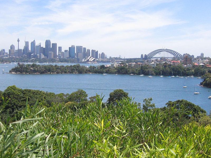
All considerations of Sydney must begin with and center on the harbour, which Joseph Conrad described in his autobiography The Mirror of the Sea (1906) as ‘...one of the finest, most beautiful, vast and safe bays the sun ever shone upon.’ The harbour provides one of the most stunning locations of any city in the world.
| The harbour dominates Sydney life, and any visitor to the city will undoubtedly begin explorations at the ferry terminus in the heart of the city, the Circular Quay. The quay vibrates with activity, intermingling a variety of regular buskers and vendors with a multitude of tourist attractions and excursion opportunities; tens of thousands of Sydneysiders take the ferry into the quay every day. Several organised walking tours commence from the quay, leading into the thick of the central city itself. For details of these walks, enquire at one of the Sydney Visitor Centres, t 02 9240 8788. | 
|
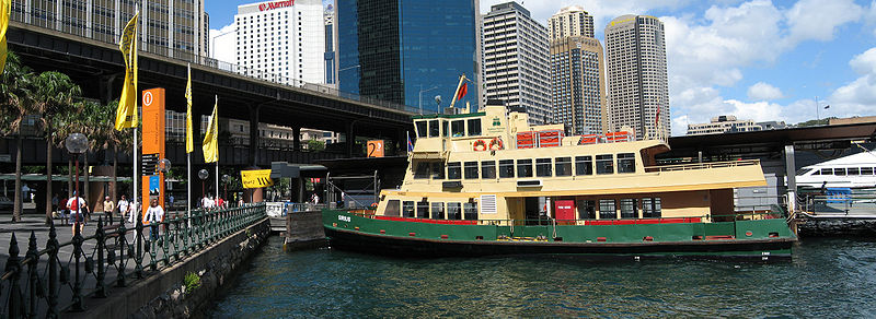
Harbour trips
You can choose from any number of harbour excursions, from individual taxi-boats, sometimes cheaper and faster than a land-taxi, to cruises on a replica of the Bounty. But one of the most enjoyable ways to explore the harbour and the city itself is to take the regular service ferries to their various destinations.
The most extensive and enjoyable sightseeing experience is the ferry to Manly, which leaves Circular Quay regularly to cross the entire bay, culminating at Manly Beach, next to the Heads which mark the entrance to the harbour itself. Many writers and regular travellers maintain that this trip is the one thing that all visitors to Sydney should do.
Other ferries travel from the Quay to Balmain, the North Shore, Hunter Hill and Parramatta. One of the most popular services is the ferry to Taronga Park Zoo, at the end of which visitors walk up to the zoo or, if in operation, ascend above the harbour in a cable car.
The harbour is the true heart of Sydney; explore the
city from its shores, and take advantage of transportation
on the water.
Walk 1 Circular Quay and Macquarie Street
Starting at the railway station, follow the pedestrian tunnel at Circular Quay to emerge at the entrance to central Sydney on Alfred Street. Here turn left (east).
Customs House
About 300m down Loftus Street is the Customs House (t 02 9247 2285; open daily), now an isolated example of Victorian architecture among the glass and steel skyscrapers. Nearby is a small flagpole, marking the spot where Governor Phillip raised the Union Jack on 26 January 1788.
The original customs house was erected on this site to the Georgian design of Mortimer Lewis in 1844. When additions were necessary, structural difficulties required that this building be demolished. As it stands today it is a conglomerate of government architects’ styles, the first floor completed in 1887 by James Barnet and the other floors added by Walter Vernon between 1887 and 1917. The floor in the entryway includes swastikas, traditionally symbols of good fortune.
Customs House was renovated in 1999 by the architectural firm Tonkin Zulaikha Greer, creating spaces for galleries and corporate reception areas. The renovation is certainly controversial, demonstrating little sympathy for the colonial character of the structure and adding an incongruously proportioned glass-and-steel upper deck; but the interior levels offer airy public spaces. The building now functions largely as a public library.
Continue east on Alfred Street to Albert Street. Between Young and Phillip Streets along this stretch is the AMP Building, which for many years after its opening in 1962 was the highest building in Sydney at 114m (380 ft). Its appearance, along with the opening of the Cahill Expressway in the same year, signalled the end of the old accessible Circular Quay.
At present, construction between the quay and Macquarie Street, along with the rumbling of cars on the expressway overhead, combine to present an unfortunately uninspiring view towards the harbour and the Opera House. Recently mobilised Sydneysiders have begun protesting against the monstruous building blocks being constructed here, on arguably the most valuable real estate in the world, but so far the demonstrations appear to have come too late to save any vestige of the harbour’s skyline on the south side.
On the corner of Albert and Phillip Streets is the NSW Justice
and Police Museum (t 02 9252 1144; open daily
10.00–17.00), identified by the kitschy mannequins of police
officer and convict on the front of the building. Now a
complex of Classic Revival buildings, the first section
facing Albert Street was designed by Edmund Blacket in 1854
in a Palladian style with an open portico and Doric columns.
It originally served as the Water Police Court. Around the
corner on Phillip the additions, also in sandstone, were
probably designed by Mortimer Lewis (1870) and James Barnet
(1885).
Edmund Blacket
Edmund Blacket 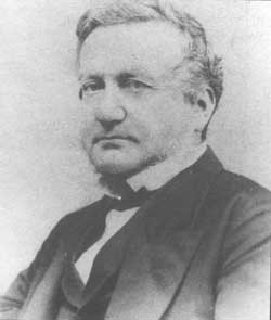 Edmund Blacket (1817–83), New South Wales’s most prolific ecclesiastical architect, is sometimes referred to as the ‘Christopher Wren of Australia’. He arrived from England in 1842, having escaped a father opposed to his dream of being an architect. Intending to settle in New Zealand, he was persuaded by Sydney acquaintances to stay in the city and became inspector of Church of England buildings. In 1845 he began practice as an architect, and was appointed colonial architect in 1849; in 1854 he set up private practice. His first impressive building was the main building for the new University of Sydney, completed in 1860. In all, Blacket completed some 58 churches, most of them in Sydney and almost all in Gothic Revival style. For more on Blacket, see Joan Kerr, Our Great Victoria Architect, Edmund Thomas Blacket, (1817–1883). |
Proceed south up Phillip to Bridge Street; on the corner was the site of the first Government House. Governor Phillip’s first headquarters consisted of a canvas tent placed at Loftus Street near Macquarie Place, but by July 1788, a permanent residence was begun on this site by convict bricklayer James Bloodworth. Consisting initially of six rooms, the house was completed in time for King George III’s birthday in June 1789. Although the house continued as the official residence until 1845, every early governor complained of its dilapidated condition; it was officially declared unfit for occupation in 1825, yet continued as the residence until Governor Gipps finally moved to New Government House. At that time, the old house simply disintegrated. In 1984, archaeological excavation uncovered the remains of the foundations, and plans were made to commemorate the site. It is now the location of the controversial Museum of Sydney (MOS) (t 02 9251 5988; open daily 9.30–17.00), which, its detractors say, does not emphasise enough the history of the original Government House.
The MOS is part of the Historic Houses Trust of New South Wales, and is certainly the most post-modern museum in the city; such state-of-the-art exhibition techniques have been employed that it is sometimes difficult to know what artefacts you are supposed to be seeing. The changing exhibitions are varied and eclectic, and always innovatively presented. The plaza includes a ‘talking poles’ sculptural monument, Edge of Trees by Janet Laurence and Fiona Foley, evoking through objects and voices the history of Sydney’s people. Its exhibitions emphasise early Sydney history, with special displays concerning the Eora, the Aboriginal peoples of the Sydney region, and it has one of the most exciting bookshops in the city, emphasising architecture and design, as well as the requisite chic restaurant on the plaza.
Rising enormously behind the museum is Governor Phillip
Tower (1989–94), one of the many post-modern skyscrapers in
the central business district, touted for its impressive
integration of contemporary elements with the needs of a
historical site.
The Opera House
To reach the Opera House, walk over one block and north
down Macquarie Street to the Opera House at Bennelong Point
(c 500m) (Contact 61 2 9250 7111: Sydney Opera House
).
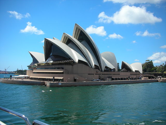
No landmark more readily identifies Sydney today than its Opera House, placed on Bennelong Point overlooking the harbour. Its silhouette is so well-known internationally that it is hard to believe that it was only begun in 1959 and was not completed until 1973.
History of the Opera House
The saga of the construction of the Opera House can itself be described as operatic. Indeed, its story has served as the basis for an opera, The Eighth Wonder, by Alan John and Dennis Watkins, which premiered here in 1995.
The location at Bennelong Point was an inspired choice. This jutting bit of land to the east of Circular Quay was named in honour of the Aboriginal Bennelong, the first ‘domesticated’ native, whom Governor Phillip took to England as a specimen of the ‘civilising experiment.’ When he returned he lived in a small hut at this point. He remained a familiar character in early Sydney until his death in 1815 in Ryde.
Until 1902, Bennelong Point was the site of Fort Macquarie, designed by convict architect Francis Greenway in 1817; it served as a sentinel post to warn of approaching ships. It was demolished in the early 1900s to make way for, of all things, an elaborately castellated tram shed, built by W.L. Vernon. It still served as a tram terminus when it was torn down to make way for the construction of the Opera House in 1959.
The initial impetus for the building of the Opera House
came in 1947, when the English composer Eugene
Goossens—ironically, a direct descendent of Captain Cook—was
appointed Conductor of the Sydney Symphony Orchestra.
Goossens persuaded the government that the city should have
its own opera house and found an unlikely supporter in the
Labor Premier, J.J. Cahill.
In 1956, Cahill announced a £5000 international design
competition, for which 216 entries arrived from 36
countries. The winning design, selected by a four-man jury,
came from a young Danish architect, Joern Utzon. A disciple
of Le Corbusier and Frank Lloyd Wright, Utzon conceived of a
structure with a dramatically soaring roof line, ‘the fine
lines defining the form of the curve like the seams in a
billowing sail’. (Utzon has described his idea as ‘wedges of
an orange’.) The jury was impressed with the concept. They
also believed that the estimated price—£3.5 million—made the
design the cheapest to build. They announced that the entire
building would be completed in three years.
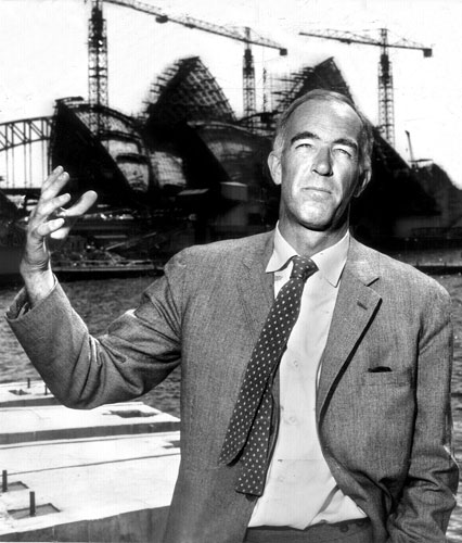
Joern Utzon
Controversy surrounded the project from the beginning on nearly every front. First of all, the project’s greatest supporter, Eugene Goossens, was forced to resign his post as conductor and left Australia in 1956, after he was found guilty of importing ‘indecent material’ in his luggage after a trip abroad. More horrifically, a public lottery organised to fund the project ended in tragedy when the eight-year-old son of the winner of the £100,000 prize was kidnapped and murdered.
Then there was the problem of the building itself. It
became apparent that neither Utzon nor anyone else had an
idea of how his magnificent sails could actually be
constructed. The task of solving complex engineering
problems led to endless delays and ever-increasing costs,
exacerbated by political infighting and mismanagement. Utzon
also confronted bureaucratic resistance and political
battles, which increased when a new director of public
works, Davis Hughes, was appointed in 1965 after the Liberal
Party came to power. When Hughes tried to downgrade Utzon’s
position from controlling architect to design consultant,
Utzon resigned, asking that his name no longer be associated
with the Opera House. He left Australia, never to see the
building finished. It was finally completed by a team of
Australian architects headed by Peter Hall. When Utzon died
in 2008, plans were underway for a massive refurbishing of
the building, plans which initially caused a clash with
Utzon's son and grandson, who believed the initial design
would be ruined by subsequent architects.
The building was opened by Queen Elizabeth on 20 October 1973, fifteen years after construction began. The original cost of $7 million had increased to $102 million.
Despite his rejection of the finished product, Utzon’s
original vision prevailed, at least in modified form, and
the Opera House, with its soaring roof, stands as a work of
sculpture. (Utzon’s original models and plans have been
donated to the State Library of NSW.) Not everyone enjoys
its presence; the writer Blanche d’Alpuget wrote that it
looks like ‘an albino tropical plant rootbound from too
small a pot’, and Jan Morris considered it ‘unguent’, making
the visitor feel like an ‘insect in an ice-cream’.
The surface of the roof is covered in 1,056,000 ceramic
tiles covering an area of 4 acres (1.6 hectares), bonded to
4228 tile panels which had to be constructed on the ground
and slotted onto the skeletal shells. Acoustically, the
concert hall rates as one of the best in the world; over
2900 events take place annually in its five theatres.
The Sydney Opera House contains more than 1000 rooms,
some of curious shape due to the angular exterior. The
entrance is up the southern steps off the forecourt to the
ticket box and information desk. The major halls are the
Opera Theatre on the northeast and the Concert Hall on the
northwest. The northern foyers offer panoramic views of the
harbour. The Possum Dreaming mural in the Opera Theatre
foyer is by Michael Nelson Tjakamarra who also designed the
mural at Parliament House in Canberra. The theatre seats
1547 and has a 12 metre wide proscenium. The Concert Hall
seats 2690. Despite its size, the wood panelling and
acoustic vaults give it an intimate feeling. Ronald Sharp
designed and built the Grand Organ (10,500 pipes).
Smaller theatrical venues are accessible along the western
boardwalk. These are the Playhouse at the boardwalk's
northwest corner, the recently opened Drama Theatre, and the
Studio.
Macquarie Street
From the Opera House, walk back to Macquarie Street. Named by Governor Macquarie in October 1810, in honour of himself, the street was to be a grand avenue of impressive public buildings; at the time, it was only a rough ridge of sandstone between the valleys of the Tank Stream and Woolloomooloo Bay. Eventually it was to become the most fashionable residential street in the city. The street extends from the Opera House to Hyde Park; on the eastern side it is flanked by the Botanic Gardens and Government Domain.
At East Circular Quay, you come to Moore’s Stairs which
lead onto Macquarie Street itself. Moore’s Stairs were named
for Charles Moore, mayor of Sydney who dedicated them in
1868. From here one can look out over the Quay and into The
Rocks.
Governor Macquarie
|
Lachlan Macquarie (1761–1824) was born in the
Hebrides and took up a military career at an early
age. He fought in the American War of Independence,
then went to India in 1788. His first wife died of
tuberculosis in 1796, which caused him immense
suffering, as recorded in his voluminous writings.
In 1807, he married Elizabeth Campbell, who became
an active participant with her husband in the
development of the new colony of New South Wales.
They arrived in Sydney on 1 January 1810; Macquarie
remained in his post as governor until 1821, the
longest tenure of any Governor until the 20C. I found the colony barely emerging from infantile imbecility and suffering from various privations and disabilities; the country impenetrable beyond 40 miles from Sydney; agriculture in a yet languishing state; commerce in its early dawn; revenue unknown; threatened by famine; distracted by faction; the public buildings in a state of dilapidation and mouldering to decay; the few roads and bridges formerly constructed, rendered almost impassable; the population depressed by poverty; no public credit nor private confidence; the morals of the great mass of the population in the lowest state of debasement and religious worship almost totally neglected.
|
At the same point is Tarpeian Way, at the end of which is the Sudan Memorial, a plaque in Tarpeian Rock, commemorating the first Australian expeditionary force to participate in a military engagement. A New South Wales contingent was dispersed on 3 March 1885 to support the British in the Sudan. Political debate about the constitutionality of this action led to a return of the troops only three months later with three wounded and six dead of fever, but Australia’s commitment to fight in British wars was established.
Continue south on Macquarie Street about 200m to see to
the east at Bridge Street the Conservatorium
of Music (t 02 9230 1222). The location was the
original site of the windmill of John Palmer, purser with
the First Fleet; early prints of Sydney clearly show this
prominent structure, which has long since been demolished.
The current conservatorium was designed by Francis Greenway,
Macquarie’s emancipated convict architect, and was intended
initially as the stables for the governor’s proposed new
Government House. It was begun in 1817 and completed in
1821. When one views this elaborately ‘castellated’
structure, meant to house horses behind an even more
palatial Government House, one can understand why
Commissioner Bigge, arriving in Sydney in 1819 to
investigate charges of mismanagement, would criticise
Macquarie’s extravagant and unnecessary expenditure of
public moneys. To make matters worse, Macquarie had not
informed the home government of this project for two years.
It was this building more than any other which led to
Bigge’s negative report; Macquarie’s new government house
was never built.
Between 1908 and 1915, the stables building was converted
into the State Conservatorium of Music by W.L. Vernon,
amidst protests at such a public expenditure during the
First World War. The Premier of New South Wales, W.A.
Holman, supported the project which culminated in an
inaugural concert held in the new hall on 6 May 1915. The
first director was Henri Verbrugghen, appointed in 1914 and
responsible for establishing a first-rate conservatory
training programme. When Holman’s government lost power in
1920, funds ceased and Verbrugghen left for America. Other
directors have included Arundel Orchard and Sir Eugene
Goossens in 1946–56 (see Opera House). The first
Australian-born director, Sir Bernhard Heinz, succeeded
Goossens. During term time, free recitals are held by
Conservatorium students in the Concert Hall.
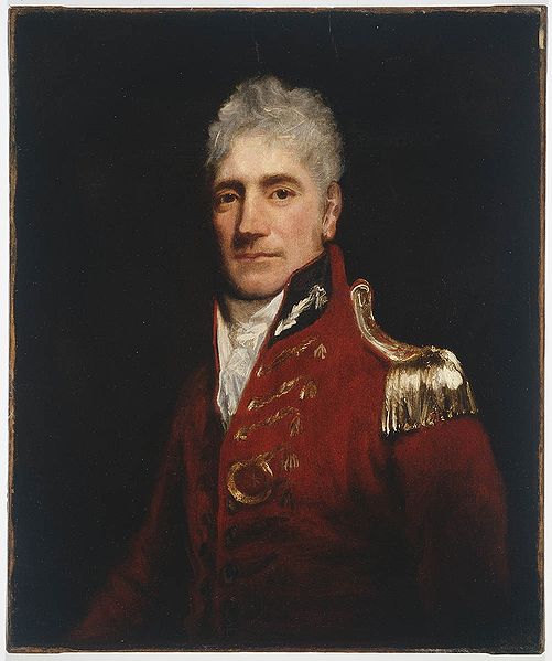
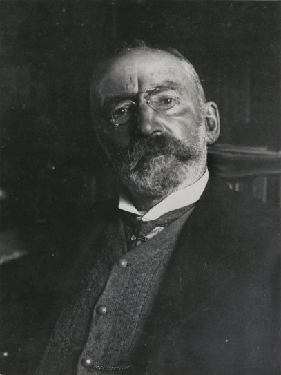
Francis Greenway
Francis Greenway (1777–1837) was the first fully-qualified architect in Australia. He was trained as an architect and painter in England, and had exhibited works at the Royal Academy in 1800. Greenway was transported to New South Wales for forgery in 1813, following the bankruptcy o |
 f
his family’s company; he carried with him a letter
of recommendation from Governor Phillip to Governor
Macquarie. By the end of 1814, Greenway
had a ticket of leave and had
established a practice. Macquarie was so impressed
with his skills, and so in need of a real architect
to carry out his amibitious plans, that he granted
him a full pardon in 1819, and commissioned him for
most of his major public buildings. These schemes
were considered by Commissioner Bigge as too
grandiose for the colony; such condemnation, coupled
with Greenway’s difficult nature, led to his
decline. By the time of Macquarie’s departure,
Greenway was exiled in poverty to his farm near
Newcastle. On his death, he is believed to have been
buried in the East Maitland cemetery, in an unmarked
grave. While many of his structures have been
destroyed, his elegant style can still be
appreciated in such important monuments as Hyde Park
Barracks and St James’s in Sydney, St Luke’s in
Liverpool, and St Matthew’s in Windsor.
f
his family’s company; he carried with him a letter
of recommendation from Governor Phillip to Governor
Macquarie. By the end of 1814, Greenway
had a ticket of leave and had
established a practice. Macquarie was so impressed
with his skills, and so in need of a real architect
to carry out his amibitious plans, that he granted
him a full pardon in 1819, and commissioned him for
most of his major public buildings. These schemes
were considered by Commissioner Bigge as too
grandiose for the colony; such condemnation, coupled
with Greenway’s difficult nature, led to his
decline. By the time of Macquarie’s departure,
Greenway was exiled in poverty to his farm near
Newcastle. On his death, he is believed to have been
buried in the East Maitland cemetery, in an unmarked
grave. While many of his structures have been
destroyed, his elegant style can still be
appreciated in such important monuments as Hyde Park
Barracks and St James’s in Sydney, St Luke’s in
Liverpool, and St Matthew’s in Windsor.Along Macquarie Street, near Bridge Street, an information sign commemorates the site of Exhibition Building, built in 1879 to house the Sydney International Exhibition. Covering almost two hectares, it was designed in four days and erected in eight months to showcase Australian design, art and technology. On the morning of 22 September 1882, the structure burnt to the ground. In the blaze 300 paintings were lost, as well as relics of the Eora, Sydney’s Aboriginal tribe and records of early convicts; legend has it that the fire was deliberately lit by descendants of these convicts wanting to erase their history. All that survived were the gates, still standing near Mitchell Library.
On the corner of Bridge Street is the Treasury Building and Colonial Secretary’s Office (now the InterContinental Hotel), built 1849–51. The Treasury was designed by Colonial Architect Mortimer Lewis, with additions by W.L. Vernon in 1896. Built of sandstone, these two are quintessential examples of colonial Classical Revival style. The Gold Room in the Treasury, now the hotel’s restaurant, was used during the 1850s gold rush to receive gold from the New South Wales goldfields.
On the south side of Bridge Street is the Colonial
Secretary’s Office, now the Chief Secretary’s Department,
designed in 1878–80 by Colonial Architect James Barnet.
Influenced by the French Second Empire style, Barnet covered
the building with stone figures, copper towers and cupolas.
The three foyers are open to the public on weekdays; at the
entrances one can view three statues by Italian sculptor
Giovanni Fontana. They represent Queen Victoria and the
Prince of Wales, as well as a young girl symbolising the
spirit of New South Wales.
History House, at no. 133, is the headquarters of the Royal Australian Historical Society (t. 02 9247 8001, history@rahs.org.au) Built in 1872, the building had many owners, including the surgeon William Bland, who had been transported in 1814 for duelling. Bland was pardoned in 1815, and became one of the most eminent doctors in the colony. (George Goodman's 1845 daguerreotype portrait of Bland is the earliest surviving photograph made in Australia.) Macquarie Street was long associated with the medical profession, as many doctors established practices in its buildings. The Historical Society acquired the building in 1969; it now houses their library. Several historical tours originate from the building.
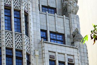
BMA House, nos 135–137, was built in 1929, and is one of the
few skyscraper examples of the adaptation of Australian
motifs to Art Deco design; its façade includes wonderful
renditions of koalas (the only examples on a façade in
Australia), as well as the traditional symbol of snake and
staff. It is now part of the Australian Medical
Association’s quarters, despite the entryway’s statement to
the contrary.
Royal Australasian College of Physicians, no. 145, was once the residence of John Fairfax, founder of the Sydney Morning Herald; today’s media corporation, the Fairfax Corporation, is an outgrowth of this family’s contribution to Sydney’s publishing history. The building is described in Joseph Fowles’ Sydney in 1848, an invaluable source on the architectural history of the city. One of the last Georgian buildings of its type, it is notable for the four-storey timber verandah with box-frame windows on the ground floor and French casements on the upper floors.
Outside the Mitchell Library across the street at
Shakespeare Place is a monument to Governor Richard Bourke,
governor of New South Wales 1831–37, and responsible for
enlightened reform measures concerning emancipated convicts
and education.
State Library of New South Wales ~ the Mitchell Library
At this point you will find the entrance to the State Library of New
South Wales, often referred to as Mitchell Library,
although the Mitchell Library only occupies one wing of the
building. The library itself was founded in 1845 by members
of the Australian Subscription Library, who erected a
building on the corner of Macquarie and Bent Streets. The
organisation was taken over by the State Government in 1869
to become the New South Wales Public Library. In 1899, the
library incorporated the collection of David Scott Mitchell
in order to receive his unprecedented bequest of
Australiana.
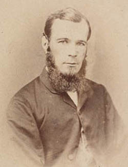
David Scott Michell
David Scott Mitchell (1836–1907) was born in Sydney, the son of the Chief Surgeon of Sydney Hospital. One of the first graduates of the University of Sydney, Mitchell devoted his life and his considerable inheritance to the collection of anything relating to the history of Australia. Legend has it that he became a recluse when he was spurned in love; by all accounts he was an eccentric figure, dressed entirely in black and with an ever-present bowler hat. Mitchell’s initial bequest to the Library consisted of 10,000 volumes and fifty pictures, donated to make room in his home for more of his collection. In order to house the rest of his donation, Mitchell wanted a separate building to be constructed; the Mitchell Wing began to be built in 1906, and was not completed until after Mitchell’s death. At that time the Library received the entire bequest of some 61,000 volumes, papers, manuscripts, and paintings, along with an endowment of £20,000. The collection was stored in bank vaults until the Mitchell Wing was opened in 1910. The Library has continued to grow by purchase from this endowment. Recently, Mitchell’s excellent collection of 19C erotica has finally been opened for public view. |
Another collection, containing even rarer items pertaining to the South Pacific and Australia, was accumulated by William Dixson (1870–1952), a Sydney bachelor who offered his works to the library in 1919. To accommodate the collection, the Dixson Wing of the library was built adjacent to the Mitchell Wing. Upon his death in 1952, Dixson bequeathed the rest of his rarities, along with an endowment of £100,000 for additional purchases, and for the publication of manuscripts and reprinting rare books.
The Mitchell Wing is an architectural delight. On the floor of the foyer is a mosaic rendering of the Tasman map, a copy of the original 17C hand-drawn map from the voyages of Abel Tasman in 1642 (the map itself was given to the Mitchell Library in 1933 by Prince George of Greece). The mosaic was completed by the Melocco Brothers in 1941; they are also responsible for the mosaic in the crypt of Sydney’s St Mary’s Cathedral. The interior of the Library itself includes a stained-glass dome. While the entire holdings of the Mitchell library are not open to the general public, anyone with a serious scholarly purpose may obtain permission to use the collection. The Dixson Wing also holds regular exhibitions pertaining to Australian history and culture. For information on exhibitions, call the State Library, t 02 9230 1414, open various hours.
The State Library itself is housed in a 1960s building
connected to the Mitchell and Dixson wings. It contains a
two-level reference library and collection of books and
serials. Film screenings and poetry readings are regular
events. An excellent shop containing items relating to
Australian history and literature is located on the ground
floor.
On the Macquarie Street side of the Mitchell
Library
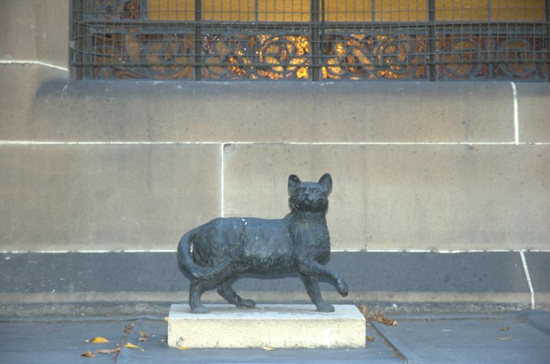
stands a memorial statue to the explorer Matthew Flinders
and his cat, ‘Trim’ (1996, bronze, John
Cornwell). Flinders
praised the cat in his essay A Biographical Tribute to
the Memory of Trim
Matthew Flinders
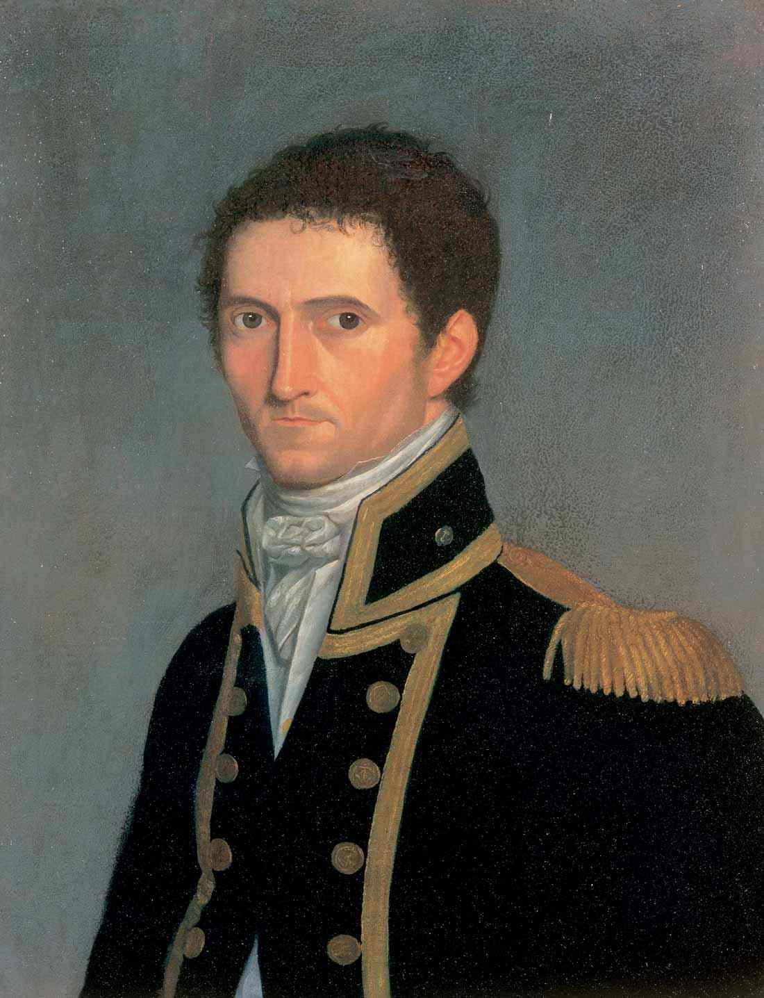 Matthew Flinders (1774–1814) is one of the most intriguing naval explorers associated with the early Australian expeditions. Born in Lincolnshire, England, into a family of surgeons, he took to sea after reading Robinson Crusoe. He joined the Royal Navy in 1789 and sailed with Captain Bligh’s second voyage in 1791. He sailed to Sydney with Captain Hunter aboard the Reliance in 1795; it was on this voyage that he met George Bass, the ship’s surgeon. They struck up an alliance that led to their joint explorations of the Georges River and the south coast of Sydney. In 1798, the pair, in command of the Norfolk, circumnavigated Tasmania by passing through the Bass Strait, which Bass had explored in 1797. They returned to Sydney in January 1799, having made some of the first detailed surveys of the Tasmanian coast and establishing Flinders’ reputation as a superb cartographer. After a return trip to England in 1800 where he married, Flinders received command of the Investigator with instructions to explore the entire coast of New Holland, as it was still called. He completed this circumnavigation on 6 December 1803, completing records so accurate that they are still used by the Royal Australian Navy. He was the first person on record to apply the term ‘Australia’ regularly to the continent. Remarkable also on this voyage was the botanical and biological work carried out by the expedition’s appointed draughtsman, the Viennese Ferdinand Bauer (1760–1826). Bauer made over 1000 drawings, meticulously rendered and later hand-coloured according to an elaborate colour gradation system devised by the artist. His publication in 1815, Illustrationes Florae Novae Hollandiae, was not a financial success but his works are now recognised as the most precise and aesthetically pleasing examples of natural history painting ever produced. Flinders named Cape Bauer on the South Australian coast in his honour, and his name is perpetuated in several Australian plants. Upon his return to England in 1803, and unaware that war had broken out between England and France, Flinders called in at Mauritius (then known as Ile de France) to make repairs on his ship, only to be imprisoned for almost seven years. He finally returned to London in 1810, where he completed his remarkable A Voyage to Terra Australis at the end of 1813. His health had been ruined in captivity, and he died on 18 July 1814, only 40 years old, before he saw the first copy of his beloved book. The inclusion of Flinders’ cat in the memorial is an appropriately affecting one. Trim was born a seafaring feline in 1799 aboard the Reliance, when Flinders commanded a supply ship to South Africa. He accompanied his master on the voyages of the Norfolk and the Investigator, thus circumnavigating the world. In 1809, Flinders wrote an affectionate and delightfully informative ‘Tribute to Trim’, describing his unique qualities as a feline sailor. During Flinders’ detention on the Ile de France, Trim disappeared without a trace; Flinders wrote, ‘My sorrow may be better conceived than described.' |
Across Macquarie Street in this block is St Stephen’s
Church, built in 1935 on the site of Burdekin House,
reputedly the most significant Regency-style building in
Australia. The Presbyterian Church purchased the site in
1933 for £50,000; the present structure, now a part of the
Uniting Church, houses a congregation of over 600 and offers
special services and musical recitals during the week. From
1952 to 1965, the church was the domain of Reverend Gordon
Powell, the first Australian-born minister of the church who
gained international renown as a preacher, writer, and
supporter of Billy Graham Crusades.
 The now
demolished Burdekin House was built in 1841 for Thomas
Burdekin, an ironmonger from England who came to Sydney in
1826. Built by architect James Hume, also responsible for
the National Trust property Lindesay on Darling Point, the
three-storeyed mansion included colonnades and fretted
stonework on the façade and offered some of the most richly
and elegantly appointed interiors in the colony. It was
inherited by Thomas’ son, Sydney Burdekin, born in the city;
he became a Member of Parliament and Mayor of Sydney. From
the 1860s to the 1890s, Burdekin House was the centre of
élite social life in the city, as well as a meeting place
for politicians from Parliament House across the street.
The now
demolished Burdekin House was built in 1841 for Thomas
Burdekin, an ironmonger from England who came to Sydney in
1826. Built by architect James Hume, also responsible for
the National Trust property Lindesay on Darling Point, the
three-storeyed mansion included colonnades and fretted
stonework on the façade and offered some of the most richly
and elegantly appointed interiors in the colony. It was
inherited by Thomas’ son, Sydney Burdekin, born in the city;
he became a Member of Parliament and Mayor of Sydney. From
the 1860s to the 1890s, Burdekin House was the centre of
élite social life in the city, as well as a meeting place
for politicians from Parliament House across the street.
State Parliament House is still located in one of the wings of the famous ‘Rum Hospital’, so called because it was paid for by giving the rum monopoly to the builders (‘rum’ referring to all alcoholic spirits). The hospital was built from 1811 to 1816, allegedly to a design by Mrs Macquarie herself. This wing has served as Parliament House for the State of New South Wales since 1829, making it the oldest Parliament House in the world. In 1843 the Legislative Assembly Chamber, designed by Mortimer Lewis, was added on to the wing; the Legislative Council Chamber is made of a pre-fabricated cast-iron building, which had been shipped from England to serve as a church on the Victorian gold-fields. In 1856, it was dismantled and sent to Sydney when the state legislature expanded.
Parliament House is open to the public on weekdays
09.00–16.30 when not in session, and until 19.00 when in
session. If Parliament is in session, visitors can view the
proceedings from the upper galleries. The sessions are often
quite raucous and pugnacious affairs, for Australian
politicians love a good shouting match. Excellent
exhibitions and historical displays are housed throughout
the building, and informative brochures are available.
Bookings for viewing of sessions can be made on (t 02 9230
2111); bookings for visits during Question Time (Tuesdays)
are advised.
Next to the Parliament House, on the site of the original Rum Hospital, is Sydney Hospital, built in 1894. The Rum Hospital itself had been structurally unsound since it was built; the builders had been eager to get the rum monopoly, and were not necessarily competent workers. Early stories of the horrors of the hospital itself were rife: unsanitary surgical conditions (operations often occurred on the kitchen table), no facilities or adequate food, inadequate and untrained staff. By the 1860s, improvements had been made, including the beginnings of a nurses’ training school approved by Florence Nightingale. By 1879, the structure was considered so dangerous that it was demolished; the new hospital’s design, attributed to architect Thomas Rowe, dates from that time, but was not finished for 15 years. The entrance hall stands as an elegant example of late Victorian style, with a grand staircase and stained glass windows. Frequent attempts have been made to close the facility, so far without success. Outside the hospital is a replica of Il Porcellino, the famous fountain statue of Florence. The boar collects money for the hospital, as all wishing coins thrown into the fountain benefit their activities.
Next to the present-day hospital is The Mint,
originally the southern wing of the Rum Hospital, and now
the headquarters of The Historic Houses Trust (t. 02 8239
2288). In response to the discoveries on the goldfields, the
building served as a branch of the Royal Mint from 1854
until 1926, when a new mint was opened in Perth. It served a
variety of governmental functions until 1982, when it was
salvaged from further dereliction and opened as a Museum of
Colonial Decorative Art. While that museum has now closed,
some displays still remain in the public spaces. Both the
public and the office functions are located in the remaining
sections of the historic Coining Factory buildings and in
new additions located to the north and south east of the
site. The Macquarie Street building – referred to as
the Mint Offices and originally the south wing of the 'Rum
Hospital' – provides the "front door" to these new
facilities. It will continue to be open to the public with
the existing café, meeting rooms available to the Trust and
general public and the Members of the Historic Houses Trust
lounge and office. The Coining Factory buildings and the
project area can be viewed from the rear corridor.
The most exciting addition to the Mint's facilities since the Historic Houses Trust's occupation of the space is The Caroline Simpson Library and Research Collection, housing the HHT's magnificent library of artefacts, books, and ephemera relating to the history of house, garden, and interior design in New South Wales. The collections are open to anyone with a scholarly interest in the Trust's areas of expertise. The new buildings and integration of the old structures into new ones were conceived by architect Richard Francis-Jones, of FJMT Architects; Clive Lucas Stapleton and Partners as conservation architects and Godden Mackay Logan as archaeologists, and were carefully located to compliment the proportions and geometric alignments of the existing buildings. The Library is open M-F 10.00-17.00; according to the website, 'Paintings, prints, textiles, wallpapers and other large format collection items can be viewed by appointment every Tuesday, 1.30pm – 4.30pm'. (t 02 8239 2233).
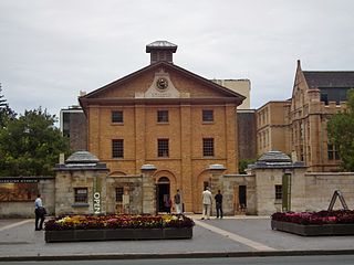 Continue south on Macquarie Street; next to
the Mint is Hyde
Park Barracks (t 02 8239 2311; open daily
10.00–17.00). Designed for Governor Macquarie by Francis
Greenway between 1817 and 1819, the barracks provided the
first permanent lodging for convicts, who until this point
were allowed to roam free. Described by architectural critic
J.M. Freeland as ‘just a barn—but a very handsome barn’,
this three-storey sandstone construction could sleep 600
convicts; it is considered one of Greenway’s most successful
and elegant buildings. After transportation ended, it was
used for a variety of purposes, until it was restored as a
museum in 1984. The museum shop is an excellent source for
books on Australian history and culture. Tours include one
that allows the visitor to spend the night in the barracks
as a convict would.
Continue south on Macquarie Street; next to
the Mint is Hyde
Park Barracks (t 02 8239 2311; open daily
10.00–17.00). Designed for Governor Macquarie by Francis
Greenway between 1817 and 1819, the barracks provided the
first permanent lodging for convicts, who until this point
were allowed to roam free. Described by architectural critic
J.M. Freeland as ‘just a barn—but a very handsome barn’,
this three-storey sandstone construction could sleep 600
convicts; it is considered one of Greenway’s most successful
and elegant buildings. After transportation ended, it was
used for a variety of purposes, until it was restored as a
museum in 1984. The museum shop is an excellent source for
books on Australian history and culture. Tours include one
that allows the visitor to spend the night in the barracks
as a convict would.
Walk 2 Hyde
Park
and surroundings
Now proceed to St James Church, another of Greenway’s achievements, built 1819–22. Originally designed as a courtroom, the plans underwent a change when Macquarie requested a church instead. Built of characteristically red-brown local brick, the building’s design is admired for its simplicity and balanced proportions. The only exterior ornamentation is the inclusion of pilasters of a different colour. The current building includes numerous additions and alterations, including the spire, probably added in 1824 by Greenway’s successor, and eastern porches by John Verge. The opulent interior furnishings were created in the Edwardian era by Anglican Diocesan Architect, J.H. Buckeridge. The basement houses church offices, as well as a delightful Children’s Chapel, decorated in the 1930s by a group of women artists known as the Turramurra Painters, led by Ethel Anderson and Grace Cossington Smith. The frescoes depict biblical stories transposed to a Sydney setting, a rare example of what art historian Joan Kerr calls ‘Early Christian Australian Nationalism’.
Hyde Park
Cross St James Road to enter Hyde Park itself, a
cosmopolitan oasis of greenery that also houses several
architectural monuments and is surrounded by some of the
most elegant buildings in town. Situated in the park between
Elizabeth and College Streets is the Archibald Memorial
Fountain, erected in 1933 at a cost of £12,000 from the
bequest of Jules François Archibald. The fountain
commemorates Franco-Australian cooperation in the First
World War. In keeping with Archibald’s wishes, it was
designed by a French sculptor, François Sicard, and
represents mythological personifications of the Arts, Beauty
and Light.
Jules François Archibald
 Jules François Archibald (1856–1919) was an important figure in Australian cultural life. Christened John Feltham by his Irish-Australian parents, his romantic flair for all things French led him to adopt a French name. He was in 1880 one of the founders of the Sydney Bulletin, a weekly newspaper which helped to define a national Australian character. Appealing to the native-born Australian, the Bulletin conveyed a distinctive mixture of idealism, republicanism, racism, and vulgar humour; it was particularly well-known for its editorial cartoons, the artists of which contributed to an illustrative style known as ‘The Black and White School’. Archibald was responsible for the cultural aspects of the paper, and it was in this capacity that he supported and encouraged a group of young Australian writers and artists, including Henry Lawson, A.B. ‘Banjo’ Paterson, and Norman Lindsay. Upon his death in 1919, his will specified not only the Memorial Fountain, but an amount for an annual prize of £156 for the best portrait painted by an Australian; today, the Archibald Prize has grown to $20,000, making it one of the most lucrative art prizes in the world. |
Also in Hyde Park is the Anzac War Memorial, an impressive
Art Deco structure designed in 1934 by a local artist, C.
Bruce Dellit, with sculpture by Rayner Hoff (1894–1937). At
a height of 33m (100 feet), the memorial contains a circular
Hall of Memory above a circular Hall of Silence which
incorporates a group of statuary symbolising Sacrifice. The
walls of the Hall of Memory include the names of those who
fell in the Great War.
Recently, some Sydney politicos have sought to turn much of
Hyde Park into an aquatic centre, to the dismay of heritage
activists and environmentalists. At the time of writing,
final plans were still being debated, although renovations
appear to have won out; the section next to St Mary’s
Cathedral is to become an aquatic centre.
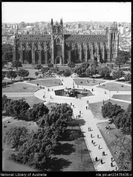
On the College Street side of Hyde Park is St Mary’s
Catholic Cathedral, designed in 1865 by William Wilkinson
Wardell, who had earlier designed St Patrick’s Cathedral in
Melbourne. Modelled on Lincoln Cathedral, St Mary’s is
probably the largest church erected in the British colonies
and appears, according to Jan Morris, as a ‘kind of standard
Gothic cathedral, such as you might order from an
ecclesiastical catalogue’. The interior is rich in dark
stained-glass windows, and also includes a majestic mosaic
floor in the crypt by Peter Melocco, who also produced the
Tasman map mosaic at the Mitchell Library. Currently the
cathedral is carrying out a massive fund-raising campaign,
highlighted by concerts and operas performed on site.
At the corner of William and College Streets, south of
the Cathedral, is The Australian
Museum (t 02 9320 6000; open daily 09.30–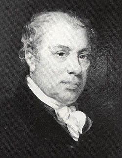 17.00); the street façade is of
Neo-Palladian design, constructed by James Barnet’s office
between 1861 and 1866.The original museum building, evident
in the first rooms of the interior, was built by Mortimer
Lewis between 1846 and 1852; it was opened to
the public in 1857. The museum was founded in 1836, and
supported by Alexander Macleay (1767–1848), then Colonial
Secretary and an enthusiastic scientist. The original
specimens were from his own collection; subsequently
government funding allowed the museum to grow into one of
the most important collections of Australian zoology,
mineralogy, palaeontology and ethnology. The institution has
an illustrious history, with many famous scientists and
cultural figures serving as directors and curators. The
present museum has expanded in a variety of directions,
allowing for numerous exhibition spaces, as well as the
display of the original 19C holdings. The museum also houses
a large reference library and publishes several scientific
and popular journals. Regular lectures and gallery talks are
scheduled, and the museum is one of the most popular venues
for Sydney school children, particularly drawn to the
dinosaur collection.
17.00); the street façade is of
Neo-Palladian design, constructed by James Barnet’s office
between 1861 and 1866.The original museum building, evident
in the first rooms of the interior, was built by Mortimer
Lewis between 1846 and 1852; it was opened to
the public in 1857. The museum was founded in 1836, and
supported by Alexander Macleay (1767–1848), then Colonial
Secretary and an enthusiastic scientist. The original
specimens were from his own collection; subsequently
government funding allowed the museum to grow into one of
the most important collections of Australian zoology,
mineralogy, palaeontology and ethnology. The institution has
an illustrious history, with many famous scientists and
cultural figures serving as directors and curators. The
present museum has expanded in a variety of directions,
allowing for numerous exhibition spaces, as well as the
display of the original 19C holdings. The museum also houses
a large reference library and publishes several scientific
and popular journals. Regular lectures and gallery talks are
scheduled, and the museum is one of the most popular venues
for Sydney school children, particularly drawn to the
dinosaur collection.
Next door to the museum on College Street is Sydney Grammar School, now a conglomeration of many buildings in various styles. The school itself has great historical significance, as one of the oldest educational institutions in the colony and as the focal point of many public meetings in Sydney’s formative years. The earliest buildings here were erected between 1831 and 1835 by Robert Cooper as part of a neo-Classical block of the old Sydney College (from which College Street derives its name). The college closed in 1847. The buildings were next to the University of Sydney which was inaugurated in 1850. After years of financial vicissitudes, the school became Sydney Grammar, founded by an Act of Parliament in 1854 and opened in 1857. While the buildings of the school are of modest sandstone, the school’s status as the longest continuous home of an Australian educational institution gives them a special significance.
On the other side of Hyde Park is Elizabeth Street,
named for Governor Macquarie’s wife; it is the longest and
straightest street in central Sydney, beginning at Hunter
Street and extending to the Central Railway Station. At the
head of the park is the Old Supreme Court Building group,
originally designed by Francis Greenway, but substantially
altered by the addition of a stone colonnade in 1868 by
Colonial Architect James Barnet. The interior, with its
cedar staircase, gives some indication of Greenway’s
gracious design, although additional elements appeared in
the 1890s, giving a more opulent Edwardian atmosphere to the
chambers.
Further south on Elizabeth Street is the Great Synagogue.
Opened in 1878, the building was designed by Thomas Rowe and
constructed of Pyrmont sandstone. Intende9225 1700d to
accommodate two previous Jewish congregations, the ground
floor seats 1600 people. Considered one of the major
monuments to Australian Jewry, it still holds services,
although larger congregations exist in Bondi and elsewhere
in the city. Special admission and tours can be arranged
through the synagogue’s offices; regular tours occur at noon
on Tuesdays and Thursdays (t 02 9267 2477).
The first Jews in Australia
 Jews arrived in Australia with the First
Fleet; at least one, James Larra, eventually became an
innkeeper in Parramatta. By 1817, 20 Jews formed a burial
society in the colony and from 1828 prayers were held
regularly at the home of P.J. Cohen in Jamison Street. By
1835, the Jewish population in Sydney was 345. The first
minister, M.E. Rose, arrived in this year. By 1862, under
the leadership of senior minister Alexander Davis, Jewish
education and philanthropy became organised; Davis presided
over the community for 40 years, and was instrumental in the
merger of the two congregations that culminated in the
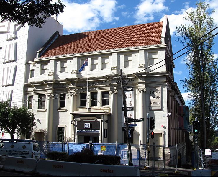
erection of The Great Synagogue. The Sydney Jewish
Museum, which holds regular exhibitions and
illustrates the entire history of Australian Jewry, is
located at 148 Darlinghurst Road and very near to Kings
Cross (t 02 9360 7999, open Sun–Thurs 10.00–16.00, Fri
10.00–14.00).
Jews arrived in Australia with the First
Fleet; at least one, James Larra, eventually became an
innkeeper in Parramatta. By 1817, 20 Jews formed a burial
society in the colony and from 1828 prayers were held
regularly at the home of P.J. Cohen in Jamison Street. By
1835, the Jewish population in Sydney was 345. The first
minister, M.E. Rose, arrived in this year. By 1862, under
the leadership of senior minister Alexander Davis, Jewish
education and philanthropy became organised; Davis presided
over the community for 40 years, and was instrumental in the
merger of the two congregations that culminated in the
erection of The Great Synagogue. The Sydney Jewish
Museum, which holds regular exhibitions and
illustrates the entire history of Australian Jewry, is
located at 148 Darlinghurst Road and very near to Kings
Cross (t 02 9360 7999, open Sun–Thurs 10.00–16.00, Fri
10.00–14.00).
Walk 3 The Domain, Botanic Gardens, and the Art Gallery of New South Wales
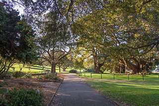
The central park area known as the Domain is integral to Sydney city life. It was part of the original government reserve set aside by Governor Phillip. Under Macquarie it acquired the official title ‘Government Domain’ and was enclosed by stone walls, but it seems to have been accessible to all sorts of citizens from the beginning. By the 1860s, the Domain Gates were opened to the public, and by the 1890s it had become the site for public speakers and political demonstrations. Huge crowds demonstrated against conscription in 1917, and protests here accompanied the dismissal of Premier Lang in 1931 and Prime Minister Gough Whitlam’s sacking in 1975. Today the Domain is still a site for public gatherings, including concerts during the Festival of Sydney in January and carols at Christmas time, as well as what appears to be regular lunch-hour cricket games.Woolloomooloo
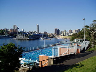
From the Domain one looks out over Woolloomooloo (yes, eight ‘o’s!), once the busiest industrial dock area, now occupied by the navy. Still in operation as a popular public swimming pool and accessible from the Domain is the Andrew (Boy) Charlton Pool, which juts into Woolloomooloo Bay; it is named after a great Australian swimmer of the 1920s. The pool is now the site of the annual Gay Swimming Carnival.
The district itself long held a reputation as a tough tenement for sailors and dock-workers; today it has lost some of that image, housing great pubs and entertainment venues. At the time of writing, Harry’s Cafe de Wheels, a Sydney institution since 1945, was still stationed on the wharf of Woolloomooloo; you go there for late-night ‘pies and peas’, as you would for a cheese-steak in Philadelphia—definitely not haute cuisine, but a fun stop for visitors. The van has photographs of celebrity customers pinned on its walls.
The Royal Botanic Gardens
 The Royal
Botanic Gardens (t 02 9231 8111, daily sunrise until
sunset) are accessible through several entrances on each
side of the Domain. The 1889 entrance across from the
Shakespeare monument in front of the State Library is often
considered the main entrance, although the ‘official’
entrance is across the street from the Art Gallery of New
South Wales.
The Royal
Botanic Gardens (t 02 9231 8111, daily sunrise until
sunset) are accessible through several entrances on each
side of the Domain. The 1889 entrance across from the
Shakespeare monument in front of the State Library is often
considered the main entrance, although the ‘official’
entrance is across the street from the Art Gallery of New
South Wales.
The gardens were originally the site of Government Farm,
established by the First Fleet from seeds brought with them;
the settlers were able to raise nine acres of corn at what
is now called Farm Cove. When barren soil caused the main
farm to be moved to Parramatta, Phillip declared this area
for the government; hence its earlier name of Phillip
Domain.
The Botanic Gardens proper date from 1816, when Mrs
Macquarie’s Road was completed. This road in the Gardens and
along the harbour marks the favoured excursion route of
Elizabeth Macquarie, culminating in Mrs Macquarie’s Chair, a
stone bench where she allegedly sat to enjoy the view.
From here one can look out into the harbour to Fort Denison,
more popularly known as ‘Pinchgut’ Island, supposedly
referring to the fact that in the early days repeat
offenders were sentenced to stay here on a diet of bread and
water; a more likely reason is that it is at this point that
the harbour narrows around it. The island still bears guns
and defence towers, evidence of early attempts to defend the
harbour from invasion. In 1942, when a Japanese midget
submarine entered the harbour, an American cruiser attacked,
hitting the fort’s tower; the submarine was hit, and its
remains can be seen today outside Canberra’s Australian War
Memorial.
You can also see across to Garden Island, now the site of
the Royal Australian Naval base. Here First Fleet sailors
grew vegetables. It is also the site of Australia’s first
known graffiti, and the oldest evidence of white settlement:
carved in rocks on the former island are the initials ‘F.M.’
for Frederick Meredith, a steward on the Sirius.
The gardens themselves offer a number
of delightful walks, incorporating native and introduced
species. Fruit bats hang in abundance in the palm groves.
Ornate statues of all sorts, including replicas of Canova’s
Boxers on the Main Walk, dot the gardens. In the middle of
the gardens is a refreshment kiosk, including a
highly-touted restaurant above and a cafeteria-style
facility below; a visitor’s centre also provides brochures
and books on natural history and gardening.
Most spectacular is the walk along the Harbour around Farm
Cove which ultimately leads out of the gardens and to the
Opera House. Of special interest is the Pyramid Glasshouse
near the Macquarie Street entrance, containing rare and
endangered species and other tropical plants.
In the middle of the gardens, near Farm Cove Crescent,
you can see Government
House (t 02 9931 5222; open Fri–Sun, tours every half
hour 10.30–15.00, otherwise check https://www.governor.nsw.gov.au/government-house/visit-us/visitor-information/).
It was designed by Edward Blore, an English architect who
had designed Sir Walter Scott’s estate, Abbottsford. The
foundation stone was laid in 1837, and Mortimer Lewis became
supervising architect. It was officially opened on 26 June
1845. The design, with its crenellated turrets and
porte-cochère entrance, complements Greenway’s earlier
stables, and marks the rise of the popularity of Gothic
Revival style in the colony. Built of Australian cedar,
Pyrmont stone and native marble, the structure included
cloisters that form a covered verandah comprised of Gothic
arches. First occupied by Governor Gipps, the colonial
chronicler Joseph Fowles described it in 1848 as: ‘an
elegant stone edifice in Tudor Gothic... It is one of the
most imposing buildings we have; and whether viewed from the
adjacent Domain, the Harbour, or the City, its tall chimneys
of elaborately carved stone, white turrets, and numerous
windows, render it a conspicuous ornament to our
metropolis’. It now houses a collection of 19C and 20C
decorative art and furniture.
Sydney Harbour Islands
|
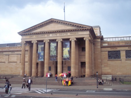
The Art Gallery of New South Wales
 To get to the Art Gallery of
New South Wales (open 10.00-17.00) , enter the Domain
after Hyde Park Barracks on Macquarie Street and you come to
Art Gallery Road. Three hundred metres from here is the art
gallery.
To get to the Art Gallery of
New South Wales (open 10.00-17.00) , enter the Domain
after Hyde Park Barracks on Macquarie Street and you come to
Art Gallery Road. Three hundred metres from here is the art
gallery.
The gallery dates from 1871, when the New South Wales
Academy of Art was formed; it was formally initiated in
1874, when the directors of the Academy formed a Board of
Trustees entrusted with the task of purchasing artworks in
London. Several temporary locations existed before the
gallery moved to its present site. In 1883 it officially
became the National Art Gallery of New South Wales, although
the ‘National’ was dropped in 1958. (Note that Melbourne’s
gallery is still called the National Gallery of Victoria,
despite the fact that the National Gallery of Australia is
now in Canberra—evidence of the continuing cultural
competition between the two states.)
The gallery also includes two restaurants, a coffee shop on
Level 3 with a delightful terrace and interesting view into
the naval base at Woolloomooloo Bay, and a more elegant
restaurant on level 5 which overlooks the entrance lobby.
The original building of 1885 was designed by John Horbury Hunt. Always considered a temporary building, it was concealed in 1895 by the classically designed façade of Colonial Architect W.L. Vernon. It is Vernon’s plan that still constitutes the main floor galleries, including the Roman-style entrance completed in 1909, and the grand oval lobby of 1902. Vernon envisioned large bronze reliefs on the exterior walls, only four of which were completed. The building had fallen into disrepair by the 1960s, when the government agreed to rebuild the site as part of the Captain Cook Bicentenary projects. Architect Andrew Andersons completed the new building in 1972, demolishing the original Hunt structure at the rear and doubling exhibition space. Andersons was also responsible for the newest extension at the east end, which opened for the Bicentenary in 1988.
By far the most impressive part of the gallery’s
collections is its holdings in Australian art. As early as
1875, the gallery committed itself to the purchase of local
artists’ work, an admirable decision at a time when culture
was widely believed to originate in Europe alone. The
collection, then, is strongest in works after 1875, with
earlier works acquired at a much later date.
On entering the gallery’s foyer, you step through the oval
lobby and into the central hall, where the information desk
is located to the left; admission is free except to special
travelling exhibitions, which are charged separately.
The Aboriginal gallery is on the third level below.
On the right are the European galleries. The current design
of these exhibition spaces consciously alludes to 19C
academic practices, with richly-coloured walls and paintings
hung densely on the walls. Fittingly, the two middle
galleries on this side, including the large central gallery,
concentrate on 19C Australian paintings; the small holdings
of early European art are in the first gallery off to the
left of the first of the Australian rooms, and 18C century
and 19C European works in the gallery behind them.
The first gallery of Australian art includes works painted
before 1875, including John Glover’s Natives on the Ouse
River, Van Diemen’s Land, one of the artist’s interesting
depictions of Tasmanian Aboriginals; several works by Conrad
Martens, often considered the ‘Turner of Australia’ for his
wispy seascapes; and a characteristic landscape by Victorian
artist Eugène von Guerard.
In the central gallery the most famous works appear: those
of the so-called Australian Impressionists, the artists of
the late 19C, whose works are now known as near icons of
national identity, popularly accepted as having created a
distinctly Australian style. Ironically, many of these
artists were either foreign-born or lived extensively as
expatriates abroad. Included here are Charles Conder’s
atmospheric Departure of the S.S. Orient-Circular Quay,
painted in 1888 and purchased by the gallery in the same
year; Arthur Streeton’s ‘Fire’s on!’ (Lapstone Tunnel)
(1891), probably his most famous narrative landscape;
Frederick McCubbin’s On the Wallaby Track (1896), redolent
of the plein-air techniques of Belgian painter
Bastien-Lepage; and Tom Roberts’s Shearing at Newstead (The
Golden Fleece) (1894), establishing the iconography of the
Australian shearer.
Dominating the room’s walls, however, are the enormous
canvases of Rupert Bunny (1864–1947) and George Lambert
(1873–1930), two expatriate Australians who concentrated on
figurative painting in the grandest and most elegant
European tradition.
The galleries to the rear and at the far side, painted in
the original deep red, house a considerable number of late
Victorian and Edwardian British painting, including Frederic
Leighton’s voluptuous Cymon and Iphigenia (1884) and Ford
Madox Brown’s Chaucer at the Court of Edward III. Other
works by the Pre-Raphaelite School demonstrate the strong
British concentration of the gallery’s early acquisitions.
To the left of the central hall on the main floor are the
works of 20C Australian art, intelligently arranged to
present an overview of the country’s more recent aesthetic
development. Of special interest are the works of the Early
Moderns, most particularly the progressive paintings of the
women painters Margaret Preston (1875–1963), Thea Proctor
(1879–1966) and Grace Cossington Smith (1892–1984), who are
now seen as the most accomplished modern painters of the
1920s and 1930s.
The contribution of Melbourne artists to Australian
modernism is also recognised with works by the
social-realists Josl Bergner and Noel Counihan. Works by
Sydney artists Russell Drysdale (1912–81) and William Dobell
(1899–1970) are especially well-represented, indicative of
the Australian directions in portraiture and landscape in
the 1930s and 1940s.
No Australian collection would be complete without examples
by Sidney Nolan (1917–92), probably the most internationally
recognised Australian artist; his Burke (c 1962) and Pretty
Polly Mine (1948) are representative of his mythologising of
Australian history.
Abstraction enters Australian art in the 1950s and 1960s, in
the works of painters such as John Olsen, Peter Upward, and
Fred Williams. Williams’ You Yangs landscape (1963) is
exemplary of his abstracted approach to the Australian
landscape.
Next to these galleries is one of the spaces for travelling and/or project exhibitions, of which the gallery has had many of international stature. The ‘blockbuster’ mentality has invaded the Australian art world as it has in every other country, and great competition arises among the leading galleries for the shows that will bring in the largest crowds. Important regular shows occurring here are Perspecta, held inFebruary to March of odd-numbered years, and the Sydney Biennale, held in July to August of even-numbered years. Both exhibitions focus on Australian and international contemporary art.
Take the escalator to Level 3, which has space for
temporary exhibitions as well as housing the permanent
collections of Asian, Aboriginal and Melanesian art. The
gallery began collecting Aboriginal art in the late 1950s
under the enlightened curatorship of Tony Tuckson, himself
an artist who believed that such works belonged in art
galleries rather than ethnographic collections. Its new
Aboriginal gallery, called Yiribana, brings together these
holdings for the first time; changing exhibitions include
video displays about the artists and Aboriginal culture.
Central to the collection is a set of seventeen grave posts
from Snake Bay, Melville Island, which form a sculptural
grouping that inspired Tuckson’s own work.
Asian art holdings have grown substantially in the last
decade, as increased recognition of Australia’s presence in
an Asian context leads to greater awareness of these
cultures. The holdings are varied and eclectic, although
concerted effort is being made to enhance the collections of
South East Asian art.
Level 2 includes rooms concentrating on the gallery’s
substantial holdings of prints and drawings, as well as
contemporary art and a small collection of 20C European
works. Descending ever further, Level 1 provides a space for
photography exhibitions.
Walk 4 The Rocks
History of The Rocks
Amidst the boulders and cliffs of this sandstone
outcropping the first convicts built their huts, and
eventually created in the section closest to the harbour one
of the Pacific’s toughest seaports, where whalers and
sailors filled the narrow alleyways to carry out every form
of vice and mayhem. As many as 20 pubs existed here by 1813
(along with the illegal ‘sly-grog’ shops and brothels), with
37 by 1855; two pubs, The Lord Nelson on Argyle Street
(1834) and The Hero of Waterloo on Lower Fort Street (1843),
survive from the era.
In the 1850s the area also filled with Chinese who had
arrived during the gold rush; they established opium
parlours, fantan gambling shops, and vegetable hawkers,
creating a Chinatown that added to the general cacophony of
The Rocks. Chinatown moved to the Haymarket district, near
Darling Harbour, in the 1890s.
Long after the penal system ended, this section of The Rocks
continued as a filthy, overcrowded slum; sailors’ anecdotes
maintained that you could hear the noise from The Rocks a
mile out to sea and smell it for two miles. In the 1890s,
The Rocks ‘Pushes’ were notorious for their gang-style
streetfighting; these are brilliantly described by Henry
Lawson in his poem ‘The Captain of the Push’:
then his whistle, loud and piercing, woke the echoes of 'The rocks',
And a dozen ghouls came sloping round the corners of the blocks.
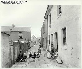 As late as 1900, a major epidemic of bubonic
plague broke out here, leading to the first systematic
‘cleansing’ through demolition. Further destruction occurred
in 1927 when the most elegant of the upper streets of The
Rocks, Princes Street, disappeared as the Harbour Bridge was
built, and again in 1957, to make way for the Cahill
Expressway.
As late as 1900, a major epidemic of bubonic
plague broke out here, leading to the first systematic
‘cleansing’ through demolition. Further destruction occurred
in 1927 when the most elegant of the upper streets of The
Rocks, Princes Street, disappeared as the Harbour Bridge was
built, and again in 1957, to make way for the Cahill
Expressway.
While housing such seamy elements of life, The Rocks also
became the site of reputable establishments and genteel
neighbourhoods: the first hospital and cemetery were here,
and it was the home of the earliest wharves and commercial
warehouses. The neighbourhood along the ridge at present-day
Argyle Place became by the 1850s the location of neat
bourgeois houses, with pleasant greens and elegant terraces.
This area was known as ‘Bunker’s Hill’, reputedly in honour
of American sea captain Eber Bunker, who arrived in Sydney
in 1791 with a convict ship and subsequently became one of
the first whalers in the colony. Bunker participated in the
arrest of Governor Bligh and was given 1500 acres at
Liverpool by Governor Macquarie.
Tours of The Rocks and a self-guided tour map are
available from The Rocks
Visitor Centre, no. 106–108 George Street (t 02 9255
1788).
On the west side of Circular Quay, just below The Rocks
proper, is the Museum of
Contemporary Art (t 02 9245 2400, open Mon.,
Tues., and Thurs. - Sun. 10.00-17.00,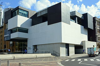 Wed. 10.00-21.00), which opened in 1993 in
the former Maritime Services Board Building. The structure
itself, built in 1949, appears almost Stalinesque in its
solidity and functional severity, but the interiors include
elegant marble fittings. The transformation of the rooms has
created appropriately expansive spaces for the presentation
of contemporary art. Along with travelling exhibitions, the
museum also houses the Power Collection, a bequest of John
Power, and some of the first modern art collected in
Australia. By the time this collection was transferred from
its old home at the University of Sydney in 1991, it
contained works by Warhol, Lichtenstein, Christo and
Hockney. Along with displays of the permanent collection,
the musem mounts exhibitions of the most contemporary art,
including video, holography, and multi-media presentations.
Wed. 10.00-21.00), which opened in 1993 in
the former Maritime Services Board Building. The structure
itself, built in 1949, appears almost Stalinesque in its
solidity and functional severity, but the interiors include
elegant marble fittings. The transformation of the rooms has
created appropriately expansive spaces for the presentation
of contemporary art. Along with travelling exhibitions, the
museum also houses the Power Collection, a bequest of John
Power, and some of the first modern art collected in
Australia. By the time this collection was transferred from
its old home at the University of Sydney in 1991, it
contained works by Warhol, Lichtenstein, Christo and
Hockney. Along with displays of the permanent collection,
the musem mounts exhibitions of the most contemporary art,
including video, holography, and multi-media presentations.
As seems to be required of all Sydney facilities these days,
the museum has an excellent restaurant (one of Neil Perry’s
creations) and the hippest art-bookshop in town—a welcome
change from the duty-free tourist shops littering the rest
of The Rocks.
On the George Street side of the museum at no. 119 was the Julian Ashton Art School. Ashton (1851–1942) was a significant figure in Sydney’s art life, gaining fame as one of the ‘Black and White’ illustrators of The Bulletin and in the production of the immense Picturesque Atlas of Australasia (1888). His school was one of the most progressive in the city, and many of the early modern artists of Sydney began their careers here.
Now walk north up Lower George Street. The first
street in Sydney, it originated as a track from the Tank
Stream’s spring at present-day Martin Place. Originally
called Spring Street, it was renamed in honour of King
George III by Governor Macquarie in 1810.
Orient Hotel, no. 89 Argyle Street, was built in the 1850s
as a sailor hotel, with a rounded corner façade typical of
colonial Georgian style. Across the street, at no. 91, is
the Rocks Police Station, formerly the Victorian ASN Hotel,
a three-storey structure in an elaborate Italianate style
noted for its unusual garland decoration below the parapet.
From here look across towards Circular Quay c 200m to see
Cadman’s Cottage, 110 George Street off Circular Quay West.
Sydney’s oldest extant building, it was built in 1815–16 for
John Cadman, pardoned convict and official government
coxswain for Governors Macquarie, Brisbane, Darling, Bourke
and Gipps; he was Superintendent of Boats 1827–45. Cadman
lived in the cottage until 1845; his diminutive size
explains the height of the doorway. It was subsequently the
headquarters of the Sydney Water Police and, until 1965,
part of the Sailors’ Home. It was rebuilt and renovated in
1972 and is now the information centre for the New South
Wales National
Parks & Wildlife Services (t 02 9247 8861; open
Tues–Sun 11.00–16.30).
No. 106–108 George Street, as just mentioned, the Rocks
Visitors Centre was originally The Sailors Home (the name
still appears in blue letters on the façade facing the
harbour). The home, which dates from the 1860s, provided
room and board for sailors as a more comfortable alternative
to the rowdy inns of The Rocks. One can still look up to
three floors of cubicle-rooms and see the pressed-tin roofs.
A permanent exhibition on the history of The Rocks is on the
second floor. Tours of The Rocks begin here, and self-guided
tour brochures are available.
The Australian Steam Navigation Company Building, 1 Hickson
Road, was designed by William Wardell in 1884; it clearly
mimics Flemish mercantile buildings. It stands on the site
of Robert Campbell’s first home and overlooks his
warehouses. It is now occupied by the Ken Done Galleries.
Now take Customs Officers’ Stairs down to the warehouses.
Robert Campbell
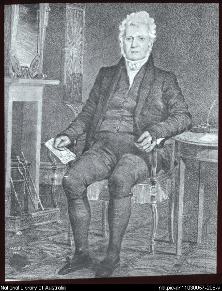 |
Robert Campbell (1769–1846) built a wharf here in 1800–03, becoming the first private import-export merchant in the colony; he is quaintly referred to as the ‘Father of Australian Commerce’, or ‘Merchant Campbell’, renowned for his part in breaking the Rum monopoly. He later settled at Duntroon, today the Australian Military Academy in present-day Canberra, where he died in 1846. The warehouses were expanded in the 1840s and again in the 1890s, when the third floor and slate roofs were added. Campbell’s Stores occupy 7–27 Circular Quay West/11–31 Hickson Road. Now a row of restaurants with marvellous views of the harbour at Campbell’s Cove, these sandstone warehouses include remnants of the original 1820s Campbell’s Stores. |
You might now decide to go back south to Upper George
Street, to examine several restored terraces and sandstone
hotels, including the interesting houses on Atherden Street,
Sydney’s shortest street. For a longer walk, you can
continue down Hickson towards Harbour Bridge to Miller’s
Point. You will pass the entrance to the new Hyatt Hotel,
which faces out onto Campbell’s Cove. The hotel was built in
the booming 1980s, in attractive sandstone to blend with the
other buildings. Under the bridge is Dawes Point, which has
a marvellous view of Luna Park and Lavender Bay on the North
Shore.
Miller’s Point
Walking under the Harbour Bridge, you enter the original
wharf district of Miller’s Point. The first wharves have now
become restaurants and shops. Further on, the old passenger
terminal is now home to the Sydney Dance
Company (t 02 9221 4811) and the Sydney
Theatre Company (t 02 9250 1777), two of the
city’s premier cultural institutions with active and
innovative programmes throughout the year.
At Pottinger Road, walk up the steep incline to reach The Upper Rocks. At the top, turn left on Windmill Street towards Lower Fort Street. At no. 73 Windmill Street is the Stephens Building. Built for J.M Stephens, a well-known musician and publican, at a cost of £4000, it opened in 1900 as Sydney’s first walk-up block of flats. It represents, along with the other terrace houses on the streets, a typical housing form of the early 20C.
 At the corner of
Windmill and Lower Fort Streets is the Hero
of Waterloo, (t 02 9252 4553) licensed in 1845. A
simple three-storey stone building, the inn must have been
one of the toughest of The Rocks’ pubs—its cellar was used
to store drunks until press gangs could shanghai them for
ship’s crews. It still maintains an air of rowdiness—it has
not been entirely gentrified for tourists.
At the corner of
Windmill and Lower Fort Streets is the Hero
of Waterloo, (t 02 9252 4553) licensed in 1845. A
simple three-storey stone building, the inn must have been
one of the toughest of The Rocks’ pubs—its cellar was used
to store drunks until press gangs could shanghai them for
ship’s crews. It still maintains an air of rowdiness—it has
not been entirely gentrified for tourists.
Continue down Lower Fort Street to Holy Trinity Church
(The Garrison Church) on the corner of Argyle and Lower Fort
Streets. Built in 1840–44 to the design of Henry Ginn, the
building was enlarged between 1855 and 1874 by prominent
Gothic Revival architect Edmund Blacket. Still known as
Garrison Church, it served as the chapel for the British
Regiment stationed at Dawes Point Battery until 1880. The
east window of the church was donated by Dr James Mitchell,
father of David Mitchell of the Mitchell Library. Next to
the church is the old church school, dating from the 1850s,
and last used as a school in 1942; it is now the parish
hall.
William Dawes
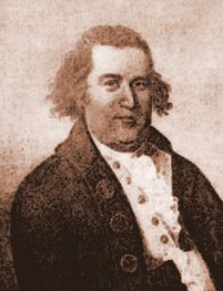 |
William Dawes (c 1758–1836) was the son of an admiralty official at Portsmouth. He joined the Royal Marines in 1779, and distinguished himself as a scientific observer and astronomer. He volunteered to sail with the First Fleet to New South Wales, and was put in charge of astronomical observations. He built the first observatory at this site, which was then known as Point Maskelyne in honour of the Astronomer Royal. He also worked as a surveyor, laying out many of the streets of Sydney and Parramatta. A man of great intellectual energy, Dawes came into conflict with Governor Phillip when he refused to join a party sent to track down an Aborigine who had wounded his convict ‘master’. He returned to England in 1791, and eventually became Governor of Sierra Leone. He spent the last years of his life in Antigua, West Indies.
|
Across from the church to the west is Argyle Place, a village green surrounded by houses dating as early as 1830. The name Argyle refers to the Scottish birthplace of Governor Lachlan Macquarie, that inveterate bestower of place-names. The houses here are perfect examples of the colonial style of architecture, with stone walls, wooden columns, and iron lace work. At 50 Argyle Place is Undercliff Cottage, built in 1840; it was the home of James Merriam, who was Lord Mayor of Sydney in the mid-1840s.
Continue west up Argyle Street to Kent Street; on the
northwest corner is the Lord Nelson. Built in 1834, it is
the oldest operating hotel in Sydney. Originally a private
home for ex-convict William Wells, it became a licensed pub
in 1842, and now serves its own brand of beer.
Return along Argyle Street, continuing east to the Argyle
Cut; above, on the south side, is Observatory Park.
Argyle Cut itself was the work of convicts from Hyde Park Barracks, who, in 1843, began to hack through solid rock using nothing but pick and hammer. Since transportation had ended in 1842, work had to be completed in 1859 under the direction of the Municipal Council using free labourers. The Cut provided quick access from Sydney Cove to Miller’s Point and the wharves of Watson’s Bay. The tons of rock excavated was used to form a sea wall at Semicircular Quay. Old photographs, most notably by Harold Cazneaux, make the Cut appear like a scene from the Old World. In the middle of the Cut, a plaque states simply ‘Charles Moore Mayor 1867–1868’.
At the top of Argyle Stairs entering into The Rocks by
the Cut, you will find the entrance to the Pylon Lookout, at
the top of the southeast pylon of the Harbour Bridge. Climb
the 200 stairs for a spectacular view of the harbour and the
surrounding area. At this point it is also possible to reach
the pedestrian footpath which leads across the bridge to
North Sydney, about a 20 minute walk one way.
After the Cut to the north is Argyle Arts Centre, 18–20
Argyle Street at Playfair Street. Formerly Mary
Reibey’s Argyle Bond Stores, this conglomeration of
shops represents a variety of architectural periods, most
prominently the 1880s, but with some sections dating from as
early as 1828. It is now the home of crafts shops aimed at
the tourist market.
Mary Reibey
 |
|
At Nurses Walk and Globe Street is the New South Wales
State Archives, a good source of information on early
settlement and family history.
Observatory Hill
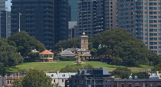
From York Street, walk through the pedestrian walkways
to Kent Street and the Bradfield Highway. From Argyle Place
in The Rocks use the steps to Watson Road, or climb the
steep Argyle Stairs to Gloucester Street, then take Bridge
Stairs to Observatory Road. The area near Bridge Stairs is
one of the most pleasant and calmest parts of Old Sydney,
evoking some sense of the old neighbourhoods here near the
harbour.
At the base of the Hill, at 120 Kent Street, is the Richmond
Villa, now home of the Australian
Society of Genealogists (t. 02 9247 3953; open
Tues.-Thurs., Sat. 10.00-16.00). Originally located in The
Domain on Hospital Street, the villa was the home of
Colonial Architect Mortimer Lewis, who designed it in 1849.
An elegant example of ‘Carpenter’s Gothic’, with pointed
parapets and bay windows, Richmond Villa remained in a row
of villas behind the State Parliament and served a variety
of uses until it was moved, stone by stone, to its present
site in 1975.
Next to Richmond Villa is Glover’s Cottage, the only
remaining house of those built in 1820 on the original land
grant by stonemason Thomas Glover.
Observatory Hill stands 44 metres (144 feet) above the
harbour; since settlement, it has been a major landmark, and
was originally the site of the colony’s first windmill
(hence its earlier name of Windmill Hill). In 1804, Governor
King began construction of a citadel to be named Fort
Phillip; it was never completed, but remnants of the
original stone wall surround the Observatory. The hill was
also known as Flagstaff Hill, since Governor Phillip erected
a flagpole here in 1788, and a later Signal Station (1825)
served the same purpose for incoming ships. In 1848,
Colonial Architect Mortimer Lewis built a second Signal
Station, which remains as the hill’s oldest building.
The Observatory
(t 02 9217 0111, open daily 10.00–17.00, 2-hour evening
sessions include a lecture and view through the telescope
but must be booked well in advance; admission adults
$210.00, concession and children $8.00; night telescope
viewing about twice that) itself was designed by Colonial
Architect Alexander Dawson and built between 1857 and 1859.
From 1858, a time ball on the weather vane dropped daily at
13.00 to signal that a gun be fired at Fort Denison in the
Harbour to indicate the correct time; the practice ceased
during the Second World War, but was revived in 1987. The
copper-domed observation chambers with telescopes were added
in 1877, and served as the official astronomical observatory
until the 1980s; it is now a marvellously informative
museum, offering many hands-on displays and evening
observation times.
Immediately to the south of the observatory is the National
Trust Centre, headquarters of the New South Wales
Branch of the National Trust of Australia (t 02 9258 0126,
open Mon.-Fri 10.00-17.00). Part of the present building
includes the remains of the original Military Hospital,
built in 1815 for Governor Macquarie by John Watts; the
hospital was moved to Victoria Barracks in 1848, and the
structure was significantly altered in 1849 by Mortimer
Lewis, who replaced the elegant Doric columns around the
verandahs with the heavier Corinthian columns of the Classic
Revival Style. From 1850 until 1974 the building was the
home of Fort Street School, one of the most prestigious
schools in the colony; when the boys were moved in 1916, it
became Fort Street Girls’ School. The first kindergarten in
New South Wales was opened here in 1856; many of Sydney’s
most prominent citizens were graduates of the school.
Along with the offices of the National Trust, the building’s
brick extension now houses the S.H. Ervin
Gallery (t 02 9258 0173; open Tues–Sun
11.00–17.00; admission adults $10.00, concession $7.00),
named for the businessman who donated his collection of
Australian paintings and established the gallery; changing
exhibitions are usually devoted to retrospective exhibitions
of contemporary Australian artists.
A pleasant way to descend from Observatory Hill is down
Watson Road into Lower Fort Street, proceeding north down
the street itself from Argyle Place. The entire length of
the street is known as Regency Row, and contains a variety
of restored houses from all periods of the 19C. This was
considered Sydney’s most fashionable neighbourhood by the
mid-19C, an indication of how closely housed were the most
divergent elements of society, with squalid settlements only
a few blocks below.
At no. 53 Lower Fort Street is the Colonial House Museum (t.
02 9247 6008), maintained as a typical Victorian terrace
house. The Regency townhouses at nos 39–41 are some of the
only remaining examples of the elegant work of architect
John Verge (1782–1861). Bligh House at no. 43 (closed to the
public) was the mansion of Robert Campbell Jr, son of the
merchant Robert Campbell, and a leading campaigner for the
end of convict transportation. Constructed of local
sandstone bricks, the mansion has a verandah supported by
Doric columns and beautiful cedar joinery in the interior.
To enter back into The Rocks at George Street, continue down
to the end of Lower Fort Street, known as Milton Terrace,
site of some of the best examples of High Victorian domestic
architecture in Sydney. At the end of Hickson Terrace are
the Hickson Steps leading down to Hickson Road and a return
to The Rocks under the Harbour Bridge.
The Harbour Bridge
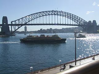
From the earliest days of settlement, contemplation of a bridge from Dawes Point on the South Shore to Milson’s Point on the North Shore was on the minds of Sydneysiders. The first serious proposal was made to Governor Macquarie by Francis Greenway in 1815, although there is no record of its actual plan. Many proposed schemes followed throughout the 19C, but no practicable solution could be found, because the depth of the water and the need to maintain access to upstream wharfage for large ships necessitated a high bridge. Finally, in 1912, Dr J.J.C. Bradfield (the Bradfield Highway is named in his honour), Chief Engineer of the Public Works Department, designed a single-arch steel bridge which was accepted. The First World War delayed action, but construction was finally implemented with the selection of architect Sir Ralph Freeman of Dorman Long & Co., England, who received the contract in 1921. Estimated cost was £4,217,721; the final cost was £6,250,000, paid off in 1988.
Work began 28 April 1923, with the excavation of
sandstone beds 12m deep, filled with concrete. The bridge
took nine years to build, employing some 1400 workers during
the worst years of the Depression. Sixteen workers were
killed; one wrote on seeing the first die: ‘I remember I was
standing there with one hand on the wire rope, and I had to
prise my fingers off it with my other hand. I was quite safe
where I was. But it was the shock—it was just seeing him go
down, I knew he’d be killed.’
Constructed as two halves on both shores, the bridge was
finally joined in the middle, as cantilevered arches held in
place by cables connected to tunnels in the subterranean
granite were stretched over the water.
The height at the top of the arch is 134m (439ft) above
water level, at the deck 59m (194ft); the entire span is
503m (1650ft). Clearance for shipping is 53m (172ft). The
bridge’s weight is 65,000 tonnes, all pivoted on six small
pins and held together by 6 million rivets.
Its construction generated unprecedented excitement, as a
symbol of Australia’s modernity and sophistication, and a
linking of the north and south. It has served as a source of
inspiration for artists, writers, and photographers. Grace
Cossington Smith’s painting The Bridge in Curve (1930) in
the Art Gallery of New South Wales is a stunning example;
she called the Bridge ‘Te Deum in progress’. Max Dupain,
David Moore and Harold Cazneaux all made photographic
studies during and after construction.
Opening ceremonies were planned for 19 March 1932, and
thousands lined the harbour shores to witness the event. As
New South Wales Premier Jack Lang began the official opening
speech, a Captain Francis de Groot, member of the extreme
right-wing New Guard opposed to Lang’s socialist policies,
rode up on a horse and cut the ribbon before he was dragged
away by the police. The ribbon was restored and Lang
officially opened the bridge. The scissors used for the
‘real’ opening are now on display at the State Parliament
House on Macquarie Street.
The bridge is part of Australian folklore, known
affectionately as The Coathanger. On a sombre note, it has
been the site of at least 200 suicides, despite extensive
security; 60 jumps occurred in the first seven months, until
protective barriers were erected, which, unfortunately,
block the harbour view for passing motorists or train
passengers. Automobiles crossing the bridge from north to
south pay a $2 toll. Walking across the bridge takes about
20 minutes and offers exhilarating views.
Darling Harbour
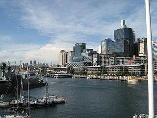
For generations, Darling Harbour (first called Cockle Bay,
as it still is at its southern end) was the leading cargo
facility of the port, the centre of dockside activity. There
were berths for 40 deep-sea vessels, with additional wharves
for smaller ships. In 1815, the harbour was the site of the
assembling of the first steam engine in Australia, brought
from England by engineer John Dickson and used to crush
grain. Governor Macquarie was so impressed with Dickson’s
enterprise that he gave him 16 acres of land around Darling
Harbour as far as George Street; Dickson eventually became a
prosperous brewer and miller, with substantial land holdings
throughout the country. Dickson sold his brewery in the
1840s to the Toohey Brothers, who established the most
enduring of Sydney beers, Toohey’s.
The bay acquired the name of Darling Harbour in honour of
Governor Darling (1825–31), who, despite the plethora of
places named after him, was the most detested of all
colonial governors. By the 1890s, the harbour had an
enormous iron wharf with six cargo cranes and a goods yard
that covered some 56 acres (22 ha).
Such a thriving industrial port brought with it the
inevitable problems of pollution and filth: abattoirs were
blamed for luring the rats which led to the outbreak of
bubonic plague in The Rocks. During the Depression of the
1930s, the wharves were known as The Hungry Mile, as
desperate men queued in their thousands for the few jobs
available. As maritime industry dwindled in significance,
the harbour became more derelict; by the 1970s, the old
wooden wharves were filled in with sterile concrete ones to
accommodate container shipping.
In 1984, Premier Neville Wran spearheaded a reclamation
programme for the harbour, conceived as a Bicentennial gift
to the city. The current entertainment extravaganza is the
result of this enormous project. The Harbour is now home to
the National Maritime Museum, the National Aquarium, the
Sydney Entertainment Centre, and a Chinese Garden which
links Chinatown to the harbour.
Pyrmont Bridge
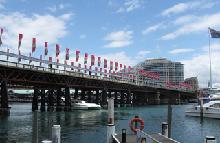
While today the Pyrmont Bridge seems an inconspicuous span
across a bit of the Darling Harbour entertainment complex,
its initial construction was heralded as a major engineering
achievement. Completed by bridge designer Percy Allan and
opened in 1902, it is today the world's oldest electrically
operated swingspan bridge; the central gates, which open for
ships going up to Cockle Bay, are still driven by the
original motor. At the time of its construction, as the
second Pyrmont Bridge, the harbour was a bustling industrial
area, filled with warehouses and shipping terminals; the
first bridge had already provided the thoroughfare enabling
industrial expansion to the other side of the bay. The
bridge is 1200 feet (369m) long, with 14 spans, the middle
ones made of steel and the rest of Australian ironbark.
Allan's great innovation was the use of electricity for the
bridge's opening mechanism—this accomplished at a time
before Sydney streets were fully electrified, and made
possible by power generated from the Ultimo station, now the
site of the Powerhouse Museum.
Cockle Bay Wharf, at the southern end of the harbour, has
now been restored and is filled with sparkling restaurants
and al fresco cafes, including Ampersand, chef Tony Bilson’s
latest extravagana. The building, designed by award-winning
architect George Freedman, seats enormous numbers inside and
out.
A monorail loop from the city crosses Pyrmont Bridge, stops
near the Powerhouse Museum, and ends at the harbour. The
monorail system, costing more than $60 million, was
vehemently criticised at the time, as evidence of the
government’s desire to turn Sydney into ‘Sydneyland’, and it
is easy to agree with those critics. The monorail serves
little public purpose except to bring tourists to the
harbour without the necessity of looking at many of the
historic buildings and streets of the city; it does not run
from Circular Quay, which would be the most logical
starting-point if it were really meant to provide convenient
transportation. But children like it, and it does prepare
the visitor for the carnival-like atmosphere that permeates
Darling Harbour’s activities. Tickets are purchased from
machines at the stations, the main one being on Pitt Street.
Darling Harbour can also be reached by the ferry leaving
from Circular Quay Wharf 5.
This is not to denigrate any of the Darling Harbour
venues, which are all well worth a visit; both the Maritime
Museum and the National Aquarium receive top honours for
presentation and educational effort. The Sydney Aquarium (t
02 8251 7800, open daily 09.30–22.00) allows visitors
to walk through an acrylic tube to view the sea life above
(no performing seals here). The National
Maritime Museum (t 02 9298 3777, open daily
09.30–17.00) houses, along with fascinating displays of
historical artefacts, actual ships, from the famed America’s
Cup winner Australia II to the sad little Vietnamese refugee
boat Tu Do. The museum’s design, by leading contemporary
architect Philip Cox, consists of a steel-roofed structure
that sets the architectural tone of Darling Harbour.
Powerhouse Museum
One of the stops on the monorail is the Powerhouse Museum,
Harris Street, Ultimo (t 02 9217 0111, open daily
10.00–17.00; admission adults $15.00, concession $8.00). The
largest museum in Australia, the Powerhouse is one of the
best museums of its kind in the world. Covering more than
35,000 square metres (376,750 sq ft), the comprehensive
nature of its collections is reminiscent of The Smithsonian
Institution in Washington. Situated in a converted power
station (hence the name) with a tasteful addition of
barrel-vaulted glass designed by Lionel Glendenning(the
addition is named in honour of former New South Wales
Premier Neville Wran), the museum contains exhibitions on
everything to do with Australian culture, as well as
substantive displays on science and technology, and
decorative arts. The exhibitions are state of the art, using
computers and videos and other ‘hands on’ methods to
enlighten and entertain; locomotives and aeroplanes can
often be climbed on, and scientific apparatus sampled.
Changing exhibitions range widely, from the history of
television commercials to Australian furniture designers. A
favourite permanent display presents the history of the
Australian pub and brewing, with films describing the
infamous days of the ‘pub-push’, or ‘the swill’, when all
drinking establishments were frantically full before they
had to close at 6pm. The restaurant in the museum has murals
designed by Ken Done.
Set aside a good amount of time to take in all the museum’s
floors; it is an absolute must for any Sydney visitor,
especially those with children.
The lovely Chinese Gardens (open daily 09.30–17.00) sit on the northern side of Pier Street, c 250m from the Powerhouse Museum. Known as the Garden of Friendship, the design was a gift of Sydney’s Chinese sister city, Guangdong, in 1987. The gardens offer a tranquil spot in the middle of the area’s bustle, with a small lake, Chinese pavilion, and tea house. Appropriately, the gardens lead into Sydney’s Chinatown.
Chinatown
While not as colourful as the Melbourne version, this
Chinatown is certainly thriving, with restaurants, Asian
food markets and shops, as well as legitimate practitioners
of traditional Chinese medicine. Chinatown is definitely the
place to go for authentic and reasonably priced
Chinese food. Originally, the centre of Chinatown was
the area around Dixon and Hay Streets; it is now expanding
into the Haymarket District, west to Harris Street, south to
Broadway, and east to Castlereagh Street. Dixon Street is
still its main thoroughfare.
The Chinese in Australia
Large numbers of Chinese first came to Australia after the cessation of transportation in the 1840s, when they were imported as cheap labour. The discovery of gold in the early 1850s resulted in a mass exodus to the gold fields in Victoria and New South Wales. In Melbourne, many of the Chinese remained to establish a still-thriving community (see Melbourne). In New South Wales, the situation was a bit different. Lambing Flat near the town of Young was the site in 1860 of one of the worst aggressive actions against Chinese miners, when 3000 whites stormed their camps and demanded that they leave. In all, some 1200 Chinese fled and hid in the countryside, saved from starvation only by the aid of a station-owner, James Robert, who fed them. In the end, the Lambing Flat incident saw the curtailing of Chinese immigration; indeed, the incident is considered the impetus for the infamous White Australia policy.
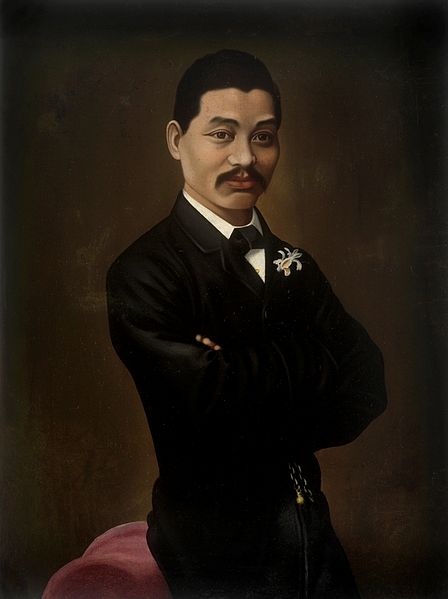 On the other hand, individual
Chinese gained influence and prosperity in colonial
Australia. The most noted figure was Quong Tart (1850–1903),
a Cantonese who came to New South Wales in 1859. He managed
to acquire an interest in a gold mine in Braidwood, and
eventually became a wealthy man. He acted as an interpreter
and mediator among the white and Chinese communities. Quong
Tart was quite fond of Scottish culture, learning to recite
in correct accent the poems of Robert Burns. He acted as the
first Chinese member of the Oddfellows’ Lodge in Australia.
In 1874, he moved to Sydney and became a tea and silk
merchant with headquarters eventually in the Queen Victoria
Building. He married a Scottish woman, and became the
unofficial Chinese Consul-General of the colony. In 1902, he
was attacked by a robber in his shop. The citizens of Sydney
gave him a testimonial at the Town Hall and presented him
with a cheque for 300 guineas. He did not fully recover from
his injuries and died in 1903, at which time some 1500
people attended his funeral.
On the other hand, individual
Chinese gained influence and prosperity in colonial
Australia. The most noted figure was Quong Tart (1850–1903),
a Cantonese who came to New South Wales in 1859. He managed
to acquire an interest in a gold mine in Braidwood, and
eventually became a wealthy man. He acted as an interpreter
and mediator among the white and Chinese communities. Quong
Tart was quite fond of Scottish culture, learning to recite
in correct accent the poems of Robert Burns. He acted as the
first Chinese member of the Oddfellows’ Lodge in Australia.
In 1874, he moved to Sydney and became a tea and silk
merchant with headquarters eventually in the Queen Victoria
Building. He married a Scottish woman, and became the
unofficial Chinese Consul-General of the colony. In 1902, he
was attacked by a robber in his shop. The citizens of Sydney
gave him a testimonial at the Town Hall and presented him
with a cheque for 300 guineas. He did not fully recover from
his injuries and died in 1903, at which time some 1500
people attended his funeral.
Haymarket
From Chinatown, to the south of Hay Street, is
the area known as the Haymarket, for it was traditionally
the home of the grain and hay trade and businesses. Into the
early 1900s, the area was the main working-class shopping
district; Ruth Park describes a Saturday night here at
Paddy’s Market in her book, The Harp in the South
(1948). Paddy’s Market, which opened as early as 1869, lives
on today, a bit smarter, but still a good place for
bargain-hunting, good produce, and some atmosphere. The
markets are open on weekends, and are now located on the
corner of Thamos and Hay Streets.
At 13 Campbell Street is Capitol Theatre
(t 02 9320 5000), in the 1920s a grand movie house. The
theatre has recently been reopened as a venue for musical
theatre.
Sydney Fish Market
About 15 minutes’ walk from Darling Harbour to
Blackwattle Bay one finds the Sydney Fish Markets (t. 02
9004 1100; open 7.00-16.30); access to the markets by water
taxi is a more exciting way to get there. The markets
provide a fascinating, very Sydney, experience, and also
some of the best seafood restaurants in the city (of the
buy-and-cook-on-the-spot sort).
Walk 5 Pitt Street and George Street
Walk another 100m to Bridge Street, the main east-west link in central Sydney. At the corner of Bridge and Loftus Streets (west) is Macquarie Place, still a delightful little patch of green with great Moreton Bay fig trees. It first served as Governor Phillip’s vegetable garden. Governor Macquarie, with his ever grandiose visions, planned it as the centre of Sydney at the time when it was much closer to the waterfront. Located here are two monuments of interest: the gun and anchor from the Sirius, Governor Phillip’s ship in the First Fleet; and Macquarie’s Obelisk, designed by Greenway in 1816, and intended to serve as the measuring point for all roads leading out of Sydney.
At Bond Street, 100m south, between George and Pitt Streets is Australia Square, completed in 1967 by Harry Seidler, controversial Bauhaus-trained architect credited with bringing International Style architecture to Australia. At the time of its construction, it was the first substantial skyscraper in Sydney, with 50 floors reaching a height of 171m (560ft) and a diameter of 41m (135ft). Of greatest interest was the building’s surrounding plaza, similar to those created in New York City by Phillip Johnson and Mies van der Rohe; it created an open space amidst the cramped quarters of lower George Street. While in the 1960s its pre-cast concrete construction was revolutionary by Sydney standards, today its emphatic rendering of International Style modernism is dated and predictable. Its limited ornamentation and severe forms places it firmly in the context of its time; its influence on subsequent building in the city is apparent in the many other ‘glass and steel’ constructions that followed. Housed in the Australia Tower are numerous shops, as well as restaurants and other tourist venues.
Harry Seidler
 |
When Harry Seidler (b. 1923) arrived in Sydney in 1947, via his native Vienna and after training with Walter Gropius in the US, ‘International Style’ architecture had made no appearance on the Australian landscape. His first construction here, a house for his mother completed in 1951, caused immediate controversy as being ‘too European’; it is still referred to as ‘the white box’ by many who object to its incongruous placement in the Australian bush. Uncompromisingly Bauhausian with glass walls, flat roof, open planning and minimal colouring, the Rose Seidler House, 71 Clissold Road in Wahroonga at the edge of the Ku-ring-gai Chase National Park, is now a property of the Historic Houses Trust and is open to the public (t. 02 9989 8020; Sundays 10.00–17.00). Seidler remains an important figure in Sydney, still fighting the modernist fight against the onslaught of post-modernism and any architectural ornamentation. |
Martin Place
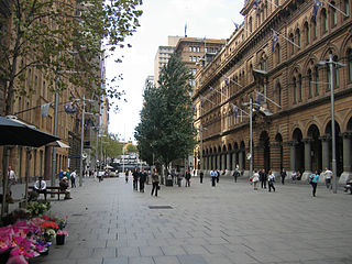 Continue south on Pitt Street, c
300m to Martin Place. Jan Morris describes the square as
‘Sydney’s substitute for a truly ceremonial centre’, and it
still serves this purpose in a town not overburdened with
public plazas. While it now includes a public fountain,
train station, and theatre ticket booth, it is also
surrounded by substantial commercial buildings dating
primarily from the beginning of the century.
Continue south on Pitt Street, c
300m to Martin Place. Jan Morris describes the square as
‘Sydney’s substitute for a truly ceremonial centre’, and it
still serves this purpose in a town not overburdened with
public plazas. While it now includes a public fountain,
train station, and theatre ticket booth, it is also
surrounded by substantial commercial buildings dating
primarily from the beginning of the century.
Of most significance architecturally is the General Post
Office. As in all Australian cities, and particularly in the
major city of the country, the post office was constructed
as a monumental landmark, symbolising civilisation and
commerce. This fact is certainly evident in the history of
the Australian postal service, The City’s Centre-piece: The
History of the Sydney GPO, available at the post office
shops. Built between 1865 and 1874 by James Barnet, it still
exudes an elegant charm, enhanced by colonnades and
beautiful brass letter-boxes.
When Australia Post became a private enterprise in 1989, it
acquired this landmark. Lamentably, not only has there been
no effort to renovate its impressive public spaces, but the
exterior has been boarded with unattractive temporary
materials for several years, presenting an uninviting and
confusing façade. Recently, some construction activity is
afoot, which may restore the building to its former glory.
In the clock tower is, according to rumour, the last
surviving chalked ‘Eternity’ of Sydney legend Arthur Stace.
Martin Place is also the site of the Cenotaph. Designed by
sculptor Bertram MacKennal (1863–1931), a ceremonial guard
and band pay honour to Australia’s war dead every Thursday
at 12.30. On Anzac Day (25 April), a dawn vigil begins
memorial services here.
From Martin Place cross George Street to Barrack Street, now
a pedestrian mall, and on to York Street; looking south up
York Street, you will see the 1930s Grace Building on the
corner of King Street. Modelled on the Chicago Tribune
Building, it housed the administrative offices of Grace
Bros. department store until the Second World War, when it
became the headquarters of General Douglas MacArthur.
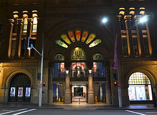 At George Street is
the Queen Victoria Building. Built in 1898 by Scottish
architect George McRae as a market in a style described as
‘Late Victorian American Romanesque’, it fell into decline
after the city markets were moved in 1910. Its spaces were
hideously transformed into temporary city offices, and by
1959 it was considered a white elephant threatened with
demolition for a car park. Noted modernist Harry Seidler
considered it a ‘monstrosity’ that should be destroyed. Only
a vigorous campaign by admirers, including Barry Humphries,
saved this phantasmagoric piece of Victoriana. It has now
been renovated, at a cost of $72 million, to be, as designer
Pierre Cardin has said, ‘the most beautiful shopping centre
in the world’. It is architecturally delightful, with tile
work, filigree, stained glass domes, cantilevered iron
staircases, and beautiful woodwork joinery. Its length is
201m (660ft), all covered with an enormous barrel-vaulted
glass ceiling, along with 20 smaller metal domes. A hanging
clock in the centre hourly displays a series of mechanical
scenes of British kings and queens, including the beheading
of King Charles I.
At George Street is
the Queen Victoria Building. Built in 1898 by Scottish
architect George McRae as a market in a style described as
‘Late Victorian American Romanesque’, it fell into decline
after the city markets were moved in 1910. Its spaces were
hideously transformed into temporary city offices, and by
1959 it was considered a white elephant threatened with
demolition for a car park. Noted modernist Harry Seidler
considered it a ‘monstrosity’ that should be destroyed. Only
a vigorous campaign by admirers, including Barry Humphries,
saved this phantasmagoric piece of Victoriana. It has now
been renovated, at a cost of $72 million, to be, as designer
Pierre Cardin has said, ‘the most beautiful shopping centre
in the world’. It is architecturally delightful, with tile
work, filigree, stained glass domes, cantilevered iron
staircases, and beautiful woodwork joinery. Its length is
201m (660ft), all covered with an enormous barrel-vaulted
glass ceiling, along with 20 smaller metal domes. A hanging
clock in the centre hourly displays a series of mechanical
scenes of British kings and queens, including the beheading
of King Charles I.
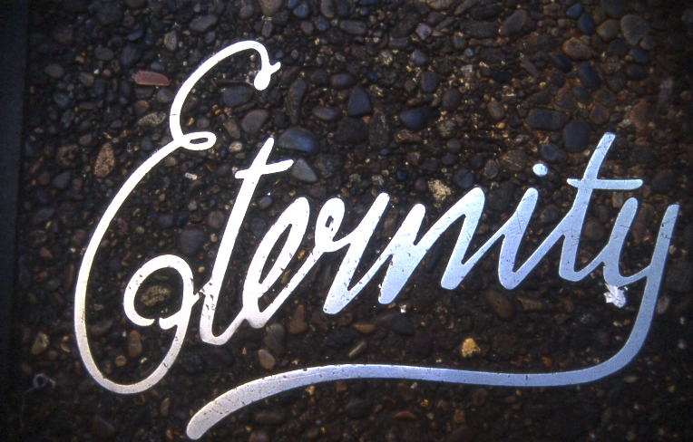
The architect Ridley Smith also included here a plaque with the single word ‘Eternity’, a memorial to Arthur Stace (1884–1967), a revered Sydney character, who after having a spiritual revelation was saved from ‘demon rum’ and for 40 years wrote in a fine, flowing script the word ‘Eternity’ in chalk on Sydney’s sidewalks every night; at the time of his death, it was estimated he had written the word 500,000 times. Rumour has it that one of his inscriptions still exists, inside the bell of the GPO Clock Tower.
South of the Town Hall group and St Andrew’s Cathedral, George Street passes by Chinatown and the Haymarket on the west side. At Rawson Street, turn left to come to the front entrance of the grand Central Station, the main railway terminal for the city. All local and long-distance trains depart from here. The station itself is a fine old structure, built by W.L. Vernon between 1901 and 1906, redolent of the glory days of steam trains and rail travel. The main floor of the terminal demonstrates one of the first uses of reinforced concrete in Australia. You can also still see the Mortuary Terminal, the departure terminal of the old ‘funeral train’ that used to take the dead and the grieving out to Rookwood Cemetery (the terminal that originally stood at the other end has been rebuilt as a church in Canberra). It was built in 1869 to designs by James Barnet, of sandstone in Gothic Revival style. Intriguingly, one of Sydney’s original burial grounds had to be moved to build the Central Station.
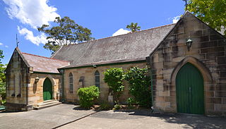 Back on George Street, at the
point near the Central Station, where George and Pitt
Streets intersect, is a much-neglected architectural gem,
Edmund Blacket’s Christ Church St Laurance. The design of
the church and its ancillary buildings is attributed to
Henry Robertson, but was constructed 1843–45 under the
supervision of Blacket. The interior of the sandstone Gothic
Revival church, on George Street, has cedar joinery,
hand-carved ‘poppyhead’ pews, and a ceiling supported on
octagonal timber beams. Blacket’s rectory and school were
demolished when the railway terminal was built; the current
buildings, designed by J. Burcham Clamp, were erected in
1905.
Back on George Street, at the
point near the Central Station, where George and Pitt
Streets intersect, is a much-neglected architectural gem,
Edmund Blacket’s Christ Church St Laurance. The design of
the church and its ancillary buildings is attributed to
Henry Robertson, but was constructed 1843–45 under the
supervision of Blacket. The interior of the sandstone Gothic
Revival church, on George Street, has cedar joinery,
hand-carved ‘poppyhead’ pews, and a ceiling supported on
octagonal timber beams. Blacket’s rectory and school were
demolished when the railway terminal was built; the current
buildings, designed by J. Burcham Clamp, were erected in
1905.
Surry Hills
To the south of Hyde Park and east of Central
Station is the traditionally working-class suburb of Surry
Hills. The best way to get there is to take a train to
Central Station, then walk into the neighbourhood; bus nos
302, 303 and 304 also travel from Elizabeth Street down
Bourke Street through Surry Hills, and bus nos 372, 393 and
395 traverse Elizabeth Street to Cleveland Street at the
edge of the suburb. This area was the location for Ruth
Park's vivid depictions of desperate slum-dwellers in her
brilliant novels, Harp in the South (1948) and Poor
Man's Orange (1949). While some gentrification is
currently taking place, Surry Hills is still pretty grotty
in places, but there are good cheap restaurants here, mainly
Turkish and Lebanese, around Elizabeth and Cleveland
Streets. Once the city's garment district, the area also has
some good factory outlets and alternative fashion shops at
the Oxford Street end of Crown Street.
Of most interest here are two 'cultural' sites: the
excellent Belvoir Theatre,
25 Belvoir Street (t 02 9699 3444), home of Company B,
sometimes described as Sydney's hottest and most creative
theatre company, with plays regularly featuring the best
actors in Australia (Nicole Kidman chooses to appear here
when she can, and Geoffrey Rush, Ruth Cracknell, and Hugo
Weaving make regular appearances); and the Brett Whiteley Studio,
2 Raper Street (t 02 9225 1881; open Fri.-Sun. 10.00-16.00;
free admission thanks to J.P. Morgan), the late artist's
studio that is now a public gallery and museum.
Walk 6 Darlinghurst and Paddington
Starting from Elizabeth Street, walk past Hyde Park to Liverpool Street and turn left (east)—buses no. 380 and 381 proceed along Oxford Street from here. At the end of the Park, Liverpool veers right to become Oxford Street, now a lively centre of gay culture. It is also a well-known place for bistros, bars and restaurants. Some parts of it have become decidedly seedy of late, although the area is still worth a visit for shopping, bookstore browsing, and dining. The main interstate bus depot is located around the corner from Taylor Square, so for many visitors, this is their first view of Sydney.Mardi Gras
The Sydney Gay and Lesbian Mardi Gras is held on the
first weekend in March. In 1978, when homosexuality was
still illegal in New South Wales, a group of some 1000 gays
marched from Oxford Street to King’s Cross in protest
against hostile police. This event marked Sydney’s first
homosexual Mardi Gras, which is now an enormously successful
international event, drawing crowds of more than 500,000 to
watch what has become one of the world’s most outlandish
parades. The event is now televised and even the police
force sends a contingent of officers to join the gay
marchers. The post-parade all-night party at the Royal
Agricultural Showgrounds is by ticket only. They sell out
two months in advance. Foreign visitors with passport
identification can purchase them from the Mardi Gras
offices, although it is becoming increasingly difficult to
obtain them.
Proceed along Oxford Street past the five-street hub, Taylor Square (600m). Continue on Oxford Street; on the left at Darlinghurst Road (200m) behind Darlinghurst Court House is East Sydney Technical College, whose imposing sandstone walls betray its earlier function as Darlinghurst Gaol, Sydney’s main prison from 1841 until 1914. Some of the walls date from as early as 1822, and architects included Francis Greenway and Mortimer Lewis. The grass outside the main gates was once the public gallows, where many of Sydney’s most notorious criminals were hanged before large crowds.
Back on Oxford Street, proceed southeast to Glenmore
Road, about 500m from Taylor Square. On the right is the
entrance to Victoria
Barracks (t 02 8335 5330; open Thurs 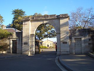 10.00–13.30 with
guided tours featuring the Australian Army Band, Sydney),
once the centre of Paddington and home to the British
garrison regiments in Sydney from 1848 until 1870. Designed
by Lt-Col George Barney of the Royal Engineers, this
enormous building was constructed between 1841 and 1848 by
convicts and free stonemasons. At 220m (740ft), the main
building is one of the longest buildings in Australia and is
considered to be one of the finest British imperial barracks
in the world. When it was built, Paddington was a
backwater, described as ‘the saddest heath, the most
melancholy swamps’, surrounded by desolate sand dunes.
Soldiers’ pay was so poor that for many years, soldiers’
wives sold cabbage tree hats made of cabbage tree fronds
outside the gates. Guided tours are available regularly,
including the Changing of the Guard ceremony (the barracks
is now the permanent headquarters of the Eastern Command); a
view of a museum examining Australia’s military history; and
a visit to Busby’s Bore, the famous water-tunnel that
brought water from present-day Centennial Park to Hyde Park.
10.00–13.30 with
guided tours featuring the Australian Army Band, Sydney),
once the centre of Paddington and home to the British
garrison regiments in Sydney from 1848 until 1870. Designed
by Lt-Col George Barney of the Royal Engineers, this
enormous building was constructed between 1841 and 1848 by
convicts and free stonemasons. At 220m (740ft), the main
building is one of the longest buildings in Australia and is
considered to be one of the finest British imperial barracks
in the world. When it was built, Paddington was a
backwater, described as ‘the saddest heath, the most
melancholy swamps’, surrounded by desolate sand dunes.
Soldiers’ pay was so poor that for many years, soldiers’
wives sold cabbage tree hats made of cabbage tree fronds
outside the gates. Guided tours are available regularly,
including the Changing of the Guard ceremony (the barracks
is now the permanent headquarters of the Eastern Command); a
view of a museum examining Australia’s military history; and
a visit to Busby’s Bore, the famous water-tunnel that
brought water from present-day Centennial Park to Hyde Park.
Immediately south of Victoria Barracks at Moore Park Road is
the Royal Agricultural Society Show Grounds. Home of the
annual Royal Easter Show for more than 100 years, the
grounds are also home to the Sydney Football Stadium and the
Sydney Cricket Ground, both hallowed shrines to
Sydneysiders’ obsession with sports. The notorious
entrepreneur and ex-Australian Rupert Murdoch has turned the
grounds into a movie production lot, making Sydney a
down-under Hollywood (George Lucas filmed Star Wars sequels
here). The Royal Easter Show, after 120 years on the site,
was moved to the new Homebush Stadium in 1998.
Centennial Park
About 1km east at the junction of Moore Park Road and
Oxford Street is the entrance to Centennial Park. Opened in
Australia’s centennial year, 1888, the park comprises some
220 ha and includes 12 lakes. It is Sydney’s only
English-style park, and its popularity with city dwellers is
comparable to Central Park in New York City. In the centre
is Lachlan Swamp, origin of Busby’s Bore, the tunnel which
provided water for the city in the 1820s. The swamp remains
essentially untouched, with prolific birdlife and numerous
native species. At Hamilton Drive, where the road turns into
Grand Drive and overlooking the playing fields, is a
wonderful sculpture honouring Rugby League football; called
‘We Won’, it was designed in 1893 by Tommaso Sani.
Immediately south of Centennial Park on Alison Road is
Randwick Racecourse, site since 1833 of some of Australia’s
most exciting horse races.
   |
As the Australian Encyclopedia wrote in 1956, horse-racing ‘might almost be called the Australian national sport’. While today’s Australians are less devoted to the sport than past generations, it is still true that any town of any size has a racecourse, and betting on the horses is a major business, aided by an Australian invention, the automatic totalisator. Racing began in the earliest days of the colony, although the first recorded event dates from 1810, when officers held three days of races at Hyde Park. As early as 1802 Robert Campbell brought from Calcutta Arab Hector, who remained the most important sire until 1823. Horse-breeding has been given serious attention since that time, and today’s Australian horses rank among the healthiest and most beautiful in the world. The Australian Jockey Club was founded in 1842, and the Australian Stud Book appeared in 1878. In the 1880s it was agreed that all racehorses in Australasia would take their ages from 1 August, thus marking the beginning of the racing season. Many trainers and owners will have a Horses’ Birthday Party on that day, when the public can visit the horses in their quarters at the race-tracks. Legendary trainer Gai Waterhouse has her stables at Randwick. The degree to which horse-racing is part of the Australian psyche is indicated by the significance placed on the annual Melbourne Cup in Melbourne. First held in 1860, the Cup is held on the first Tuesday of November at Flemington Racecourse; the entire country virtually stops for its running, with factories and businesses halting for its three minutes’ run. The event regularly attracts 80,000 viewers to the track, and includes traditional accoutrements, such as elaborate hats and formal dress, roasted chicken, strawberries, and champagne (see Melbourne). In 1998, more than $80 million in bets were placed on that single race. |
In 1973 the author Ruth Park, in her guide to Sydney, observed that the area had become ‘so picturesque that it makes me feel as though I’ve been belted over the head with a teddybear’. Its current state is somewhat self-congratulatory, although grimy spots remain.
Return to Oxford Street and continue to Oatley Road/Ormond Street. On the southwest corner is the Paddington Town Hall, the epitome of Victorian Classic Revival style, built in 1891 at tremendous cost and on what was then a grandiose scale for the area; particularly impressive is its colonnaded balcony rounding the corner of the street. Its tower, at one time a major landmark in the area, houses a clock with an inscription to King Edward VII in place of the numerals. The building is now the location of Chauvel Cinema, run by the Australian Film Insitute, as well as the Paddington Library.
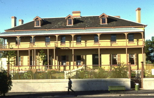 Directly across the street on the
northwest corner is the Paddington Post Office, a great
example of Late Victorian design. Opposite, on Ormond Street,
is Juniper
Hall (t. 02 9357 5222, Wed.-Sun. 10.00-17.00 for
details). The most important historical structure in
Paddington, it was built in 1824 as the residence of
ex-convict and gin distiller Robert Cooper, another of
Sydney’s fascinating early characters, its generous
proportions were no doubt necessary because Cooper had 23
children. For years the house served as an institution for
children, including an orphanage and a children’s court. In
the 1920s it was turned into flats, but was finally purchased
by the National Trust, which restored it to its present state.
For a while, a Museum of Childhood occupied the space; that
museum is now housed at another National Trust property,
Merchant House, in George Street. The Hall is currently owned
by the Moran family and is now used for the Moran Prize, a
photographic exhibition.
Directly across the street on the
northwest corner is the Paddington Post Office, a great
example of Late Victorian design. Opposite, on Ormond Street,
is Juniper
Hall (t. 02 9357 5222, Wed.-Sun. 10.00-17.00 for
details). The most important historical structure in
Paddington, it was built in 1824 as the residence of
ex-convict and gin distiller Robert Cooper, another of
Sydney’s fascinating early characters, its generous
proportions were no doubt necessary because Cooper had 23
children. For years the house served as an institution for
children, including an orphanage and a children’s court. In
the 1920s it was turned into flats, but was finally purchased
by the National Trust, which restored it to its present state.
For a while, a Museum of Childhood occupied the space; that
museum is now housed at another National Trust property,
Merchant House, in George Street. The Hall is currently owned
by the Moran family and is now used for the Moran Prize, a
photographic exhibition.Walk north on Ormond Street for excellent examples of Paddington’s terrace houses, with their impressive cast iron work of Australian motifs, decorative balconies and varying entrance levels depending on the topography. Views to Rushcutters Bay appear occasionally, especially at nos 32 and 34.
Down the hill to Olive Street is Olive Bank Villa, mansion of Alderman John Ely Begg, built in 1869. The last of the great Paddington mansions, the property’s acreage was quickly subdivided in the 1870s along with the rest of the large properties.
Glenmore Road developed from the bullock tracks
determined by the carts carrying Robert Cooper’s gin from
Rushcutters Bay to what is now Oxford Street. The consequent
street arrangements were haphazard, leading to the
present-day web of narrow alleys and hilly lanes. On these
streets are examples of a variety of architectural styles,
from the blue-brick 1920s flats near Ormond Street, to the
Victorian villas at Cooper Street a few blocks west on
Glenmore and down a short Paddington laneway.
At Cooper Street walk west past the Scottish Hospital,
original site of The Terraces, one of Paddington’s finest
mansions. Parts of the original buildings have been
incorporated into the hospital, and special care was taken
to preserve a remnant of The Terrace’s magnificent gardens.
At the entrance, at Cooper and Brown Streets, you can still
see a near rainforest landscape amidst the urban
surroundings.
Turn left (south) on Brown Street to MacDonald Street,
noting on the left four Edwardian terrace houses, some of
the last of their type built in Paddington about 1910. At
Macdonald continue west c 200m to Cutler Footway, and walk
down towards Campbell Avenue, getting a remarkable
‘backyard’ view of terrace house chimneys, parapets, and
rooftops.
On the corner of Campbell and Hopewell Streets note a
Paddington corner shop, exemplary of the establishments that
were so essential in Paddington’s early ‘commuter suburb’
days. The second-storey balcony would have originally been
part of the shopkeeper’s living quarters.
Continue to Glenmore Road, turn right (south) to Gipps
Street, turn left at the Rose and Crown, a traditional
Victorian hotel. At Gipps and Prospect Streets are
Paddington’s earliest cottages, sandstone single-storey
buildings from the 1840s. These would have been constructed
for the stonemasons and carpenters working on the nearby
Victoria Barracks.
Meander north again to Glenmore Road, past the Royal
Hospital for Women and continue east to Fiveways,
Paddington’s major intersection. The hospital served as the
main hospital for women for 100 years, until it was closed
in 1997 and moved to the outer suburbs. At Fiveways is a
beautiful corner hotel from the 1880s, complete with
ironwork balconies and decorative moulding. At this point,
you can continue northeast down Gurner Street to Cascade
Street (c 300m), admiring the harbour views and fine terrace
houses. At the corner of Windsor and Cascade Streets is
‘Warwick’, a castellated wonder built in 1860 in what is
affectionately referred to as ‘King Arthur’ style.
Alternatively, continue south on Heeley Street from Glenmore
Road and return to Oxford Street and its many alluring
shops.
From Cascade Street (the original stream for Cooper’s
distillery was located here), turn right (south) to
Paddington Street, then left (east) past Victorian and
Edwardian terraces, many of which are now art galleries and
boutiques. Some of these terrace houses are as little as
4.5m (15ft) wide. At Elizabeth Street, turn right (south)
and return to Oxford Street. Proceed left (southeast) down
Oxford Street c 300m to St Matthias Anglican Church, a
Gothic Revival church designed in 1859 by Edward Bell that
long served as the Victoria Barracks’ garrison church.
Paddington Markets
Proceed back up Oxford Street (northwest) to Newcombe
Street, where the Paddington Markets take place every
weekend, with some 250 stalls selling clothing, books,
antiques, jewellery and great take-away food. It is one of
the oldest Sydney open-air merchandise markets, and quite
beloved by locals.
Kings Cross area
At Queen Street, Paddington merges into the suburb of
Woollahra, a very upscale neighbourhood marking the
beginning of the exclusive eastern suburbs. Queen Street
itself is filled with genuine antique shops, exclusive
galleries, and fashionable boutiques.
From Queen Street, you can connect with Edgecliff Road,
which leads into Old South Head Road, the route across the
eastern suburbs to Vaucluse and Watsons Bay. Alternatively
take Old South Head Road along the Royal Sydney Golf Course
to Newcastle Street, and connect with New South Head Road to
travel to Watsons Bay on the ‘bays side’ of the harbour.
From the city, the main bus route from Circular Quay along
New South Road to Watsons Bay is no. 324, with connections
to no. 325; a ferry also leaves Wharf 4 that stops at
Darling Point, Double Bay, Rose Bay and Watsons Bay.
Kings Cross
At the top of William Street, where Darlinghurst Road,
Victoria Street and Bayswater Road intersect, is Kings
Cross. Named Queen’s Cross in 1897 in honour of Queen
Victoria’s Diamond Jubilee, it was renamed when Edward VII
took the throne in 1904. Touted rather proudly as Sydney’s
red-light district, it will appear rather tame to most
seasoned travellers.
‘The Cross’ has been the centre of bohemian Sydney since
the beginning of the century, and it was the home of many
authors, actors and writers, including the poet Dame Mary
Gilmore, now on the $10 note, and Kenneth Slessor, who in
1965 wrote Life at the Cross. London-based film producer
Robin Dalton, née Eakin, has written a delightful account of
growing up in the genteel era of ‘the Cross’ surrounded by
eccentric Jewish relatives in Aunts Up the Cross
(1965, 1997).
Dulcie Deamer, ‘Queen of Bohemia’ in the 1920s, wrote of its
‘impulse towards Lawsonian mateyness [referring to poet
Henry Lawson’s famous larrikinism], but rather more
sophisticated’. By 1946, the writer George Johnson, who
lived here with his wife, author Charmian Clift, described
it as ‘a coarse, tougher city, poised on the edge of
violence. A cocky, callous place’.
It gained its sleaziest reputation after the invasion by
American troops on leave during the Second World War and
especially those on ‘R and R’ (rest and recreation) during
the Vietnam War. At night the area does fill with street
life, taking in strip shows, nightclubs, and many fine
restaurants, and drug dealers are apparent. In the daytime,
however, it appears as a pleasant village, with cheap
tourist hotels and backpacker hostels, good coffee shops,
and even some interesting architecture on the side streets.
At the end of the Darlinghurst Road strip in Fitzroy
Gardens is El Alamein Fountain. Installed in 1961 as a
memorial to the Australian soldiers who fought in North
Africa during the Second World War, the design of the
fountain has prompted such nicknames as the Dandelion
Fountain or, more rudely, the ‘elephant douche’. The
fountain’s designer was Robert Woodward, who was also
responsible for The Tidal Cascades fountain in front of the
Convention Centre at Darling Harbour.
At Fitzroy Gardens, Darlinghurst Road becomes MacLeay
Street, which leads into Potts Point and Elizabeth Bay, an
area recently rated in the Sydney Morning Herald as
containing one of the most pleasing streetscapes in the
city, especially the stretch from Macleay Street to St. Neot
Avenue. This was originally the land grant of that
remarkable scientist and politician Alexander Macleay.
Indeed, here are three of the best remaining Georgian
Regency houses by John Verge.
John Verge
 |
John Verge (1782–1861) came from a family of Hampshire stonemasons and worked in London as a builder during the Regency period. In 1828 he left his wife to settle in Australia, bringing along sheep and salt to sell; he was given a large land grant on the Williams River. His agricultural pursuits failed, and he returned to Sydney to set up as an architect. Along with many shops and dwellings in the city, now destroyed, Verge designed mansions for the city’s wealthiest landowners. His graceful renderings of Greek Revival and Regency ideas, and his attention to elegant interior details make his works the most beautiful of Colonial architectural monuments. |
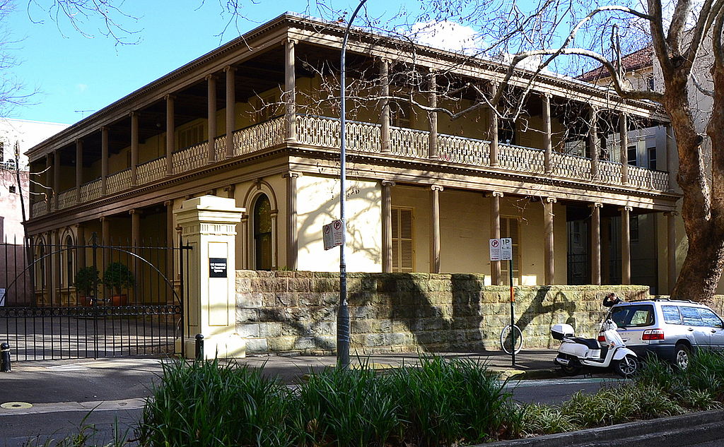 At Macleay and Manning Streets is Verge’s
Tusculum, now administered by the New South Wales Chapter of
the Royal Australian Institute of Architects. Built as an
investment property for the banker Alexander Brodie Spark
(Verge also designed Spark’s mansion Tempe), the first tenant
was the Bishop of Australia, William Grant Broughton, who
lived here from 1836 to 1851. Later owners, after Spark’s
bankruptcy, included Sir William Manning, Lord Mayor of
Sydney. The building is of stuccoed brick and includes a
colonnaded two-storey verandah on three sides, added in 1870.
Fittings include cedar from Lebanon and marble from Tusculum
in Italy. Its history is a typical one: a private residence
until 1927, it then went through several institutional hands,
falling eventually into total dereliction until it was taken
over by the state government in 1983.
At Macleay and Manning Streets is Verge’s
Tusculum, now administered by the New South Wales Chapter of
the Royal Australian Institute of Architects. Built as an
investment property for the banker Alexander Brodie Spark
(Verge also designed Spark’s mansion Tempe), the first tenant
was the Bishop of Australia, William Grant Broughton, who
lived here from 1836 to 1851. Later owners, after Spark’s
bankruptcy, included Sir William Manning, Lord Mayor of
Sydney. The building is of stuccoed brick and includes a
colonnaded two-storey verandah on three sides, added in 1870.
Fittings include cedar from Lebanon and marble from Tusculum
in Italy. Its history is a typical one: a private residence
until 1927, it then went through several institutional hands,
falling eventually into total dereliction until it was taken
over by the state government in 1983. Further down Macleay Street at Rockwall Crescent (c
200m) is Rockwall, designed by Verge in 1830 for John Busby,
engineer of ‘Busby’s Bore’, Sydney’s source of water. Over
the years, quite glaring alterations were made, and it was
in great disrepair when the site was purchased by an Asian
company for a shopping complex. They were required to repair
the villa as part of the agreement for purchase.
Elizabeth Bay House
At Onslow Avenue, across Macleay Street, is the most stunning of the area’s 19C mansions, Elizabeth Bay House (t 02 9356 3022, open Fri–Sun 9.00–16.00). Described at the time of its construction as ‘the finest house in the Colony’, Elizabeth Bay House was designed in 1838 by John Verge for Colonial Secretary and renowned scientist Alexander Macleay and his large family. Fortunately for posterity, one of John Macarthur’s granddaughters married a grandson of Macleay; the house thus remained in the family which owned the other great Verge masterpiece, Camden Park.
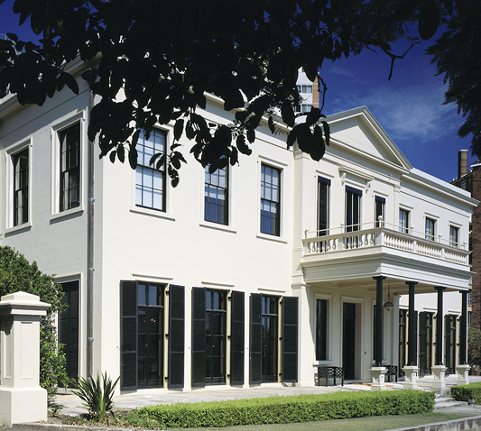
Now a property of the Historic Houses Trust, the house’s
crowning glory is its stair hall, with a cantilevered
winding staircase and domed oval ceiling. The rooms are
superbly restored with Regency period furniture (1835–50).
Understandably, for one so interested in science and botany,
Macleay’s original property of 23 ha (56 acres) included
magnificent gardens of rare and native plants which
stretched to the harbour’s edge; the grounds were the talk
of colonial society. Unbelievably, the house itself was
subdivided into flats during the 1940s; the artist Donald
Friend lived in what was the morning room, and from here
watched in 1942 the Japanese torpedo bombing of the ferry
Kuttabul. The house fortunately came into the hands of the
Historic Houses Trust in the 1970s, and was opened to the
public in 1977. Along with providing regular tours, the
Historic Houses Trust also mounts occasional exhibitions
here on architectural themes.
The novelist C.J. Koch, who lived in Elizabeth Bay in the
1950s, described its scenery in The Doubleman (1985)
as ‘inviting as a dream of pre-war Hollywood, from which it
took its style, with its white Spanish villas, gardens on
the harbour, and apartment towers’. Koch may have been
referring here to apartment buildings such as Del Rio, on
Billyard Avenue just across the road from Elizabeth Bay
House. Built in the 1910s, the building demonstrates the
influence of Spanish Mission style architecture that had by
this time filtered over from California.
Eastern suburbs
Returning to Kings Cross Road, continue east c 1.5km, when
the road becomes New South Head Road at Darling Point. At
this point, take New Beach Road north around Rushcutters Bay
Park to the Cruising Yacht Club, where the magnificent
sailing boats that participate in the Boxing Day
Sydney-to-Hobart Race converge before the start at
13.00. The best view of the start, after a spectator
boat on the harbour, are Nielsen Point and Camp Cove on the
south shore or more or less anywhere from Clifton Gardens to
Middle Head on the north shore. From either of the
Heads you can usually watch the maxis' spinnakers unfurl
once they clear the harbour.
 To the south side of New South
Head Road at Glenmore Road and Alma Street, nominally in
Rushcutters Bay Park and Paddington, is the famous ‘White
City’, the city’s beloved monument to Australia’s golden era
of tennis. Founded in the 1920s on the site of an amusement
park, the courts now have grass courts next to Ace Rebound
ones. White City’s greatest moment of glory was the 1954
final of the Davis Cup between Australia and the United
States, when some 25,578 spectators showed up to cram the
stands of the centre court; the US players Victor Seixas and
Anthony Trabert defeated the Australians Lew Hoad and Ken
Rosewall. The Garden Enclosure, the second ‘stadium’ court
seating 1500, is considered by many to be the best place to
watch tournament play in Australia.
To the south side of New South
Head Road at Glenmore Road and Alma Street, nominally in
Rushcutters Bay Park and Paddington, is the famous ‘White
City’, the city’s beloved monument to Australia’s golden era
of tennis. Founded in the 1920s on the site of an amusement
park, the courts now have grass courts next to Ace Rebound
ones. White City’s greatest moment of glory was the 1954
final of the Davis Cup between Australia and the United
States, when some 25,578 spectators showed up to cram the
stands of the centre court; the US players Victor Seixas and
Anthony Trabert defeated the Australians Lew Hoad and Ken
Rosewall. The Garden Enclosure, the second ‘stadium’ court
seating 1500, is considered by many to be the best place to
watch tournament play in Australia.
At Darling Point, take a detour by turning left (north)
onto Darling Point Road, passing Ashcam Girls School,
traditionally the most exclusive girls’ school in the city.
At the end of the road is McKell Park, a lovely spot
directly on the harbour; a small pier makes it possible to
reach the water and take a swim if feeling daring.
Immediately above the park you can glimpse ‘Lindesay’, I
Carthona Avenue, a Gothic Revival mansion built in 1834 and
home of many famous figures of the colonial era. The house’s
design is attributed to Edward Hallen and James Hume, with
sympathetic additions in the 1910s by Robertson and Marks.
Owned by the National Trust, the house is currently
available only for special events.
One of the most delightful views of this urbane
neighbourhood and out to the harbour and beyond can be had
by returning on Darling Point Road to Marathon Avenue; walk
down the beautiful Marathon Steps all the way to Double Bay
itself.
Return to New South Head Road, and drive past Double Bay,
Point Piper, and Rose Bay, the most upmarket neighbourhoods
for shopping and dining; properties here are among the most
valuable in Sydney (and that makes them very valuable
indeed), and many elegant historic mansions can be glimpsed
on the side streets. Rose Bay was also the site of Sydney’s
first airport, and seaplanes still land here regularly.
The Royal Sydney Golf Course
(02 9371 4333) is also located on Rose Bay, in
what was a scallop-shaped swamp. The club first played at
Concord in the western suburbs, then moved to the dunes and
scrubland at Bondi in what had been mixed pasturage between
Ben Buckler Fort and the Ostridge Farm on South Head. These
moves all occurred between founding in 1893 and the building
of the current clubhouse just after the turn of the century,
giving an indication of the contemporary nature of Sydney’s
social establishment. Reports
says that the par 4 11th hole is a putter's challenge.
Vaucluse
Continue on New South Head Road, to reach Vaucluse, c 3km.
Vaucluse
House (t 02 9388 7922; open Wed.-Sun 10.00–16.00;
admission adults $10, concessiion $8.00; gardens open always
with no fee) is the largest property administered by the Historic Houses
Trust.
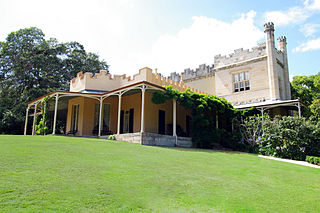 Vaucluse was first built and
named by Sir Henry Brown Hayes (1762–1832), an eccentric
Irish ‘Gentleman Convict’ transported for kidnapping an
heiress and subsequently involved in all kinds of mayhem and
political intrigue. He named it Vaucluse because it reminded
him of Fontaine-de-Vaucluse in France. He bought 100 acres
on this site in 1803 for £100, and built a stone cottage. In
the belief that Irish soil would deter snakes, Hayes
imported barrels of it and had a trench dug around the house
by convicts, in which the soil was placed. His original
cottage provided the walls of the living room for present
Vaucluse, so in part this structure is the oldest house in
Sydney.
Vaucluse was first built and
named by Sir Henry Brown Hayes (1762–1832), an eccentric
Irish ‘Gentleman Convict’ transported for kidnapping an
heiress and subsequently involved in all kinds of mayhem and
political intrigue. He named it Vaucluse because it reminded
him of Fontaine-de-Vaucluse in France. He bought 100 acres
on this site in 1803 for £100, and built a stone cottage. In
the belief that Irish soil would deter snakes, Hayes
imported barrels of it and had a trench dug around the house
by convicts, in which the soil was placed. His original
cottage provided the walls of the living room for present
Vaucluse, so in part this structure is the oldest house in
Sydney.
The house was acquired by the notorious John Piper in 1822,
he who made and lost a fortune through the Sydney rum trade
and other activities. Piper sold it in 1827 to William
Charles Wentworth (1790–1872, see box, p 151), a remarkable
man and important early figure in Australian history.
The house and grounds are extraordinarily well done,
presented as a ‘living house’ rather than a museum. Some of
the furniture is original, dating from the 1840s, and
donated by the Wentworth family, who remain an eminent
Sydney name. The house is impressive in its rusticated
‘Georgian Romantic’ style. It includes one of the best
verandahs in Australia. Especially fine are the meticulously
restored wallpapers and floor coverings.
Immediately west of Vaucluse House is Nielsen Park,
originally part of Wentworth’s estate and now part of the
Sydney Harbour National Park (t 02 9977 6522). The park is
frequently voted the most popular beach and picnic spot in
Sydney. The views are spectacular, the swimming tranquil,
and you can picnic in the shade of trees—a rarity at Sydney
beaches. In the middle is Greycliffe House, built in the
1840s by Wentworth as a wedding present for his daughter.
The house was gutted by fire in the 1890s, and has been
completely restored. It now serves as a national park
information centre. The Park also has the North Head
Quarantine Station, now a hotel, restaurant and free museum
documenting the sequestering of residents and particularly
immigrants thought to be carrying contagious diseases.
William Charles Wentworth
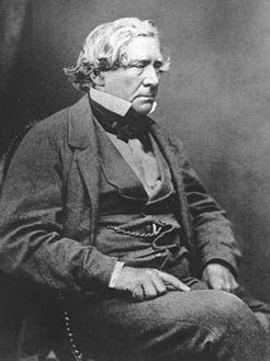 |
William Charles Wentworth was the
son of D’Arcy Wentworth (1764–1827), Assistant Surgeon
with the Second Fleet and Catherine Crawley, a convict
on the ship transported for stealing clothes.
Wentworth, always filled with bitterness at the
scorning of his father by Sydney ‘society’, determined
to become a significant and prosperous pillar of
society. A solicitor and statesman, he married Sarah
Cox, herself the child of two convicts. Despite this
‘mismatch’, they were apparently quite happy and had
ten children on whom he doted. Wentworth was with the
first group to cross the Blue Mountains in 1813 and
was instrumental in the establishment of New South
Wales self-government in 1854; he is often referred to
as the ‘Father of the Constitution’. Wentworth lived at Vaucluse from 1827 to 1853, and in brief periods thereafter. Upon his death in 1872, the house was inherited by his wife and children, but had several other tenants. The house fell into disrepair until it was taken over by the New South Wales government in 1910. |
Watsons Bay
Drive or take bus no 324 or 325 from Circular Quay, no. 387 from Bondi Junction to Watsons Bay. The bay is named after Robert Watson, who came as quartermaster of the Sirius with the First Fleet, and was harbour master in 1811. Along the way, on Old South Head Road, is St Peter’s Church of England, designed by Edmund Blacket, completed in 1864. The church houses an organ, which, according to a plaque on the church, purportedly belonged to Napoleon, and was built by Robert and William Grey in London 1796.
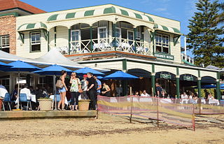 Watsons
Bay has always been a fishing harbour, as well as a base for
pilot boats, which it still is. It is also the home of the
original Doyle’s Restaurant, a seafood restaurant,
established over 100 years ago and situated directly on the
water with a stunning view of the harbour and city skyline.
The walk around the town gives evidence of its earlier
origins in the many small cottages which are now, of course,
entirely gentrified and outrageously valuable on the real
estate market.
Watsons
Bay has always been a fishing harbour, as well as a base for
pilot boats, which it still is. It is also the home of the
original Doyle’s Restaurant, a seafood restaurant,
established over 100 years ago and situated directly on the
water with a stunning view of the harbour and city skyline.
The walk around the town gives evidence of its earlier
origins in the many small cottages which are now, of course,
entirely gentrified and outrageously valuable on the real
estate market.
Walk along the beach to reach the small stretch of sand
called Camp Cove. This was where Captain Phillip first
stopped with the First Fleet on 21 January 1788 before
landing at Sydney Cove; a marker commemorates the fact.
However, because the land was swampy, they went on to Port
Jackson.
A walk along the cliffs, part of the Sydney Harbour
National Park, leads past Lady Bay with Lady Jane Beach
below, one of two or three official nude beaches (today
largely gay), and on to the South Head and Hornby
Lighthouse.
The lighthouse was completed in 1858 after the tragic wreck
of the Dunbar (see below). The lighthouse is named after Sir
Phipps Hornby, Commander in Chief of the British Pacific
Fleet at that time. Evident around the point, along with
stupendous views of the harbour entrance (it is a great
place for watching sailboat racing), are several old
fortifications spanning the 1870s to the Second World War.
Further along from the lighthouse is the Gap Park, where 50m
cliffs have made it the traditional site for suicide jumps.
Nearby is a monument to the wreck of the Dunbar, an
immigrant ship which crashed onto the rocks here on 20
August 1857, with all but one of the 122 passengers lost; a
remarkable photo of this survivor by Sydney’s greatest
daguerreotypist, T.S. Glaister, still exists in the Mitchell
Library collection.
Along the descending path in the Gap Park you find the
anchor of the Dunbar, set in concrete as a monument. At the
southern end of the park is a dangerous break in the cliffs
called Jacob's Ladder, whence the Dunbar survivor was hauled
to safety. From here you can keep walking along the cliffs c
300m to the Signal Station, built in 1848, on the site,
Dunbar Head, where a flagstaff had been manned since 1790.
Whenever a ship was sighted, a flag was raised to warn the
colony. Another 300m south along the cliffs brings you to
Macquarie Lighthouse, an 1883 replica (by James Barnet) of
the colony's first lighthouse, built in 1818 by Francis
Greenway. Legend has it that Governor Macquarie was so
pleased with Greenway's 'noble magnificent edifice' that
upon seeing it for the first time, he granted Greenway his
pardon on the spot. Robert Watson, for whom Watsons Bay is
named, was the first lightkeeper. From the Lighthouse
Reserve, it is possible to catch bus no. 324 back into
central Sydney.
Bondi to Bronte
While no train currently reaches Bondi Beach, they do
reach Bondi Junction from which it's an easy 15 minute bus
ride to the beach via nos 380,
381, 382 or 333. Plans are afoot to extend
the links to the beach, but these are vigorously opposed by
some locals.
Continuing by car, a right turn (south) on Ocean Street to
Oxford/Einfeld Drive, which becomes Bondi Road, leads to
Sydney’s most famous beach, Bondi (pronounced BOND-eye;
purported to mean in Aboriginal ‘water breaking over the
rocks’). From the central business district (CBD), a most
popular drive is the ‘Bays to Bondi’, taking New South Head
Road through Double Bay, Rose Bay, and Watsons Bay, then
back turning on Old South Head Road to Military Road,
through Dover Heights and into Bondi.
 Sydney
is justly known for its many accessible beaches. Despite the
fact that Bondi is no longer the cleanest or most inviting
among the many along the shoreline, it is still worth a
visit if only to see its new North Bondi Surf Live Saving
Club. The Monthly published David Neustein's
story of its wonderful design by Durbach Block and Jaggers
(January 2014). At the opposite end of the beach is
the Bondi Icebergs' club serving a group of older stalwarts
who swim daily, event in winter. A third club,
the Bondi Surf Livesavers Club sits between the two.
Founded in 1907, it is the oldest lifesaver's organization
in the world. Also of interest are the Esplanade and
Bondi Pavilion, where jazz concerts and exhibitions
entertain the throngs of sunbathers. The cafes and bars on
the streets near the beach have now become a real haven for
the trendy and cosmopolitan, especially for breakfasts and
brunches. During Christmas/New Year’s holidays, the beach
and surrounding pubs swarm with foreign tourists,
celebrating the warmth of the season. Recent outbreaks of
violence and pandemonium have made the New Year’s event less
enjoyable of late, with police crackdowns on rowdiness and
drunken behaviour. Visitors are advised to investigate the
current situation and alcohol regulations before venturing
forth.
Sydney
is justly known for its many accessible beaches. Despite the
fact that Bondi is no longer the cleanest or most inviting
among the many along the shoreline, it is still worth a
visit if only to see its new North Bondi Surf Live Saving
Club. The Monthly published David Neustein's
story of its wonderful design by Durbach Block and Jaggers
(January 2014). At the opposite end of the beach is
the Bondi Icebergs' club serving a group of older stalwarts
who swim daily, event in winter. A third club,
the Bondi Surf Livesavers Club sits between the two.
Founded in 1907, it is the oldest lifesaver's organization
in the world. Also of interest are the Esplanade and
Bondi Pavilion, where jazz concerts and exhibitions
entertain the throngs of sunbathers. The cafes and bars on
the streets near the beach have now become a real haven for
the trendy and cosmopolitan, especially for breakfasts and
brunches. During Christmas/New Year’s holidays, the beach
and surrounding pubs swarm with foreign tourists,
celebrating the warmth of the season. Recent outbreaks of
violence and pandemonium have made the New Year’s event less
enjoyable of late, with police crackdowns on rowdiness and
drunken behaviour. Visitors are advised to investigate the
current situation and alcohol regulations before venturing
forth.
Waverley
Bondi is in the municipality of Waverley, which itself
contains several locations of historical interest. The name
itself comes from the area’s first (now demolished) estate,
so named by the original landowner Barnett Levey. Levey was
the colony’s first theatrical entrepreneur, operating the
Theatre Royal in the 1830s; he named his estate in honour of
Sir Walter Scott’s novels.
Directly south of Bondi Beach is Tamarama, site of a
turn-of-the-century amusement park mentioned in Ethel
Turner’s famous Seven Little Australians (1894). It
is now a patrolled beach, with good surf. Continuing around
Tamarama Bay, you come to Bronte Park, site (at 470 Bronte
Road) of Bronte House, one of the colony’s oldest surviving
homes. Begun in 1836–38 by Colonial Architect Mortimer Lewis
as his home, it was soon sold to famous barrister Robert
Lowe, who named it Bronte in honour of Admiral Nelson’s
title (he was named the Duke of Bronte by the king of
Naples). The house was originally so isolated it required
shuttered windows for protection from bushrangers. Recently
the house has been completely restored and is occasionally
opened for public viewing by heritage activist and cultural
guru Leo Scofield (he has had a regular column on things
cultural and gustatory in the Sydney Morning Herald,
and has run both the Sydney and Melbourne Festivals).
If you continue south on Bronte Road, Waverley Cemetery appears on a bluff looking out to the sea. Described in 1973 by Ruth Park as ‘ugly as sin’, the cemetery has been restored somewhat, and contains the graves of many important figures in the country’s history, including the poets Henry Lawson and Henry Kendall; Dorothy Mackellar, author of the poem ‘My Country’ (‘I love a sunburnt country...’); and a monument to US Civil War Veterans. Also buried here are Fannie Durack, first woman Olympic champion in swimming in 1912, and the first to swim the Australian crawl; and Lawrence Hargraves, pioneering aviator.
Manly
An old saying (coined in 1940 by the Port Jackson and
Manly Steamship Co. to foster tourism) claims that Manly is
‘seven miles from Sydney and a thousand miles from care’.
This beach suburb, located on the inner harbour side of the
North Head, is most easily (and happily) reached by ferry,
from Wharf 3 (Jet Cat from Wharf 2), Travelling by car
involves a tortuous drive through North Sydney and over the
Spit Bridge (often closed to traffic as it opens to allow
boats through). Manly has a great Visitor’s
Centre on North Steyne, providing information on North
Shore walks and tours (t 02 9976 1430).
The most famous Sydney beach after Bondi, Manly was named by
Governor Phillip, in honour of the local Aborigines: ‘their
confidence and manly behaviour,’ he wrote, ‘made me give the
name of Manly Cove to the place’. It is a sad irony that one
of these same Aborigines, Wil-ee-ma-rin, speared Governor
Phillip after a misunderstanding, an event graphically
described in Watkin Tench’s account of the early colony.
Despite its famed long beach, it may disappoint, as it is a
bit polluted and the famous line of Norfolk Pines along the
beach wall is dying. But the ferry trip from Circular Quay
across the harbour to Manly is certainly worth the trip;
unless you are in a great hurry, take the old-fashioned
ferry rather than the JetCat. The ferry lands in the same
place where it has been landing since 1855.
Manly became famous because of its Victorian gentility, and
one can almost imagine the old bathing houses. In 1852,
English entrepreneur Henry Gilbert Smith envisioned here a
resort such as that in Brighton; the location quickly became
the elegant, if chaste, place to holiday. Indeed, it was
here in 1902 that newspaper editor William Gocher challenged
the laws that until that time forbade daylight swimming in
New South Wales; he won, and Sydneysiders have been swimming
ever since.
Along the Corso at Manly, where the ferry and Jet Cat
dock, is a small
aquarium (opren 9.30-16.30; admission adults $25.00,
concession $20.00, children $17.00, somewhat less if
ticketing on-line) quite fun for children, as well as the
Datillo Rubbo Art
Gallery and Museum (it is usually called simply Manly
Art Gallery and Museum, t. 02 9976 1420; open Tues-Sun
10.00-17.00; admission appears to be free).
Rubbo (1871–1955) was an Italian artist who arrived in
Sydney in 1897; he was an influential teacher of new art
methods for decades, introducing Australian artists to
Post-Impressionism. The museum contains works by him and
some of his students, as well as small exhibitions on
cultural history, such as the development of the bathing
costume and other events in Manly’s history.
Balmain
Take the ferry from Bay 5 (Circular Quay) to Balmain; this is by far the most appropriate way to visit this harbourside suburb, which is about 2km west of the centre of the city. A hilly 2.7km walking tour map is available through the Balmain Association Watch House. At 179 Darling Street (t 02 9818 4954; open Sat 11.30-15.00), guided walking tours can be arranged. The shop includes such publications as Joan Lawrence’s Exploring the Suburbs series.
No Sydney suburb has experienced as profound a
demographic transformation in the last few decades as
Balmain. The suburb derives its name from William Balmain,
surgeon of the First Fleet who was granted the land in 1800.
Long the centre of marine industry, Balmain was
traditionally the home of sea-captains, as well as a
distinctively ‘larrikin’ working class. Now its crooked
streets and cramped little houses, as well as its
ostentatious homes, have become gentrified, many of them
owned by well-known artists and writers. For many years,
Peter Carey, author of Oscar and Lucinda (much of
which is set in Balmain), lived here, as did the playwright
David Williamson.
The most poignant indication of this gentrified change is
that in 1994, the Balmain Rugby League team, once the pride
of the suburb’s dockies and wharfies, moved to Parramatta
(it has since returned to its old home at Leichardt Oval).
Balmain High School, which had historically produced several
of the game’s scrappiest and most revered players, could no
longer man a team.
Neville Wran, Premier in the 1980s and the quintessential
Balmain Boy, made a famous remark in a case concerning the
Rugby League chairman, Kevin Humphreys: ‘Balmain boys don’t
cry. We’re too vulgar and too common for that and probably
vote Labor anyway.’ The New South Wales Labor Electoral
League, forerunner of today’s Australian Labor Party, was
founded here in 1891. Sydney policemen, who traditionally
came from Balmain, were purported to say ‘there are only two
kinds of people—those born in Balmain and those who wish
they were’. The loyalty of Balmain locals is evident in the
naming of the suburb’s swimming pool near Elkington Park
after Balmain girl and swimming great Dawn Fraser, whose
larrikin behaviour endeared her to the hearts of her
hometown fans.
With its long history of mercantile development,
shipbuilding, and cheek-by-jowl living, the area has
numerous sites of architectural and cultural interest, the
most remarkable being its amazing variety of domestic
dwellings. The best way to arrive at the suburb is,
predictably, by sea; the ferry to Balmain goes under the
Harbour Bridge, past Ball’s Head and Goat Island; it then
lands at Darling Street Wharf, the base of the main street.
Immediately to the right of the landing is Thornton Park,
once owned by the Russell family, foundry owners; the
expatriate painter and friend of Van Gogh John Peter Russell
(1858–1930) owed his fortune to the family’s business.
At 12 Darling Street is Waterman’s Cottage. Built in 1841 by John Cavill, it was home from 1880 to 1907 of the waterman Henry McKenzie who rowed passengers after ferry hours to Miller’s Point. The entire street, as well as the closest side streets, contain stone cottages and Victorian terrace houses built between the 1840s and 1900.
At Darling and Duke Streets is St Mary’s Anglican Church, the first Anglican church in Balmain. It was also one of Edmund Blacket’s first buildings, begun in 1845; Blacket himself lived in Balmain, at 393 Darling Street, at the end of his life. While the original minister, a Mr Wilkinson, wanted a Norman church, Blacket, predictably, based his design on 13C Gothic.
 Turn north (right) at The Avenue and walk down
to Mort Bay. Named for the great wool magnate and Balmain
resident, Thomas Sutcliffe Mort, the bay was the site of
some of the earliest docks, and also the most militant
workers’ strikes of the 19C.
Turn north (right) at The Avenue and walk down
to Mort Bay. Named for the great wool magnate and Balmain
resident, Thomas Sutcliffe Mort, the bay was the site of
some of the earliest docks, and also the most militant
workers’ strikes of the 19C.
Return to Darling Street, and proceed to Ewenton Street, on
the south. At no. 6 is Ewenton house. Begun in 1854 by
Robert Blake, it was consequently named Blake Vale. In 1856
the house was bought by Major Ewen Wallace Cameron, a
partner of Thomas Sutcliffe Mort. Cameron added an extra
storey, a porch, and, in 1872, an additional wing with views
of Sydney; at this time, it acquired its name of Ewenton.
Despite numerous vicissitudes and threats of demolition, the
property survived and was tastefully restored in the 1990s.
The many additions to the original structure make it a
showcase of various eclectic styles, not always harmoniously
coordinated.
Return to Darling Street and proceed to no. 179. This is the
Watch House, built in 1854 by Edmund Blacket. The structure
served as the suburb’s police headquarters until 1887, after
which time it fell into disrepair. It narrowly escaped
demolition in the 1950s, but managed to be salvaged by the
Balmain Association in 1970, which is now using it as their
headquarters. It is rumoured to be haunted.
Balmain Market
St Andrew’s Congregational Church at the corner of
Darling and Curtis Road, is a Gothic Revival sandstone
church built in 1855, reminiscent of an English village
church. On Saturdays (9.00-15.00), the church’s yard is the
location of the Balmain
Market, considered by many to be the best market in
the city, specialising in antiques, arts and crafts and
jewellery. Further along Darling Street are the remains of
the many famed pubs of the suburb (in the 1880s, there were
41 pubs, or one for every 360 Balmain citizens). Local
historians Bonnie Davidson, Kath Hamey, and Debby Nicholls
provide a pictorial documentation of these celebrated pubs
in Called
to the Bar: 150 Years of Pubs of Balmain and Rozelle.
Hunter’s Hill
Take the ferry from Bay 5 Circular Quay to Hunter’s Hill. Hunter’s Hill Peninsula lies across the harbour to the northwest of Balmain. The Aborigines called it ‘Moocooboola’, or ‘meeting of the waters’ (note: many translations of Aboriginal names may be viewed with some scepticism, since many of the true meanings have been lost; the majority of them seem to be translated as having something to do with water, when it is just as likely that they originally meant ‘white man, go away!’).
First settled in the 1830s, the peninsula is one of the
few on the harbour that runs west to east. Mary
Reibey settled here near the present-day Fig Tree
Bridge, living in a house with sheet-iron shutters to
protect against bushranger attacks. In 1838, the artist and
writer Joseph Fowles, who wrote the invaluable illustrated
history Sydney in 1848, leased this property.
In 1847, this undesirable area was transformed when two
wealthy French brothers, Jules and Didier Joubert, purchased
land here. Dubbed ‘the first large-scale speculative
builders in Sydney’ by writer Ruth Park, the Joubert
brothers began in 1848 the first of 200 elegant stone
houses, complete with European tiles and fittings and
finished by French and Italian masons. By 1860, the Jouberts
operated a ferry, and when the municipality was incorporated
in 1861, Jules was the first chairman of council; Didier
became mayor in 1867.
In recent times, Hunter’s Hill has been the residence of
many authors and playwrights. Author Kylie Tennant lived
here for twenty years, and her novel Tantavallon
(1983) alludes to the peninsula in her descriptions of the
fictitious ‘Balm Point’.
The remaining houses and streetscapes offer charming
sights for strollers. Many of the original stone cottages
appear surprisingly French on narrow streets with lovely
gardens. Of special interest are Passy, off Passy Avenue,
built by Joubert in 1854 for the French Consul and later
occupied by Sir George Dibbs, Premier of New South Wales;
the Garibaldi Inn, on Alexandra Street, built in 1861 by the
same Italians who built many of the neighbouring stone
cottages; and Carey Cottage, 18 Ferry Street. On Yerton 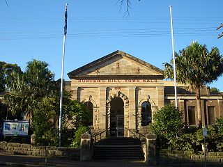 Street is the only
survivor of four German prefabricated houses brought from
Hamburg in 1854, and assembled by German workers. Also of
note are the 1866 Town Hall at Alexandra and Ellsmere
Street, which houses an historical museum (open weekdays
10.00-12.00), and Vienna
Cottage, built in 1871 and now a National Trust
property open to the public (open on the second and fourth
Sunday of each month from 14.00-16.00, admission $4.00).
Detailed brochures for walking tours are available from the
Town Hall museum.
Street is the only
survivor of four German prefabricated houses brought from
Hamburg in 1854, and assembled by German workers. Also of
note are the 1866 Town Hall at Alexandra and Ellsmere
Street, which houses an historical museum (open weekdays
10.00-12.00), and Vienna
Cottage, built in 1871 and now a National Trust
property open to the public (open on the second and fourth
Sunday of each month from 14.00-16.00, admission $4.00).
Detailed brochures for walking tours are available from the
Town Hall museum.
Glebe and the southern suburbs
South of Darling Harbour and west of Central Railway Station at the point where Broadway turns into Parramatta Road is the historic neighbourhood of Glebe. The University of Sydney is immediately south of Glebe on Parramatta Road. Glebe can be reached from central Sydney on bus nos 431 and 433.
The word ‘glebe’ traditionally referred to land given to
the church and its officials. Sydney’s Glebe was the area
allotted by Governor Phillip to the colony’s first chaplain,
Richard Johnson; a piece was also laid out for a
schoolmaster, although none existed at the time of the First
Fleet. By 1828, this land was subdivided into estates by the
Anglican diocese to raise money for the church, and
prosperous merchants began to build substantial residences
on the most elevated sites to avoid the noxious odours of
nearby Blackwattle Bay. Edmund Blacket lived here as early
as the 1850s, when the area was still remote enough to be
the haunt of bushrangers in the thick forests. By the 1890s
the suburb had been further developed to accommodate growing
numbers of immigrants; thus, the plethora of Victorian
row-houses, with minuscule gardens, tile-work, and
stained-glass windows.
The suburb’s ethnic diversity dates from this period,
although now gentrification is again transforming this
colourful mix. Old Glebe nearly fell entirely to the
wrecking ball in the 1960s, when it was planned to extend
the expressway through the district. Fortunately,
preservation efforts were successful and in 1976, with the
support of Premier Neville Wran’s Labor Government, the
entire suburb was declared a conservation area by the
National Trust and National Estate.
Glebe Point Road is now filled with trendy restaurants,
health food stores, and excellent bookshops catering to the
nearby university crowd. Saturdays (10.00-16.00) bring a
colourful market
to the yard of the Glebe Point School, Glebe Point Road at
Derby Street, which rivals the more famous one at
Paddington.
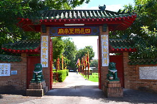 One example of the
district’s cultural diversity is the presence here, off
Victoria Road on Edward Street, of the Sze
Yup Temple, a Chinese joss house. Glebe was an early
residence of the Chinese vegetable gardeners who arrived in
Sydney as early as the 1840s. It is estimated that half of
the city’s market gardeners before the 1940s were Chinese,
many of whom had been in Australia for generations. The
current temple dates only from 1955, but replaced a joss
house that had been on the same site since 1893. The temple
is still actively attended, and visitors are able to view
its incense-filled interior.
One example of the
district’s cultural diversity is the presence here, off
Victoria Road on Edward Street, of the Sze
Yup Temple, a Chinese joss house. Glebe was an early
residence of the Chinese vegetable gardeners who arrived in
Sydney as early as the 1840s. It is estimated that half of
the city’s market gardeners before the 1940s were Chinese,
many of whom had been in Australia for generations. The
current temple dates only from 1955, but replaced a joss
house that had been on the same site since 1893. The temple
is still actively attended, and visitors are able to view
its incense-filled interior.
At the intersection of Glebe Point Road and Parramatta
Road is a monument to Dave Sands, Aboriginal boxer of the
1940s, who was killed in a car crash in 1952.
Along Glebe Point Road and on the side streets, especially
Toxteth and Avenue Roads and Allen Street, are lovely
examples of Victorian cottages with cast-iron lacework and
decorative plaques using native species as motifs.
At the corner of Avenue and Victoria Roads is St
Scholastica’s College, the main building of which was
Toxteth House, built by John Verge 1829–31 for George Allen,
the first Australian-trained solicitor. Toxteth refers to
the home in England of the Allens’ benefactor, Sir Robert
Wigram. An elegant Regency stone house, a third storey of
Italianate style was added in 1877–81 by architect George
Mansfield for Allen’s son, George Wigram Allen, also a
prominent civic leader. The home was purchased in 1904 by
the Roman Catholic Church.
The grounds of the original Toxteth estate, which included a
cricket ground and acres of orchards, extended to the area
now occupied by the Harold Park Raceway; at Avenue and
Arcadia Streets, turn right into Arcadia, then left at
Maxwell to see the Raceway. Named after Childe Harold—not
Byron’s hero, but a famous American racehorse—it has had a
trotting course since 1902 and a greyhound track since 1927.
Walk back to Toxteth Road, turn left, noting the iron work
and decorative plaster of the terrace houses; at The Avenue
is The Lodge, originally the gatekeeper’s house for the
Toxteth Estate. It was built in a Gothic Revival style in
1877 by George Mansfield, who subsequently lived here. Note
the asymmetrical house at no. 27 Mansfield, with wooden
verandah and stone and iron fence.
From Mansfield Street, walk to Wigram Road, turn left
(north) and return to Glebe Point Road; turn right (south)
and proceed to Hereford Street. The street is named for the
original Hereford House, an elegant early mansion that stood
at the corner of Glebe Point Road and Bridge Road; it was
demolished in the 1960s. At no. 53 is another Hereford
House, built in 1874, and now part of the New South Wales
College of Nursing. Glebe’s most famous son, tennis star Lew
Hoad, learned to play on the now demolished courts behind
this building.
‘Kerribee’, no. 55, built 1889 by James Fitzpatrick, is one
of the last of the large houses on impressive grounds built
in the Glebe.
Proceed south to Bridge Street, turning east past Glebe
Point Road to Bridge Street (c 600m) to reach ‘Lyndhurst’ at
61 Darghan Street. Along with Toxeth, which has been
extensively altered, this is the only surviving Regency
building in Glebe, built at the centre of Lyndhurst Estate
in 1833–36 by John Verge. The owner was John Bowman, John
Macarthur’s son-in-law and Principal Surgeon at Sydney
Hospital. Overlooking Blackwattle Bay and with lavish
fittings, the home’s design greatly resembled Verge’s work
at Camden Park for the Macarthur family. By 1842, financial
hardship forced the Bowmans to leave Lyndhurst, and it
passed through several hands. In the 1850s and 1860s it
housed St Mary’s College; run by English Benedictines, the
school was renowned for its rigorous classical education. By
1877, the school had lost favour, and the college was
closed, the land subdivided and the estate sold. At this
time, its verandah and additional wings were demolished.
After serving various functions, from a lying-in hospital to
a laundry and broom factory, the house was by the 1970s
nearly declared uninhabitable. A campaign spearheaded by the
National Trust and supported by Premier Wran saved the
building, which has now been fully restored to its original
form. It serves as the headquarters of the Historic Houses
Trust of New South Wales, recently renamed Sydney
Living Museums (t 02 8239 2288; open Mon–Fri 09.00–17.00; no
tours), and includes a resource centre for the conservation
of historic houses. In many ways, this house is the most
enjoyable reminder of Verge’s great designs.
University of Sydney
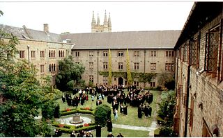 At the beginning of
Glebe Point Road and across Broadway to the south are the
gates to the grounds of the University of Sydney. Founded in
1850 and opened in 1852, it is Australia’s oldest
university; today it boasts some 30,000 students. The older
buildings of the main quadrangle, designed by Edmund Blacket
and completed in 1857, certainly mimic Victorian Gothic
‘Oxbridge’ style, while the additional structures over the
years have created a mishmash of institutional architecture.
The Chancellor’s Committee souvenir shop under the
clock-tower is manned by volunteer guides who can answer
questions and provide a free map of the campus (t 02 9351
4002). If you happen to be there on a Sunday
afternoon, stay for a free carillon concert at 14.00 and
tour the tower afterwards.
At the beginning of
Glebe Point Road and across Broadway to the south are the
gates to the grounds of the University of Sydney. Founded in
1850 and opened in 1852, it is Australia’s oldest
university; today it boasts some 30,000 students. The older
buildings of the main quadrangle, designed by Edmund Blacket
and completed in 1857, certainly mimic Victorian Gothic
‘Oxbridge’ style, while the additional structures over the
years have created a mishmash of institutional architecture.
The Chancellor’s Committee souvenir shop under the
clock-tower is manned by volunteer guides who can answer
questions and provide a free map of the campus (t 02 9351
4002). If you happen to be there on a Sunday
afternoon, stay for a free carillon concert at 14.00 and
tour the tower afterwards.
Of interest on campus are the Nicholson
Museum (t. 02 9351 2812; open Mon.-Fri. 10.00-16.30,
first Sat. of the month 12.00-16.00) and the Macleay
Museum (t 02 99036 5253; closed until late 2018). The
Nicholson contains archaeological artefacts collected by the
university faculty on digs all over the world. These include
the Jericho Head, a rare skull from Joshua; Egyptian
sculpture; and glass and sculpture from Roman times.
The Macleay is a biological collection displayed in
cluttered profusion in a delightful 19C room with cast-iron
stairs and arches. The museum includes a stuffed example of
a Tasmanian tiger and the best collection of foreign insects
in Australia. Its Aboriginal bark paintings are believed to
be the oldest known specimens, and its collection of
photographs of pioneer Australia numbers 700,000.
In Clive James’s Unreliable Memoirs, he describes
his days at Sydney University in the late 1950s :
the the place where all the half-worlds met was the Royal George Hotel, down in Pyrmont. The Royal George was the headquarters of the Downtown Push, usually known as just the Push. The Push was composed of several different elements. The most prominent component was, or were, the Libertarians—a university free-thought society consisting mainly of people who, like the aesthetes, failed Arts I on a career basis, but in this case as a form of political protest against the state...Here was Bohemia.
The Push also included Germaine Greer and Margaret Fink.
Newtown
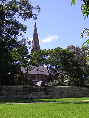
To the southwest of the campus, on the other side of
Missenden Road (the site of The Royal Prince Alfred and King
George V Hospitals), is Camperdown and Newtown, two of the
oldest inner-city suburbs and still filled with tiny 19C
rowhouses now eagerly gobbled up by gentrifying buyers. In
the middle of the district, at Church Street, is St
Stephen’s Church and cemetery. Designed and built by Blacket
in 1871–74, the church is an excellent example of Gothic
Revival style, and the cemetery contains the graves of some
of Sydney’s earliest settlers.
Immediately south of the church is King Street, a bustling
and grimy thoroughfare serving the nearby university
community, as well as a decidedly multicultural and gay
population. An enormous number of good, inexpensive
restaurants of all ethnic stripes line the street, along
with great bookstores and secondhand shops. Continuing west,
King Street turns into Enmore Road, then into Stanmore Road,
and finally Canterbury Road, which leads to the western
suburbs and also the M5 Tollway to Canberra. On Enmore Road,
just off King Street, is the Enmore Theatre,
a good venue for new plays, musicals and alternative comedy
shows.
Despite the congestion which often makes for slow going,
Enmore to Stanmore Road is a fantastic reminder of Sydney’s
ethnic diversity. One sees—along with one of Sydney’s most
exclusive schools, Newington College—Portuguese butchers,
Lebanese funeral parlours, Korean furniture stores, and even
a Greek doctors’ roller-skating rink! You pass through
Marrickville, the suburb most affected by the aeroplane
noise from Sydney Airport’s new runway, 5 km to the north
east. The neighbourhood coalesced into massive
demonstrations to force the government to do something about
the situation; at the time of writing, some compensation had
been considered, but nothing substantive has yet been
accomplished.
Redfern
To the south of King Street is the suburb of Redfern, locally considered one of Sydney’s roughest neighbourhoods, primarily because the city’s largest population of Aborigines live here in neglected poverty. As a centre for the Aboriginal community, Redfern houses some excellent Aboriginal community centres and performance venues. In the 1960s the dispersed Aboriginal people living in urban centres of New South Wales and Victoria began calling themselves ‘Koori’, a term meaning ‘people’ in a number of related languages in the area. (‘Murri’ is the equivalent word in Queensland, ‘Nunga’ in South Australia and ‘Nyungar’ in Western Australia.) While anyone with an Aboriginal affiliation can identify themselves as a Koori, a degree of political engagement accompanies the term.
 Redfern is also the
first train stop out of Central Station, and consequently
has a large rail interchange. Immediately south of the
Redfern station is the Eveleigh Railway Workshops, an
enormous 19C complex where trains were built and serviced.
Ambitious efforts by the Australian
Technology Park, a consortium of university interests
along with the National Trust, succeeded to conserve a
portion of this extraordinary site as a monument to early
technology. The US Smithsonian Institution has declared
Eveleigh ‘the most important historic railway workshops
remaining in the world’, with its unparalleled collection of
19C equipment and machinery. Sydney photographer David Moore
has completed a spectacular photo-essay of the buildings and
machinery, instrumental in the drive to preserve this unique
piece of Australian history.
Redfern is also the
first train stop out of Central Station, and consequently
has a large rail interchange. Immediately south of the
Redfern station is the Eveleigh Railway Workshops, an
enormous 19C complex where trains were built and serviced.
Ambitious efforts by the Australian
Technology Park, a consortium of university interests
along with the National Trust, succeeded to conserve a
portion of this extraordinary site as a monument to early
technology. The US Smithsonian Institution has declared
Eveleigh ‘the most important historic railway workshops
remaining in the world’, with its unparalleled collection of
19C equipment and machinery. Sydney photographer David Moore
has completed a spectacular photo-essay of the buildings and
machinery, instrumental in the drive to preserve this unique
piece of Australian history.
Leichhardt and Haberfield
Leichhardt can still be described as an inner-city
suburb, although it is off the Parramatta Road that leads to
the unending western suburbs. It is the traditional ‘Little
Italy’ section of town, where Italian migrants first settled
and mingled in the 1950s, bringing cappuccino, focaccia and
soccer to the city. Leichhardt also refers to the
municipality which administers this district of the city, as
anyone who saw the fascinating 1996 documentary film, Rats
in the Ranks, will know.
A visit to Leichhardt must involve food: restaurants,
bakeries, and classic Italian cafes. the Leichhardt Hotel,
on Balmain Road and Short Street, also demonstrates the
suburb’s new face as a centre for artists, as well as an
active lesbian community. It is from here that the Dykes on
Bikes take off for their ride in the Gay and Lesbian Mardi
Gras each March. The Norton Street Festival is a real
old-fashioned block party, when the length of Norton Street
is filled with food.
Some of these suburb communities did not just grow like topsy, but were planned as a whole, and many offer interesting examples of experimentation with planned residential living. Haberfield exemplifies this trend. Described by Jan Morris as ‘the Sydney suburb in excelsis... one of the most truly Sydneyesque places in Sydney’, it was created by developer Richard Stanton and architect J. Spencer-Stanfield in the early 1900s as the ideal urban environment. ‘Slum-less, Lane-less, Pub-less’, every house had a bathroom and every home was owned. It is a town of bungalows, most of them designed on 200 acres, by Spencer-Stanfield, in what is known as the ‘Federation Style’, a reference to their appearance at the time of Australia’s Federation in 1901. Morris’s description of this style is perfect:
It has a touch of Prairieism from the United States, and a hefty dose of Arts and Crafts from England...It is a Queen-Anne-ish Tudory, semi-countrified, sometimes whimsical sort of style, with eaves often, and fancy chimneys, and ornamental ridge cappings, and much woodwork. Stained-glass windows goes well with the Federation style, and tiled floors, and bargeboarding, and a verandah is almost essential.
Still referred to as the Federation Suburb, it is now
largely inhabited by Italian immigrants. Every single house
is different, with lots of stained-glass and tiles of
Australian natives; there are no back alleys, no slums and
still no pubs.
Other good examples of such suburban planning can be seen in
Croydon, Burwood, and elsewhere.
The western suburbs
Sydney is, perhaps more than any other city outside Los
Angeles, a city of suburbs. These residential neighbourhoods
extend for astonishing distances; the area loosely labelled
as ‘Sydney’ certainly rivals that of Los Angeles in size,
covering some 12,500 sq km, twice the size of Beijing and
six times the size of Rome. It continues, chock-a-block, in
a seemingly unending and for the most part monotonous
expanse of small lots with brick and fibro houses in all
directions. (‘Fibro’ is a fibrous-plaster sheeting material
much favoured in Australia for quick and inexpensive
construction, as was needed in the 1950s housing boom.) ‘The
West’ encompasses the entire region from about Strathfield
all the way to the Blue Mountains, north to Richmond and
Windsor, and south as far as Liverpool and Campbelltown. In
truth, this is Sydney, since 80 per cent of the population
lives in these municipalities.
While the planning for the 2000 Olympics in Homebush
included massive attempts to improve traffic patterns
leading to the Games site, travelling on the Great Western
Highway, which is the Old Parramatta Road, still remains
nightmarish at times, crowded and unattractive. One
constantly thinks there must be a better driving route to
take; so far, there isn’t, at least not in this direction.
Taking the train is probably the best bet as it provides a
service all the way to Penrith and on to the Blue Mountains,
is quicker and relatively inexpensive. Check at Central
Station or the Circular Quay exchange for schedules and
ticket prices.
 The Glebe Island
Bridge, an electrically operated swing bridge opened in 1903
and closed in December 1995 after engineering assessments
described is at unsound. Left in a permanently open
position, it is likely that it will eventually be used again
for bicyle and light rail traffic. It crosses the mostly
industrialised areas of old shipping docks and warehouses,
to lead to the Western suburbs through Rozelle, Drummoyne,
and over the Gladesville Bridge towards Gladesville and
Ryde, the real multicultural heart of ‘Westie’ land. A
‘Westie’ is stereotyped as a car-loving larrikin of any of a
variety of ethnicities, loyal to the Wests (or Penrith)
Rugby League team and prone to playing the ‘pokies’ and
drinking beer at the casino-like RSL (Returned Servicemen’s
League) Clubs that dot the western landscape. The Rooty Hill
RSL (t 02 9625 5500), in one of the area’s least desirable
suburbs, is a stunning example of Westie suburban culture:
an eight-storey hotel with Las Vegas-style entertainment,
near the Eastern Creek Grand Prix Raceway, site of regular
motor-racing events, and Australia’s Wonderland amusement
park. Take the Rooty Hill Road exit off the M4.
The Glebe Island
Bridge, an electrically operated swing bridge opened in 1903
and closed in December 1995 after engineering assessments
described is at unsound. Left in a permanently open
position, it is likely that it will eventually be used again
for bicyle and light rail traffic. It crosses the mostly
industrialised areas of old shipping docks and warehouses,
to lead to the Western suburbs through Rozelle, Drummoyne,
and over the Gladesville Bridge towards Gladesville and
Ryde, the real multicultural heart of ‘Westie’ land. A
‘Westie’ is stereotyped as a car-loving larrikin of any of a
variety of ethnicities, loyal to the Wests (or Penrith)
Rugby League team and prone to playing the ‘pokies’ and
drinking beer at the casino-like RSL (Returned Servicemen’s
League) Clubs that dot the western landscape. The Rooty Hill
RSL (t 02 9625 5500), in one of the area’s least desirable
suburbs, is a stunning example of Westie suburban culture:
an eight-storey hotel with Las Vegas-style entertainment,
near the Eastern Creek Grand Prix Raceway, site of regular
motor-racing events, and Australia’s Wonderland amusement
park. Take the Rooty Hill Road exit off the M4.
If driving from the city, you can also follow the old route along Parramatta Road. Take George Street to Broadway, which becomes Parramatta Road, now marked as M4, the Great Western Highway.
It was possible to walk from Parramatta to Sydney in eight hours along this 25km length of bad road which opened in about 1790. By 1835 the trip took two hours by coach. In the old days, carriages and wagons were required to stop at Brickfield Hill brickworks for a load of broken bricks to fill in potholes along the route from Sydney westward. The ferry service to Parramatta was a week-long round trip. By the end of the 1790s, Parramatta was the real centre of the settlement, while Sydney itself was simply a port with a few governmental buildings. The next section of the road was from Parramatta to the farming area around Windsor and eventually to Wiseman’s Ferry across the Hawkesbury River. A public ferry still crosses the Hawkesbury at Wiseman’s Ferry (established in the early 1820s) and Peat’s Crossing (established in 1844 as part of the infrequently used Sydney-to-Newcastle road); a small ferry also crosses the Berowra at Berowra Waters. The first train out of Sydney went to Parramatta in 1855.
At Strathfield, you join the Western Motorway (still
M4), which is a real freeway. From Strathfield or Burwood
Train Stations, you can at the moment take an Explorer Bus
(nos 401, 402, 403, or 404) for a tour of the Homebush
Olympic site.
Homebush
As sports commentators and comedians Roy Slaven and
H.G. Nelson are quick to point out, Homebush was originally
the site of an abattoir in an industrial part of town. Much
of the Olympic village was built near Bicentennial Park,
which itself was initiated in 1988 as a study centre for the
area’s ecological environment. The Bell Frog, made fairly
well-known by Olympic coverage, is indigenous to the
area. The Olympic Village is now a large sporting,
performance, leisure, and hotel complex
Still, residential areas here were part of the sprawling
western suburbs from the beginning of the 1900s. Writer
Thomas Keneally, author of The Chant of Jimmy Blacksmith
(1972) and Schindler’s Ark (1982) (source for
Stephen Spielberg’s Schindler’s List), grew up here
and writes about its Roman Catholic insularity, its great
remove from cosmopolitan Sydney, in Homebush Boy: A
Memoir (1995).
Parramatta
About 20km west of the centre of
Sydney, Parramatta has a population of 140,000. Its tourist
information office is on the corner of Church and
Market Streets, t 02 8839 3311. The spot where the
First Fleet finally found arable soil, Parramatta’s history
goes back to the earliest days of white settlement. While
many of the most historical structures have been tragically
lost to mindless development, recent efforts have led to the
permanent preservation of those few remnants of the colonial
days.
By far the most enjoyable and convenient way to reach
Parramatta is by taking the River Cat ferry from Wharf 5 at
Circular Quay, a delightful ride up the ‘other side’ of the
Harbour Bridge onto the Parramatta River. The trip takes
about an hour to Parramatta Wharf. From here, you can take
an Explorer Bus to visit all the historic sites of the town,
or can walk into Parramatta’s centre.
You can also take the train from Central Station to
Parramatta/Harris Park Station. From the station, walk south
on Station Street, turn left (east) on Bridge Street to
Wigram Street; turn left (north) and walk (700m) to Una
Street. Turn right (east) and walk (500m) to Experiment Farm
Cottage.
If driving on the Western Motorway, exit at James Ruse Drive
(route 55); drive past the Rose Hill Racecourse, on the site
of Rose Hill, where swarms of parrots, subsequently named
rosellas, were first seen by colonialists. Turn left at
Hassall Street (1.5km), then left on Alfred Street (400m).
At Alice Street (300m), turn left to find Elizabeth Farm.
To explore Parramatta thoroughly will take a whole day.
If coming from the centre, take the train from Central
Station to Parramatta Station to begin this exploration of
the city. A detailed walking guide can be obtained from the
Tourist Bureau on the corner of Macquarie Street and Church
Street Mall.
From Harris Street at Experimental Farm Cottage (described
below) walk north c 100m to Macquarie Street and turn left
(west). At Smith Street, turn left (south) c 100m to Lancer
Barracks (across from the train station), a Macquarie-era
building still used by the army, also a military museum
(open most Sundays 10.00-16.00; admission $8.00, concession
$6.00). Back to Macquarie Street, continue west; at Church
Street, now a pedestrian mall, note the Town Hall, built in
1883. Across the Church Street Mall at this point stands St
John’s Church, site of an Anglican Church since 1803; here
the first colonial chaplain, Sam Marsden, preached for 40
years. The current structure theoretically dates from 1855,
when the dilapidated old church began to be rebuilt, but it
is essentially a hodgepodge of styles and subsequent
renovations; the twin steeples are said to have been donated
by Mrs Macquarie, modelled on a church in Kent.
Of greatest interest in connection with the church is St
John’s Cemetery; from the church itself, walk west on
Macquarie Street to O’Connell Street and one block south to
Aird Street. Many of the most famous early colonists are
buried here: Australia’s first farmer Henry Dodd, who died
in 1791; Baron von Alt, Governor Phillip’s surveyor; D’Arcy
Wentworth, father of William Charles Wentworth (see
Vaucluse, Sydney); Reverend Marsden; and Robert ‘Merchant’
Campbell.
Elizabeth Farm
Elizabeth
Farm (t 02 9635 9488; open Wed.-Sun. 10.00-16.00;
admission adults $10.00, concession $8.00) was the original
homestead of John and Elizabeth Macarthur, established in
1793, although its main period of habitation was in the
1820s–30s. The original site consisted of 250 acres (100
ha), set on the first arable land discovered by the First
Fleeters in 1789. Using all his famous manipulative skill,
John Macarthur was able to have as many convicts as he
wanted sent up to work the land; Greek pirates even arrived
to make the first wine in the colony, and later Germans were
employed.
The remarkable Elizabeth Macarthur lived here for 50 years,
including the period of her husband’s exile to England and
finally during the years of her husband’s madness. Before
being sent to his property at Camden Park, he was confined
to Elizabeth Farm’s library, alienated from his family and
convinced of innumerable conspiracies against him.
Miraculously, six acres of the original homestead have
survived intact due to the foresight of the purchasers in
1904, William Swann and his family, who lived in the house
until 1968. When originally purchased, Swann paid only the
price of the land because the house was deemed
uninhabitable; it had at one time been use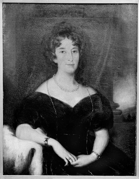 d as a
glue factory. Fortunately, the Swanns recognised the
structure’s historical importance.
d as a
glue factory. Fortunately, the Swanns recognised the
structure’s historical importance.
The buildings were also lucky to survive the wreckers’ ball
which was so enthusiastically utilised in the 1960s
throughout Sydney. When restoration began in the 1970s,
the structure itself was remarkably intact, and so
provides an excellent example of colonial architectural
techniques. Run by the Historic Houses Trust, every attempt
has been made at authenticity. The furniture, as an example
of the restorers’ craft, was reproduced to include the
‘mistakes’ made making Macarthur’s. One bed, for example, is
made with three mattresses: the first of straw, the second
of horse-hair, and the top of feathers; as the mercurial
John shot 300 wild duck at an outing, they were not without
materials. The rooms include kangaroo rugs and lovely
oil-cloth floor coverings. Excellent models depict the
progressions of the house’s development, showing for example
that no verandah existed until 1826.
The volunteers and guides who work here are particularly
dedicated; the farm even has school groups come to perform
‘convict’ tasks. A 10-minute video presentation tells the
history of the Macarthurs, rightly giving most of the credit
for the farm’s success to Elizabeth.
The gardens include some of Macarthur’s original exotic
plants, such as olive trees; the banana plants are not
original, although bananas were grown from the early days.
The farm is now completely encompassed by the suburban
sprawl of multicultural Sydney; a wonderful example of this
new diversity can be seen immediately across the street on
Alice Street, where there are some extremely garish houses.
At the time of writing, most of this neighbourhood appeared
to be Lebanese, as is evidenced in Our Lady of Lebanon
Church also in Alice Street, the church of the Diocese of St
Maroun, Lebanese Christian Church.
From Alice Street, follow the road down the hill towards
Hassell Street and Hambledon
Cottage (t 9635 6924; phone for openning hours
previously open Thurs–Sun 11.00– 16.00; admission
adults $8.00, concession $6.00, children $2.00), an easy
walk to the flatlands of the Parramatta River. Built in
1824, it was originally occupied by Miss Penelope Lucas, the
governess who became Mrs Macarthur’s dearest friend and
confidant. Described by Ruth Park as a ‘charmer’, with its
lovely courtyard and iron roof, the cottage has been
lovingly restored.
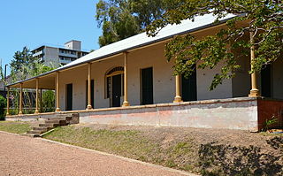 Now turn left (west)
into Harris Street and left again (south) into Ruse Street,
to find at no. 9 Experiment
Farm Cottage (t 02 9635 5655; open Wed.-Sun.
10.30-15.30; admission adults $9.00). This property is under
the auspices of the National Trust. The cottage was restored
in the 1970s to emulate the period 1798–1840.
Now turn left (west)
into Harris Street and left again (south) into Ruse Street,
to find at no. 9 Experiment
Farm Cottage (t 02 9635 5655; open Wed.-Sun.
10.30-15.30; admission adults $9.00). This property is under
the auspices of the National Trust. The cottage was restored
in the 1970s to emulate the period 1798–1840.
Governor Phillip, impressed by the character of convict
James Ruse, provided him the land and some basic implements
as an experiment to determine how long it would take a
hard-working man to become self-supporting. Remarkably, it
took him only about two and a half years to become
thoroughly independent; in his account of the early
settlement, Watkin Tench meticulously describes Ruse’s
efforts.
Before moving to a farm in the Hawkesbury river district,
Ruse sold the land to surgeon John Harris who in 1798 built
the house which is supposed to be the second oldest building
in the country. Purchased in 1960 by the Trust for £9000,
the restoration focuses not only on the history of the house
itself, but on the remarkable story of James Ruse and his
agricultural achievements.
Government Domain
From O’Connell Street walk north to Macquarie Street, turn
left to enter Parramatta Park, the original government
domain. Old
Government House (t 02 9635 8149; open Tues–Sun
10.00–16.30; admission adults $16.00, concession $14.00,
children $8.00), built in 1799, is the oldest public
building in Australia, and always filled with visitors.
Operated by the National Trust, the building has been
beautifully restored, with guided tours and extensive
historical material available on site.
Exit through the Tudor Gatehouse; the present structure
replaced the original Macquarie gatehouse, and was erected
in 1885 to a design of a local architect, Gordon MacKinnon.
Just before leaving the park is the Fitzroy Tree with a
memorial obelisk alongside, commemorating the spot where, in
1847, Governor Fitzroy’s wife was killed when her carriage
overturned against the oak.
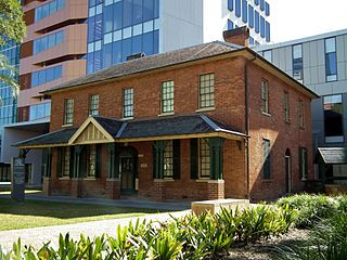 On exiting the park,
you will find yourself on George Street; walk east one block
to Marsden Street; on the corner is the Brislington
Medical and Nursing Museum (t 02 4751 4360; admission
$2.00; open Tues. and Thurs. 10.30-14.00), in one of the
oldest Parramatta houses. It was built in 1821 for
emancipated convict John Hodges; a diamond design in the
back wall commemorates Hodges’ winnings at euchre (a card
game) with an eight of diamonds. Formerly known as
Brislington, it was for nearly 100 years the ‘doctor’s
house’, owned by the Brown medical family.
On exiting the park,
you will find yourself on George Street; walk east one block
to Marsden Street; on the corner is the Brislington
Medical and Nursing Museum (t 02 4751 4360; admission
$2.00; open Tues. and Thurs. 10.30-14.00), in one of the
oldest Parramatta houses. It was built in 1821 for
emancipated convict John Hodges; a diamond design in the
back wall commemorates Hodges’ winnings at euchre (a card
game) with an eight of diamonds. Formerly known as
Brislington, it was for nearly 100 years the ‘doctor’s
house’, owned by the Brown medical family.
Across the street where the Courthouse now stands, was
the Woolpack Inn, dating from 1821 (and the location for
Hodges’ game of euchre); earlier on this site, First Fleet
convict James Larra had a hotel. Larra is often referred to
as Australia’s first Jewish landowner. Across George Street
is the Woolpack Hotel, built in 1890 when the licence was
transferred from the old inn, making the hotel that with the
oldest renewed licence in Australia.
Walk north on Marsden Street to Marist Place and St
Patrick’s Church and Presbytery, the site of some of the
first Catholic services in the colony in 1803; there was an
uncompleted church structure here in 1828, a few years
before the arrival of the first bishop, Bishop Polding. A
second church built in 1834 was declared unsound by 1853,
and a larger building, designed by James Houison, was
erected in 1854–59, with the spires added in 1878–83. An
arsonist’s fire gutted the historic structure in 1996;
parishioners and city officials have begun to rebuild it.
Around the corner west on O’Connell Street is Roseneath
Cottage, a simple Georgian structure, built in 1837 for
Janet Templeton, a Scottish widow who arrived in the colony
with eight children and a flock of merino sheep. As evidence
of the kind of dwellings that once characterised Parramatta,
it is a relief that it has survived the town’s modern
transformations.
One has to search hard now to find these reminders of
Parramatta’s colonial history. As the shopping centre of the
western suburbs, this is perhaps to be expected, but urban
sprawl has overwhelmed it almost entirely.
Towards Penrith
From Parramatta, you might continue on the M4 motorway,
zooming past the fibro-and-brick houses of many suburbs en
route to Penrith and then the Blue Mountains. Or, at
Hawkesbury Road west of Parramatta, you can transfer back to
the old Great Western Highway (route 44) to travel more
sedately through the suburbs themselves. It is also possible
to take the train all the way from Central Station to
Penrith (and indeed into the Blue Mountains) with frequent
stops.
If driving, when you reach St Mary’s, turn off at Mamre Road
to the south to come to Mamre
homestead (t 02 9670 5321), the original
farmhouse of Rev. Samuel Marsden, early Sydney’s ‘flogging
preacher’. Despite his fearsome temper, Marsden was
apparently an efficient farmer, and developed this area,
explored by Watkin Tench in 1789, into good farming and
grazing land; Marsden sent the first shipment of Australian
wool to England. The homestead is now open to the public,
run by the Sisters of Mercy, with a craft shop and tea room
and historical displays. The name apparently refers to the
biblical ‘Oak of Mamre’ under which Abraham lived. The house
is a two-storey Georgian structure with verandahs,
constructed of sandstone c 1830.
Off the Great Western Highway c 1.5km from Mamre Road, turn
north on Werrington Road; c 3km, near the Werrington train
station, is the privately owned Werrington
House, built in 1829–32 of local stone for the
Lethbridge family. The house’s design is based on the
family’s Cornish home. The land on which the house was built
was originally granted to Mary Putland in the early 1800s;
Putland was Governor Bligh’s ‘arrogant’ daughter, who had so
vigorously defended him when he was deposed as Governor.
Near the Werrington train station is a campus of the
sprawling University of Western Sydney, a product of the
amalgamation of several polytechnic colleges. The
university, with campuses throughout Western Sydney, is now
concentrating on the arts, and is quickly growing into one
of the state’s most innovative educational institutions.
Penrith
Another 5km west is Penrith (population 150,000), founded in 1789 when Watkin Tench and his party explored the region and discovered the Nepean River, which was named after the Secretary of the Admiralty. A flat, broad river that tumbles into the spectacular Nepean Gorge some 20km upstream, the river is actually a tributary of the Hawkesbury River. The Nepean Belle, a paddlesteamer boat, takes tourists on trips from Penrith about on the Nepean. The river at Penrith is also to be the site of the rowing competitions during the Olympic Games. The rowing sprint course begins at Victoria Bridge, originally built in the 1860s to bring the railway to the Blue Mountains. Today, Penrith is quite suburbanised, with the Penrith Panthers League Club on Mulgoa Road a glitzy centre of entertainment. Still, historic bits remain and Penrith’s agrarian roots are evident in the landscape around it, with the sense that the Blue Mountains are very near. The tourist information office is in the car park of the Penrith Panthers Club on Mulgoa Road, t 02 4732 7671.
Local heritage is well-presented at the Arms of Australia Inn History Museum, on the corner of Gardenia Avenue and the Great Western Highway in Emu Plains (across the Victoria Bridge; t 02 4735 4394; open Mon, Wed, Thurs 9.00-14.00, first and third Sun 13.00-16.00; admission adults $6.00, concession and children $4.00). The Archives Room, run by the Nepean District Historical Society, is available through appointment for students and interested citizens. The inn itself was built in 1840 by John Mortimer.
North Sydney and the north shore
Crossing the Harbour Bridge by foot or train, or taking one of several ferries, brings you to Sydney’s North Shore. A harbour tunnel now also travels under the harbour itself. The city of North Sydney has become a high-rise commercial enclave of its own, and the suburbs on this side have a distinct character. Many Sydneysiders would maintain that ‘North Shore’ types are a breed apart, entirely removed from the more down-to-earth concerns of those on the south side. The suburbs closest to the harbour are indeed some of the most exclusive in the city, and the views across to the Opera and Circular Quay are stunning. The North Shore is also the site of several inner harbour beaches, including the quite popular Little Sirius Cove in Mosman.
North Shore’s earliest development was as a residential settlement. A township site was laid out in 1838, to be known as St Leonards, but it never materialised as planned, although St Leonards is today one of the many suburbs along the Pacific Highway north.
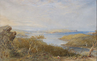 One
of the first permanent settlers on the shoreline was the
artist Conrad Martens, who in 1844 lived in what is
present-day St Leonards. Here he produced an abundant
number of watercolours depicting the harbour and the town
itself. Other pioneers, especially loggers, had already
penetrated the woodlands beyond the bay’s shore, and
whalers established an industry in the area of present-day
Mosman. By the 1850s, vast tracts of land were in the
hands of a few landholders whose names have now been given
to the suburbs created out of their original estates. The
first white settler was William Henry, who received a land
grant here of 1000 acres (400 ha) from Governor Bligh, to
whom he remained loyal, even after the governor’s ousting
in 1808.
One
of the first permanent settlers on the shoreline was the
artist Conrad Martens, who in 1844 lived in what is
present-day St Leonards. Here he produced an abundant
number of watercolours depicting the harbour and the town
itself. Other pioneers, especially loggers, had already
penetrated the woodlands beyond the bay’s shore, and
whalers established an industry in the area of present-day
Mosman. By the 1850s, vast tracts of land were in the
hands of a few landholders whose names have now been given
to the suburbs created out of their original estates. The
first white settler was William Henry, who received a land
grant here of 1000 acres (400 ha) from Governor Bligh, to
whom he remained loyal, even after the governor’s ousting
in 1808.
The first train stop, and the endpoint after walking across the bridge, is Milson’s Point. James Milson was one of the area’s first free settlers, who ran a dairy here and was one of the founding members of the Royal Sydney Yacht Squadron.
Kirribilli
At this point, you can either walk east into the
commercial centre of North Sydney itself, or west into the
pleasantly undulating streets of Kirribilli (an Aboriginal
word allegedly meaning ‘place for fishing’). From the
shoreline at Kirribilli, there is the most spectacular
view of the Harbour Bridge, the harbour, and across to
Circular Quay and the Opera House at Bennelong Point. The
small winding streets of the suburb also present
structures of every architectural style, from elegant
apartment houses to Federation cottages. Many of these
houses are now private hotels, most of them quite
inexpensive (and some a bit spooky; check out the
clientele before accepting your booking).
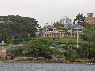 Kirribilli Point
is the site of Admiralty House, built in 1845 by the
Collector of Customs J.G.N. Gibbes. From the 1880s the
house served as the residence of admirals of the British
Fleet; it is now the Sydney residence of the New South
Wales Governor-General. Next door on Kirribilli Avenue,
and joined by extensive gardens, is Kirribilli House,
built in the 1850s in Gothic Revival style for merchant
Adolf Frederick Fez. It now serves as the residence of the
Prime Minister when he is not in Canberra. John
Howard, quite controversially, chose to use this as his
permanent residence rather than move to the national
capital’s official residence, The Lodge.
Kirribilli Point
is the site of Admiralty House, built in 1845 by the
Collector of Customs J.G.N. Gibbes. From the 1880s the
house served as the residence of admirals of the British
Fleet; it is now the Sydney residence of the New South
Wales Governor-General. Next door on Kirribilli Avenue,
and joined by extensive gardens, is Kirribilli House,
built in the 1850s in Gothic Revival style for merchant
Adolf Frederick Fez. It now serves as the residence of the
Prime Minister when he is not in Canberra. John
Howard, quite controversially, chose to use this as his
permanent residence rather than move to the national
capital’s official residence, The Lodge.
Blue’s Point
At the very tip of McMahons Point on the other side
of the bridge is Blue’s Point, named for a fascinating
early Sydney character, a black Jamaican named Billy Blue
who was transported in 1801. Dubbed the Old Commodore by
Governor Macquarie, Blue ran the ferry service from this
point to the other side of the harbour for many years. It
is said that he often had his passengers do the rowing and
sometimes changed the price of the trip in midstream. He
fathered a family after he was 70, two of his daughters
marrying other prominent North Shore pioneers, George
Lavender, for whom Lavender Bay is named, and James French
of French’s Forest.
Blue’s Point is now the site of Blue’s Point Tower, one of
Harry Seidler’s early ‘skyscraper’ apartments (1961–62),
considered a modernist eyesore along the shoreline. Blue’s
Point Road, running into Miller Street in the congested
centre of town, is one of the major thoroughfares of lower
North Sydney.
McMahons Point
The little neighbourhood of McMahons Point is now a tremendously gentrified location, filled with tastefully renovated period townhouses. To have a McMahons Point address is to have arrived, an ironic transformation from its early working-class status. Poet Henry Lawson lived here with his aunt in 1892, near the present-day approach of the bridge. He lived in the area again in the early 1900s; a plaque at 23 Euroka Street, commemorates his residence in 1914.
Lavender Bay and Luna Park
One of the best ways to get to
MacMahons Point and Lavender Bay is to take the Hegarty’s
ferry, a private ferry company, from Bay 6 in Circular
Quay; the ride gives a spectacular view under the bridge
and into this unpretentious little bay. Lavender Bay was
the site of the artist Brett Whiteley’s studio in the
1960s and 1970s, when the area was still rather
down-at-the heels and genuine. From here, you can stroll
along the foreshore with great views of the harbour and
Sydney city with the high-rise buildings of North Sydney
behind.
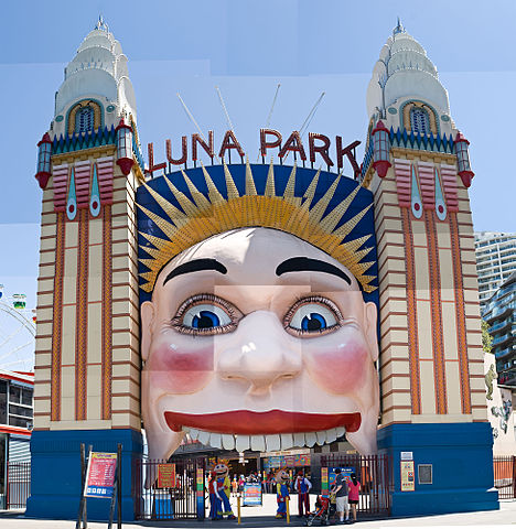 Right
under the bridge at Milson’s Point on Lavender Bay is Luna Park. This
amusement park has been a much-loved part of Sydney since
the 1930s, when it was built on the construction site
headquarters of the Harbour Bridge, prime harbourfront real
estate at any time. It has always been a favoured spot for
migrants and American G.I.s on shore leave. Closed down
after a disastrously fatal fire in the 1970s, it was
lovingly restored and reopened with great fanfare, and much
state funding, in 1993. While local residents continually
protest about the Big Dipper’s noise, and threats of funding
loss continue, so far it has managed to remain open. Even if
you are not a fan of carnival rides and greasy food, Luna
Park is worth a visit to see the vintage decorations and
billboard paintings.
Right
under the bridge at Milson’s Point on Lavender Bay is Luna Park. This
amusement park has been a much-loved part of Sydney since
the 1930s, when it was built on the construction site
headquarters of the Harbour Bridge, prime harbourfront real
estate at any time. It has always been a favoured spot for
migrants and American G.I.s on shore leave. Closed down
after a disastrously fatal fire in the 1970s, it was
lovingly restored and reopened with great fanfare, and much
state funding, in 1993. While local residents continually
protest about the Big Dipper’s noise, and threats of funding
loss continue, so far it has managed to remain open. Even if
you are not a fan of carnival rides and greasy food, Luna
Park is worth a visit to see the vintage decorations and
billboard paintings.
Just below Luna Park is the North Sydney Olympic Pool (weekdays 05.30–21.00, weekends 07.00–19.00), beautifully situated next to the waters of the harbour, with lovely Art Deco ornaments on its walls.
City of North Sydney
North Sydney itself contains some interesting
historical sites amidst all the new skyscrapers. At Lavender
Street and Blue’s Point Road, turn left into William Street
to see Sydney Church of England Grammar School, known
locally as SCEGGS or ‘Shore’, and very prestigious indeed.
Given its current status as a leading institution for the
rich and famous, it is surprising to find that the school
was not established here until 1889.
At Mount Street, turn back towards Miller Street; this small
triangle is known as Victoria Cross, and, as the North
Sydney Post Office is here, it is the centre of town.
Designed by James Barnet in 1886, it also houses the Court
House. At the intersection is Greenwood Plaza. The original
building was an Art Deco 1930s structure; a new
post-modernist skyscraper has now been added behind. The
Plaza has become a whole complex, connected to Old School
House (1883), and is now a series of elegant bars, shops and
cafes.
Sydney swimming pools
  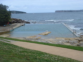 |
Life in Sydney, especially in summer, understandably revolves around water. In addition to traditional, chlorinated pools, Sydney has a number of ocean-fed pools. Each of them have their own atmosphere and aesthetic. In addition to the handful mentioned below, any Sydney-sider will happily volunteer the location and particulars of their favourite pools. North
Sydney Pool (Mon.-Fri. 5.30-21.00, Sat. and
Sun.7.00-19.00; admission adults $7.80, concession
$6.50, children $3,90), Alfred St. Milsons
Point. An Olympic-sized chlorinated pool, for
example, is known for its intimidating
lane-swimmers; if you are in the Very Fast Lane,
watch out. |
On Miller Street, between McLaren and Ridge Streets are
the attractive North Sydney Council Chambers; all kinds of
enlightened social services are available here, from the
Baby Health Clinic, to holiday care and the Stanton Library,
an excellent public facility. The council building itself
includes mural-size copies of the harbour panoramas
originally created in 1875 by Bernard Holtermann (1838–85),
discoverer at Hill End, New South Wales, of the largest
deposits of gold, quartz and slate ever mined. In order to
create these panoramas, Holtermann constructed an enormous
tower overlooking the harbour and had photographs made of
all angles. The chambers’ photograph is placed next to one
made in 1975 of the same view.
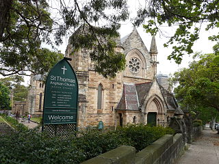 Behind
the Council Chambers, at McLaren and Church Streets, is St
Thomas’s Church, Church Street. This was the last
substantial structure designed by Edmund Blacket; the final
construction was carried out by his sons, and completed in
1884. An older St Thomas’s was on the site from 1843, and it
is in this church’s cemetery that the painter Conrad Martens
and family are buried. The cemetery includes a pyramidal
monument, commemorating Edward Wollstonecraft (1783–1832)
and his sister Elizabeth Wollstonecraft Berry, cousins of
writer and the poet Shelley’s wife, Mary Wollstonecraft. The
monument was erected by Alexander Berry, Edward’s business
partner and founder of the New South Wales town of Berry.
Wollstonecraft also established a 500-acre landgrant at
Crow’s Nest in North Sydney, and the nearby suburb of
Wollstonecraft was named for him. St Thomas’s first rector
in the 1840s was William Branwhite Clarke (1798–1878), a
well-known geologist who is often called the father of
Australian science.
Behind
the Council Chambers, at McLaren and Church Streets, is St
Thomas’s Church, Church Street. This was the last
substantial structure designed by Edmund Blacket; the final
construction was carried out by his sons, and completed in
1884. An older St Thomas’s was on the site from 1843, and it
is in this church’s cemetery that the painter Conrad Martens
and family are buried. The cemetery includes a pyramidal
monument, commemorating Edward Wollstonecraft (1783–1832)
and his sister Elizabeth Wollstonecraft Berry, cousins of
writer and the poet Shelley’s wife, Mary Wollstonecraft. The
monument was erected by Alexander Berry, Edward’s business
partner and founder of the New South Wales town of Berry.
Wollstonecraft also established a 500-acre landgrant at
Crow’s Nest in North Sydney, and the nearby suburb of
Wollstonecraft was named for him. St Thomas’s first rector
in the 1840s was William Branwhite Clarke (1798–1878), a
well-known geologist who is often called the father of
Australian science.
At Ridge and Miller Streets to the east is the entrance to
St Leonard’s Park and the site of North Sydney Oval, in 1987
a tasteful modern pitch replaced a lovely old ground
complete with Victorian stands. It was the home of the North
Sydney Bears Rugby League football team, which, sadly, moved
to Gosford in 1999.
St Francis Xavier’s, on McKenzie Street, was built in 1881.
The church contains a massive stained-glass wall, and
charming wood-carvings of the Stations of the Cross,
completed by German carver Josef Dettlinger in the 1880s.
North shore suburbs
Military Road, on the east side of the bridge, is the
main thoroughfare from the Harbour Bridge to The Spit. The
road is almost always congested, filled with shops and an
unbelievable range of good restaurants. Any drive to Manly
requires traversing its full length to Spit Road. Note also
that the Spit Bridge has specific opening times; be sure to
check before setting out, so that you can avoid delays (t 02
9194 1018).
The first suburb along Military Road is Neutral Bay, so
named by Governor Phillip, because it was designated as the
anchorage for all foreign ships entering the harbour.
In Neutral Bay, at no. 5 Wallaringa Avenue, is Nutcote, home in
the 1920s of illustrator and children’s author May Gibbs,
creator of the enormously popular Snugglepot and Cuddlepie
stories and The Gumnut Babies. The house is open Wed–Sun
11.00–15.00 (t 02 9953 4453; admission adults $10.00,
concession $6.00, children $4.00).
On Military Road, Neutral Bay blends into the suburb of
Cremorne. At no. 380 Military Road is the Hayden Orpheum
Theatre, a marvellous old picture house, built in the 1930s;
admission to the cinema includes, before the film,
performances on the grand old Wurlitzer organ, mounted on a
hydraulic stage that rises majestically in front of the
screen. It was built by Italian immigrant Angelo Vergona,
whose son, Bob, in the 1940s, greeted every guest in the
foyer, and sometimes drove home the last patrons after
late-night screenings.
Cremorne leads east into Mosman, named for Archibald Mosman,
who in the 1820s established a whaling industry here. Today
Mosman is one of the prestige suburbs. The area along the
harbour boasts some of the most ornate Edwardian houses,
complete with copper cupolas and gabled roofs. The Mosman
strip of Military Road is also one of the best places in the
city for upmarket fashion shopping.
Taronga Park Zoo
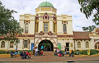
Mosman is also the site of Taronga Park Zoo (t 02
9969 2777; open daily 09.30–16.30, some evenings
17.30–23.30, but telephone first for details; admission
adults $46.00, concession $26.00), undisputably the most
beautifully situated zoo in the world. As already mentioned,
a ferry from Circular Quay arrives at the base of the zoo
and a lift (when operating) brings you to the top of the
hill, from which the views of the harbour and Sydney are
breathtaking. The city’s first zoo was in Moore Park. When
Taronga opened in 1916, all the animals were conveyed by
ferry to the new site, including the much beloved elephant
Jessie, who lived until 1939 and provided Sydneysiders with
the expression ‘a hide like Jessie’s’.
Great attempts have been made in the last few years to
upgrade the animals’ facilities, so that the exhibits are
more comfortable for the enclosed wildlife. The zoo is
active in worldwide breeding campaigns of endangered
species, and Australia’s native species receive particular
attention. As the facility is excessively popular with
school groups and other visitors, it is almost always
crowded. Admission is relatively expensive (the zoo depends
entirely on private funding), although family packages are
also available.
To the south of the zoo—and, indeed, around nearly every point along this part of the North Shore, all the way to Manly—segments of the Sydney Harbour National Park have preserved bushland for walking and recreation. At the end of Bradley’s Head Road is Bradley’s Head, named for First Fleet cartographer William Bradley; you can see here remnants of fortifications installed around the harbour in the 1870s. Bradley’s Head is a superb spot from which to view the start of the Sydney-to-Hobart Yacht Race on Boxing Day (26 December). The sight of the yachts lining up in the harbour for the starting gun is one of the most exquisite visions imaginable, not to be missed by any visitor.
Balmoral
Take Bradley’s Head Road back up to Raglan Street and turn west to come to Balmoral Beach, a lovely inner-harbour spot on Middle Harbour. On the Esplanade is the beautiful 1930s Bathers Pavilion, considered by The Sydney Morning Herald to be one of the ‘best places in Sydney for a lunch or coffee’. The architecture is that of a quasi-Moorish palace. During the Sydney Festival in January, Balmoral hosts performances, ‘Shakespeare by the Sea’, by the Sydney Theatre Company, and concerts take place in the Rotunda.
North of North Sydney
If you continue out of North Sydney on Miller Street,
it turns into Strathallen Avenue; when this street ends,
turn left (west) to Eastern Valley Way, and enter
Northbridge. This now thoroughly urbanised part of town is
entered through an elaborately crenellated bridge that
appears as if it is part of a medieval castle. It was built
in the 1890s by the area’s land developer as a ploy to lure
potential buyers.
At Edinburgh Road, turn right (east) to enter Castlecrag, a
residential community planned by Walter Burley Griffin,
designer of Canberra. Several of his houses, all bearing the
mark of his teacher Frank Lloyd Wright, still exist, set
back and blending into the craggy cliffs and twisting roads
above Middle Harbour.
Back on Eastern Valley Way, continue north through the
suburban sprawl of Chatswood. This area is named in honour
of the wife of Richard Hayes Harnett, an early settler of
land from Willoughby to Mosman. Charlotte, or ‘Chat’, loved
to sketch the wildlife in the forests of the area, which
thus became known as ‘Chat’s wood’.
Northern beaches
Eastern Valley Way will become Warringah Road (Route
29) at Roseville; continue east to Wakehurst Parkway (Route
22) to Pittwater Road (Route 14), turning east into
Barrenjoey Road. This route will pass the beautiful northern
beaches of Bilgola, Avalon, Palm Beach and Whale Beach,
ending finally at Barrenjoey Head, part of the vast
Ku-ring-gai Chase National Park. The no. 12 bus from Manly
Wharf also travels along this coastline to Pittwater,
including the popular beaches of Curl Curl, Dee Why and
Collaroy.
At Barrenjoey Head, the view across the Bay and out into the
Tasman Sea is worth the trip. As novelist C.J. Koch
describes the Barrenjoey Peninsula in The Doubleman (1985),
‘the latitude is the South Seas; and the time, for the
Peninsula’s cargo of beachside suburbs, is always holiday.’
Ku-ring-gai Chase National Park
Encompassing the entire end of West Head Road and across
Pittwater at Barrenjoey Headland, Ku-ring-gai
Chase National Park consists of 14,712 ha of bushland
only 24km from the city itself. It was set aside in 1894,
and is one of Sydney’s most popular recreational sites; the
name derives from the Guringai people, the local Aboriginal
clan. Damage from the 1994 bushfires was extensive, but
regrowth of natural bush has been speedy.
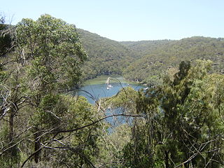 To enter
the main part of the national park, return via Barrenjoey
Road, turn north into Pittwater Road, and follow around
Church Point to the toll booth at West Head Road; there is
an entrance fee of $12.00 per vehicle.
To enter
the main part of the national park, return via Barrenjoey
Road, turn north into Pittwater Road, and follow around
Church Point to the toll booth at West Head Road; there is
an entrance fee of $12.00 per vehicle.
The park’s main visitor centre is the Kalkari
Discovery Centre (t 02 02 9472 9301, open daily
09.00–17.00), where brochures and guided tours are
available; this centre can be reached by taking Ku-Ring-Gai
Chase Road off the Pacific Highway in Mt Colah. The railway
also stops at Mt Colah near the park’s entrance. Shorelink
bus no. 577 also leaves from the Turramurra Station to the
Bobbin Head Road entrance of the park.
Perhaps the most enjoyable way to come to the park is via
ferry. The ferry from Palm Beach Wharf will stop at The
Basin Entrance to the park, and provides a marvellous tour
of Broken Bay itself.
The park is the site of several Aboriginal carvings which
can be visited, especially along the Basin Trail off West
Head Road on the Lambert Peninsula. This part of the park
also offers spectacular views of Pittwater, Palm Beach, and
Warringah Peninsula. A community project in the park and the
rest of the Pittwater region is attempting to ensure the
future of the long-nosed bandicoot, a small native marsupial
once abundant in number and now decimated by feral and
domestic animals.
Pittwater
Governor Phillip explored the Pittwater region in 1788,
describing it as ‘the finest piece of water which I ever
saw... it would contain all the Navy of Great Britain’. He
named the region after British Prime Minister William Pitt.
As mentioned above on access to Ku-ring-gai Chase National
Park, exploration of Broken Bay is most enjoyable on the
Palm Beach Ferries, leaving from Palm Beach Wharf. Several
boat hire options are also available from Palm Beach, to
explore the bay and on into the Hawkesbury River. Another
exciting possibility is to take the regular commuter flight
of the Sydney Harbour Seaplanes, flying from Rose Bay along
the coastline to Palm Beach.
Palm Beach
That a regular commuter flight is available to Palm
Beach gives some indication of the privileged status of the
place. It is home for many people in the arts and wealthy
businessmen. The place has also been associated in the
public eye with shady political doings, as the site of some
famous weekend party deals; writer Peter Corris plays on
this image in his story Heroin Annie (1984), in
which his investigator Cliff Hardy comes here to bust a drug
ring and refers to Palm Beach as ‘the biggest playspot of
them all...all chicken fat and pinballs and the popping of
cold, cold cans.’ Recent attempts by beachside landowners to
privatise the beach itself has been greeted with horror; the
idea of owning a beach is seen as completely un-Australian,
no matter how exclusive the area might be.
The ‘Macquarie towns’ ~ Richmond and Windsor
From Penrith, you can take Parker Street/Richmond Road
(route 69), which becomes the Great Northern Road to the
twin Macquarie towns of Windsor and Richmond along the
Hawkesbury River, some 55km from Sydney. From the city, you
can take the M2 Motorway. The train also travels all the way
to Richmond, with a stop at Windsor. Many tours to the towns
are organised by the Tourist Information Bureau as well;
check at any of the city offices, particularly at the
services at the Circular Quay.
The M2 Motorway is now a completely concealed freeway from
Lane Cove on the north side of Sydney Harbour, zipping past
the countryside northwest to Windsor Road; the old road
closely follows the original Windsor Road of 1794. The Old
Windsor Road route will take you through Ryde, location of
the first hops-grower and brewer in the colony, James
Squire. Squire also befriended the famous Aborigine
Bennelong after his return from England in 1794; Bennelong’s
grave is believed to be in the Ryde district.
The Ryde district’s other great claim to fame is as the site
where Maria Ann Smith, better known as ‘Granny Smith’, first
cultivated her famous apples in the 1860s. A small park to
her memory exists in nearby Eastwood, off Abuklea Road on
Threlfall Street, the location of her original orchard.
Today it is hard to imagine that the area along the M2 at
Pennant Hills was in the 19C teeming with bushrangers where
the suburban homes are now thick on the hills looking over
the city. Drive through Castle Hill, site of one of the two
armed uprisings in Australia, the Battle of Vinegar Hill,
brought about in 1804 by Irish political prisoners
attempting to escape. The ‘battle’ was quickly quelled by
authorities, leaving 15 dead; nine of the ‘conspirators’
were hanged for their attempts at insurrection.
Continue along the Windsor Road (route 40 and 2) to Rouse
Hill. The area was named for Richard Rouse, free settler and
Superintendant of Public Works in 1806. In 1813–18, Rouse
built Rouse
Hill House (t 02 9627 6777; open for guided tours
Wed.-Sun. 10.00-16.00; admission adults $12.00, concession
$8.00), now part of the National Estate. Despite many
additions to the original dwelling, the house still survives
intact, as one of the earliest private country dwellings in
the country and with many of the original furnishings. Of
special interest are its outbuildings and the gardens, still
extant in its original design. For 162 years, until taken
over by the New South Wales government in 1979, descendants
of Richard Rouse occupied the property.
The Hawkesbury region was explored by Governor Phillip
in his desperate attempt to find farmland for the colony. By
1794, 22 pioneers had settled along the river, and by 1796,
some 1000 acres (400 ha) were under cultivation here. Of
most importance to the colony was the success of grain
farming in the region, but soon all kinds of produce
flourished and reached the Sydney markets via the river. The
river itself, then, became a centre of great activity,
including a vigorous boat building industry.
Windsor
Although it was named Green Hill by the original settlers, Windsor (population 13,500) was the name given by Governor Macquarie in 1810 when he established the ‘Five Macquarie Towns’; these were Windsor, Richmond, Wilberforce, Pitt Town and Castlereagh. Macquarie selected these sites on high land to avoid the river floods which habitually plagued early settlements, and along with the inveterate architect Francis Greenway, indulged his passion for town planning and architectural ambition. The towns today still retain evidence of this planning and the original buildings—even the street curbs and guttering are those built by convicts—are still home to the descendants of the first settlers. Tourist information, including waling tours of Richmond and Windsor, can be obtained from Hawkesbury Visitor Centre, Ham Common Bicentary Park, Richmond Road, Clarendon, t 02 4560 4620; open Mon.-Fri. 9.00-17.00, Sat. and Sun. 9.00-16.00.
Entering Windsor from the M2 at Macquarie Street leads to Thompson Square, the centre of the town. The train stops at Church Street south of the Richmond Road; walk north on George Street to come to Thompson Square. Substantially restored as part of a Bicentennial project, Thompson Square’s numerous colonial buildings now remain as a monument to the Hawkesbury pioneers. The square owes its name to the first landowner Andrew Thompson, an emancipist whom Macquarie so admired for his diligence and ambition that he made him magistrate. Thompson died heroically in 1810, after valiant efforts to save lives and property during one of the Hawkesbury’s many floods.
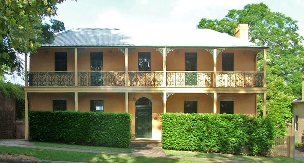 On the southeast
corner of the square is the Macquarie Arms, built to the
order of Governor Macquarie in 1811–15. The inn was built
and operated from 1815 to 1840 by ex-convict Robert
Fitzgerald, who became the richest man in the town. The
building includes excellent cedar joinery and stone
verandahs. Next door to the Macquarie Arms is the Hawkesbury
Museum (t 02 4560 4655; Wed–Mon 10.00–16.00; free
admission), housed in an 1820s building that was originally
an inn. Along with historical displays, the museum is also
the Tourist Information Centre. The next structure on the
square is a small cottage from the 1850s, privately owned;
next to the cottage towards the river is the Doctor’s House,
so named because doctors have lived here since the 1870s.
The structure itself dates from 1844 and is a great example
of a colonial terrace building, with fanlights above the
doors and columns flanking the doorways.
On the southeast
corner of the square is the Macquarie Arms, built to the
order of Governor Macquarie in 1811–15. The inn was built
and operated from 1815 to 1840 by ex-convict Robert
Fitzgerald, who became the richest man in the town. The
building includes excellent cedar joinery and stone
verandahs. Next door to the Macquarie Arms is the Hawkesbury
Museum (t 02 4560 4655; Wed–Mon 10.00–16.00; free
admission), housed in an 1820s building that was originally
an inn. Along with historical displays, the museum is also
the Tourist Information Centre. The next structure on the
square is a small cottage from the 1850s, privately owned;
next to the cottage towards the river is the Doctor’s House,
so named because doctors have lived here since the 1870s.
The structure itself dates from 1844 and is a great example
of a colonial terrace building, with fanlights above the
doors and columns flanking the doorways.
Continue to walk towards the river, cross over The Terrace and turn right onto a walkway, which will lead under a bridge to the river. From here you can see Windsor Wharf. Walk up the hill and return to Thompson Square. Houses on this side date from the 1850s and 1860s. Cross George Street to the site of the School of Arts, built in 1861 in an Italianate style; it is now a boot factory. Turn north onto George Street and walk one block to Arndell Street; on the left side of the street is a plaque commemorating the site of Old Government House, built here in the 1790s. Turn into Arndell Street; on the left at North Street are a series of cottages built 1840–60, some of the only examples of this period remaining. On the corner is the Swallows Inn, so named because of the fairy martin nests under the eaves; the building also served as the surgery in the television series ‘A Country Practice’.
Walk down North Street for a view of the farmland near the town; turn right into Palmer Street and continue to a set of buildings called the John Tebbutt F.R.A.S. Observatories (t 02 4577 7306). Here the famous amateur astronomer John Tebbutt (1834–1916) first set up his observatory in 1863; the building now on the site was built in 1879. Here Tebbutt established local mean time, discovered the Comet Tebbutt of 1881, and published some 370 accounts of meteorological observations. Tebbutt was such an important figure in astronomical circles that he appeared on the Australian $100 note in the 1980s. The observatories are still owned by the Tebbutt family; they are now open to the public, particularly for weddings and similar celebrations.
Return via Palmer Street to Pitt Street; turn left and walk to the corner of Court Street. Here is the Windsor Courthouse, built in 1822 by William Cox (of Blue Mountain exploration fame) to the design of Francis Greenway. It is considered by many as Greenway’s most harmonious building and one of the best preserved, built of sandstone bricks with worked stone lintels and sills. The interior includes rough cedar beams; it still serves as the town’s courthouse. In the public gallery is a controversial portrait, believed by many to be of Governor Macquarie, although debate about its authenticity continues.
Off Court Street, turn left onto a footpath leading to
the Tollhouse, a reminder of the old toll system on the
roadways. The current building dates from the 1880s; its
unrestored condition points to the continuation of flooding
along the river. Return to Bridge Street and proceed into
Thompson Square and then right (west) onto Baker Street;
turn left (south) onto The Terrace along the river. Between
Kable and Fitzgerald Streets is Sunnybrae, built in 1875 and
still owned by the same family. Continue on The Terrace,
cross the small park by the water tower, built in 1889. At
New Street are two cottages from 1830; continue down the
Terrace to Catherine Street and turn left to Little Church
Street, on the corner of which is the Bell Inn, built c 1845
with an interesting barrelled corner. Walk down Little
Church Street and note St Matthew’s Catholic Church, built
in 1840.
At Tebbutt Street turn right and return to The Terrace; on
the left, on what is now Moses Street, is the Rectory and St
Matthew’s Anglican Church, Francis Greenway’s most memorable
building. The site was chosen by Macquarie expressly for
building a church; its elevated position led it to become
the district’s most famous landmark, as it could be seen
throughout the Hawkesbury region. The church is built of
bricks produced by William Cox; its most stunning feature is
the sculptural square tower with octagonal cupola. When the
foundation stone was laid in 1817, Governor Macquarie placed
a Spanish dollar under the stone; it was stolen that night.
After another ceremony led to the same result, the stone was
quickly laid without the coin and built over. Halfway
through the building, Greenway, angry at the building
contractor’s shoddy workmanship, demolished the entire
structure and rebuilt it. It was consecrated in 1822 by the
fiery colonial chaplain Samuel Marsden. Marsden in fact died
here, at the rectory, while visiting a friend in 1858. In
the church’s portico is the Bible, along with the clock and
bell tower, presented to the congregation by King George IV.
The rectory was built in 1825 by William Cox; the architect
is unknown, but its Georgian design complements Greenway’s
church. The church’s cemetery contains the graves of Andrew
Thompson, for whom Thompson Square was named, and explorer
William Cox, as well as the Tebbutt family vault.
Past the cemetery is Claremont Crescent; Claremont Cottage
was built in 1822 out of stuccoed brick either by John Jones
or William Cox.
Return to Moses Street, turn right and cross Richmond Road
into Cox Street; turn right onto Fairfield Avenue to reach
the High Victorian mansion of Fairfield House. The first
part was built as early as 1833, again for William Cox. In
1866, it was acquired by the McQuade family, who added the
two-storey northern wing in the 1880s. William McQuade was
the manager of Her Majesty’s Theatre in Sydney and lived in
opulent style; he even had a private race track here.
From Fairfield, head back to Barbyn Street; turn left into
George Street. No. 394 was built in 1897 as a general store
by George Robertson; the façade includes interesting carved
stonework. Further along George Street past the Richmond
Street crossing is Oxalis Cottage, between the city council
chambers and the library. It was built in the 1850s by
Wesleyan missionary Peter Turner. At no. 312 is Mrs Cope’s
House, a large five-bay Georgian structure with 15-pane
windows; it was once home to one Maria Cope, who apparently
owned extensive grounds here in the 1830s. At no. 266 is the
old Royal Theatre, now the Windsor Antique Markets. George
Street soon becomes a pedestrian mall and ends back at
Thompson Square.
Author Ruth Park, in her 1973 guide to Sydney,
considered Richmond the prettiest of the Five Macquarie
Towns. Only 8km from Windsor, at the end of the train run,
the town used to be the busiest in the area, as it was at
the convergence of the main trading roads. The railway line
was opened in 1864, linking Richmond directly with Sydney.
The Richmond RAAF Base now dominates the road linking
Windsor and Richmond, and a major campus of the University
of Western Sydney, emphasising agriculture and animal
sciences, occupies a large expanse of land to the south of
town.
From the train station, you enter Richmond at Richmond Park,
once the town’s market square. To the west of the park is
the Post Office, built in 1875, with a second storey added
in 1888. Further west on West Market Street is St Andrew’s
Uniting Church, built in 1845 as a Presbyterian Church by
George Bowman, Richmond’s leading philanthropist. A memorial
to Dr Andrew Cameron in front of the church demonstrates the
significance of the Cameron family to the Richmond area;
James Cameron was the minister of the Presbyterian church in
the 1860s, and was married to Bowman’s daughter. Across West
Market Street is the Masonic Lodge, built as the
Presbyterian School in the 1860s. Next door, on the corner
of March Street, is the old School of Arts building, opened
in 1866 by politician Henry Parkes. George Bowman was again
involved in the organisation of this public institution.
Further west on March Street are interesting early houses,
and in the middle of the block, the offices of Shaddick
Baker and Paul, with fine iron lacework and a bull-nose
verandah; the original structure was built in 1868, with
sympathetic additions made in the 1980s.
On the corner of March and Bosworth Streets, turn right and walk to Windsor Street. On the southeast corner is the site of the Black Horse Inn—now only the roof line is visible—once the most famous hotel in the region. The inn opened in 1819 and for years was known for its sign of a black horse in full gallop (now in the Hawkesbury Museum in Windsor). At one time the inn marked the centre of town, and was the finishing post for horse races down the main street. The inn served as the polling place in Australia’s first election in 1843; it was also a popular honeymoon destination until it closed in the 1920s.
Turn left into Windsor Street, the oldest residential section of the town. No. 315, now the Richmond Restaurant, was built in 1865 by the Cornwell family, and was known as ‘the Cottage. Across the street is Bowman Cottage, built 1815–17 by free settler James Blackman; it was acquired by George Bowman in 1820, and was run as the Royal Arrow Inn. Bowman lived here until his death in 1878. Today it is the local headquarters of the National Parks and Wildlife Service (t 02 4588 2400; open Mon–Fri 08.30–16.30).
Towards the end of Windsor Street past Chapel Street is St Peter’s Church of England, a rectangular brick church built between 1837 and 1841 to a design by Francis Clarke, a prominent architect; this is only one of two surviving works by him. The interior is intact, with beautiful cedar work and stained glass windows added in the 1890s. In the churchyard, a small obelisk was made out of the bricks of the 1810 school-church once on the site. William Cox was also involved with the early construction of the church. From the churchyard you have a panoramic view of the Blue Mountains to the northwest, with Pughs Lagoon in the foreground. The church’s cemetery was first laid out in 1811 under Governor Macquarie’s direction, and bears the graves of several prominent pioneers, including the remarkable ex-convict Margaret Catchpole (1762–1819), who served as a midwife in her Richmond years. Catchpole became something of a legend in her native Suffolk (England), with a highly fictionalised account of her adventures made popular through Richard Cobbold’s The History of Margaret Catchpole: A Suffolk Girl (1845). Other graves include those of the Bowman family, and William Cox, Sr.
 Back along Windsor Street, turn
left at Chapel Street. On the corner of Chapel and Francis
Streets is ‘Josieville’, built in the 1830s for Joseph Onus,
a convict who arrived in Australia in 1803 and went on to
become one of the most prosperous farmers in the Hawkesbury
region. The additional storey was added in the 1870s,
creating a great two-storey verandah. Also on Francis Street
is Clear Oaks Homestead, also owned by the Onus family; the
two-storey brick farmhouse dates from the 1820s.
Back along Windsor Street, turn
left at Chapel Street. On the corner of Chapel and Francis
Streets is ‘Josieville’, built in the 1830s for Joseph Onus,
a convict who arrived in Australia in 1803 and went on to
become one of the most prosperous farmers in the Hawkesbury
region. The additional storey was added in the 1870s,
creating a great two-storey verandah. Also on Francis Street
is Clear Oaks Homestead, also owned by the Onus family; the
two-storey brick farmhouse dates from the 1820s.
Far at the end of Chapel Street is ‘Hobartville’, a fine
sandstock brick mansion built for William Cox Jr, possibly
from a design by Greenway. The property is still in private
hands, but you can view the house with its three-sided
verandah bay in beautiful grounds.
Proceed along Windsor Street back into town. On the other
side of Richmond Park, at East Market Street, is Toxana,
residence of William Bowman, George Bowman’s younger
brother. It was built in the 1840s and stood in magnificent
grounds. The Cameron family lived here in the 1880s, but by
the 1890s, the building had a variety of owners and
lamentable incarnations. It was restored in 1978, and is now
used by the Macquarie Towns Arts Society.
Continue along Windsor Street, turning left into Toxana
Street. On the right at Francis Street is Benson House,
built in the 1840s by the shipwright Benson’s. The upper
floor was added in 1900, but the bottom storey and servants’
quarters are original. Continue along Francis Street c 1km
and turn right into Jersey Street; here is the Presbyterian
Cemetery, which dates from the 1860s and includes the graves
of the Camerons and the Bowman family vault.
Going back to Windsor Street, at the corner is a modern
Catholic church on the site of St Monica’s, first
consecrated in 1854. Turn right into Windsor Street; the
first cottage on the southern side was the shop and
residence of Bob Eggleton, prominent Richmond wheelwright in
the 1860s. The building is typical of the kind of tradesman
shops that existed here in the mid-19C.
No. 89 Windsor Street is the Manse, an 1890s Presbyterian
school. In the grounds are the incongruous Kamilaroi Gates,
all that remain of a grand house built in the 1890s by
Benjamin Richards, one of Richmond’s wealthiest citizens.
The house was used as a school from the 1920s until 1956,
when it was demolished.
At the corner of Windsor and Paget Streets is Andrew Town’s
House. It was from this point that the old horse races to
the Black Horse Inn began. Appropriately, Andrew Town was
one of Australia’s most famous horse breeders and racing
figures; in the 1880s, he had the largest pedigreed stock in
the world, until the 1890s depression saw him lose his
properties.
Finally, at no. 126 is ‘Heritage Cottage’, which displays
three period rooms from the 1850s, along with the
ever-present tea-room that occupy nearly every historical
venue in the country.
Windsor to Wiseman’s Ferry
To the west of the Hawkesbury River at Windsor, route 69 travels north to Wilberforce, another of the Macquarie Towns, and now best known as the home of Bill McLachlan, who introduced water-skiing to the Hawkesbury. Appropriately, Wilberforce is now home to one of the world’s leading water-ski speed races, 50km from Brooklyn up to this point. The town of Wilberforce still has a few old buildings, including a ‘Macquarie’ schoolhouse, built in 1819 by John Brabyn; it was here that the famous bushranger Thunderbolt (Fred Ward) went to school. Edmund Blacket also built a church here, St John’s, in 1856. Nearby to the west in Freeman’s Reach is ‘Reibycroft’, one of the district’s oldest farmhouses, built for the ever-acquisitive Reibey family in the 1820s.
From Wilberforce, the Sackville road continues north to
a ferry crossing on the river; at Ebenezer, c 5km,  is a rectangular
stone Presbyterian Church (now Uniting Church), built by
Scottish farmers between 1807 and 1817 overlooking the
Hawkesbury River; it is the oldest extant church in
Australia.
is a rectangular
stone Presbyterian Church (now Uniting Church), built by
Scottish farmers between 1807 and 1817 overlooking the
Hawkesbury River; it is the oldest extant church in
Australia.
Further north on route 69 is Colo and the Wollemi National Park (t 02 4588 2400). Only 100km northwest of Sydney, the park of 487,648 ha is the state’s largest and most unpolluted wilderness, with spectacular canyons and gorges. There is an old railway tunnel near the ruins of the old settlement of Newnes that is filled with glow-worms. The park is also the location of the recently discovered Wollemi Pine, the world’s oldest species of tree. These trees are in completely inaccessible locations. Their whereabouts are carefully guarded from any human intrusion by the Parks and Wildlife Service, whose rangers discovered them (as reported in The Sydney Morning Herald, 7 June 1997). The Colo River, reached by following Bob Turner’s Track, provides swimming possibilities and scenic beaches.
On the eastern side of Windsor, route 65, the Pitt Town - Cattai Road travels through the other Macquarie Town of Pitt Town, a very small village; 6km north is Cattai National Park, a small area which is great for picnics and walks; it surrounds the ‘Cad-Die’ homestead, built in 1821 for Thomas Arndell.
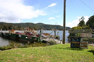 Another 30km brings you to
Wiseman’s Ferry, the most historic of the Hawkesbury ferry
crossings. Solomon Wiseman (1778–1838) was transported to
New South Wales in 1806 for the crime of stealing wood; he
was pardoned in 1812 and in 1817 took up 200 acres of land
at this site on the Hawkesbury River. He ran an inn here
from the 1820s, and had his finger in every sort of
industry, legal and otherwise; a contemporary clergyman
wrote that Wiseman was ‘deeply read in the corruption of
human nature’. He built the imposing Cobham Hall, still
standing, and the remains of his inn are still part of the
present-day hotel, said to be haunted by his first wife,
whom he supposedly tossed down the steps, and perhaps by old
Wiseman himself.
Another 30km brings you to
Wiseman’s Ferry, the most historic of the Hawkesbury ferry
crossings. Solomon Wiseman (1778–1838) was transported to
New South Wales in 1806 for the crime of stealing wood; he
was pardoned in 1812 and in 1817 took up 200 acres of land
at this site on the Hawkesbury River. He ran an inn here
from the 1820s, and had his finger in every sort of
industry, legal and otherwise; a contemporary clergyman
wrote that Wiseman was ‘deeply read in the corruption of
human nature’. He built the imposing Cobham Hall, still
standing, and the remains of his inn are still part of the
present-day hotel, said to be haunted by his first wife,
whom he supposedly tossed down the steps, and perhaps by old
Wiseman himself.
Wiseman became a wealthy man once the road from his ferry was continued across the river to the Hunter Valley in 1827; this convict-built Great Northern Road still exists, and was for half a century the main road leading north. Today it continues to the old settlement of St Alban’s, with its church ruins and historic cemetery (the oldest grave dates from 1837); and to Dharug National Park (t 02 4320 4200), named for the local Aboriginal people. This park has many Aboriginal rock engravings believed to be more than 8000 years old.
Good sources of infomation on Sydney and its surroundings
can be had from the Historic
Houses Trust and the National Trust.
Illustrations:
800px-Bronte_Beach_2.jpg - Cookaa
800px-Sydney_from_Taronga_Zoo.jpg - Richard Ling <richard@research.canon.com.au
Sydney_Hyde_Park_and_St_Marys_Hurley.jpg – Frank Hurley National Library of Australia
800px-SydneyTheRocks2_gobeirne.jpg - Greg O'Beirne
428px-GymeaLilyFlowers.jpg - Eug
784px-Pitt_Street_Sydney_looking_south_from_The_Powerhouse_Museum_Collection.jpg
- The Powerhouse Museum
Kings_Cross_Sydney_1950.jpg - City of Sydney Archives
Juniper_hall0001.jpg - Sardaka
512px-Entrance_to_Victoria_barracks_Paddington_Sydney.JPG -
Dinkum
Neutral Bay panorama - David
Edwards
800px-Sydney_Cove,_Port_Jackson_in_the_County_of_Cumberland_-_F._F._delineavit,_1769.jpg
- http://nla.gov.au/nla.map-
Sydney_seaports_1906.jpg - Justhus Perthes See Atlas 1906
edmund_blacket.jpg
640px-Circular_Quay,_Sydneyoperahhouse.jpg - Shannon Hobbs
Gallery-J-rn-Utzon-1918-2-004.jpg
501px-Ln-Governor-Lachlan_macquarie.jpg - http://acms.sl.nsw.gov.au/
BMA House 320px-BMADetailKoala.jpg - Xxpaulm
mitchell_david_A050297.jpg
800px-Trim-the-illustrous.jpg
flinders1.jpg
BurdekinHouse_hht.jpg – Historic Houses Trust
Tusculum - Sardaka
Nightengale wind and fountain Sydney hospital - Witty
lama
Hyde Park Barracks - sv1ambo
Alexander_Macleayhttp://www.anbg.gov.au/biography/macleay-alexander.html
Jules François Archibald - National Library of
Australia
Sydney Jewish Museum - dunedoo
Sydney Botanic Gardens - Maksym Kozlenko
Art Gallery of New South Wales - Paulscf
The Rocks 1901 - Photographic
Collection
Museum of Contemporary Art - Sardaka
Charlton Pool - Robyn
Lawrence
Hero of Waterloo Street - sv1ambo
Robert Campbell - sv1ambo
William Dawes - http://www.colorpro.com/wmdawes/images/dawes-who-rode.jpg
Mary Reiby - State Library of New South Wales
Sydney Harbor Bridge - Erika Esau
Obsservatory Hill - Sardaka
Darling Harbor - StefanoStefano
Pyrmont Bridge - inas
Baby Buddha - Andrew McMillan
Quong Tart - HappyWaldo and State Library of NSW
Rose Seilder House - Photographer Max Dupain; Marcell Seidler
(State
Library of New South Wales)
Martin Place - User:John
Rotenstein
Queen Victoria Building - Sardaka (talk)
Juniper Hall - Sardaka (talk)
Christ Church - Sardaka (talk)
Sydney Mardi Gras - Hasitha Tudugalle
Victoria Barracks - J Bar
Tambo Valley Races - http://www.flagstaffotos.com.au/
Tusculum Potts Point - Sardaka (talk)
Robert Stace Eternity
Women in hats - Synyan
Kings Cross 1950 - City
of Sydney Archives
John Verge portrait - Tempe House, State Library of NSW
Christ Church Gladesvill Sydney - Sardaka (talk)
Elizabeth Bay House - (please send photographer)
Observatory Hill - Sardaka
White City Tennis - http://www.austadiums.com/forum/viewtopic.php?t=3346
Vaucluse - Bgabel
Wentworth - State Library of Australia (?)
Doyles Restaurant Watson's Bay - Sardaka
North Bondi Surf Life Saving Club - Sardaka (talk)
Manly sunrise - Nigel Howe
Mort Bay Park - Hpeterswald
Hunter's Hill Town Hall - J Bar
Sze Yup Temple Gate - Sardaka (talk)
Sancta Quad U. Sydney - Tawdrylace
St Stephen's Church - TTaylor
Eveleigh Railway Workshop - Hpeterswald
Leichhardt Italian Forum - J Bar
Glebe Island Bridge - Andy Mitchell (Amitch)
Elizabeth Farm Interior - Sardaka (talk)
Elizabeth Macarthur - State Library of NSW
Experimental Farm Cottage - Sardaka (talk)
Conrad Martins North Head from Balmoral - Art
Gallery of New South Wales Online Catalog, entry 4385,
Admiralty House - A Kowatsch (Alex2031)
Luna Park entrance - Steve
Collis
Sydney fresh water pool - Mhsb
Coogee pool - Dfrg.msc
St. Thomas's Church - Mike Young
Giobbs' studio NutCote - Dvdcst80
Taronga Zoo entrance - tom
heyes
Ku-ring-gai Chase National Park view - Barendpt
Hawkesbury Museum - Hawkesbury
Council
Richmond park - Maksym
Kozlenko
Ebenezer Uniting Church - Peter
Gaylard
Wiseman's Ferry - Tirin
http://www.esauboeck.com/images/