 |
 |
|
|
|
 |
 |
 |
 |
| |
|
 |
 |
 (click on map to
enlarge)
(click on map to
enlarge)Queensland comprises the northeastern section of Australia. Most of the settlements are along its eastern coastline, particularly near Brisbane, its capital in the extreme southeast. From Brisbane the highways are no. 1, the Bruce Highway, which follows the coast northwards and a variously named and numbered highway extending inland to the Stuart Highway of the Northern Territory. Other highways between these two lead from Rockhampton (no. 66, Capricorn Highway) and Townsville (no. 78, Flinders Highway).
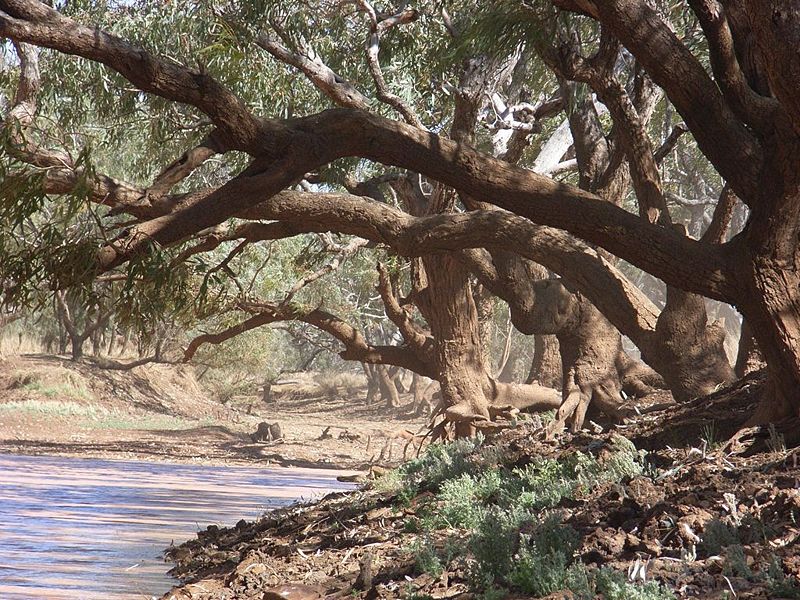
Queensland's most praiseworthy geological features include the Great Barrier Reef and associated islands, Cape York Peninsula, the coastal areas to Brisbane's south (the Gold Coast) and north (the Sunshine Coast), mountain ranges around Lamington National Park and the Great Artesian Basin which makes up the interior of the state west of the Great Dividing Range. The Tropic of Capricorn passes through the state. The monsoons along the north of the continent fill seasonal rivers flowing into the Gulf of Carpentaria and, under exceptional circumstances, south into Lake Eyre in South Australia.
Towards the interior south from the Gulf of Carpentaria, mangroves line the coast. Monsoon, blue and Mitchell grass eventually yield to hummock grasses and acacia as the conditions become more arid, finally leading to the Simpson Desert's expansive parallel sand dunes. The Cape York Peninsula is about 150km south of Papua New Guinea to which it was attached in the last Ice Age. This land bridge allowed considerable movement of flora and fauna into Australia. Most of the species shared with Papua New Guinea are found on the peninsula. Queensland has the most diverse wildlife of any Australian state: of the 223 Australian mammals, Queensland has 149; of the 683 birds, it has 546, and 251 out of the country's 431 reptiles.
Travelling across the coastal highlands towards the interior of the state, the conditions become increasingly arid. In common with the rest of the northern section of the continent, rain from December through March or April alternates with seasonable hot and dry conditions increasing during the middle of the year. The far southwest of the state is unlikely to receive rain at any time of year, and flooding is often the result when it does rain. Climatic extremes include Australia's hottest day, 53º C, recorded at Cloncurry in January 1889; and the wettest month was recorded in Bellenden Ker near Cairns with nearly 5.4m in February 1979. The state's vast size and climatic diversity is further evidenced in the contrasts of rainfall averages: Tully, on the coast 1500km north of Brisbane, receives an average rainfall of over 4000mm, and in one year received 7900mm; while Birdsville, in the far southwest corner of the state, is lucky to get 150mm a year.
South along the east coast conditions are not dissimilar to those of New South Wales and Victoria. Highland rainforests extend from Cooktown to Townsville. In the southern part of this area and on the interior of the coastal ranges, native forest alternates with cultivated and pasture land. The most productive land is comprised of volcanic soils and includes the Atherton Tablelands south of Cairns, Peak Downs south of Townsville, the Capricornia region west of Rockhampton and Darling Downs west of Brisbane. West of Brisbane from about St George to Cunnamulla and north to Cloncurry, cattle and sheep range in mulga brush land or Mitchell grass. The southwestern corner is interior desert uplands.
The Queensland coast itself faces the Coral Sea to the north and the South Pacific Ocean in the south. The modern names of the Sunshine and Gold Coast regions are real estate developers' idioms; the shore in either case is splendid and swimmable nearly all year round except at times of jellyfish invasion. The coastal ranges to the interior are verdant.
The Great Barrier Reef
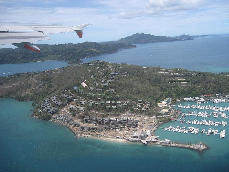
The Great Barrier Reef extends for 2000km from north of Newcastle to the Torres Strait. It is not a single reef, but consists of nearly 3000 individual coral reefs, making it the most complex living coral reef system in the world. It protects numerous island groups, the best known of which are probably the Whitsundays. The predominant corals include the fragile staghorn, brain corals in communities as large as 3m across, and solid Porites in even larger communities. Mushroom corals are individuals as large as 25 or 30cm each. Red pipe organ and blue coral are also prevalent.
The reef's structure is based on numerous sea-level changes which have built a foundation slightly more than 100m deep. The Outer Barrier follows the continental shelf at the 100 fathom line. At times the shelf drops steeply from the Outer Barrier, reaching 1000 fathoms (555 metres) within 10km. The Pacific rollers and cyclones have broken and assembled reef limestone and beach rock to create the Outer Barrier.
The Inner Reef may have crescent-shaped formations of reef due to south-easterly winds, but most are platform reefs which slope back towards the interior sand reefs. It is among these reefs that tourists can fish, snorkel or simply explore tide pools, especially at low tide. Many of the sightseeing boats have glass bottoms and most have well-informed guides. The distance to the reef from the continent varies from 150km in the south to within 75km in its central section at Townsville and 15km off the coast near Cooktown.
Its wildlife is spectacularly abundant. Better-known fish species include clown fish (Amphiprion percula) which live in the anemones, the beautiful and fiercely territorial butterfly fish (Chaetodons), coral trout, manta rays, and whale sharks. The reef is an important breeding area for sea turtles. Six of the seven species of these reptiles have been sighted in the reef. The green turtle and loggerhead, flatback and hawksbill all nest predominantly or exclusively in the reef.
Bird species are not particularly prevalent on the reef itself. The associated islands, however, support numerous populations of terns, particularly large colonies of the crested tern and sooty tern (breeding on Michaelmas Cay and the Swain Reefs) and breeding populations of the roseate tern, wedge-tailed shearwaters and brown gannets (Raine Island and Swain Reef cays).
Naturalist and poet Judith Wright describes the profusion of species on Lady Elliot Island in the Bunker Group:
White-breasted sea-eagles and frigate birds soared and circled over it, herons fished the shallows and the reef edge, noddies swept over and into the waves, boobies and gannets dived and plunged into passing shoals of fish...Between the terns and the other breeding species, and the mutton-birds underground grumbling and booming in the tunnels, it seemed there could be no more room for wings in the air or nests on the ground.
The island groups associated with the Great Barrier Reef are the Southern Coastal Islands, the Southern Reef Islands, the Whitsunday Islands and the Tropical North Islands.
Global climate change has caused coral bleaching of as
much as 80% of the reef, leading to about 20% of the coral
dieing. The worst effected portions are in its
northern reaches. (Coral bleaching occurs when warm
water causes the coral to expel its symbiotic algae, its
primary food source.) A 2017 UNESCO report states that
recovery from bleaching is compromised by fertilizer run-off
from sugar cane fields in the reef's catchment.
The establishment of Queensland and the selection of Brisbane as its capital followed a course familiar in Australian history. The desire to deter a perceived rising crime rate in Britain, hostility between free and convict colonists in Sydney, and insecurity about potential settlements by foreign interests prompted a plan to establish a penal colony somewhere along Australia's northeast coast.
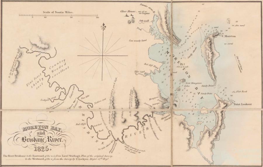
The selection of Moreton Bay as the location of this colony in 1823 and its subsequent selection as the state's capital were largely accidents of weather and tide. Brisbane's current form and appearance is due to its river and the civic aesthetic of its late 19C merchants, developers and benefactors.
The essential dates for the area include when Captain Cook mapped the coastline in 1770. John Oxley landed at Red Cliff on Moreton Bay in 1823 and shortly afterwards moved the colony to where Brisbane stands today, selecting what would become the corner of William and Queen Streets for settlement in 1825. His accompanying botanist Allan Cunningham described the inland country, particularly the Darling Downs and Cunningham Gap leading to the Moreton Bay area in 1828.
Squatters Patrick Leslie and his brothers followed Cunningham's overland route to the Darling Downs agricultural area in 1840. New South Wales opened the area for free settlement, beginning land sales upon the end of the penal interests in 1842. Brisbane became the capital of Queensland upon the state's founding in 1859. Gold discoveries in the period from 1861 to 1882 and sugar cane plantations kept the young state prosperous. Severe floods in 1893 prompted prominent citizens to rebuild on higher ground at Hamilton, Ascot and Clayfield. Dr and Miss Mayne donated St Lucia as the permanent site for the University of Queensland in 1926. Long-serving National Party Premier Joh Bjelke-Petersen, the epitome of political corruption Queensland-style, was suspected of fraud and indicted for perjury in 1987. The Great Barrier Reef received World Heritage Protection in 1982.
In greater detail, the history of Queensland begins when the Dutch Captain Willem Jansz mapped part of the west coast of Cape York in 1606 as did Jan Carstensz in 1623. Jansz described the region in his journal in the most uncomplimentary terms: 'In our judgement this is the most arid and barren region to be found anywhere on earth; the inhabitants, too, are the most wretched and poorest creatures that I have ever seen.'
More than a century and a half later, Captain Cook mapped the coast, making nine landfalls and spending seven weeks repairing his reef-damaged ship at the mouth of the Endeavour River, near present-day Cooktown, at Cape Tribulation. Legend has it that it was here he learned from local Aborigines to call the strange hopping creature 'kangaroo', which probably meant 'I don't know'. Matthew Flinders visited the area in the first decade of the 19C, although he missed the Brisbane River.
Reporting in 1822 to Lord Bathurst, who was then Secretary of State for War and the Colonies, John Thomas Bigge suggested that new penal colonies be established at Port Bowen (now Point Clinton south of Townsville), Port Curtis (now Gladstone) and Moreton Bay. Their purpose was to provide more punitive conditions for transported convicts who subsequently offended in New South Wales or Van Diemen's Land and to act as a further deterrent to crime in Britain, as if the threat of transportation to Sydney were not enough.
Simultaneously, Governor Brisbane was trying to cope with the growing conflict between free settlers and former transportees. A penal colony at Moreton Bay was a concession to the free settlers, which did little to lessen free settler animosity towards the emancipists (convicts who had served their time) and their allies in the trades in Sydney. Port Macquarie in New South Wales was founded in 1821 for similar purposes. By the time Parliament enacted enabling legislation in 1824, sufficient numbers of transportees had been assigned to private employers to reduce the number of additional colonies needed to one, that at Moreton Bay.
Lord Bathurst instructed Brisbane to affect Bigge's proposals, and in 1823 surveyor John Oxley travelled to the northeast coast to examine his locations. Weather prevented him from visiting Port Bowen; seasonal dry conditions and scant timber led him to discourage settlement at Port Curtis. The Brisbane River and surrounding land suitable for agriculture led Oxley to recommend Moreton Bay. He described the Brisbane River as 'by far the largest freshwater river on the east coast of New South Wales'. Red Cliff Peninsula on the northern shore of the river's mouth was a convenient initial settlement and the eventual permanent colony could be located a little further inland.
In 1824 Oxley, commandant Lieutenant Henry Miller,
botanist Allan Cunningham, assistant surveyor Robert Hoddle,
a handful of 40th Regiment guards, 29 convicts (mostly
skilled volunteers) and a few family members established the
outpost on Red Cliff. The next year Miller moved the colony
to the present-day location of Brisbane, above Breakfast
Creek.
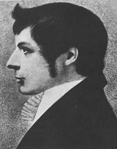 |
John Oxley (c 1785-1828) was
born in Yorkshire and named John Joseph William
Molesworth Oxley. The Australian Encyclopedia
reports that when he joined the navy as midshipman in
1799 the interviewing officer impatiently exclaimed,
'Damn it all, plain John Oxley is good enough!' He first visited Australia in 1802 and returned in 1808 as a commissioned lieutenant and in 1812 as surveyor general. He traced the Lachlan and Macquarie Rivers and reported disparagingly on what became the rich pastoral lands of the Liverpool Plains, maintaining that the country was 'uninhabitable and useless for all purposes of civilised men'. Similarly, his report of the Illawarra stated that he 'saw no place on which even a cabbage might be planted with a prospect of success'. Rather than on these inaccurate assessments, his fame derives from his work furthering the settlement of Brisbane. Sent north along the coast to select a site for the new penal colony in 1823, he favourably described Moreton Bay and the Brisbane River. His civic responsibilities were fairly ambitious. He was an early member and officer of the Bible Society, a founding member of the Philosophical Society, on the committees of the Female and Male Orphan Institutions and the Public School Institution, a subscribing member of the Scots and St James churches and briefly a member of the Legislative Council. Despite having at one time or another owned large tracts of good land and having engaged in a variety of mercantile interests, he died aged only 42 'much embarrassed in his pecuniary circumstances'. The colony's Executive Council recommended special assistance to his widow and children; the British government granted his sons 5000 acres adjoining what is now Bowral in recognition of his services to the colonies. |
Immediately, the prospects at Moreton Bay Penal Colony proved too favourable for intractable convicts. In response, Norfolk Island was slated to be reopened and Governor Darling, Brisbane's successor, toughened the regime at Moreton Bay by sending the vicious Captain Patrick Logan to be commandant in 1826. He had convicts flogged for misbehaviour, routinely exceeding the regulation 50-lash maximum. Men worked shackled in irons. He had cells for solitary confinement erected and a treadmill installed. Not surprisingly, he had occasion to explain the low productivity of the colony.
During Logan's command, however, the limestone kiln at what would eventually be Ipswich was built, Cunningham described the Darling Downs and a route to them, and several stone buildings were erected in Brisbane itself. Logan was murdered in 1830 while mapping the area around Mount Beppo. The circumstances were never made clear, but it seems likely that his skull was bashed in by convicts accompanying him.
The number of prisoners at the colony increased to 1066 in 1831, then declined as reoffending convicts were increasingly used as road workers in the Sydney region. Calls for the colony to be closed as a penal settlement and opened to free settlement continued until 1839 when all but 94 male convicts were removed; those remaining looked after the governmental livestock.
Colonial functions established the course of many of Brisbane's streets. Although only two structures survive from the penal era--the Commissariat Store and the Windmill-paths, now roads, which led from them to the bridge. The outline of the gardens and the outlying farms can still be followed. Logan situated the Prisoners' Barracks, a large stone building, perpendicular to the river. The surveyors who laid out central Brisbane in 1839 accepted this structural orientation and ran what would become a main thoroughfare, Queen Street, past its front. The remainder of the grid and the naming of the streets after British royalty followed shortly thereafter.
Governor Brisbane's initial conception of an area where the intractable convicts from Sydney could be sequestered proved impractical. The area was considered too far from Sydney, an objection which did nothing to deter squatters eager for new land. In fact, the first substantial number of permanent settlers to the territory crossed inland from Cardwell to the Herbert River following a track cleared by pioneering pastoralist Walter J. Scott's party as late as 1864.
The selection of Brisbane as the state's capital was often in jeopardy. Commandant Logan would have preferred moving the colony up river near to Oxley Creek to service more easily the Logan River and Tweed districts to the city's south. Commandant Major Sydney Cotton and his foreman of works Andrew Petrie ended the discussion to move Brisbane Town entirely following their survey of the area in 1838. Cotton then set about improving road transport to facilitate cartage in the area.
For a period in the 1840s South Brisbane rivalled Brisbane proper as a port, particularly after the Hunter River Steam Navigation Company built a wharf and warehouses there. Kangaroo Point, again on the south side, became a manufacturing centre with ferry access beginning in 1844. By the 1850s, however, the north side of the river took ascendancy. In addition to businessmen with commercial interests centred in North Brisbane, the populist Reverend Dr J.D. Lang sponsored the settlement of Fortitude Valley in 1849. The colony spread west via access to the Darling Downs and West Moreton through Ipswich and Bremer.
Squatters had moved into southwest Queensland from the New England district of New South Wales in 1840, two years before the area was formally opened to free settlement. One Francis Bigge suggested Ipswich be the agricultural service centre with a port on Moreton Bay. Robert Dixon, a surveyor, pressed for Cleveland as the port. These suggestions were the basis of Governor Gipps's inspection tour in 1848.
Theoretically, the area around the Moreton Bay colony was not available for settlement until 1842. Nonetheless, a German missionary community established itself several miles northwest of Brisbane at Xion Hill (now Nandah) in 1838, two years before squatters settled in the Darling Downs.
In fact, it was the building of the Customs House in Brisbane in 1855, the dredging of the Brisbane River and establishment of Queensland as a state independent of New South Wales in 1859 that finally established Brisbane as the capital city.
In the first 20 years after its separation from New South Wales the population of Queensland increased from about 28,000 to 211,040. In addition to some mining and industry in the Ipswich area, the rise of sugar plantations along the coast and grazing land on less fertile land ensured that the state would be solvent. The discovery of gold in 1867 in Gympie, in 1872 in Charters Towers, and in 1882 near Rockhampton did much to spread the population throughout the state. It kept the state bank afloat and financed Brisbane's growth in the 1880s and 1890s.
The second period of pastoral settlement followed William Landsborough's description of interior grazing land. He had been sent in 1861 by the Victorian government to search for the Burke and Wills expedition. Robert Burke was commissioned by the Royal Society of Victoria to find a route along which the inevitable telegraph line could be laid. Eminently ill suited to the task, he made it as far as Normanton, virtually within sight of the Gulf of Carpentaria. The party's retreat ended at the base camp at Cooper Creek the day after their rearguard who had been waiting for their return had abandoned it.
William Landsborough's rescue party was one of several that established that the semi-arid interior was habitable if harsh. A number of herds of cattle were overlanded to central and northern Queensland in the early 1860s based on these reports. An example of these settlers, John Jardine, who was the first government magistrate in Somerset on the tip of the Cape York Peninsula, sent his sons with a herd of cattle from Rockhampton overland to the Cape York Peninsula in an eventful ten month trek in 1864-65. His son Frank built an empire from cattle-raising and pearl-fishing.
Simultaneously, the agricultural regions along the coast were being settled. Initially, cotton was the major export, but the end of the American Civil War in 1865 ended the market for inexpensive cotton and its transport. Fortunately, the second crop of choice was sugar cane. It became the mainstay of the southern coastal region. Driving through this region is as monotonous as driving through the cornfields of the American Midwest, perhaps more so because the cane is equally dense, equally monotonal but considerably taller. Lengths of road become corridors with no hint of landscape or habitation, and certainly no views of the sea.
Slaves were abducted from the South Pacific Islands and sold to cotton and pineapple plantation owners in Queensland between 1863 and Federation in 1901. These people were called Kanakas (Hawaiian for 'man'). To assuage the conscience of sensible Australians, the trade in Kanakas was presented as voluntary servitude, something like apprenticeships. The two most despicable of the traders were Ross Lewin, who first offered the 'best and most serviceable natives to be had in the islands at £7 a head', and Dr James Patrick Murray, who kidnapped and murdered about 70 labourers then turned Queen's evidence to escape punishment. Efforts to control the practice failed. The courts used jurisdictional and legal definitions as a way of avoiding convictions or carrying out sentences. The licensing authorities gave little heed to the practices they were authorised to control. In the end, the Pacific Island Labourers Act was passed in 1901 as Australian labourers pressed for the jobs the islanders held and the White Australia Policy came to full effect. In all something like 60,000 men were brought to Queensland; about 1600 of those working at the turn of the century stayed. Faith Bandler, an important activist in the Aboriginal rights movement today, has Kanaka heritage. Increased conversions to Christianity in the South Pacific Islands was a consequence of enslavement, repatriation and public concern about the practice of 'Blackbirding', as this trade was known.
In the last quarter of the 19C considerable acrimony existed in the state. When the railroad was laid to Ipswich, the agricultural interests clamoured for similar consideration. Improved roads to the cane fields and stringent requirements of land tenure caused disaffection among the pastoralists. Crown tenants on large properties pressed subsistence squatters from small parcels of better land. Nearly all of the outlying communities were angered by rather than proud of Brisbane's civic building boom. For a period there were calls for the state to be divided into thirds.
Once the alluvial gold had been gleaned, the diggers returned to a tight labour market. Shearers unionised and the Darling Downs Pastoralists' Association hired non-union workers exclusively in 1889. The maritime workers refused to load wool from Jondaryan woolshed and insisted on other conditions as well. The shearers were returned to the sheds, but the maritime workers lost their award in 1890.
The most serious shearers' strike was near Barcaldine in 1891. By the time the matter was controlled, the unions had formed militias and the government had sent 1400 soldiers, armed with machine guns and artillery, to support the pastoralists. In any event, another army of unemployed labourers was more than eager to work at any wage. The Labor Party, born of this dispute, actually won the first labor government in the world in 1899 (the decision to spell 'Labor' in American style was a conscious choice of the organisers, to stress their affinity with the more 'progressive' American labour movement). After six days in office, the feuding Liberals and Conservatives resolved their arguments, formed a coalition, and dissolved parliament.
Amid these fractious times, the Whites Only Policy became legitimate. The Kanakas were repatriated or absorbed into the local population. The Chinese living in Australia were virtually expelled. For decades immigrants had to prove language proficiency in a dictation test which could be given in a language as obscure as the testers could manage. This test was only abolished in 1958.
Miraculously, by 1908 the minimum wage had been implemented and was sufficient to support a male worker, his wife and three children. Old age and invalid pensions were being paid. The 40-hour working week was the norm. In 1915 the Labor Party was returned to office on an anti-conscription policy. (It remained in office until 1957 when Labor lost due to internal strife and a coalition between Country and Liberal parties.)
Australia shared the worldwide economic Depression of the early 1930s. Strong wool and ore prices and a surfeit of mutton, wild rabbit and agricultural produce sustained the state. Arguably these factors contributed to Australia's subsistence economy until reconstruction following the Second World War. As Queensland native and author David Malouf frequently asserts in his writings, the arrival of large numbers of American troops in Brisbane during the Second World War caused a significant transformation of the city into a more modern, 'Americanised' place.
The Liberal loss in 1957 brought National Party leader
Joh Bjelke-Petersen into office for 19 years of
self-righteousness and resulting strife and, in the end,
corruption. In 1989 the National Party was finally voted out
of office when the state returned Labor to government. Since
the 1980s, Queensland has been the fastest-growing state in
terms of population, as increasing numbers of pensioners and
young families have opted for the warm climate of the north.
The negative effect of this influx has been the massive
high-rise developments from the New South Wales border all
the way to Brisbane, turning the Gold Coast into a
Miami-Beach-style community. The positive effect has been a
breaking up of Queensland's traditional conservativism and
'red neck' image. Brisbane now has more sophisticated
cultural institutions and dining experiences, and the rest
of the state, with all its lush scenery, is more aware of
the needs of visitors from all over the world. These
visitors include wealthy Chinese property investors, by the
way, who prefer newly built apartment houses in suburbs
adjacent to the city's center.
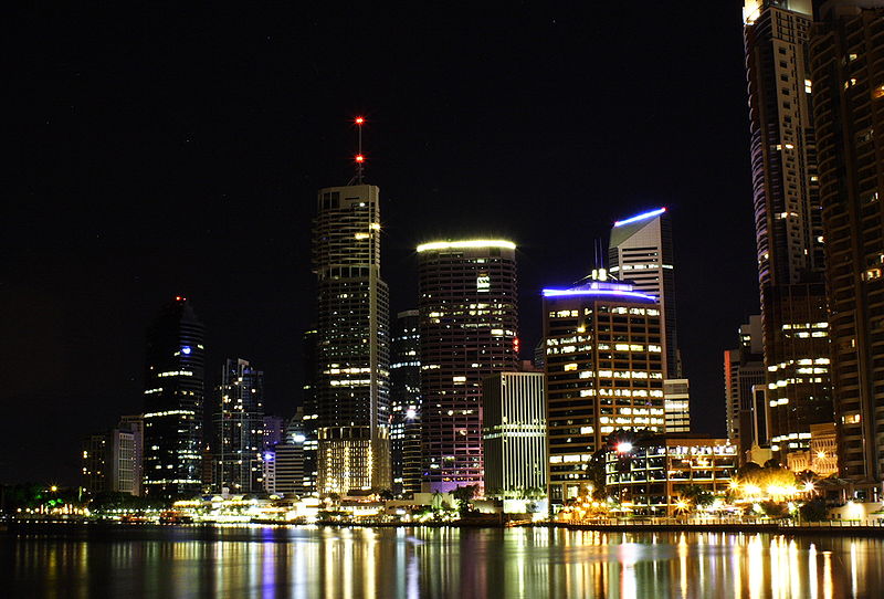
Brisbane (population 2,350,00 up from 1,530,000 in the 1990s) is situated on the delta of the Brisbane River, which flows as a serpentine path through the city to Moreton Bay. The central business district faces South Brisbane Reach on a northern tongue of the river. The streets are named after British monarchs--the queens running southeast to northwest and the kings perpendicular. The art gallery, performing arts centre and convention centre can be found across Victoria Bridge. Like the city centre, the university is on the northern bank of the river in the next ox-bow inland. 5km to the west, Mount Coot-Tha rises to 250m.
Among the city's most pleasant picnic locations is C.T. White Park, on Kangaroo Point with a view across the Brisbane River to the city centre. It is accessible by ferry and a short walk. Between Woowong and St Lucia, University of Queensland, Kaye's Rocks on Brisbane Street offers good river views of St Lucia and Toowong. Bellbird Grove Picnic Area is in the Enoggera State Forest about 20km west of the city centre following Musgrave and Waterworks Roads.
City tour
Some years ago the Royal Australian Institute of Architects, Queensland Chapter, published A Map Guide to the Architecture of the City which provides the basis for the following tours.
This walk leads from Adelaide Street beyond Edward
Street at the edge of Anzac Square to the Post Office on
Queen Street east to the Brisbane River, then either by
ferry across to Kangaroo Point or, continuing on foot, along
lower Edward Street. In either case, the walk 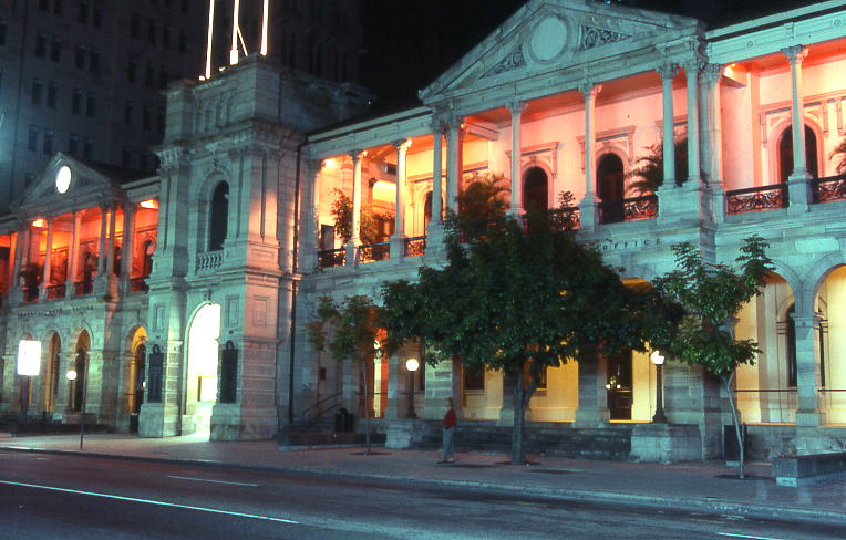 leads to the Botanic
Gardens then proceeds up George Street to the Queen Street
Mall. The General Post Office is on Queen Street between
Edward and Creek Streets and was built on the site of the
female convict factory. The design has a Tuscan colonnade at
the street level and Corinthian columns with pilasters
above. Stone for the columns and façade was quarried near
Helidon and at Albion Heights. The cast-iron balustrades on
the upper verandah give the building a pleasant lightness,
unconventional in governmental buildings. Details include a
hitching post, a clock on the pediment of the northern wing
and a crest in the first-floor balustrade. The northern wing
was built by John Petrie in 1871-72; the central tower and
matching southern wing were added in 1877-79. Colonial
Architect F.D.G. Stanley designed the southern wing.
leads to the Botanic
Gardens then proceeds up George Street to the Queen Street
Mall. The General Post Office is on Queen Street between
Edward and Creek Streets and was built on the site of the
female convict factory. The design has a Tuscan colonnade at
the street level and Corinthian columns with pilasters
above. Stone for the columns and façade was quarried near
Helidon and at Albion Heights. The cast-iron balustrades on
the upper verandah give the building a pleasant lightness,
unconventional in governmental buildings. Details include a
hitching post, a clock on the pediment of the northern wing
and a crest in the first-floor balustrade. The northern wing
was built by John Petrie in 1871-72; the central tower and
matching southern wing were added in 1877-79. Colonial
Architect F.D.G. Stanley designed the southern wing.
Newspaper House (formerly the Colonial Mutual Life Building and currently serviced apartments, adjacent to the General Post Office to the east), designed by Hennessey and Hennessey, is a steel frame construction with a locally manufactured Benedict stone façade. Hennessey and Hennessey designed the CML Building on King Street in Adelaide as well. The sculptural detail on the street and side façades adds style to this 1931 building.
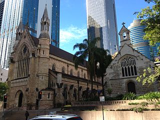
Central to ANZAC Square, the Shrine of Remembrance (designed by Buchanan and Cowper) commemorates the Boer War. The square is contained by the General Post Office, the Central Railway Station and St John's Cathedral. English architect John Pearson designed the cathedral; the Duke of Cornwall (later George V) laid the cornerstone in May 1901. In a Gothic Revival style, a number of slender piers support a high stone-vaulted ceiling; there are rose windows at the transept ends and elegant curved choir stalls.
R.S. Dods designed the associated buildings Webber House (1904-05) and Church House (1910), using steep gabled roofs and brick and stone building materials to match the cathedral. Interesting Art Nouveau ornament makes them visually interesting as well.
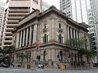 The National Australia Bank,
across Queen Street on the corner of Creek Street, is a good
example of the Classical Revival style in Australia. Former
Colonial Architect F.D.G. Stanley designed this opulent
building with references to Italian Renaissance
architectural detail. The bank was awarded the government
account in 1879 and became the Queensland National Bank.
Many of its branches are of similar, though more modest,
style. The bank's interior features fine joinery and
fireplaces (the second floor was originally intended to be
residential), a massive leaded glass central chamber and
coffered ceiling in the entry corridor. Conrad Gargett and
Partners restored the bank in 1982; their work on the
interior cedar joinery and plasterwork is particularly
praiseworthy.
The National Australia Bank,
across Queen Street on the corner of Creek Street, is a good
example of the Classical Revival style in Australia. Former
Colonial Architect F.D.G. Stanley designed this opulent
building with references to Italian Renaissance
architectural detail. The bank was awarded the government
account in 1879 and became the Queensland National Bank.
Many of its branches are of similar, though more modest,
style. The bank's interior features fine joinery and
fireplaces (the second floor was originally intended to be
residential), a massive leaded glass central chamber and
coffered ceiling in the entry corridor. Conrad Gargett and
Partners restored the bank in 1982; their work on the
interior cedar joinery and plasterwork is particularly
praiseworthy.
Crossing Queen Street at the apex formed by Eagle Street leads to the Mooney Memorial Fountain. It commemorates volunteer fireman James Mooney who lost his life fighting a fire at a Queen Street grocery store in 1877. Using funds from a public appeal, his friends and relatives built a memorial to him at the Toowong Cemetery. Due to the persistent popular notion that the Gothic-style fountain at the head of Queen Street was his memorial, the Brisbane City Council installed a tablet to Mooney here. In fact, this fountain was erected in 1880 at the request of nearby merchants who simply wanted to improve this triangle of land.
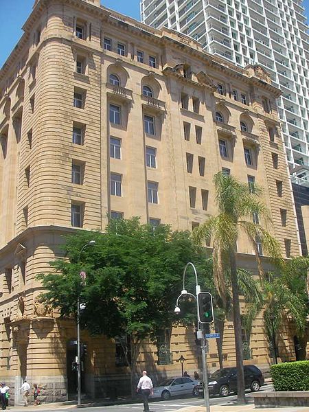
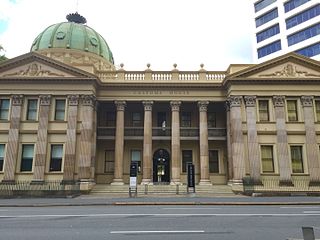 Customs
House, at the top of Queen Street, is currently the
city offices of the University of Queensland. Between 1842,
when the Morton Bay Colony was opened for free settlement,
and 1848, when the New South Wales government established
customs facilities in Brisbane, some debate occurred
regarding the location of the colony's principal port.
Cleveland, the site favoured by settlers in the Ipswich
region, might have become the port had the tide not been out
during Governor Gipps's inspection tour. Local lore has it
that he and his party were forced to trudge some distance
across mud flats to reach that city at low tide. He thought
it would make an inadequate port. Establishing Customs House
in Brisbane seriously disadvantaged other ports from
contention as the capital.
Customs
House, at the top of Queen Street, is currently the
city offices of the University of Queensland. Between 1842,
when the Morton Bay Colony was opened for free settlement,
and 1848, when the New South Wales government established
customs facilities in Brisbane, some debate occurred
regarding the location of the colony's principal port.
Cleveland, the site favoured by settlers in the Ipswich
region, might have become the port had the tide not been out
during Governor Gipps's inspection tour. Local lore has it
that he and his party were forced to trudge some distance
across mud flats to reach that city at low tide. He thought
it would make an inadequate port. Establishing Customs House
in Brisbane seriously disadvantaged other ports from
contention as the capital.
John Petrie built this classical Renaissance building in 1886-89 to designs by Charles McLay who worked in the Colonial Architect's office. Its features include Corinthian columns, a fine copper dome, unusual heraldic shields and fig trees in the grounds. The solidity of this imposing building seemed to Brisbane native David Malouf to counter the transience of the town's other architecture; in his book, A Spirit of Play (1998), he says of the Customs House, the Post Office and Parliament House, 'they were the nearest thing we had to something ancient and historical'.
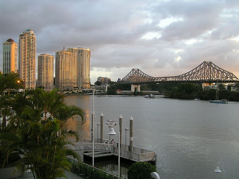
The Story Bridge (visible behind the Customs House) was designed by Dr J.C. Bradfield, who also designed the Sydney Harbour Bridge. Opened in 1940, it is often referred to as Jubilee Bridge in reference to George V's Silver Jubilee. The massive abutments were built of river gravel and coral cement dredged from near the river's mouth. The largest steel cantilevered bridge in Australia, it was built by Evans Deakin and Hornibook Constructions.Either walk south along the Brisbane River through the Plantation Reserve and along the riverside boardwalk to the Botanic Gardens or ferry across the Brisbane River to Kangaroo Point. Either way is about the same distance.
Kangaroo Point was originally a manufacturing area. In addition to a number of pleasant residences dating from the middle and late 19C are the immigrant hostel Yungaba ('land of the sun') and the Story Bridge Hotel.
 The return ferry
from Thornton Street docks near the Alice Street entrance to
the Botanic Gardens. St Stephen's Cathedral, on Elizabeth
Street beyond Creek Street, an English Gothic Revival
structure, is made of local porphyry stone. Designed by
Benjamin Backhouse and built between 1863 and 1874, it was
meant to replace the original St Stephen's which stands
beside it. This earlier church is a fine piece of Gothic
Revival architecture designed by A.W. Pugin, the English
architect associated with the construction of the London
Houses of Parliament. Consecrated in 1850 as part of
Sydney's diocese, this is Brisbane's oldest standing church
and with the cathedral offers insights into the development
of the city's 19C aesthetic aspirations.
The return ferry
from Thornton Street docks near the Alice Street entrance to
the Botanic Gardens. St Stephen's Cathedral, on Elizabeth
Street beyond Creek Street, an English Gothic Revival
structure, is made of local porphyry stone. Designed by
Benjamin Backhouse and built between 1863 and 1874, it was
meant to replace the original St Stephen's which stands
beside it. This earlier church is a fine piece of Gothic
Revival architecture designed by A.W. Pugin, the English
architect associated with the construction of the London
Houses of Parliament. Consecrated in 1850 as part of
Sydney's diocese, this is Brisbane's oldest standing church
and with the cathedral offers insights into the development
of the city's 19C aesthetic aspirations.
The lower Edward Street area contains a number of late 19C warehouses. Brisbane Community Arts Centre, Coronation House, was built in 1884. It features five levels and a basement with original ironbark support beams. The State Health Building, on Charlotte Street beyond Edward Street, has kept the Classic Revival façade of the original Brabant and Company import firm.
The busy Greek and Egyptian motifs of Charlotte House, adjacent to the State Health Building, were erected in the 1880s for Wallace and Warren, shipping agents. The Inglis Tea Merchants have leased part of the building since 1912. James Inglis (1845-1908) made 'Billy Tea' a common-place in Australia. His merchandising tactics included setting 'Banjo' Paterson's poem 'Waltzing Matilda' to music and wrapping it around the tea packet as a promotional gift; this was the method by which the song became so well known throughout Australia.
Sydney architects A.L. and C. McCredie designed Naldham House as an Indian Colonial, Classic Revival building for the Australasian United Steam Navigation Company in 1889. It is currently a private club on the corner of Mary and Market Streets. Flood levels from 1890, 1893 and 1897 are recorded on the base of the tower.
In contrast to Stanley's design for the Queensland National Bank, the Harbours and Marine Building at the corner of Margaret and Edward Streets is a Victorian Classic Revival structure. Erected by John Petrie, this was originally the Port Office with a river bank location in 1878-80. Note the restored porte cochère coach drive and cast-iron roof ridging. A reference guide for flood levels, the ground floor was added long after the original two-storeyed section with bays and verandahs.
On the same corner, the Naval Stores offers a welcome
relief from the Classic Revival pomposity. This building
dates from 1900-01. Constructed for the Queensland Marine
Defence Force, it is Queen Anne style with a Rococo porch
entry, Tuscan columns and an elaborate coat of arms.
Botanic Gardens
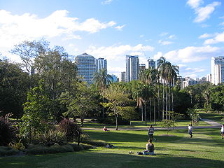 The site of the
Botanic Gardens (t 07 3403 8888; open daily 24 hours)
was originally an Aboriginal river crossing. Situated below
Alice Street from the river to George Street, they were
established in 1825 as a Government Garden at the
instruction of Governor Thomas Brisbane. The area was
extended in 1855 as Grace Botanical Garden. In 1865 it
became Queen's Park when Governor George Bowen added the
river frontage and former sports fields.
The site of the
Botanic Gardens (t 07 3403 8888; open daily 24 hours)
was originally an Aboriginal river crossing. Situated below
Alice Street from the river to George Street, they were
established in 1825 as a Government Garden at the
instruction of Governor Thomas Brisbane. The area was
extended in 1855 as Grace Botanical Garden. In 1865 it
became Queen's Park when Governor George Bowen added the
river frontage and former sports fields.
The gardens were the site of the first sugar cane grown in Queensland. John Buhôt made the first sugar in Queensland from the garden's cane, using a lever to extract cane juice and his kitchen stove to boil off the liquid. The first commercial plantation and mill was established by Louis Hope in 1886-65 at Ormiston, about 35km east of Brisbane.
Noteworthy early plantings still evident include the Bunya Pines. These were planted in the 1850s by the first Colonial Botanist, Walter Hill. Hill experimented with a number of tropical crops which eventually became central to Queensland agriculture, including pineapple, mangoes and ginger. The avenue of weeping figs was planted in the 1870s. The garden's water features, especially the Mangrove Boardwalk along the river, are particularly popular. The garden seeks to provide native and exotic plant species in a traditional park. Volunteers give one hour long leisurely guided tours at 11.00 and 13.00 Mon-Sat. The new gardens at Mount Coot-tha are devoted to the Queensland natural habitat.
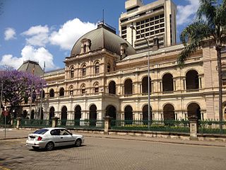 Parliament House
(t 07 3226 7562) is across George Street. Colonial Architect
Charles Tiffin designed the building in a French Renaissance
style. Its walls are of freestone quarried from the banks of
the Brisbane River at Woogaroo. Parliament's first sitting
here was on 14 July 1865, but the colonnade was not
completed until 1879. The Alice Street wing was built in
1889-91. The porte cochère and any number of other original
designs were restored in 1981-82 by Conrad Gargett and
Partners. The first sitting of Queensland's Parliament was
actually at the Military and Convicts Barracks (Queen Street
between George and Albert Streets) on 22 May 1860. At the
time of Parliament House's erection, the Guardian newspaper
observed that the legislature would be 'transferred from the
forbidding-looking building in Queen Street, with its evil
recollections of cells and bolts and chains ... to a hall of
assembly befitting the dignity of the legislature'. Guided
tours are given Mon.- Fri. at 13.00, 14.00, 15.00, and 14.00
when Parliament is not sitting and at 14.00 when Parliament
is not in session.
Parliament House
(t 07 3226 7562) is across George Street. Colonial Architect
Charles Tiffin designed the building in a French Renaissance
style. Its walls are of freestone quarried from the banks of
the Brisbane River at Woogaroo. Parliament's first sitting
here was on 14 July 1865, but the colonnade was not
completed until 1879. The Alice Street wing was built in
1889-91. The porte cochère and any number of other original
designs were restored in 1981-82 by Conrad Gargett and
Partners. The first sitting of Queensland's Parliament was
actually at the Military and Convicts Barracks (Queen Street
between George and Albert Streets) on 22 May 1860. At the
time of Parliament House's erection, the Guardian newspaper
observed that the legislature would be 'transferred from the
forbidding-looking building in Queen Street, with its evil
recollections of cells and bolts and chains ... to a hall of
assembly befitting the dignity of the legislature'. Guided
tours are given Mon.- Fri. at 13.00, 14.00, 15.00, and 14.00
when Parliament is not sitting and at 14.00 when Parliament
is not in session.
Unlike most clubs in Australia, entrance to which is simply a matter of signing a register, the Queensland Club (diagonally across George Street) is strictly for members and has been since it opened in 1859. This climate-conscious building, again from designs by F.G.D. Stanley, opened in 1884 and features an interesting upper level verandah balustrade, pleasant grounds and high ceilings in the members' common rooms.
The George Street campus of Queensland University of Technology, more generally known as QUT, is one of three campuses. Its noteworthy buildings date from the 1970s and include the Community Building, particularly for the brick finishes, and the Music Conservatory, complete in 1974. The Kindler Theatre's design by Blair M. Wilson allowed the first in-the-round staging in Brisbane.
Northwest along George Street to Margaret Street leads to The Mansions. Oakden, Addison and Kemp designed these six privately owned terrace houses which were built in 1890. They feature considered responses to the climate--the large verandah, recessed main hall and, particularly, the bay windows which extend across the roof line to the attic. A stylish address at the turn of the century, their red brickwork accentuates the Oamaru (New Zealand) limestone. The same firm designed the Albert Street Uniting Church on Ann Street at about the same time. (They used the same contrasting limestone for a similarly striking visual effect.) Note the cats on the parapets at each end.
The Sciencentre (t 07 3840 7555; open daily 9.30-17.00; admission adults $14.50, concession $12.50, children $11.50), up George Street towards Charlotte Street, was originally the Government Printing Office, hence the Printers' Devils as gargoyles atop the parapet. The centre functions as an interactive science and engineering display.
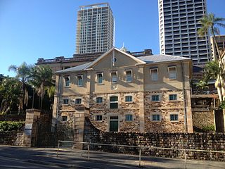 A number of Italian
Renaissance-style governmental buildings from the late 19C
and early 20C are set around Queen's Park. This area was the
site of the Moreton Bay penal colony. The Commandant's
residence was on the site of the Sciencentre. Across William
Street is the Commissariat Stores, built in 1829 under the
infamous Captain Patrick Logan as a two-storey structure.
Convict labour quarried local stone, adzed ironbark for the
girders and pit-sawed the yellowwood floorboards. The
building is open to the public thanks to the Royal Historical
Society Museum (t 07 3221 4198; open Tues-Fri
10.00-16.00) whose offices are located here.
A number of Italian
Renaissance-style governmental buildings from the late 19C
and early 20C are set around Queen's Park. This area was the
site of the Moreton Bay penal colony. The Commandant's
residence was on the site of the Sciencentre. Across William
Street is the Commissariat Stores, built in 1829 under the
infamous Captain Patrick Logan as a two-storey structure.
Convict labour quarried local stone, adzed ironbark for the
girders and pit-sawed the yellowwood floorboards. The
building is open to the public thanks to the Royal Historical
Society Museum (t 07 3221 4198; open Tues-Fri
10.00-16.00) whose offices are located here.
The substantial Treasury Building facing Queens Park is an Italian Renaissance-styled structure with elaborate façades and verandahs. It sits on the location of the original Officers' Quarters and Military Barracks. Designed by Colonial Architect J.J. Clark in 1885, it was built in three sections and currently functions as a casino. The former Lands Administration Building directly across the park is the casino's associated hotel. A. Morry designed this well-proportioned building at the turn of the century.
Walking along George Street, past the Queen Street Mall, taking a right turn up Adelaide Street leads to the City Hall on King George Square. Except for the tower, the building is a well-proportioned Classical Revival structure designed by Hall and Prentice and built between 1920 and 1930. Its tympanum relief, though difficult to see without field glasses, was designed by Daphne Mayo. The figures in the tympanum are allegories for the cattle and wool industries. The building is closed for restoration, probably until 2012
 The variety of building styles
fronting on the Queen Street Mall provide a welcome relief
from the imposing governmental district. On the corner of
Queen and George Streets is the Bank of New South Wales (now
the Westpac) which was erected in 1929 to designs by Hall
and Devereaux. The sandstone facing on the modern
steel-framed structure suggests that the 19C aesthetics of
stolid banks lasted well into the 20C. Across Queen Street
the Colonial Mutual Life Assurance Society building,
designed by Richard Gailey in 1883, originally had a tower
which, like many such towers was removed during the Second
World War to be used as shell casings.
The variety of building styles
fronting on the Queen Street Mall provide a welcome relief
from the imposing governmental district. On the corner of
Queen and George Streets is the Bank of New South Wales (now
the Westpac) which was erected in 1929 to designs by Hall
and Devereaux. The sandstone facing on the modern
steel-framed structure suggests that the 19C aesthetics of
stolid banks lasted well into the 20C. Across Queen Street
the Colonial Mutual Life Assurance Society building,
designed by Richard Gailey in 1883, originally had a tower
which, like many such towers was removed during the Second
World War to be used as shell casings.
South Brisbane
Queensland Cultural Centre
South Brisbane is an easy walk across Victoria Bridge
from the city centre. The Queensland Cultural Centre here
includes the State Library, the Art Gallery and Museum and
the Performing Arts Centre (t 07 3840 7444). The Queensland State Library
(t 07 3840 7666; open Mon-Thurs 10.00- 20.00, Fri-Sun
10.00-17.00) occasionally has interesting smaller
exhibitions but is best known for its collection of
materials relating to Queensland's history and society.
The Queensland Art Gallery (t 07 3840 7303; open daily 10.00-17.00; free admission and guided tours at 11.00 and 13.00; wheelchair access), while concentrating on Australian painters, also has a selection of Aboriginal and European art.
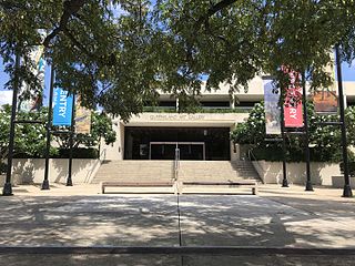 The Art Gallery first opened in
1896, with an exhibition of British and European artworks
purchased in London. The collection now includes such
important European paintings as Tintoretto's Resurrection
(c 1552), Sir Henry Raeburn's Portrait of Major General
Alexander Murray MacGregor (c 1780), Picasso's La
Belle Hollandaise (1905), and Degas' Three Dancers
(1888-90). English art is still a focus, including
Walter Sickert's 1925 painting of Whistler's studio, and an
excellent collection of English porcelain. Australian art is
understandably strong, with major works by Tom Roberts, S.T.
Gill, Piguenit, and Streeton; Charles Conder's Quiet
Beach (1887) is a particularly good example of the
Heidelberg School's Impressionistic phase. Also in the
Australian collection is the important Symbolist work by
Sydney Long, The Spirit of the Plains (1897) and
Frederick McCubbin's Edge of the Forest (1911). More
recent Australian painters' work include those of Hilda Rix
Nicholas and Noel Counihan from the 1930s; representative
works from the 1960s by Iain Fairweather and Leonard French;
and some of John Brack's later paintings (Procession
from 1979) among the most contemporary pieces. The gallery
carries out an ambitious programme of educational activities
and lecture series.
The Art Gallery first opened in
1896, with an exhibition of British and European artworks
purchased in London. The collection now includes such
important European paintings as Tintoretto's Resurrection
(c 1552), Sir Henry Raeburn's Portrait of Major General
Alexander Murray MacGregor (c 1780), Picasso's La
Belle Hollandaise (1905), and Degas' Three Dancers
(1888-90). English art is still a focus, including
Walter Sickert's 1925 painting of Whistler's studio, and an
excellent collection of English porcelain. Australian art is
understandably strong, with major works by Tom Roberts, S.T.
Gill, Piguenit, and Streeton; Charles Conder's Quiet
Beach (1887) is a particularly good example of the
Heidelberg School's Impressionistic phase. Also in the
Australian collection is the important Symbolist work by
Sydney Long, The Spirit of the Plains (1897) and
Frederick McCubbin's Edge of the Forest (1911). More
recent Australian painters' work include those of Hilda Rix
Nicholas and Noel Counihan from the 1930s; representative
works from the 1960s by Iain Fairweather and Leonard French;
and some of John Brack's later paintings (Procession
from 1979) among the most contemporary pieces. The gallery
carries out an ambitious programme of educational activities
and lecture series.
The Queensland Museum (t 07 3840 7555; open 9.30-17.00, ANZAC Day 1.30-17.00; admission adults $14.50, concession $12.50, children $11.50) is contiguous to the art gallery. The displays are devoted to natural history and archaeology (notably maritime archaeology), with particular attention being paid to Queensland. The display devoted to aviator Bill Hinkler is particularly moving for the transcript of his final message to his family.
Finally, the Performing
Arts Centre (t 07 3840 7444, tickets 07 3846 4444) was
designed by architect Robin Gibson and opened in 1985. Its
concert hall features a Klais pipe organ (7089 pipes) as the
central architectural feature. While the complex offers an
ambitious schedule of performances in both popular and
classical genres, during the Brisbane
Festival (usually every September) the schedule is
particularly busy. Their Out of the Box festival (even
numbered years) is directed at young children, ages three to
eight years.
The Queensland
Maritime Museum (t 07 3844 5361; open daily
09.30-16.30, last entry 15.30; admission adults $16.00,
concession $14.00, children $7.00) is located in a former
dry dock at the southern end of the Southbank Parklands. As
well as an exhibition devoted to shipwrecks, the museum has
a reconstruction of a first-class passenger cabin, a
functioning coal-fired steam tug built in Scotland in 1925
and the Second World War frigate Diamantina.
About 2km southeast of the cultural centre, on Stanley Street between Merton and Annerly Roads, is an interesting block of shops and shop houses which indicate aspects of the late 19C in Brisbane. They serviced the fine houses of Highgate Hill, which has been one of Brisbane's 'dress circle' residential areas since the 1920s. On Merton Road, the six two-storey shops called the Phoenix Buildings, were built for mining entrepreneur William Davies in 1889-90.
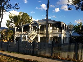
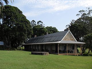
The 'Queenslander' house
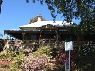 Miehunyah House
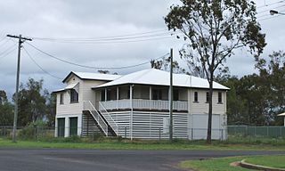 House in Chinchilla
 House in Sherwood |
'Miegunyah' House (open Wed. 10.30-15.00, weekends 8.00-16.00; admission adults $8.00, children $4.00) is one of the more elaborate examples of the distinctive vernacular architectural style referred to now as the 'Queenslander'. At one time, these timber houses, built on stilt-like stumps with ample verandahs and adequate ventilation to reduce heat and humidity, could be found everywhere throughout the state. Many of these delightfully idiosyncratic structures have now fallen victim to 'progress' and the penchant for air-conditioning, and have disappeared. Only in recent years has an active restoration campaign attempted to save these wooden marvels. Authors who grew up in them or with them around remember them nostalgically. Brisbane native David Malouf writes most eloquently of their appropriateness to coastal Queensland's semi-tropical climate in his 12 Edmonstone Street (1985): They have about them the improvised air of tree-houses. Airy, open, often with no doors between the rooms, they are on easy terms with breezes, with the thick foliage they break into at window level, with the lives of possums and flying-foxes, that living in them, barefoot for the most part, is like living in a reorganised forest. As Malouf also notes, 'most people in my youth were ashamed of this local architecture. Timber was a sign of poverty ... it made "bushies" of us'. Termites, of course, were another reason for the Queenslander's lack of favour. Another Queensland writer, Thea Astley, in a 1976 lecture titled 'Being a Queenslander: a form of literary and geographical conceit,' alludes to the insect-infested architecture as a metaphor for the place and its difference from the rest of the country: Houses perched on stilts like teetering swamp birds held stiff skirts all around, pulled a hat-brim low over the eyes; and with the inroads of white-ants [termites] not only teetered but eventually flew away. And then, we tend to build houses so that we can live underneath them. Perhaps those stilts made southerners think of us as bayside-dwelling Papuans. Fortunately, Brisbane and other Queensland towns were still too poor in the 1960s heyday of 'urban renewal' to be entirely rebuilt, when Sydney lost so much of its architectural history to progress and brick, so enough of the Queenslanders survive to still get a glimpse of their whimsical and imaginative character. Along with the Brisbane suburbs of Highgate Hill and West End and other inner-city neighbourhoods, Queenslanders of all kinds-from simple one-storey weatherboard houses to extravagant multi-storeyed hotels and public buildings-can be found in abundance in most Queensland towns, especially around Ipswich and Warwick, Rockhampton and Charters Towers.
|
Further down the street are Hillyard's and Pollock's shops and houses from the 1860s. Those next to the hotel are from around 1903. To the left, at Stanley Street's junction with Vulture Street, is an obvious three-part building, initially a telegraph and post office (left facing), a library (central with turret) and concert hall (behind). To the left on Vulture Street is an Italianate clock tower of archetypal proportions above the Town Hall.
The elegance of the area can best be seen in the
Memorial Park across the street and the Somerville House
School, which was originally built as William Stephens'
mother's residence in 1890. William and his father Thomas
were politicians and businessmen supportive of the South
Brisbane area.
North Brisbane
Fortitude Valley is about 1km northwest of the business district and centred at Ann Street and Brunswick Street (bus nos 370, 375, 379 from Ann Street). Formerly a working-class residential area, its multicultural population, ethnic restaurants and cheap rents have attracted a new and younger population. Brisbane's cafe and nightclub scene is centred here. It can still be a bit seedy, so travel accompanied after dark.
Some of the nicest public buildings in Fortitude Valley are a pair of hotels designed by Richard Gailey, the Empire Hotel, 339 Brunswick Street at the junction with Ann Street, and the simpler Prince Consort Hotel, at the juncture of Brunswick and Wickham Streets. He also designed 'Windermere' on Sutherland Avenue in Ascot which has an elegant verandah forming a pavilion by the front entrance. His design somewhat later for a bank in Normanton, a small town at the tip of the Gulf of Carpenteria, continues his penchant for lighter, timber balustrades and open verandahs.
The Queensland Women's Historical Association maintains Miegunyah Folk Museum (see the box above regarding Queenslander house design) north of Fortitude Valley at 35 Jordan Terrace, Bowen Hills, as a memorial to pioneer women. This fine colonial homestead was built in 1884 by William Perry and features lacy wrought-iron on the verandah and remarkable period furnishings and household accoutrements. Honeycomb brickwork screening covers the underhouse area.
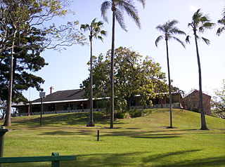 Newstead House
(t 07 3216 1846; open Fri. and Sat. 10.00-14.00, Sun.
10.00-16.00; admission $12.00, concession $9.00, first two
children free; bus no. 117), on Breakfast Creek Road about
4km northeast of the city centre, is operated by the Royal
Historical Society. The oldest of the existing private homes
in the area, it was built in 1846 for Patrick Leslie, an
early settler of the Darling Downs. He sold it to his
brother-in-law John Wickham, the Police Magistrate and
Government Resident at Moreton Bay. Until 1859 the house
served as the government house, making it the social centre
of the district. It would have been the first house of
substance seen from approaching ships. The Bulimba and
Hamilton reaches of the Brisbane River can be seen from its
verandah.
Newstead House
(t 07 3216 1846; open Fri. and Sat. 10.00-14.00, Sun.
10.00-16.00; admission $12.00, concession $9.00, first two
children free; bus no. 117), on Breakfast Creek Road about
4km northeast of the city centre, is operated by the Royal
Historical Society. The oldest of the existing private homes
in the area, it was built in 1846 for Patrick Leslie, an
early settler of the Darling Downs. He sold it to his
brother-in-law John Wickham, the Police Magistrate and
Government Resident at Moreton Bay. Until 1859 the house
served as the government house, making it the social centre
of the district. It would have been the first house of
substance seen from approaching ships. The Bulimba and
Hamilton reaches of the Brisbane River can be seen from its
verandah.
St Lucia ~ south of Brisbane
Queensland University can be reached by bus no. 269. To get there by car, follow Ann Street to North Quay, and Coronation Drive to Sir Fred Schonnel Drive and then on to St Lucia.
The school's first substantial benefactor was grazier
and philanthropist Samuel McCaughey who gave £228,000 in
1920. To provide a campus for the school, Dr J.O. Mayne and
his sister Miss Mary E. Mayne donated their property at St
Lucia for its permanent home. Architects Hennessey,
Hennessey and Company designed the original plan of the
setting which acknowledged the curve in the Brisbane River
and laid out the Great Court. This is a semicircular
arrangement of seven buildings (named for the university's
founders) faced with Helidon sandstone. The variety of
carved figures, historical scenes, coats of arms of other
universities, and prominent historical thinkers on the older
buildings are the work of John Theodore Muller. The more
recent ones are by Rhyl Shepherd. A central figure not
depicted is 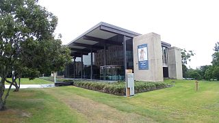 C.B. Christesen who as a
student in 1940 founded the literary journal Meanjin. The Anthropology
Museum (t 07 3365 2674; open Mon. - Fri. 11.00-16.00;
admission free) and Antiquities
Museum (t 07 3365 1111; open weekdays 09.30-16.30;
admission free) in buildings on the Great Court are well
worth a visit. The University's Art Museum
(t. 07 33 65 3046; open daily 10.00-16.00; free admission)
mounts interesting contemporary exhibits and often has
accompanying concerts. It is in a re-purposed Mayne
Centre designed by Brisbane architect Robin Gibson.
C.B. Christesen who as a
student in 1940 founded the literary journal Meanjin. The Anthropology
Museum (t 07 3365 2674; open Mon. - Fri. 11.00-16.00;
admission free) and Antiquities
Museum (t 07 3365 1111; open weekdays 09.30-16.30;
admission free) in buildings on the Great Court are well
worth a visit. The University's Art Museum
(t. 07 33 65 3046; open daily 10.00-16.00; free admission)
mounts interesting contemporary exhibits and often has
accompanying concerts. It is in a re-purposed Mayne
Centre designed by Brisbane architect Robin Gibson.
In the vicinity of Brisbane
Beyond the central city are several interesting venues easily accessible by car or public transport. The drive through Forest Park, 12km west of town, is very pleasant.
Mount Coot-tha refers to the area rather than the botanic gardens here and is from the local Aboriginal language, a phrase meaning 'dark honey'. The park is open continuously, but the gardens (t 07 3403 2533) are open from 08.00-17.00 (17.30 in the summer). A pleasant arrangement proscribes vehicles in the botanic gardens on the weekends and on holidays. The new botanic gardens and tropical display house, a planetarium with observatory, and superb views of the city and bay (particularly at night) can be found a few minutes by car to the west of Brisbane's centre on Milton Road. Bus no. 37A from Ann Street on King George Square stops at both the gardens and the lookout. The Aboriginal Trail presents plants used by the area's Murri people and features tree marking, rock painting and etching and a dance pit.
The park is at the end of the Taylor Range, Mount Coot-tha rising to 244m at the lookout and 285m at the summit.
At its base is Brisbane's oldest cemetery, the Toowong
Cemetery. Initially, it was received with little enthusiasm,
being a difficult 7km from the city. At its entrance on
Frederick Street is the Temple of Peace, designed and
constructed by Richard Ramo for his sons who died in the
First World War, his adopted son Fred and the family dog.
Bearing several inscriptions defaming war and its effects,
several thousand people attended its dedication. Among the
other notable funeral monuments is that for the Petrie
family, builders and stone masons from the 19C and 20C.
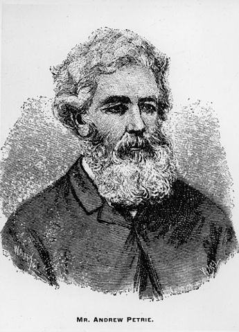 |
Andrew Petrie (1798-1872) and his sons John and Thomas (1831-1910) played interesting roles in Queensland's early history. Andrew was recruited as a free migrant by Rev. Dr J.D. Lang, emigrating in 1831 with his family which included three-month-old Thomas. After working in Sydney until 1837 as a civil engineer, he was sent to Moreton Bay as the Clerk of Works. Here he was appointed Engineer of Works and subsequently acted as the builder of most of early Brisbane. Among the stories associated with Andrew, the rescue of two white men who had lived with the Aborigines for a number of years is most remarkable. James Bracefield (or Bracefell, known as Wandi, 'great talker') and James Davis (Duramboi, 'kangaroo rat') were retrieved from indigenous life during an exploratory trip up the Mary River. Davis had escaped from Moreton Bay as a lad and lived with local Aborigines for 16 years. Petrie assured both Bracefield and Davis that they would not be punished upon their return to Brisbane. Although Davis could only haltingly remember English, he was able to break into Scottish songs learned in childhood. As he embarked with Petrie and Henry Stuart Russell, members of his community appeared and chanted him farewell. In response he promised to return 'when the moon has come back to you in three months'. In fact, he died in Brisbane 47 years later, having worked as a blacksmith and owned a crockery shop. Both men soon became reticent about their lives in the Aboriginal community, Davis suggesting, 'If you want to know about the blacks, take off your clothes and go and live with them, as I did.' Andrew's eldest son John took over the family business when his father became blind, acting as a builder and city patron. A cabinet maker by inclination, his buildings are marked by tasteful interior finishes. Among his most prominent buildings are the General Post Office, Customs House and the Harbours and Marine Building. Andrew's third son Thomas fraternised with Queensland Aborigines, particularly in his youth. As a 14-year-old he was honoured to have accompanied a tribe on a bunya nut (bon-yi) feast in the Bunya Range. His capacity to speak some local languages allowed him to intercede during conflicts between settlers and Aborigines and gave him access to unexplored areas of the settlement. His daughter's book Tom Petrie's Reminiscences of Early Queensland (1904) presents a detailed account of his early life and settlement on Murrumba, a property on the Pine River. The planetarium's name honours Sir Thomas Brisbane, Governor of New South Wales from 1821 to 1825. Known as the father of Australian science, he established an observatory at Parramatta and was first president of the Philosophical Society of Australia in his first year as governor.
|
Racial conflict in 19C Brisbane
The Petrie family's interest and respect of Aboriginal people living in their traditional areas, while not unique, was an exception. During the period immediately after establishment of the Moreton Bay colony, the military administration considered them little more than a nuisance. Guards were posted in the grain fields, but small rewards were given them for the return of escaped convicts. By the late 1830s officials in London and Sydney were pressing for a more active conversionary approach to Aborigines. The Reverend Dr J.D. Lang went so far as to arrange for a small community of Germans to establish itself at Xions Hill (now Nundah) with a missionary purpose. Although it did become a fairly prosperous agricultural community, the Aborigines took virtually no heed of efforts to civilise and convert them.
Once the Brisbane area was opened to free settlers, however, the lot of the local Aborigines worsened considerably. The traditional owners of the land were generally given no access to it and no recompense for it. The poisoning of an Aboriginal community at Kilcoy Station on the Darling Downs in 1842 is arguably one of the central illustrations of atrocious greed in the 19C.
The Cullin-la-ringo Massacre resulted in 19 white
settlers--men, women and children--being killed, the worst
such incident in Australian history. More frequently, there
is no record of the deaths. Following the slaughter of ten
whites in the Dawson Valley in 1857, white settlers spent a
full year killing every Aboriginal in the area. Frequently
quoted figures estimate that as many as 500 whites and
anywhere between 5000 and 15,000 Aborigines died as a result
of settlement-related racial conflict.
The traveller interested in rural life can take a day trip west of Brisbane to the verge of the Darling Downs. Toowoomba is a leisurely two-hour drive, but you might consider a stop in Ipswich, and given sufficient time, a southern return route through Warwick. Darling Downs was discovered by botanist Allan Cunningham in 1827, four years after his visit to Moreton Bay. The name refers to then governor of New South Wales, Sir Ralph Darling (1775-1858), who was in office at the time of the region's first exploration. The drive from Brisbane to Ipswich is via the Cunningham Highway (the Bradfield Highway, no. 1, south to 15). Toowoomba is west on route 54 (here the Warrego Highway). Warwick is south of Toowoomba on route 42; the return trip to Ipswich can be made via the Cunningham Highway.
 About 18km along the way at
Grindle Road in Wacol is a National Trust property called Wolston
House (t 07 3088 8133; Wed.-Sun. 10.00-16.00;
admission adults $10, concession $7.00, children $5.50).
Built from local material in 1852, it is a good example of
the country residences of the era. William Pettigrew
designed and built it for Dr Stephen Simpson, then
Commissioner for Crown Lands in Moreton Bay. Before coming
to Australia, Simpson studied under Samuel C.F. Hahnemann
and wrote the first book on homoeopathy in English.
About 18km along the way at
Grindle Road in Wacol is a National Trust property called Wolston
House (t 07 3088 8133; Wed.-Sun. 10.00-16.00;
admission adults $10, concession $7.00, children $5.50).
Built from local material in 1852, it is a good example of
the country residences of the era. William Pettigrew
designed and built it for Dr Stephen Simpson, then
Commissioner for Crown Lands in Moreton Bay. Before coming
to Australia, Simpson studied under Samuel C.F. Hahnemann
and wrote the first book on homoeopathy in English.
Ipswich
The area around Ipswich (population 73,000) was initially known as Limestone Hills and was the starting point for Cunningham's exploration of the Darling Downs. The limestone was quarried by convicts as early as 1827, the blocks being ferried to Brisbane on the Bremer River in whale boats. Subsequent coal-mining and the arrival of the railroad in 1876 made for a prosperous town.
Drive through the town on Brisbane Street; the tourist information centre is on the corner of Brisbane Street and d'Arcy Doyle Street in the Claremont House (t 07 3281 0555). A walk around the older section of town gives a lesson on the changing styles of civic architecture in the last decades of the 19C. The corner building is the former Bank of Australasia (1879) with the manager's residence behind. Next to the bank is the Town Hall built in 1869. Across Nicholas Street is St Paul's Anglican Church built in 1859, but modified in 1886 (aisles and vestry) and 1929 (sanctuary and chapel).
Turning south on Ellenborough, South and Nicholas
Streets gives views of the Ipswich Technical College and RSL
Memorial Hall, both designed by George Brockwell Gill. The
CSA Hostel, a few steps along Limestone Street, is a Jackie
Howe.
Jacky Howe
 |
The blue singlet, a sleeveless undershirt, the uniform of the Aussie country worker, is known as a Jacky Howe. The shearer Jackie Howe (1855-1922), along with cricket batsman Don Bradman, are the nearly iconic symbols of early 20C male Australia. Howe was a Warwick native. In 1892 he used hand blades to shear 327 merino ewes in 7 hours 20 minutes. No Luddite, he sheared 337 sheep in 8 hours using machine shears in 1904. His father had been a well-known circus acrobat and his mother a companion of Catherine Leslie, wife of pastoralist Patrick Leslie. Jackie was taught shearing by a Chinese shearer in the late 1880s. Recognised as a good bloke, the publican Jimmy Ah Foo described him, saying 'Jack Howe champion. Him much first-class man altogether. Quiet man. No dlink much. No dance Highland Fling. No pullee girl around. No lallikin tlicks [larrikin tricks].' He was also an outstanding athlete, particularly excelling at running and jumping. A memorial to Howe stands in a small park on the corner of New England Highway and Jackie How Drive. Colonial Georgian home built in the 1860s for the Campbell family. As well as the Technical College and RSL, Gill designed a private home called 'Arrochar' in a district of substantial houses just north of the Boys' Grammar School and the City View Hotel on the corner of Brisbane and Roderick Streets. These buildings are much less heavy than most public buildings of the era, and sympathetic to the climate. Among the many other interesting buildings in town, the former Courthouse on East Street (by Charles Tiffin, 1859) and former incinerator (by Walter Burley Griffin, 1936) deserve mention. |
Toowoomba
The fertile bottom land where Toowoomba (population
76,000) now stands atop the Great Dividing Range was a stop
for travellers and team-drivers. Initially a reedy, grassy
swamp, Toowoomba (Aboriginal for 'a place to get melons')
grew around that function, becoming an 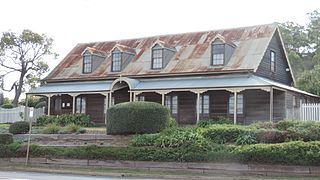 important stage
stop between Brisbane and the Darling Downs by the time it
was formally established in 1860. This history makes its
most significant building the Royal
Bull's Head Inn (t 07 4637 2278; open first Sun. of
the month; admission adults $6.00, concession and children
$4.00) on the corner of Brisbane and Drayton Streets. The
inn was a stage stop in about 1847 and the present structure
dates from 1859. The Lynch family home from 1879 until
1973. Its renovation is due to the efforts of the
National Trust.
important stage
stop between Brisbane and the Darling Downs by the time it
was formally established in 1860. This history makes its
most significant building the Royal
Bull's Head Inn (t 07 4637 2278; open first Sun. of
the month; admission adults $6.00, concession and children
$4.00) on the corner of Brisbane and Drayton Streets. The
inn was a stage stop in about 1847 and the present structure
dates from 1859. The Lynch family home from 1879 until
1973. Its renovation is due to the efforts of the
National Trust.
The Cobb
& Co Museum at 27 Lindsay St (t 07 4639 1971; open
daily 09.30-16.00, tours given 10.30-14.30; admission
free to Toowoomba residents, otherwise adults $12.50,
concession $10.00, children $6.50) describes the history of
this firm and horse-drawn transport generally. The town has
literary and artistic leanings evident in the Toowoomba
Regional Art Gallery, 531 Ruthven St (t 07 4688 6611;
open Tues-Thurs. 11.00-15.00, Sun 13.00-16.00; free
admission). The first regional art centre in
Queensland, it was founded in 1937, housed in the city hall
until 1994 when a permanent building was erected next to
city hall. The collection includes regional art and
craft collected by the city, an interesting bequest from
Lionel Lindsay in 1959 which brought both works from members
of the Lindsay family and from leading Australian artists,
and a variety of items donated in 1950 comprising the Fred
and Lucy Gould Collection.
Warwick
The area around Warwick (population 10,000) was settled in 1841 by Patrick Leslie and his brothers as the Canning Downs Station. Warwick was surveyed and established by Patrick Leslie in 1849, becoming the first town proper in Queensland after Brisbane. The railway line from Ipswich opened in 1871.
Warwick's single most significant event occurred in 1917 when Prime Minister Billy Hughes was pelted with an egg during a speech here. Hughes was defending his attempt to impose conscription during the First World War. He demanded that the local police arrest the man who threw the egg. The policeman refused. Based upon this refusal, Hughes eventually established the Commonwealth Police Force.
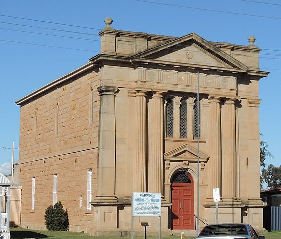 Most of the
buildings of note in Warwick are constructed of locally
quarried sandstone. On Dragon Street, Pringle
Cottage (t 07 4661 2028; open Wed-Fri 10.00-12.00, Sat
and Sun 14.00-16.00; a modest admission fee), now a local
museum comprised of several buildings, was built in 1869 by
John McCullouck and is reminiscent of Scottish cottages. The
massive two-storey Masonic Hall (1886) is an example of the
architectural taste of late-19C businessmen, with eclectic
classical and Doric elements. The design of the Court House
(1885-87) and Town Hall (1888) derives from similar sources.
The National
(c 1890) and Criterion
(1917) Hotels show more character and sympathy with the
climate. Both have pleasant verandahs and the Criterion has
a splendid bar and Art Nouveau ornament.
Most of the
buildings of note in Warwick are constructed of locally
quarried sandstone. On Dragon Street, Pringle
Cottage (t 07 4661 2028; open Wed-Fri 10.00-12.00, Sat
and Sun 14.00-16.00; a modest admission fee), now a local
museum comprised of several buildings, was built in 1869 by
John McCullouck and is reminiscent of Scottish cottages. The
massive two-storey Masonic Hall (1886) is an example of the
architectural taste of late-19C businessmen, with eclectic
classical and Doric elements. The design of the Court House
(1885-87) and Town Hall (1888) derives from similar sources.
The National
(c 1890) and Criterion
(1917) Hotels show more character and sympathy with the
climate. Both have pleasant verandahs and the Criterion has
a splendid bar and Art Nouveau ornament.
The Jondaryan Woolshed Complex (t 07 4692 2229; open daily 8.30-16.30; admission adults $10.00, concession $8.50, children $5.00), 45km northwest of Toowoomba, presents demonstrations of horse shoeing and shearing. It was non-union labour at Jondaryan that prompted the maritime workers to refuse to handle its wool-clipping in 1890. The maritime workers lost this battle, though the shearers eventually received their wage award. Station owners continue their animosity towards maritime union workers to this day.
Returning to Ipswich from Warwick, the road passes
through Cunningham's Gap, a remarkable feature due to the
steep rise on either side of the road. There are a variety
of walks from the car park at the Gap which gives a look at
the Main
Range
National Park's (t 07 4666 1133) forest. West of the
loop to Toowoomba and Warwick is pasture and range land on
Mesozoic sediments. As the scattered eucalypts become
shorter and further apart, the ground cover changes to
tussock grass. Highlands of the Dividing Ranges cause some
increased rainfall east of the road running north and south
through St George.
Some 350km west of Toowoomba on the Warrego Highway is
Roma (population 6100). The first gazetted settlement in
Queensland after its separation from New South Wales in
1859, the town was not named for the Italian city, but after
the wife of Sir George Bowen, Queensland's first governor.
Its great claim to fame is as the site of the trial in 1872
of Harry Redford, alias Captain Starlight, one of the most
notorious bushrangers. Also at Roma were the beginnings of
Queensland's wine-making in 1863, when vine cuttings were
brought to the district. Today, Roma is best known as the
source of natural gas, with a 450km pipeline running to
Brisbane.
Waltzing Matilda
|
The image of the outback stockman as a defining attribute of the Australian character received its greatest anthem further north on the Diamantina River beyond Winton. While staying with the Macpherson family at Dagworth Station, Andrew Bardon 'Banjo' Paterson wrote Australia's most popular national theme, 'Waltzing Matilda'. He set his poem to a Scottish tune played for him by one of the family's daughters Christina Macpherson. Its first public performance was at the North Gregory Hotel in Winton (burnt down in 1900, 1915 and 1946 and now constructed of brick). Matching sentiment centred on the struggle by itinerant shearers and station workers, the song was an immediate success. It spread rapidly through the outback in the repertoire of the very swagmen it honoured. The music for the ballad in its current form was composed by Marie Cowen, wife of James Inglis. He used it as a promotional wrapping for his Billy Tea, an inexpensive black tea which is still available.
|
A Waltzing Matilda Festival is held in Winton in April, and there is a museum and information office on Elderslie Street, t 07 4657 1544. Also on Elderslie Street in Winton is the Royal Theatre Open Air Picture Show (t 07 4657 1488). Opened in 1918 it is, along with Broome's open-air cinema, the last of its kind in Australia.
Carnarvon National Park
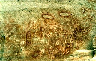 270km north of Roma is the
Carnarvon National Park (t 13 0013 0372), which has
some of the most extensive stencilling art by Aborigines in
the country. The largest of the 46 sites recorded in the
area are the Art Gallery and Cathedral Cave. Engraving and
stencilling are by far the most common techniques. Entire
walls of hands make the most striking stencil, but emu feet,
and implements are readily found as well. The engravings are
of women's vulvas, human and animal tracks and geometric
shapes. Some free-hand drawings are also displayed.
270km north of Roma is the
Carnarvon National Park (t 13 0013 0372), which has
some of the most extensive stencilling art by Aborigines in
the country. The largest of the 46 sites recorded in the
area are the Art Gallery and Cathedral Cave. Engraving and
stencilling are by far the most common techniques. Entire
walls of hands make the most striking stencil, but emu feet,
and implements are readily found as well. The engravings are
of women's vulvas, human and animal tracks and geometric
shapes. Some free-hand drawings are also displayed.
Walking tracks into the gorge proceed from the information centre. The Art Gallery is 5.6km into the gorge and Cathedral Cave is 9.3km in. Expect to spend a half-day walking. There are no facilities beyond the information centre, so carry your own water.
Archaeological evidence suggests that Cathedral Cave was only occasionally and recently inhabited, but that considerable tool-making occurred here. Further, a large amount of cycad seed shells were found here. The palm cycad seeds are toxic until thoroughly processed in a manner not dissimilar to that used for acorns by native American groups-grinding, then leeching and fermenting. A relatively recent addition to the diet (4000 years ago), they are currently believed to be associated with large ceremonial events. An ochre mine existed at West Branch Camp 12km away. Visitors can stay in Injune or at the Carnarvon Gorge Wilderness Lodge (t 07 4984 4503) at the entrance to the gorge. The next road inland is the Mitchell Highway (A71) north from Bourke, New South Wales, through Cunnamulla and Charleville to Barcaldine near Longreach. This Bourke is the place referred to when one speaks of being 'back o'Bourke', that is, in the middle of nowhere. It marks the cessation of eucalypt and commencement of acacia wattle, called the mulga. In fact, north of Charleville and certainly beyond Bardaldine, Mitchell grass becomes the prevalent flora.
Barcaldine is remembered for a shearers' strike here in 1891, which led to the birth of two of Australia's current national political parties, Labor and National. Although the strike was a failure and the leaders were imprisoned, the effort eventually led to significant changes in industrial relations and labourers' conditions.
Longreach (population 3610) has more noteworthy history
than its modest size and remote location would suggest. A
range cattle and sheep station district, it was the home of
the Queensland and Northern Territory Aerial Service
(QANTAS), founded by Flying doctors W. Hudson Fysh and P. J.
McGuiness. The hangar in which they had six DH-50 biplanes
contracted is still in use at the local airport. The visitor
desk at the information
centre (t 07 4658 4150, on Eagle Street in the centre
of town) is a replica of the first Qantas booking office.
--------------------------------------------------------------------------------------------------------------------------------------
Stock routes
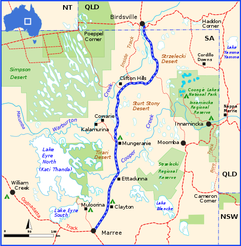
Australia's three most mentioned stock routes are the
Birdsville Track, the Canning Stock Route, the Murranji
Track. They were used to transport cattle overland to
railway lines prior to the introduction of haulage by truck.
Until the state governments bore wells along their lengths,
cattle losses during the drives were often prohibitively
high.
The Birdsville Track opened in the 1880s once the Port Augusta-to-Oodnadatta railway line was completed in South Australia. Cattle mustered in the Channel Country of Queensland were driven about 480km to Marree. They came under tariff as they crossed the border into South Australia near Birdsville, confirming it as the logical starting point of the drive.
The track proceeds south from Birdsville along the Diamantina River. During dry periods, Goyders Lagoon (into which the Diamantina flows) could probably be crossed. Otherwise the longer and sandier outer track would be used. From the bore at Clifton Hills, the track continued south to the bore near Mulka. The final leg of the journey is across the Cooper, Clayton and Frome Rivers to Marree. During wet periods, these crossings are quite dangerous.
The Canning Stock Route in Western Australia proceeds from around Halls Creek in the East Kimberley region nearly 1400km to Wiluna. Surveyor Alfred Canning discovered the route in 1906. The Aboriginal people along the route directed him to their wells. In his second pass through the country, he established dependable water supplies in 52 places. The Aboriginal people across whose land the cattle passed were never happy about this use of their land. A number of incautious drovers were speared while on this route.
The Murranji Stock Route was reputed as the most
difficult due to uncertain water at Murranji. Pastoralist
Nat Buchanan (1826-1901) pioneered the route in the 1890s,
which extended from the Victoria River region of
northwestern Northern Territory to Camooweal in western
Queensland. It more or less followed what is now the
Buchanan Highway, eventually depending on bores every 30km
to 50km.
-----------------------------------------------------------------------------------------------------------------------------------------
Longreach also has
the Stockman's
Hall of Fame (t 07 4658 2166; open daily 09.00-17.00
except Christmas; wheelchair access; admission adults
$32.00, concession $27.00, childen $15.00). An important
symbol as well as a description of working life in the
outback stations, the displays here are largely of text and
photographs documenting outback life from the 1860s to the
present.
19C author 'Rolf Boldrewood' described a cattle theft
by 'Captain Starlight' and accomplices in the area in his
book Robbery Under Arms (1888). In fact, in 1870
Harry Redford and four associates gathered 1000 head of
mixed range cattle and drove them to South Australia,
pioneering a 2400km stock route along the meagre Thomson,
Cooper and Strzelecki Rivers. Arrested in Adelaide and tried
in Roma for the obvious theft of Bowen Downs Station cattle,
they were acquitted for their stockman daring-do.
Cloncurry and Mount Isa
Cloncurry and Mount Isa are mining and agricultural communities in Queensland's remote northwest, reached via route 66 from Winton. Silver, lead, copper and zinc are extracted and processed here. Places on tours of both surface and underground mines at Mount Isa can be booked at the Outback at Isa tourist office 19 Marian Street, Mount Isa (t 07 4749 1555).
Ore from the Mount Isa Mine comes from shafts up to 2km below the surface. The extent of the works may be gauged by the large open-cut mine. Its entire production is used not as a source of ore but as in-fill for shafts being closed.
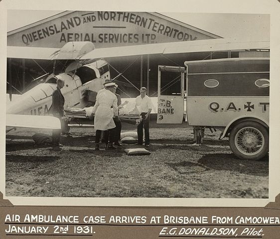 Cloncurry (population 2300) was
the first location of the Royal Flying Doctor Service,
conceived by Reverend John Flynn and initiated in 1928.
Flynn recognised the need for the service during his outback
missionary work in the 1910s and '20s. Communication with
the service was made possible by Alfred Traeger's
development of a pedal-powered wireless radio with a
typewriter-style keyboard. The service is free, supported by
donations and a variety of fund-raising efforts.
Cloncurry (population 2300) was
the first location of the Royal Flying Doctor Service,
conceived by Reverend John Flynn and initiated in 1928.
Flynn recognised the need for the service during his outback
missionary work in the 1910s and '20s. Communication with
the service was made possible by Alfred Traeger's
development of a pedal-powered wireless radio with a
typewriter-style keyboard. The service is free, supported by
donations and a variety of fund-raising efforts.
The history of the service is presented at the John
Flynn Place Museum (t 07 4742 1251; open weekdays year
round 08.00-16.30 and weekends 09.00-15.00 May-Sept.).
Southwest Queensland
The southwest corner of Queensland is known as Channel Country. An area of sparse population and uncertain water, it has been a range cattle producing area since the 1870s. Birdsville, one of the smaller towns in the region, is the starting point of the Birdsville Track, a former stock route. It is now known for one of the most serious of Australian horse race meetings. a series of races, the Birdsville Cup Race Meeting is held on the first weekend in September. As many as 6000 visitors come for the event, an attraction known for the number of light planes flying in for the Friday and Saturday races and semi-professional boxing matches in the evening.
NOTE:
Travel in the area of Channel Country qualifies as serious
outback travel and requires full preparation, including the
supply of your own water, food, and petrol. Motorists should
ring the Boulia Police on 074 746 3120 for
information before departing down the Birdsville Track. At
times flooding will completely shut down the road.
The Queensland coastal road from the south passes between lush coastal mountains and extensive beaches. A number of interesting islands lie just offshore. Brisbane is about 550km south of the point at which the Great Barrier Reef begins. The tropical north begins south of Townsville and continues up Cape York beyond the extent of readily passible roads.
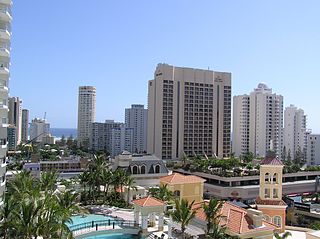 The Gold Coast is
the first 42km north from the New South Wales border.
Visited by three million people a year, it has been the
developers' dream. The beach-front property looks much as
you should expect from the advertisements: a bit crowded, a
few too many towers, and an occasional building design
deserving an award. If you are looking for a Miami
Beach-style experience, with excellent beaches, the Gold
Coast is the place to come. At all costs avoid the place
during the end-of-school holidays, when the area is mobbed
by recent graduates (and others).
The Gold Coast is
the first 42km north from the New South Wales border.
Visited by three million people a year, it has been the
developers' dream. The beach-front property looks much as
you should expect from the advertisements: a bit crowded, a
few too many towers, and an occasional building design
deserving an award. If you are looking for a Miami
Beach-style experience, with excellent beaches, the Gold
Coast is the place to come. At all costs avoid the place
during the end-of-school holidays, when the area is mobbed
by recent graduates (and others).
Fortunately, the area has natural attractions as well.
These include Lamington National Park (an extensive
temperate rainforest), near perfect surfing waves at
Burleigh Heads, and miles of beaches with swells varying
from negligible to rough, and all surfing levels in between.
Lamington
National Park (t. 13 0013 0372) is accessible at
either Binna Burrra via Beechmont (10km) or Green Mountains
via Canungra (37km). These roads diverge from Nerang on the
Pacific Highway. The park is served by ranger stations. The
area is a subtropical 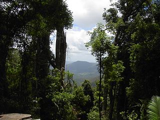 rainforest set on a plateau at
600-1100m high. A Mesozoic lava flow from a caldera centred
on Mount Warning, the area is in the Macpherson Range.
Ecologically consistent since the supercontinent Gondwana
split into continents, the park contains Antarctic beeches
related to those in Tasmanian rainforests, though much
larger. It is also the home of a curious rootless and
leafless precursor to ferns, Psilotum nudum, dating
from prior to the separation of the continents. The
rainforest flora most readily identified, though, are
elkhorn and staghorn ferns, figs and a plethora of orchid
species. The birdlife is diverse and includes three
bowerbird species, both species of lyrebird and a variety of
kingfishers, lorikeets, cockatoos and fairy wrens. As ever,
the mammals are harder to see, but the pademelon wallaby and
some of the possums (ringtailed and mountain brushtail) can
be seen in the late afternoon, around dawn and, of course,
during nightwalks.
rainforest set on a plateau at
600-1100m high. A Mesozoic lava flow from a caldera centred
on Mount Warning, the area is in the Macpherson Range.
Ecologically consistent since the supercontinent Gondwana
split into continents, the park contains Antarctic beeches
related to those in Tasmanian rainforests, though much
larger. It is also the home of a curious rootless and
leafless precursor to ferns, Psilotum nudum, dating
from prior to the separation of the continents. The
rainforest flora most readily identified, though, are
elkhorn and staghorn ferns, figs and a plethora of orchid
species. The birdlife is diverse and includes three
bowerbird species, both species of lyrebird and a variety of
kingfishers, lorikeets, cockatoos and fairy wrens. As ever,
the mammals are harder to see, but the pademelon wallaby and
some of the possums (ringtailed and mountain brushtail) can
be seen in the late afternoon, around dawn and, of course,
during nightwalks.
Well-marked walking tracks and hiking trails lead to much frequented as well as secluded areas. The two most recommended starting points are the guest houses at Binna Burra (t 07 5533 3622) and at O'Reillys (t 07 5502 4911) on the Green Mountains side of the park. A 14km Border Trail links the two. Both are accessible by car via Canungra or by bus daily from the coast. Reserved as a park in 1915, Lamington became part of the popular imagination due to a campaign at the time to save the area from loggers, undertaken by R.W. Lahey, at the time a young civil engineer. Its stature grew in the 1940s when personal accounts of experience in natural settings were a popular genre.
In One Mountain After Another, Bernard O'Reilly (founding owner of the guesthouse mentioned above) describes his search in 1937 for the crash site of a Stinson aeroplane bound for Sydney with eight aboard. He reports that the surviving passengers first asked after Bradman's cricket score (165 not out). In all it took O'Reilly ten days to find the site and return with a rescue party.
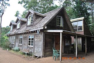 Romeo Lahey and
Arthur Groom, early conservationists, established Binna Burra
Mountain Lodge (t. 07 5533 3747) in 1933. The name is
from a local Aboriginal dialect and translates as 'where the
beech trees grow'. Walks in the park can take anywhere from
an hour to half a day and are particularly fulfilling during
wildflower blossoming in July and September. At Binna Burra
is a 'senses trail', designed for blind people. A botanical
garden near O'Reilly's Guest House is an educational treat
before walking. O'Reilly's also has rainforest walkways
raised far enough off the ground to give a view into the
canopy.
Romeo Lahey and
Arthur Groom, early conservationists, established Binna Burra
Mountain Lodge (t. 07 5533 3747) in 1933. The name is
from a local Aboriginal dialect and translates as 'where the
beech trees grow'. Walks in the park can take anywhere from
an hour to half a day and are particularly fulfilling during
wildflower blossoming in July and September. At Binna Burra
is a 'senses trail', designed for blind people. A botanical
garden near O'Reilly's Guest House is an educational treat
before walking. O'Reilly's also has rainforest walkways
raised far enough off the ground to give a view into the
canopy.
Camping hikes can last as long as you like. Dirk Flinthart, author of the irreverent Coasting: Real Guide to the East Coast of Australia (1996), praises the four-day caldera rim walk as utterly unforgettable. Less adventurous forays into these coastal mountains would stop at the tea rooms at Tamborine Mountain (North Tamborine and Eagle Heights) or, farther south, the sights at Springbrook National Park. The Springbrook Plateau is known for its Best of All Lookouts and the nearby glow worm site at Natural Bridge. Roads to the park are off the road to Lamington National Park out of Nerang.
Brisbane area islands
A number of islands lie offshore from Brisbane.
Moreton Island and North Stradbroke Island are both
accessible by ferry from Lytton, and Holt Street Wharf in
Pinkenba; St Helena Island is reached by private plane
charter. Fraser Island is accessible from Hervey (pronounced
Harvey) Bay at Mary River Heads, Moon Point and Inskip
Point. In addition to fishing, bird-watching and swimming,
these islands are favourite four-wheel-drive sand-buggy
venues. Seabreeze has a nice forum
discussing anchorages.
Moreton Island
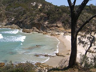 Moreton
Island, 40km from Brisbane, is 38km long and 9km
across. Its most prominent physical feature, Mount Tempest
(280m), is one of the highest stable sand dunes in the
world. Except during the Christmas holidays, the island is
largely left to the 125-plus bird species and the lovely
beaches. The lighthouse at its northern tip was built in
1857 and still functions. In addition to Aboriginal shell
middens, the island boasts freshwater lakes and associated
bird life, native scrub and banksias and big-game fishing
from its resort
hotel at Tangalooma (t 07 3268
6333). This hotel operates the daily catamaran between the
Holt Street Dock off Kingsford Smith Drive in Eagle Farm and
the island. Booking is essential. While four-wheel drive
vehicles can be rented at the hotel, vehicular ferries
depart from Scarborough (t 07 3203 6399), a suburb in
Northern Brisbane and from Lytton on the south bank of the
Brisbane River near its mouth.
Moreton
Island, 40km from Brisbane, is 38km long and 9km
across. Its most prominent physical feature, Mount Tempest
(280m), is one of the highest stable sand dunes in the
world. Except during the Christmas holidays, the island is
largely left to the 125-plus bird species and the lovely
beaches. The lighthouse at its northern tip was built in
1857 and still functions. In addition to Aboriginal shell
middens, the island boasts freshwater lakes and associated
bird life, native scrub and banksias and big-game fishing
from its resort
hotel at Tangalooma (t 07 3268
6333). This hotel operates the daily catamaran between the
Holt Street Dock off Kingsford Smith Drive in Eagle Farm and
the island. Booking is essential. While four-wheel drive
vehicles can be rented at the hotel, vehicular ferries
depart from Scarborough (t 07 3203 6399), a suburb in
Northern Brisbane and from Lytton on the south bank of the
Brisbane River near its mouth.
North Stradbroke Island
North Stradbroke Island, like Moreton Island, is a wildlife sanctuary. Ferry and water taxi service is from Cleveland, a suburb at the end of Cleveland Road (highway number 22) from south Brisbane, bus numbers 621 or 622 or by train. Stradbroke Island has a bus service between its three small towns, Dunwich, Point Lookout and Amity Point. Dunwich, 40km long, was originally a quarantine station (1828). A typhoid plague (other authorities identify it as having been cholera) in 1850 is recorded in the local graveyard. A storm in 1896 broke the spit at Jumpinpin which joined the north and south islands. As with many other places on the coast in winter, humpback whales can be spotted migrating northward. A number of literary figures frequent North Stradbroke Island. In a light-hearted poem entitled 'Ocean Beach', John Manifold describes the tourists here in a sense familiar to nearly every vacation spot:
Visitors with three weeks' tan
Flaunt it at the raw beginners-
Raw indeed, like uncooked dinners
Pink and oily for the pan.
Aboriginal poet Oodgeroo Noonuccal (Kath Walker,
1920-93) grew up on the island and lived here near Myora
Springs outside Dunwich. St Helena Island, just 4km from the
mainland, was originally planned as a quarantine station as
well. It acted as a model prison from 1867 to 1932. Its
reputation was largely due to its being more or less
self-sufficient. The island was named for an unfortunate
Aborigine called Napoleon who was marooned here by keepers
at Dunwich gaol. St Helena Island
Guided Tours (t 07 3893 1240) provides ferry
services from Breakfast Creek.
Sunshine Coast
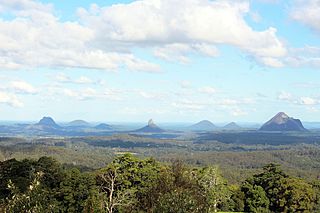 A day trip further
north to the Sunshine Coast offers similar opportunities to
the Gold Coast. The area extends from Caloundra 96km north
of Brisbane to Noosa. The highway (no. 1) passes through a
dairy farming area around Caboolture and past the Glasshouse
Mountains. These curious trachyte volcanic cores rising to
300m were named by Captain Cook. He gave them the name
either because they reminded him of the reflections off his
Yorkshire garden sheds or, as more trustworthy sources
suggest, of that region's glass furnaces. Caboolture is
famous for dairy products, particularly yoghurt. The Abbey Museum (t. 07
5495 1652; open Mon.-Sat, 10.00-16.00; admission adults
$12.00, concession and children $8.50) is 7km east towards
Bridie Island, on Old Toorbul Road. The museum's collection
spent time in a number of cities between London and
Australia. It describes itself as devoted to the cultural
history of the Mediterranean and Europe, and contains an
impressive, if incongruously located, collection of ancient
artefacts and weaponry. Near it are two Aboriginal sites,
one a tidal fish trap, the other a bora ground. An
end-of-year event worthy of note in the area, the Maleny-Woodford Folk
Festival, held end of Dec. early Jan. on a property at
Woodford, 29km south of Maleny, has an active Aboriginal
participation (t 07 5496 1066 for information).
A day trip further
north to the Sunshine Coast offers similar opportunities to
the Gold Coast. The area extends from Caloundra 96km north
of Brisbane to Noosa. The highway (no. 1) passes through a
dairy farming area around Caboolture and past the Glasshouse
Mountains. These curious trachyte volcanic cores rising to
300m were named by Captain Cook. He gave them the name
either because they reminded him of the reflections off his
Yorkshire garden sheds or, as more trustworthy sources
suggest, of that region's glass furnaces. Caboolture is
famous for dairy products, particularly yoghurt. The Abbey Museum (t. 07
5495 1652; open Mon.-Sat, 10.00-16.00; admission adults
$12.00, concession and children $8.50) is 7km east towards
Bridie Island, on Old Toorbul Road. The museum's collection
spent time in a number of cities between London and
Australia. It describes itself as devoted to the cultural
history of the Mediterranean and Europe, and contains an
impressive, if incongruously located, collection of ancient
artefacts and weaponry. Near it are two Aboriginal sites,
one a tidal fish trap, the other a bora ground. An
end-of-year event worthy of note in the area, the Maleny-Woodford Folk
Festival, held end of Dec. early Jan. on a property at
Woodford, 29km south of Maleny, has an active Aboriginal
participation (t 07 5496 1066 for information).
The coastal road is accessible from Nambour. This superb stretch of coastline is less heavily developed than the Gold Coast. Agriculturally very productive, the area has a thriving Devonshire tea/cottage garden/bed-and-breakfast gentility about it. Queenslanders would not be comfortable in a less structured fantasy strip. The pride of Nambour is the Giant Pineapple, a hollow roadside grotesque at the Sunshine Plantation which offers a display describing pineapple cultivation.
Gympie and Cooloola National Parks are north of Noosa
Heads. Named for a kind of stinging tree, Gympie (population
11,200) is a favourite place in Australia because the gold
found here in the 1860s saved the state and, perhaps, the
national bank. Situated among picturesque hills and sharp
ravines, larger hills are visible inland. Tourist
information: Bruce Highway, Lake
Alford; t 07 5483 1661. At the nearby Cooloola
National Park (t 07 5485 3245) is Rainbow Beach, noted
for multicoloured sandstone caused by minerals leaching down
cliffs. Several walking trails, including the 46km Cooloola
Wilderness Trail, depart from the park's visitor's centre.
At Inskip Point ferries leave for Fraser Island.
Fraser Island
 Fraser
Island is about three hours north of Brisbane by car
followed by a short ferry ride from River Heads or Hervey
Bay. Travel on the island is by four-wheel drive or on foot.
Like Moreton Island, it is composed of quartz sand weathered
from the Great Dividing Range. At 132km long, it is the
world's largest sand island and is World Heritage-listed for
that reason. Noteworthy for its slightly acidic dune lakes,
its cover ranges from mangroves to temperate rainforests and
includes a variety of low open scrub, heath and low eucalypt
forests. The island is named for Eliza Fraser who was among
a group shipwrecked somewhat north of the island in 1836.
Making their way to the island and with the help of the
Butchulla Aboriginal community, they waited two months for
rescue. She alone survived. The story is re-worked by
Patrick White in his novel A Fringe of Leaves (1977)
and by Sidney Nolan in a series of paintings (1947). The
Aboriginal people were displaced to missions when the
satinay timber cutters came for this wood. Highly resistant
to marine borer, this timber lined the Suez Canal.
Fraser
Island is about three hours north of Brisbane by car
followed by a short ferry ride from River Heads or Hervey
Bay. Travel on the island is by four-wheel drive or on foot.
Like Moreton Island, it is composed of quartz sand weathered
from the Great Dividing Range. At 132km long, it is the
world's largest sand island and is World Heritage-listed for
that reason. Noteworthy for its slightly acidic dune lakes,
its cover ranges from mangroves to temperate rainforests and
includes a variety of low open scrub, heath and low eucalypt
forests. The island is named for Eliza Fraser who was among
a group shipwrecked somewhat north of the island in 1836.
Making their way to the island and with the help of the
Butchulla Aboriginal community, they waited two months for
rescue. She alone survived. The story is re-worked by
Patrick White in his novel A Fringe of Leaves (1977)
and by Sidney Nolan in a series of paintings (1947). The
Aboriginal people were displaced to missions when the
satinay timber cutters came for this wood. Highly resistant
to marine borer, this timber lined the Suez Canal.
While air transport from Brisbane is the quickest means of reaching the Great Barrier Reef, there is a coastal road north from Brisbane. Understandably, the associated mainland towns and inland nature areas tend to be slighted in favour of the reef. The trip by land follows in segments. Note that much of the highway passes through endless fields of cane, with few views of the coastline itself. An excellent rail service extends from Brisbane 1680km north to Cairns (t 13 2232).
The Capricornia section of the southernmost part of the
Great Barrier Reef lies off the area between Bundaberg and
Rockhampton.  Maryborough, Hervey Bay and
Bundaberg lie well south of the group. Maryborough
(population 23,000) is known for the gardening in its city
parks and well-presented colonial architecture. The 19C
bandstand in Queen's Park is a cast-iron fantasy that
originally housed a drinking fountain. Geraghty's
Store Museum on Lennox Street (t 07 4121 2250; open
daily 10.00-15.00; admission adults $5.50, concession and
children $4.00) has a remarkable façade for such a small
building. Maryborough
and District Tourist Information Centre, corner Alma
and Nolan Streets, t 07 5460 4511. Excellent 'heritage walk'
brochures of the town's colonial architecture, including its
many 'Queenslander' buildings, are available here. The
unassuming Lamington Bridge (1896) across the Mary River was
the world's first concrete girder bridge. Poet John
Blight described the area based on his perceptions while
there as a proprietor of a timber mill in the 1960s.
Maryborough, Hervey Bay and
Bundaberg lie well south of the group. Maryborough
(population 23,000) is known for the gardening in its city
parks and well-presented colonial architecture. The 19C
bandstand in Queen's Park is a cast-iron fantasy that
originally housed a drinking fountain. Geraghty's
Store Museum on Lennox Street (t 07 4121 2250; open
daily 10.00-15.00; admission adults $5.50, concession and
children $4.00) has a remarkable façade for such a small
building. Maryborough
and District Tourist Information Centre, corner Alma
and Nolan Streets, t 07 5460 4511. Excellent 'heritage walk'
brochures of the town's colonial architecture, including its
many 'Queenslander' buildings, are available here. The
unassuming Lamington Bridge (1896) across the Mary River was
the world's first concrete girder bridge. Poet John
Blight described the area based on his perceptions while
there as a proprietor of a timber mill in the 1960s.
A lazy couch of beach and sun in the morning
make me forget the threat of rocks and warning
beacons on the bay. Comfortable mooring
for little ships and an elderly beachcomber snoring
intermittently between blink and blink of the waves
wash and splash of the waters, until the tide comes in.
Set on rich basalt soil, Bundaberg (population 47,200) is known to every Australian as the home of Bundaberg Rum. Another of Australia's icons, 'Bundy' begins as sugar cane molasses and ends as a spirit to rival that distilled in the Caribbean. Tours of the distillery (t. 07 4131 2999; the particulars) are more or less on the hour and, following a video presentation and tour of some of the facilities, end with an opportunity to sample some of the best of their product. The tourist information centre (on the corner of the highway and Bourbong Streets; t 07 4153 8888) can direct you to the distillery on Avenue Street in East Bundaberg.
Rockhampton (population 65,000) first flourished as a
result of a gold find 60km upriver at Canoona in 1858.
Prosperity followed the discovery of gold and, particularly,
copper at Mount Morgan in 1882. A number of historic
buildings on the south bank of the Fitzroy River date from
the 1880s and 1890s. The commercial buildings along Quay
Street show the effect of a tropical climate in the use of
verandahs, colonnades and loggias. Tourist
information centre: Curtis Park, Gladstone Road; t
07 4921 2311. On the Fitzroy River, Rockhampton  eventually became the shipping point for the
inland pastoral country as far west as Longreach. In fact,
the livestock auction Central
Queensland Livestock Exchange (t 07 4931 7300; cattle
most Fridays) immediately west of town receives mention as a
novel tourist venue. A number of limestone caves are about
20km north of town. The privately owned Capricorn Caves
(open daily with hourly tours from 09.00- 16.00; admission
$32.00, concession $28, children $16.00). The Tropic of
Capricorn passes a few kilometres south of town.The town's Botanical
Gardens (t 07 4922 1654; open 6.00-sunset; free
admission) were established in 1869; it has an attractive
Japanese garden section.
eventually became the shipping point for the
inland pastoral country as far west as Longreach. In fact,
the livestock auction Central
Queensland Livestock Exchange (t 07 4931 7300; cattle
most Fridays) immediately west of town receives mention as a
novel tourist venue. A number of limestone caves are about
20km north of town. The privately owned Capricorn Caves
(open daily with hourly tours from 09.00- 16.00; admission
$32.00, concession $28, children $16.00). The Tropic of
Capricorn passes a few kilometres south of town.The town's Botanical
Gardens (t 07 4922 1654; open 6.00-sunset; free
admission) were established in 1869; it has an attractive
Japanese garden section.
The Capricornian Group
The accessible islands of the Capricornian Group
include Lady Elliot, Lady Musgrave, Heron, Great Keppel and
North West Islands. These lie off the coast from Bundaberg
to Rockhampton. Overnight
accommodation is available on Lady Elliot Island
(t 07 5536 3644, light plane from Brisbane, Bundaberg
and Hervey Bay), Heron
Island (t 03 9413 6288, catamaran or helicopter
daily from Gladstone), Great
Keppel Island (light plane from Rockhampton or launch
from Rosslyn Bay) and for Lady
Musgrave Island (Catamaran from Bundaberg).
Camping permits are available from the Marine
Parks Authorities (t 07 750 0700). All of these
islands provide world-class diving opportunities for all
levels of divers.
Lady Elliot Island is a sand-covered coral cay 80km from
Bundaberg at the far southern edge of the reef. Set in 40m
deep water, the coral gardens in the ten or more major dive
sites contain spectacularly diverse submarine life. From
about November to February the shores are nesting sites for
green turtles. Rookeries serve up to 56 bird species. The
island's resort is spartan but comfortable and accommodates
a small number of people.
Lady Musgrave Island is similarly a coral cay with a
navigable lagoon and an underwater observatory. Turtles nest
here in the summer. The large pisonia trees common to
tropical coral-limestone soils provide roosting places for
gannets and terns. The extremely sticky fruit of these trees
occasionally trap small birds. The two-hour catamaran trip
from Bundaberg (daily during summer, Tues, Thurs, Sat and
Sun during winter) make this a day-trip venue. Day
tours depart from Port Bundaberg (t 07 4152 9011; Tues,
Thurs, Sat and Sun 08.30; phone to confirm). As usual,
contact the carriers for particulars.
Heron Island's surrounding reef is partly exposed at low
tide. Despite being only about 1km across, the island's bird
life has a dense palm, pisonia and she-oak forest for
refuge. Prevalent species include herons, muttonbirds, noddy
terns and sea eagles. Like the other islands in the
Capricornian group, the turtles lay their eggs here from
October to January; hatchings occur from late December to
May. Visits to the island, except by helicopter (t 07 4978
1177; phone to confirm), require an overnight stay at Heron
Island Resort.
 Great Keppel Island has over 30km of white,
sandy beaches. The resort
here has a variety of rooms and dwellings and offers a
variety of activities, including organised activities for
children during the school holidays. The water here is clear
and warm. The beaches even slightly beyond the immediate
area of the hotel are not likely to be crowded. Snorkelling
at Monkey Beach, about 30 minutes' walk south of the resort,
is said to be fine. Quantas flies here from Rockhampton.
Several ferries depart from Rosslyn Bay Harbour just south
of Yeppoon to a number of islands in the Keppel group.
Halfway Island has particularly good snorkelling as well.
Great Keppel Island has over 30km of white,
sandy beaches. The resort
here has a variety of rooms and dwellings and offers a
variety of activities, including organised activities for
children during the school holidays. The water here is clear
and warm. The beaches even slightly beyond the immediate
area of the hotel are not likely to be crowded. Snorkelling
at Monkey Beach, about 30 minutes' walk south of the resort,
is said to be fine. Quantas flies here from Rockhampton.
Several ferries depart from Rosslyn Bay Harbour just south
of Yeppoon to a number of islands in the Keppel group.
Halfway Island has particularly good snorkelling as well.
The Whitsundays
Mackay, Townsville and Ingham are the mainland towns for the Whitsundays and the central section of the reef. Mackay is known for sugar-processing and as a coal-shipping port. Eungella National Park (t 13 0013 0372), a rainforest in the Clarke Range, is 74km inland. Platypuses are frequently seen near Broken River bridge at dawn and dusk. Townsville (population 97,000) has an attractive waterfront residential area around Cleveland Bay, the basis for its existence. Its origin was on Castle Hill overlooking Ross Creek. Tourist information: Bruce Highway; t 07 4721 3660. The intellectual life of the town is centred on James Cook University and the marine sciences carried out at the Great Barrier Reef Marine Park Authority and at the Australian Institute of Marine Science. The Great Barrier Reef Aquarium, Flinders Street East (t 07 4750 0800; open daily 09.00-17.00; admission adults $28.00, concession $22.00, children $14.00) is the largest living coral reef aquarium in the world, and includes excellent underwater displays and shark and turtle feeding sessions. Today Townsville is best known as a military town, as many Australian troops are stationed here.
The Flinders Highway to Mount Isa starts here. Passing along the way the nearby mining community Charters Towers and Ravenswood (the latter a near ghost town of surprising vitality--two hotels, a cavaran park and free tenting at the showgrounds an easy morning drive from the Whitsundays' mainland). As elsewhere, fine pastoral land lies further inland beyond the Great Dividing Range at Flinders, Thompson and Diamantina. Along the coast, an hour to the north, Ingham (population 5700) is interesting for its Basque and Italian settlers. Cairns is less than three hours' drive from Townsville along the coast, about six hours with minimum stops inland via Charters Towers.
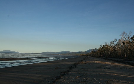 Another 53km north of Ingham on the Bruce
Highway is the tiny town of Cardwell (population 1400), the
only place on the highway between Brisbane and Cairns that
is actually on the coast directly. Tourist
information centre: Seaview Cafe, t 07 4066 8601.
Directly north of Cardwell is Edmund
Kennedy National Park (t 1300 130 372), one of
the parks included in the Wet Tropics World Heritage Area of
northern Queensland. It is named for explorer Edmund Kennedy
(1818-48), who in 1848, along with his Aboriginal guide
Jacky-Jacky and a party of 13, attempted to land near here
and make an overland voyage north to Cape York. The mangrove
swamps and dense vegetation, as well as the enormous
mosquitoes, in the park today give a good indication of why
Kennedy's expedition failed (Kennedy was speared to death
trying to reach the rescue ship at Cape York; only
Jacky-Jacky survived from Kennedy's group and eventually led
a rescue party to the two survivors stranded at Pascoe
River). The park has beautiful walking tracks and boardwalks
into the forests and near the beach at Wreck Creek.
Estuarine crocodiles live in the creeks here, so swimming is
not allowed. Insect repellent is also essential for any
visitor in the park.
Another 53km north of Ingham on the Bruce
Highway is the tiny town of Cardwell (population 1400), the
only place on the highway between Brisbane and Cairns that
is actually on the coast directly. Tourist
information centre: Seaview Cafe, t 07 4066 8601.
Directly north of Cardwell is Edmund
Kennedy National Park (t 1300 130 372), one of
the parks included in the Wet Tropics World Heritage Area of
northern Queensland. It is named for explorer Edmund Kennedy
(1818-48), who in 1848, along with his Aboriginal guide
Jacky-Jacky and a party of 13, attempted to land near here
and make an overland voyage north to Cape York. The mangrove
swamps and dense vegetation, as well as the enormous
mosquitoes, in the park today give a good indication of why
Kennedy's expedition failed (Kennedy was speared to death
trying to reach the rescue ship at Cape York; only
Jacky-Jacky survived from Kennedy's group and eventually led
a rescue party to the two survivors stranded at Pascoe
River). The park has beautiful walking tracks and boardwalks
into the forests and near the beach at Wreck Creek.
Estuarine crocodiles live in the creeks here, so swimming is
not allowed. Insect repellent is also essential for any
visitor in the park.
Cardwell's greatest attraction is its close proximity to Hinchinbrook Island, 5km offshore and accessible by private boat, water taxi or charter boat from Cardwell or Dungeness; check with the tourist information office for details. According to legend, an old sailor remarked about the channel separating the island from the mainland, 'nobody can sail through the Hinchinbrook Channel and not believe in God'; it is indeed paradisaical, with the most complex system of mangroves in Australia. The island is the largest totally protected island national park in the world, over 45,000 ha ranging from mountainous peaks (the highest is Mount Bowen, at 1121m) to waterfall-laden rainforests and virginal beaches.
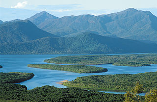 The park is a
bushwalker's dream; the 32km Thorsborne Trail follows the
coastal side of the island and takes three to five days to
complete. The numbers walking this trail at any given time
are limited, so bookings are advisable
(t 13 7468). The wildlife here includes wallabies,
large cassowaries (Casuaris casuarius) the brilliant
blue Ulysses Butterfly (Papilio ulysses), the small
Boyd's Forest Dragon (Gonocephalus boydii), and the
nocturnal Giant Tree Frog (Litoria infrafrenata). The
Atlas Moth (Coscinocera hercules), one of the world's
largest moths with a wing span of 25cm, can also be found in
the forest canopy. Less welcome sights for campers and
bushwalkers are the Giant White-tailed Rat (Uromys
caudimaculatus), a native species that has an
insatiable appetite for all foods brought in by campers; and
marine stingers, one of the highly venomous
jelly-fish of the northern waters that make swimming here
impossible between October and April. Estuarine crocodiles
are also in the creeks and mangrove areas, so avoid these
waters as well.
The park is a
bushwalker's dream; the 32km Thorsborne Trail follows the
coastal side of the island and takes three to five days to
complete. The numbers walking this trail at any given time
are limited, so bookings are advisable
(t 13 7468). The wildlife here includes wallabies,
large cassowaries (Casuaris casuarius) the brilliant
blue Ulysses Butterfly (Papilio ulysses), the small
Boyd's Forest Dragon (Gonocephalus boydii), and the
nocturnal Giant Tree Frog (Litoria infrafrenata). The
Atlas Moth (Coscinocera hercules), one of the world's
largest moths with a wing span of 25cm, can also be found in
the forest canopy. Less welcome sights for campers and
bushwalkers are the Giant White-tailed Rat (Uromys
caudimaculatus), a native species that has an
insatiable appetite for all foods brought in by campers; and
marine stingers, one of the highly venomous
jelly-fish of the northern waters that make swimming here
impossible between October and April. Estuarine crocodiles
are also in the creeks and mangrove areas, so avoid these
waters as well.
Port Hinchinbrook Resort in Cardwell has a small low-key
resort (t 07 4066 2250). The resort on
Hinchinbrook itself was abandoned after the 2010 financial
crisis and shortly thereafter Cyclone Yassi in 2011. More
recently the buildings burnt in a bush fire in 2014.
Its remains is now something of an embarrassment.
Unlike the relatively flat coral cays of the Southern Reef Islands, the Whitsundays are continental which gives most of them a mountain peak in their interior. As well as affording remarkable views of the neighbouring islands, this variety of elevation results in a greater variety of wildlife. Long Island, for instance, is known for its scrub turkeys and Lindeman for its butterflies. Coral reefs fringe most of them, although the Barrier Reef itself is 10 or more kilometres oceanward.
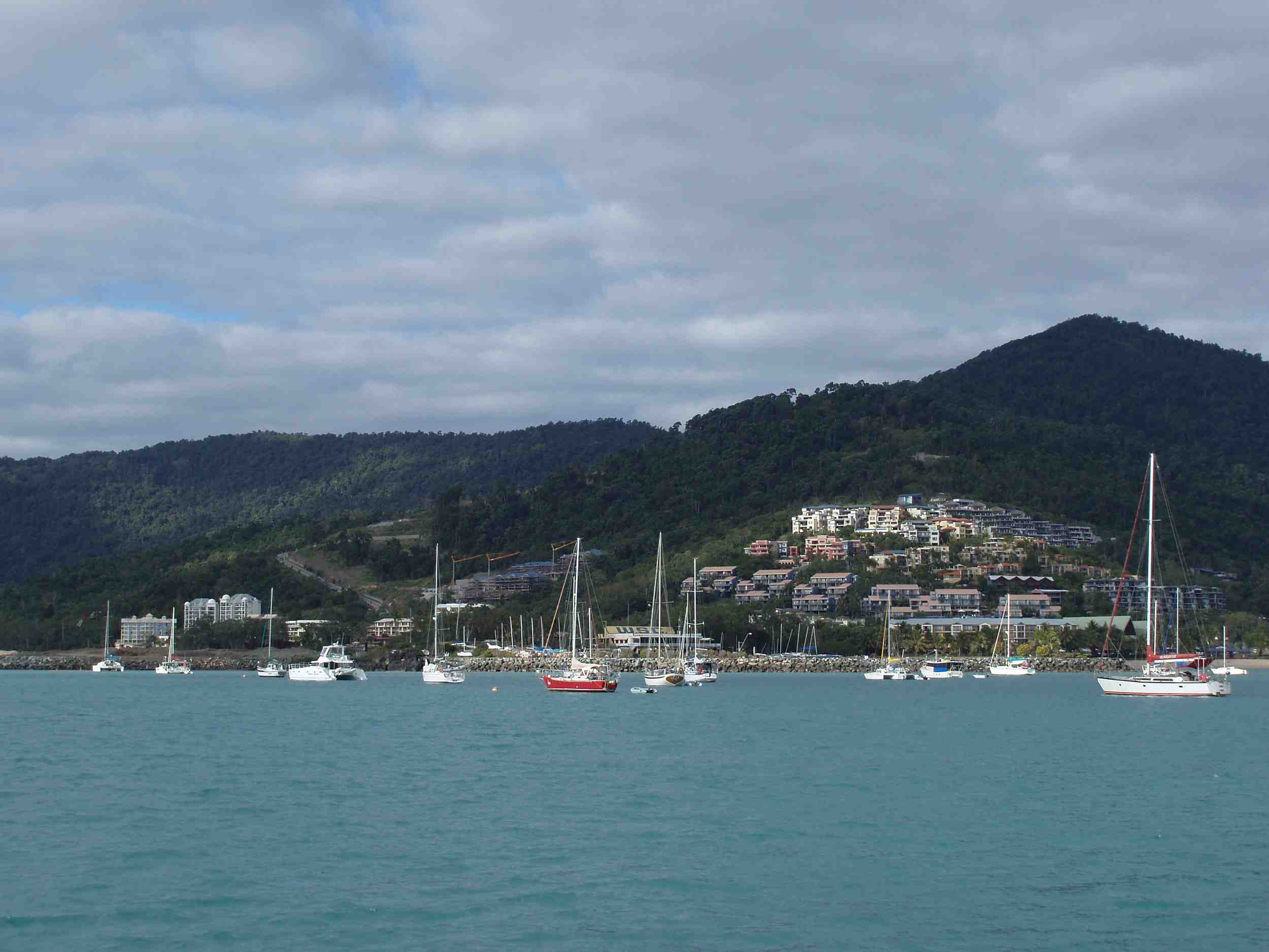 Shute Harbour and the nearby
Airlie Beach, Mackay and Prosperine are the starting points
for tours. Most of the resort islands are accessible by
launch and light plane from Shute Harbour, Hamilton Island
and Mackay. The Queensland National Parks and Wildlife
Service Whitsunday District Office (t 13 0013 0372) is
between Shute Harbour and Airlie Beach.
Shute Harbour and the nearby
Airlie Beach, Mackay and Prosperine are the starting points
for tours. Most of the resort islands are accessible by
launch and light plane from Shute Harbour, Hamilton Island
and Mackay. The Queensland National Parks and Wildlife
Service Whitsunday District Office (t 13 0013 0372) is
between Shute Harbour and Airlie Beach.
Captain Cook sailed though the Whitsunday Passage on 3
July 1770. He remarked that the area was a safe harbour, but
the fast-flowing tidal currents (the tide shifts are
relatively large, sometimes turning lovely beaches into
extensive tidal mud-flats) and brief squalls can be tricky
for the inexperienced boatman. The resort islands of the
Whitsundays include Lindeman, Hamilton, Long Island, South
Molle, Hook, Hayman and Daydream. All of these have
anchorages, those at Hamilton and Hayman are marinas with
full services. There are over 70 uninhabited islands as
well. In fact, there is little to be said about these
paradisiacal places. They satisfy all the senses in a
languorous, tropical fashion. Each has splendid beaches,
unexcelled snorkelling and scuba diving. As a group they are
a fantasy for amateur sailing. Hamilton Island was developed
by Gold Coast property developer Keith Williams. Controversy
surrounded the permission to convert the farming lease to a
tourism venue during Joh Bjelke-Petersen's premiership. The
resort was completed in 1986 and is currently a publicly
held company managed by Holiday Inn. The Hamilton
Yacht Race begins from the island in mid-August.
Even if you lack a keeled yacht, the excitement of the races
and the camaradarie about the marina are wonderful.
Innisfail
Innisfail's opera festival in December and Nerada tea plantation tours (t 07 4096 8328, 28km west of town, daily between 09.00 and 16.00, closed February) add to its presence as the point of access to Dunk Island.
A fascinating side trip from Innisfail is to travel
west 17km on the small road into the South Johnstone River
Valley, through gorgeous rainforest scenery, until you reach
Paronella Park.
The park's address is Japonvale Road (Old Bruce Highway),
Mena Creek (t 07 4065 0000; open 9.00-19.30; admission
adults $45.00, concession $40.00, children $24.00). As Dirk
Flinthart describes it, the park is 'a bizarre monument to
one Spaniard's homesickness'. It was built by Jose
Paronella, a Catalonian who came to Australia in 1911 as a
cane cutter. With his wife, he began to build Paronella Park
in 1929; he opened it to the public in 1935, at which time
it included a dance hall, a theatre, a tennis court, a tea
garden and a children's playground. Paronella, alas, did not
understand the area's tropical climate, and many of his
concrete buildings were washed away by floods. Since he
reinforced them with steel railway tracks, the buildings
have now become rusty, and the wooden parts have been eaten
away by termites. Consequently, the complex now looks like
an old ruin in the middle of the rainforest. The gardens are
particularly wonderful, with a 'Tunnel of Love' now filled
with little bats leading to a waterfall, and rare rainforest
plants that Paronella planted.
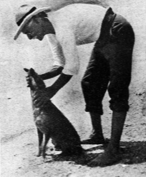 Dunk Island was the home of
E.J. Banfield author of The Confessions of a Beachcomber,
between 1897 and 1923. Having suffered something like a
mental breakdown after some years' work as a journalist in
Townsville, he retired to Dunk and took up natural history.
His descriptions were instrumental in familiarising
Australians with the beauties of the reef:
Dunk Island was the home of
E.J. Banfield author of The Confessions of a Beachcomber,
between 1897 and 1923. Having suffered something like a
mental breakdown after some years' work as a journalist in
Townsville, he retired to Dunk and took up natural history.
His descriptions were instrumental in familiarising
Australians with the beauties of the reef:
... gardens of the sea, nymphs, wherein fancy feigns
cool, shy, chaste faces and pliant forms half-revealed
among gently swaying robes; a company of porpoise, a herd
of dugong; turtle, queer and familiar fish, occasionally
the spouting of a great whale, and always the company of
swift and graceful birds.
Today Dunk Island is three-quarters national park and
the rest is resort development. Access to the island--the
largest of the Family Group--is from Mission Beach, 5km away
on the mainland. Tourist information: Mission
Beach Tourist Information Centre, Porters Promenade, t
07 4068 7099. The resort on the island is still being
rebuilt following the damage caused by Cyclone Yasi in
2011. On the other hand camping is more than pleasant
and quite popular. Reservations
(fees adults $6.50, families $24.00) through Queensland
National Parks are necessary. Families have
superb rainforests and beaches to enjoy. The island has over
150 species of birds, and most of the brilliant tropical
butterflies associated with northern Queensland.
Cairns
Cairns (population 66,000), the next town of substance up the coast, is 1717km north of Brisbane. Writing in 1895, Archibald Meston praised its Trinity Inlet, as well as Port Curtis at Gladstone, as second only to Port Jackson (in Sydney Harbour) as the finest ports in Australia. In fact, Gladstone is a busier port than Sydney, shipping coal and alumina smelted from nearby Weipa's bauxite. As a port, Cairns shipped tin until about 1915. After the Second World War sugar came to prominence, but the real growth here was in tourism after the airport was built 4km north of town in 1984. Tourist information: t 07 4036 3341.
The boardwalk through a mangrove at the entrance to the airport sets the natural tone of the area. The town is a tourist centre, a backpackers' Mecca and a starting point for explorations of the tropical rainforests around the town. All activities can be booked at the visitor's centre.
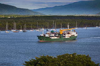 Cairns sits on Trinity Inlet,
described and named by Captain Cook on Trinity Sunday 1770.
Like a number of northern Queensland ports, mineral export
started the town in the 1880s, in this case tin from the
Atherton Tablelands immediately to the west. Timber, cane
and tableland agriculture supported the town prior to
tourism.
Cairns sits on Trinity Inlet,
described and named by Captain Cook on Trinity Sunday 1770.
Like a number of northern Queensland ports, mineral export
started the town in the 1880s, in this case tin from the
Atherton Tablelands immediately to the west. Timber, cane
and tableland agriculture supported the town prior to
tourism.
The palm-lined coast extends north and south of town. Oceanward are Arlington, Moore and Sudbury Reefs and Green Island National Park (t 13 0013 0372) where visitors can scuba dive, snorkel or simply putter about in a glass-bottomed boat. Trips beyond the reef allow surfing in three metre breakers.
Rivers flowing from the Atherton Tablelands provide a chance to whitewater raft or canoe. The Daintree National Park is an hour north. This is Australia's largest pristine rainforest and some of the world's oldest existing rainforest. Cruises on the Daintree River are in the Wet Tropics World Heritage Area; cruise operators abound between the small township at the edge of the park and the ferry. Ecotourism is saving this area from timber-felling operations. Visitors can even join bird-watching and bird-banding tours in the Daintree (Fine Feather Tours t 07 4094 1199).
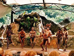 The Tjapukai Aboriginal
Dance Theatre and Menmuny Museum present the area's
Aboriginal community in an ambitious variety of forms and
venues. The dance
theatre is in Kuranda, 27km northwest of Cairns, a
town known for its craft
markets (open 9.30-15.00). The most interesting way to
get to Kuranda is by steam train. The tracks were laid in
1891 and pass through 15 tunnels. Book at the Kuranda Scenic Railway
office in the Cairns railway station (t 07 4036 9333).
The Tjapukai Aboriginal
Dance Theatre and Menmuny Museum present the area's
Aboriginal community in an ambitious variety of forms and
venues. The dance
theatre is in Kuranda, 27km northwest of Cairns, a
town known for its craft
markets (open 9.30-15.00). The most interesting way to
get to Kuranda is by steam train. The tracks were laid in
1891 and pass through 15 tunnels. Book at the Kuranda Scenic Railway
office in the Cairns railway station (t 07 4036 9333).
Port Douglas, 75km north of Cairns, is an upmarket, if
casual, beach community much redeveloped by Christopher
Skase in the 1980s. Skase escaped to Majorca, where he
remains in exile from his creditors, perhaps a banking loss
but a social gain for Australia. Its allure is from its
four-mile (6.5km) beach (no waves or swells, of course, due
to the nearby reef). Port Douglas is the kind of well-run
and predictably tidy resort where people such as President
Clinton stay when they holiday in Australia. Tourist information: 23
Macrossan Street, t 07 4099 4540.
Cane toads
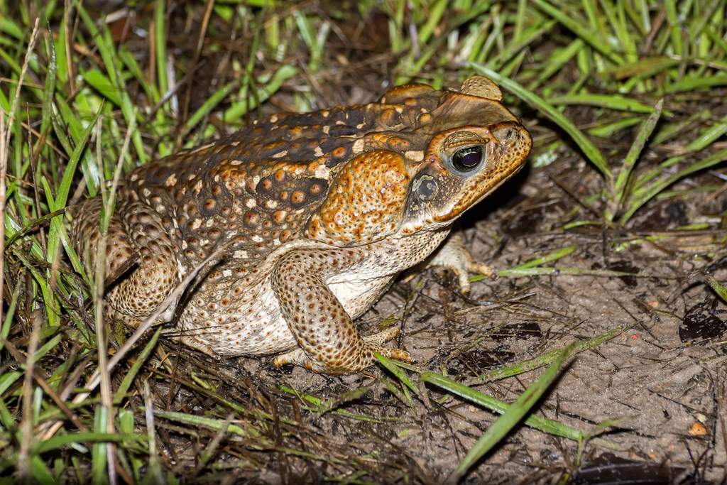
Falling into the category of 'it seemed like a good idea at
the time', cane toads (Bufo marinus) were introduced into
Queensland from Central America in 1935 in a failed attempt
to control the indigenous Frenchi and Greyback beetles whose
grubs were infesting the cultivated sugar cane. While the
toads do eat these beetles, they will not eat the grubs
simply because they do not dwell on the ground, a fact that
seemed to escape the attention of the authorities
responsible for introducing the toad to Australia. The
mature beetles propagate in cleared cane fields in daylight;
the toads avoid sunlight, thus missing the breeding beetles
as well as their grubs.
Not only do they prefer to eat just about everything else, but behind each eye they have a sack of poison. Contrary to most defence mechanisms, which give predators a chance to learn to avoid noisome or dangerous prey, any creature which eats these toads dies. When pressed, the glands can even squirt this poison as far as a metre.
Further, the toads are legendary breeders. Males mount long-dead roadkilled females, preferring to breed even over food after starvation. The females lay remarkable quantities of eggs in any available water.
In an award-winning documentary written and directed by Mark Lewis entitled Cane Toads: An Unnatural History (1989), the toad's role in Queensland's ecology and society receives truly humorous treatment. Despite everything-the folly of the agricultural agents who introduced the pest, the danger the toads present to indigenous and domestic animals, their grotesque sexuality-any number of Queenslanders appreciate their adaptability, intelligence, and even patience when handled as playthings by children. They are reportedly moving south, and have been sighted in Sydney in 1999. Great efforts are being made to prevent their spread into Kakadu National Park, where the toad's impact on the natural environment would be particularly devastating.
Cooktown
Cooktown (population 1300), 350km north of Cairns, is the departure point for touring Cape York. Captain Cook touched land here for repairs after running the Endeavour aground on the coral reef in 1770. His description of the kangaroo was written here (see p 621). The only river Cook named was Cooktown's Endeavour River. Tourist information is at the Botanic Gardens.
Botanist Alan Cunningham visited the area in 1820,
climbing the jungle-clad Mount Coongoon. Cooktown's
settlement in 1873 was furthered by a brief gold rush in
1876, but the town's evacuation for fears of Japanese
bombing during the Second World War nearly led to its
demise. The Aboriginal name Carco surfaced repeatedly in
early accounts referring to the harbour. Its James
Cook Historical Museum, St Helen Street near Furneaux
Street (t 07 4069 5386; open May-Sept. daily
9.00-16.00, Oct.-Apr. Tues-Sat. 9.00-16.00; admission adults
$10.00, concession $8.00, children $3.00), presents a lucid
history of the town, including the gold rush, riots against
the Chinese during that period and the Aboriginal presence.
The museum's building was erected in 1889 as the Convent of
St Mary and became North Queensland's first high school.
During the Second World War, the US troops took over the
convent as a command post, and the Sisters of Mercy never
returned. The National Trust took over in 1969 and have
created one of the best local history centres in Australia.
The museum includes the original cannon and anchor from
Captain Cook's ship Endeavour.
Rock art in northern Queensland
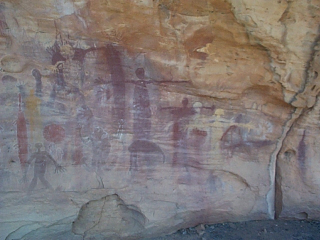 80km south of Cooktown is the
Quinkan Rock Art Gallery on Aboriginal land near Springdale
on the road to Lakeland and Laura. The Split Rock and
Guguyalangi sites, 12km south of Laura, are the only
galleries easily accessible to the public. The earliest
examples here are the pecked geometric motifs in the Early
Man shelter which date from about 13,000 years ago. Later
pecked and engraved images (c 4000 years ago) portray
tracks, designs and occasional human figures. Tours of the
rock art sites are booked through the Quinkan
and Regional Cultural Centre (t. 07 4060 3457, from
Mar.-Dec.) which also organizes the Laura Dance
Festival in late June to early July in odd numbered
years.
80km south of Cooktown is the
Quinkan Rock Art Gallery on Aboriginal land near Springdale
on the road to Lakeland and Laura. The Split Rock and
Guguyalangi sites, 12km south of Laura, are the only
galleries easily accessible to the public. The earliest
examples here are the pecked geometric motifs in the Early
Man shelter which date from about 13,000 years ago. Later
pecked and engraved images (c 4000 years ago) portray
tracks, designs and occasional human figures. Tours of the
rock art sites are booked through the Quinkan
and Regional Cultural Centre (t. 07 4060 3457, from
Mar.-Dec.) which also organizes the Laura Dance
Festival in late June to early July in odd numbered
years.
The most impressive works here are the post-contact rock paintings around Laura River. These present human figures, horses, and, most impressive, the mythological figures from which the area takes its name. The figures are generally plain solids in red ochre. Human figures and ancestral heroes are in red or yellow ochre or white clay and in-filled with spots, stripes or bars. The spidery figures with pendulous earlobes are Quinkan; the heavier figures, often with legs bent to their sides and branches coming from their heads, are Anurra.
Easiest access to the area generally and the rock art galleries specifically is through the Quinkan & Regional Cultural Centre (t 07 4060 3457) at Laura. The Quinkan Hotel hosts an Laura Dance Festival during the last weekend in June on odd-numbered years. This festival has attracted increasing numbers of participants and spectators recently. Incidentally, the hotel was built in 1887 and features bushlore construction of timber and iron with exposed round posts. Its rooms are air-conditioned.
The rock art of the Mutumui People in the Bathurst Bay
area of eastern Cape York revolves around the lives of
cultural heroes Itjibiya and Almbarrin. Their burial site on
Clack Island continues to have ritual significance to
Mutumui males. The art on Stanley Island and at Bathurst
Head is probably less culturally sensitive. In addition to
incidents during the travels of Itjibiya and Almbarrin, the
depictions are of butterflies, animals and humans.
Normanton
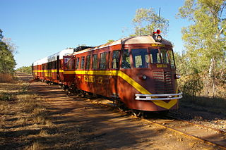 Situated 2152km northwest of
Brisbane and 577km west of Innisfail on the Gulf of
Carpentaria, Normanton (population 1150) is the major
business centre for the gulf. It would not be worth
mentioning as a place for visitors to stop except that it is
the starting point for the Gulflander,
the award-winning tourist train that travels between here
and Croydon, 153km east of here.
Situated 2152km northwest of
Brisbane and 577km west of Innisfail on the Gulf of
Carpentaria, Normanton (population 1150) is the major
business centre for the gulf. It would not be worth
mentioning as a place for visitors to stop except that it is
the starting point for the Gulflander,
the award-winning tourist train that travels between here
and Croydon, 153km east of here.
Originally planned to link the river port at Normanton to the cattle stations around Cloncurry, the line was diverted to Croydon when huge gold reefs were discovered in the area in 1891. The route begins at the National Trust-registered Normanton railway station, built in 1891 and ends in Croydon five hours later. Contact Normanton Railway Station, t 07 4745 1391. Both towns have interesting heritage-listed buildings dating from the gold rush times.
Helpful sites for more information:
Queensland National Parks allows you to search for the park you are interested in visiting. The results include a description of park, how to get there, and the brochures that are available at the park.
Queensland
Museums and Galleries a private site gives access
details to a variety of public locations.
Australian National Trust Queensland branch provides a list of buildings which are open to visitors and descriptions of these and numerous historic sites of particular historic significance throughout the state.
Heritage
Queensland describes sites of historical significance
to the state
Queensland
Places - a list with short descriptions of every
location having more than 500 people in residence. It
is maintained by the University of Queensland.
Queensland
Dept of National Parks - an alphabetical list of the
State's parks and reserves
Illustrations:
800px-Combo_Waterhole.jpg - Alun
Hoggett
800px-Brisbane_Skyline_at_Night.jpg - Mnisawlpsa
Morton Bay 1825 - http://www.qhatlas.com.au/content/brisbane-river-and-moreton-bay-thomas-welsby
800px-Brisbane_Skyline.jpg - Cyron Ray Macey from Brisbane
(-27.470963,153.026505), Australia
800px-StGeorgeCobb&CoHotel.JPG - Mattinbgn
tockman-Hall-of_Fame.jpg - Stockman Hall of Fame
Box_Log_Falls.jpg - Malcolmj
800px-Hamilton_Island,_Queensland.jpg - wallpapermine.tk (?)
Map of Queensland roads - Summerdrought
John Oxley - National
Library of Australia
Post Office Brisbane - Sardaka
Aust. National Bank, NAB _ Kgbo
Customs House - Kgbo
St Stephen's Cathedral - Kgbo
Botanic Gardens Alice Street - Lilywatanabe
Parliament House - Kgbo
Commissariat Store - Kgbo
Westpac Bank - WalkingMelbourne
Queensland Art Gallery - Kgbo
Miegunyah House - Kgbo
House in chinchilla - Mattinbgn
House in Sherwood - Kgbo
ewstead House - Figaro
University of Queensland Art Museum - SpringbokSam
Wolston House - Queensland
Heritage Register: Wolston House from E (2009)
Andrew Petrie - John Oxley
Library, State Library of Queensland.
Pringle Cottage - Kerry Raymond
Jacky Howe singlet - Warwick
Daily News 24.02.2009
Royal Bull's Head Inn - Kerry Raymond
Masonic Hall Warwick - Kerry Raymond
Carnarvon Park Aboriginal art - Shiftchange
Map of Birdsville Track - Summerdrought
Stockmans' Hall of Fame - Mjrogers50
Royal Flying Doctor Service plane - http://acms.sl.nsw.gov.au/album/albumView.aspx?acmsID=845415&itemID=866851
Gold Coast Hotels - Donaldytong
Mtr Warning path - User:Asphinx
Moreton Island - pcwiles
Binna Burra Mountain Lodge - [https://environment.ehp.qld.gov.au/heritage-register/detail/?id=601899#!lightbox-uid-0
Glass House Mountains - CoolBeans123
Cathedral Sliffs Fraser Island - Ingvard
Pedersen.
Geraghty's store museum - Queensland
Heritage Register: Brennan & Geraghtys Store & two
adjacent buildings and stables (1992)
Japanese section Rockhampton Botanical Garden - Ethel Aardvark
Great Keppell Island beach - Matthieumat
Hinchinbrook Island - Willem van Aken,
CSIRO
Airlie Island - http://freeaussiestock.com/free/Queensland/slides/airlie_beach_boats.htm
Banfield with dog - http://trove.nla.gov.au/work/184317573?q&versionId=200735465
Kuranda dancers - Bgabel
Trinity Inlet - Page1PR
Cane toad - https://www.flickr.com/photos/ferjflores/15092707441
Quintan rock - MichaelGG
Gulflander - Kenneth Fairbairn
http://www.esauboeck.com/images/