 |
 |
(revised 12-2016)
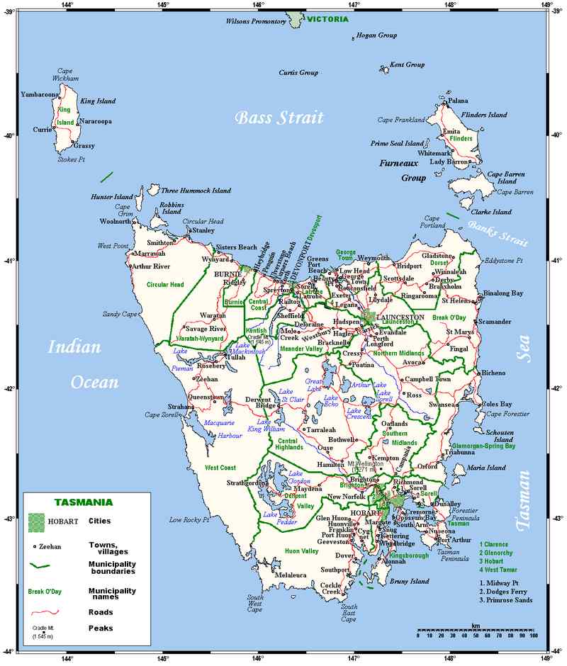
Tasmania
One of the most significant aspects for the development of
Tasmania is the island's geographical location. Hobart, the
capital city, lies at latitude 42º53' south, longitude 147º21'
east, making it one of the southernmost cities in the world.
The only land further south is the southern section of New
Zealand, a bit of South America, and Antarctica. This extreme
isolation allowed the development of unique flora and fauna.
The Tasmanian tiger, the thylacine, occurred only here, and
was last seen alive in 1935 (although myths persist about
sightings in the wild). The Tasmanian Aborigines appear to be
an indigenous group distinct from those on the mainland.
 Most strikingly, present-day Tasmania, despite
its accessible size, is a land of stark contrasts, with the
settled eastern portion more 'English' than the mainland and
the wild western portion containing primeval forests and some
of the most untrammelled terrain remaining in the world.
Today, the apples and potatoes for which the island was famed
have dwindled in number as orchards disappear, but the state
can now provide visitors with some of the most exquisite
dining experiences in the country, with its unparalleled dairy
products and seafood, especially shellfish.
Most strikingly, present-day Tasmania, despite
its accessible size, is a land of stark contrasts, with the
settled eastern portion more 'English' than the mainland and
the wild western portion containing primeval forests and some
of the most untrammelled terrain remaining in the world.
Today, the apples and potatoes for which the island was famed
have dwindled in number as orchards disappear, but the state
can now provide visitors with some of the most exquisite
dining experiences in the country, with its unparalleled dairy
products and seafood, especially shellfish.
Tasmania's geology is as complex as any in Australia. Its
basic form proceeds from older Proterozoic rock on the
northwest tip and as a tongue from the South West Cape
extending inland to an area east and north of Queenstown.
Sedimentary formation from the Palaeozoic era surround this
tongue and are found in the northeast as well. The most arable
land is found in the east and central basins between Hobart
and Launceston along the island's northern coast and consists
of weathered igneous deposits from the Mesozoic period. Many
of the peaks, including Ben Lomond and Mount Wellington, are
of dolerite extruded at this time.
Tasmania was joined with the mainland until the Tertiary
Period when the Bass Strait, a rift valley, subsided. The
Kosciuszko Uplift raised the island, tilting it to the south.
During the three ice ages of the Pleistocene, glaciers covered
as much as half of the island. Evidence of these glacial
periods can be seen in the island's southwestern highlands in
erosion of rock, deeply cut watercourses, and moraines. In
each of these periods marine water levels were low enough to
provide a landbridge to Victoria. As far as Aboriginal
populations are concerned, the Yolande (100,000 to 50,000
years ago) and Margaret (20,000 to 10,000 years ago)
glaciations allowed cultural and genetic introductions between
the mainland and Tasmania.
The physical features most attractive to tourists include the
Mount Wellington and Ben Lomond areas, the agricultural and
pastoral plain from Hobart to Launceston and east along the
northern coast, and the highland camping and bushwalking areas
in the west and south. Ben Lomond, Mount Barrow and Mount
Arthur are situated in a relatively accessible mountainous
area in the northeast. The Tasman Highway east from Launceston
passes through relatively tall eucalypt forest to as far as
Scottsdale. At this higher elevation herbaceous groundcover
and grasses predominate until the road turns south, returning
to eucalypt as it drops into the George River Valley toward St
Helens.
The agricultural areas to the east of Launceston are bordered
to the south by the Great Western Tiers. This remarkable
escarpment rises virtually from sea level to over 1000m. About
50km west of Launceston, then south an hour out of Deloraine
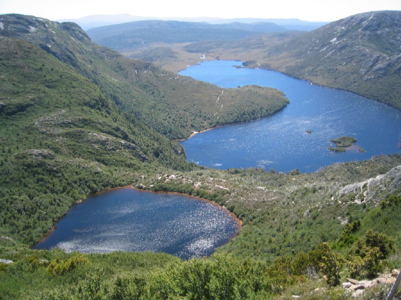
is a tableland with numerous lakes, the Great Lake being the
largest and Lake St Clair described as the most beautiful.
Lake St Clair is on the eastern edge of a series of national
parks extending from the southern coast nearly to the Bass
Strait. These parks contain two World Heritage Areas and some
areas which have been protected since 1863. The six day, 76km
trek between Waldheim Chalet in Cradle Valley and Lake St
Clair is a favourite with campers. Details, maps and gear are
available at well-stocked campers' stores in Hobart and
Launceston. Much of the equipment for camping can be rented.
Mount Field National Park, an easy drive 80km west of Hobart,
is noted for its waterfalls. Russell Falls cascades in two
steps into forested gorges. The walking and camping in this
area varies from sedate to strenuous. Many of the best views
of Russell Falls are easily accessible.
The beech trees of Tasmania, like many of the plants in the
rainforest reserves in western and southern parts of the
island, date from the Cretaceous period. They vary depending
upon the niches in which they grow from scrub-like in the
highlands to huge in sheltered areas. Similar species are
found in the rainforests of Lamington National Park in the
Mcpherson Range on the New South Wales-Queensland border and
at Barrington Tops.
The Parks
and Wildlife Service lists more than a dozen National
Parks. The passes are quite inexpensive, starting at
$11. While we are at it, the National
Trust lists eight properties.
History
Tasmania, initially called Van Diemen's Land after the
Dutch East India company's progressive administrator who sent
Abel Tasman to explore the area in the 1640s, became an
independent colony in 1825, making it the second Australian
colony. Soon after the settlement of New South Wales, the
authorities realised Tasmania's strategic importance and
decided it should be settled before another maritime power
conquered it. As the frequency of French place names
throughout and around the island attest, French vessels had
explored the region extensively in the years immediately
following the Revolution. First scouted by Lieutenant James
Bowen in 1803, Van Diemen's Land as a colony began actively in
1804 with the arrival of Lieutenant Governor David Collins.
Collins is remembered in his famous First Fleet narrative for
having attempted a settlement first in Victoria. Once in Van
Diemen's Land, he moved the location of the colony from that
first sited by Bowen to a more advantageous spot at what was
called Sullivan's Cove, present-day Hobart.
Another bleak chapter in Tasmania's history concerns the confrontation of settlers and Aboriginal natives. From the beginning of white settlement, the Tasmanian natives, who probably numbered about 4000 when Collins arrived, were seen as an impediment to economic and cultural growth. Initially few attempts were made at any kind of peaceful coexistence. In 1824, Lieutenant Governor George Arthur (1784-1854) arrived and, with the declaration of Tasmania's status as a separate colony, established a despotic administration intent on 'civilising' the island according to Arthur's own ideas about moral good and civilised institutions. By this time, many free settlers had arrived in the colony, and their interests were foremost in Arthur's plan.
Hostilities with the Aborigines, or at least the fear of black aggression from those natives who had resisted, were so intense that the government devised one of the most notoriously farcical campaigns in history, the so-called Black Line. The purpose of this effort was to round up those remaining blacks (probably less than 2000 by 1830) and to confine them to a single reserve away from white settlement. The offensive took the form, as Robert Hughes says, 'of an immense pheasant drive', in which every white man in Van Diemen's Land participated, walking across the bush to 'flush out' the natives. In the end, only two blacks were caught, but the natives' days were numbered.
The next, seemingly more benign, approach to the problem involved a well-meaning Methodist house-builder, George Augustus Robinson (1788-1866) who earned the title of 'The Great Conciliator'. Instead of force, Robinson, with the help of the natives Woureddy and Truganini, used persuasion to convince the remaining natives to 'give themselves up' and to enter a camp set up for them at Flinders Island, and later at Oyster Cove. Thus another form of transportation was imposed upon another group of unfortunates. By 1855, only three 'full-blooded' natives survived, while others, taken as wives and slaves of American whalers, persevered on the Bass Strait Islands and as small groups in Victoria. Despite the belief, then, that all traces of Tasmanian Aboriginals were vanquished, Aboriginal awareness today has led to a reassertion of Aboriginality among those who identify themselves as such. For instance, Tasmanian Aboriginals have sole rights to the hunting of mutton birds on Flinders Island. Conscious efforts to voice their presence and their sense of pride are evident in a number of Aboriginal centres on the island.
Sharing with Western Australia the distinction of having been a separate colony, Tasmania presents a character unlike the rest of Australia. Affected by its extreme southerly position and the surrounding seas, the climate as well as the geography differ markedly from that of the mainland, giving the island a more 'English' atmosphere, an attitude quite consciously nurtured by popular sentiment and the Tasmanian tourist industry. In Following the Equator (1895), Mark Twain wrote:
How beautiful is the whole region, for form, and grouping, and opulence, and freshness of foliage, and variety of colour, and grace and shapeliness of the hills, the capes, the promontories... And it was in this paradise that the yellow-liveried convicts were landed, and the Corps-bandits quartered, and the wanton slaughter of the kangaroo-chasing black innocents consummated on that autumn day in May, in the brutish old time. It was all out of keeping with the place, a sort of bringing of heaven and hell together.
More recently, Tasmanian native Christopher Koch, author of The Year of Living Dangerously (1978), describes the ambivalence associated with Tasmania's history:
One of Tasmania's greatest talking points, at least by Australian standards, is its weather. 'Changeable' would be the best way to describe it. In the space of a few hours, especially on the Mount Wellington side of Hobart, temperature and winds can change dramatically and quickly, from scorching heat to blasting breezes and blustery conditions. On the whole, Tasmania is usually cooler than the rest of Australia. Planning of any outing must include provisions for any type of weather, from rain to heat. Patrick White, in A Fringe of Leaves (1976), states the situation poetically:
... buffeted by wind, threatened by a great cumulus of cloud, between the mountain which presided over man's presumptuous attempt at a town, and the shirred waters of the grey river rushing towards its fate, the sea.
Hobart
History
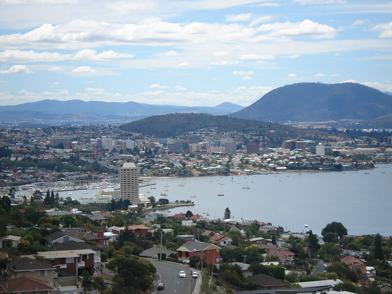
The second oldest city in Australia, and with a
population of 184,000, Hobart is situated on both the eastern
and western shores of the Derwent River. The river was named
in 1793 by John Hayes, a naval officer who explored the region
independently and without knowledge of previous explorations;
most of the names he gave places were not acknowledged, but
the Derwent and Risdon Cove remain. Hobart was established in
February 1804 by Lieutenant Governor David Collins, when he
left Victoria and decided Van Diemen's Land was a more
appropriate location for a second settlement separate of New
South Wales. He had moved settlement across the river from
Risdon Cove, where Lieutenant John Bowen had initially
established a headquarters. Collins wrote: 'In respect to
situation, I am as well placed as I could wish. I have land
immediately about me...sufficient for extensive agricultural
purposes.' Collins named the settlement after Robert Hobart,
Earl of Buckinghamshire and secretary of state for war and the
colonies; it was actually called Hobart Town until 1881.
Governor Macquarie, ever the intrepid organiser, visited in
1811, and immediately drew up a town plan consisting of a main
square and seven streets, which he also named. He also
formulated regulations for future development. By the time of
his second visit in 1821, buildings had trebled and faced
regular street fronts.
Even today Hobart's 'Englishness' both in town planning and
architecture is particularly striking. The town's gardens
contain very little evidence of native flora, preferring
'cottage garden' arrangements, the plants of which do well in
this climate. Houses are varied in design, and the grander
ones often look like British country homes, with classical
columns and Georgian proportions, constructed of sandstone or,
later on, red brick.
Despite being located so far south, Hobart's latitude is
comparable to that of New York City or Rome. In fact, the
town's blustery weather and harbour setting, with its strong
seafaring tradition, are somewhat reminiscent of American New
England, although the weather is never as rugged as the
American upper Eastern Seaboard. This atmosphere is not
surprising, when you consider that from the 1830s onwards,
Hobart was a great port of call for American whalers, who were
active in Tasmanian waters until the American Civil War. The
French whalers were also drawn to Hobart; Alexandre Dumas
gives vivid descriptions of the town in Les Baleiniers, based
on the diary of a surgeon on a French whaling ship.
The plethora of substantial buildings from Hobart's early
period of settlement is so unlike anything to be seen in New
South Wales that you begin to wonder why this should be.
Historically, it seems that Tasmania by the 1830s, despite its
grimly effective convict system, actively sought ambitious
free settlers who would develop an agricultural economy.
Colonists were enticed with promises of large land grants, the
use of convict labour, and, as one settler approvingly wrote
home in 1834, 'the scarcity of the Black Natives'.
While free settlers also began arriving in New South Wales at
this time, the colonial government did not as actively
encourage the development of the land and its resources.
Consequently, rural agriculture was at least initially more
modest on the mainland, and with less conscious emphasis on
the cultivation of the trappings of English culture.
Writer Hal Porter, in his novel The Tilted Cross (1961), calls it 'a town of
the dispossessed...a foundling London', which it seemed to be
in its early days. Cultural aspirations were more readily
pursued in Van Diemen's Land than in early New South Wales.
Indeed, the first book of general literature in Australia was
published here in 1818: Michael
Howe, the Last and Worst of the Bushrangers of Van Diemen's
Land by Thomas H. Wells. At present only three copies
are known to exist, making it one of the rarest colonial books
in the English language. That the modest publication concerned
bushrangers is appropriate, as Tasmania was tyrannised by
outlaws well into the 19C. Michael Howe was by no means the
last one!
Today, Hobart is a delightful place to visit, quite unlike any other city in Australia. The sense of tradition is strong with less ethnic mix in the population, making islanders more conservative and predictably insular; but tourists will find the residents friendly, the facilities and attractions accessible and enjoyable. Currently the greatest attraction in Hobart is the availability of Tasmanian food-products; restaurant culture here is thriving, taking advantage of the superb resources available both on the island and from the surrounding sea and its islands.
Exploring Hobart
Hobart is a pleasant town for walking, although its
position at the foot of Mount Wellington means that some
streets proceed steeply uphill. All of the following walks
begin at the Visitor Information Centre, conveniently located
north of Salamanca Place on the corner of Davey and Elizabeth
Streets by the wharves on Sullivans Cove.
For more distant tours, you will need a car, or public
transport, details of which are given, although it is not
always plentiful.
Walk 1 Constitution Dock and Battery Point
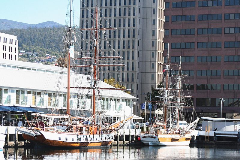
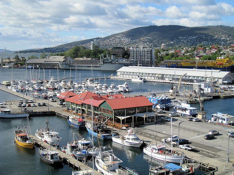 On leaving the tourist bureau, turn
left, and walk two blocks to Constitution Dock. Constitution
Dock is at the centre of the wharf area, where you can find a
variety of harbour tours, famous seafood restaurants, and fish
markets. Harbour cruises depart from the Brooke Street Pier,
about 100m east of Constitution Dock. Of greatest significance
is that Constitution Dock is the terminus of the Sydney to
Hobart Yacht Races. An alternative terminus might be the
Customs House Pub where yachtsmen often gather for a beer and
scallops after docking.
On leaving the tourist bureau, turn
left, and walk two blocks to Constitution Dock. Constitution
Dock is at the centre of the wharf area, where you can find a
variety of harbour tours, famous seafood restaurants, and fish
markets. Harbour cruises depart from the Brooke Street Pier,
about 100m east of Constitution Dock. Of greatest significance
is that Constitution Dock is the terminus of the Sydney to
Hobart Yacht Races. An alternative terminus might be the
Customs House Pub where yachtsmen often gather for a beer and
scallops after docking.
Sydney to Hobart Yacht Race
Begun in 1945 with nine entrants, the race now attracts
upwards of 200 entrants and is considered to be one of the
most exciting and treacherous of blue water yacht races. The
first race was initially to be a leisurely sail down to
Hobart, but John Illingworth, a British Naval officer,
suggested that they race. He won in Rani, a 35 foot
cutter, in 6 days 14 hours. Peter Luke, sailing
Wayfarer, came in last at 11 days 6 hours. D.D. McNicoll
wrote a good history
of the race in The
Australian, Dec. 26, 2016. It is worth a trip
to the continent just to experience the thrilling start of the
race from Sydney Harbour on Boxing Day (26 December). The
yachts must brave Bass Strait, which even in summer can
present dangerous seas. A recent example of its
unpredictability occurred in the 1993 race when off Flinders
Island, the lead boat's skipper was lost overboard; he was
miraculously found after six hours by tanker ship. Many of the
other favoured boats were damaged and forced to drop out.
Following the 1998 race, which was also affected by rough
weather and loss of life, the race organisers reaffirmed that
the yachts' skippers are ultimately responsible for deciding
whether to continue or not under the conditions at sea.
Unusual events aside, the end of the yacht race marks Hobart's
biggest party and most exciting event of the year. Anyone
visiting at this time should be sure to book accommodation
well in advance, and expect to get caught up in the
excitement.
Just above the docks is a raised plaza where placards
describe the wharf buildings and point to Parliament Square,
which is past Elizabeth Pier further south on Morrison Street
at the corner of Murray Street. Originally Customs House,
Parliament House was built between 1836 and 1841, by Colonial
Architect John Lee Archer. Other alterations were made in
1856, and with the introduction of responsible government, it
became Parliament House. The exterior presents a rusticated
first floor, ashlar work on the second floor. Fine interior
chambers remain intact and can be visited; the tiny
Legislative Council Chamber, which remains exactly as it was
in 1856, can also be viewed.
Across the street from Parliament Square is Customs House
Hotel, built in 1846 for Charles Gaylor. Still in business,
this was the hotel where many politicians resided while in
town for parliamentary sessions.
 Circle around Parliament Square to the left to
come to Salamanca Place. The place runs in front of a series
of seafront buildings dating from 1835-60. Originally fronting
on to 'New Wharf', these buildings were the centre of trade in
Hobart, and still represent the best-surviving examples of
Georgian warehouses in Australia. The New Wharf in front of
Salamanca Place is now called Prince's Wharf in honour of
Prince Alfred, Duke of Edinburgh, who visited here in 1868.
The wharf is still the passenger terminal, and you can
sometimes see in port such cruise ships as the P & O's Sea
Princess.
Circle around Parliament Square to the left to
come to Salamanca Place. The place runs in front of a series
of seafront buildings dating from 1835-60. Originally fronting
on to 'New Wharf', these buildings were the centre of trade in
Hobart, and still represent the best-surviving examples of
Georgian warehouses in Australia. The New Wharf in front of
Salamanca Place is now called Prince's Wharf in honour of
Prince Alfred, Duke of Edinburgh, who visited here in 1868.
The wharf is still the passenger terminal, and you can
sometimes see in port such cruise ships as the P & O's Sea
Princess.
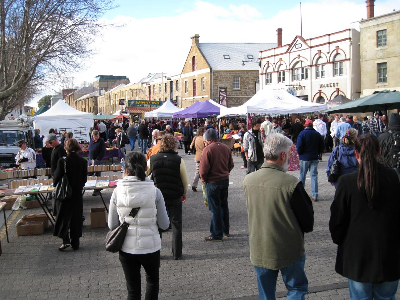
As with so many other place-names in Australia, Salamanca
Place was named in honour of a battle in the Napoleonic Wars
(hence the proliferation of Wellington place-names throughout
the country). The façades of the Salamanca Place warehouse
buildings are virtually unchanged, except now they are shops,
galleries, and cafes. Each Saturday (08.00-15.00) since 1972
the Salamanca Markets have been held here, essentially a more
upscale 'trash and treasure', with arts and crafts, Tasmanian
products, produce, and all the other kinds of stalls seen at
flea markets. It is a delightful setting, exuding an old-world
atmosphere.
Battery Point
To the east and above the cliffs behind Salamanca Place is Battery Point, the most historic area of Hobart. Its significance is in its preservation of continually occupied buildings which were built from the 1820s through to the early 1900s. Many of these structures are unequalled in Australia in terms of historical and architectural significance. The area's name stems from the battery of guns originally placed here in 1818. By 1828 they had been supplanted by a signal station (see box), which now stands in Prince's Park, at the northern end of Salamanca Place.
The Signal Station
The Signal Station became an important element in the
elaborate semaphore telegraph system devised in the 1830s by
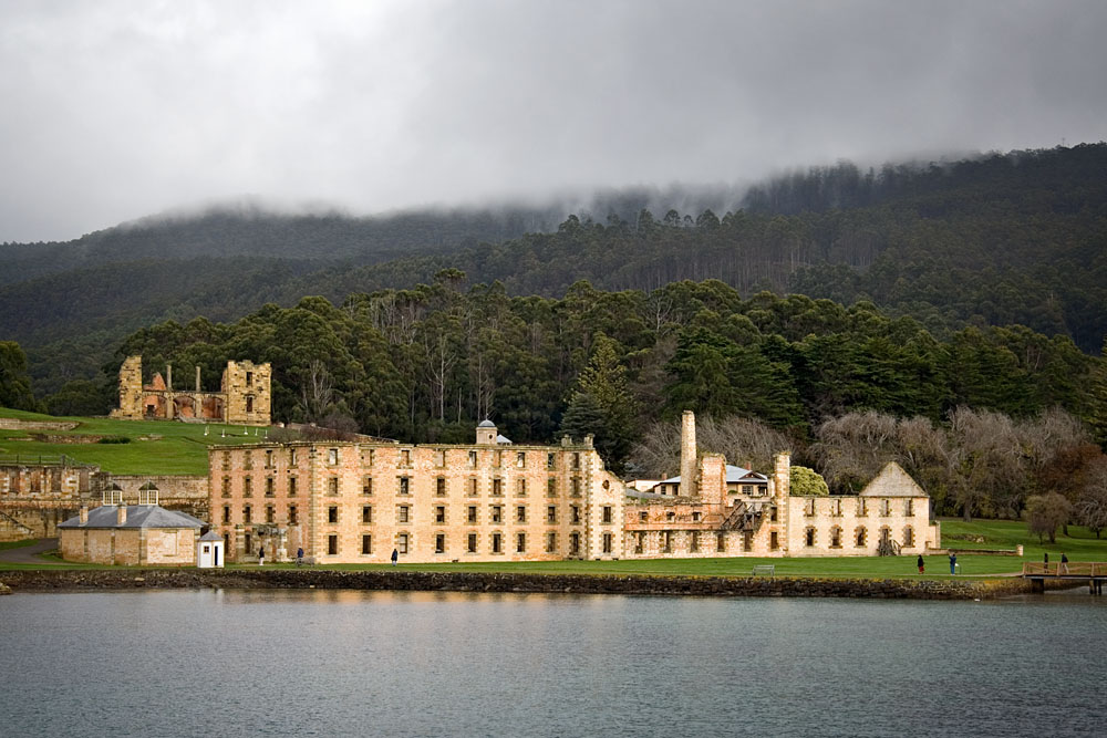
the Commandant at Port Arthur, Captain Charles O'Hara Booth.
By 1840, Booth had established a series of eleven stations
between Port Arthur and Hobart Town which enabled messages to
be relayed within 15 minutes. At its height, the coded system,
using a three-tiered six-armed semaphore mast, could relay as
many as 3000 phrases. By the 1850s the system was abandoned as
too costly and by the 1860s the telegraph replaced this
inventive device.
History of Battery Point
The area of Battery Point was first occupied by Reverend
Robert 'Bobby' Knopwood (1761-1838), first clergyman in
Tasmania and a notoriously colourful character in the island's
early history. Taking up the ministry only when he had
squandered his own considerable fortune and was in need of
employment, Knopwood was fond of the bottle and loose with
money. The Australian Encyclopedia describes him delicately,
'It was a brutal, hard-drinking, hard-swearing age, and
Knopwood does not appear to have been in advance of his time.'
He arrived in Hobart in 1804 and was granted 30 acres near
Sullivans Cove by Lieutenant Governor Collins. Financial
difficulties, however, compelled Knopwood to sell off plots by
the end of the 1810s. Concerned about Knopwood's failing
health and general dissipation, Governor Macquarie pensioned
him in 1821 to land at Rokeby, in the Clarence area near
Risdon Cove. Here he continued to minister unofficially until
his death in 1838. His diaries, kept for 30 years, are a
remarkable, if at times nearly incomprehensible (his spelling
and penmanship were idiosyncratic at best), account of the
early days of Hobart.
William Sorell, third Lieutenant Governor, acquired the
remaining 90 acres (36.5 ha) of Battery Point, but eventually
sold it to William Kermode, who developed the property,
transforming the area from a rural expanse to a residential
district. By the 1830s, this transformation was well under way
and many buildings constructed in this era still survive.
Governor Arthur (see below), upon his arrival in the colony in
1824, decided that the waterfront road, initially a part of
Knopwood's grant, should be turned over to the government for
access to the wharves. This decree caused great outrage among
those who had purchased the land from the original grantee.
Nonetheless, Arthur was able to effect the usurpation when he
found that Sorell had never signed an earlier agreement with
Knopwood. This disputed strip is now the site of Salamanca
Place.
George Arthur
 George Arthur
(1784-1854) was a career soldier who had already established
his reputation as a colonial administrator in
British Honduras before arriving in Hobart to take on the
duties of Lieutenant Governor. Implacably stern and morally
self-righteous by nature, Arthur imposed on the colony what to
his detractors was a despotic rule. His rigid system of
punishment and rewards for convicts affected not only the
convicted but their overseers as well. His establishment of
Port Arthur was to his mind a crowning achievement, as it made
possible the implementation of his supposedly foolproof system
for penal administration. Ultimately it would remain as his
infamous legacy to Australian history. During his tenure, he
attempted to rout the notorious bushrangers who plagued the
countryside and sought to appease the growing number of free
settlers by attempting to round up the Aborigines in the
infamous 'Black Line' campaign. Constantly criticised by the
press and even at odds with the home government, Arthur was
recalled in 1837, serving further in Canada and as Governor of
Bombay in 1842.
George Arthur
(1784-1854) was a career soldier who had already established
his reputation as a colonial administrator in
British Honduras before arriving in Hobart to take on the
duties of Lieutenant Governor. Implacably stern and morally
self-righteous by nature, Arthur imposed on the colony what to
his detractors was a despotic rule. His rigid system of
punishment and rewards for convicts affected not only the
convicted but their overseers as well. His establishment of
Port Arthur was to his mind a crowning achievement, as it made
possible the implementation of his supposedly foolproof system
for penal administration. Ultimately it would remain as his
infamous legacy to Australian history. During his tenure, he
attempted to rout the notorious bushrangers who plagued the
countryside and sought to appease the growing number of free
settlers by attempting to round up the Aborigines in the
infamous 'Black Line' campaign. Constantly criticised by the
press and even at odds with the home government, Arthur was
recalled in 1837, serving further in Canada and as Governor of
Bombay in 1842.
From Salamanca Place, you can enter Battery Point at
several spots. Climb up Kelly's Steps between the warehouses
at Kelly Street. These steps were built in 1839 by James
Kelly, Hobart's first harbourmaster. Walk down Kelly Street
one block, turn right on Hampden Road and walk two blocks to
the corner of Hampden and James Street, the site
of Narranya. Alternatively, at the south end of Salamanca
Place, turn left up Montpelier Retreat; walk two blocks to
Hampden Road, and turn left. On the left corner 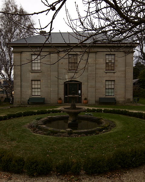 is Narryna, now the Narryna
Heritage Museum (t 03 6165 7000; open Tues. - Sat. 10.00
- 16.30 except closed 12.30 - 13.00, Sun. 1`2.00 - 16.30,
closed Good Friday, Christmas Day, Boxing Day, New Years Day,
and 20 October (Hobart Show Day), admission $10, $8
concession, $4 young children). Narryna was originally
built as a house for a Scotsman, Captain Andrew Haig, on two
acres bought from Knopwood in 1824. Haig constructed the first
stone warehouse on Salamanca Square, then left Hobart for nine
years. He returned with his wife and family in 1833 and began
to build this house with the help of convict architect Edward
Winch. At the time of its completion in 1836, only three other
houses existed in Battery Point. Financial difficulties
compelled Captain Haig to sell the house in 1842. Owned
privately until 1946, it was then sold to the Government which
allowed the hospital across the street to use it as a home for
the elderly.
is Narryna, now the Narryna
Heritage Museum (t 03 6165 7000; open Tues. - Sat. 10.00
- 16.30 except closed 12.30 - 13.00, Sun. 1`2.00 - 16.30,
closed Good Friday, Christmas Day, Boxing Day, New Years Day,
and 20 October (Hobart Show Day), admission $10, $8
concession, $4 young children). Narryna was originally
built as a house for a Scotsman, Captain Andrew Haig, on two
acres bought from Knopwood in 1824. Haig constructed the first
stone warehouse on Salamanca Square, then left Hobart for nine
years. He returned with his wife and family in 1833 and began
to build this house with the help of convict architect Edward
Winch. At the time of its completion in 1836, only three other
houses existed in Battery Point. Financial difficulties
compelled Captain Haig to sell the house in 1842. Owned
privately until 1946, it was then sold to the Government which
allowed the hospital across the street to use it as a home for
the elderly.
In 1957, through the efforts of several prominent Tasmanians,
Narryna was established as a museum depicting 19C colonial
living. It contains a large collection of artefacts
representing comfortable living in a seafaring community,
among them, for some reason, Reverend Knopwood's death mask.
Narryna provides an excellent reconstruction of everyday
living, highlighting dress, kitchenware, leisure activities,
including lantern slides and children's games, most of which
were donated by Hobart families. Especially noteworthy is a
collection of early Tasmanian daguerreotypes, some of them
most certainly by Albert Bock, son of the artist Thomas Bock.
Interesting stables and back rooms are reminiscent of a
European open-air museum.
Walking down Hampden Road, you will see on both sides of
the street, rows of small cottages dating from the 1840s and
50s. On the corner of Stowell Avenue is a chocolate shop and
milk bar, still selling old-fashioned 'penny candies' from the
jar, even if they are no longer a penny each. It has been a
candy shop since 1886, an indication of the traditional pace
of Battery Point.
After crossing South Street, walk half a block, turn left into
Arthur's Circus, a fascinating residential circle with modest
if historically significant houses. The land was divided into
16 plots by Governor Arthur himself, and sold at auction in
March 1847. A children's playground now stands in the central
oval.
Cross Colville Street, veering right into Secheron Road, which
will lead you to Secheron House. Now privately owned, it
was built by George Frankland (1797-1838), surveyor-general of
Van Diemen's Land 1828-1838. Arriving in Hobart with his
family in 1827, Frankland's first task was to improve the
harbour and waterfront. He also assisted Governor Arthur in
the design of the Presbyterian church at Bothwell. He was
responsible for naming the Hobart suburb of Bellerive, taking
its name-as well as that of Secheron--from places he knew on
Lake Geneva. The Frankland Range near Lake Pedder is named in
his honour.
He received a grant of 8 acres (3 ha) at Battery Point at this
time, and began to build this impressive residence.
Constructed of Australian cedar, it offers a spectacular view
of the Derwent River.
Return to walk along Colville Street towards Sandy Bayfor an admirable view of a variety of historic houses and cottages; indeed, each house in the entire neighbourhood is an architectural entity. The street itself was named after Lord Colville, whose grandson was the same George Frankland who built Secheron. No. 57 at the end of the street is thought to be the oldest building on the street, part of the original Gleeson's Farm which occupied the site in the 1830s.
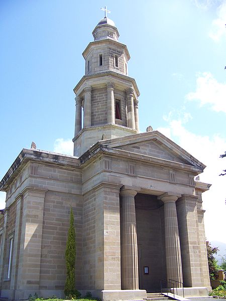 Turn right on Cromwell Street, to find on the
left St George's Anglican Church, often called 'the mariner's
church'. Designed by John Lee Archer (nave) and James
Blackburn (tower) between 1836 and 1847, it is one of
Australia's finest examples of Greek Revival style. The church
includes a nave of five bays divided by pilasters and with
50-pane windows. Next door is St George's School, in a simple
Georgian style of stone blockwork. A very early school
building, it preceded the first state school, Trinity School.
Turn right on Cromwell Street, to find on the
left St George's Anglican Church, often called 'the mariner's
church'. Designed by John Lee Archer (nave) and James
Blackburn (tower) between 1836 and 1847, it is one of
Australia's finest examples of Greek Revival style. The church
includes a nave of five bays divided by pilasters and with
50-pane windows. Next door is St George's School, in a simple
Georgian style of stone blockwork. A very early school
building, it preceded the first state school, Trinity School.
Continue to De Witt Street, turn left; on the other side of
the street is a row of cottages built in the early 1850s by
Robert Logan. At St George's Terrace you have a good view down
to the bay and up to the hillside residential areas.
Return to Elizabeth Street by returning to De Witt Street and
walking back to Hampden Road; a turn in either direction leads
to Sandy Bay Road, a busy street. At Sandy Bay Road and
Harrington Street, continue along the diagonal plaza of houses
into Harrington Street (one block) and enter on your right
into St David's Park.
St David's Park was Hobart's original burial grounds and
because it was on a raised hill with views of the sea, it also
quickly became a popular picnic spot. Included here are the
tombs of Lieutenant Governor David Collins, designed by John
Lee Archer in 1838, and a Gothic Revival memorial to Governor
Wilmot dating from 1850. When it was decided to change the
place into a public park in 1926, some of the headstones were
removed to Anglesea Barracks; others have been preserved in
two walls leading out of the park up to Harrington Street (the
graves themselves remain at rest beneath the grass). The park
also includes a charming bandstand and the Salamanca Place
entry way has a delightful gate with carved lions' heads.
Leave the park at the Harrington and Davey Street gateway.
Across Davey Street on your left is an old stone building
which stands in front of the Royal Tennis Court. In 1875, S.
Smith Travers purchased this building (originally part of a
brewery built in 1860) to introduce royal tennis (or real
tennis, as known here) to Australia. Smith's house next door
became the Hobart Trades Hall and is now part of the
Commonwealth Law Courts buildings. Unlike tennis as we know it
today, royal tennis relies on angled shots off sloping
surfaces. Regular sessions occur on the courts, and visitors
may attend. There are now courts for Royal Tennis in Melbourne
and Ballarat, with plans for one in Sydney.
From here proceed down Davey Street, some two blocks, back to
the Visitor
Information Centre (t 03 6238 4222) to visit the
Art Gallery.
Walk 2 The Tasmanian Art Gallery
At the Visitor Centre, turn right on Macquarie Street, one block to Argyle Street. On the corner is the Tasmanian Museum and Art Gallery (t 6165 7000; open daily 10.00-16.00,free admission). The building is an interesting conglomeration of styles. The central part dates from 1808 and is Hobart's oldest surviving building. The main edifice dates from 1902, and an addition was made in 1966, in a predictably diluted 'urban renewal' modernism. The separate wings are now joined by a complementary post-modernist entryway.The museum originated in the activities of the Tasmanian Society for the Study of Natural Science, founded by Sir John Franklin when he was Lieutenant Governor of the colony. This organisation eventually became the Royal Society. By the 1850s, the group was conducting monthly meetings, often presenting original scientific research. The museum's collections are quite impressive, beginning in the right wing with natural history displays which include the sad story of the Tasmanian tiger, the thylacine. The last Tasmanian tiger died in a Hobart zoo in 1936. After years in which a bounty was placed on their heads, they were ambitiously hunted and killed, despite early warnings by naturalists of the possibility of extinction. Rumours abound that tigers still exist in the wilds of the southwest, but no substantiated sightings have been documented.
John Glover
John Glover (1767-1849), born near Leicester, had an established reputation as a watercolourist and oil painter in the Claudean Romantic landscape tradition. His views in the early 1800s, especially those done in the Lake District and in Italy, made him so fashionable that at one time he was seen as a serious rival to J.M.W. Turner. In 1820 Glover was wealthy enough to open his own gallery in London. By the end of the decade, however, interest in his style of painting -- he had devised a characteristically meticulous 'stippling' method for depicting foliage -- was waning. In 1830, at the age of 64, Glover sold everything and joined his sons, already immigrated to Van Diemen's Land. He received a land grant in Deddington, near Ben Lomond, where he established a farm, 'Patterdale', in memory of the Lake District.
The paintings Glover produced in Tasmania, art historians claim, are markedly different from his works completed in England. The argument concludes that, confronted with a wholly new environment, Glover was compelled to adapt his technique to different atmospheric conditions and to the unique elements of the antipodean landscape. Many experts maintain that Glover was the first to depict accurately the Australian gum-tree, one of the major points of contention when discussing Australian painting of the 19C.
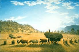 His My Harvest Home (now at the National Gallery in Canberra) is
a delightful piece of propaganda, emphasising his new country's
fecundity, in its abundant harvest of wheat, and symbolising the
presence of British culture in the appearance of a typically
lush garden filled with northern flowers. Glover is buried in
the churchyard of Deddington, next to the church he supposedly
helped to design. When the artist Tom Roberts honeymooned near
here in the 1880s, he spearheaded a campaign to restore Glover's
neglected grave.
His My Harvest Home (now at the National Gallery in Canberra) is
a delightful piece of propaganda, emphasising his new country's
fecundity, in its abundant harvest of wheat, and symbolising the
presence of British culture in the appearance of a typically
lush garden filled with northern flowers. Glover is buried in
the churchyard of Deddington, next to the church he supposedly
helped to design. When the artist Tom Roberts honeymooned near
here in the 1880s, he spearheaded a campaign to restore Glover's
neglected grave.The collection of colonial art exhibited on the first
floor is especially significant for its representation of the
Tasmanian landscape. The most impressive works are by William
Piguenit (1836-1914), one of the first Australian-born
landscape artists of note, and by John Glover, probably the
most famous immigrant artist of the period.
George Augustus Robinson and Truganini
George Augustus Robinson (1788-1866), a Methodist bricklayer
and builder, had been appointed in 1829 to take charge of the
Aborigines on Bruny Island immediately prior to Lieutenant
Governor Arthur's failed 'Black Line' round up of Aborigines.
Robinson suggested that he take a number of the Bruny Island
people with him on an attempt to talk the Aboriginal people
around Hobart into accepting relocation. After a number of
trips into the interior with Truganini as his guide and
protector, he had convinced nearly all of the local people to
accept transport to Flinders Island. As the Encyclopedia of
Australia describes the Aborigines' situation, 'removed from
their regular hunting grounds, they pined away and
died'.'Robinson was subsequently made Chief Protector of
Aborigines and stationed near Port Phillip, a position he held
between 1839 and 1849 when administration became more
important than contact with the indigenous people in the
region.
 Truganini (1803-1876) was the daughter of
Mangana, an elder in the group of Aborigines living on Bruny
Island. She had witnessed her mother's death, stabbed by a
white settler in a night raid, and her sisters' abduction by
whalers. She was living as a prostitute in Hobart when
Robinson and his guide Woorrady convinced her to accompany
them on the 'conciliation' trip. Truganini is credited with
saving Robinson's life by floating him across a river while
under attack by hostile Aborigines during his early ventures
at concilliation in Tasmania. Efforts by Robinson to
'Europeanise' the Aborigines at Flinders Island were
unsuccessful. The efforts of his successors to demoralise them
further succeeded in reducing the population to 54 in 1843. In
1856 Truganini was among the surviving Aborigines moved to
Oyster Cove near Hobart. She died in 1876 in Hobart, seven
years after her husband William Lanne (or Lanney)'s corpse had
been mutilated in a gruesome conflict between the Royal
College of Surgeons in London and the Royal Society in
Tasmania. Her dying wish was to have a decent burial 'behind
the mountains'; it was not to be, as her bones were displayed
for years in the Tasmanian Museum. Her wish was finally
honoured a century later when her ashes were scattered in
D'Entrecasteaux Channel.
Truganini (1803-1876) was the daughter of
Mangana, an elder in the group of Aborigines living on Bruny
Island. She had witnessed her mother's death, stabbed by a
white settler in a night raid, and her sisters' abduction by
whalers. She was living as a prostitute in Hobart when
Robinson and his guide Woorrady convinced her to accompany
them on the 'conciliation' trip. Truganini is credited with
saving Robinson's life by floating him across a river while
under attack by hostile Aborigines during his early ventures
at concilliation in Tasmania. Efforts by Robinson to
'Europeanise' the Aborigines at Flinders Island were
unsuccessful. The efforts of his successors to demoralise them
further succeeded in reducing the population to 54 in 1843. In
1856 Truganini was among the surviving Aborigines moved to
Oyster Cove near Hobart. She died in 1876 in Hobart, seven
years after her husband William Lanne (or Lanney)'s corpse had
been mutilated in a gruesome conflict between the Royal
College of Surgeons in London and the Royal Society in
Tasmania. Her dying wish was to have a decent burial 'behind
the mountains'; it was not to be, as her bones were displayed
for years in the Tasmanian Museum. Her wish was finally
honoured a century later when her ashes were scattered in
D'Entrecasteaux Channel.
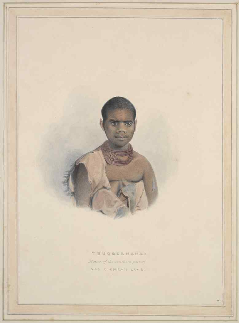
In his essay The Spectre of Truganini, art historian Bernard
Smith elucidates the cultural significance of depictions of
Truganini, the 'last Tasmanian Aboriginal', and Robert Hughes
writes movingly of Truganini's gruesome plight in The Fatal
Shore. Indeed, in the recent ABC-TV (Australian Broadcasting
Corporation) series, Frontier (1997), Truganini's story
symbolises the worst of white-black conflict in 19C Australia.
Several works in the gallery concentrate on the depiction
of Tasmanian Aboriginals. Intriguingly, the earliest white
settlers, unlike those in New South Wales, seem not to have
had an artistic interest in the island's native population. No
images exist until the late 1820s and 1830s, by which time
native 'containment' was nearly complete. Of greatest
importance are Benjamin Duterrau's historically significant if
artistically lamentable depictions of the Tasmanian Aborigines
and George Augustus Robinson ('The Conciliator')'s attempts to
bring them into settlements. Duterrau (1767-1851), who revered
his fellow Methodist Robinson, wanted to create an epic
historical painting of such an attempt; his The Conciliation
(c 1840), is indeed the first history painting created in
Australia. While earlier examples of Duterrau's work,
including his self-portrait on the other side of the room,
indicate that he had some painterly skills, the deterioration
in ability evident in his Tasmanian paintings may be the
result of age, or perhaps over-ambition. There is some
evidence that this version of the Conciliation was a smaller
one than that Duterrau eventually planned to make. Also on
display here are casts of Benjamin Law's brooding busts of
Truganini (see box, p 418) and Woureddy, presented
appropriately in classic pose, as the last representatives of
their race.
The most poignant portrait in this gallery is Thomas
Bock's small watercolour of Mathinna (1842), commissioned from
Bock by Lady Jane Franklin. This picture offers an appropriate
focus to consider two important figures in the cultural life
of colonial Tasmania. Thomas Bock (c 1790-1855) had been a
painter and engraver before being sentenced to 14 years'
transportation for administering a drug to cause abortion.
Upon arrival in Hobart in 1824, his skills as an engraver were
quickly put to use in the design of banknotes and
illustrations. By 1832 he gained a full pardon and had already
established himself as a portrait painter. His portraits in
pastels, watercolour and oil include those of prominent
citizens, as well as condemned prisoners and bushrangers. He
even made a post-mortem likeness of the cannibal Alexander
Pearce. It is no surprise that he would have been commissioned
for portraits by Lady Jane Franklin (1791-1875), wife of the
Lieutenant Governor John Franklin (1786-1847). When they
arrived in Hobart in 1837, Sir John was already famous as an
Arctic explorer (he would perish in an attempted exploration
of Antarctic waters). Lady Jane was an intelligent, ambitious
philanthropist. She was the first woman to climb Mount
Wellington and the first to travel overland from Melbourne to
Sydney. She involved herself in a number of projects to
improve the lot of prisoners and to advance education and
cultural pursuits in the colony (see Lady Jane Franklin
Museum, p 425).
Further galleries on the first floor house changing
exhibitions on Australian 20C art, Aboriginal art, and
photography.
Mathinna
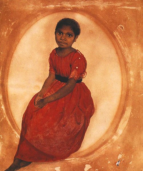 One of Lady Jane's 'projects' was
Mathinna, an Aboriginal girl brought to Government House when
she was seven. Franklin's aim, it seems, was to show the
'degree of civilisation' that natives under guidance could
acquire. The red dress in which Bock depicts her was her
prized possession, and she wrote of it proudly in a letter to
her real stepfather. As with so many of her other charitable
projects, Lady Jane eventually moved on to other concerns and,
when the Franklins left the island in 1843, Mathinna was
abandoned. She was sent to the Queen's Orphan School and
eventually joined the remaining Aboriginals at Oyster Cove.
She was found dead at 21, 'intoxicated...in mud and water on
the road...choked, suffocated and stifled'. The small mining
town near Fingal in northeastern Tasmania is named in her
honour.
One of Lady Jane's 'projects' was
Mathinna, an Aboriginal girl brought to Government House when
she was seven. Franklin's aim, it seems, was to show the
'degree of civilisation' that natives under guidance could
acquire. The red dress in which Bock depicts her was her
prized possession, and she wrote of it proudly in a letter to
her real stepfather. As with so many of her other charitable
projects, Lady Jane eventually moved on to other concerns and,
when the Franklins left the island in 1843, Mathinna was
abandoned. She was sent to the Queen's Orphan School and
eventually joined the remaining Aboriginals at Oyster Cove.
She was found dead at 21, 'intoxicated...in mud and water on
the road...choked, suffocated and stifled'. The small mining
town near Fingal in northeastern Tasmania is named in her
honour.
Museum of Old and New Art
(MONA) from the Franklin Wharf
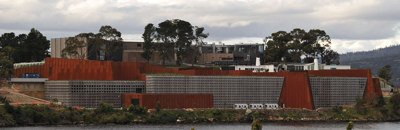 On the water side of the museum is
the Franklin Wharf from which the MONA Brooke Ferry departs
for a 25 minute ride to the relatively new Museum of Old and
New Art (ferry $20, museum admission adults $28, concession
$25, under 18 or Tasmanians free; open daily 10.00-17.00,
closed Tues.). Located in the former Moorilla Winery,
the museum displays art from the collection of David
Walsh. A professional gambler, he first presented his
collation at the Moorilla Museum of Antiquities in 2001.
After extensive renovations begun in 2007, MONA was opened
with considerable fanfare in January 2011. The museum
building is largely underground. Designed by architect
Katsalidis, it gives an impression of danger and ominous
idiosyncrasy. The pieces displayed and the exhibits
themselves can take a turn
On the water side of the museum is
the Franklin Wharf from which the MONA Brooke Ferry departs
for a 25 minute ride to the relatively new Museum of Old and
New Art (ferry $20, museum admission adults $28, concession
$25, under 18 or Tasmanians free; open daily 10.00-17.00,
closed Tues.). Located in the former Moorilla Winery,
the museum displays art from the collection of David
Walsh. A professional gambler, he first presented his
collation at the Moorilla Museum of Antiquities in 2001.
After extensive renovations begun in 2007, MONA was opened
with considerable fanfare in January 2011. The museum
building is largely underground. Designed by architect
Katsalidis, it gives an impression of danger and ominous
idiosyncrasy. The pieces displayed and the exhibits
themselves can take a turn 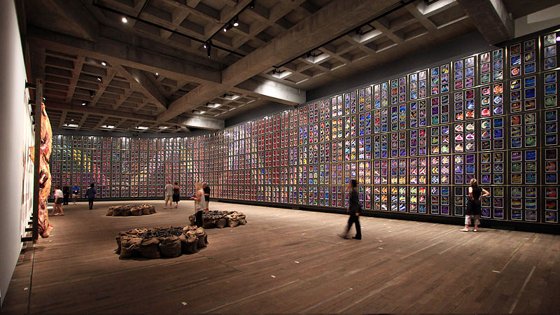 toward confrontation
and even salaciousness. That said, a particularly moving
piece in a purpose-built gallery is Sydney Nolan's Snake (1970-72), evoking
the Aboriginal Rainbow Serpent. The great Tasmanian
writer Richard Flanagan wrote a good description of the Museum
and Walsh's intentions is in The New Yorker article, "Tasmanian
Devil, A Master Gambler and His High-Stakes Museum"
(Jan. 21, 2013).
toward confrontation
and even salaciousness. That said, a particularly moving
piece in a purpose-built gallery is Sydney Nolan's Snake (1970-72), evoking
the Aboriginal Rainbow Serpent. The great Tasmanian
writer Richard Flanagan wrote a good description of the Museum
and Walsh's intentions is in The New Yorker article, "Tasmanian
Devil, A Master Gambler and His High-Stakes Museum"
(Jan. 21, 2013).
Leaving the Tasmanian Museum toward the city on Macquarie
Street, you can see across the street on the corner of Argyle
Street a red-brick Classical Revival style building which is
now used by the Hobart City Council. It was built in 1907 as
the city's public library, funded largely by the American
philanthropist Andrew Carnegie, who donated £7500 for its
establishment.
Immediately across Macquarie Street on the opposite corner is
Hobart's General Post Office, a two-storey building with,
predictably, a corner clock tower; it was designed by A.C.
Walker and built in 1905.
Turn right at the museum's exit and continue up Macquarie
Street one block to the Town Hall on the corner of Elizabeth
Street. The Town Hall was completed in 1866 by Henry Hunter,
one of the colony's best architects. With its three-bay
Corinthian entry porch, rich interior and grand staircase it
reflects the confident ambitions of a prosperous city in the
middle of the Victorian period.
Across Elizabeth Street is Franklin Square, a lovely park with
a famous Wishing Well fountain.
Next to Franklin Square on the same block is a complex of
buildings, often referred to simply as the Treasury, although
it actually has had several functions and today houses a
variety of public offices that have integrated previous
structures on the site. The central façade on Macquarie Street
was designed by W.P. Kay and built between 1860 and 1914. The
impressive scale of this three-storey building presents a fine
example of the Victorian Classical Revival style that
dominated public buildings in Australia during this period.
The right-hand side of the building was originally the 1830
courthouse, an important cultural centre for the early colony;
the left-hand side was the 1858 courthouse.
Across the street is St David's Cathedral, a stone Gothic
Revival building begun in 1868 to a design by the English
architect G.F. Bradley; it was not finished until 1936. The
entryway includes a west window with tracery. The tower, made
of stone quarried in Oatlands, has a castellated parapet. To
the south is a lovely small close with many old trees.
At 130 Macquarie Street is the J. Walch & Sons Building,
dating from 1860, and housing Walch's Stationery, the oldest
surviving stationers in Australia. St Joseph's Catholic
Church, at 165 Macquarie Street, dating from 1841-43, was
designed by J. Thomson and is the oldest surviving Roman
Catholic church in Hobart.
Anglesea Barracks
At Barrack Street, turn left, walk across Davey Street to the
entrance to Anglesea Barracks. The grounds are open
routinely; the buildings are not open. The Museum is
devoted to Australian military history (t 03 6237 7160; open
Tuesdays - Saturdays 09.00-13.00 with a guided tour on
Tuesday at 11.00, admission $5 adults, $10 family). The
barracks were built between 1814 and 1879, making it the
oldest occupied military facility in Australia. They were
named after the Duke of Anglesea, hero of the Battle of
Waterloo. Devised by Governor Macquarie on his first Tasmanian
visit in 1811, the first building was the hospital,
constructed in 1814. It is now the Commandant's residence. At
the same time work began on the Officer's Quarters and Mess,
but these were not completed until 1829. These were designed
by Lieutenant John Watts and John Lee Archer and consist of
three single-storey buildings with verandahs, cement-rendered
bricks and slate roofs. The Officers' Married Quarters and the
Old Drill Hall were completed in 1824, and contain interesting
architectural details, such as the pilasters placed between
each set of windows.
buildings are not open. The Museum is
devoted to Australian military history (t 03 6237 7160; open
Tuesdays - Saturdays 09.00-13.00 with a guided tour on
Tuesday at 11.00, admission $5 adults, $10 family). The
barracks were built between 1814 and 1879, making it the
oldest occupied military facility in Australia. They were
named after the Duke of Anglesea, hero of the Battle of
Waterloo. Devised by Governor Macquarie on his first Tasmanian
visit in 1811, the first building was the hospital,
constructed in 1814. It is now the Commandant's residence. At
the same time work began on the Officer's Quarters and Mess,
but these were not completed until 1829. These were designed
by Lieutenant John Watts and John Lee Archer and consist of
three single-storey buildings with verandahs, cement-rendered
bricks and slate roofs. The Officers' Married Quarters and the
Old Drill Hall were completed in 1824, and contain interesting
architectural details, such as the pilasters placed between
each set of windows.
The military gaol, finished in 1846, is built out of local
sandstone. The Garrison Tap Room from 1834 includes an
interesting stuccoed brick entrance portico. Set in the most
imposing location of the complex is the Soldiers' Barracks,
built in the 1850s and facing the Lower Parade Ground.
Tours of the complex are available with a detailed brochure
describing the barracks' history. Enquire at the barrack's
museum or at the Visitors' Information Centre at Davey and
Elizabeth Streets.
After touring the barracks, you may want to return to the
centre of the city by catching a bus on Macquarie Street.
Walk 3 Cat and Fiddle Arcade
From the Visitor Centre walk up Elizabeth Street two
blocks to Collins Street, where Elizabeth Street becomes a
pedestrian mall known as 'Restaurant Row'. The restaurants
here, as well as others throughout Hobart, demonstrate how
Tasmanian produce is being used to create some of the best
dining experiences in the world. Halfway up the mall is the
Cat and Fiddle Arcade, an intriguing complex of shops. Enter
the arcade on the left, and walk through to Murray Street.
Outside turn right and walk 150m across Liverpool Street to
the State Library on the corner of Bathurst Street.
The State Library building is a hideous early 1960s glass and
metal five-storey structure, but housed inside (along with a
lending 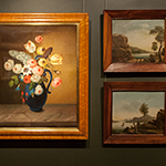 library, research library, archives, and the
W.C. Crowther Tasmaniana Library) is the Allport
Museum and Library (t 03 6165 5584; open weekdays,
09.30-17.00, Saturdays 09.30 - 14.00, free admission). On the
library's ground floor is a small collection, a bequest from
Henry Allport, heir to the Allport family, one of the earliest
free settlers in Tasmania. The original generation included
Mary Morton Allport (1806-95), a gifted artist and musician,
who left some of the earliest artistic and literary accounts
of the colony. The Allports remained one of Tasmania's leading
families, producing many significant artists. The collection,
based on Allport's own bequest, plus purchases through his
endowment, consists of decorative arts, period rooms, as well
as an impressive library of rare books and items of
Tasmaniana. While the holdings are rather eclectic, and at
times it is difficult to determine the collection's aim,
within the atmosphere of the library it seems a sweet attempt
at cultural loftiness. The library itself includes some of the
most important works concerning Tasmania, Australia, and the
South Pacific. The presentation of the significance of the
Allport family in Tasmanian history is appropriate and
warranted. The Allports' estate 'Aldridge' (c 1830) on Elboden
Street stayed in the family until 1968.
library, research library, archives, and the
W.C. Crowther Tasmaniana Library) is the Allport
Museum and Library (t 03 6165 5584; open weekdays,
09.30-17.00, Saturdays 09.30 - 14.00, free admission). On the
library's ground floor is a small collection, a bequest from
Henry Allport, heir to the Allport family, one of the earliest
free settlers in Tasmania. The original generation included
Mary Morton Allport (1806-95), a gifted artist and musician,
who left some of the earliest artistic and literary accounts
of the colony. The Allports remained one of Tasmania's leading
families, producing many significant artists. The collection,
based on Allport's own bequest, plus purchases through his
endowment, consists of decorative arts, period rooms, as well
as an impressive library of rare books and items of
Tasmaniana. While the holdings are rather eclectic, and at
times it is difficult to determine the collection's aim,
within the atmosphere of the library it seems a sweet attempt
at cultural loftiness. The library itself includes some of the
most important works concerning Tasmania, Australia, and the
South Pacific. The presentation of the significance of the
Allport family in Tasmanian history is appropriate and
warranted. The Allports' estate 'Aldridge' (c 1830) on Elboden
Street stayed in the family until 1968.
After leaving the library, make a right on to Bathurst Street.
At 106 Bathurst Street is the Playhouse, originally the Union
Chapel. It was built in 1863 by H.R. Bastow in an unusual
'Romanesque' Revival style that incorporated a colonnade and
Roman-arched windows.
Two blocks along Bathurst Street is Argyle Street; turn left
to see midway down the block at no. 59, Australia's oldest
existing synagogue. Before its construction, the Jewish
community met at the home of Judah Solomon, who eventually
donated this site in his garden for the synagogue. It was
built in 1845 by James Thomson in a delightful Egyptian
Revival style, a popular style for synagogues of the 1840s. At
one time, the Jewish population of Hobart rivalled that of
Sydney, but the population dwindled significantly by the
1870s. Services, both Liberal and Orthodox, are held on
Fridays. Contact the Hebrew Congregation of Hobart for tours
of the building.
Return to Bathurst Street and proceed right to Scots Church.
Built in 1834-36 by J.E. Addison as St Andrew's Presbyterian
Church, it was one of the first attempts in the colony at an
historically accurate Gothic Revival style. The building
complex includes a hall with a simple sandstone chapel of
undressed block; this edifice seems to have been designed by
W. Wilson in 1834. The church is the oldest surviving
Presbyterian church in Australia.
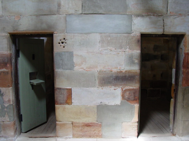
After leaving the church, turn left to Campbell Street, then
left again for two blocks to Penitentiary
Chapel and Criminal Courts, on the corner of Brisbane
Street. An extensive site, it is the remaining portion of the
original military complex, much of which is now occupied by
the Royal Hobart Hospital. The chapel was commissioned after
the free citizens of the city complained about the convicts
attending services at St David's Church. Building commenced in
1831, again from a design by Colonial Architect John Lee
Archer. As well as being the convicts' church, it was also the
original church for the Holy Trinity Parish. By 1857 the
addition of law courts made the entire site part of the Hobart
Town Gaol. It remains the only surviving example of Georgian
ecclesiastical architecture in the Commonwealth. The chapel
was used until 1961, the courts until 1983. Tours of the site,
including subterranean tunnels, and solitary cells, were
recently being conducted (t 03 6231 0911, by tour only,
Mon.-Fri. 10.00, 11.30, 13.00, 14.30, Sat. sun. 13.00, 14.30,
admission $15 adults, $12 concession, $10 children).
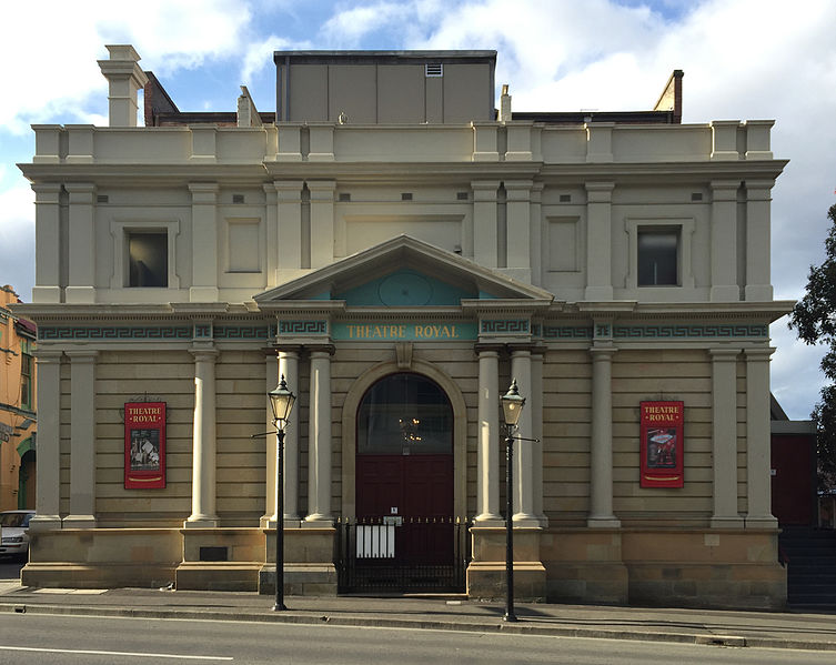 Leave the complex on Brisbane Street, turn
right back to Campbell Street, and proceed right five blocks
to the Theatre
Royal (t 03 6233 2299/1 800 650 277, tours Mondays,
Wednesdays, and Fridays at 11.00, admission adults $15,
concession $12, children $10). Opened in 1837 as the Royal
Victoria Theatre, it is the oldest continuously working
theatre in Australia. It was designed and financed by Peter
Degraves, owner of the Cascade Brewery. Originally a plain
Georgian structure, it was remodelled in 1857 by the new owner
John Davies. Many of the world's greatest actors and
musicians, from Ellen Tree and Sarah Siddons to Dame Sybil
Thorndike, have performed here. Laurence Olivier, who acted
here in the late 1940s with his wife Vivien Leigh, called it
'the best little theatre in the world'.
Leave the complex on Brisbane Street, turn
right back to Campbell Street, and proceed right five blocks
to the Theatre
Royal (t 03 6233 2299/1 800 650 277, tours Mondays,
Wednesdays, and Fridays at 11.00, admission adults $15,
concession $12, children $10). Opened in 1837 as the Royal
Victoria Theatre, it is the oldest continuously working
theatre in Australia. It was designed and financed by Peter
Degraves, owner of the Cascade Brewery. Originally a plain
Georgian structure, it was remodelled in 1857 by the new owner
John Davies. Many of the world's greatest actors and
musicians, from Ellen Tree and Sarah Siddons to Dame Sybil
Thorndike, have performed here. Laurence Olivier, who acted
here in the late 1940s with his wife Vivien Leigh, called it
'the best little theatre in the world'.
Threatened with demolition in the early 1950s, the theatre was
saved largely through the efforts of novelist Hal Porter, who
physically barred the bulldozers at the door. The interior is
a gem of early Victorian decoration, with a domed ceiling
including painted portrait roundels of the great composers; in
a disastrous fire in 1984, all of these (save Wagner!) were
destroyed, but they, as well as the entire interior, have been
lovingly restored.
Queen's Domain and Botanical Gardens
Take the bus from the Elizabeth Street Bus Station to the
Royal Tasmanian
Botanical Gardens (t 03 6166 0451, hours seasonal, 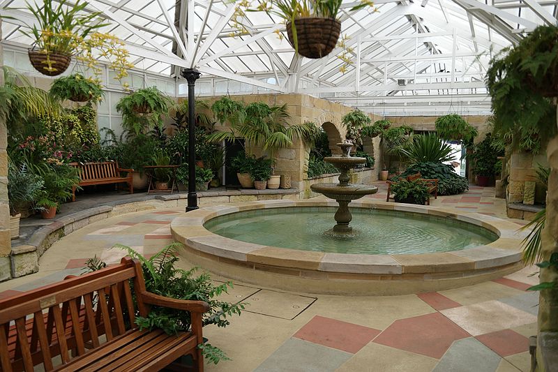 May - Aug. 8.00-17.00, Apr. and Sept
8.00-17.30, Oct-Apr. 8.00-18.30; admission by golden coin, ie
voluntary donation, at entrances). The gardens are located in
Queen's Domain, the largest park in Hobart, which also
includes the cricket grounds, Olympic swimming pool, and Rose
Garden. These facilities are located near the Domain entrance
off the Tasman Highway. At this same junction on the other
side of the highway is the Memorial Cenotaph, an obelisk
honouring Tasmania's war dead.
May - Aug. 8.00-17.00, Apr. and Sept
8.00-17.30, Oct-Apr. 8.00-18.30; admission by golden coin, ie
voluntary donation, at entrances). The gardens are located in
Queen's Domain, the largest park in Hobart, which also
includes the cricket grounds, Olympic swimming pool, and Rose
Garden. These facilities are located near the Domain entrance
off the Tasman Highway. At this same junction on the other
side of the highway is the Memorial Cenotaph, an obelisk
honouring Tasmania's war dead.
The bus into the Domain ends its route a short and pleasant
walk from the entrance to the Botanical Gardens. The gardens
are adjacent to the Government House, residence of the
Tasmanian Governor-General. Built in 1857, its elaborate
castellation and grand appearance caused it to be considered
an extravagant waste of colonial funds. From here, you have a
grand view of the Derwent River as it is crossed by the Tasman
Bridge. This bridge was opened with much ceremony in 1965. In
1975, the bulk ore carrier Lake Illawarra struck the bridge,
demolishing several spans and sinking the vessel. Remnants of
the spans can still be seen. The bridge was repaired and
reopened.
Huon Pine
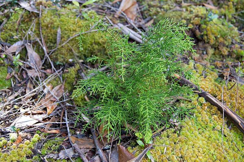 As every tourist will be bombarded with
examples of Tasmania's unique wood Huon Pine, a description of
its appearance is perhaps not necessary, but its significance
cannot be overlooked in an antipodean setting where workable
hardwoods were so hard to come by. Huon Pine, moreover, holds
a singular place in Australian history, as it contributed
greatly to the rise of shipbuilding and the viability of
seafaring enterprise. First discovered in the Huon River
district by Robert Brown (the river and region were named
after the French explorer Huon de Kermandec, who explored the
region in 1792), the wood was the economic excuse for the
establishment of the penal colony by Governor Sorell at
Macquarie Harbour in the southwest corner of the colony. From
1821 until its abandonment in 1832, Macquarie Harbour was by
far the grimmest and most isolated penal settlement of the
English-speaking world, not least of all because of the
treacherous efforts
As every tourist will be bombarded with
examples of Tasmania's unique wood Huon Pine, a description of
its appearance is perhaps not necessary, but its significance
cannot be overlooked in an antipodean setting where workable
hardwoods were so hard to come by. Huon Pine, moreover, holds
a singular place in Australian history, as it contributed
greatly to the rise of shipbuilding and the viability of
seafaring enterprise. First discovered in the Huon River
district by Robert Brown (the river and region were named
after the French explorer Huon de Kermandec, who explored the
region in 1792), the wood was the economic excuse for the
establishment of the penal colony by Governor Sorell at
Macquarie Harbour in the southwest corner of the colony. From
1821 until its abandonment in 1832, Macquarie Harbour was by
far the grimmest and most isolated penal settlement of the
English-speaking world, not least of all because of the
treacherous efforts 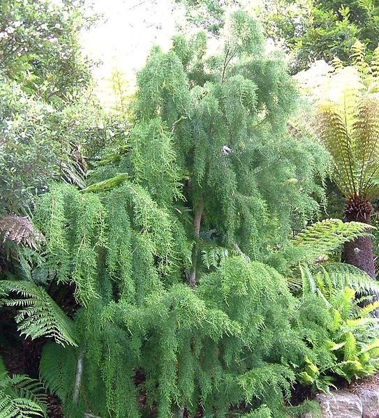 necessary
to lumber the pine trees growing there. While slow-growing and
long-lived-one tree was ringed in 1974 as being 2200 years
old-Huon Pine is considered to be the best shipbuilding timber
in the world. It is so durable that a sea-going vessel of its
timber can remain unaffected by rot for more than 100 years.
necessary
to lumber the pine trees growing there. While slow-growing and
long-lived-one tree was ringed in 1974 as being 2200 years
old-Huon Pine is considered to be the best shipbuilding timber
in the world. It is so durable that a sea-going vessel of its
timber can remain unaffected by rot for more than 100 years.
As you can see in many of the museums and historic houses, the
wood's beautiful colour and texture also made it ideal for
furniture and framing. Such an economic goldmine in the days
of wooden vessels necessarily led to the rapid decimation of
many of the Huon forests. As early as 1879, legislation was
introduced to limit the felling-beginning what remains today
an ongoing and emotionally fraught battle between
conservationists and the timber industry in Tasmania. Current
accounts seem to indicate that at present the tree is not in
danger of extinction, as it will propagate easily. Examples of
the tree and an informative brochure are available at the
Botanical Gardens.
The Botanical Gardens are quite a hidden treasure, being
probably the best-kept and most advantageously situated small
public garden in Australia. The gardens were established in
1818, initially as a government garden to provide food for the
colony. As early as 1826, Governor Arthur had planned
construction of Government House nearby, but this early
project was abandoned because of costs. Arthur then set
himself to the task of establishing a proper botanical
gardens. In 1828, William Davidson, a young horticulturist
from England, arrived to become the first Superintendent. Not
only did he import plants and trees from England, but he
collected native plants from the Hobart area. His house in the
grounds is now the Museum and Education Centre.
One interesting early feature is the heated wall, commissioned
by General Arthur, to warm experimental fruit trees. The wall
was not in operation for very long, as Tasmania's relatively
mild climate made it unnecessary; it is now in some disrepair.
The gardens are beautifully laid out, with a walk along
Derwent River on one side, and stunning views up to Mount
Wellington behind. The grounds also include an elegant
Conservatory, filled with blooming plants and lovely
fountains. The Japanese Gardens were created in honour of
Hobart's sister city, Yaizu, Japan. A nice restaurant with
views to the river serves teas and lunch. Near to the
restaurant, examples of Tasmania's most famous wood, the Huon
Pine, are on view.
Upper Hobart and Mount Wellington
Travelling up Davey Street, at Southern Outlet Road turn
right to Macquarie Street which now becomes Cascade Road,
leading to 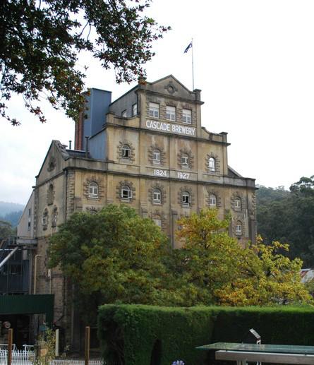 the Cascade
Brewery (t 03 6224 1117; daily 10.00 - 17.00,
bookings essential for tours; Brewery Tour and Tasting (1.5
hrs., closed toed, flat shoes, fully covered from the waist
down, no loose jewelry, admission adults $30, concession $25,
over 16 $15, Cascade Story Tour (45 minutes, brewery's history
not the production facility nor a tasting) adults $15,
children $5; the Davey Street bus from Elizabeth Street
opposite the post office will pass the brewery). The brewery
itself is a delightful structure, with a seven-storey façade
that is reminiscent of a German castle or a Victorian 'wedding
cake' style (the interior was gutted in the 1967 bushfires).
The brewery, founded in 1824 by the Degraves family, is the
oldest operating brewery in the country. Cascade Beer still
enjoys a well-deserved reputation as one of Australia's purest
and best beers.
the Cascade
Brewery (t 03 6224 1117; daily 10.00 - 17.00,
bookings essential for tours; Brewery Tour and Tasting (1.5
hrs., closed toed, flat shoes, fully covered from the waist
down, no loose jewelry, admission adults $30, concession $25,
over 16 $15, Cascade Story Tour (45 minutes, brewery's history
not the production facility nor a tasting) adults $15,
children $5; the Davey Street bus from Elizabeth Street
opposite the post office will pass the brewery). The brewery
itself is a delightful structure, with a seven-storey façade
that is reminiscent of a German castle or a Victorian 'wedding
cake' style (the interior was gutted in the 1967 bushfires).
The brewery, founded in 1824 by the Degraves family, is the
oldest operating brewery in the country. Cascade Beer still
enjoys a well-deserved reputation as one of Australia's purest
and best beers.
Peter Degraves was granted 2500 acres on the side of Mount
Wellington by Governor Sorell. Here he established a sawmill,
which prospered; in the next decade he initiated the brewery,
which Degraves designed himself. Degraves was also responsible
for the design and financing of the Theatre Royal. Today you
can tour Woodstock, Degraves' original home. Immediately below
the brewery are the Cascade Gardens, owned and operated by the
company. Nestled in a cool gully, the gardens offer a soothing
atmosphere in its well-kept grounds which include some of the
plants originally brought by Degraves.
If you return to Davey Street and continue west, the
winding road becomes Huon road and eventually travels to the
top of Mount Wellington (the Met runs buses from Macquarie
Street opposite the post office). At 1271m high, it is one of
Tasmania's highest peaks. In his novel A Fringe of Leaves
(1976), Patrick White describes the peak as a 'shrouded
mountain looming over all', and the native Tasmanian writer
Peter Conrad in Down Home declared that 'Hobart belongs to
Mount Wellington'. Along the road to the top there is an
interesting picnic stop at the point where the earliest inn
opened in the 1860s; it was destroyed in the bush fire of
1967, also chronicled in the placards here. At The Pinnacle,
you can experience an impressive display of Tasmanian weather
at its most whimsical. A well-organised enclosure presents
spectacular views of Hobart and the entire Derwent River area;
placards describe views and give an account of some of the
intrepid early explorers to this wind-swept site. A small path
allows visitors to venture into the craggy rocks and low bush
that make up this barren landscape.
Runnymede and Lady Franklin Gallery
Drive north out of central Hobart on Highway 1, Brooker
Highway. Turn left at Risdon Road, follow signs to Runnymede
at 61 Bay Road, or take Bus Route 20.
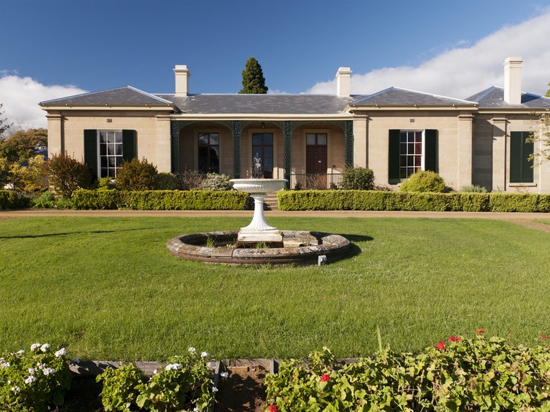 Runnymede
(t 6278 1269; Sept.-June Tues.- Fri 10.00-16.00, Sun.
12.00-16.00, admission used to be $8) was built c 1836 for
Robert Pitcairn, Tasmania's first lawyer and
anti-transportation advocate. In 1850 Pitcairn sold the
property to the first Anglican bishop, Rev. Francis Russell
Nixon, who made additions to the house. Finally it was
acquired in 1864 by Captain Charles Bayley, who named it
Runnymede after his favourite ship. Now run by the National
Trust, the house has been furnished in period style, and the
beautiful cottage gardens are a popular wedding spot.
Runnymede
(t 6278 1269; Sept.-June Tues.- Fri 10.00-16.00, Sun.
12.00-16.00, admission used to be $8) was built c 1836 for
Robert Pitcairn, Tasmania's first lawyer and
anti-transportation advocate. In 1850 Pitcairn sold the
property to the first Anglican bishop, Rev. Francis Russell
Nixon, who made additions to the house. Finally it was
acquired in 1864 by Captain Charles Bayley, who named it
Runnymede after his favourite ship. Now run by the National
Trust, the house has been furnished in period style, and the
beautiful cottage gardens are a popular wedding spot.
Upon leaving Runnymede, turn north on Risdon Street; continue
to Augusta Street and turn right. Augusta Street becomes Lenah
Valley Road.
Continue c 1.5km to Lady
Franklin Gallery (t 03 6228 2662; open weekends
11.00-16.00). This incongruous location for a Doric temple is
another result of Lady Franklin's ambitious philanthropic
activities. In this case, she had acquired 410 country acres
(166 ha) with the intention of establishing a cultural and
educational centre. Designed in 1843 by James Blackburn, it is
a skilful example of the Greek Revival style. As the Heritage
of Australia guide describes it, 'the values of convict-based
society were inimical to its use as a cultural centre and it
was abandoned for many years, then used as an apple shed'. It
is now owned by the Art Society of Tasmania, who hold weekend
exhibitions there.
Return to Highway 1, proceed north c 5.5km to Elwick
Street. The Elwick Racecourse is on the right. Turn left, then
right on to Grove Street to Anfield (100m); here is the Tasmanian Transport
Museum, Glenorchy (t 03 6272 7721; open weekends
and some holidays, 13.00-16.00, admission adults $6, children
$4, on train ride days adults $10, concession $8, and children
$5), with an exhibition of the history of trains in Tasmania,
including train rides on first and third Sundays (open 11.00),
both diesel and steam. More serious train running days
are listed on their web-site.
University of Tasmania
From the centre of town, take Davey Street to Harrington, turn
left; the road will become Sandy Bay Road. At Grace Street (c
2km), turn right to the University of Tasmania. The university
is the fourth oldest university in Australia, founded in 1890.
Beginning with three lecturers and six students, classes were
originally held in a former high school in Queen's Domain; it
moved to its present site after the Second World War. Errol
Flynn, who was born in Hobart, was the son of Thomas Flynn,
professor of biology at the university. In 1961, Peter Loftus
and Paul Fenton revived the university magazine Diogenes
with this scathing editorial:
Can Tasmania ever be anything but an intellectual backwater? Will Tasmanians ever progress from their present stage-a collection of passive natives ogling at coloured beads-the ships in the dock, the snow on the mountains, the ANZ Bank, the castration of Georgian charm, pyjama-pants, television towers, and the university's soulless shiver of squares? ... Culture? There's no such animal-maybe that's why Hobart needs a zoo.
The university was also the site of Australia's most
notorious sexual harassment case, that of Professor Sydney
Sparkes Orr in the 1950s; Orr's case has been the subject of
much study, including Michael Boddy's story 'A Matter of
Mourning', W.H.C. Eddy's Orr (1961) and the more
recent explorations of the topic such as the 1993 film 'Orr'
by George Miller of Mad Max fame.
Today the university magazine Island is a
widely-respected journal of literary and cultural review.
The university's architecture is for the most part
undistinguished, dating primarily from the functionalist
1960s; one interesting attraction is the John Elliott Classics
Museum (Classics.Museum@utas.edu.au,
previously open most afternoons) on Churchill Avenue. It
contains examples of art and artifacts of the ancient world,
from Mesopotamia to Early Christian.
From Churchill Road, turn left into Nelson Street; cross Sandy
Bay Road and continue on Drysdale Place to the Wrest Point Casino
(t 03 6225 0112), the site of Hobart's claim to glamorous
nightlife. When it opened in 1973, it was the first legal
casino in Australia and was touted as a tourist goldmine.
Designed by one of Australia's most prolific 'modernists' Roy
Grounds, the tall tower of the building-yes, complete with
revolving restaurant at the top-is endearingly known by locals
as the Salt Shaker.
From the casino, Heritage Walks by the Sandy Bay Historical Society
(t 03 6223 6703 or earicketts@iinet.net.au;
adults $15, concession $10, 2 hrs. long, by appointment).
South of Hobart
On the road out of Lower Sandy Bay to Snug and Kettering, 11km south outside of Hobart, is the Shot Tower (t 03 6227 8885; open daily, 09.00-17.30). The tower was built in 1870 by Scottish immigrant Joseph Moir. Standing 48m high, it contains 31 landings and some 300 steps to the top, where you have a tremendous, vertigo-inducing view of Derwent River and out to Storm Bay. A small museum and video presentation gives the history of Moir and his tower and explains the process of making shot, which varies little from modern methods. From all reports, the Moir family, heirs included, were amusingly eccentric, given to inventive practical jokes. The site includes a house with tea room and gift shop.
Kettering and Bruny Island
Kettering (population 318), 34km from Hobart, is a picturesque
fishing village. From here you can catch one of the more or
less hourly vehicular ferries to Bruny Island, today a
leisurely getaway, but historically significant in the early
exploration of the South Pacific (more or less hourly,
pedestrians free passage, autos $70-85 depending on the
season). It was actually discovered by Abel Tasman, and
explored by every other prominent explorer from Cook to Bligh.
Its name was bestowed upon it by the French Admiral Antoine
Raymond Joseph de Bruni D'Entrecasteaux (1739-93), who made
the first extensive survey of the channel now known by the
admiral's last name. Only a thin isthmus connects the southern
and northern portions of the island; at this point you can
often see fairy penguins on shore.
At Adventure Bay is the Bligh Museum
(t 03 6293 1117; open daily 10.00-16.00, small admission
charge) chronicling the island's early history as a whaling
centre; it is said that Bligh himself planted the island's
first apple tree here in 1788. The building was made out of
26,000 convict-made bricks that were collected from Variety
Bay. The artefacts exhibited include the remains of Cook's
Tree, a tree on the bay where Captain Cook had carved his name
in 1777. The tree was destroyed in a fire in 1905; a monument
now marks the spot where it stood.
The Aboriginal name for the island was Lunawanna-Allonah, and
these names are still preserved for two towns on the southern
end of the island. It was here that Truganini (see note
above), known as the last full-blooded Tasmanian Aborigine,
was born in 1812. After years in which her skeleton was on
display in Hobart's Museum, her wishes were finally granted in
1975, when the remains were cremated and the ashes scattered
on the island.
Bruny Island has several places to stay, most of the 'holiday
cottage' or caravan park variety. Bookings can be made through
any Tasmanian tourist office.
From Kettering, you can continue on the Channel Highway
(route B58) south around the edge of D'Entrecasteaux Channel
48km to Cygnet (population 924), originally named Port de
Cygne by D'Entrecasteaux because of the number of swans here.
This region is still the centre of Tasmania's famous
apple-producing orchards (Tasmania is still called the Apple
Isle), although many orchards have fallen to development.
At Huonville, 17km north on B58, Huon pine was first
discovered by D'Entrecasteaux and named, along with the town
and the river, after his colleague Captain Huon de Kermadec.
6km north of Huonville on the road back to Hobart is Huon
Valley Apple and Heritage Museum, a display and collection of
all things apple.
At Huonville, you can also join the Huon Highway (route
A6) and travel south through the timber town o f
Franklin, named for Sir John Franklin,
who took up property here on the river before his ill-fated
journey to Antarctica in 1845. In town is Shipwright's Point School of Wooden
Boatbuilding (t 03 6266 3586; visitor center open
weekdays 9.30-16.00, Sun. 10.30-16.00), which offers
Australia's only accredited course in wooden boatbuilding.
f
Franklin, named for Sir John Franklin,
who took up property here on the river before his ill-fated
journey to Antarctica in 1845. In town is Shipwright's Point School of Wooden
Boatbuilding (t 03 6266 3586; visitor center open
weekdays 9.30-16.00, Sun. 10.30-16.00), which offers
Australia's only accredited course in wooden boatbuilding.
Further on is Geeveston (population 750), another timber
town at the gateway to Hartz
Mountains National Park (t 03 6264 8460),
a very popular park for weekend walks; the Arve River and Weld
Valleys to the west of town contain 95m tall hardwood trees,
said to be the tallest in the world. The road is sealed part
of the way, and leads to several lookouts to the Huon Valley
and forests. At Port Huon, just outside Geeveston, you can
join cruises of the Huon River. Geeveston is also the site of
Australian Paper Mills' pulp-mill, one of the largest in
Australia.
Continue south through the picturesque fishing village of
Dover, with three islands in the harbour known as Faith, Hope,
and Charity. Finally, 21km south of Dover, you come to
Southport, the southern end of the roads of Tasmania. The
intrepid can continue a further 2km on to route C635 to Lune
River, which boasts the southernmost post office in Australia,
and the site of thermal springs and good walking trails.
Nearby are Hasting Caves, impressive limestone caves
discovered in 1917.
Tasman Peninsula and Port Arthur
Travel from Hobart across Tasman Bridge to Sorell (27km). The Tasmania Golf Club (t 03 6248 5098) is on Barilla Bay near Hobart airport before you cross over to Midway Point and on to Sorel. Set on a rock promontory and surrounded on three sides by water, the physical setting of the course alone might make the game here a treat. Par is hard to beat as well. Originally called Linisfarne, it was only accessible by boat until a bridge was built and the club moved to its present site. Al Howard designed the course and Ian Grimsley constructed the fairways, greens and landscaping.Proceed east via the Arthur Highway to Copping (21km), turn south to Dunalley, c 10km, the site of a monument of Tasman and
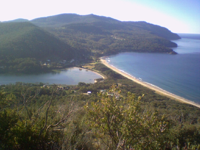 the
location of a spit bridge. You now travel through the Forestier
Peninsula to Eaglehawk Neck, 21km, and the Tasman Peninsula. A
number of tour buses make this trip and can be booked at the
Visitor's Information Centre in Hobart.
the
location of a spit bridge. You now travel through the Forestier
Peninsula to Eaglehawk Neck, 21km, and the Tasman Peninsula. A
number of tour buses make this trip and can be booked at the
Visitor's Information Centre in Hobart.Tasman Peninsula is itself a contradiction; today's gorgeous wind-swept beaches must not have seemed so beautiful to those incarcerated at Port Arthur, or even those stationed there. Located at the end of the Tasman Peninsula, it was connected to the rest of the island only by a 420m-wide stretch of land, Eaglehawk Neck. Today a beautiful beach site with several natural sites worth visiting, at the time of Port Arthur's existence this isthmus was guarded by fierce dogs chained across it, nine to eleven of them, effectively preventing any possibility of escape. It worked, for there were very few escapes. The Visitor's Centre at the beach provides some contemporary descriptions by soldiers and a soldier's wife, describing the intense isolation, loneliness, and boredom endured at this outpost.
Be sure to stop at Eaglehawk Neck to see the natural wonders, especially the Tessellated Pavements, a remarkable geological
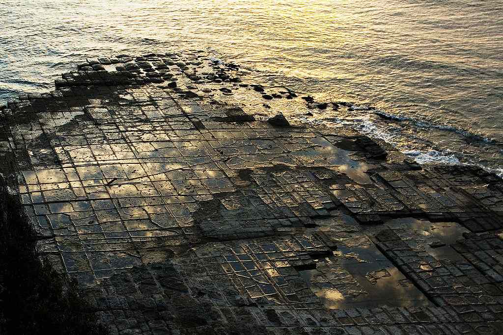 feature
at the beach, in which rocks appear almost as a sunken man-made
tile floor. The phenomenon is caused by curiously straight
fractions in Permian mudstone which, following water erosion,
give the appearance of gigantic natural bricks or tiles.
feature
at the beach, in which rocks appear almost as a sunken man-made
tile floor. The phenomenon is caused by curiously straight
fractions in Permian mudstone which, following water erosion,
give the appearance of gigantic natural bricks or tiles. The water at the beach, even in the height of summer, is treacherous and very cold; there is beautifully inviting surf, but a wet suit is recommended at all times if you want to swim. Be sure to put your foot in the water if you are there. It is so cold as to take your breath away.
On the other side of Eaglehawk Neck (c 3km) are other interesting sites: the Tasman Arch and the Devil's Kitchen are worth a view, again for the bizarre interaction of sea and stone. The Blowhole can be a bit of a disappointment, except at the right time of tide. It was here that Marcus Clarke set the climax for his 1872 novel For the Term of His Natural Life. Travelling to Tasman Arch, you will pass through Doo-town, a holiday resort village in which all the houses have been given a name with 'Doo' in it, as in 'Doo Drop Inn', 'Love Me Doo'.
Port Arthur
Return to the main highway and continue on to Port Arthur
(21km). The tragic events of April 1996 at Port Arthur, during
which a deranged young man shot and killed 35 innocent
visitors, must be mentioned here, if only to commemorate the
victims of this senseless slaughter and to commend the
attempts by all Tasmanians to persevere and endure. More than
any other place, this historic site captures the dichotomy of
Tasmanian life, with its romantic ruins belying an horrific
past. Notably, the Australians immediately instituted
strict gun laws and successfully called for the surrender of
many thousands of firearms to protect the safety of
everyone. Currently, gun owners register and are
required to keep their firearms in locked cupboards or under
lock and key at licensed firing ranges with the ammunition
securely stored separately.
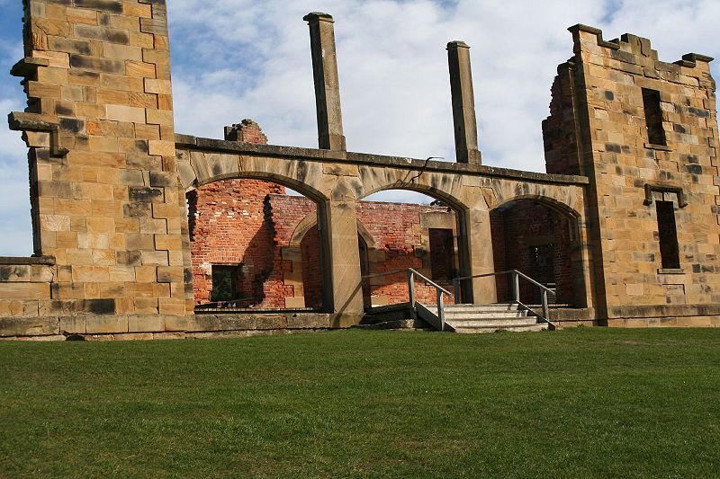 Port Arthur Historic Site
(t 1 800 659 101; open daily 09.00-17.00, admission adult
$37, concession $28, chlid $17, family $90), as it is called
today, early on became the most notorious penal colony in
Australian history. Founded in 1833 by Lieutenant-Governor
George Arthur, the prison intended, a contemporary document
quite clearly states, 'to inspire terror and to improve the
moral character of an offender'. Its main purpose was as a
place of incarceration for transportees who committed further
crimes while in the colony, or for those convicts deemed
incorrigible and incapable of following Arthur's specific
rules of behaviour. It continued to operate as a prison until
1877, some 24 years after transportation ended in Tasmania.
Port Arthur came to symbolise all that was most hideous about
the transportation system, although by contemporary standards
the conditions were probably better than in many other
prisons.
Port Arthur Historic Site
(t 1 800 659 101; open daily 09.00-17.00, admission adult
$37, concession $28, chlid $17, family $90), as it is called
today, early on became the most notorious penal colony in
Australian history. Founded in 1833 by Lieutenant-Governor
George Arthur, the prison intended, a contemporary document
quite clearly states, 'to inspire terror and to improve the
moral character of an offender'. Its main purpose was as a
place of incarceration for transportees who committed further
crimes while in the colony, or for those convicts deemed
incorrigible and incapable of following Arthur's specific
rules of behaviour. It continued to operate as a prison until
1877, some 24 years after transportation ended in Tasmania.
Port Arthur came to symbolise all that was most hideous about
the transportation system, although by contemporary standards
the conditions were probably better than in many other
prisons.
Robert Hughes, in his book, The Fatal Shore and elsewhere, has
warned of the temptation to turn the site into a convict
Disneyland:
Australia has many parking lots but few ruins. When Australians see the ruin of an old building, our impulse is either to finish tearing it down or to bring in the architects and restore it as a cultural centre, if large, or a restaurant, if small. Port Arthur is the only example of an Australian historical ruin appreciated and kept for its own sake (although local entrepreneurs have tried, and so far failed, to refurbish it as Convictland)...Far more than Macquarie Harbour or even Norfolk Island, Port Arthur has always dominated the popular historical imagination in Australia as the emblem of the miseries of transportation, 'the Hell on earth'.
While it is not quite that blatant, the deference paid to tourists at this most popular Tasmanian attraction does run the risk of such commercialisation. The fascination of the site lies in the incongruity of its current romantic atmosphere with the realities of its true 19c past. Arthur offered the possibility of 'reform' by good behaviour through a rigid system of steps. Convict life was obsessively proscribed, as the book of regulations (reprinted and for sale at the Port Arthur Museum) indicates. Convicts were kept at hard labour from sunrise to sunset, with two brief breaks for meals; those on the chain gangs were forced to wear chains, and to dress in the distinctive yellow and grey costumes with the word 'felon' stamped across them in several places. Conversation was forbidden, with separate cells for each prisoner. Food, while by present standards minimal, was probably more plentiful and reliable than the free poor of England would have had at the time; those in extreme hard labour received as much as a pound of meat a day. Training in trades was possible. Port Arthur was also one of the first institutions to set aside a separate facility for young offenders (Port Puer), where they were provided with training, religious instruction, and some rudimentary education.
A well-devised pocket-size map accompanies admission to the complex. The entry fee is a rather hefty sum, but includes the boat ride to the cemetery on the Isle of Dead. The guide indicates walking routes to take on the basis of time available for those who do not want to take an organised tour (of which there are many). Displays and presentations concentrate on archaeological excavation and restoration, with some discussion of social history, although little is said about the women (wives and servants) and children who were part of this bizarre social matrix.
The four-storey Penitentiary building, while badly
damaged, still gives enough evidence of its inhospitable
purpose. The Museum, which at one time was an insane asylum,
has an excellent, if limited and eclectic, presentation of
actual social conditions of the place. There are examples of
stone carving done by convicts, an example of their uniform,
excerpts from writings by soldiers and convicts, and displays
of physical remnants.
The 'Model Prison' is a grotesquely ironic name for the
building reserved for the most recalcitrant inmates. Based on
the ideas of England's Pentonville Prison, punishment took the
form of total silence and isolation. The building included 50
cells, two 'dark and dumb' cells for those who refused to
obey, exercise yards, and even a chapel in which cubicles made
it impossible for prisoners to be in contact with each other.
When out of their cells, 'model prisoners' were required to
wear a cap over their faces which prevented them from
recognising each other.
The Commandant's House has meticulous descriptions of its
restoration following its many careers. After abandonment of
the site, the structure became a tourist resort, the Hotel
Carnarvon; in the 1880s it apparently acquired the unusual
wall murals of exotic scenes, probably completed by the Mason
sisters who lived in the hotel.
William O'Brien's cottage commemorates the stay at Port Arthur
of its most 'high profile' convict, the Irish political
prisoner, who was only there for three months. Leader of the
Irish Home Rule movement, O'Brien refused to state that he
would not escape, and was consequently sent to Norfolk Island,
where he indeed tried to escape. As O'Brien was a highly
volatile political prisoner, the government was unable to dole
out the normal treatment for him; they could not afford a
martyr to the cause. The authorities simply watched his
activities, placing him under a kind of house arrest. O'Brien
was finally given a ticket-of-leave, whence he made his way to
Brussels at the end of the 1850s; in 1856, he was finally
allowed to return to Ireland.
Port Arthur's Church was central to Governor Arthur's penal
system; attendance at religious services was compulsory, in
the belief that moral rehabilitation of the convicts might
arise (as one of the descriptive plaques points out, very few
prisoners were thus reformed). The colony's church, then, was
a significant edifice, able to seat as many as 1500 convicts
and members of the garrison. Apparently designed by convict
architect Henry Laing, the foundation stone was laid in April
1836. The remaining ruins of the church (it was burned in the
1880s) give evidence of an ambitious building campaign.
Religious dissent at the prison arose when the many Catholic
convicts eventually refused to attend the Anglican religious
services. An embarrassed government finally succumbed and
allowed a Catholic priest. The Catholic church was built in
1857.
Offshore from the main complex is the Isle of Dead where
convicts and other Port Arthur figures were buried, many with
elaborate tombstones. While the trip to the island is included
in the entrance fee, an additional fee is charged to take a
longer harbour tour. Some 1769 convicts were buried in
unmarked graves, while officers and free person's graves
include interesting headstones. Many of them sculpted by
convicts, they include the work of Thomas Pickering,
recognised by his rope-like borders and penchant for flowers
and verse. The grave of Henry Savery, whose Quintus Servinton
(1831) is considered Australia's first novel, is one of the
anonymous graves; he committed suicide here in 1840.
Port Arthur also conducts 'ghost tours' during some
evenings. Check at the Davey Street Information Centre for
availability, or at the Port Arthur entrance gate. As you can
imagine in a place with such a desperate past, legends of
lingering ghosts abound. A display in the Commandant's House
even includes supposed photographic 'evidence' of their
presence.
Hobart to Launceston
The Hobart to Launceston road was completed in 1826. At that time it took 12 hours to complete by coach. By 1872 Anthony Trollope could observe that 'the road from Launceston to Hobart Town is as good as any road in England and is in appearance exactly like an English Road.' While the comment was probably meant as a compliment, the paternal implication offended a number of Tasmanians. Buses make the trip between Hobart and Launceston routinely. Tour buses will make some of the stops described here.From Hobart travel north on Highway 1, the Midland
Highway, to Bridgewater (19km), which for years was the main
north-south crossing of the Derwent River. The original
causeway was constructed in the 1830s by convict labour in
chains, who brought by wheelbarrow some two million tons of
stone and clay. Continuing on 8km, you will come to the twin
towns of Brighton and Pontville (population 908), situated on
the Jordan River. Named perhaps facetiously by Macquarie,
being nowhere near the sea, Brighton was at one time seriously
considered to become the colony's capital. It has always been
an important garrison town, and is still the site of the main
Tasmanian military base. When passing through Brighton, look
left to see Mount Dromedary, famed as the hideout for the
legendary 'Robin Hood' of bushrangers, Martin Cash.
Martin Cash
Convicted as an attempted murderer, Cash arrived in
the colony in 1837; he was one of the only prisoners to escape
from Port Arthur (four times!) by swimming
Eaglehawk Bay. As a bushranger, he was famed for his courtesy
to women and the poor. After many successful years as an
outlaw, Cash was caught and sentenced to death in Hobart, but
ended up on Norfolk Island. When that settlement closed, he
returned to Tasmania and was for years caretaker of the
Government House gardens; he died on his farm in Glenorchy in
1877.
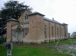
Pontville is known for its lovely Anglican church, St
Mark's, designed by James Blackburn and built 1839-41. From
the entrance there is a splendid view back to Mount
Wellington. The church graveyard contains many interesting
gravestones of the Butlers, a leading Tasmanian family.
The highway now proceeds through Mangalore and Bagdad (6km
and 8km). The proliferation of such exotic place-names,
including as well Lakes Tiberias and Jericho, has two
conceivable explanations. The more prosaic is that the early
soldiers in the region had seen service in Africa and the
Levant before arriving in Tasmania; the other, more romantic,
story is that the original surveyor Hugh Germain carried with
him into the inland the Bible and a copy of Arabian Nights,
and named sites from them.
Kempton (population 226), 19km from Brighton, was originally
named Green Duckholes, and was changed to honour Anthony Fenn
Kemp (1773-1867). An early settler, he built Mount Vernon, a
rural property named in honour of George Washington whom he
had apparently met in America. Mount Vernon was located in
Melton Mowbray, 6km further north on the highway. Kempton used
to have seven inns, but is now becoming an arts-and-crafts
village, known now as Kempton Village. Of architectural
interest here is 'Dysart House', built as a hotel in 1842, and
St Mary's Church, built in 1844 and attributed to
convict-architect James Blackburn.
The Lake Highway (route A5) begins at Melton Mowbray and
ends in 83km at Great Lake, a popular fishing resort which is
40km in length, one of the largest freshwater lakes in
Australia. 19km from Melton Mowbray on the A5 is Bothwell
(population 370), declared a Historic Town and filled with
remnants of its 19C past; at least 20 buildings are classified
by the National Trust. Particularly striking is the quite
formal layout of the town, indicating the civic awareness of
the founders. Tourist information: Council Offices, Alexander
Street, t 03 6259 5503.
Founded in the 1820s by Scottish settlers, Bothwell is
probably not the site of the very first golf course in
Australia. Still, the course, located on 'Ratho Farm' (t +61
3 6259 5553), the property of early settler
Alexander Reid, is still in use and open to anyone holding
membership in any golf club. Appropriately, Bothwell also
houses the Australasian
Golf Museum on Market Place (t 03 6259 4033; open
daily Sept- May10.00-16.00, June-Aug 10.00-15); it is located
in the historic sandstone school house.
Of note in Bothwell itself is St Luke's Church, on Alexander
Street, one block to the right off the main street, Patrick
Street. Designed by John Lee Archer, the church first held
services in 1831. The sculptures over the door are believed to
have been carved by convict artist Daniel Herbert. The town is
also the site of Nant Cottage, home in the 1850s to John
Martin and John Mitchell, famous Irish political exiles, known
for their 'treasonable' political writings.
Return to route A1 and continue north. 16km further is Jericho, outside which is Spring Hill, at 488m the highest point on the Midland Highway. The next Historic Town is Oatlands (13km; population 545), so named by the peripatetic Macquarie because the region reminded him of the oat-growing country of Scotland. Established as a garrison town, it still feels like one. The town possesses the largest number of remaining sandstone buildings in all of Australia, some 138 within the town boundary, including a Court House from 1829 and a gaol building from 1835. Tourist information: 71 High Street, t +61 3 6254 1212.
Most impressive, and dominating the landscape, is a
delightful white windmill, one of only four in Australia. For
years derelict, 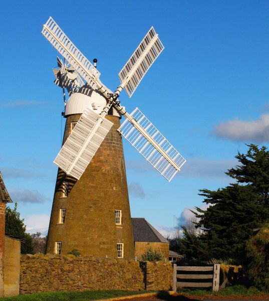 the mill complex has been restored as the
Callington Mill Historic Site, with admirably instructive
explanatory signs. Included in the complex is a steam-driven
mill for times when there was no wind. It operated from 1846
until the early 1900s, when mass-produced flour made it
impracticable. While many historical buildings remain in the
town, most are extremely small and, in the end, uninteresting
in their sameness, even if they give a good picture of a 19C
townscape.
the mill complex has been restored as the
Callington Mill Historic Site, with admirably instructive
explanatory signs. Included in the complex is a steam-driven
mill for times when there was no wind. It operated from 1846
until the early 1900s, when mass-produced flour made it
impracticable. While many historical buildings remain in the
town, most are extremely small and, in the end, uninteresting
in their sameness, even if they give a good picture of a 19C
townscape.
When heading north from Oatlands to Tunbridge, look for
several amusing examples of topiary that local landowner Jack
Cashion created from the hawthorn bushes on his property; they
have been maintained with regular trimming since his death.
The landscape now becomes flatter with growing evidence of the
grain crops for which the Midlands are famous.
Ross
37km from Oatlands turn off to the village of Ross (population
300). Named in 1821 by Governor Macquarie in honour of the
hometown of his friend H.M. Buchanan, Ross marks the dividing
line between the original northern and southern counties
created in 1804 by Governor King. Described by the Irish exile
Thomas Meagher, who lived here in 1849, as a 'little apology
of a town', Ross remains a modest village rife in historical
monuments. The region possesses a large quantity of freestone,
which made it possible to complete substantial structures in a
Georgian style. Tourist information: Tasmanian Wool Centre,
Church Street, t 03 6381 5466.
Danish author Jorgen Jorgensen was constable here in 1833, at
which time he reported the town had seven pubs, a military and
a convict barracks. He was forced to resign when he accused
the local magistrate of allowing the theft of materials for
the new bridge being built across the river.
Jorgen Jorgenson
 The most famous Scandinavian associated with Australia, Jorgen Jorgensen was described by the historian Marcus Clarke as 'one of the most interesting human comets in history'. Born in 1780, he went to sea under the British flag as a boy. In 1800 he was in Australia as part of the crew of the surveying vessel Lady Nelson, which landed in Victoria. On this ship he saw the founding of Newcastle, and the establishment of both Hobart and Launceston. In 1804 as captain of the Alexander, he was instrumental in the establishment of Tasmanian whaling. After returning to England under ever more adventurous circumstances, Jorgensen ended up in Iceland, where he proclaimed himself king for nine weeks, before the British took him into custody. He then managed to find work as a spy during the Napoleonic Wars; ultimately his penchant for gambling led him into debt, and when he pawned his landlady's furniture, he was arrested and exiled for life to Van Diemen's Land. Here he again managed to wriggle his way out of the sentence, serving instead as an explorer of the inland. After receiving a full pardon in 1835, he preferred to remain in the colony working as a journalist and writer, until his death in 1841. |
 It is this
same disputed bridge which today is the best known and most
striking architectural feature of the village, and probably the
most well-known monument in Tasmania. Built in 1836, the bridge
was designed by Colonial Architect John Lee Archer, but its fame
rests on the work of the stonemasons who actually constructed
it. They were two convicts, Daniel Herbert, convicted as a
highwayman in 1827, and James Colbeck, a thief. Consisting of
three symmetrical arches, the bridge has attractively
proportioned stone staircases on either side leading down to the
river, with chain-linked stone pillars leading to the bridge on
each side of the road. In the arches of and underneath the
bridge, Herbert carved Celtic symbols along with images of
royalty, heads of animals and indecipherable inscriptions; in
all, there are 186 panels decorating the arches. For this work
he received a full pardon; his headstone, carved by himself,
marks his grave in the town's old burial ground. The house where
Herbert is believed to have lived still stands in the village on
Badajos Street.
It is this
same disputed bridge which today is the best known and most
striking architectural feature of the village, and probably the
most well-known monument in Tasmania. Built in 1836, the bridge
was designed by Colonial Architect John Lee Archer, but its fame
rests on the work of the stonemasons who actually constructed
it. They were two convicts, Daniel Herbert, convicted as a
highwayman in 1827, and James Colbeck, a thief. Consisting of
three symmetrical arches, the bridge has attractively
proportioned stone staircases on either side leading down to the
river, with chain-linked stone pillars leading to the bridge on
each side of the road. In the arches of and underneath the
bridge, Herbert carved Celtic symbols along with images of
royalty, heads of animals and indecipherable inscriptions; in
all, there are 186 panels decorating the arches. For this work
he received a full pardon; his headstone, carved by himself,
marks his grave in the town's old burial ground. The house where
Herbert is believed to have lived still stands in the village on
Badajos Street. The centre of the village, at the intersection of Bridge
and Church Streets, is affectionately known as the Four
Corners. Each corner caters to one of humankind's needs: on
the southwest, Temptation: the Man-O-Ross Hotel, established
in 1835; the southeast, Salvation: the Roman Catholic Church,
originally a store; the northwest, Recreation, in the form of
the Town Hall; and the northeast, Damnation, the site of the
original gaol, now an elegant colonial home of the Council
Clerk.
The entire length of Church Street, essentially the only
street in town, consists of buildings of historic interest.
These include the Scotch Thistle Inn, built in 1844 as a
public house and now a well-known restaurant, and St John's
Church of England, built in 1868 from the stones of the
original 1848 church. The interior of the church is well known
for its stained-glass windows, oak lectern, stone pulpit, and
hundred-year-old organ.
To the north of the Four Corners on Church Street is the
Uniting Church, built as a Methodist church in 1885. With pews
of blackwood and a ribbed pine ceiling, the church contains a
modern tapestry designed by Australian artist John Coburn,
which was woven in France.
Walking up the hill to the right of the church and across the
street, you can see the foundation stones of one of the two
female factories in the state. Here women convicts did sewing
and laundry for the town, and were allowed nurseries for their
children. A gate leads across the railway to the cemeteries,
including the original burial ground where Daniel Herbert and
other pioneers are buried.
Campbell Town
Return to the highway and continue north 10km to Campbell Town
(population 879), an attractive town on the Elizabeth River.
Another example of Governor Macquarie's orgy of
self-commemoration, the town was named for his wife. The main
street is the highway and is here called Bridge Street. Most
of the town's major buildings are located along it. Originally
another garrison station, the area soon became more important
for its agricultural and wool productivity. Each June Campbell
Town hosts Australia's longest-running agricultural show,
initiated in 1838. The town also has a convict-built bridge,
this one of red brick and built in 1836. (Tourist
information: 105 High Street, t 03
6381 1353.)
Important buildings include St Luke's church, on the corner of
Pedder Street, designed by John Lee Archer in 1837; the
church's cemetery includes the graves of many early prominent
citizens of the area. In the block between William and Queen
Streets is The Grange, built in the 1840s for Dr William
Valentine, a doctor and scientist who even installed an
observatory in the house. It now offers tourist accommodation.
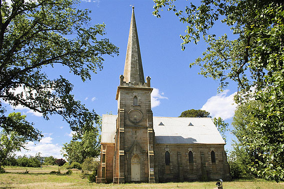 Further along on the corner of the High Street
is St Andrew's Presbyterian Church. Built in 1857 and
considered to be one of the best churches of this period in
Australia, the interior includes an organ and desk that
belonged to Bishop Nixon, first Anglican Bishop of Tasmania.
Further along on the corner of the High Street
is St Andrew's Presbyterian Church. Built in 1857 and
considered to be one of the best churches of this period in
Australia, the interior includes an organ and desk that
belonged to Bishop Nixon, first Anglican Bishop of Tasmania.
Before leaving town, you will notice on the left in a small
park an odd little memorial to Harold Gatty, native son, who
with American Wiley Post first circumnavigated the world by
plane in 1931. After leaving Campbell Town, you enter the
region known as the Norfolk Plains, covering some 5830 sq km
of pastoral land. It takes its name from some of the original
settlers who came in 1807 from Norfolk Island where their
attempts to establish a viable free settlement had
failed.
Passing through evidence of their successful agricultural
efforts for 48km, you then turn left on C521 to Longford
(c 8km; population 2027). Originally named Latour by a member
of the Cressy Establishment, a land syndicate that purchased
massive tracts here in the 1820s, Longford's history is tied
to that of some of the most prominent pastoral families in
Tasmania. The many estates in the district, built by
pioneering members of these families, bear witness to the
agricultural prosperity made possible by the area's rich soil
and successful stock-breeding. Tourist information: Council
Offices, Smith Street, t (03) 6397 7303.
Longford has been classified an Historic Town, and here you
will find a succession of interesting archit ectural sites, most dating from
after the founding of the township in 1827. Of special note is
Christ Church, erected of sandstone between 1839 and 1844. The
bell and clock were supposedly donated to the earlier church
on this site by King George IV. The church's cemetery contains
the vaults of the Archer, Reibey and Brumby families. Special
mention should be made of the vault of James Brumby, who died
in 1838, for he supposedly lent his name to an Australian
legend, the wild horses of the high country. The story goes that
when James left New South Wales for Van Diemen's Land, he
could not round up his horses and they 'went bush'. When
people asked who owned the wild horses, the answer was 'they
are Brumby's'. Some experts are sceptical of this derivation
and provide other possible sources, but it makes a good local
story.
ectural sites, most dating from
after the founding of the township in 1827. Of special note is
Christ Church, erected of sandstone between 1839 and 1844. The
bell and clock were supposedly donated to the earlier church
on this site by King George IV. The church's cemetery contains
the vaults of the Archer, Reibey and Brumby families. Special
mention should be made of the vault of James Brumby, who died
in 1838, for he supposedly lent his name to an Australian
legend, the wild horses of the high country. The story goes that
when James left New South Wales for Van Diemen's Land, he
could not round up his horses and they 'went bush'. When
people asked who owned the wild horses, the answer was 'they
are Brumby's'. Some experts are sceptical of this derivation
and provide other possible sources, but it makes a good local
story.
8km southeast of Longford on the banks of the Macquarie
River, just past Point Road on your right is Woolmer's
(t 03 6391 2230, accommodations and open daily
10.00-16.30, 45 minute guided tours daily at 10.00, 11.15,
12.30, 14.00, 15.30 $0 adult, $7 child,  $45
family, self-guided tours adults $14, family $32, both sorts
start at the Store and Office), the estate of Thomas Archer
(1790-1850), one of four brothers who would prosper in the
area. Thomas Archer came to Launceston in 1813, and by 1818
began this estate, named after a place in Hertfordshire. One
of the least altered historic houses today, Woolmer's is still
in the hands of Archer's descendants, who conduct tours of the
residence. The original part of the house comprises two wings
at the rear which form a courtyard. After Archer retired to
the estate in 1821, he began extensive additions, including
the Italianate front, completed in the 1840s. The dining room,
'redecorated' in 1859, remains in its original condition; many
original artefacts and paintings, including works by Salvator
Rosa, are also in situ. Equally impressive are the extensive
number of outbuildings on the complex outside the high wall
surrounding the main house. At one time, the estate supported
fifty families, so several cottages, stables, coach-houses and
workman's quarters were necessary. The coachhouse still houses
the Archers' original 1913 Wolseley car.
$45
family, self-guided tours adults $14, family $32, both sorts
start at the Store and Office), the estate of Thomas Archer
(1790-1850), one of four brothers who would prosper in the
area. Thomas Archer came to Launceston in 1813, and by 1818
began this estate, named after a place in Hertfordshire. One
of the least altered historic houses today, Woolmer's is still
in the hands of Archer's descendants, who conduct tours of the
residence. The original part of the house comprises two wings
at the rear which form a courtyard. After Archer retired to
the estate in 1821, he began extensive additions, including
the Italianate front, completed in the 1840s. The dining room,
'redecorated' in 1859, remains in its original condition; many
original artefacts and paintings, including works by Salvator
Rosa, are also in situ. Equally impressive are the extensive
number of outbuildings on the complex outside the high wall
surrounding the main house. At one time, the estate supported
fifty families, so several cottages, stables, coach-houses and
workman's quarters were necessary. The coachhouse still houses
the Archers' original 1913 Wolseley car.
The gardens contain many of the plants Archer imported in the
1820s. The hawthorn hedgerows along Woolmers Lane are also
authentic, and are listed on the Register of Significant
Trees.
Another Archer property, Brickendon (t +61 3 6391 1383; open daily Oct -
mid-May 9.30-17.00, mid-May - Sept. 9.30-16.00, animal feeding
starts at 10.15, accomodation available), on Woolmers Lane 2km
from Longford town centre on route C520, is also part of the
Archer Family Guided Tour. Built by Thomas's brother William
in 1823, the farm complex still contains the area's earliest
brick cottage in which he lived while building the estate. Now
a museum and working farm(!), the bricks were made on the
property and timber was hand-split by convict labour. On view
now are the blacksmith's shop, shearing shed, and cookhouse,
as well as 6 ha of gardens planted with imported species in
the 1830s.
3km northwest of Longford Township is Perth, so-named by Governor Macquarie on his visit in 1821. Macquarie stayed there with early settler David Gibson, a native of Perth in Scotland, hence his choice of name. Here was located a dock for the punt-crossing of the river before a bridge was built in 1839. The bridge was washed away in the 1929 floods. A walking tour brochure is available at the Longford Information Centre. An intriguing structure along the tour is the Baptist Tabernacle on Clarence Street. Erected in 1889 by William Gibson, its unusual octagonal shape and the vaguely Indian architectural elements perhaps reflect the fact that Gibson had travelled extensively in the East.
Now travel east, cross Highway 1 and into Evandale (13km;
population 850). Named after explorer and Deputy Surveyor
George William Evans (1780-1852), the village of Evandale is
obviously conscious of and nurtures its historic sites.
Several of the earliest structures still exist as tea-rooms,
bed-and-breakfasts and restaurants. The village was not
incorporated until 1866, but settlement dates from 1809; it
has been an agricultural centre since 1811.
A township named Morven by Governor Macquarie was laid out 3km
to the southeast. When a scheme was initiated to build a water
tunnel from the South Esk River to Launceston, it developed
instead at its present site. The Information
Centre, housed in the community's original circulating
library on High Street (t 03 6391 8128), provides walking
tours, a family history library and local history books of all
kinds. The history of the town was written by a Karl von
Stieglitz, one of the few German names prominently evident in
Tasmanian history. Of architectural note are the two St
Andrew's churches, across the street from each other on High
Street. St Andrew's Church of England, in Gothic style, was
built in 1879 to replace an earlier structure of 1841. It
contains a bishop's chair made of timbers from Australia's
first warship, HMS Nelson. St Andrew's Uniting Church across
the street, is a fine early example of Greek Revival
architecture, and was built 1839-41 through the efforts of
Reverend Robert Russell, the first Presbyterian minister to
the district. His grave in the churchyard is marked by an
impressive memorial.
Also on High Street on the way to Launceston is the town's
unused 'landmark', a Gothic water tower erected in 1896. While
no longer in use, it features in logos for the town and is
floodlit at night as their 'ruin'. Other historical buildings
include, next to the information centre, Solomon House, built
in 1836 by merchant Joseph Solomon, whose son would be
Tasmanian Premier from 1912 to 1914; it is now a bed and
breakfast and tea room. Also on High Street is 'Blenheim' (c
1832), originally Patriot King William IV Hotel, an excellent
example of hotel architecture of the period.
Evandale is the site of the annual Penny-Farthing
Cycle Races, held the last weekend of February. They now
attract thousands of participants and spectators, and include
a race down the runway of the Launceston airport, which lies
immediately out of town.
Outside Evandale to the south on Nile Road (route C416) c 10km
is Clarendon
(t 03 6398 6220; open daily 10.00-16.00), now preserved by the
National Trust. The Red Line bus from Hobart will stop near
here. One of the finest Georgian houses in Australia,
Clarendon was built in 1838 as the home of James Cox
(1790-1866).
William Cox and the history of Clarendon
Cox was the son of William Cox, the engineer who was a member
of the first party to cross the Blue Mountains in New South  Wales. After schooling in England, James
arrived in Sydney in 1804, and settled in Tasmania in 1814; he
was granted 700 acres in 1817. By 1819 he managed to acquire
the 6000 acres that would become Clarendon; eventually his
estate comprised some 20,000 acres (8000 ha). Cox was
instrumental in establishing Merino sheep in Tasmania,
bringing Merino stud first from James Macarthur's flock in
Camden, New South Wales, and then importing them from England
and the Continent. He also established cattle breeding and
bred a renowned stable of thoroughbred horses, having imported
the stallion Hadji Baba.
Wales. After schooling in England, James
arrived in Sydney in 1804, and settled in Tasmania in 1814; he
was granted 700 acres in 1817. By 1819 he managed to acquire
the 6000 acres that would become Clarendon; eventually his
estate comprised some 20,000 acres (8000 ha). Cox was
instrumental in establishing Merino sheep in Tasmania,
bringing Merino stud first from James Macarthur's flock in
Camden, New South Wales, and then importing them from England
and the Continent. He also established cattle breeding and
bred a renowned stable of thoroughbred horses, having imported
the stallion Hadji Baba.
Cox became involved in politics, eventually representing his
district in the first elective House of Assembly in 1856. He
lived the life of an English squire, even establishing the
Clarendon Hunt and a deer park, and the village of Lymington
nearby (now Nile). The fortune amassed from these activities,
and from his work as a merchant in Launceston, enabled Cox to
commence work on this estate, completed at a cost of some
£30,000. The house remained in family hands until 1917 (James
Cox had 19 children by two wives); it was finally donated to
the National Trust in 1962 by the owners, W.R. Menzies.
While the architect is not known, it is possible that the
plans for Clarendon were purchased from England. The builder
was John Richards who worked with convict labour, taking eight
years to complete this impressive mansion. Its spacious
proportions are most impressive, with a high-columned Ionic
portico and large windows, reminiscent, perhaps not
coincidentally given the fact that they were built at the same
time, of the antebellum plantations of the American South.
There are six rooms on the ground floor and ten on the first,
with a kitchen and seven other rooms in the basement. A
connecting service wing included a dairy, bakehouse,
butcher's, laundry and store-rooms. The stables and barns are
still in the process of restoration, but the nine-acre grounds
have been restored to evoke garden settings of the 1840s.
The house was in need of serious repair when turned over to
the National Trust; in fact, it was sinking into the alluvial
soil. As 'before and after' photographs reveal, the basement
had been filled in and the front portico had been bricked
over. Restoration continues, and displays of the work in
progress are included in the house. Artefacts of the period
have been donated in generous numbers, so that every room
appears as it would have in the period. Of special interest
are two beautiful period clocks which still chime on the
quarter hour. Despite its rather isolated location, it is one
of the only public sites that does not include a kiosk or tea
room (although tea and biscuits can be purchased by placing
money in a tin in the kitchen, an indication of an endearing
Australian approach!).
From Evandale you can join the road leading to the entrance to Ben Lomond National Park (t 03 6777 2179), some 50km east of Launceston and only 30 minutes from Evandale. Ben Lomond is the premier ski resort in Tasmania, located amidst the 16,450 ha of the park. Legges Tor at 1572m is the park's highest peak. The park consists of glacial boulders and moorland and alpine flora and fauna. In warmer seasons, the area is ideal for bushwalks, with abundant examples of cold-weather eucalypts, wildflowers, and birdlife.
Launceston
Now return to Evandale and proceed 20km on Highway 1 to Launceston. The second largest city in Tasmania (population 94,000) and the third oldest city in Australia, Launceston (pronounced LON-sess-ton) lies on the confluence of the Tamar, North and South Esk Rivers. Accessible by air from Melbourne, with possible stops on Flinders or King Island, or from Hobart, most visitors will be motoring from Hobart or the ferry stop at Devonport. The Red Line buses depart from the top of George Street for northern and western towns.
History
Launceston's history dates from the discovery of the Tamar
River by Flinders and Bass on their 1798 circumnavigation of
Van Diemen's Land. They named the harbour at the mouth of the
river Port Dalrymple in honour of the Admiralty Hydrographer.
Settlement did not begin until Lieutenant Colonel William
Paterson was dispatched by Governor King in 1804 with the
express purpose of securing the northern part of the island
for British settlement. First settling in George Town,
Paterson moved to the town's present site in 1806. It was
first called Patersonia, but by 1807 the name had changed to
Launceston, in honour of Governor King's hometown. By 1824,
when it was officially proclaimed a township, it had
consolidated as the second city of the island, beginning a
long-standing rivalry with Hobart to the south.
Launceston became a centre for anti-transportation efforts in
the 1840s, and its non-conformist tradition still sets it
apart from Hobart. Ironically, one of Launceston's greatest
claims to fame is as the birthplace of Melbourne. John Batman
(1801-39) left from Launceston in the scoop Rebecca in May
1835 to explore the area which would become the Victorian
capital. Melbourne's other founder, John Pascoe Fawkner, moved
here in 1819 and established the newspaper the Launceston
Advertiser in 1829 before sailing for Port Phillip in 1835.
Famous novelist Katharine Susannah Prichard lived here as a
child in the 1880s when her father was editor of the town's
Daily Telegraph. She wrote of her time in the town in The Wild
Oats of Han (1928). Today the centre of Launceston is filled
with late Victorian buildings, most dating from 1880-1900.
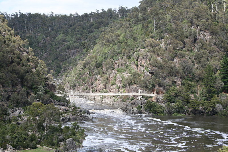 The most impressive aspect of Launceston is a
natural attraction-the spectacular Cataract Gorge and Cliff
Grounds. Only a 15-minute walk from the centre of
Launceston, the gorge was described by its discoverer, William
Collins in 1804, as a 'strange gully between perpendicular
rocks about 15 feet high. The beauty of the scene is probably
unsurpassed in the world'. The result of its unusual geology,
the area has been successfully incorporated into the town's
civic landscape. In typical Australian fashion, several walks
for all levels of fitness have been created throughout the
grounds, and a detailed brochure with maps, including walking
time and grade, is available at the Visitor
Information Centre. Tasmanian Chairlifts ((t
03) 6331 5915, adults $12 or $15 return, concession $10
or $12 return, children $8 or $10 return, 3 years and under
free, starts at 9.00 until 16.30 in winter, 17.00 in spring
and autumn, 17.30 or 18.00)) also runs a chairlift ride across
the gorge every day, weather permitting.
The most impressive aspect of Launceston is a
natural attraction-the spectacular Cataract Gorge and Cliff
Grounds. Only a 15-minute walk from the centre of
Launceston, the gorge was described by its discoverer, William
Collins in 1804, as a 'strange gully between perpendicular
rocks about 15 feet high. The beauty of the scene is probably
unsurpassed in the world'. The result of its unusual geology,
the area has been successfully incorporated into the town's
civic landscape. In typical Australian fashion, several walks
for all levels of fitness have been created throughout the
grounds, and a detailed brochure with maps, including walking
time and grade, is available at the Visitor
Information Centre. Tasmanian Chairlifts ((t
03) 6331 5915, adults $12 or $15 return, concession $10
or $12 return, children $8 or $10 return, 3 years and under
free, starts at 9.00 until 16.30 in winter, 17.00 in spring
and autumn, 17.30 or 18.00)) also runs a chairlift ride across
the gorge every day, weather permitting.
To walk to the gorge from the Information
Centre (68-72 Cameron Street near St. John Street, t +61
1800 651 827, 9.00 - 17.00), in town, turn
right from St John Street into Paterson Street and proceed
west until Paterson Street becomes Bridge Road. Here the
Cataract Gorge Reserve begins at Kings Park. Kings Bridge
spans the gorge. This graceful open girder iron bridge was
built in two sections, the earlier in 1863 designed by W.T.
Doyne. Other attractions in the park, aside from the famed Zig
Zag Walk to the gorge's First Basin, are the Penny Royal
Watermill, erected in 1825 and now containing displays of a
gunpowder mill and cannon foundry. The Richies Mill Art Centre
is near the landing dock of the paddle steamer Lady Stelfox
which makes daily cruises up the gorge.
An easy walk from the Information Centre on St John Street
leads around the corner east to George Street where the
National Trust runs the old Umbrella
Shop (t 03 6331 9248; open Mon-Fri 09.00-17.00, Sat
09.00-12.00) on the original premises of a real umbrella shop
and factory, opened in the 1860s by the Shott Family. It is
lined with beautiful Tasmanian blackwood and retains the
shop's original fittings. Further down George Street, turn
east on Cameron Street to find City Park, site of the original
Government House grounds which were laid out in 1820. The
elegant iron entrance gates were added in 1903. Inside the
park are the Tasmanian
Design Centre (t 03 6331 5506; Mon-Fri 10.00-16.00),
supporting local crafts with excellent examples of the
island's woodwork; Albert Hall, containing a unique
water-powered organ in a High Victorian exhibition building;
and the John Hart Conservatory presenting a variety of ferns
and flowers, as well as a monkey island with Japanese
macaques.
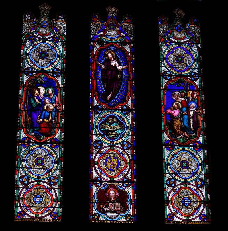 From the
Elizabeth Street car park back in town, turn right on
Elizabeth Street and walk to St. John Street (50m); on the
corner to the left is St John's Church. Commissioned by
Governor Arthur in 1824, the church's foundation stone was
laid by him in January 1825. Legend has it that the original
plans, designed by David Lambe, were for a church as large as
that in Hobart, but that Governor Arthur demanded that it be
made smaller. The clock tower was added in 1830, and further
additions made by architect Arthur North in 1901-11. The
interior of the church contains some amusing carvings which
depict Tasmanian animals and plants amidst biblical emblems
and coats of arms. These were apparently designed by the
architect North himself and carried out by Hugh Cunningham and
Gordon Cumming. Note especially the choir stalls which include
figures of four pairs of possums.
From the
Elizabeth Street car park back in town, turn right on
Elizabeth Street and walk to St. John Street (50m); on the
corner to the left is St John's Church. Commissioned by
Governor Arthur in 1824, the church's foundation stone was
laid by him in January 1825. Legend has it that the original
plans, designed by David Lambe, were for a church as large as
that in Hobart, but that Governor Arthur demanded that it be
made smaller. The clock tower was added in 1830, and further
additions made by architect Arthur North in 1901-11. The
interior of the church contains some amusing carvings which
depict Tasmanian animals and plants amidst biblical emblems
and coats of arms. These were apparently designed by the
architect North himself and carried out by Hugh Cunningham and
Gordon Cumming. Note especially the choir stalls which include
figures of four pairs of possums.
Turn left into St John Street and enter Prince's Square at the
next corner, on Frederick Street. Originally a brick field, it
became a military parade ground in the 1840s, and by 1859 was
established as a public park designed by Thomas Wade. The
square includes a fountain, commemorating the first water
supply; the fountain was purchased at the Great Paris
Exhibition of 1889.
Continue east on Frederick Street; opposite is Chalmers
Church, named for Sir Thomas Chalmers and opened in 1860. A
good example of Gothic Revival, it now houses the Launceston
Players Theatre. Further down in the same block is Milton
Hall. Built in 1842, this simple brick building with Doric
portico was originally St John's Square Independent Chapel,
the pastorate of noted historian and newspaperman, the
Reverend John West. West preached vehemently against
transportation and wrote the first account of The History of
Tasmania (1852). He was instrumental in the establishment of
The Examiner, Tasmania's oldest newspaper, the Mechanics'
Institute, and the City Mission. (The City Mission Chapel,
built in 1862, still stands at 46 Frederick Street.) In 1854
West left to become editor of the Sydney Morning Herald.
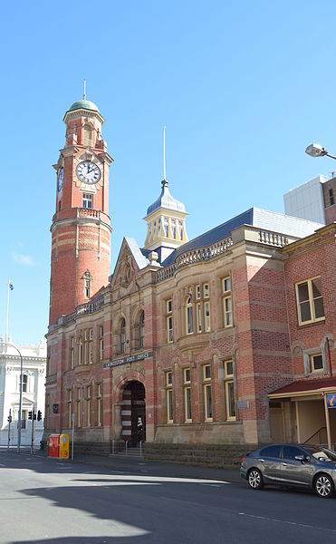
The main Post Office is on the corner of St John and Cameron
Streets. As in all other Australian cities, distances between
towns are measured from the post office, which perhaps
explains the grandiose scale of their construction and the
ubiquitous presence of a tall clock tower. Launceston is no
exception. The building was completed in 1889 without a tower,
but public demand led to its addition in 1909, after which
time it did indeed dominate the skyline.
On Civic Square, bordered by St John, Paterson, Charles
and Cimitiere Streets, is Macquarie House, built in 1830 as a
warehouse for early merchant Henry Reed. It now houses the
local history collection of the Queen Victoria Museum.
From Civic Square, exit west on to Charles Street. The block
of Cameron Street between Charles and Wellington Streets is
one of the town's oldest, with a remarkably well-preserved 19C
streetscape. The buildings include several impressive
flour-mills and warehouses, evidence of early river trade
nearby, as well as the Batman Fawkner Hotel, no. 37. The
present hotel is late Victorian, but remnants of the original
1823 building on this site have been preserved at the rear.
The original name was the Cornwall Hotel, Fawkner having built
it shortly after starting the Launceston Advertiser. Also of
interest on Charles Street is Staffordshire House at no. 56,
originally Fergusson's Warehouse. A rare example in Australia
of a Regency style building, it was built in 1833 for James
Cox, founder of the Clarendon estate.
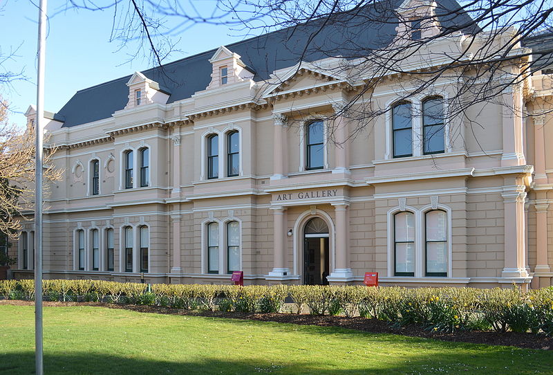 Queen Victoria Museum and Art
Gallery (t 03 6323 3777; open daily 10.00-16.00, free
admission) is on Wellington and Patterson Streets in Royal
Park. Parking near the museum is nearly impossible, and you
must cross busy intersections to reach it, but it is worth the
effort. As a museum and gallery for such a small community,
the institution is admirably well organised and intent on
educational display. Opened in 1891 in honour of Queen
Victoria's Golden Jubilee, exhibits are varied, ranging from a
complete Chinese Joss House (with an interesting history of
the Chinese presence in Tasmania from the time of the gold
rush to the present) to artefacts of convict life, and
displays of Tasmanian flora and fauna. Tucked away in one dark
corner is a fascinating glass case containing the hummingbird
collection of the famous naturalist John Gould. The upper
galleries are devoted to Australian art, including decorative
arts and crafts. The gallery of colonial art, while not as
extensive as that in Hobart, contains some important examples
by John Glover, Thomas Bock, and William Piguenit.
Queen Victoria Museum and Art
Gallery (t 03 6323 3777; open daily 10.00-16.00, free
admission) is on Wellington and Patterson Streets in Royal
Park. Parking near the museum is nearly impossible, and you
must cross busy intersections to reach it, but it is worth the
effort. As a museum and gallery for such a small community,
the institution is admirably well organised and intent on
educational display. Opened in 1891 in honour of Queen
Victoria's Golden Jubilee, exhibits are varied, ranging from a
complete Chinese Joss House (with an interesting history of
the Chinese presence in Tasmania from the time of the gold
rush to the present) to artefacts of convict life, and
displays of Tasmanian flora and fauna. Tucked away in one dark
corner is a fascinating glass case containing the hummingbird
collection of the famous naturalist John Gould. The upper
galleries are devoted to Australian art, including decorative
arts and crafts. The gallery of colonial art, while not as
extensive as that in Hobart, contains some important examples
by John Glover, Thomas Bock, and William Piguenit.
George Town
50km north of Launceston on the Tamar Highway (A8) is George
Town (population 5310). Considered by many to be the
oldest town in Australia (as distinct from the oldest city),
the area was indeed visited by Bass and Flinders in 1798, when
it was named Port Dalrymple. Renamed George Town five years
later by Colonel William Paterson, it no doubt would have
remained the chief northern city if it had a reliable water
supply. For this reason, and other more elaborate political
intrigues involving Governor Macquarie and Inspector Bigge,
the capital was moved to Launceston, up the Tamar River, in
1825.
Because of its age, and its importance as a port in the 1830s
and 1840s, George Town today still possesses several
historical sites and buildings of interest. Entering the town
on route A8, the Information
Centre at the far east side of town on Main Rd.
The Old Watchhouse is at the corner of Macquarie and Sorell
Streets (t +61 3 6382 4466);
built in 1843, it used to be the gaol and is now a folk
museum.
Walking up Macquarie Street, you come to Anne Street; turn
left to St Mary Magdalene Anglican Church. Built in 1883 as
the third church on this site, the graveyard contains
interesting gravestones of early settlers. Further up
Macquarie Street you find several early residences; at
Windmill Point is a monument to William Paterson, founder of
the town in 1804. Continuing the walk, turn right at Cimitiere
Street, to no. 25, 'The Grove'. Situated in an excellent Old
World garden, 'The Grove' was built c 1827 for the Port
Officer, Matthew Curling Friend. It is a good example of a
Georgian building, with Tuscan portico and columns.
Franklin House
6km south of Launceston on the road back to Hobart is Franklin
House in Franklin Village (t 03 6344 6233; check
for hours, Mon-Sat 09.00-16.00, Sun 12.00-16.00, $10). It is
most easily reached by driving east on Bass Highway until this
becomes Normanstone Road at an intersection known as Six Ways;
here turn left on to Hobart Road, drive through the suburb of
Kings Meadow, and in the village of Franklin, the house is on
the left.
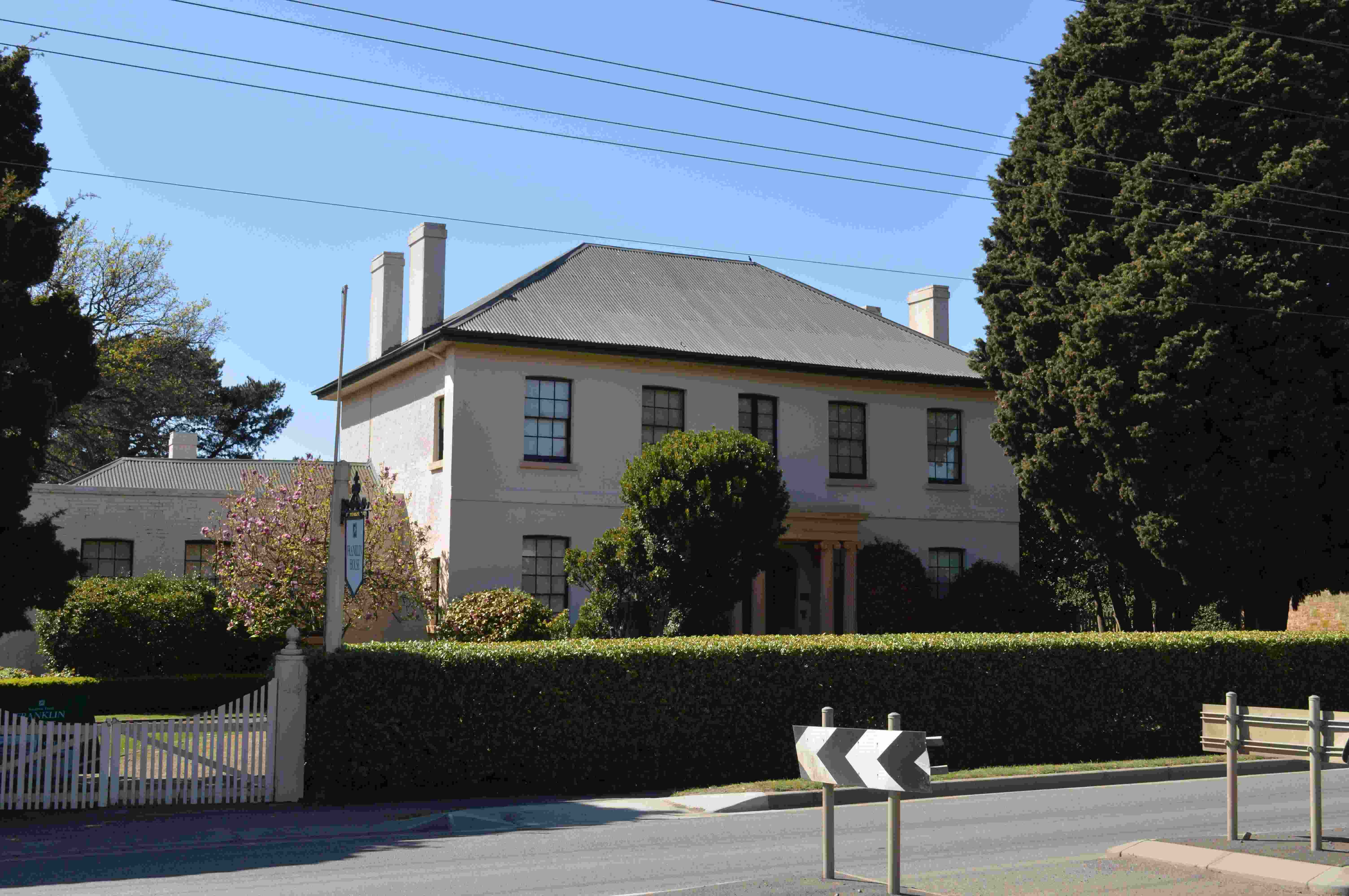 The first house owned by the National Trust in
Tasmania, Franklin House was, like Clarendon, built in 1838.
Not nearly as grandiose in scale or pretension, Franklin House
was built on speculation by brewer and innkeeper Britton Jones
on 4 ha across the road from the inn. Jones stated in his
initial advertisement for the sale of the property that the
house has 'all the appurtenances fit for the reception of a
respectable family and are finished without regard to
expenses, by the proprietor in a manner not to be surpassed in
this colony'.
The first house owned by the National Trust in
Tasmania, Franklin House was, like Clarendon, built in 1838.
Not nearly as grandiose in scale or pretension, Franklin House
was built on speculation by brewer and innkeeper Britton Jones
on 4 ha across the road from the inn. Jones stated in his
initial advertisement for the sale of the property that the
house has 'all the appurtenances fit for the reception of a
respectable family and are finished without regard to
expenses, by the proprietor in a manner not to be surpassed in
this colony'.
First owned by George Horne, a keen gardener, its grounds were
well established when it was purchased by William Keeler
Hawkes (1804-82) in 1842. Hawkes, with his wife and three
spinster sisters, arrived in Launceston in April of that year,
with the intention of establishing a school. This house served
for some 40 years as a boarding school, and became the leading
educational institution of the colony. A strict
disciplinarian, Hawkes was, in keeping with his time, free
with the stick. In 40 years of teaching, according to guides
at the house, he only caused the death of one student!
After Hawkes's death (he and his family are buried in the
cemetery of St James's Church across the street) the house
passed through several hands until it was purchased by the
National Trust in 1960. At that time it was renamed Franklin
House; the house has no direct connection to Sir John and Lady
Jane Franklin (although two rosewood chairs in the dining room
supposedly belonged to her).
The informative brochure available at the house gives an
elaborate explanation for the choice of furnishings used in
the presently restored building. It is argued that, although
officially built during Victoria's reign, the house itself is
actually Late Georgian, probably built from English plans, and
that furniture from earlier eras would be more readily
available in the colonies; thus, the furniture selected for
display is period rather than Victorian. Some rare early
Tasmanian pieces are included, as well as several fine
examples of English furniture and clockwork.
Great care has been taken in preserving the original fittings
and surfaces. Of particular note are the floors and other
wooden fittings of Australian cedar which Jones had imported
from New South Wales. This wood was so sought after as one of
the best native hardwoods that today no substantive cedar
forests survive. Plantation grown cedar, heritage conservators
mention, is lighter because it is harvested at a young age.
The upstairs reception room is especially noteworthy, and
includes the original floor-to-ceiling room partitions which
were found languishing in the stables. Another interesting
piece is the 18C Welsh bacon cupboard in the kitchen, made of
oak and containing the original meat hooks at the back. To the
side of the original house is the schoolroom added by Hawkes
in 1842.
Hobart to Richmond
An alternative route from Hobart north to Oatlands (see p 432) includes several sites of historical interest. These sites will be included on several of the coach day-tours to the area; check with the Hobart Visitor's Centre for a variety of tour options. If travelling by car, leave Hobart heading north on Highway 1 c 6km to Goodwood Road/Bowen Bridge (route B35); proceed right across the bridge and immediately turn right on to route C324 towards Risdon Vale; at this juncture is the Risdon Cove Historic Site, the location of Tasmania's first settlement in 1803. A visitor's centre contains interesting relics and displays. Ironically, Risdon is also the site of Tasmania's only current prison, a pink Victorian structure that you can see from the Historic Site. Risdon Cove itself is now Aboriginal land, having been returned recently to the Tasmanian Aboriginal community. The site will be used for Aboriginal cultural events, and may on occasion be closed to the public. The Aboriginal community are preparing plans for the future use of the site; t 03 6243 8606 for details.Richmond
Return to route C324 and continue north 12km to the town of Richmond
(population 587). Richmond is a charming town, laid back, with
a mucky little river, imbued with the Tasmanian desire to
emulate an English village. Until 1872, when the Sorell
Causeway connected Hobart and Port Arthur directly, Richmond
was the major crossroads en route to the Tasman Peninsula.
Since then, it has become a sleepy rural village, and now a
tourist destination, with many substantial buildings dating
from the 1830s and 1840s.
At present, Prospect House is closed and for sale. A heritage
accommodation property, it was built in the 1830s by James
Buscombe, a local innkeeper who was responsible for several of
the other Georgian-style buildings in the town.
Turn right on to Henry Street, site of the Richmond Hotel,
then left into Torrens Street. Here is an old sandstone school
designed by John Lee Archer in 1834, and the old
Congregational burial ground with many gravestones from the
last century. Further along the same street, at no. 26, is St
Luke's Anglican Church, another of Archer's designs from 1834.
Built of local sandstone, the church has a square, three-level
tower with a clock; made in England in 1828, it was in
Hobart's St David's before being brought here in 1922.
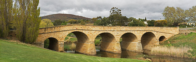
The bridge across the Coal River at Richmond is Australia's
oldest existing bridge. Completed in 1823 using convict
labour, it spans 41.5 metres. Much of its charm springs from
its irregularity; the arches are not uniform and one span
humps at the corner.
St John's Church, on St John's Circle, is the oldest Roman
Catholic church in Australia. The foundation stone was laid in
August 1835. Designed by convict architect Frederick Thomas,
the nave was built in 1836, the rest in 1839, and the spire in
the 1900s. It is famed for its polished brown wood ceilings.
Richmond Gaol (t
03 6260 2127; open daily 09.00-17.00; adults $9, $4,
family $22) predates Port Arthur, having been built in 1825 to
house both local convicts and convict road gangs. The complex
is nearly intact and unaltered. While the earliest elements,
the original gaol and gaoler's house, were probably designed
by Colonial Architect David Lambe, the additional wings were
added by John Lee Archer.
Evidence of Richmond's early prominence is the complex of
public buildings, including municipal buildings, court house,
watch house and hall situated near the gaol, and a number of
fine inns and hotels dating from the early days of settlement.
In about 1832 James Buscombe built a group of buildings at
36-8 Bridge Street, now the Old Store and Granary Group. The
plethora of granaries and mills in the region indicate the
significance of wheat production to its economy in the 19C.
Oaklodge,
at 18 Bridge Street (t 03 6260 4153, daily 11.30-15.30), is
looked after by the Coal River History Society. It
features the office of the local doctor, Bill Clark, resident
here in the early 20thc. Richmond Golf
Club (t 03 6248 5450; visitor welcome, hire clubs
available; par 66) is a challenging nine-hole course with
spectacular water views over Barilla Bay, Pittwater and Midway
Point. The course is just west of town, on Middle
Tea Tree Road off of Richmond Road.
Leave Richmond via route B31 north towards Campania (6km),
then proceed 40km to connect at Jericho with the Midland
Highway.
The Islands north of
Launceston
Several islands lie off Tasmania to the north in the
Bass Strait, the largest being Flinders, Cape Barren, and King
Islands. Flinders and King Islands are accessible using
Sharp Airlines (1 300 55 6694). Cape Barren Island is a
short boat trip from Flinders Island. All three are
known for their birding and golf courses. King Island
cheese is renowned.
The Bass Highway from Launceston to Devonport and along the northwest coast
From Launceston, head south and connect with Bass Highway (Highway 1) to travel west. Pass through Hadspen and turn left onto route B52 to arrive in 18km at Entally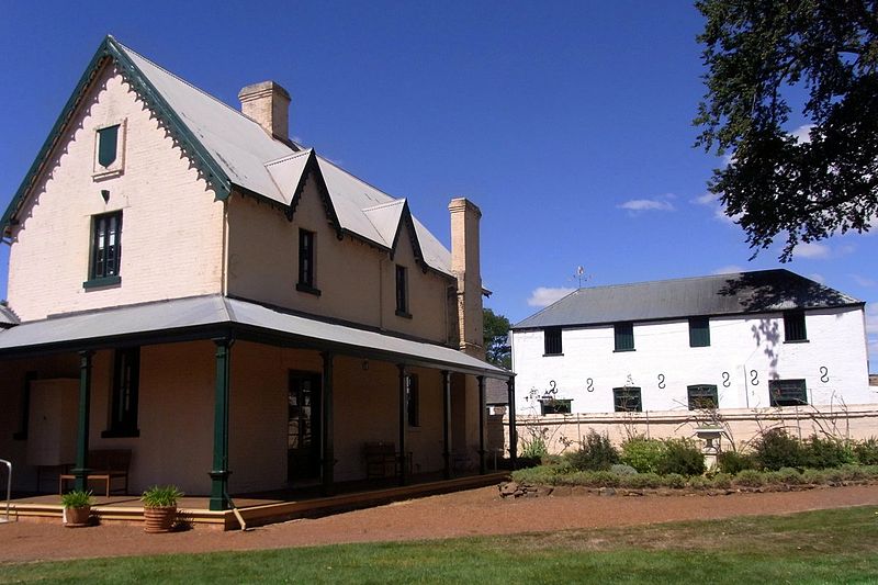 House which functions as
a lodge and restaurant but is also open as an historic house.
The House (t 03 6393 6201; open Thurs.-Mon. 10.00-16.00,
closed May-Aug., $10; the Launceston city bus from Patterson
Street has a stop near the house) was built in 1819 for Thomas
Haydock Reibey, son of Thomas and Mary Reibey. Involved in
family shipping interests, Reibey arrived in Tasmania in 1816
and received a 2600-acre (1052 ha) land grant where he built
this house in 1819, named after the family home in Sydney, which
had itself been named in honour of a Calcutta suburb. The house
and its immediate surrounds reflect his character as an
outdoorsman devoted to horses and hounds. Reibey's son Thomas
(1821-1912) would become Archdeacon of Launceston and in 1876,
premier of Tasmania: an extraordinary example of Australian
achievement, given Mary Reibey's convict origins.
House which functions as
a lodge and restaurant but is also open as an historic house.
The House (t 03 6393 6201; open Thurs.-Mon. 10.00-16.00,
closed May-Aug., $10; the Launceston city bus from Patterson
Street has a stop near the house) was built in 1819 for Thomas
Haydock Reibey, son of Thomas and Mary Reibey. Involved in
family shipping interests, Reibey arrived in Tasmania in 1816
and received a 2600-acre (1052 ha) land grant where he built
this house in 1819, named after the family home in Sydney, which
had itself been named in honour of a Calcutta suburb. The house
and its immediate surrounds reflect his character as an
outdoorsman devoted to horses and hounds. Reibey's son Thomas
(1821-1912) would become Archdeacon of Launceston and in 1876,
premier of Tasmania: an extraordinary example of Australian
achievement, given Mary Reibey's convict origins. Entally, unlike Clarendon or Franklin House, was not built on English Georgian models, but is one of the first examples of the wide-verandahed, sloped-roof single-storey dwellings so identified with Australian rural architecture. Opened to the public in 1950, Entally House contains a fine collection of Regency furniture and is set in well-restored gardens and grounds, with many interesting outbuildings, including a small bluestone chapel and a coach house.
Return to Bass Highway and continue west through Carrick
and Hagley (site of a famous experimental school) and
Westbury, another Historic Town.
49km from Launceston, at the junction of Bass and Lake
Highways, is Deloraine (population 2100). Astride the Meander
River in a valley dominated by Quamby Bluff, Deloraine was
considered in the 1950s by Emmett to be the prettiest inland
town in Tasmania. The town derived its name from its surveyor
Thomas Scott, who was inspired by his kinsman Sir Walter
Scott's The Lay of the Last Minstrel, in which Sir William
Deloraine seeks the hand of the Lady of Branksome Hall. In
1856, it was surveyed to become the terminus for the first
railway line from Launceston; the line was not completed until
1871, and was always a source of great political debate.
Entering town from the Bass Highway, on the right at 98 Emu
Bay Road is the Folk Museum (t +61 3 6362 5280,
daily 9.00-17.00, admission adults $8, children $6, groups $5
each, families $18), originally the Coaching Inn, 1865; it
houses local memorabilia and agricultural artefacts and acts
as the area's visitor centre. Continue south, turn left (west)
on West Parade. On the left is Bonney's Inn; established in
1831, it is the first brick building and inn in Deloraine. The
Deloraine Racecourse is the oldest continuously used track in
Australia; it may still hold an annual steeplechase around
Easter.
Devonport
Continue now north on Bass Highway 50km to Devonport
(population 22,700). This far northwestern tip of the island
is extremely well-watered and heavily timbered in its
interior. The wetter areas on the west-facing slopes are
dominated by myrtle and sassafras with stringybark and
peppermint eucalypts above 600m and gum-topped stringy barks
below this line. Where the soil is relatively infertile, scrub
and heath plants prevail. The better soils are eroded tertiary
basalt flows from the north-south-running Dundas Trough and
Pre-Cambrian sedimentary deposits from the coast to the
Donaldson River. Tourist
information: 92 Formby Road; t 03 6424 4466;
7.30-11.30.
After agriculture, timber and mining are the prevalent
industries in this region. The production of decorative
timbers is increasingly replacing the more destructive
practices of the recent past. Numerous joineries and furniture
manufacturers have showrooms in Burnie, Ulverstone and
Devonport, among other locations.
Emmett's comments on Tasmania's northern coastline made during
his walking tour of the island in the 1950s still apply:
If I attempted to write of each town of the rich northwest that I passed through or stayed at, I should be risking tedium for the reader, for they are, in a sense, made of the same last; though I wish to make it plain that the journey is through perhaps the very sweetest farming country in the whole of Australia.
Devonport is the landing point of the ferry from
Melbourne; those arriving in Tasmania by ferry will indeed
want to follow this route in reverse order to Launceston. The
Devonport Airport, 4km east of town, has regular flights
arriving from Melbourne. Located on the Mersey River (called
in the 1820s the 'Second Western River'), Devonport is named
after the English county. It was originally founded in the
1840s as two towns, Formby on the west bank of the river and
Torquay on the east.
Of special interest here is Tiagarra (t 03
6424 8250; contact them for a tour, they hope to be open
routinely soon), the Tasmanian Aboriginal Culture and Art
Centre. The centre's displays describe the life of Tasmanian
Aborigines prior to European contact. A map of the locations
of adjacent rock art sites allows you to view Aboriginal
carvings in rocks of the Bluff. The centre is located on the
north edge of town at the top of William Street.
Devonport was also the home of Sir Joseph and Dame Enid Lyons;
their residence 'Home
Hill', 77 Middle Road (t +61 3 6424 8055;
tours at 14.00 Wed.-Sun., admission adults $15, concession
$12, children $10, families), is now open to the public.
Joseph Lyons (1879-1939) became in 1931 Australia's only
Tasmanian-born Prime Minister. His wife Enid Lyons
(1897-1981), became the first woman to hold Federal Cabinet
rank, while also raising ten children.
From Devonport head west on Bass Highway 12km to
Ulverstone (population 14,000); from here turn on to the Old
Bass Highway for a scenic drive along the rugged coastline to
Penguin (population 3000), a further 12km. Along with the
roadside Giant Penguin, Penguin abounds in penguin symbols,
honouring the Fairy Penguins that come ashore nearby. Several
walking tracks along the cliffs are well posted for visitors;
maps of the tracks are available from Penguin Council
Chambers, Main Street, (9.30-5.30). Ask about the nearby
limestone caves which are South of Ulverstone on road B17
beyond Gunns
Plains (for a tour call 03 6429 1388 or email
info@gunnsplainscaves.com.au).
A note about your new friends the ferry penguins is
probably in keeping. These are wonderfully cute but very
shy wild animals. Please don't bother them. If
they are disturbed they sometimes can not breed or fail to
feed their young. Do not walk among them as this will
almost surely both damage their burrows and frighten
them. If you are using a flashlight, cover the light
with a bit of red cellophane. Do not use a flash when
taking photographs. Try not to be silhouetted above the
dunes -- they seem to think that you are something coming to
eat them.
Burnie
From Penguin travel west along the coastal drive 15km to
Burnie (population 21,000), the largest town in the northwest
of the state. Founded on the deep water port of Emu Bay,
Burnie was named in 1841 after William Burnie, a director of
the Van Diemen's Land Company. Now an important industrial
centre, it is the home of the Associated Pulp and Paper Mills
and Lactos Cheese. Tourist
information centre: Little Alexander Street, t 03
6430 5831.
On entering town, turn right on Alexander Street. Turn left on
Jones Street to Burnie
Regional Museum (t 03 6430 5746; open weekdays
10.00-16.30; admission adults $6.50, concession $5.00,
children $2.50, families $15), a reconstruction of Burnie's
early buildings and shops. Further along Alexander Street, at
Wilmot Street is the Burnie
Regional Art Gallery (t 03 6430 5875; open weekdays
10.00-16.30, weekends 13.30-16.30; free admission), housing a
small collection and occasional travelling exhibitions.
Continue north on Alexander Street, turn left at North
Terrace. Burnie Park will be on the left at York Street. The
park includes extensive rose gardens and Burnie Inn, the
town's oldest building, re-erected and restored in the park in
1973.
Continue west on North Terrace, which becomes Bass
Highway. At Somerset (7km), route A10 continues south to
Tullah and Queenstown. Further west (9km) on route A1 is
Wynyard (population 4582). Located on the Inglis River,
Wynyard was once the principal port of the northwest; its
airport has daily flights to Melbourne. It is now the centre
of a prosperous farming region, with beautiful gardens and
interesting natural surroundings.
7km north of town on route C234 is Fossil Bluff, a fascinating
geographical formation and for a time the site of the
discovery of the oldest marsupial fossil. Continue west on
route C234 to Table Cape, a volcanic rock some 170 metres
above the sea, offering stunning coastal views. Return to Bass
Highway and proceed 31km west to Rocky
Cape National Park (t 03 6458 1480). The cape itself was
named by Bass and Flinders who first saw it in 1798. The park
consists of 3000 ha of heathland, with several wa lking trails, a bird sanctuary, and
rich Aboriginal sites, in particular a shell midden in the
north cave. You can also see from the lighthouse point at the
end of the cape the first view of 'The Nut', the famed
volcanic plug at Stanley.
lking trails, a bird sanctuary, and
rich Aboriginal sites, in particular a shell midden in the
north cave. You can also see from the lighthouse point at the
end of the cape the first view of 'The Nut', the famed
volcanic plug at Stanley.
Stanley
Return to the Bass Highway and continue west 26km; turn north
on to route B21 and travel 7km to Stanley (population 588).
Just before entering the town, turn left into the Scenic
Drive, Dove Cote Road and follow signs to 'Highfield'
(t 03 6458 1100; open daily 10.00-17.00 Oct-Apr,
10.00-16.00 May-July), the original homestead of the director
of the Van Diemen's Land Company. Designed in 1832 by surveyor
Henry Hellyer, the house and grounds have now been
restored. Alternately, from within Stanley take
Greenhills Road, the coastal road, north along Godfrey's
Beach.
Drive into town to the north. Dominated by the volcanic plug 'Circular Head', more popularly known as 'The Nut', this small village was settled in 1825 as the headquarters for Van Diemen's Land Company. Recently declared a Historic Town, Stanley has several interesting early structures, including on Alexander Terrace the birthplace of Joseph Lyons, the only Tasmanian Prime Minister, and several houses built by the ubiquitous colonial architect John Lee Archer, who died here in 1852. Alexander Terrace includes several other historic houses and inns. Archer's own home, known as 'Poet's Cottage', sits at the base of The Nut. The Stanley Burial Ground on Browns Road contains Archer's own grave and headstone. On Church Street visit the Plough Inn, restored as a craft centre; next door is the Discovery Centre, now a folk-museum and gallery (t 03 6458 1145; open daily 10.00-16.00, closed June-Aug). Entering The Nut Reserve, you can take a chairlift to the top for a breathtaking, if windswept, panoramic view. Stanley is the site of the Circular Head Arts Festival, held every September. Of note, the first submarine telephone cable from the mainland at Apollo Bay came ashore at Stanley in 1936.
The Bass Highway continues 22km west to Smithton
(population 3495), the administrative centre of the far
northwest in a rich forestry area. The highway ends a further
51km west at Marrawah, the most westerly town in Tasmania.
Author Bernard Cronin ran cattle here at the beginning of the
century; the isolated region is well described in his five
novels, including The Coastlanders (1918) and Timber
Wolves (1920), referring to the hardwood forests so
prized here. This area marks the beginning of the densely
forested regions of Tasmania's western coast.
Northeast from Hobart to Swansea
From Hobart, take route A3 across the Tasman Bridge and on to Sorell, 27km from the centre of town. Named after Governor Sorell, the town was founded in 1821 and is one of the earliest sites for the cultivation of grain in the state. The main bus companies from Hobart and some local companies have runs between Swansea, Coles Bay, Bicheno, St Marys, St Helens and Derby. Service on weekends is very limited. Cycling along the east coast is a very popular way to travel as well (cycle rental can be arranged in Hobart). Note that banking facilities along the coast are extremely limited, and ATM facilities are (or were at the time of writing) non-existent.37km further north on route A3 is Buckland, known for St John the Baptist Church. The church contains a stained-glass window which by local legend is said to date from the 14C, from a church on the field where the Battle of Hastings took place! A local brochure attempts to substantiate this claim on the basis of a terminus post quem, arguing that the glass was in place before 1848, before which reproduction of such glass was not possible. Emmett in 1952 maintains that it was actually commissioned by the minister of the church, a Reverend Cox, in the 1850s. Despite any arguments, the church is a lovely example of a small provincial Anglican church, complete with local graveyard which seems to have specialised in ceramic rose arrangements attached to the tombstones.
At Orford, 18km further east, you reach the eastern coastline, dominated by a view over to Maria Island National Park (t 03 6257 1420, you will need a National Parks Pass $11). From Triabunna, 7km further along route A3, you can take a fascinating trip by ferry to the island, which has remnants of an old convict settlement. It is possible to arrange camping on the island overnight, where there is no electricity or facilities. The island is the only national park in Tasmania where all 11 of the state's native bird species are visible, including Cape Barren geese and emus.
From Triabunna, travel 51km north along the coast to Swansea, with outstanding views out to sea and past many beautiful beaches ideal for picnics. Outside Swansea c 8km south is Spiky Bridge, built in 1843 by convicts; the spikes are of local crystalline rock. The beach here gives a tremendous view of Oyster Bay, down to Maria Island and over to the famous Hazards of Freycinet Peninsula (see below).
Swansea
Swansea (population 400) is the centre of Glamorgan, the
oldest rural municipality in Australia. The town includes
the Glamorgan
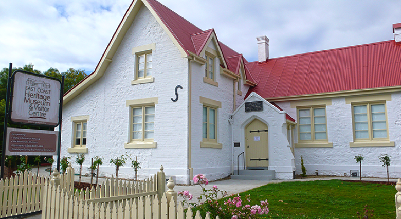 Spring Bay
Historical Society (t 03 6256 5077, open Tues and Fri
10.00-16.00) and community centre, housed in an 1850s
schoolhouse, which is a marvellous example of a home-grown
collection. Along with an eclectic collection of artefacts
donated by local residents-some of them connected with the
region and others as varied as Fijian baskets and German
swords captured in the First World War-are two portraits of
members of the Meredith family by Thomas Bock, several books
by Louisa Anne Meredith, and local watercolours by 19C
artists, very few of which have been identified. The place is
a conservator's nightmare and an historian's paradise.
Spring Bay
Historical Society (t 03 6256 5077, open Tues and Fri
10.00-16.00) and community centre, housed in an 1850s
schoolhouse, which is a marvellous example of a home-grown
collection. Along with an eclectic collection of artefacts
donated by local residents-some of them connected with the
region and others as varied as Fijian baskets and German
swords captured in the First World War-are two portraits of
members of the Meredith family by Thomas Bock, several books
by Louisa Anne Meredith, and local watercolours by 19C
artists, very few of which have been identified. The place is
a conservator's nightmare and an historian's paradise.
The museum also includes an anomalous billiard table.
Built to order by the premier billiard table makers, Alcock
Thomas & Taylor of Melbourne, for the 1879 International
Exhibition, the table had to be built larger than standard
size, because the half-a-ton slab sent from Italy was too big,
and the local craftsmen deemed it too risky to alter; the
frame is of a single Tasmanian hardwood. It is still available
for play, at $2 a game, although, as the present caretaker
states, the only takers are a regular group of elderly men.
The table is a splendid example of the skill of Alcock's, and
the museum is worth a visit.
The Merediths of Swansea
Swansea was so named by first settler George Meredith
(1778-1856), who came with his servants, John and Adam Amos,
in 1821. A son by his first marriage, Charles (1811-80),
accompanied him, and would later become a prominent politician
in the state. In 1838, Charles returned to England and married
his cousin, Louisa Anne Twamley (1812-95); in 1840 the couple
settled north of Swansea, at George Meredith's property,
Riversdale. Louisa Anne Meredith became a prolific writer and
artist; her My Home in Tasmania (1852) and Bush Friends in
Tasmania (1860) with delightful illustrations still provide
remarkable insights into 19C Tasmania. Another Meredith
property, 'Cambria', built in the late 1820s, still remains,
2km north of Swansea.
 From Swansea, it is about 10km along Nine Mile
Beach to Freycinet
National Park (t 03 6256 7000). This 10,000 ha park
begins 2km south of Coles Bay. Its most prominent feature is a
huge granite rock known as The Hazards. Mount Freycinet is the
highest point at 614m. The park contains a wide number of
orchid species, as well as other heathland plants and birds.
There are secluded sandy beaches, and a variety of excellent
walks with views to the sea. Off the coast 1km across Schouten
Passage and also part of the park is Schouten Island, named by
Abel Tasman in 1642 after a member of the Dutch East India
Company; the island can be visited by boat.
From Swansea, it is about 10km along Nine Mile
Beach to Freycinet
National Park (t 03 6256 7000). This 10,000 ha park
begins 2km south of Coles Bay. Its most prominent feature is a
huge granite rock known as The Hazards. Mount Freycinet is the
highest point at 614m. The park contains a wide number of
orchid species, as well as other heathland plants and birds.
There are secluded sandy beaches, and a variety of excellent
walks with views to the sea. Off the coast 1km across Schouten
Passage and also part of the park is Schouten Island, named by
Abel Tasman in 1642 after a member of the Dutch East India
Company; the island can be visited by boat.
You will need a National Parks Pass (at the time of writing,
$11) and will find an excellent park brochure at the gate. You
will need to supply your own water. The park is named after
Louis Freycinet (1779-1842), French naval officer on Baudin's
Le Naturaliste, who in 1802 explored throughout this region.
Freycinet is best remembered for his round-the-world voyage in
command of L'Uranie in 1818, during which time his wife Rose
disguised herself as a man in order to accompany him and kept
a lively account of her most extraordinary journey, Journa
de Madame Rose de Saulces de Freycinet (1927).
From Launceston northeast to St Marys
This route through northeastern Tasmania has some bus services
during the week, but weekend services are very spotty, if they
run at all. One road to Scottsdale from Launceston is route
B81, which leads 27km north to Lilydale (population 357). 7km
before the town is Hollybank Forest Centre, a lovely reserve
of ash trees on the site of an 1855 sawmill; it is now run by
the Forestry Commission and is open to the public from October
to May. Lilydale itself is best known for Bridestowe Lavender
Farm, a long-standing and productive source of lavender oil
and sachets, considered the purest product in the country. It
produces over 2 tonnes of lavender oil annually.
The 41km from Lilydale to Scottsdale is through heavy bush
with craft shops and wineries along the way. Scottsdale
(population 1980), settled in the 1850s by surveyor James
Scott, is the centre of the northeast's dairying region. One
interesting stop in town is Anabel's, 46 King Street (t 03
6352 3277), in an 1890 Federation building classified by the
National Trust and set in elegant gardens with a 12m wistaria
walk and rhododendron trees; it is now a restaurant and
four-star hotel.
21km north of Scottsdale on route B84 is Bridport (population
980), a popular fishing village on the Bass Strait with
excellent picnic beaches and some tremendous views from nearby
Waterhouse Point out to the strait and including Waterhouse
Island.
An example of the area's early architecture can be seen at
'Bowood', c 12km northwest of Bridport on route B82, at the
Little Forester River. Built in 1839 for Peter Brewer, the
house was constructed by ex-convict carpenter James Edwards
and an American sealer Robert Rhodes, who in the 1830s jumped
ship to stay in the region; Rhodes' headstone nearby states
that he was from Philadelphia and died here in 1863. 'Bowood'
is a private residence, but interesting to view in situ, along
what used to be the Launceston Road.
From Launceston, the Tasman Highway (route A3) also
continues north 70km to Scottsdale, then east through dairy
and hops country that used to be one of the biggest timber
regions of the state until the trees were forested to stoke
the fires of the nearby tin mines. The area from Branxholme,
25km east of Scottsdale, to Pyengana and east to the coast was
from the 1870s to the 1950s a booming tin-mining centre.
The town of Derby, 8km east of Branxholme, has a Tin
Dragon Interpretive Centre and Cafe (t 03 6354
1062). Also in the neighborhood 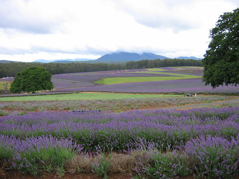 is the Bridestowe
Lavender Estate (+61 3 6352 8182, open May-Aug.
10.00-16.00, Sept.-Apr. 9.00-17.00).
is the Bridestowe
Lavender Estate (+61 3 6352 8182, open May-Aug.
10.00-16.00, Sept.-Apr. 9.00-17.00).
Weldborough, c 14km south along route A3, was also a mining
centre; its old Chinese Joss House, now in Launceston's Queen
Victoria Museum, is evidence of the thousands of Chinese
miners who came to the region during the tin boom, many of
whom stayed on in Tasmania. To the south of Weldborough is Maa
Mon Chin Dam, named for a leader of the Chinese community who
arrived in 1875. At Weldborough Pass, 595m high, is the
Weldborough Pass Scenic Reserve, a 20-minute walk through
myrtle forests that offers spectacular views of the valley and
out to the sea.
Pyengana, 19km south of Weldborough, is known for cheese and
as the site, 13km south on route C428, of St Colombia Falls,
the state's tallest waterfall, cascading 110m on to the rocks
below. The falls take their name from the property here of the
Quaker family Cotton, who arrived in 1828. In the 1870s,
Margaret Cotton set up one of the island's first apple
exporting businesses. To the east of here, the near ghost
towns of Goshen, Goulds Country, and Lottah hearken back to
the days of open tin-mining of the Blue Tier Mountain, now
closed.
St Helens (population 1200), 18km southeast of Goshen, is one
of the most popular seaside resorts in Tasmania, known for its
beaches around Georges Bay and its temperate climate. The
town's main thoroughfare is Cecilia Street; at no. 57 is the St. Helens Local
History Room (t 03 6376 1479, open 9.00-17.00, admission
$3, family $5), which is also the information centre where you
can get a detailed brochure about the town's history. The
History Room contains a quintessential conglomeration of local
artefacts, including a black hat worn by local coach driver
George Avery when in the 1880s he drove the Duke of Edinburgh
through the region. Cecilia Street and side streets include
other 19C buildings, including St Paul's Church of England,
built in 1884, the 1874 District High School around the corner
on Groom and Circassian Streets, and, at no. 5 Cecilia Street,
an 1870 weatherboard house. Surveyor George Frankland, who
laid out the town in the 1840s, endowed the streets and places
with lofty Greek names, such as Golden Fleet Rivulet and
Medeas Cove. Route C851 leads over Golden Fleece Bridge to
Jasons Gates and on to St Helens Point at the end of Georges
Bay, a state recreation ground. This is a great location for
bushwalking and, again, this area is one of the best places to
sample Tasmania's superb seafood.
Continue south on route A3 along the coast, passing
through the resort town of Scamander, known for bream fishing
in the Scamander River. At St Marys Pass, 10km south of
Scamander, is a turn-off to Falmouth, 3km further east; it is
an historic village with several convict-built structures, as
well as great views both of the coast and of the mountains
south through Elephant Pass.
The picturesque village of St Marys (population 668) sits at
the junction of the Tasman Highway (route A3) and the Esk Main
Road (route A4) and is at the headwaters of the South Esk
River. Originally known as 'Break O'Day Plains', the town is
now at the centre of a coal-mining region and is a major depot
for the distribution of hydro-electric power.
Continue on route A4 to Fingal, 21km west of St Marys.
Along the road, c 10km, is 'Killymoon', built between 1842 and
1848, by Frederick von Stieglitz, with Tuscan portico and
substantial brick-walled gardens. The property is a marvellous
example of the grandiose homestead mansions so characteristic
of Tasmania.
2km north of Fingal is 'Malahide', a Georgian stone house
built for original settler William Talbot in 1828. With a name
like Fingal, it is not surprising that the place was founded
by an Irishman, Roderic O'Connor, who arrived in Tasmania on
his own ship the Ardent in 1824; his cargo included the first
free Irish immigrants to the state. On Talbot Street in town
is the Fingal Hotel (also the tourist information centre, t 03
6374 2121), formerly the Talbot Arms, built in 1844; true to
its Celtic tradition, the hotel has the largest collection of
Scotch Whisky in the Southern emisphere, 348 different brands
acquired since the Second World War.
Route A4 continues on from here 27km to Avoca, at the junction
of the South Esk and St Pauls Rivers. The village's St Thomas
Church of England of 1842 is a local landmark, attributed
because of its Romanesque Revival style to James Blackburn.
From Avoca, you can take route B42 c 11km to the foot of Ben
Lomond; walking tracks at Rossarden lead to the top of the
mountain. On the same road c 8km a turn-off leads to 'Bona
Vista', a late Georgian style homestead built in 1845 for the
famed ex-convict Simeon Lord; at one time, the bushranger
Martin Cash was a horse-groom here. Back on the A4, the road
continues 26km to connect with the Midland Highway at Conara
Junction.
Hobart to Strahan
Leave Hobart on Highway 1 towards Launceston; at
Granton/Bridgewater, continue west on route A10 towards New
Norfolk (38km), another of the towns founded by Governor
Macquarie and named Elizabeth Town after his wife. It became
New Norfolk after the arrival of settlers from Norfolk Island
in the 1820s. Entering town, turn right at signs for Tynewald
and Oast House; originally one estate, Tynewald is now a guest
house (03 6261 2667) and Oast House, originally the drying
kilns for the extensive hop fields of the estate, the owners
hope to eventually re-open it as a museum depicting the
history of hop-growing in the region.
Returning to the main highway, continue west past Lachlan
River. At Bathurst Street on the left, note St Matthew's
Anglican Church; dating  from 1823, it is the oldest
Anglican church in Tasmania. Of special interest here is the
lovely church garden and its striking stained glass windows.
from 1823, it is the oldest
Anglican church in Tasmania. Of special interest here is the
lovely church garden and its striking stained glass windows.
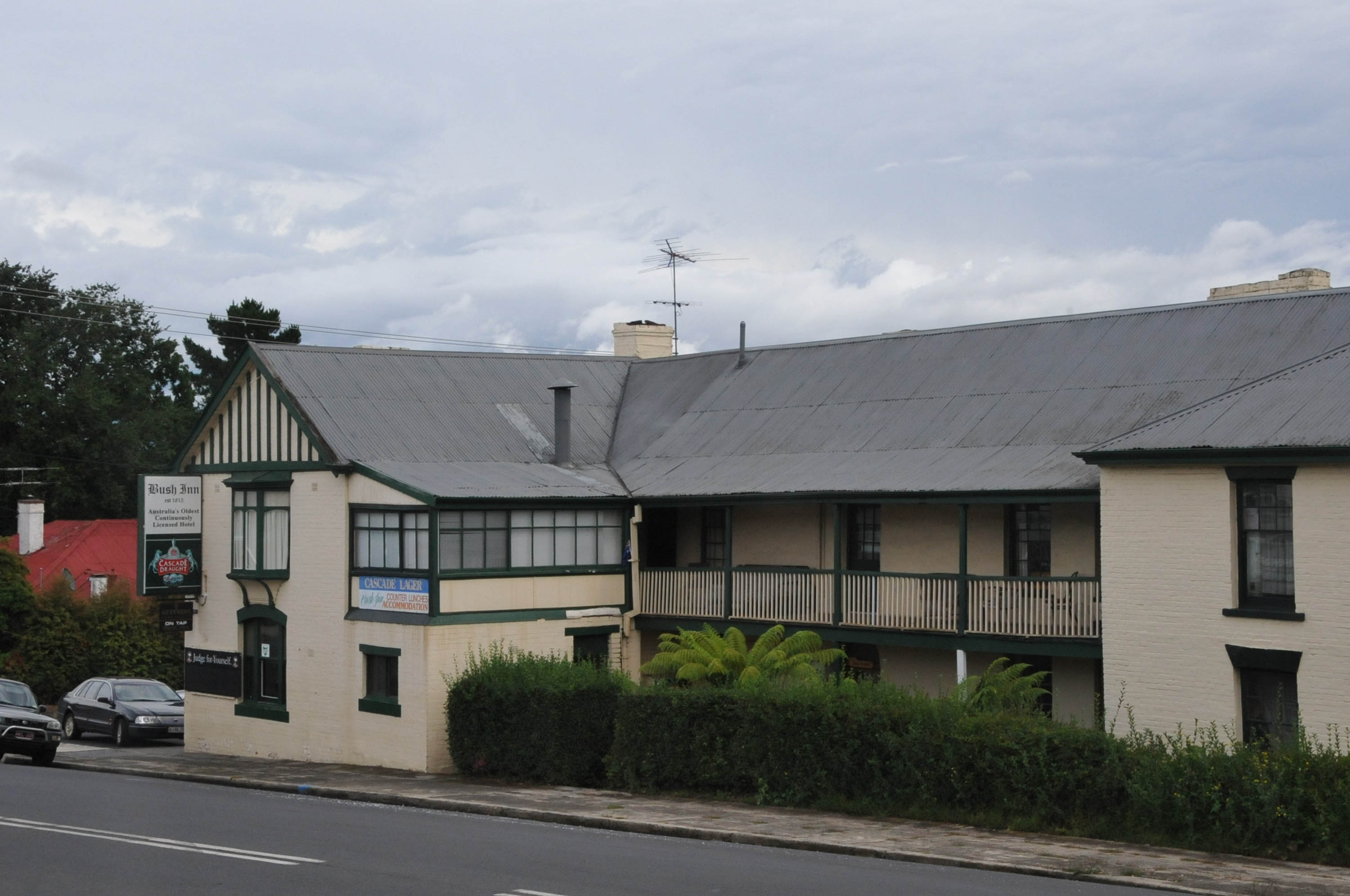 Further west on the
main highway to the right are Old
Colony Inn (t 03 6261 2731; open daily,
09.00-17.00; winter 10.00-16.00), c 1835, now a restaurant,
museum, and B&B and The Bush Inn (t 03 6261
2256), c 1815, which is reputed to be the oldest continuously
licensed inn in Australia, although this seems to be a hotly
sought-after title by several old hotels.
Further west on the
main highway to the right are Old
Colony Inn (t 03 6261 2731; open daily,
09.00-17.00; winter 10.00-16.00), c 1835, now a restaurant,
museum, and B&B and The Bush Inn (t 03 6261
2256), c 1815, which is reputed to be the oldest continuously
licensed inn in Australia, although this seems to be a hotly
sought-after title by several old hotels.
Southwest and Mount Field National Parks
From New Norfolk, you can take route B62 to B61, which leads
115km west to Strathgordon and the Gordon River Power Station,
where the road ends at Lake Gordon in the wilderness of the
Southwest National Park (t 03 6288 1283). 35km along the road
is the entrance to Mount Field
National Park (t 03 6288 1149), Tasmania's oldest
national park, preserved since 1863. Only 80km from Hobart,
the park is one of the most visited in the state, offering
great rock-climbing and bushwalking amidst the waterfalls,
Huon pine, and ancient gum trees. About 50km further,
immediately after passing through Strathgordon is McPartlan
Pass, where a lookout enables you to see both Lake Gordon to
the north and Lake Pedder to the south.
The Southwest
National Park is 605,213 ha of rugged, remote
wilderness, penetrable only by the fittest and most tenacious
of campers and walkers. Do not undertake this trek
naively. On the other hand, its World Heritage status 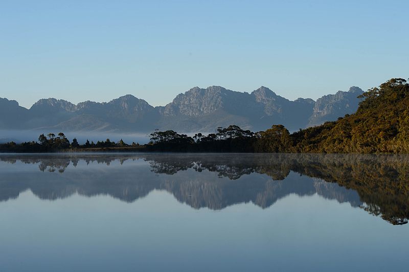 acknowledges it as a
'site of outstanding universal value' under the UNESCO World
Heritage Convention. Also included in this World Heritage Area
here are the Franklin-Lower Gordon Wild Rivers National Park
and the Cradle Mountain-Lake St Clair National Park.
acknowledges it as a
'site of outstanding universal value' under the UNESCO World
Heritage Convention. Also included in this World Heritage Area
here are the Franklin-Lower Gordon Wild Rivers National Park
and the Cradle Mountain-Lake St Clair National Park.
You get some idea of the overwhelming expanse and remoteness of the region when you learn that the Gordon and Serpentine Rivers here were first explored by Lithuanian-born Olegas Truchanas as recently as 1958. Truchanas' photographs are world-famous, gracing many a wilderness society calenda
One of the best ways to experience this vast area if you
do not want rigorous and extended trekking is to take a flight
across the region. Two airlines operate flights to Melaleuca
from Cambridge, 15km outside Hobart. Check with the tourist
information office in Hobart. Ask specifically about Airlines of Tasmania
which has offered flights into the interior.
The Lyell Highway (route A10) to the western coastline
proceeds from New Norfolk north towards Derwent Bridge.
Continue 34km to the village of Hamilton, described by Emmett
in 1954 as 'change and decay in all I see', but by Odgers in
1989 as 'one of the most charming yet sleepy of the
southernmost towns'. Tourism has led to the encouraging
restoration of originally derelict buildings, including
several 19C cottages now offering bed-and-breakfast
accommodation. On the right of the main street is Glen Clyde
House, a restored inn with craft gallery and tea rooms.
Continue north on the A10 through Ouse (14km) and on to
Tarraleah (33km), centre of the Tarraleah-Tungatinah
Hydro-electric Scheme, which channels water from the Upper
Derwent River and Lake St Clair.
Follow the A10 further north towards Bronte Lagoon; c 50m
after the turn-off to route C173 is a surveyors' monument
marking the geographical centre of Tasmania. From Bronte Park,
it is 26km to Derwent Bridge, the final stop before entering
the Western Tasmania Wilderness National Parks Area; it also
marks the southern end of the Cradle
Mountain/Lake St Clair National Park (t 03 6492 1110), a
vast wilderness area famed for its rugged walking trails,
including the 85km Overland Track known to all serious
bushwalkers. Lake St Clair itself is over 17km long and 200
metres deep. The visitor's centre has a number of maps
and pamphlets describing the area. Lake cruises and trekking
expeditions can be booked here as well. For those who would
like a less arduous walk, several two-hour-long trails start
at the Waldheim Chalet and at Lake Dover.
From Derwent Bridge, route A10 now continues west into the
forested terrain of Western Tasmania; the 83km road to
Queenstown has no shops, service stations or telephones, and
can be hazardous in snowy weather. Not completed until 1932,
the road now passes through the Franklin-Lower
Gordon Wild Rivers National Park, the centre of
Tasmania's World Heritage Area and known for its
wilderness walks and white-water rapids. Short walking
trails to spectacular lookouts and through rainforests are
also accessible from the highway for less adventurous
travellers.
At Lake Burbury, the highway skirts the lake, offering
stupendous mountain views before driving down the steep slopes
of Mount Owen past the once-thriving mining towns of
Gormanston and Linda, and into the bizarre scenery surrounding
Queenstown itself.
Queenstown
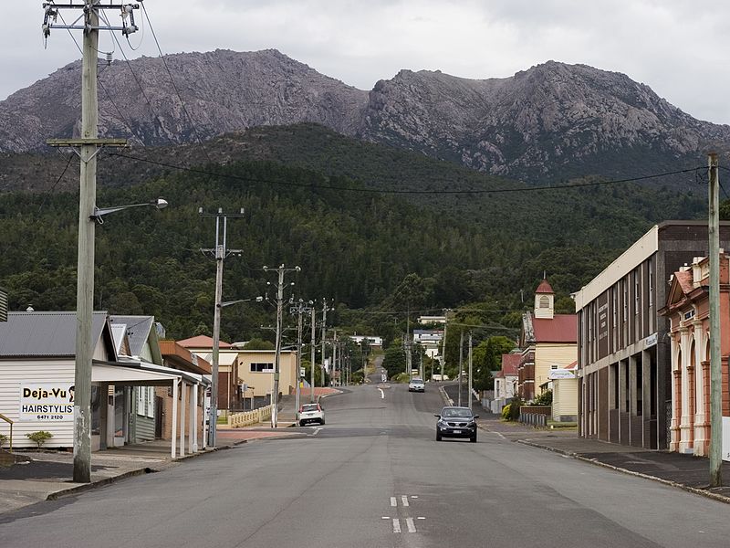 Queenstown (population
3600) was established as a mining town in 1896. Literally
carved out of the mountains, Queenstown came into being when
huge mineral resources were discovered at Mount Lyell. The
field so far has produced 670,000 tonnes of copper, 510,000 kg
of silver and 20,000 kg of gold. Copper Mines of Tasmania
employs most of the town's inhabitants. Tourist
information centre: 1 Driffield Street.
Queenstown (population
3600) was established as a mining town in 1896. Literally
carved out of the mountains, Queenstown came into being when
huge mineral resources were discovered at Mount Lyell. The
field so far has produced 670,000 tonnes of copper, 510,000 kg
of silver and 20,000 kg of gold. Copper Mines of Tasmania
employs most of the town's inhabitants. Tourist
information centre: 1 Driffield Street.
As one commentator has noted, modern-day visitors to
Queenstown will think they have landed on the moon, for the
surrounding hills are entirely barren of vegetation and
riddled with weirdly coloured craters, a result of
deforestation and the sulphur mining processes of the past.
Recent efforts by the mining company to refoliate the hills
have, it is rumoured, been thwarted by residents who recognise
that their eerie landscape is their greatest claim to fame and
the attraction of tourist dollars.
Upon entering the town, the highway becomes Batchelor Street
and then turns left into Driffield Street. On the left at the
corner of Sticht and Driffield Streets is the Galley Museum, a
delightfully idiosyncratic collection begun by local eccentric
Eric Thomas. A conglomeration of old photographs, telephones,
beds, and china, the museum offers an appropriately off-beat
introduction to the area's history. Across the street from the
museum is Miners' Siding, an equally eclectic display of
mining equipment and ore samples, as well as a set of bronze
sculptures by local artist Stephen Walker which were cast in
Queenstown. At the corner of Driffield and Ore Streets is the
Empire Hotel, one of the only surviving hotels from
Queenstown's heyday at the beginning of the century, when the
town boasted 14 hotels. Three-and-a-half-hour-long tours of
the mine are also available, departing from the Western Arts
and Crafts Centre, 1 Driffield Street. The number of people on
the tour is limited to six, so book in advance. This is one of
the few working mines allowing tours to the working face.
To travel to the coastal town of Strahan, turn left just
beyond Miners' Siding where the Murchison Highway begins and
west on to route B24; Strahan is at the end of the road, 38km
away.
Strahan (population 575), named after Tasmanian governor Sir
George Strahan, is picturesquely situated on Macquarie
Harbour. Originally the centre of Huon pine milling, it 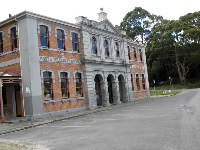 became a booming port
during the early mining years and with the establishment of
the Strahan-Zeehan railway in 1892. Today tourism is the major
industry, as the town is the starting point for the popular
Gordon River cruises, which circumnavigate Macquarie Harbour,
passing by Sarah Island with its grim reminders of its early
days as Tasmania's first and most treacherous penal prison. It
was Macquarie Harbour's penal colony that was depicted by
Marcus Clarke in his novel For the Term of His Natural Life
(1874). Its inhumane horrors are most vividly described by
Robert Hughes in The Fatal Shore (1987). Macquarie Harbour is
still notoriously hazardous to navigate, with its narrow
entrance and treacherous sandbars and waves that originated in
South America.
became a booming port
during the early mining years and with the establishment of
the Strahan-Zeehan railway in 1892. Today tourism is the major
industry, as the town is the starting point for the popular
Gordon River cruises, which circumnavigate Macquarie Harbour,
passing by Sarah Island with its grim reminders of its early
days as Tasmania's first and most treacherous penal prison. It
was Macquarie Harbour's penal colony that was depicted by
Marcus Clarke in his novel For the Term of His Natural Life
(1874). Its inhumane horrors are most vividly described by
Robert Hughes in The Fatal Shore (1987). Macquarie Harbour is
still notoriously hazardous to navigate, with its narrow
entrance and treacherous sandbars and waves that originated in
South America.
Along the town's Esplanade is the elegant Customs House, one
of the town's only substantial buildings. Strahan's
visitor's centre (t 03 6472 6800, open daily
10.00-20.00, variable in winter) on the Esplanade will help
with charter services. Further along the road is Ormiston, the
residence built in 1902 by Strahan eccentric F.O. Henry, known
as the Duke of Avram. The area also includes several
spectacular beaches, most impressively Ocean Beach which
stretches for 33km. Of particular interest at Strahan to
tourists is the availability of seaplane tours, which offer
exhilarating views of the coastal landscape.
From the town turn left into route B27 towards Zeehan (which can also be reached direct from Queenstown), 47km north. Zeehan (population 1200) derives its name from Abel Tasman's ship, which passed by the coast in 1642 and sighted the peak named Mount Zeehan by later explorers Bass and Flinders. At the height of the mining boom in 1901, Zeehan had 26 hotels and a population over 5000; its near demise by the 1950s perhaps accounts for the air of melancholy which still pervades the town, despite it modest resurgence as a tourist destination and with the opening of Renison Bell tin mine. Of interest is the Zeehan School of Mines and Metallurgy, established in 1892 and now housing the West Coast Pioneers' Memorial Museum (03 6471 6225, open daily 9.00-17.00). The museum has a characteristically eclectic assortment of mining paraphernalia, a mineral collection, a railway car, photos, stuffed animals and historical objects. Along the same street are many examples of buildings from the pioneer days, including the Gaiety Theatre where Nellie Melba and Lola Montez purportedly gave concerts.
National TrustIllustrations:
800px-Lady_Nelson_and_brigantine_in_port.jpg - John Dalton /varrqnuht (from Lauderdale, Australia)
Dove_Lake.jpg - Dr Rocks from Canberra, Australia
Offset_prison_cells%252C_Separate_prison%252C_Port_Arthur.jpg - Copyright Dysprosia
800px-Hobart_CBD.JPG - Aaroncrick
800px-Hobart_Botanical_Gardens_Entrance.jpg - Barrylb
501px-Mathinna_1842_by_Thomas_Bock.jpg – Tasmanian Museum and Art Gallery
PortArthurPenitentiary.jpg - Martybugs
Ross_bridge.jpg - Synyan
800px-Barn_Bluff_from_Waterfall_Valley.jpg - JJ Harrison
Hobart - Aaroncrick
Tassie map - IFM-Geomar.de
Constitution Dock - wlcutler
Salamanca Market - Kham Tran - www.khamtran.com
Governor Arthur's proclamation (originally attributed to Gov. Davey) - State Library NSW
Narryna - Christopher Neugebauer
450px-St_Georges,_Battery_Point.jpg - StAnselm
Glover's My Harvest Home - Art Gallery of NSW
Truggernana - Thomas Bock, 1831
Mathinna - Thomas Bock, 1831
MONA -
Nolan's Snake - jeffowenphotos
Military Museum Angelsea -
Theatre Royal Hobart - Canley
Young Huon pine - JJ Harrison (jjharrison89@facebook.com)
Young Huon pine - Securiger
Cascade Brewery - daivinandleah
Dinghy - School of Wooden Boatbuilding
Runnymede - Runnymede
Eaglehawk Neck - Pn57 at English Wikipedia
Tessellated pavements - JJ Harrison (jjharrison89@facebook.com)
800px-Ruins_of_Port_Arthur,_Tasmania.jpg - Stephen Barnett
Oatlands windmill - Oatlands tourism
Jørgen_Jørgensen_(Eckersberg).jpg - http://www.information.dk/207473
Pontville Anglican church - The Gardens Family
Ross Bridge - JJ Harrison (jjharrison89@facebook.com)
St Andrews Church - Uniting Church Cambell Town
Brumbys - Kersti Nebelsiek
Woolmers - Woolmers
Clarendon House - Peripitus
Cataract Gorge - Mattinbgn
Stained glass windows, St. John's Church - St. John's Church
Launceston Post Office - Mattinbgn
Queen Victoria Museum - Mattinbgn
Franklin House - Jin-oh Choi
Richmond Bridge - Noodle snacks
Entally House - Poyt448 Peter Woodard
Deloraine Main Street - Gary Houston
Spring blossoms Freycinet - Jörn Brauns
Bridestowe lavender fields - Rowan.M.McDonald
Bush Inn - KLOTZ
Edgar Pond, Southwest National Park -